Well, the trip invite I postd on Friday did indeed happen, and it was a great adventure and day trip.
The Players:
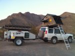
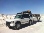
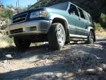
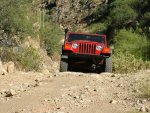
Myself in my 98 Trooper (stock), my wife Colette in her 00 Grand Vitara (stock), Mark (articulate) in his 02 Jeep Wrangler (nicely modified), and Allen (FLYWGN), his wife Diana, and Scooter in thier Nissan X-terra (stock). Sorry Allen, I don't know the year of your X. Also in attendance were my son Matt and daughter Ellesha.
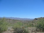
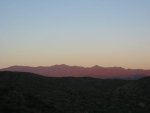
We couldn't have asked for a nicer day to do this trip, it was just beautiful, very few high cluods and I don't think the temp got above 95.
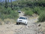
We all hooked up on the east side of I-17 on Table Mesa Rd. and did our introductions since none of had met before (with of course the exception of my wife and I, we've known each other for a while now). After a little ******** chat, gear set up, radio checks and airing down we were off. Since I organized the outing I was elected leader, which was a pretty brave decision made by the group as I had no idea on how to get where we were going except some simple directions and GPS coordinates.
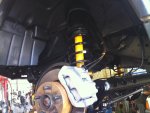
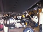
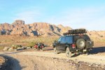
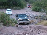
The trail started out very peaceful, not a lot of other vehicles and fairly well graded which helped to keep the pace going fairly well. After a couple of miles on the graded track we came across the first obstical, the Agua Fria River. I had a report that this was flowing swiftly and very high just a couple of weeks ago, but when we arrived it was barely flowing and was only about 15 yards wide and maybe 18" deep at it's deepest point. The crossings were no trouble as the botton of the river is more gravel than mud and rocks. After the river crossing the trail got a little more rough and rocky, but still no trouble at all for any of the vehicles.
Trip leaders first blunder:
I believe that I misunderstood the directions to get to the first ghost town of Gilette, and I missed our turn :smilies27 I did not realize this until we were about a mile past the turn though. We stopped and decided to look through some of the books that Allan had brought with him to see if we were maybe on the right track or if we need to turn around. At about that time some nice passersby stopped and gave us more directions on how to get to our final destination of Tip Top. We decided to pass on Gilette and continue on.
Trip leaders second blunder:
I zigged when I should have zagged

Misunderstanding our passersby directions , but confused by my own directions I again led us the wrong way up the trail and got us to a locked gate. O.K. everybody, lets turn around and go back and zag where we should have in the first place.
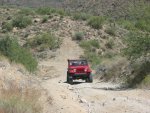
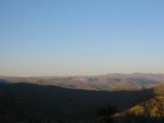
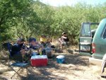
Now, going on the track that is now believed to be the correct one it does get quite a bit rockier and narrower. But still a good time with just enough challenge to make it fun. following this trail leads to some spectacular views of the area and then down into a small canyon formed by Cottonwood Creek. Once we got to the bottom the group decided to inform the leader that they were all hungry and could go no further with out some sustanance :eatchicke I, too, was famished, and this decision was made primarily by the trip leaders better half telling him to stop somewhere, anywhere, so she can eat or face the cosequences later when we are back in the privacy when we get home
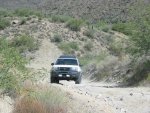
After a very nice relaxing lunch in a partially shaded area with some nice ******** chat the group decided to try and make it to Tip Top. We figured we were only a couple of miles from it and should be there shortly. We headed out and crossed the creek where I thought we were supposed to. The crossing was simple because there was no water in the creek, but a little bumpy because the creek bottom is primarily larger rocks, but it was fun . Across the creek the trail became decidedly more difficult, but still not quite a 2.5 on a 5 scale, in my opinion anyway. We came across one challenging obstical though and I had to get out and inspect. After conferring with Allen and Mark it was decided that it should not be to difficult with some spotting. On we go. After the excellent spotting by Mark we all got over the obstical and carried on. After what seemed like quite a long time I stopped to survey our situation, "where in the world is this place" is all I was thinking, that and possibly we are going in the wrong direction entirley. I was convincedby others in the group that we should push on just a bit further up the road, because we have not yet traveled the distance stated in our directions.
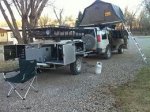
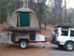
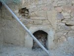
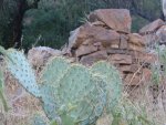
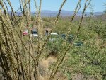
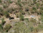
Pushing on nettted our reward. Up the road just a bit we started seeing remenants of what was once a mining town, and the buildings were in the places the directions said they would be in. WE FOUND IT!!!!! or should that be WE MADE IT!!!!, either way, we reached our primary objective, Tip Top. We spent some time exploring and taking some pictures and decided to head back for civilization. All in all I had a great time, my wife I learned can handle herself off road, and her Suzuki is far more capable off road than I had thought it to be. I think this trip is going to help her get the exploring/OHV bug. Attached are just a few of the 70+ pictures taken from my camera. I know Mark has a few good ones as well that I hope he will share with us on this post.
I still have to take another trip up there to find Gilette. Anyone want to come?