Since May this year I've been living and working at Denali National Park, AK. It was an awesome way to spend a few months, I made some great friends and some money but now the Canyon's a ghost town, the resorts are closed up, and the park is all but abandoned. So it's time to head home to Michigan. I drove up here with a friend who flew back home from Fairbanks, but for the return trip I'll be going solo. I'm usually not much on writing trip reports but I think this will force me to slow down and enjoy the ride as opposed to just putting the hammer down and trying to get home as fast as possible.
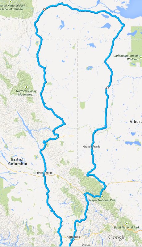
My route plan is.... loose. I'm going to be taking the Cassiar south (did the ALCAN on the way north) then hope to make some stops in Idaho. Outside of that I haven't made any plans. Suggestions welcome!
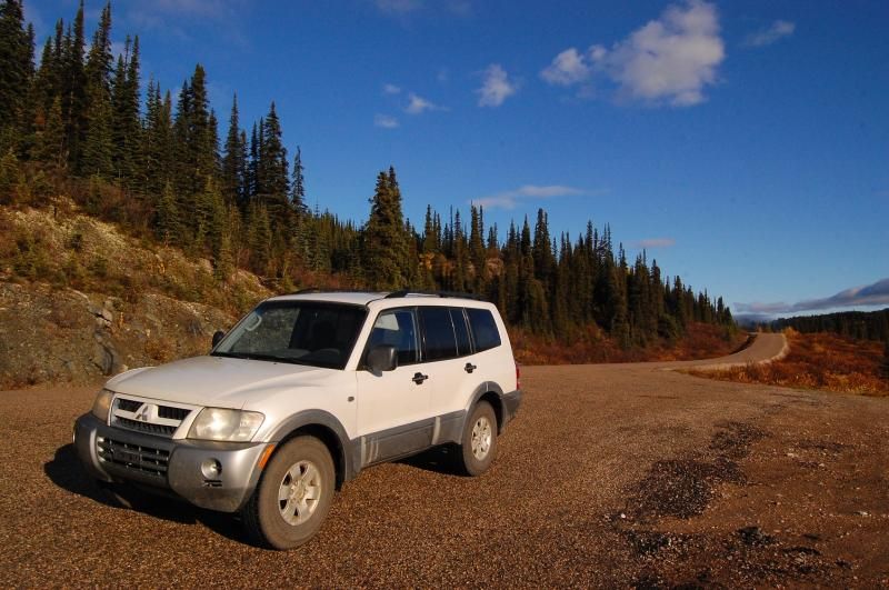
Vehicle is a 2003 Montero XLS pretty much stock except for some larger 235/85 16 tires and the stupid plastic running boards taken off. Also an Ipod jack and a sleeping platform in the back.
So. Here we go.
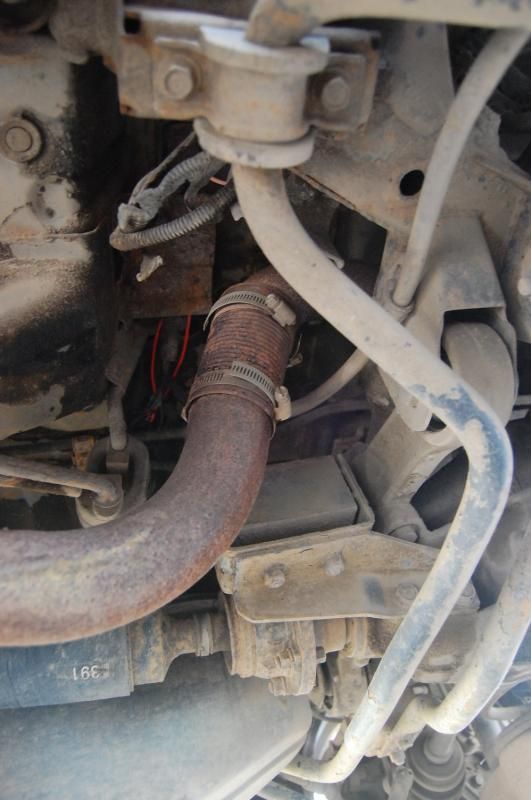
Pre-trip - My biggest concern was a slight problem with the truck. My exhaust pipe split at some point during the summer, when it did it shot hot exhaust straight up under the drivers side rear seat, melting a bundle of wires and a hole in the plastic under the seat. I discovered this when I smelled burning plastic driving down the Parks Highway. In that cluster of were, at the very least, the wires for the wheel speed sensors and taillights. So my dashboard lights, taillights, ABS, stability control, traction control, and AWD mode.... I never tried to put it in 4WD. "So basically you nuked your car back to the mid-80's." said a more technically knowledgeable friend.... Anyway I pipe clamped a soup can on the exhaust pipe, but didn't bother fixing the electrical issues because since the two months ago when it happened I wasn't driving much at all and since it wasn't getting dark, I didn't need tail lights. I finally crawled under the truck a day before leaving and with some amount of difficulty managed to get the tail lights back on by some cutting and splicing and going through about a dozen 10 Amp mini fuses. A day later all the warning lights on the dash went off and my wonderful 2003 safety features and 4WD modes were back.
Aside from that little debacle it was just a matter of throwing my life into the truck (again) and gassing up.
Day 1 - Denali to Delta Jct
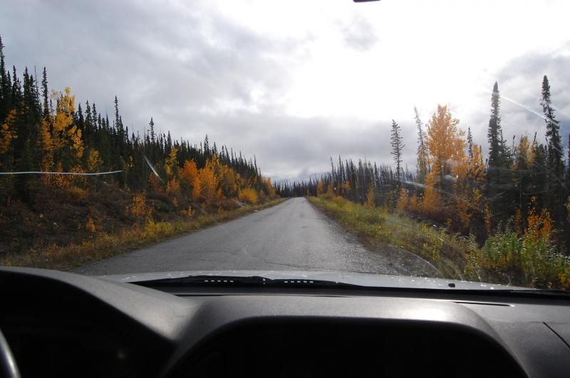
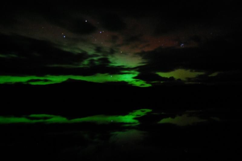
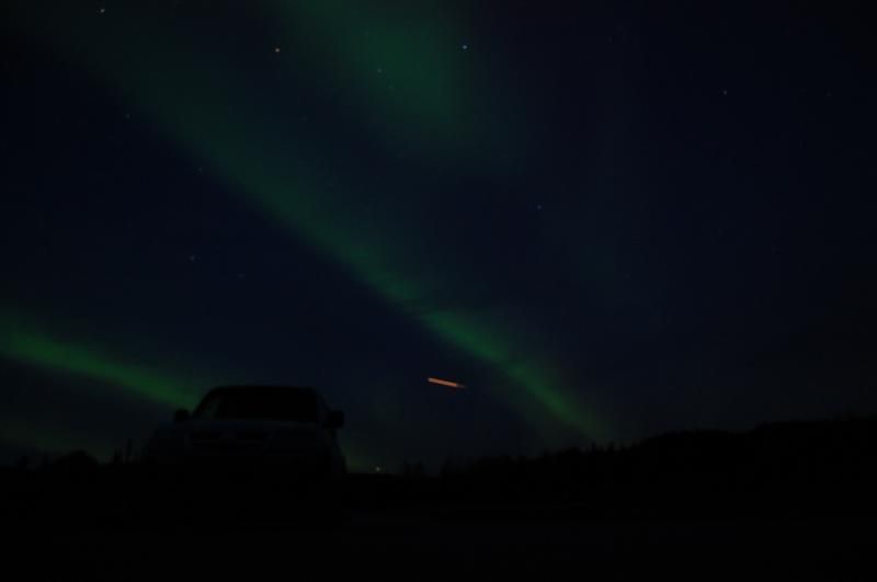
I got out of the canyon around 3pm, an uneventful drive until about 930pm when the sky got dark and the Aurora came out. This is only the second time I've seen it and it was amazing, at times it looked like the whole sky was filled. I had trouble keeping my eyes on the road for the last hour of the drive.
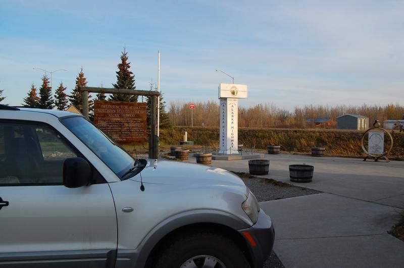
I stayed at Quartz Lake State Rec site, then hit delta jct the next morning.
Day 2 - Delta Jct to Whitehorse
Finally got to see the end of the ALCAN...exhilarating ... On the drive up in spring we went south from Tok and so we skipped the last stretch. Looking back, we didn't miss much. Lots of long straight highway.
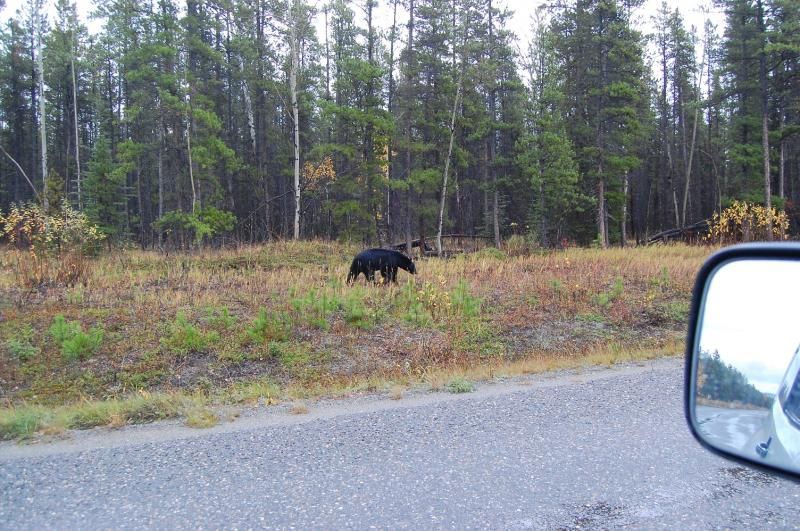
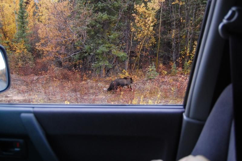
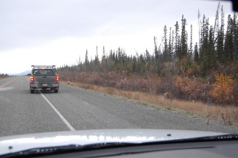
Canadian customs was thankfully quick and easy, but the first 30 miles into Canada were brutal. 50km/h speed limits and the pavement torn up. It felt like it took days to get to Destruction Bay. I saw a smaller grizz strolling along the side of the highway and a couple moose. Made it to the Wolf Creek campground just south of Whitehorse around 10pm. Now I'm back up in Whitehorse getting coffee and a donut at Tim Hortons. Time to get back on the road. Next update whenever I run across free wifi.
My route plan is.... loose. I'm going to be taking the Cassiar south (did the ALCAN on the way north) then hope to make some stops in Idaho. Outside of that I haven't made any plans. Suggestions welcome!
Vehicle is a 2003 Montero XLS pretty much stock except for some larger 235/85 16 tires and the stupid plastic running boards taken off. Also an Ipod jack and a sleeping platform in the back.
So. Here we go.
Pre-trip - My biggest concern was a slight problem with the truck. My exhaust pipe split at some point during the summer, when it did it shot hot exhaust straight up under the drivers side rear seat, melting a bundle of wires and a hole in the plastic under the seat. I discovered this when I smelled burning plastic driving down the Parks Highway. In that cluster of were, at the very least, the wires for the wheel speed sensors and taillights. So my dashboard lights, taillights, ABS, stability control, traction control, and AWD mode.... I never tried to put it in 4WD. "So basically you nuked your car back to the mid-80's." said a more technically knowledgeable friend.... Anyway I pipe clamped a soup can on the exhaust pipe, but didn't bother fixing the electrical issues because since the two months ago when it happened I wasn't driving much at all and since it wasn't getting dark, I didn't need tail lights. I finally crawled under the truck a day before leaving and with some amount of difficulty managed to get the tail lights back on by some cutting and splicing and going through about a dozen 10 Amp mini fuses. A day later all the warning lights on the dash went off and my wonderful 2003 safety features and 4WD modes were back.
Aside from that little debacle it was just a matter of throwing my life into the truck (again) and gassing up.
Day 1 - Denali to Delta Jct
I got out of the canyon around 3pm, an uneventful drive until about 930pm when the sky got dark and the Aurora came out. This is only the second time I've seen it and it was amazing, at times it looked like the whole sky was filled. I had trouble keeping my eyes on the road for the last hour of the drive.
I stayed at Quartz Lake State Rec site, then hit delta jct the next morning.
Day 2 - Delta Jct to Whitehorse
Finally got to see the end of the ALCAN...exhilarating
... On the drive up in spring we went south from Tok and so we skipped the last stretch. Looking back, we didn't miss much. Lots of long straight highway.
Canadian customs was thankfully quick and easy, but the first 30 miles into Canada were brutal. 50km/h speed limits and the pavement torn up. It felt like it took days to get to Destruction Bay. I saw a smaller grizz strolling along the side of the highway and a couple moose. Made it to the Wolf Creek campground just south of Whitehorse around 10pm. Now I'm back up in Whitehorse getting coffee and a donut at Tim Hortons. Time to get back on the road. Next update whenever I run across free wifi.