You are using an out of date browser. It may not display this or other websites correctly.
You should upgrade or use an alternative browser.
You should upgrade or use an alternative browser.
Arizona Strip - 2016 trip report
- Thread starter Explorer 1
- Start date
Explorer 1
Explorer 1
Thanks for the comments,
As I said in the preparation Thread, "I'm glad someone other than my wife and mother are enjoying this report"
Thanks,
Fred
Explorer 1
As I said in the preparation Thread, "I'm glad someone other than my wife and mother are enjoying this report"
Thanks,
Fred
Explorer 1
Explorer 1
Explorer 1
Looks like a great trip. Just got back from Twin and Kelly points. We went out in side x sides. Spent 2 nights at Oak Grove 4/23 and 4/24. Was snowing when we were there also.
Side by sides driving while it's snowing......that sound like it could be pretty cool!
Working on finishing Day 5 and drive out to Poverty on Day 6. Should be done next few days.
This "event" slowed our progress some........more later.....

Thanks,
Fred
Explorer 1
Explorer 1
Explorer 1
Kelly Point - Part 2
Day 5 – Kelly Point
Part 2
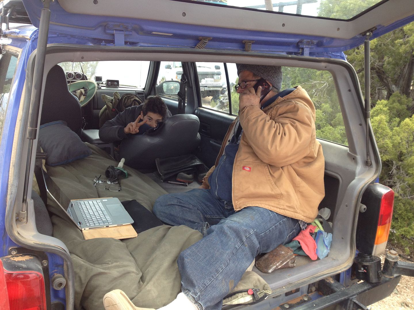
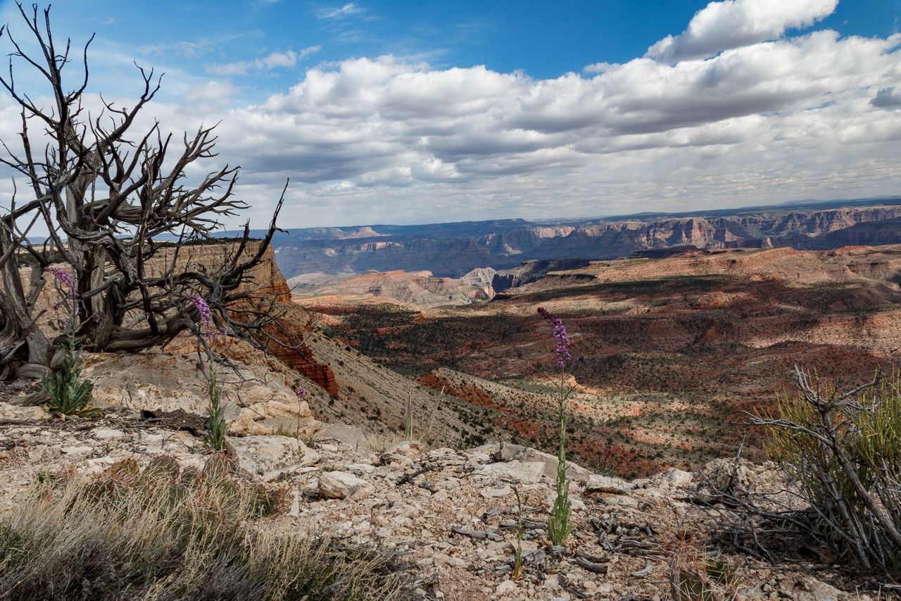
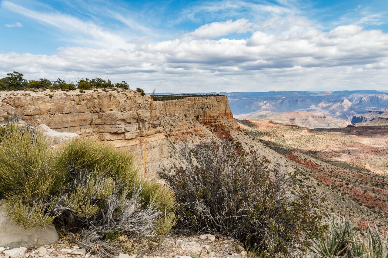
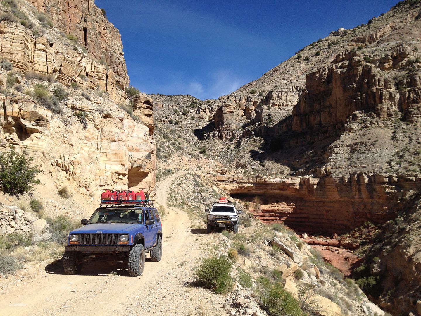
It took us only about 3 ½ hours to drive from Oak Grove to Kelly Point. With a dry road and no fallen trees to deal with we arrived at 11:20 am. This was the first time on this trip we arrive in camp so early with time for exploring, resting, meal preparation and because of the location on the rim we had cell service so some of the guys could contact home and even one of them conduct some business from the back of his Jeep.
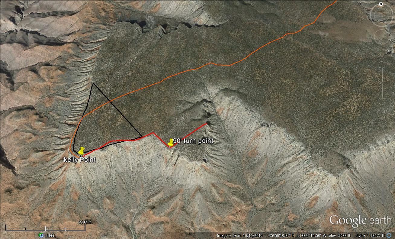
I decided to take a hike and since camp was at the end of the point I figured could hike back along the rim and then make a 90’ turn hike across the peninsula to other side and then back to our camp. All was going well except when I turned and started hiking across the peninsula and came to the other side I hadn’t crossed the road we drove in on. I require all attenders on these kinds of trips to bring a hand held compass. I’ve explained how easy it is to get turned around and become disoriented. However, the compass doesn’t do you any good if you leave it in your vehicle when you go for a hike. In addition, I had left camp exploring without a word to anyone else where I was going and when I planned on returning.
Fortunately, when I came out to the other side without passing over the road, I quickly realized I had become disoriented, my internal compass was off and in my mind north was really south. I stopped took a deep breath and then took a mental reading of where the sun was located in the sky. Knowing that it was late afternoon the sun wasn’t were I expected it to be, but knowing that I could get disoriented and the sun couldn’t set in the east, I changed direction and in about 15 minutes found signs of where I had walked before and made my way back to camp.
This map in black shows my intended hike, the red, show what actually happened.
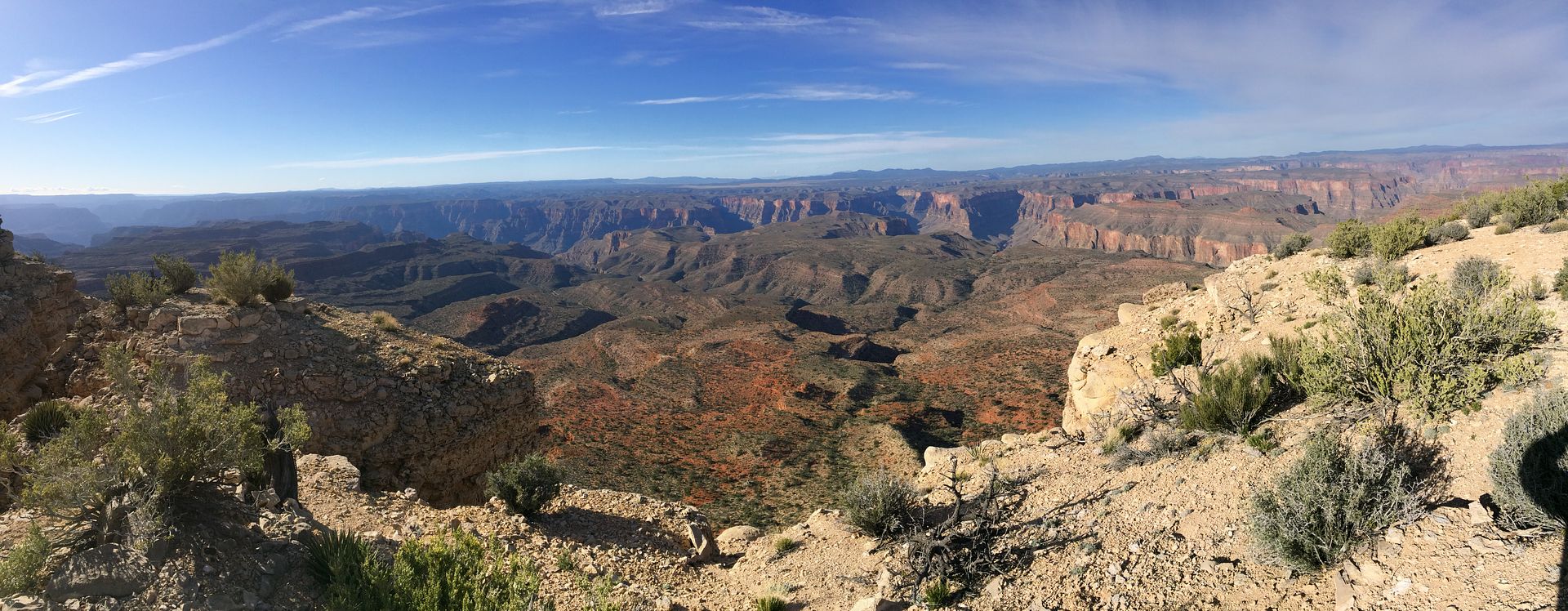
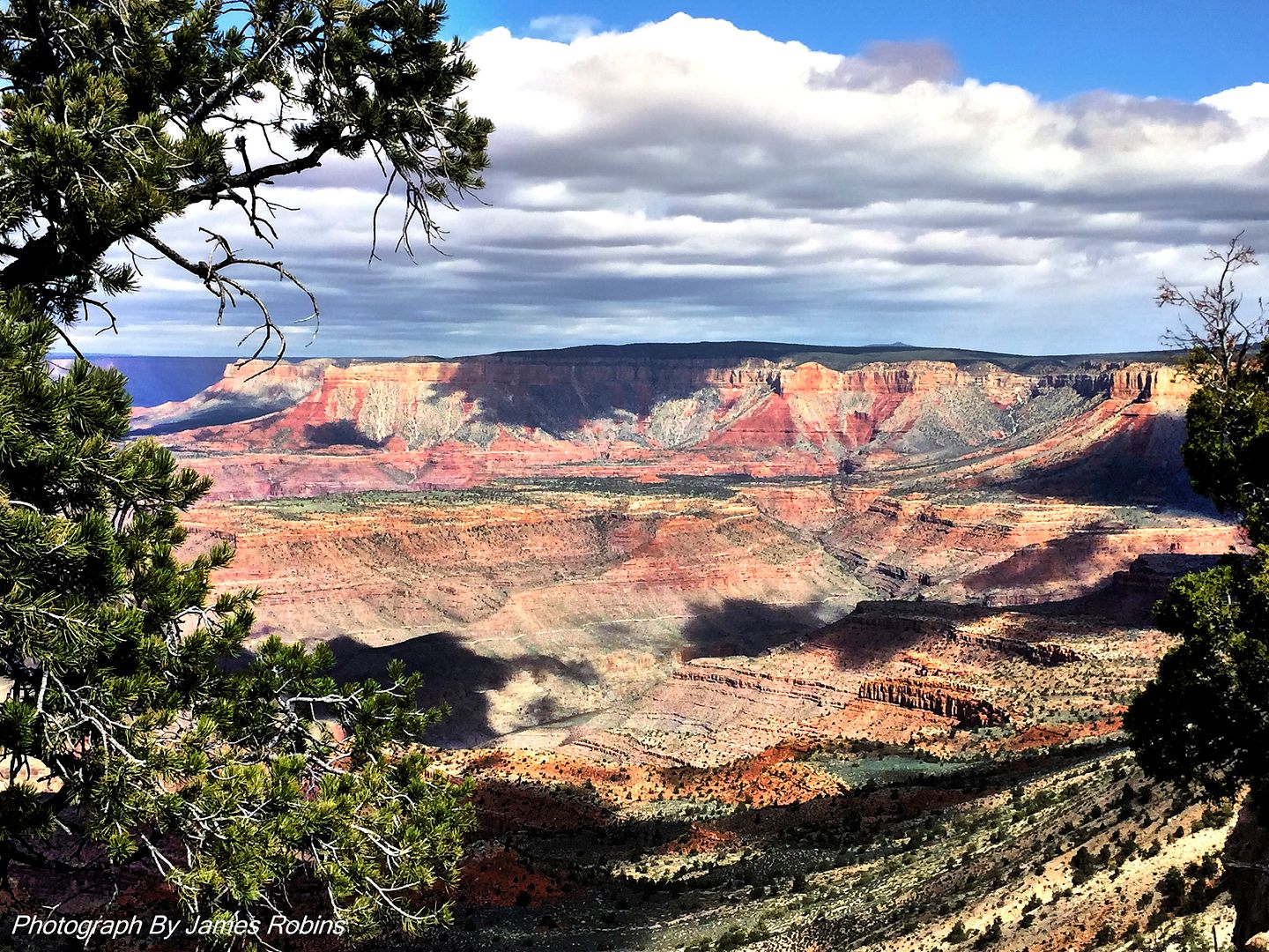
After I made the course correction I was happy to see this view after some hiking:
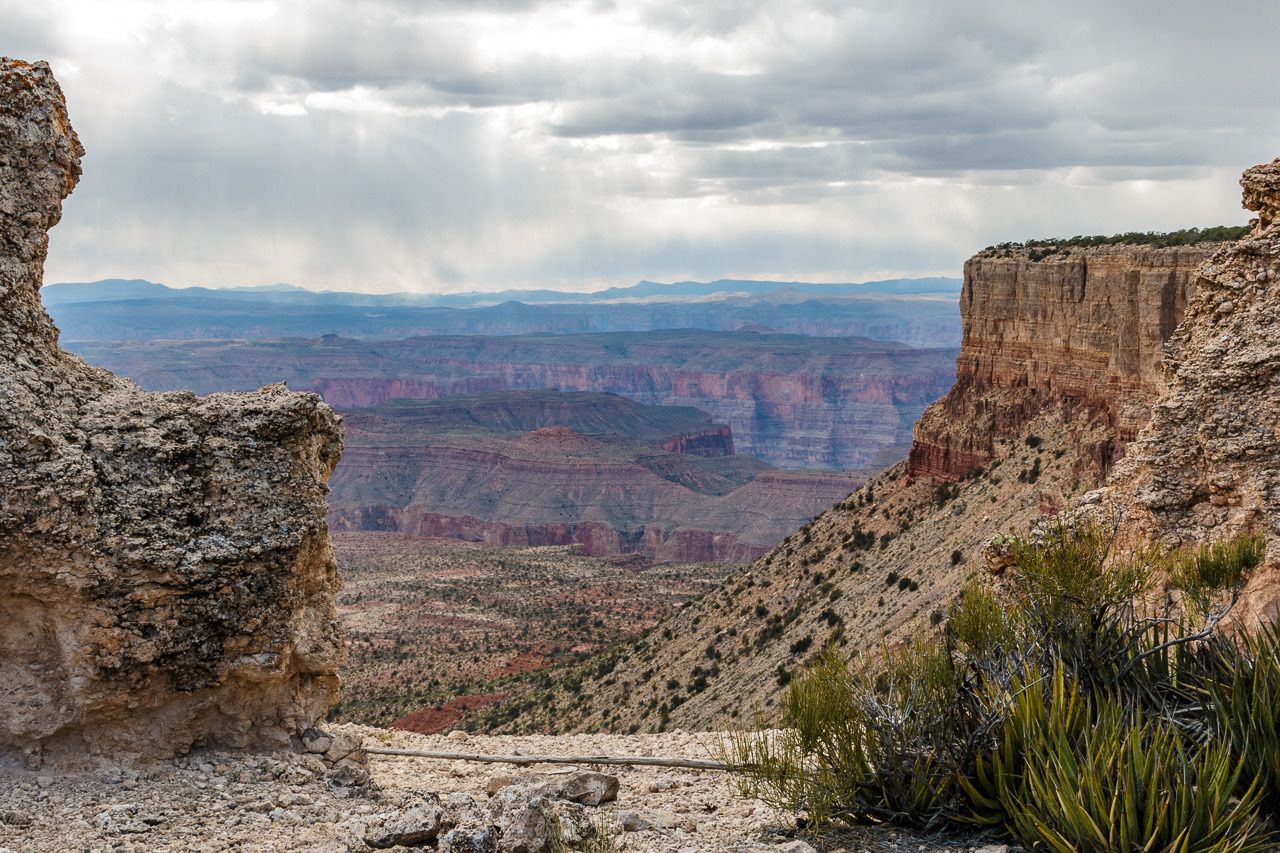
You can just see our camp on the cliff on the right.
I conveniently forgot to tell the others of my additional adventure and went straight to my vehicle and found my compass then placed it securely in my pocket.
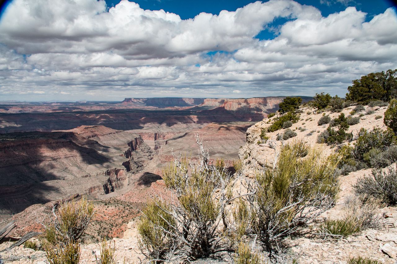
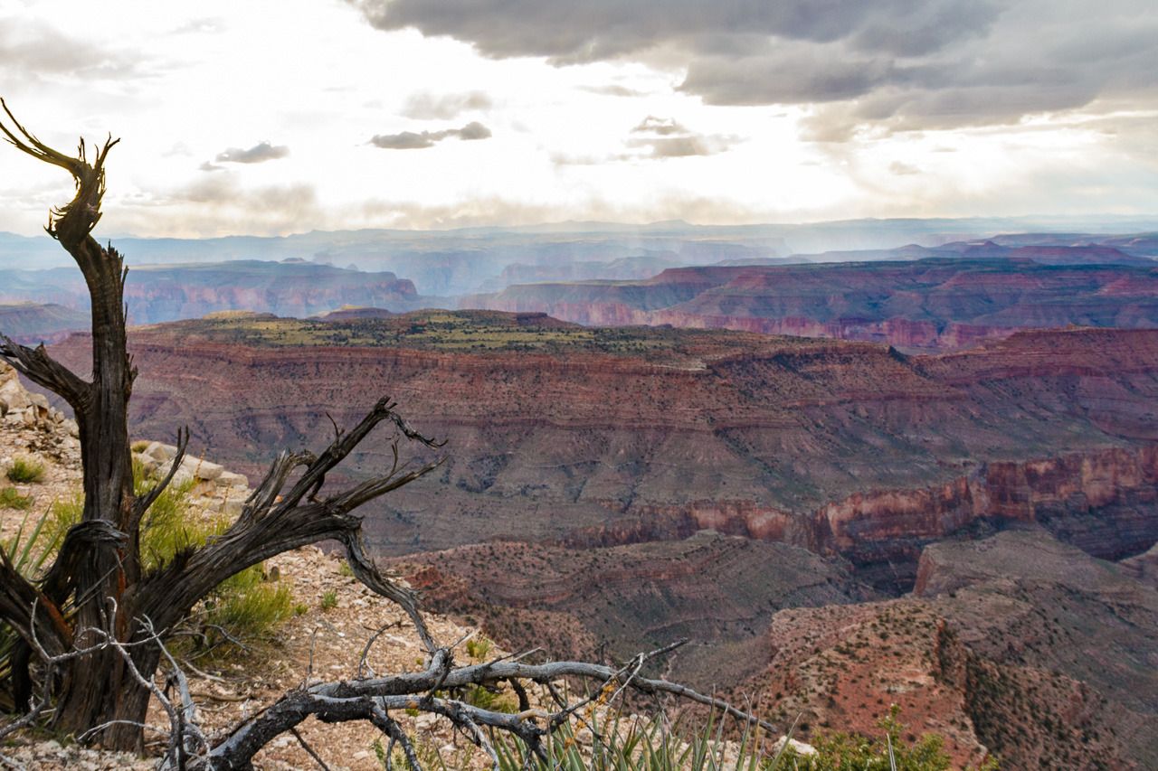
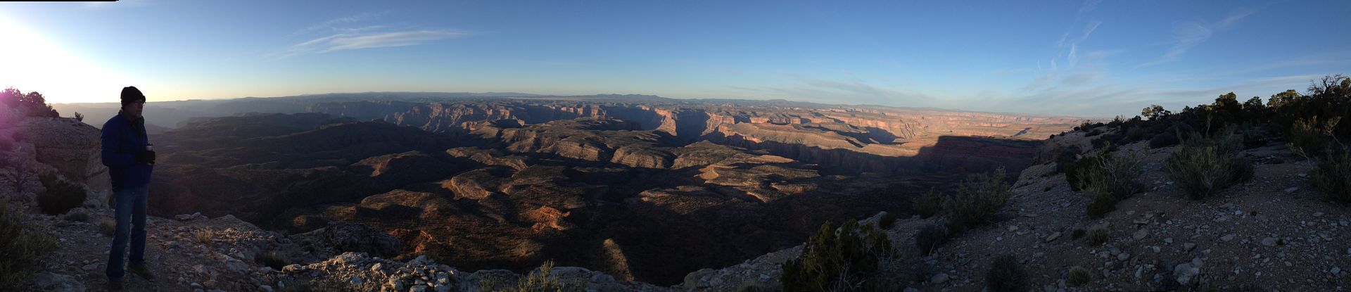
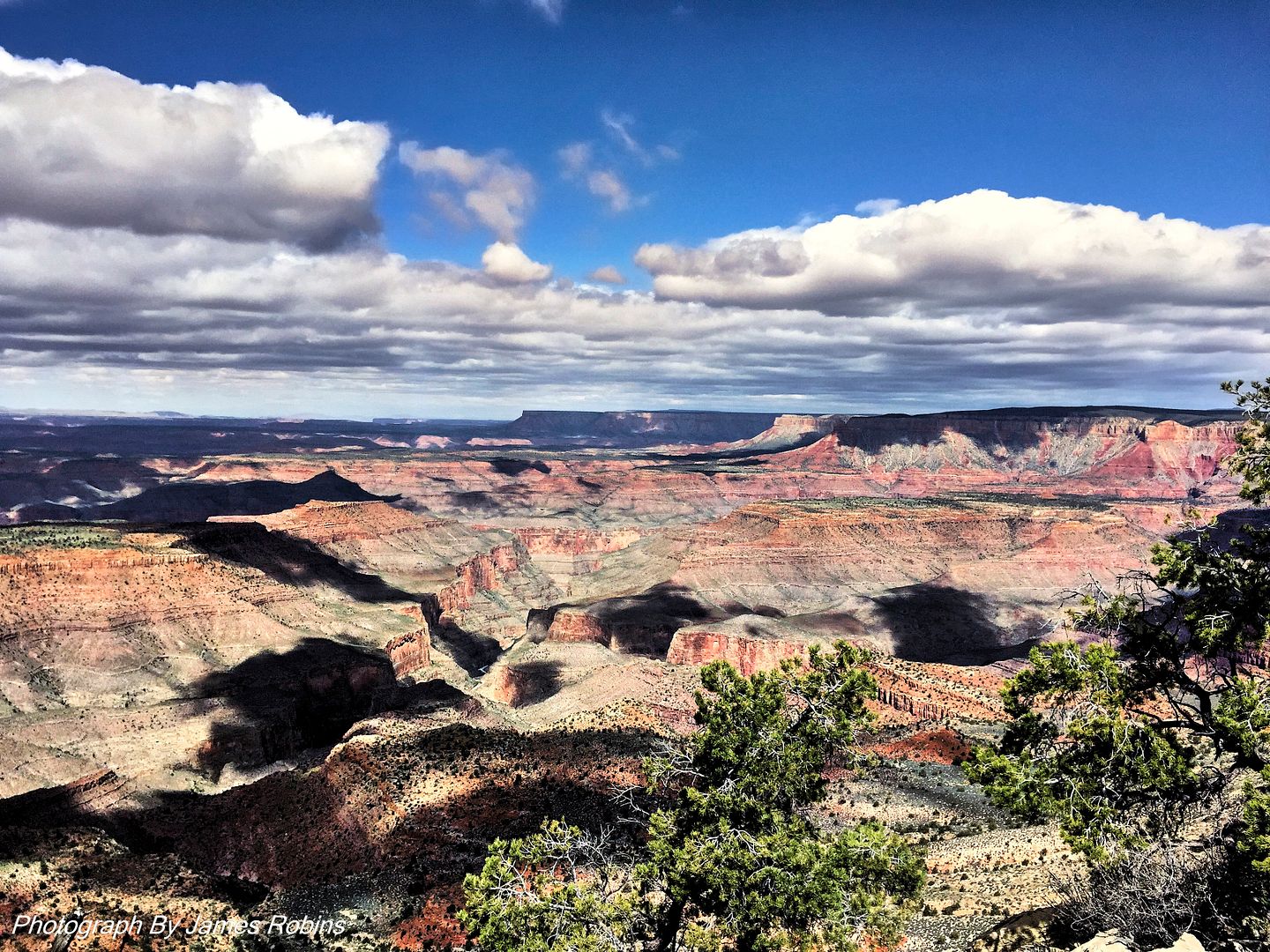
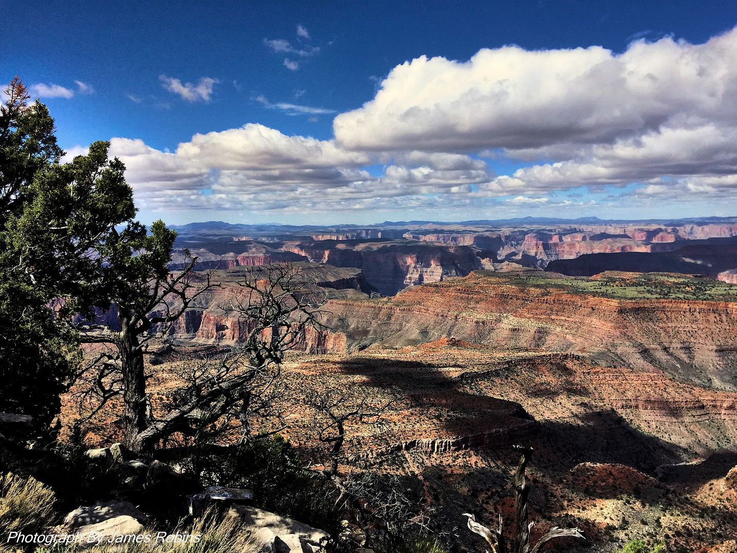
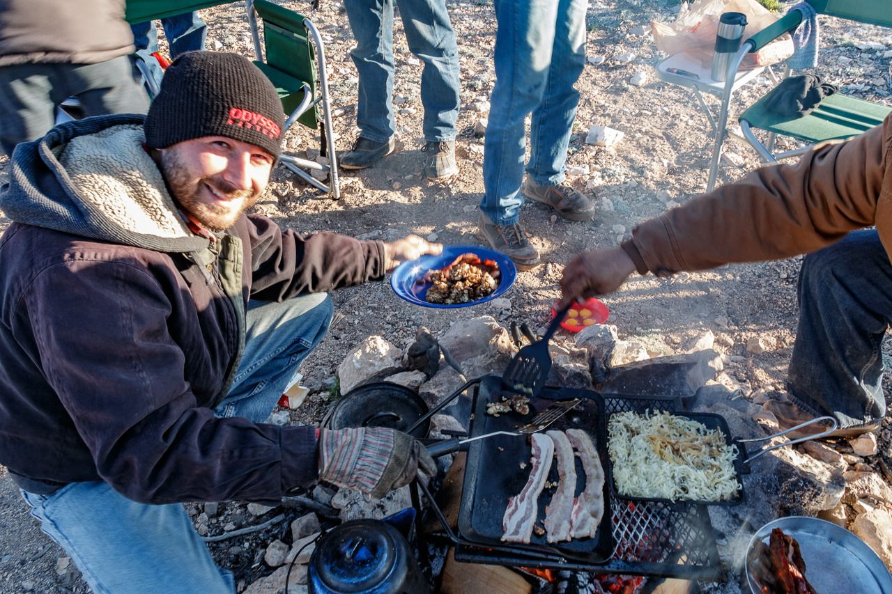
Many have documented in word, picture and painting the changing moods of the canyon far better than I can here. However, I’ll just let these few pictures “speak” for themselves as we enjoyed the sunset, moon light, sunrise and leisurely morning as we had what we call “A big breakfast morning”.
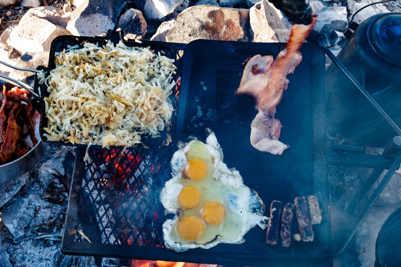
And of course pictures of our “Big Breakfast”.
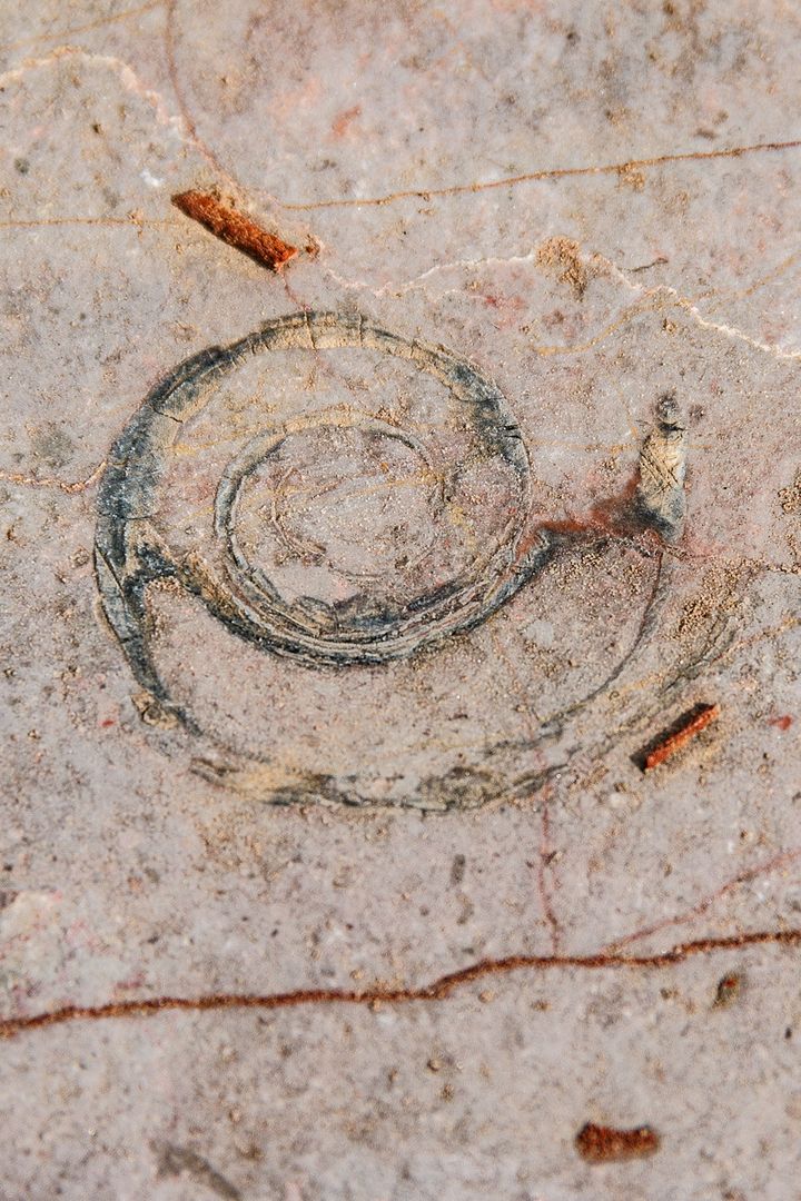
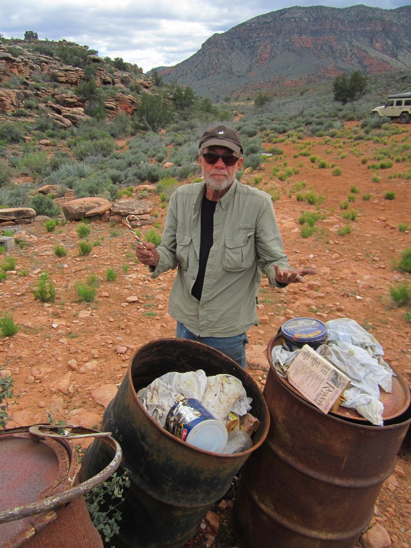
Exploring around, Wayne also found loads of fossils in the sandstone. The excitement of the guys finding these reminded me of small school boys. It was fun to watch.
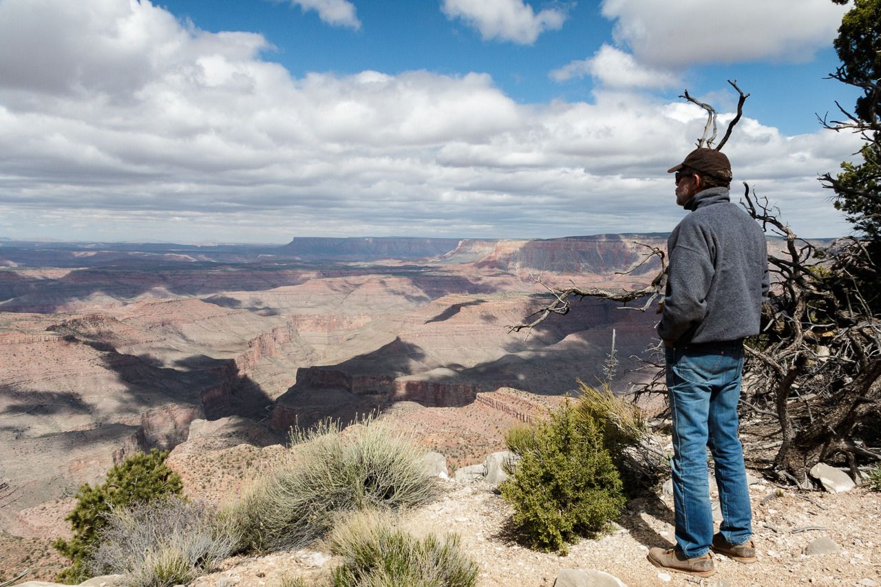
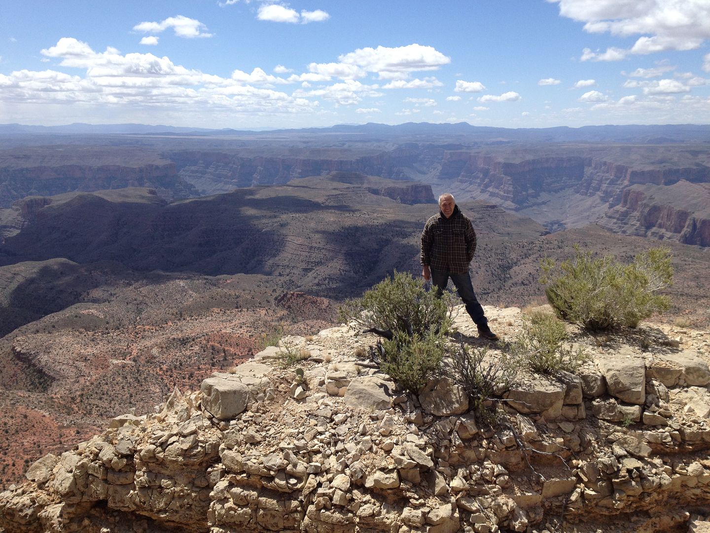
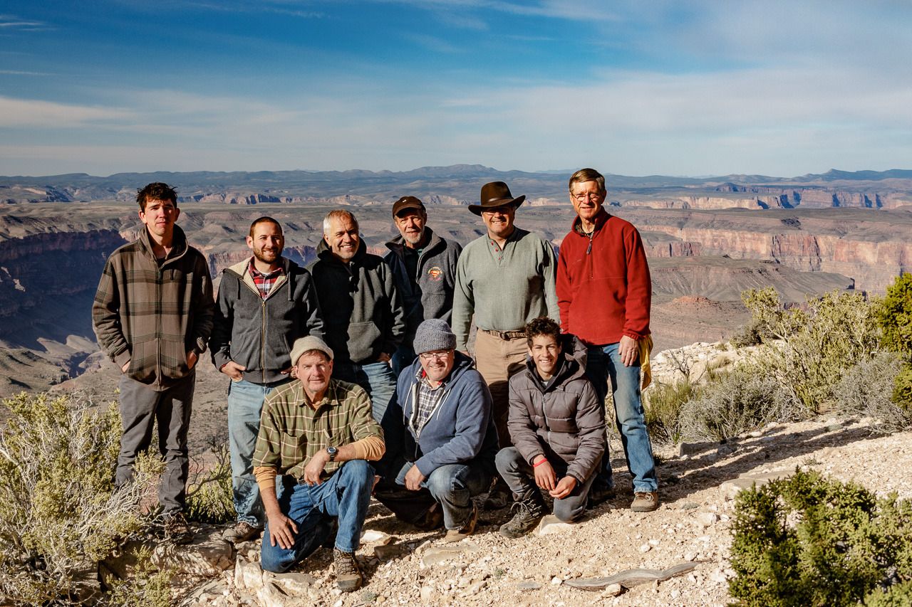
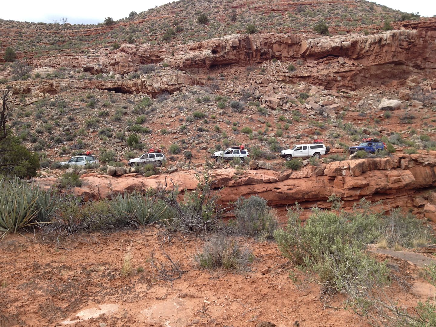
Here is our group picture just before we told Kelly Point goodbye. The last time all of us were together.
Next: the drive out to Poverty.
Thanks,
Fred
Explorer 1
Day 5 – Kelly Point
Part 2
It took us only about 3 ½ hours to drive from Oak Grove to Kelly Point. With a dry road and no fallen trees to deal with we arrived at 11:20 am. This was the first time on this trip we arrive in camp so early with time for exploring, resting, meal preparation and because of the location on the rim we had cell service so some of the guys could contact home and even one of them conduct some business from the back of his Jeep.
I decided to take a hike and since camp was at the end of the point I figured could hike back along the rim and then make a 90’ turn hike across the peninsula to other side and then back to our camp. All was going well except when I turned and started hiking across the peninsula and came to the other side I hadn’t crossed the road we drove in on. I require all attenders on these kinds of trips to bring a hand held compass. I’ve explained how easy it is to get turned around and become disoriented. However, the compass doesn’t do you any good if you leave it in your vehicle when you go for a hike. In addition, I had left camp exploring without a word to anyone else where I was going and when I planned on returning.
Fortunately, when I came out to the other side without passing over the road, I quickly realized I had become disoriented, my internal compass was off and in my mind north was really south. I stopped took a deep breath and then took a mental reading of where the sun was located in the sky. Knowing that it was late afternoon the sun wasn’t were I expected it to be, but knowing that I could get disoriented and the sun couldn’t set in the east, I changed direction and in about 15 minutes found signs of where I had walked before and made my way back to camp.
This map in black shows my intended hike, the red, show what actually happened.
After I made the course correction I was happy to see this view after some hiking:
You can just see our camp on the cliff on the right.
I conveniently forgot to tell the others of my additional adventure and went straight to my vehicle and found my compass then placed it securely in my pocket.
Many have documented in word, picture and painting the changing moods of the canyon far better than I can here. However, I’ll just let these few pictures “speak” for themselves as we enjoyed the sunset, moon light, sunrise and leisurely morning as we had what we call “A big breakfast morning”.
And of course pictures of our “Big Breakfast”.
Exploring around, Wayne also found loads of fossils in the sandstone. The excitement of the guys finding these reminded me of small school boys. It was fun to watch.
Here is our group picture just before we told Kelly Point goodbye. The last time all of us were together.
Next: the drive out to Poverty.
Thanks,
Fred
Explorer 1
Last edited:
Explorer 1
Explorer 1
Day 6 Kelly Point to Mule Point Pond...or so I thought!
Day 6
Kelly Point to Poverty, Poverty to Mule Point Pond
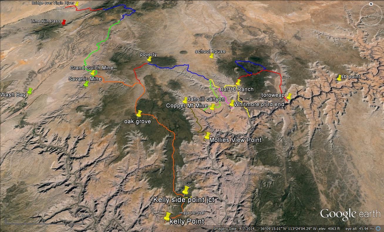
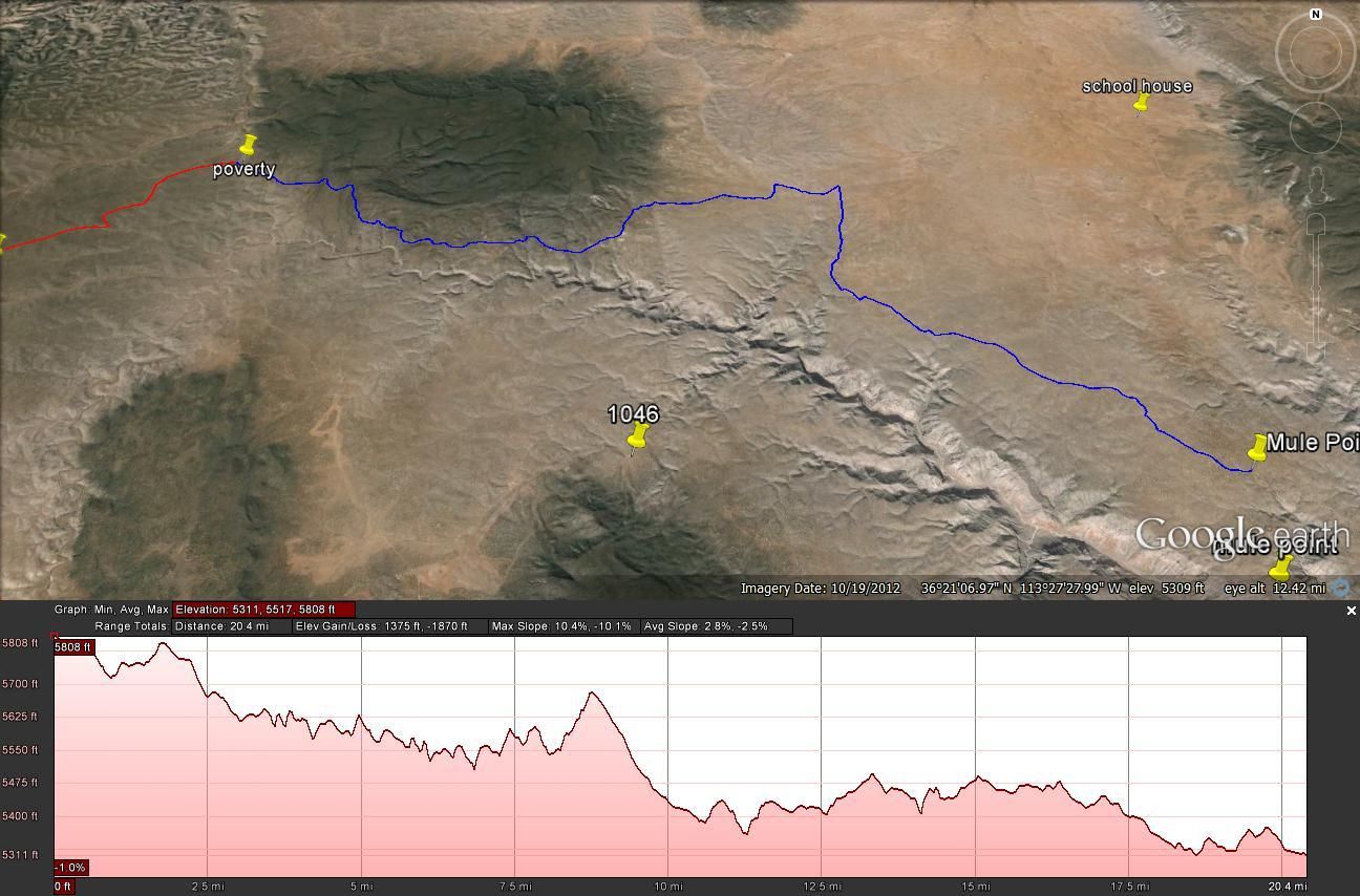
Here is the map showing the intended route from Kelly point to Poverty:
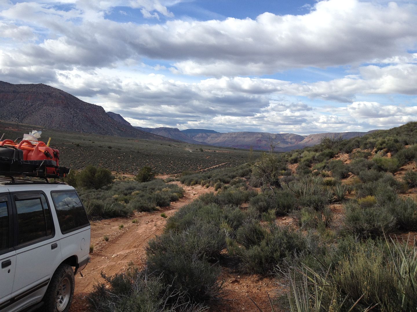
After enjoying a slow morning and our thoroughly cholesterol fortified “Big Breakfast” we were ready to head on out for our next destination, Parashant Canyon.
The drive out didn’t take but a few hours and we quickly passes our camp site 2 nights ago followed by the junction of the Grand Gulch Mine. When I was last here with a group in 2011 two of the team had to leave us when we reached the old location of the community of Poverty, one because of his work schedule and the other because three flat tires had limited his ability to risk continuing.
We all lined up our vehicle pretty much the same way that we did in 2011 for a group picture.
Here is the one from 2011:
We had a quick lunch here and I was for pushing all for getting a head start into Parashant Canyon. Perhaps we could make a few miles into the canyon and find an early camp spot. So off we went. At the minimum I wanted to at least get to the road junction at Mule Point pond.
This map shows our intended route from Poverty to the Mule Point pond:
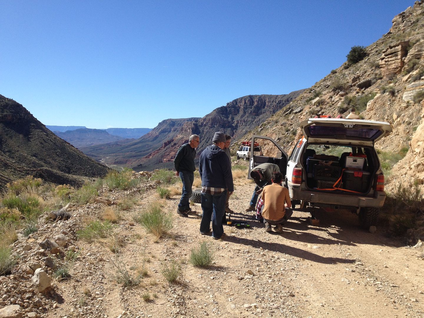
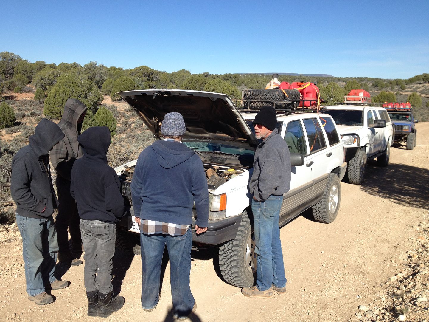
We were a couple of miles on Road 1018 when over the radio I heard Wayne announce rather calmly “ I think my front tire just fell off” I thought he was perhaps exaggerating a bit until I heard others on the radio who were making exclamations about what they saw.
I turned around and by the time I backtracked to where Wayne’s 4-runner was laying on the ground, most of the other group was already there.
Here is what we found:
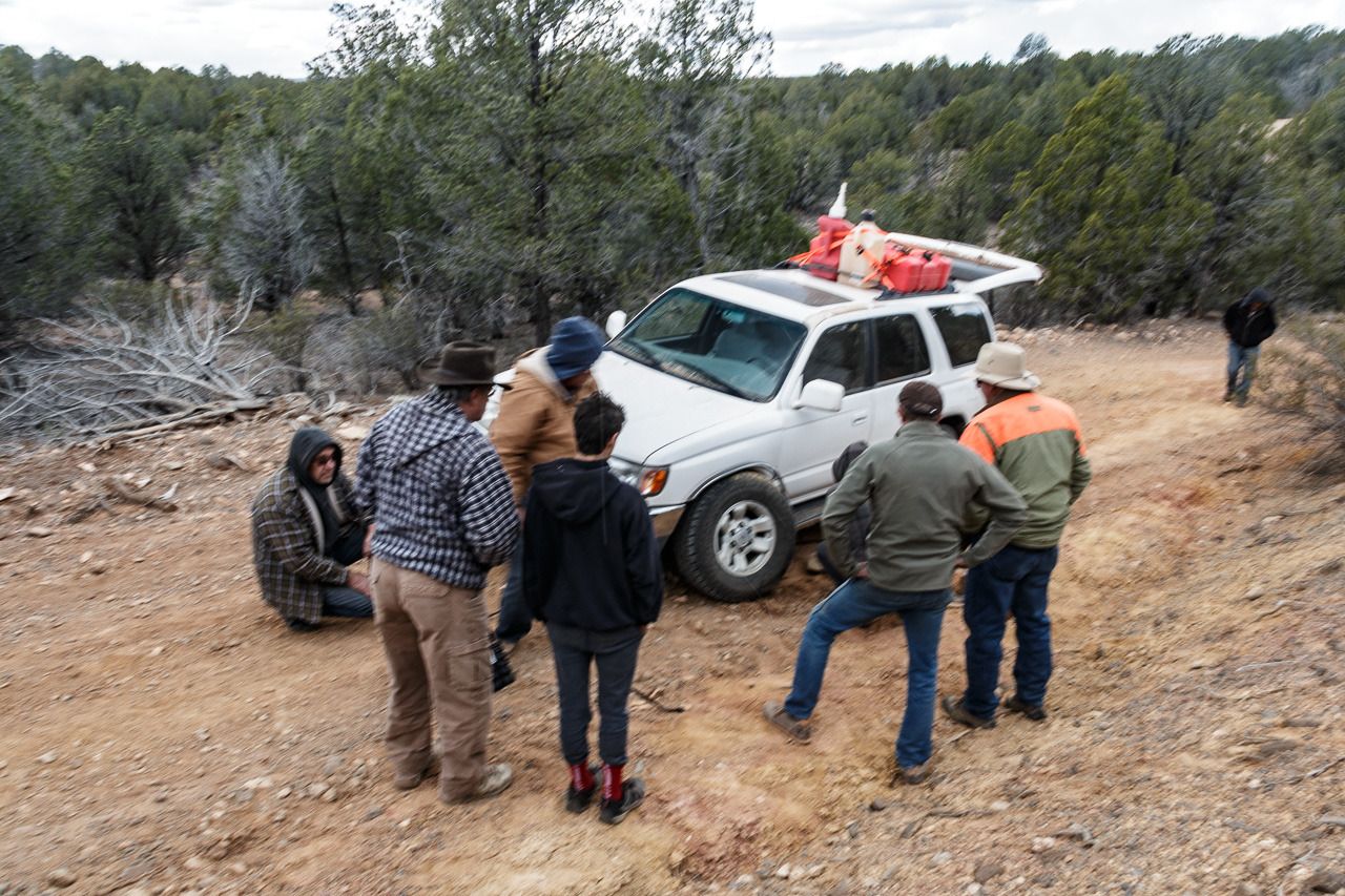
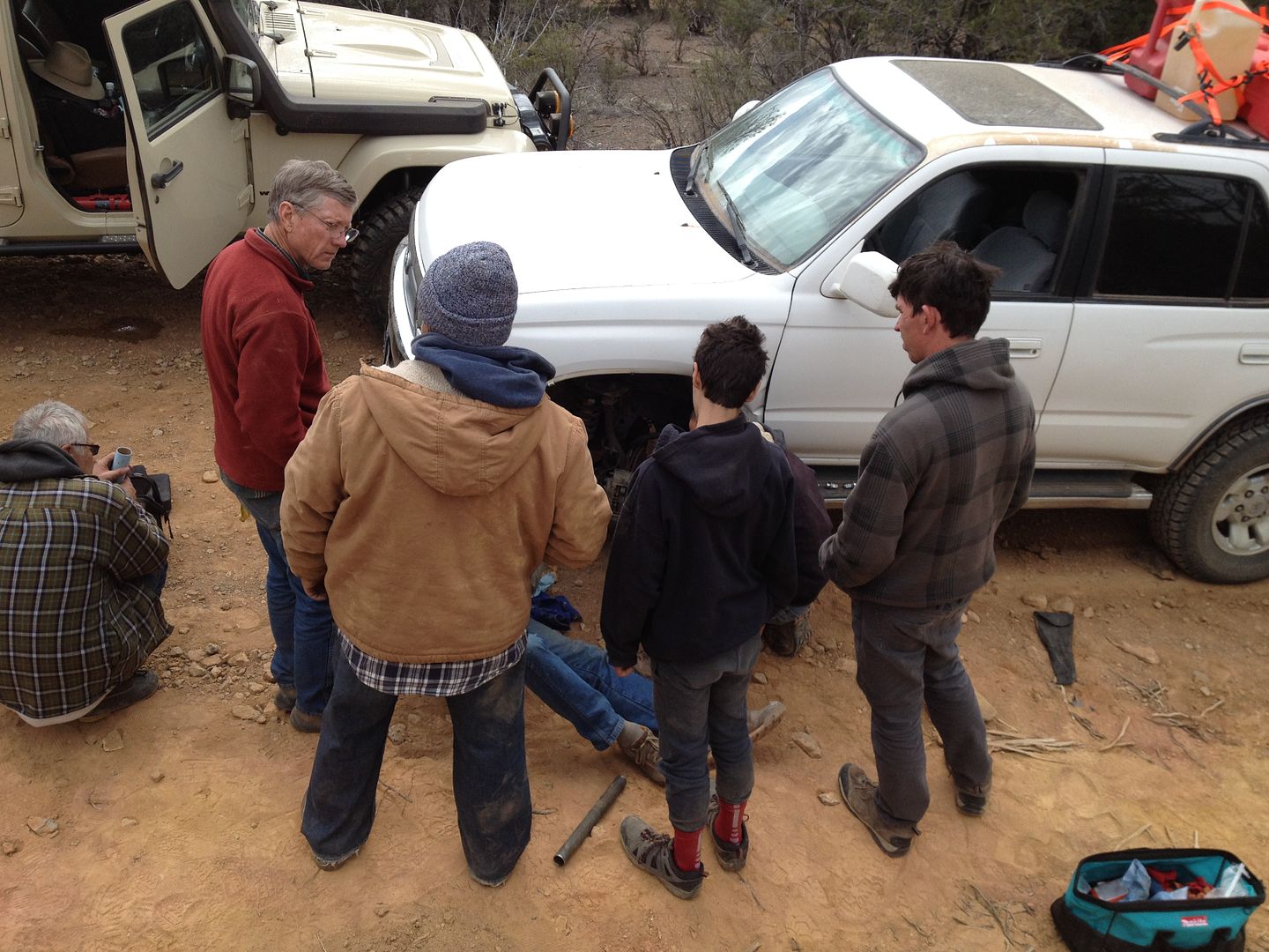
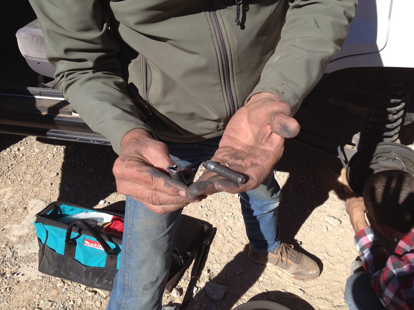
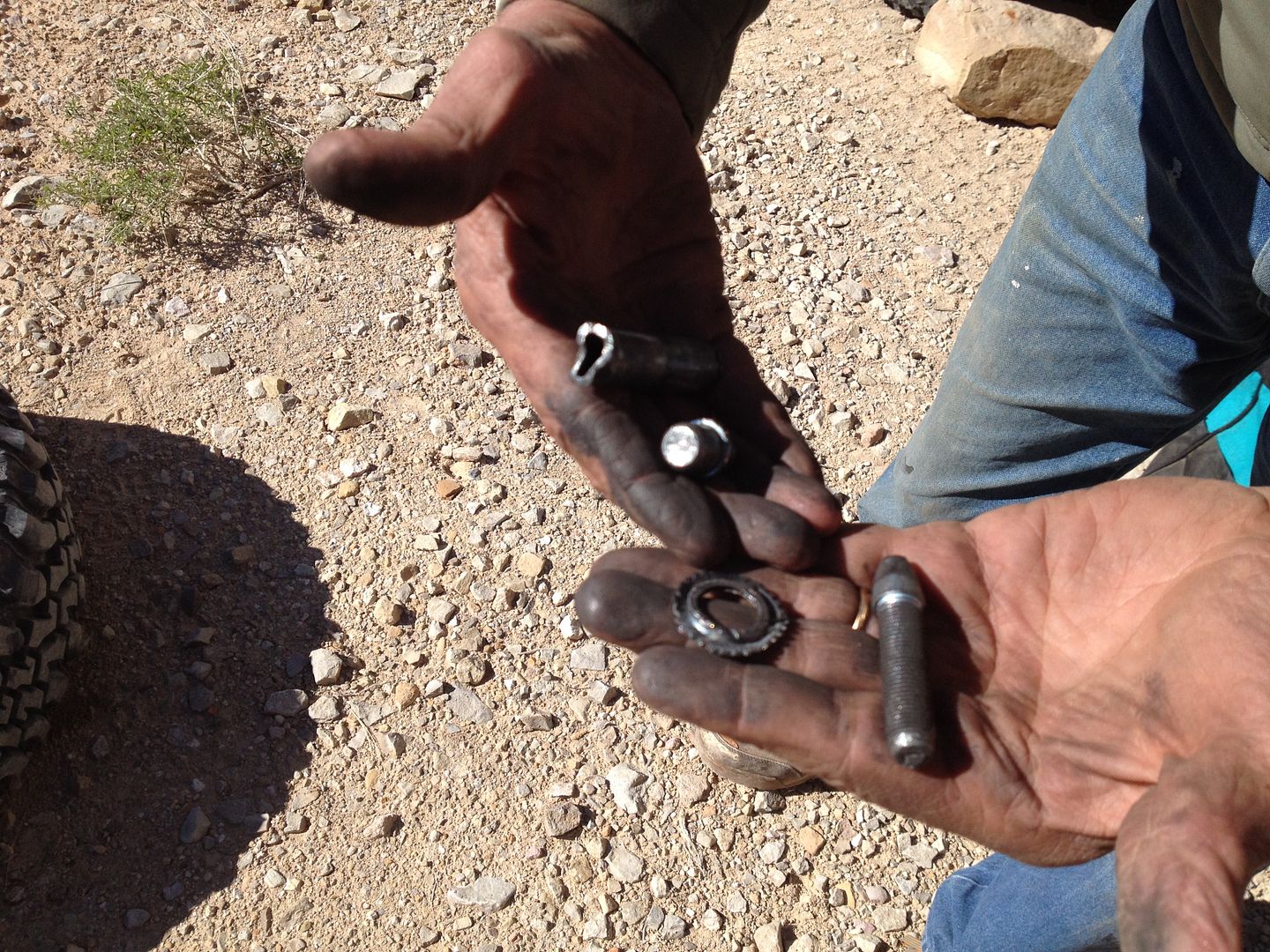
As we started assessing the damage we found that 2 of the 4 bolts holding the lower ball joint were missing and the other two were sheared off. The initial idea was to remove the front axle and try and find some bolts to re-install the ball joint to the lower A-arm.

Removing the axle was going to be a bigger job than we expected since we didn’t have a large enough metric socket to remove the wheel hub. After looking through all our extra bolts we found a few that were the right thread but none were long enough. Finally, we decided to cannibalize the other side of the axle robbing two of its four bolts to secure the damaged side. Hopefully, both sides would hold together long enough to get him within cell service.
It was late afternoon when we got Wayne’s 4-Runner rolling again. The Arizona Strip is one of those places where cell service, for the most part, isn’t available.

It was decided I would follow Wayne out toward St. George until he could get regular cell service then head back and meet up with the rest of the guys who doubled back and made camp at the road junction near Poverty. On the way out it also started to snow some.
What I planned as an easy relatively short day of driving ended up becoming a very long day with me driving 154 miles. On the drive back I kept re-calculating my gas reserves and how I stood after this extra trip. It was very dark driving back to the camp after saying goodbye to Wayne just a few miles south of St. George. When I finally met up with the group they had a fire waiting and it wasn’t long before we called it a night as the temps were dropping below freezing.
I was really sorry to lose Wayne. He will be missed. We were now a group of 6 vehicles.
Next, Day 7 – Parashant Canyon
Thanks,
Fred
Explorer 1
Day 6
Kelly Point to Poverty, Poverty to Mule Point Pond
Here is the map showing the intended route from Kelly point to Poverty:
After enjoying a slow morning and our thoroughly cholesterol fortified “Big Breakfast” we were ready to head on out for our next destination, Parashant Canyon.
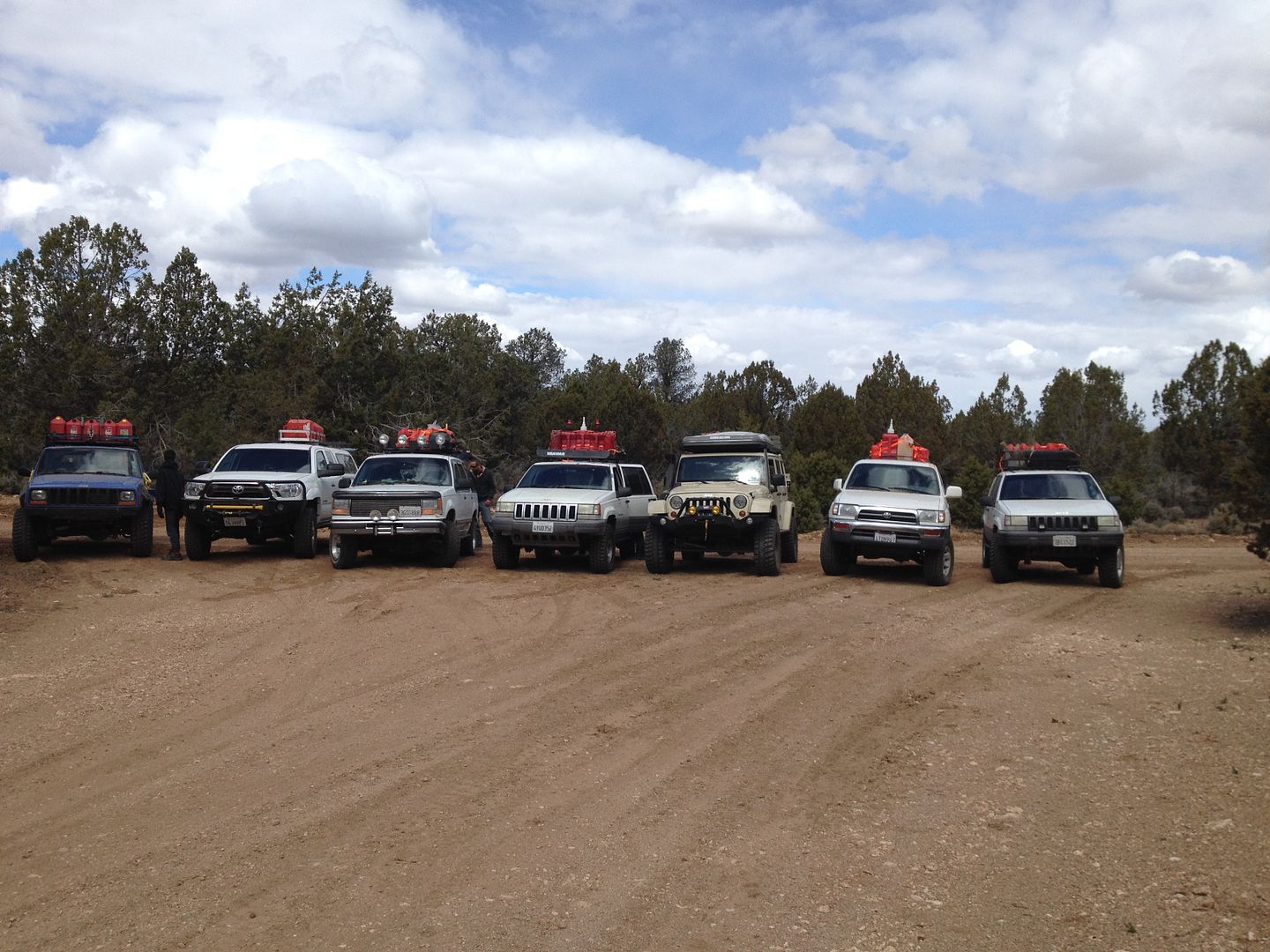
The drive out didn’t take but a few hours and we quickly passes our camp site 2 nights ago followed by the junction of the Grand Gulch Mine. When I was last here with a group in 2011 two of the team had to leave us when we reached the old location of the community of Poverty, one because of his work schedule and the other because three flat tires had limited his ability to risk continuing.
We all lined up our vehicle pretty much the same way that we did in 2011 for a group picture.
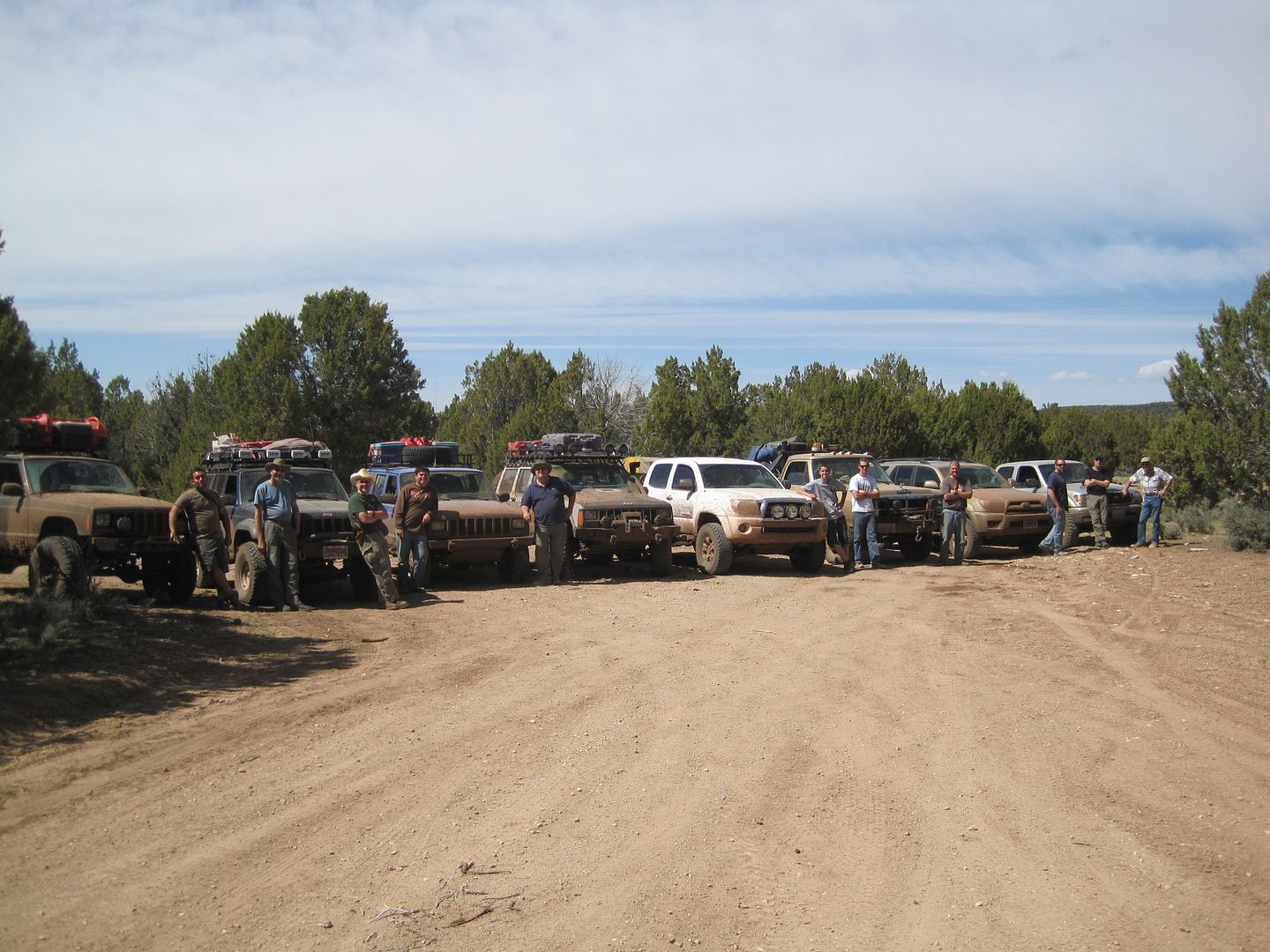
Here is the one from 2011:
We had a quick lunch here and I was for pushing all for getting a head start into Parashant Canyon. Perhaps we could make a few miles into the canyon and find an early camp spot. So off we went. At the minimum I wanted to at least get to the road junction at Mule Point pond.
This map shows our intended route from Poverty to the Mule Point pond:
We were a couple of miles on Road 1018 when over the radio I heard Wayne announce rather calmly “ I think my front tire just fell off” I thought he was perhaps exaggerating a bit until I heard others on the radio who were making exclamations about what they saw.
I turned around and by the time I backtracked to where Wayne’s 4-runner was laying on the ground, most of the other group was already there.
Here is what we found:
As we started assessing the damage we found that 2 of the 4 bolts holding the lower ball joint were missing and the other two were sheared off. The initial idea was to remove the front axle and try and find some bolts to re-install the ball joint to the lower A-arm.
Removing the axle was going to be a bigger job than we expected since we didn’t have a large enough metric socket to remove the wheel hub. After looking through all our extra bolts we found a few that were the right thread but none were long enough. Finally, we decided to cannibalize the other side of the axle robbing two of its four bolts to secure the damaged side. Hopefully, both sides would hold together long enough to get him within cell service.
It was late afternoon when we got Wayne’s 4-Runner rolling again. The Arizona Strip is one of those places where cell service, for the most part, isn’t available.
It was decided I would follow Wayne out toward St. George until he could get regular cell service then head back and meet up with the rest of the guys who doubled back and made camp at the road junction near Poverty. On the way out it also started to snow some.
What I planned as an easy relatively short day of driving ended up becoming a very long day with me driving 154 miles. On the drive back I kept re-calculating my gas reserves and how I stood after this extra trip. It was very dark driving back to the camp after saying goodbye to Wayne just a few miles south of St. George. When I finally met up with the group they had a fire waiting and it wasn’t long before we called it a night as the temps were dropping below freezing.
I was really sorry to lose Wayne. He will be missed. We were now a group of 6 vehicles.
Next, Day 7 – Parashant Canyon
Thanks,
Fred
Explorer 1
Martinjmpr
Wiffleball Batter
Wow, the story keeps getting better. :lurk:
.
Your photography is first rate, BTW. I'm really enjoying this report.
.
Your photography is first rate, BTW. I'm really enjoying this report.
justcuz
Explorer
Great trip report! Looking forward to the next installment.
I think the Arizona Strip is great because of the beauty and lack of tourists compared to the South Rim.
The last time we were out there we did not go up out of the Savanic Mine.
I was driving a Chevy extra cab short bed and one of the other guys was driving a crew cab Toyota with a 6' bed.
Neither of us had any suspension lift and had 141" wheelbases. We backtracked and went over Mudd Mtn past the ranch to the Mt Trumball School
We did it in February and spent the last night at the Mt. Trumball School. It got down to 23 degrees that night!
We left early to take advantage of the hard ground, but by mid morning it had thawed considerably.
It was so muddy going out the main road back to St George that we hardly had to steer because the ruts were so deep!
Explorer 1
Explorer 1
Day 7 Parashant Canyon - New Territory
Day 7 – Parashant Canyon
In our trip here to the Arizona Strip in 2011 it was in the original plans to visit the Parashant Canyon but due to it taking much longer than I expected to get to our first destinations, Parashant was one of destinations I had to leave off. I was determined to make it this year even if it came down to doing it alone. Fortunately, for most of the guys in the group this was their first Arizona Strip trip and they were happy to tag along with my schedule without complaint.
Besides losing Wayne yesterday we had experienced some other mechanical difficulties that threaten to decrease our number, but so far we had been able to make trail repairs sufficient to continue.
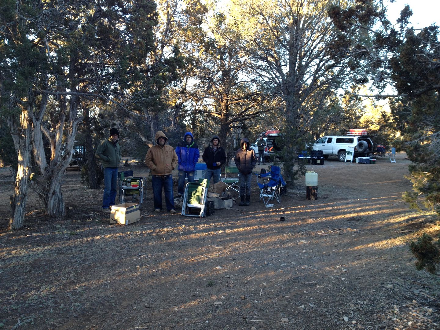
When I arrive back in camp last evening after escorting Wayne toward St. George, the guys were all bundled up around the fire. It had snowed earlier and promised to be a cold night.
Next morning as I prepared to heat some water for coffee here is what I found:
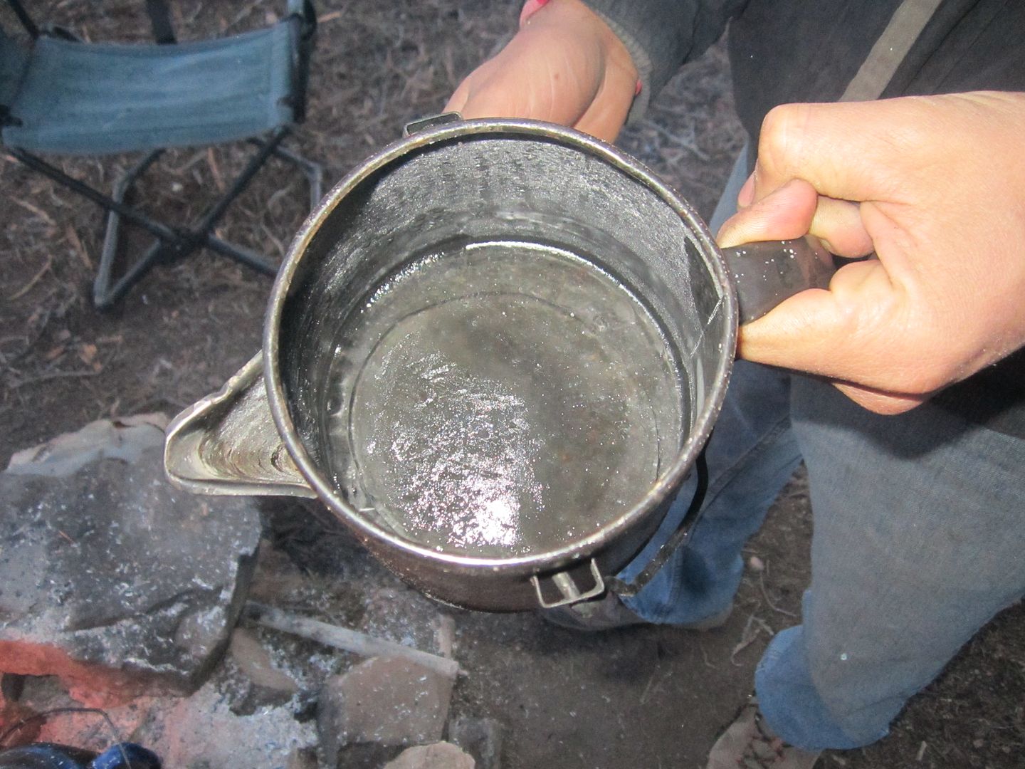
In case you can't see, that's about 4 inches of solid ice in the bottom of the coffee pot.
I took a temperature reading and here is what I found:
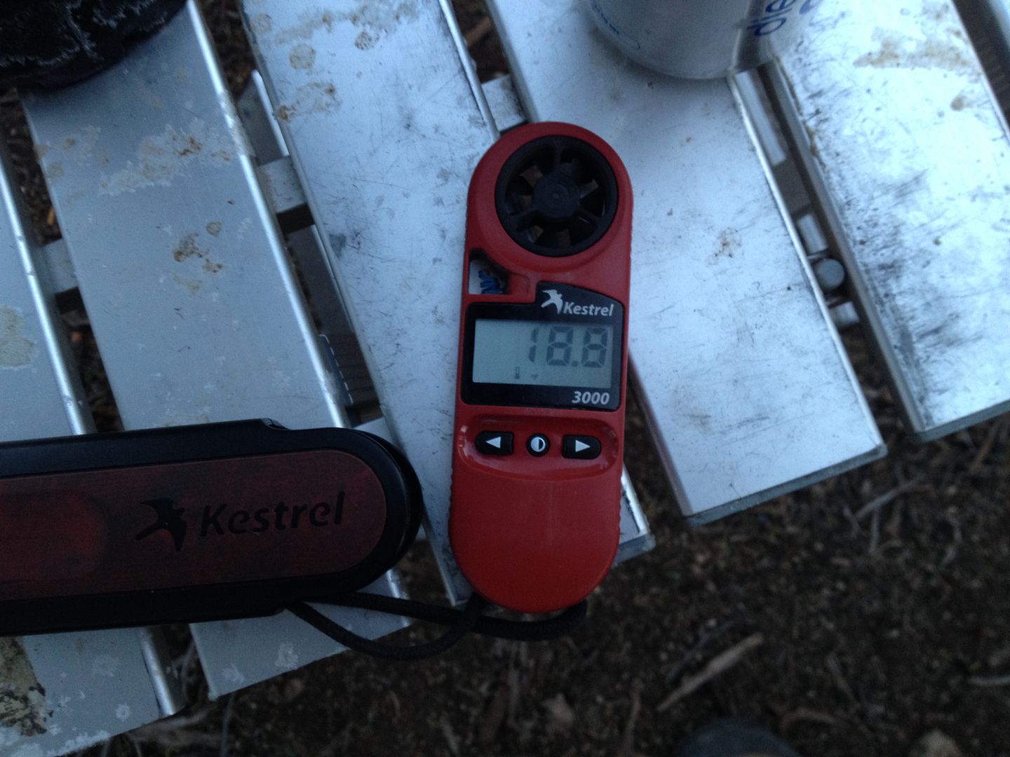
No wonder the guys were breaking camp so slow the morning:
Now that I have driven Parashant Canyon to the end I would divide it into three parts:
1. “The Decent” which would be from the Mule Pond Point down to the junction with the Copper Kind Mine road.
2. “The Middle” (real original here) which would be from the junction with the Copper King Mine road down to and up the Andrus wash, then following the canyon on its rim to the “Cabin Saddle” ( you'll learn more about this later)
3. The last section I would call the “Mollie's Nipple” part. This would be from the old cabin around Mollies Nipple.
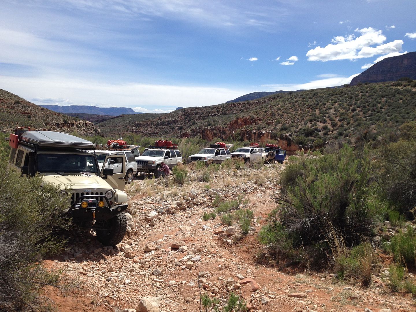
So with that understanding, here we are just before “The Decent”
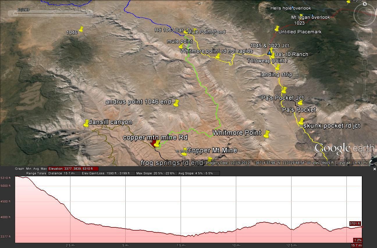
The road traveling toward Mule Point pond went uneventful. It's a fairly well graded dirt road. In route we took what I planned as a “shortcuts” which didn't always end up so, many were” two track” rarely used trails.
The junction at Mule Point pond isn't anything to write home about. The “pond” was just a mound of dirt placed in a way to collect rain water for the cattle. However, shortly after turning right unto the only known road that descends into the Parashant Canyon the scenery and grade of the road changes dramatically.
This is a fairly steep declining road which crosses the wash and at times the trail is in the wash. Any recent downpour will make this trail/road much more difficult to travel on and follow.
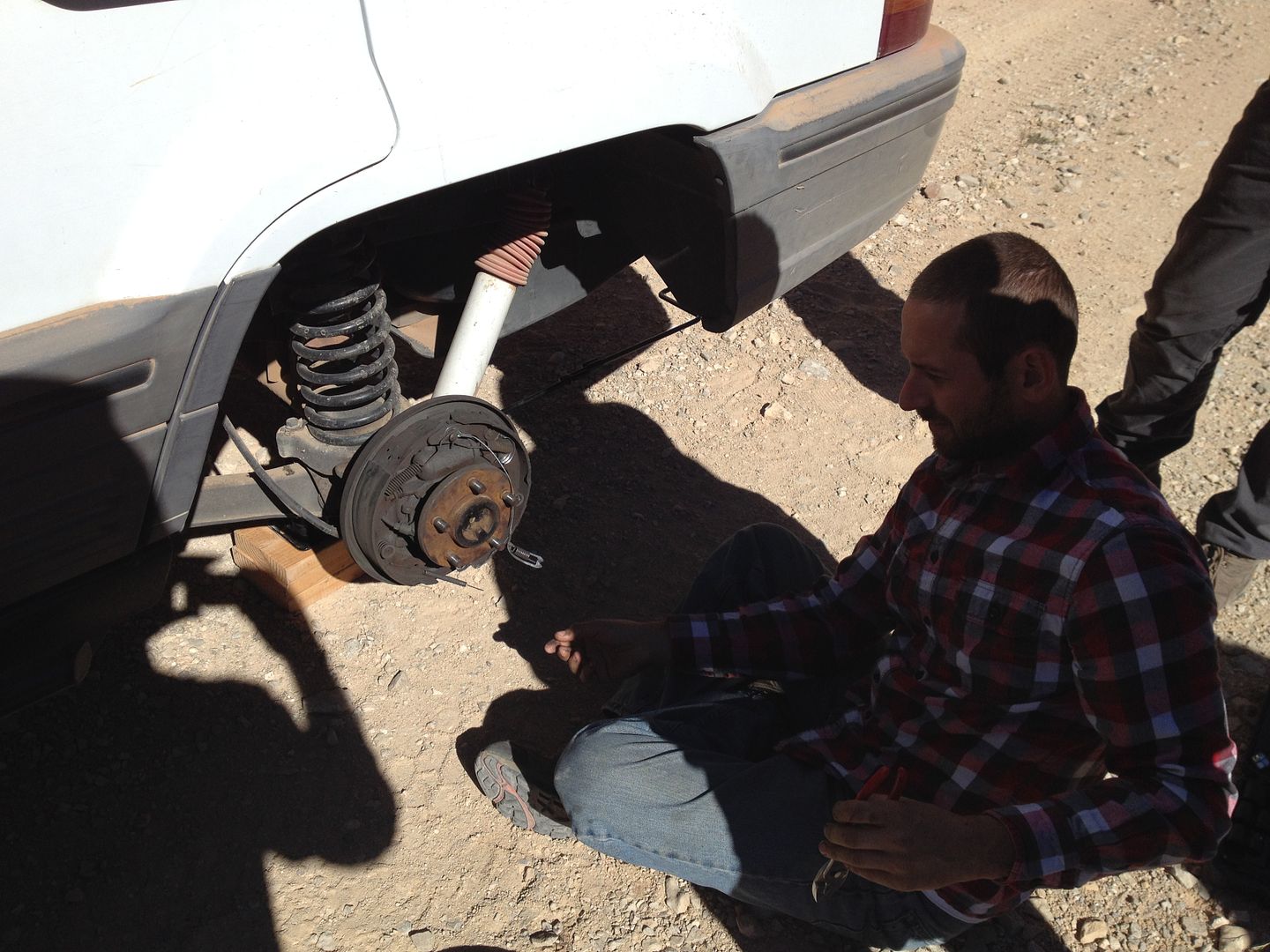
In our route down we had our first mechanical challenge of the day. You can actually hear Dan on the above video telling me over the radio that the “noise” coming from his rear axle was loud enough that he needed to stop and investigate.
It turns out that something broke apart in the rear driver's side brake assembly. The noise was all the other parts coming apart and rubbing against the brake drum.
At this point our only solution was to replicate what we did with Rudi's rear brake at the Grand Gulch Mine and crimp off the hydraulic brake line so Dan would be operating in 3 wheel brakes from this point on.
It was about a 45 minute stop and we were off again. Once through the narrow part of the canyon the road opens up and changes from sand and gravel to soft silty dust. Dust that goes just about everywhere and you drive hoping that your speed will be greater than any tail wind so the cloud your making won't overcome you.
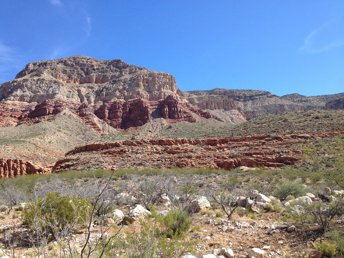
Here the road undulates up and down, side to side as the canyon broadens. You are still in a general way descending down the west side of Parashant Canyon following the south facing side of Andrus Point.
Here is where we started having another problem with Dan's ZJ. It acted like it was getting vapor lock and would become very difficult to start after a brief stop.
It had been running a bit hot so all we could do for now was be sure to let it idle and cool down before we shut it off each time.
After you round the point the turn off for the Copper King mine is a short ways before the more challenging decent into the wash coming out of Andrus Canyon. From the looks of the trails most visitors choose to visit the mine instead of traveling on toward our destination. This is where we begin Section 2 or “the Middle”.
One interesting note would be that just past the Copper King Mine Junction there is a water tank and a large watering trough. Place inside the trough protecting the float valve from damage by the cattle is an upside down metal grocery cart. When I was there wild bees were all around the water sipping water to use to cool off their hive. On the way back the next day, I washed off some of the dust off my face arms and neck with the cool water.
The road descends and empties into the Andrus Canyon wash where it briefly travels up canyon following a rather remote and unmarked “trail” (look for any signs of tire tracks), to an easily missed exit on the opposite side. This wash was the first section of the day which has some technical rock crawling requiring spotting for some of the drivers.
Here we are having lunch at the wash exit. There isn't really much of a trail in the wash. After a decent rain fall I'm sure all traces of the trail is the wash disappear.
Once across the wash it is apparent this road is less traveled. It has become a 2 track trail with loads of growth not only in the middle but on both sides. I would guess that most users are driving a UTV not a full size vehicle. All of our vehicles came out with side scratches to verify this.
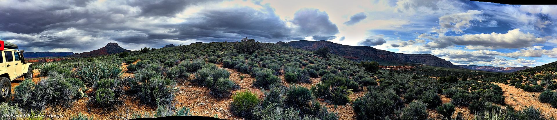
Shortly we made a left turn continuing a westward direction; straight would take us up Dansill Canyon (maybe to be explored on another trip). We now could look to our left and see where we had traveled down the Parashant Canyon. This in itself was a beautiful site.

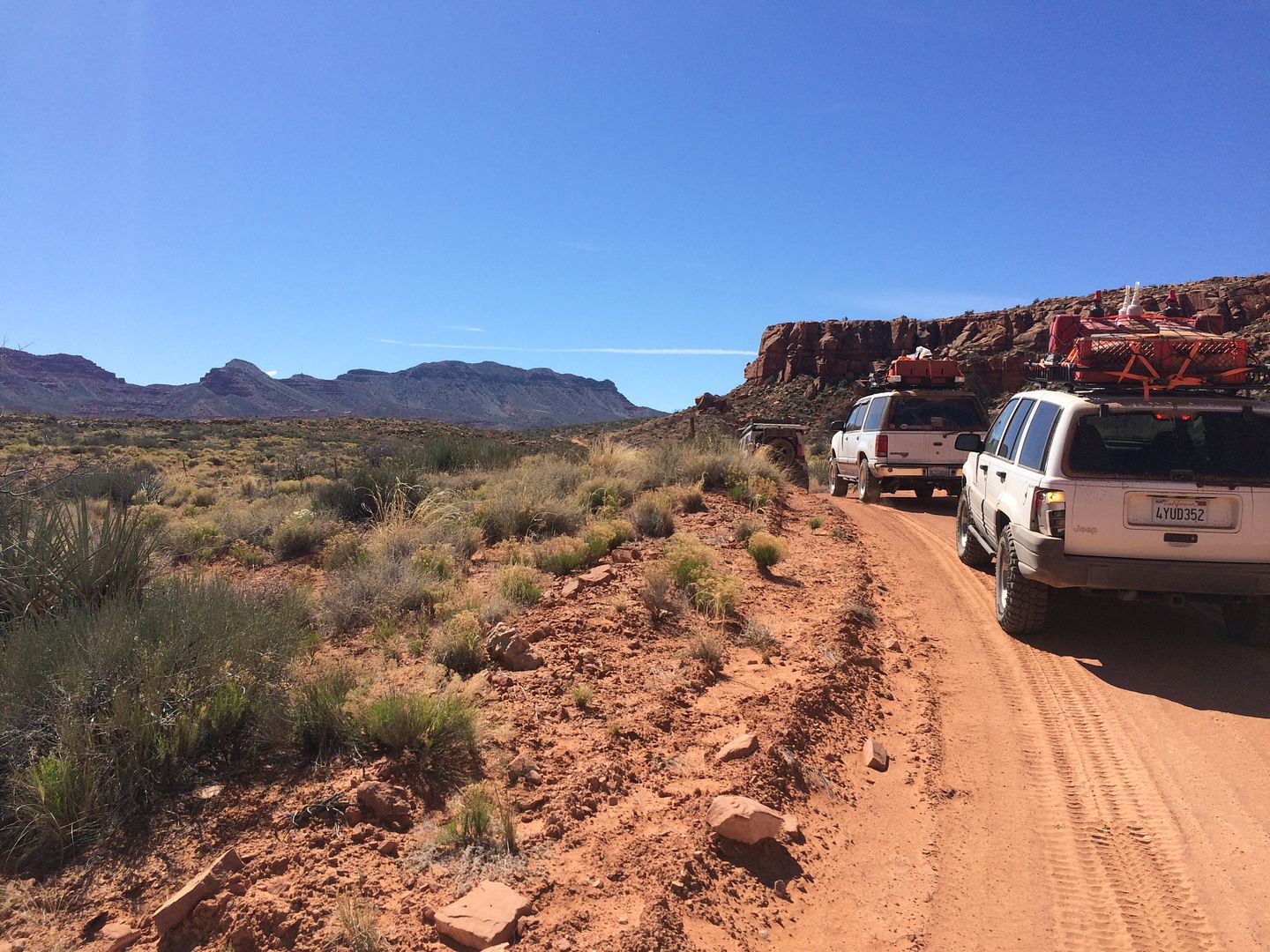
This section is very lonely; the vehicles can really spread out as your driving. I somehow got the feeling no one had been on this road for some weeks.
You can just see right of center a small dust cloud of the next vehicle in our group.
To the right of my Jeep in this picture is Mollie's Nipple.
The road was not without its own challenges; The Ford Explorer especially had difficulties. I had to break out the strap more than once. Unfortunately, the camera wasn't always running when we were coaching and spotting the vehicles up or down a difficult part but we did manage to include a few. Keep in mind most of these are heavily laden, top heavy, almost stock vehicles.
Next up – Parashant Canyon Part 2
Thanks,
Fred
Explorer 1
Day 7 – Parashant Canyon
In our trip here to the Arizona Strip in 2011 it was in the original plans to visit the Parashant Canyon but due to it taking much longer than I expected to get to our first destinations, Parashant was one of destinations I had to leave off. I was determined to make it this year even if it came down to doing it alone. Fortunately, for most of the guys in the group this was their first Arizona Strip trip and they were happy to tag along with my schedule without complaint.
Besides losing Wayne yesterday we had experienced some other mechanical difficulties that threaten to decrease our number, but so far we had been able to make trail repairs sufficient to continue.
When I arrive back in camp last evening after escorting Wayne toward St. George, the guys were all bundled up around the fire. It had snowed earlier and promised to be a cold night.
Next morning as I prepared to heat some water for coffee here is what I found:
In case you can't see, that's about 4 inches of solid ice in the bottom of the coffee pot.
I took a temperature reading and here is what I found:
No wonder the guys were breaking camp so slow the morning:
Now that I have driven Parashant Canyon to the end I would divide it into three parts:
1. “The Decent” which would be from the Mule Pond Point down to the junction with the Copper Kind Mine road.
2. “The Middle” (real original here) which would be from the junction with the Copper King Mine road down to and up the Andrus wash, then following the canyon on its rim to the “Cabin Saddle” ( you'll learn more about this later)
3. The last section I would call the “Mollie's Nipple” part. This would be from the old cabin around Mollies Nipple.
So with that understanding, here we are just before “The Decent”
The road traveling toward Mule Point pond went uneventful. It's a fairly well graded dirt road. In route we took what I planned as a “shortcuts” which didn't always end up so, many were” two track” rarely used trails.
The junction at Mule Point pond isn't anything to write home about. The “pond” was just a mound of dirt placed in a way to collect rain water for the cattle. However, shortly after turning right unto the only known road that descends into the Parashant Canyon the scenery and grade of the road changes dramatically.
This is a fairly steep declining road which crosses the wash and at times the trail is in the wash. Any recent downpour will make this trail/road much more difficult to travel on and follow.
In our route down we had our first mechanical challenge of the day. You can actually hear Dan on the above video telling me over the radio that the “noise” coming from his rear axle was loud enough that he needed to stop and investigate.
It turns out that something broke apart in the rear driver's side brake assembly. The noise was all the other parts coming apart and rubbing against the brake drum.
At this point our only solution was to replicate what we did with Rudi's rear brake at the Grand Gulch Mine and crimp off the hydraulic brake line so Dan would be operating in 3 wheel brakes from this point on.
It was about a 45 minute stop and we were off again. Once through the narrow part of the canyon the road opens up and changes from sand and gravel to soft silty dust. Dust that goes just about everywhere and you drive hoping that your speed will be greater than any tail wind so the cloud your making won't overcome you.
Here the road undulates up and down, side to side as the canyon broadens. You are still in a general way descending down the west side of Parashant Canyon following the south facing side of Andrus Point.
Here is where we started having another problem with Dan's ZJ. It acted like it was getting vapor lock and would become very difficult to start after a brief stop.
It had been running a bit hot so all we could do for now was be sure to let it idle and cool down before we shut it off each time.
After you round the point the turn off for the Copper King mine is a short ways before the more challenging decent into the wash coming out of Andrus Canyon. From the looks of the trails most visitors choose to visit the mine instead of traveling on toward our destination. This is where we begin Section 2 or “the Middle”.
One interesting note would be that just past the Copper King Mine Junction there is a water tank and a large watering trough. Place inside the trough protecting the float valve from damage by the cattle is an upside down metal grocery cart. When I was there wild bees were all around the water sipping water to use to cool off their hive. On the way back the next day, I washed off some of the dust off my face arms and neck with the cool water.
The road descends and empties into the Andrus Canyon wash where it briefly travels up canyon following a rather remote and unmarked “trail” (look for any signs of tire tracks), to an easily missed exit on the opposite side. This wash was the first section of the day which has some technical rock crawling requiring spotting for some of the drivers.
Here we are having lunch at the wash exit. There isn't really much of a trail in the wash. After a decent rain fall I'm sure all traces of the trail is the wash disappear.
Once across the wash it is apparent this road is less traveled. It has become a 2 track trail with loads of growth not only in the middle but on both sides. I would guess that most users are driving a UTV not a full size vehicle. All of our vehicles came out with side scratches to verify this.
Shortly we made a left turn continuing a westward direction; straight would take us up Dansill Canyon (maybe to be explored on another trip). We now could look to our left and see where we had traveled down the Parashant Canyon. This in itself was a beautiful site.
This section is very lonely; the vehicles can really spread out as your driving. I somehow got the feeling no one had been on this road for some weeks.
You can just see right of center a small dust cloud of the next vehicle in our group.
To the right of my Jeep in this picture is Mollie's Nipple.
The road was not without its own challenges; The Ford Explorer especially had difficulties. I had to break out the strap more than once. Unfortunately, the camera wasn't always running when we were coaching and spotting the vehicles up or down a difficult part but we did manage to include a few. Keep in mind most of these are heavily laden, top heavy, almost stock vehicles.
Next up – Parashant Canyon Part 2
Thanks,
Fred
Explorer 1
Last edited:
Explorer 1
Explorer 1
Parashant Canyon - Part 2
Parashant Canyon – Part 2
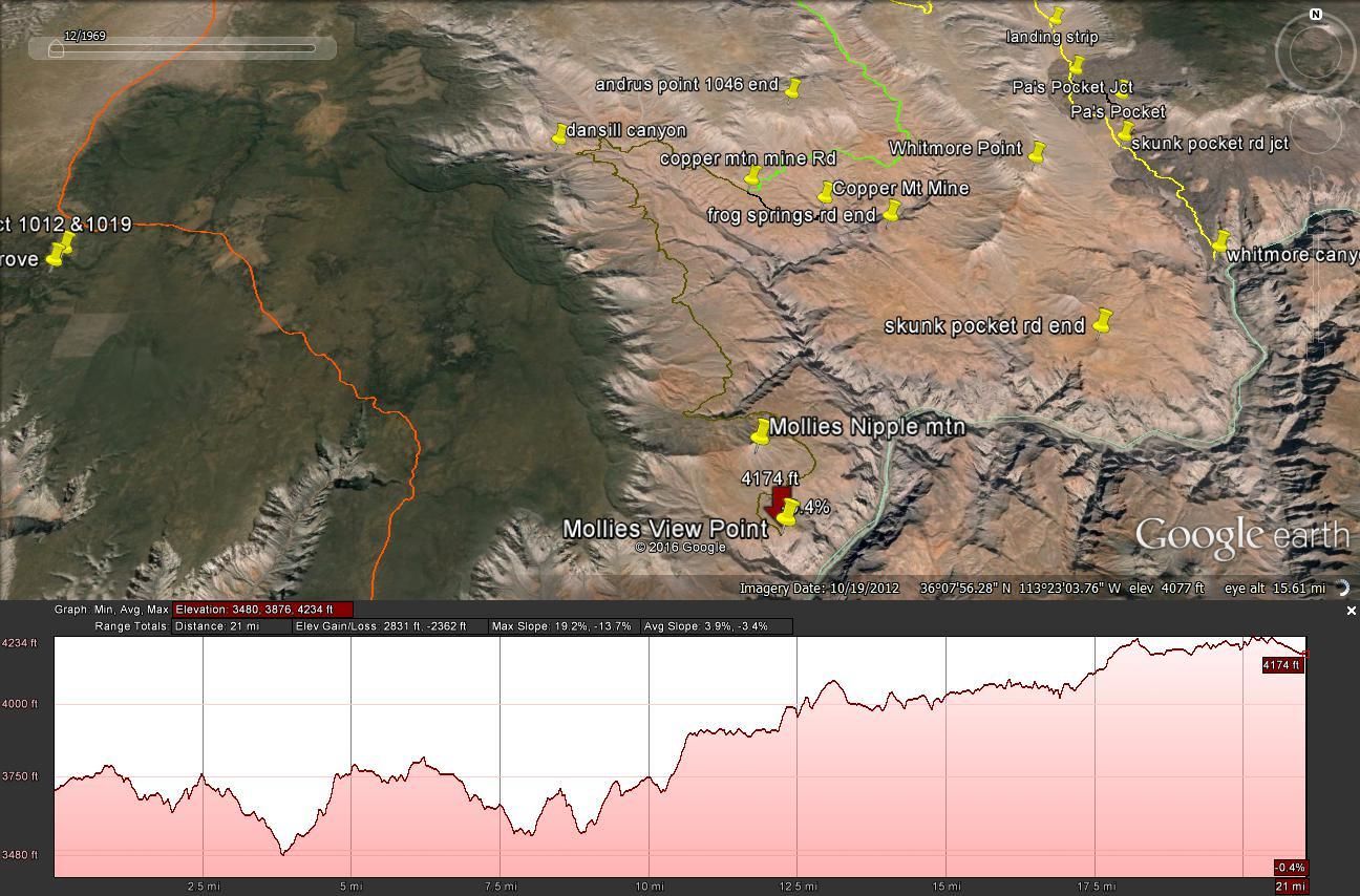
For a few miles the road pulled away from the canyon's edge and then crossed over a saddle. At this saddle we were amazed to find an old abandoned “cabin”. Judging by the supplies and equipment in and around it, it wasn't all that long ago that it was occupied. We found food stuffs still there, books, tools and an assortment of other items and equipment. It was very small, about 10 x 10 feet and the outside was constructed of corrugated metal. We were so surprised by this find, lots of pictures were taken.
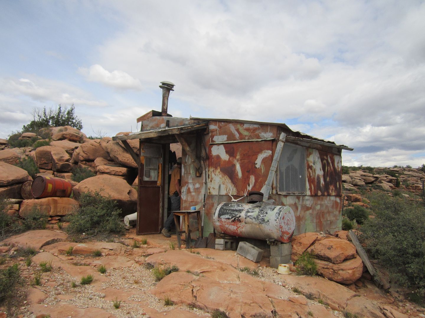
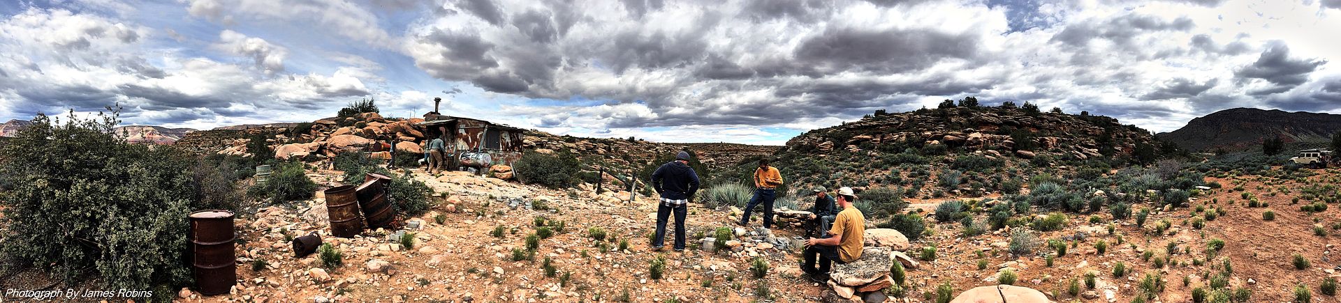
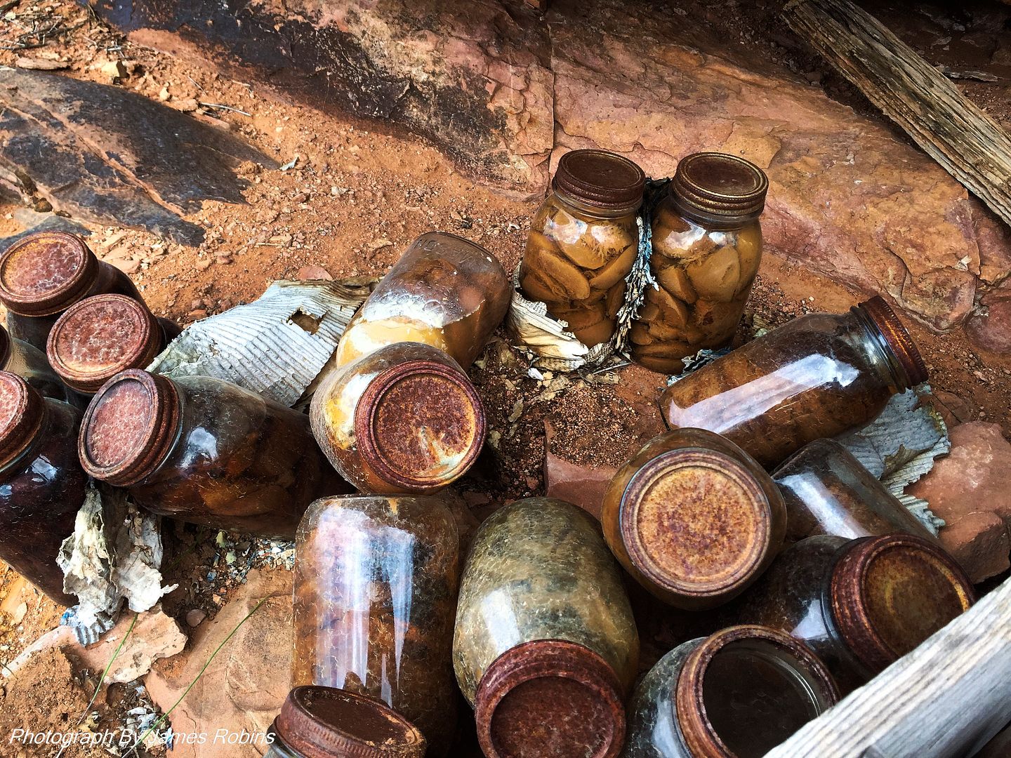
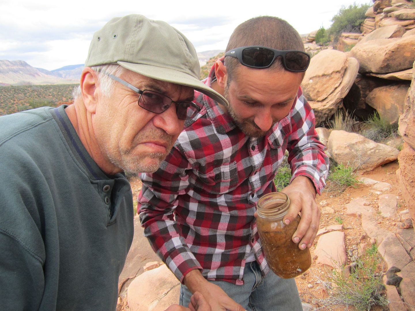
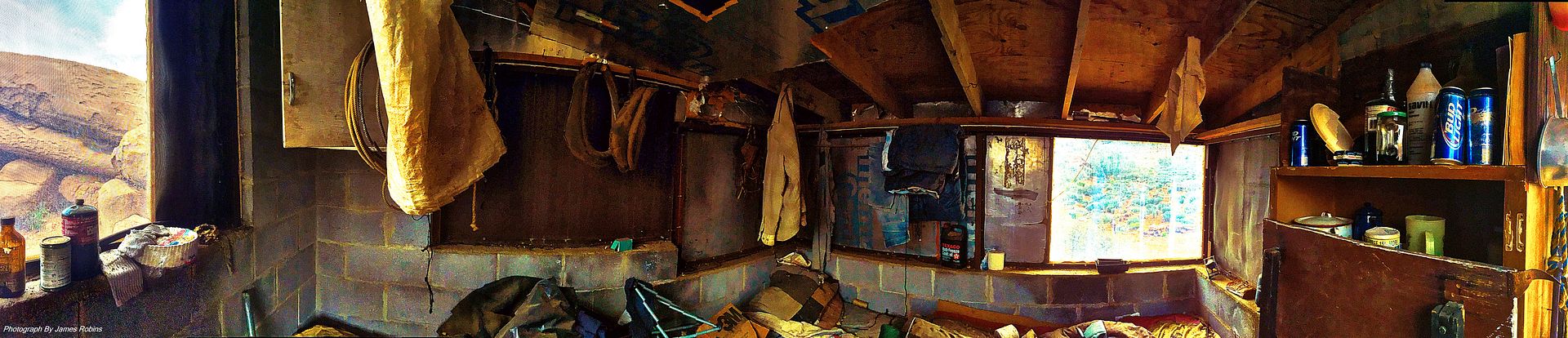
Yep, that's a candy cane still in the package. Those metal drums were packed with supplies.
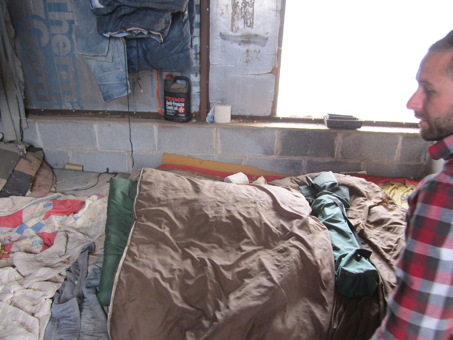
After we had satisfies our curiosity, we continued conversations over the radio wondering who it was that occupied this little cabin and what life must have been like.
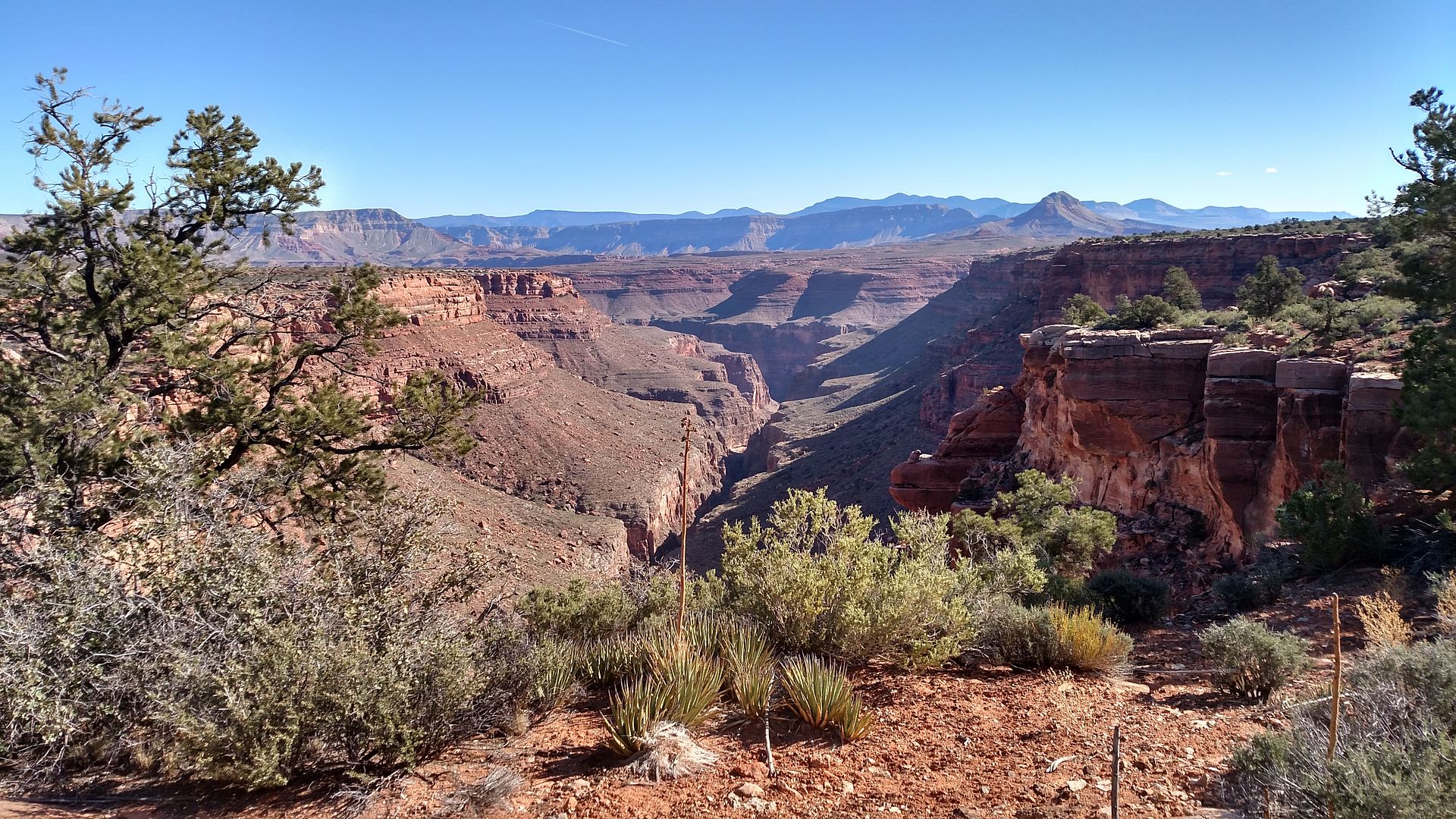
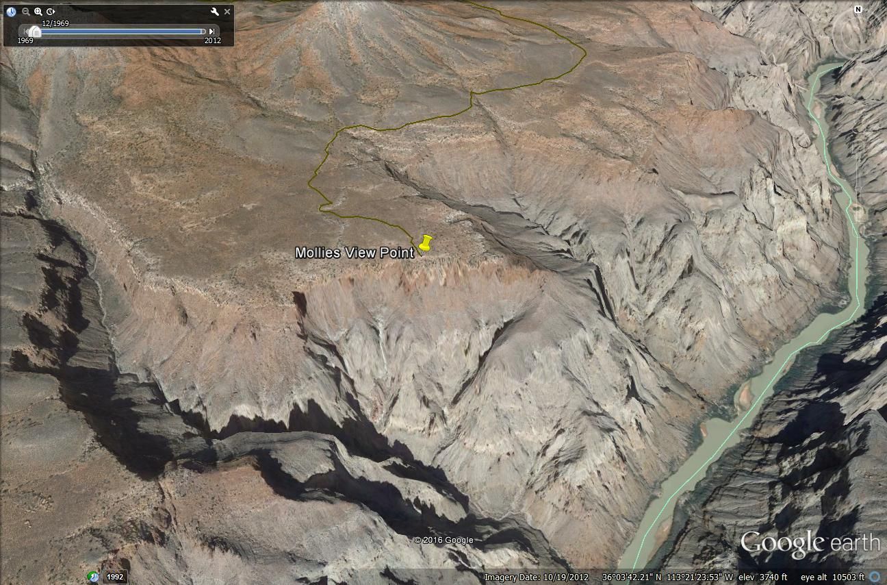
The afternoon was quickly passing and we still had quite a distance to go. From studying the maps I could see we needed to go completely around Mollie's Nipple before we would arrive at our destination. My research had yielding no information on this trail and therefore no idea how difficult the road would be. In the distance, I could see Mollies Nipple, (Sorry, no matter how often I say or write that, it always feels weird, so let's just call it “MN”") it became the focal point around every corner and over every crest, I wanted to get to our destination camp before dark.
it became the focal point around every corner and over every crest, I wanted to get to our destination camp before dark.
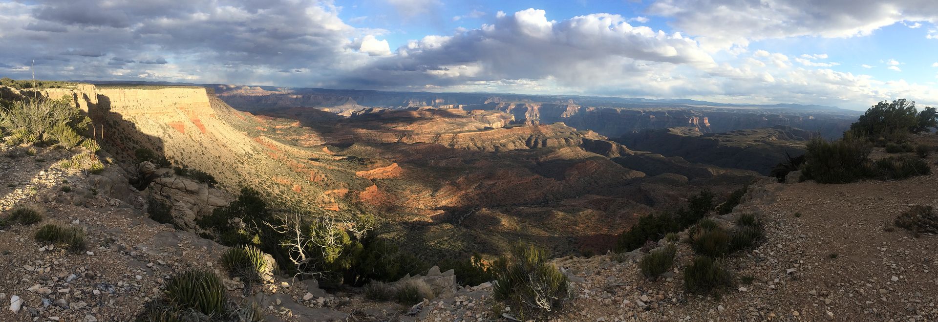
After the pass next to the cabin, Andrus canyon intersects with Parashant Canyon coming in on our left. We had some great views up Parashant and the territory we had traveled through earlier that day.
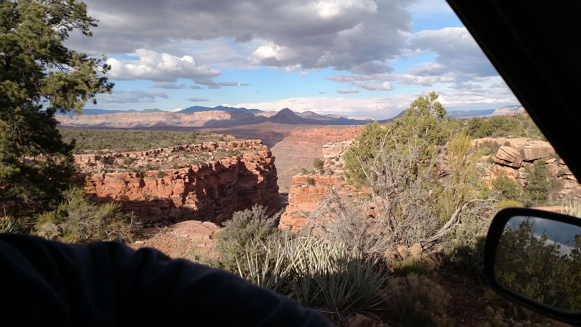
The cliffs right above center right, with the shadow on them is Whitmore Point. At the time of the picture I didn't know this, but the next day I was there and took a picture looking this way, you'll see that picture in the Day 8 report.
The clouds and the late afternoon light added a bit of drama to our drive and the pictures.
That's "MN" there on the far left in the picture.

Next up – Molly's Point
Thanks,
Fred
Explorer 1
Parashant Canyon – Part 2
For a few miles the road pulled away from the canyon's edge and then crossed over a saddle. At this saddle we were amazed to find an old abandoned “cabin”. Judging by the supplies and equipment in and around it, it wasn't all that long ago that it was occupied. We found food stuffs still there, books, tools and an assortment of other items and equipment. It was very small, about 10 x 10 feet and the outside was constructed of corrugated metal. We were so surprised by this find, lots of pictures were taken.
Yep, that's a candy cane still in the package. Those metal drums were packed with supplies.
After we had satisfies our curiosity, we continued conversations over the radio wondering who it was that occupied this little cabin and what life must have been like.
The afternoon was quickly passing and we still had quite a distance to go. From studying the maps I could see we needed to go completely around Mollie's Nipple before we would arrive at our destination. My research had yielding no information on this trail and therefore no idea how difficult the road would be. In the distance, I could see Mollies Nipple, (Sorry, no matter how often I say or write that, it always feels weird, so let's just call it “MN”
it became the focal point around every corner and over every crest, I wanted to get to our destination camp before dark.After the pass next to the cabin, Andrus canyon intersects with Parashant Canyon coming in on our left. We had some great views up Parashant and the territory we had traveled through earlier that day.
The cliffs right above center right, with the shadow on them is Whitmore Point. At the time of the picture I didn't know this, but the next day I was there and took a picture looking this way, you'll see that picture in the Day 8 report.
The clouds and the late afternoon light added a bit of drama to our drive and the pictures.
That's "MN" there on the far left in the picture.
Next up – Molly's Point
Thanks,
Fred
Explorer 1
Last edited:
Explorer 1
Explorer 1
MAPS Day 8
Sorry, forgot the maps of Day 7:
Here they are:
Thanks,
Fred
Explorer 1
Sorry, forgot the maps of Day 7:
Here they are:
Thanks,
Fred
Explorer 1
20DYNAMITE07
Just along for the ride
Fascinating. Thanks so much for sharing.
Agreed. This is a great report. I particularly enjoy the different vehicles in the same convoy. Great stuff.
Explorer 1
Explorer 1
The Arizona Strip 2016 Team
While I working on the final journey, I thought it would be good to share a bit about the brave souls in our group.
It’s interesting that without thought or request the vehicles each day before long assume a certain order. I’ll take that natural order and tell you a bit about the driver (and passenger) along with something about their vehicle.
I usually find in my mirror most of the time Cody and his encourager, spotter and friend Jim.
Cody has a dual residency in the La Habra Ca. and somewhere in Ohio. It’s a long complicated story so I won’t bore you with the details. He is a dried and dyed through and through Ford guy. It takes it from the Jeep and Toyota guys so you don’t need to pick on him anymore. As you might already know his 90’s Explorer has been greatly challenged on this trip. It comes with a stock 4.0 V6 and has a slight 1-2” lift barely allowing it to run BFG AT 31’s. Both axles are open and with all the dragging across the rocks we did I surprised it’s still running. It still has some more damage ahead of it on this trip but it does make it home under its own power. Cody is fairly new (A couple of years’ experience) to the overland of road community but has what it takes (usually) to keep going.
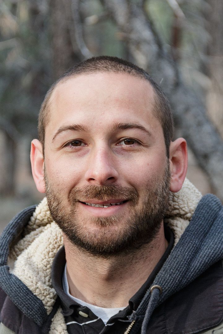
Jim, his passenger a resident of La Habra, Ca came along as what has turned out to almost be a full time job assisting the Ford in the more difficult section of road. He had his own 2015 Jeep JKU Rubicon (which he dearly wished he could have been driving on this trip, but that is again another story) Jim’s the only team member who has to set up and take down his tent each day as all other drivers sleep in their vehicles. He has been a great help spotting the group when needed.
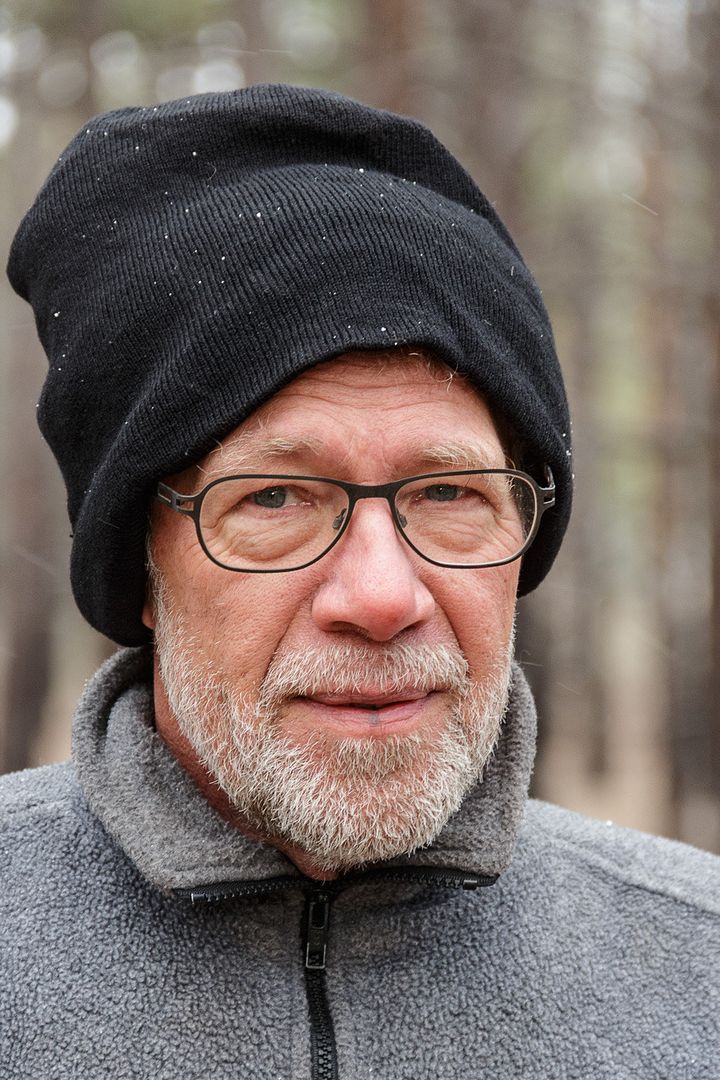
Dan, who I have known since high School days is an explorer from way back when off road exploring wasn’t cool. Then all you needed was an old pickup, a rifle and a sleeping bag and you were set. He lived in Morroco for 20 years and now has dual citizenship in England (where he currently lives) and the USA. Besides English he speaks fluent French, Arabic and can get by with Berber. On his recent visit to the US he purchased one of our off road group project vehicles, a 1993 Jeep ZJ and has been a very fast learner on the “overlanding thing”. The Jeep has a 4” lift, runs on 33” BFG MT. Open axles. Quick disconnect sway bar.

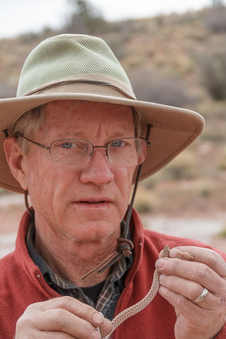
Rudi, another longtime friend was born in Siberia Russia. He immigrated to Germany and then the USA in his early 20’s. Was living on Saipan Island when I met him and we have been friends since. He has been my guide and traveling partner on several trips, “Pacific Ocean to the Atlantic Ocean driving adventure across Asia and eastern Europe”, “Moscow to Chita”, “Germany to Kirgizstan”, “All around Ethiopia”. He speaks 4 languages fluently and has a real heart for adventure. He is a natural off roader and has learned very fast to choose a good line in a rock garden. His vehicle is also one of our group’s past project vehicles. The 1997 Jeep ZJ has a 2 ½ lift, 32” ******** Cepek MT and quick disconnect sway bar.
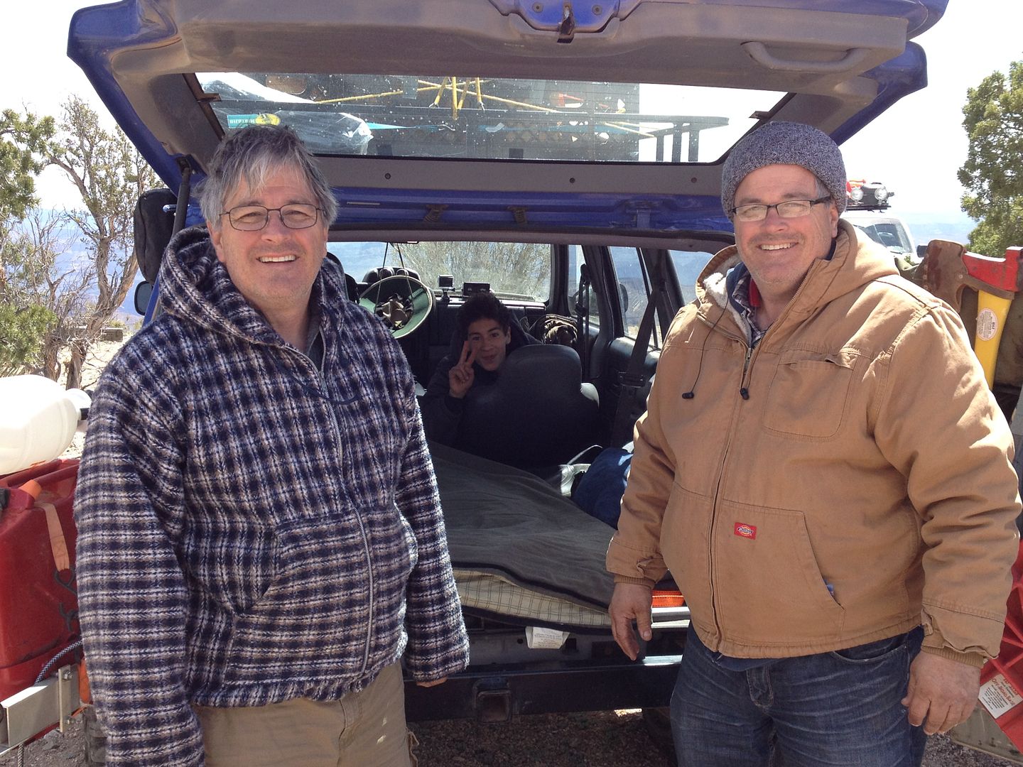
Wayne, who now has left the group due to front end damage and is at the mercy of the Toyota dealer in ST. George, was the guy I took my very first overlanding adventure with many years ago when we did the Mojave Road. He now lives in Yucaipa Ca. This is the first time he’s traveled with me in a few years. He use to say I didn’t get any satisfaction on a trip unless someone broke down! He is a true “naturalist” and a blast to have along on these trips. I’m the one who brought his first and current vehicle a late 1990’s Toyota 4-runner. It has a 2” lift and some off brand mild all terrain tire. And if you haven’t already figured it out….very open axles.
Michael is the twin brother of Murrie, interesting enough these guys were the first identical twins adopted together in California from birth. He lives in Oceanside Ca. and has been introduced and encouraged to participate in our overlanding trips by his twin, Murrie. He’s not afraid to bang up his newer Tacoma and is also a fast learner and fearless on the rocks (don’t know if that fearless or couldn’t care less) His 2014 Toyota Tacoma came with the TRD off road package, he added a 3” lift and large aluminum front and rear bumpers. Tires are BFG AT in the 32” range.
Murrie brought along his son Caleb. Caleb has been off roading with us since he was age 3. He is now within driving age and we’ll see if he will continue on his own. On this trip he got his first experience spotting. He always has a good attitude and if he can stand 8 hours in the cars with his dad, Murrie…..He’s got to be tough. They both live in Whittier, Ca. Their vehicle, a 1998 Jeep XJ has had so much work on it by the group; we consider it our adopted project vehicle. Rescued from an insurance company after its engine was destroyed diving…..not driving, through the Mojave River, it now has a newer engine, 4” lift, Limited slip Dana 44 rear, ARB front and quick disconnect sway bar.
Thanks,
Fred
Explorer 1
While I working on the final journey, I thought it would be good to share a bit about the brave souls in our group.
It’s interesting that without thought or request the vehicles each day before long assume a certain order. I’ll take that natural order and tell you a bit about the driver (and passenger) along with something about their vehicle.
I usually find in my mirror most of the time Cody and his encourager, spotter and friend Jim.
Cody has a dual residency in the La Habra Ca. and somewhere in Ohio. It’s a long complicated story so I won’t bore you with the details. He is a dried and dyed through and through Ford guy. It takes it from the Jeep and Toyota guys so you don’t need to pick on him anymore. As you might already know his 90’s Explorer has been greatly challenged on this trip. It comes with a stock 4.0 V6 and has a slight 1-2” lift barely allowing it to run BFG AT 31’s. Both axles are open and with all the dragging across the rocks we did I surprised it’s still running. It still has some more damage ahead of it on this trip but it does make it home under its own power. Cody is fairly new (A couple of years’ experience) to the overland of road community but has what it takes (usually) to keep going.
Jim, his passenger a resident of La Habra, Ca came along as what has turned out to almost be a full time job assisting the Ford in the more difficult section of road. He had his own 2015 Jeep JKU Rubicon (which he dearly wished he could have been driving on this trip, but that is again another story) Jim’s the only team member who has to set up and take down his tent each day as all other drivers sleep in their vehicles. He has been a great help spotting the group when needed.
Dan, who I have known since high School days is an explorer from way back when off road exploring wasn’t cool. Then all you needed was an old pickup, a rifle and a sleeping bag and you were set. He lived in Morroco for 20 years and now has dual citizenship in England (where he currently lives) and the USA. Besides English he speaks fluent French, Arabic and can get by with Berber. On his recent visit to the US he purchased one of our off road group project vehicles, a 1993 Jeep ZJ and has been a very fast learner on the “overlanding thing”. The Jeep has a 4” lift, runs on 33” BFG MT. Open axles. Quick disconnect sway bar.
Rudi, another longtime friend was born in Siberia Russia. He immigrated to Germany and then the USA in his early 20’s. Was living on Saipan Island when I met him and we have been friends since. He has been my guide and traveling partner on several trips, “Pacific Ocean to the Atlantic Ocean driving adventure across Asia and eastern Europe”, “Moscow to Chita”, “Germany to Kirgizstan”, “All around Ethiopia”. He speaks 4 languages fluently and has a real heart for adventure. He is a natural off roader and has learned very fast to choose a good line in a rock garden. His vehicle is also one of our group’s past project vehicles. The 1997 Jeep ZJ has a 2 ½ lift, 32” ******** Cepek MT and quick disconnect sway bar.
Wayne, who now has left the group due to front end damage and is at the mercy of the Toyota dealer in ST. George, was the guy I took my very first overlanding adventure with many years ago when we did the Mojave Road. He now lives in Yucaipa Ca. This is the first time he’s traveled with me in a few years. He use to say I didn’t get any satisfaction on a trip unless someone broke down! He is a true “naturalist” and a blast to have along on these trips. I’m the one who brought his first and current vehicle a late 1990’s Toyota 4-runner. It has a 2” lift and some off brand mild all terrain tire. And if you haven’t already figured it out….very open axles.
Michael is the twin brother of Murrie, interesting enough these guys were the first identical twins adopted together in California from birth. He lives in Oceanside Ca. and has been introduced and encouraged to participate in our overlanding trips by his twin, Murrie. He’s not afraid to bang up his newer Tacoma and is also a fast learner and fearless on the rocks (don’t know if that fearless or couldn’t care less) His 2014 Toyota Tacoma came with the TRD off road package, he added a 3” lift and large aluminum front and rear bumpers. Tires are BFG AT in the 32” range.
Murrie brought along his son Caleb. Caleb has been off roading with us since he was age 3. He is now within driving age and we’ll see if he will continue on his own. On this trip he got his first experience spotting. He always has a good attitude and if he can stand 8 hours in the cars with his dad, Murrie…..He’s got to be tough. They both live in Whittier, Ca. Their vehicle, a 1998 Jeep XJ has had so much work on it by the group; we consider it our adopted project vehicle. Rescued from an insurance company after its engine was destroyed diving…..not driving, through the Mojave River, it now has a newer engine, 4” lift, Limited slip Dana 44 rear, ARB front and quick disconnect sway bar.
Thanks,
Fred
Explorer 1
Last edited: