gorillamel
Dirty Blonde
This is my first paddling trip report. Edit: Photos now added! (06/04/16)
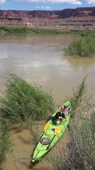
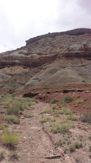
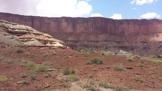
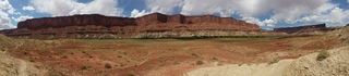
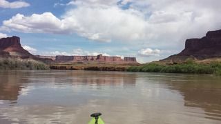
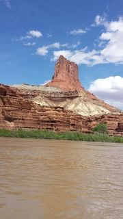
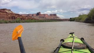
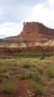
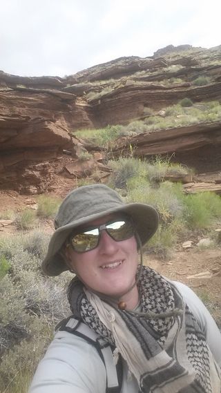
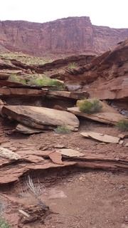
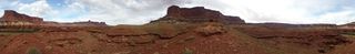
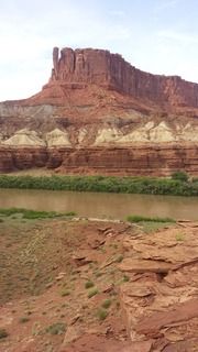
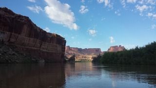
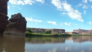
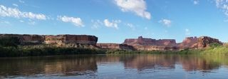
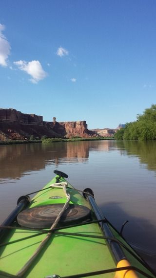
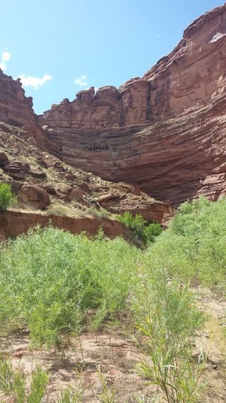
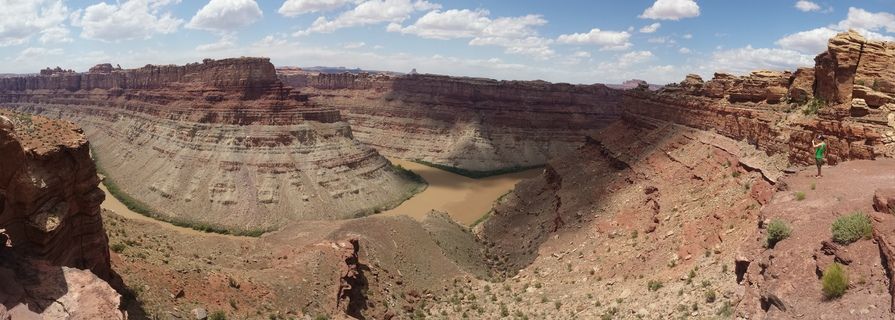
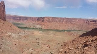
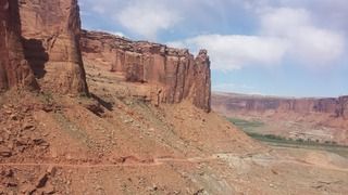
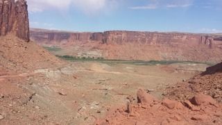
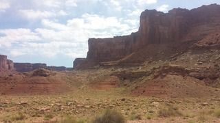
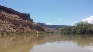
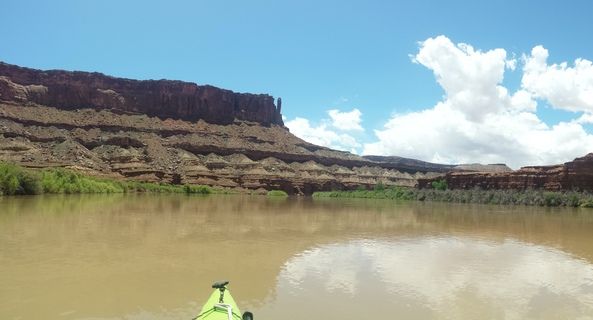
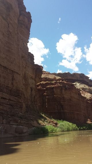
Background: Solo adventure from Mineral Bottom to Spanish Bottom on the Green/Colorado Rivers thought Canyonlands National Park from 28-31 May 2016. I made this report kind of lengthy, my apologies if it is too wordy for you. I like details. And I am trying to record it all before I forget how awesome it was.
I used this trip report as a resource: http://wildernessvagabond.com/stillwater09/stillwater09.htm and this write up, too: http://www.paddling.net/places/showReport.html?119
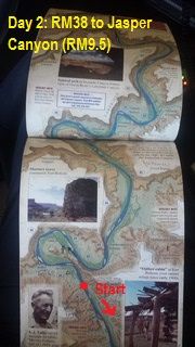
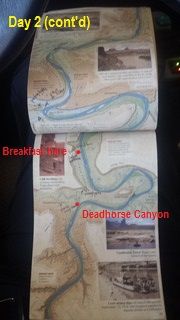
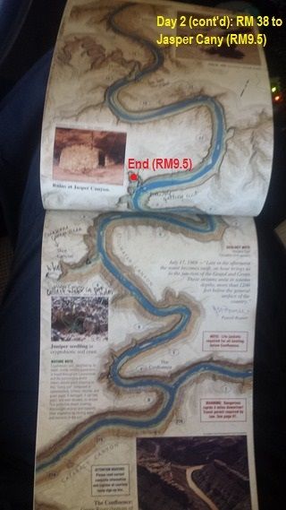
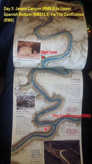
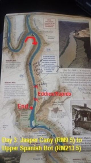
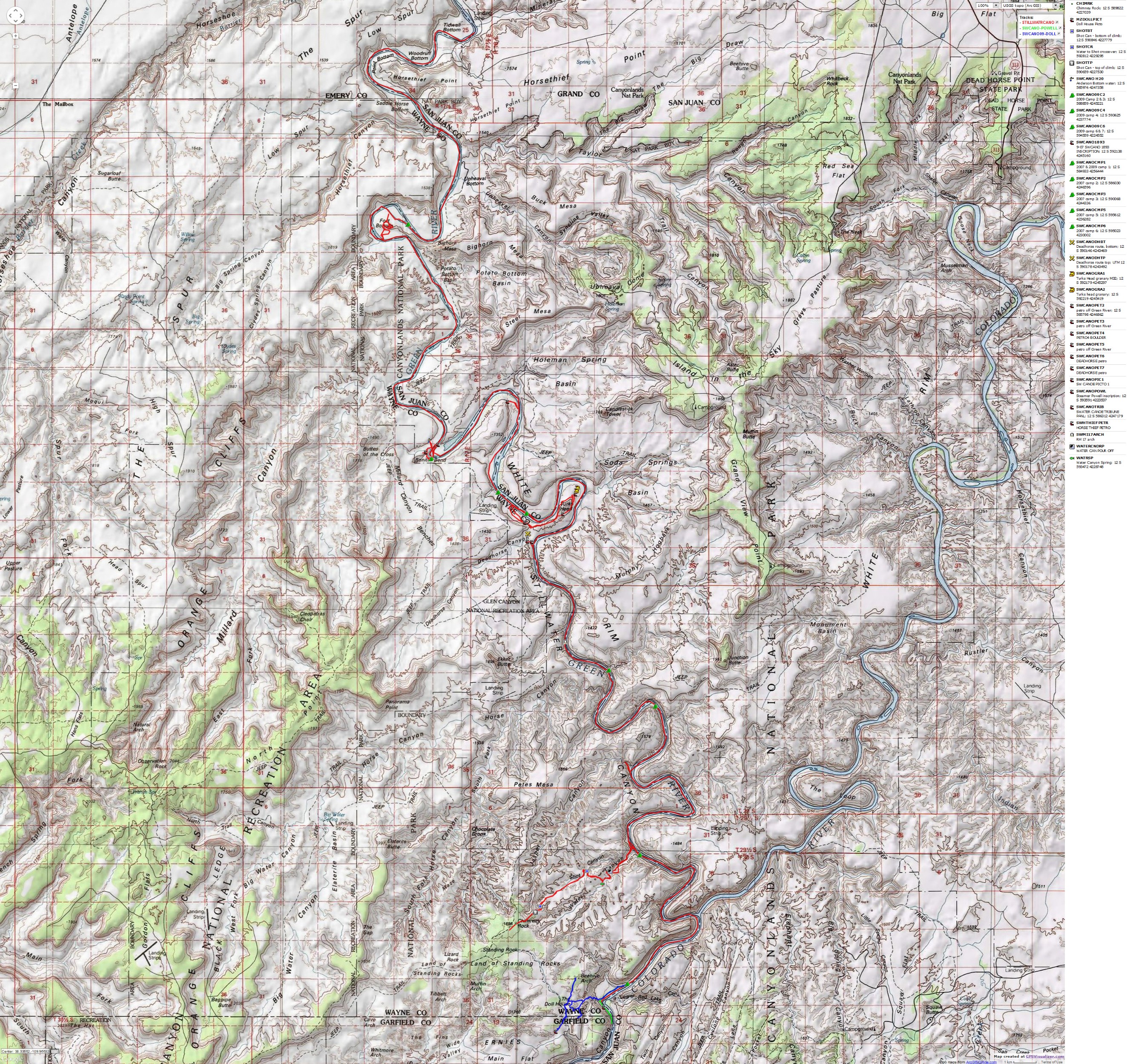
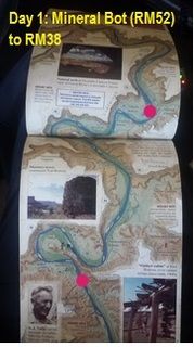
With this excellent map as a visual aide:
And by far, this was the most important guide/resource you could ever use: Belknap's waterproof Canyonlands River Guide.
------------------------------------------------------------------------------------------------------------------------------------------------
Where to start? I do not even know where. The beginning? Meh. The end? Boring. How about now. Right. Freakin’ now.
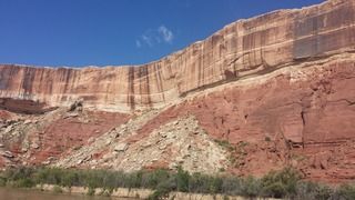
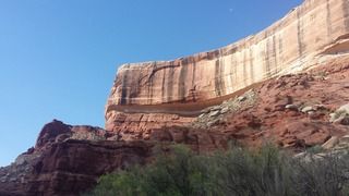
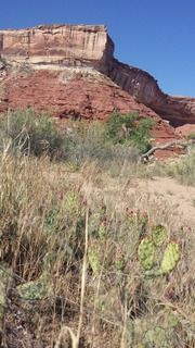
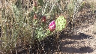
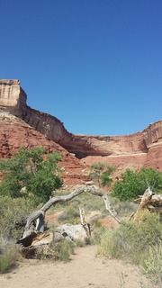
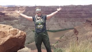
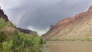
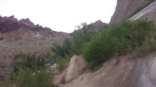
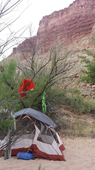
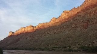
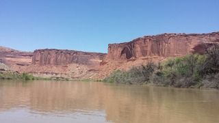
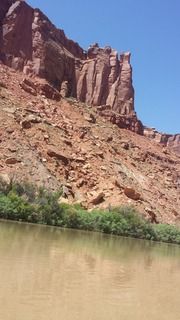
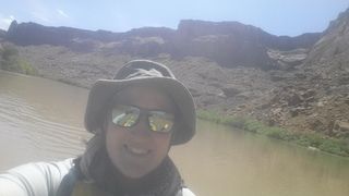
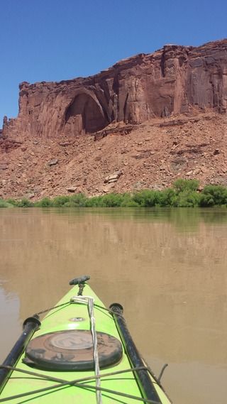
Currently, I would be lying if I told you I was not in withdrawal. I miss my adventure. As I knew I would. But what is more, I miss being a nomad. I miss the simplicity of life I lived while on my water adventure. I miss getting up with the sun. Seeing the beauty of nature throughout the day. Taking down my camp. Packing my kayak. Moving on to the next spot. Exploring. Planning ahead, following maps. Watching the weather and water conditions, knowing my well being is dependent upon it. Where will I take my next poop (and then picking it up)? Setting up my next camp. That was life. Truly living it. None of these frills of the “modern” world. I enjoyed living day to day, working on surviving from one moment to the next. I want it back. That life was so much less complicated. It was stressful. But a totally understandable and “dealable” type. This life now? No. I want the nomad one away from society back.
Ok. Now to the story. The trip. The Adventure!
First of all. When planning a trip kayaking the Green River through Stillwater Canyon in Canyonlands National Park, apply for your permit in as far advance as you can. I think the website says no more than four months. Do that. Apply at the four months. I applied two weeks before my trip. I filled out the PDF form (https://www.nps.gov/cany/planyourvisit/upload/2013_RiverReservationForm.pdf) and emailed to NPS (canyres@nps.gov). Their directions are as follows from their website (https://www.nps.gov/cany/planyourvisit/riverpermits.htm):
Email, mail or fax your request no less than two weeks in advance to: National Park Service Reservation Office 2282 Resource Blvd Moab, UT 84532-3406 canyres@nps.gov Fax: (435) 259-4285 Blocks 1 through 4 must be completed. Payment Once your reservation request is approved, you will receive an email with payment instructions. Do not include credit card informtion on this form.
Well. I waited and waited to receive the confirmation email from NPS. I waited until 05.24.16 while I was in Moab. I was at Canyonlands NP to drive Elephant Hill trail with my off road event and I saw a park ranger. He advised me to go to their HQ in Moab and inquire there. So on 05.25.16, after I got off Strike Ravine trail leading it in Area BFE for my off road event, I went to NPS Moab HQ.
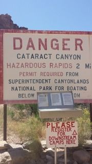
The staff was very nice and helpful. I met the man behind canyres@nps.gov. Yes. Just one man. For all those permit requests. And to top it off, their website system for permits had gone down that morning. Which meant that they could not issue any permits from the website, which is how they issue them. The Ranger(?) was extremely apologetic and I could tell he was overwhelmed and overworked. And probably way underappreciated and under paid. I did not mind. He type out my permit for me and used his card machine (first time ever!). He expressed appreciation of the fact that I had already read the information about the permits and river. Good thing he pointed out/re-iterated some of NPS’s river requirements…https://www.nps.gov/cany/planyourvisit/riverregulations.htm
• A metal fire pan that is at least 12 inches in diameter with a 2½-inch lip around the edge.
• A means to securely contain and remove human waste from the backcountry. Systems approved for river use are washable, reusable containers equipped with RV dump fittings, or commercial bag systems (e.g. Wag Bag, Restop II) that render human waste into a non-hazardous material. Bag systems must be stored in hard-sided containers or heavy-duty, waterproof bags labeled "Human Waste."
• One approved, serviceable type I, III, or V personal flotation device (PFD)2 for each trip participant.
• One spare PFD2 for every five people on the trip, or one per boat; whichever is fewer.
• A readily accessible spare means of propulsion capable of maneuvering the vessel (oar, paddle, motor, etc.) for each boat. Low capacity boats designed to carry two or fewer occupants (canoes and kayaks) may carry one spare paddle for every three boats. Commercially made hand paddles are approved for hard-hulled, whitewater kayaks.
• A serviceable, type IV throwable device (throw cushion) for every boat 16 feet or more in length. A commercially made throw bag with at least 40 feet of line is allowed in lieu of a type IV throwable device.
• Repair kit or kits adequate for repairing the number and types of boats on the trip. Hard-hulled boats may carry epoxy and duct tape or an equivalent means of repair.
• If boats with inflatable components are used on the trip, an air pump or pumps.
• A bailing device or bilge pump for boats that are not self-bailing.
• A first aid kit adequate for the number of trip participants and length of trip.
I missed the spare PFD requirement. ****. Balls. I was proud I managed to bring a spare set of paddles and a mini fire/ash pan…even though I did not plan to have a fire. But lo and behold, my ash pan was about 8” diameter, not 12”. Double ****. I guess I’d try to wing that one and just rent a spare PFD from the river guides.
When I arrived in Moab on 05.22.16, I stopped by Tex’s Riverways (http://www.texsriverways.com/; 691 N 500 W, Moab, UT 84532; 435.259.5101). This is where I made my shuttle reservations. They were informative and very responsive to my inquiries. Unfortunately (for me), they do not take debit or credit cards. Cash only. Although, you send them a $50 check deposit to hold your spot on the shuttles. I finished paying my bill ($135) once I got in to Moab. There. All set. (Except for getting my permit, see that **** storm listed above).
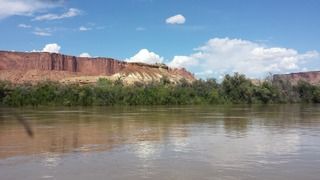
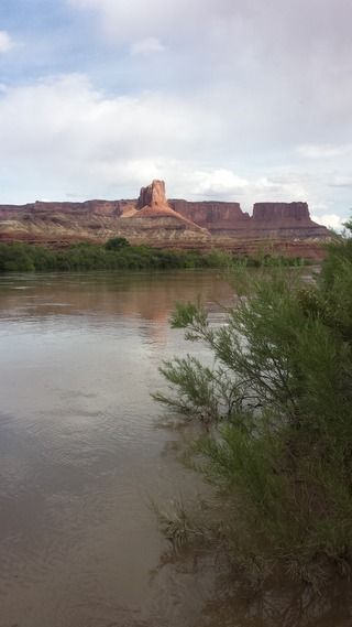
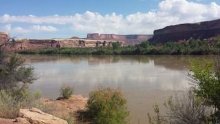
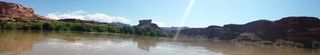
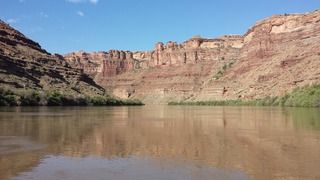
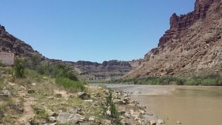
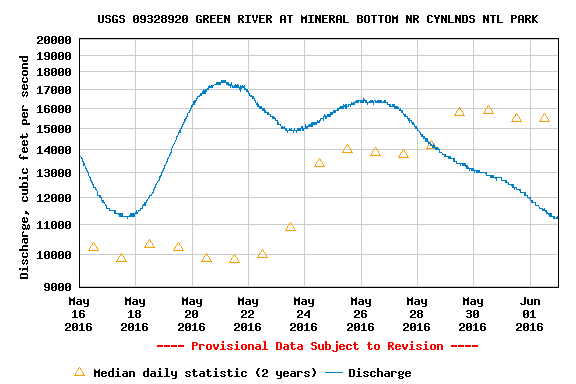
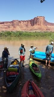
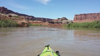
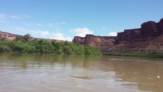
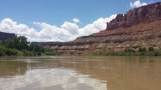
Now, let me back up and say that while I was driving to Moab and drove over the Green River on I70 at Green River, UT, I noticed that the river appeared hella high. Like, just below the bridge by less than 10’ high. So I want to emphasize the importance of researching water levels and flow rates before planning a river running trip. The USGS has invaluable information for this. Here is the Utah map of the USGS monitors: http://waterwatch.usgs.gov/?m=real&r=ut. The one I want to point out is Mineral Bottom (USGS 09328920 monitor: http://waterdata.usgs.gov/ut/nwis/inventory/?site_no=09328920). This is where the put-in is for just north of Canyonlands NP. If you look below, you can see how effing high the water was when I arrived in Moab. According to the NPS staff I spoke to, the area got a **** ton rain (and mountains got snow) on 05.19.16. Thus created the more than double normal flow rate. Shiiiiiit.
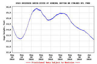
Here is the graph of CFS (inc’g historical average). FML when I saw that graph on 05.22.16.
I heard rumor from some of the off road event participants that the White Rim Road (https://www.nps.gov/cany/planyourvisit/whiterimroad.htm) was closed due to flooding. The NPS staff confirmed that parts of the road were under 2.5’-3’ of water in the Potato and Hardscrabble Bottom sections. Jebus. This trip was beginning to sound even more daunting than it already was. I was having second thoughts.
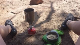
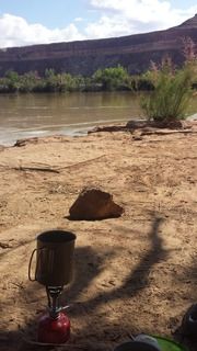
Prior to leaving for this trip, I borrowed and gathered the gear I would need. I am so very thankful to my friends who helped me get what I needed and shared insight into things that would aid me in my journey. I then packed it all up and put it in my kayak to make sure it would all fit. It did! I was not able to practice float my kayak with all my gear since I ran out of time. So I hoped and prayed it would work out well and stay balanced. I got Mountain House dehydrated meals single serve size from Wal-Mart (cheapest I could find). I opened the packaging, put the food in ziploc baggies and rolled them into smaller sizes. I kept one of the packages, since they are needed to cook the food in boiling water. Instead of getting a hard sided container to store my water, I bought a 5-gal capacity camp shower bag. I also brought 2 2.5-3L-sized water bladder bags.
The list of gear that I brought was as follows:
• 45F down compressable ultralight sleeping bag
• Sea to Summit sleeping bag insert warmer
• REI 2” inflatable sleeping pad
• 4 Mountain House meals (see description above for packing), Cliff/trail bars, ziploc baggies of beef jerky, packets of oatmeal in ziploc bags, bag of craisins, cereal and craisins in ziploc bag, 2 Beef w/BBQ long term storage sammiches in individual sealed pouches
• Snow Peak mini stove
• MSR mini burner stove and 2 small MSR propane tanks
• 2 sets of paddles
• 2 PDFs (1 borrowed from Tex’s Riverways)
• Waterproof solar charger for phone and USB connector
• GoPro and USB charger
• 2 water bladders
• Katyhadan water filer and purifying tabs
• Trekking poles
• REI half dome tent and 2 foot prints (no rain fly, it was too big. Used 2nd foot print to tie to top of tent)
• Mini cutting board
• Hatchet
• Compactable camp eating set
• Matches in water tight canister and lighter
• Mini sized case of pain meds
• Sunscreen
• Shemagh, 2 bandanas, 1 wash cloth, 1 hand towel (stored with clothes)
• Tri shorts, sports bra, swim suit, long/short sleeve merino wool top, merino wool bottom, swim short bottoms, NRS paddle shirt, beanie, NRS long sleeve shirt w/ hoodie, 2 pairs ankle running socks non-used items stored in compression sack
• Bow line (15’)
• Headlamp and LED Coleman mini camp light
• 5gal camp shower bag
• Hiking shoes, flip flops and NRS water shoes (and mesh cinch top bag to carry them in)
• Mini foldable chair
• Wag Bags, roll of RV toilet paper and collapsible mini shovel/case
• Tooth brush/mini sized paste
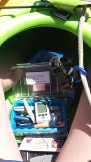
• Pelican case with insulin (spare pens of both), tester kit, NPS permit, ID and debit card
• GPS Spot device (forgot to renew it)
• Spare AA and AAA batteries
• Small camelpak
• Bike water bottle
• Electrolyte tabs and Crystal light single serve packets
• Hat with brim and chin/neck strap to keep on in wind
• Spare dry bag to store used Wag Bag/toilet **** in
• Carabiners
• Bug spray
• Sunglasses (should have gotten strap to go around head so they are not lost if you roll, but I didn’t. Oh well.)
• Cell phone (kept on airplane mode), armband case with Velcro to keep phone contained on bungee line in front of me while paddling
• Pen (to write with), spare paper to write on
• First Aid kit and mini survival guide book
• Emergency paddle kit (inc bilge pump, floaty things, etc.)
• Bike gloves
• Leukotape
• Life Staw (never used it)
• Concentrated camp biodegradable liquid soap
• Belknap’s Waterproof Canyonlands River Guide MY ************* BIBLE of the trip!!!
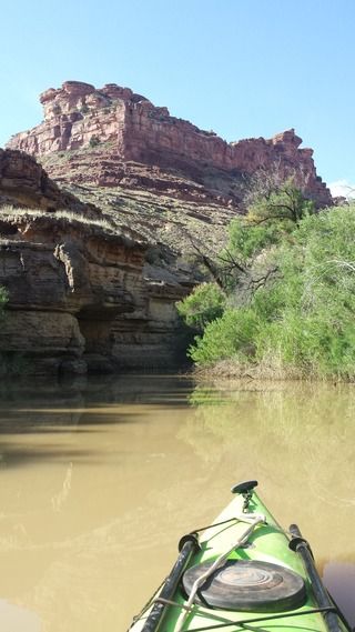
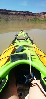
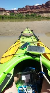
This all packed into 4 small sized dry bags (plus the spare bag for poop storage). Things that did not fit in the dry bags I made sure would be ok if they got wet. I kept the Camel pack, 2 water bladders, sunscreen, map book and small dry bag holding my pelican case in the cockpit with me. Everything else was stored in the sealed storage compartments in the kayak. The poop bag was stored in the cockpit at my feet. Things in the cock pit were secured using clips or carabiners. I kept the bow line attached from front to back of the kayak the whole time. I also kept the spare paddles under bungees on the front and the spare PDF under bungees in the back. My solar charger was carabinered to the bungees, too.
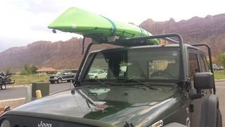
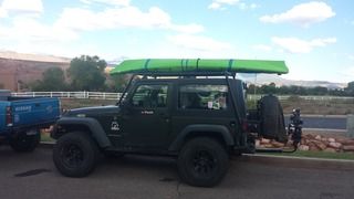
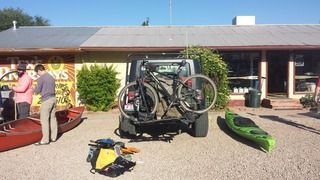
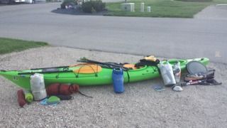 All my gear
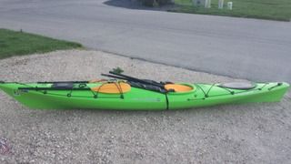 All the gear packed (practice round before heading to Utah)
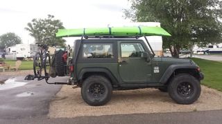
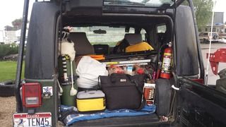 various misc stuff packed in Jeep pre-departing for Utah
 All set to go!
I had a lot of support from friends and people I met for this trip. Many expressed worry for me since I was doing it solo, had little money (most of it went on a credit card) and I am a type 1 diabetic. First, I must say, I will NEVER let having diabetes rule my life. I do not let it cause me to decide not to do something. I am a normal person. I just have to take extra care to pay attention to my body to know when I have a high or low blood sugar and take the required steps to correct the issue. This by no means will prevent me from, say, going on a 4-day solo kayaking trip completely cut off from society with no way to get help and far from any sort of help. I am a self sufficient person. I can do it. Diabetes should never be an excuse not to do something. It is not a hindrance in life. It is a part of who I am, but it is NOT what I am. I cannot change it. So why dwell on it? As long as I am in tune with my body and understand it, then I am fine. I also know that high and low blood sugars will occur. So what? Fix the problem and move on. End of story. So. Those of you who doubted I should go on this trip because I have diabetes- SHAME ON YOU. I have faith in myself. I know I can do it. So please, support me in my confidence. And if you have doubts, keep them to yourself. Those of my friends that did doubt me, I had those thoughts in my head throughout my trip. And I told myself how wrong they were. And I was proud to prove them wrong.
NPS PDF link of the parts of the Green River you can kayak: http://www.blm.gov/style/medialib/blm/ut/moab_fo/campgrounds/river_recreation.Par.74694.File.dat/LabyrinthCanyonRiverMap6.pdf

Background: Solo adventure from Mineral Bottom to Spanish Bottom on the Green/Colorado Rivers thought Canyonlands National Park from 28-31 May 2016. I made this report kind of lengthy, my apologies if it is too wordy for you. I like details. And I am trying to record it all before I forget how awesome it was.
I used this trip report as a resource: http://wildernessvagabond.com/stillwater09/stillwater09.htm and this write up, too: http://www.paddling.net/places/showReport.html?119
With this excellent map as a visual aide:
And by far, this was the most important guide/resource you could ever use: Belknap's waterproof Canyonlands River Guide.
------------------------------------------------------------------------------------------------------------------------------------------------
Where to start? I do not even know where. The beginning? Meh. The end? Boring. How about now. Right. Freakin’ now.
Currently, I would be lying if I told you I was not in withdrawal. I miss my adventure. As I knew I would. But what is more, I miss being a nomad. I miss the simplicity of life I lived while on my water adventure. I miss getting up with the sun. Seeing the beauty of nature throughout the day. Taking down my camp. Packing my kayak. Moving on to the next spot. Exploring. Planning ahead, following maps. Watching the weather and water conditions, knowing my well being is dependent upon it. Where will I take my next poop (and then picking it up)? Setting up my next camp. That was life. Truly living it. None of these frills of the “modern” world. I enjoyed living day to day, working on surviving from one moment to the next. I want it back. That life was so much less complicated. It was stressful. But a totally understandable and “dealable” type. This life now? No. I want the nomad one away from society back.
Ok. Now to the story. The trip. The Adventure!
First of all. When planning a trip kayaking the Green River through Stillwater Canyon in Canyonlands National Park, apply for your permit in as far advance as you can. I think the website says no more than four months. Do that. Apply at the four months. I applied two weeks before my trip. I filled out the PDF form (https://www.nps.gov/cany/planyourvisit/upload/2013_RiverReservationForm.pdf) and emailed to NPS (canyres@nps.gov). Their directions are as follows from their website (https://www.nps.gov/cany/planyourvisit/riverpermits.htm):
Email, mail or fax your request no less than two weeks in advance to: National Park Service Reservation Office 2282 Resource Blvd Moab, UT 84532-3406 canyres@nps.gov Fax: (435) 259-4285 Blocks 1 through 4 must be completed. Payment Once your reservation request is approved, you will receive an email with payment instructions. Do not include credit card informtion on this form.
Well. I waited and waited to receive the confirmation email from NPS. I waited until 05.24.16 while I was in Moab. I was at Canyonlands NP to drive Elephant Hill trail with my off road event and I saw a park ranger. He advised me to go to their HQ in Moab and inquire there. So on 05.25.16, after I got off Strike Ravine trail leading it in Area BFE for my off road event, I went to NPS Moab HQ.
The staff was very nice and helpful. I met the man behind canyres@nps.gov. Yes. Just one man. For all those permit requests. And to top it off, their website system for permits had gone down that morning. Which meant that they could not issue any permits from the website, which is how they issue them. The Ranger(?) was extremely apologetic and I could tell he was overwhelmed and overworked. And probably way underappreciated and under paid. I did not mind. He type out my permit for me and used his card machine (first time ever!). He expressed appreciation of the fact that I had already read the information about the permits and river. Good thing he pointed out/re-iterated some of NPS’s river requirements…https://www.nps.gov/cany/planyourvisit/riverregulations.htm
Required Equipment
Federal and state regulations outline an assortment of equipment necessary for river trips. The following items are required:• A metal fire pan that is at least 12 inches in diameter with a 2½-inch lip around the edge.
• A means to securely contain and remove human waste from the backcountry. Systems approved for river use are washable, reusable containers equipped with RV dump fittings, or commercial bag systems (e.g. Wag Bag, Restop II) that render human waste into a non-hazardous material. Bag systems must be stored in hard-sided containers or heavy-duty, waterproof bags labeled "Human Waste."
• One approved, serviceable type I, III, or V personal flotation device (PFD)2 for each trip participant.
• One spare PFD2 for every five people on the trip, or one per boat; whichever is fewer.
• A readily accessible spare means of propulsion capable of maneuvering the vessel (oar, paddle, motor, etc.) for each boat. Low capacity boats designed to carry two or fewer occupants (canoes and kayaks) may carry one spare paddle for every three boats. Commercially made hand paddles are approved for hard-hulled, whitewater kayaks.
• A serviceable, type IV throwable device (throw cushion) for every boat 16 feet or more in length. A commercially made throw bag with at least 40 feet of line is allowed in lieu of a type IV throwable device.
• Repair kit or kits adequate for repairing the number and types of boats on the trip. Hard-hulled boats may carry epoxy and duct tape or an equivalent means of repair.
• If boats with inflatable components are used on the trip, an air pump or pumps.
• A bailing device or bilge pump for boats that are not self-bailing.
• A first aid kit adequate for the number of trip participants and length of trip.
I missed the spare PFD requirement. ****. Balls. I was proud I managed to bring a spare set of paddles and a mini fire/ash pan…even though I did not plan to have a fire. But lo and behold, my ash pan was about 8” diameter, not 12”. Double ****. I guess I’d try to wing that one and just rent a spare PFD from the river guides.
When I arrived in Moab on 05.22.16, I stopped by Tex’s Riverways (http://www.texsriverways.com/; 691 N 500 W, Moab, UT 84532; 435.259.5101). This is where I made my shuttle reservations. They were informative and very responsive to my inquiries. Unfortunately (for me), they do not take debit or credit cards. Cash only. Although, you send them a $50 check deposit to hold your spot on the shuttles. I finished paying my bill ($135) once I got in to Moab. There. All set. (Except for getting my permit, see that **** storm listed above).
Now, let me back up and say that while I was driving to Moab and drove over the Green River on I70 at Green River, UT, I noticed that the river appeared hella high. Like, just below the bridge by less than 10’ high. So I want to emphasize the importance of researching water levels and flow rates before planning a river running trip. The USGS has invaluable information for this. Here is the Utah map of the USGS monitors: http://waterwatch.usgs.gov/?m=real&r=ut. The one I want to point out is Mineral Bottom (USGS 09328920 monitor: http://waterdata.usgs.gov/ut/nwis/inventory/?site_no=09328920). This is where the put-in is for just north of Canyonlands NP. If you look below, you can see how effing high the water was when I arrived in Moab. According to the NPS staff I spoke to, the area got a **** ton rain (and mountains got snow) on 05.19.16. Thus created the more than double normal flow rate. Shiiiiiit.
Here is the graph of CFS (inc’g historical average). FML when I saw that graph on 05.22.16.
I heard rumor from some of the off road event participants that the White Rim Road (https://www.nps.gov/cany/planyourvisit/whiterimroad.htm) was closed due to flooding. The NPS staff confirmed that parts of the road were under 2.5’-3’ of water in the Potato and Hardscrabble Bottom sections. Jebus. This trip was beginning to sound even more daunting than it already was. I was having second thoughts.
Prior to leaving for this trip, I borrowed and gathered the gear I would need. I am so very thankful to my friends who helped me get what I needed and shared insight into things that would aid me in my journey. I then packed it all up and put it in my kayak to make sure it would all fit. It did! I was not able to practice float my kayak with all my gear since I ran out of time. So I hoped and prayed it would work out well and stay balanced. I got Mountain House dehydrated meals single serve size from Wal-Mart (cheapest I could find). I opened the packaging, put the food in ziploc baggies and rolled them into smaller sizes. I kept one of the packages, since they are needed to cook the food in boiling water. Instead of getting a hard sided container to store my water, I bought a 5-gal capacity camp shower bag. I also brought 2 2.5-3L-sized water bladder bags.
The list of gear that I brought was as follows:
• 45F down compressable ultralight sleeping bag
• Sea to Summit sleeping bag insert warmer
• REI 2” inflatable sleeping pad
• 4 Mountain House meals (see description above for packing), Cliff/trail bars, ziploc baggies of beef jerky, packets of oatmeal in ziploc bags, bag of craisins, cereal and craisins in ziploc bag, 2 Beef w/BBQ long term storage sammiches in individual sealed pouches
• Snow Peak mini stove
• MSR mini burner stove and 2 small MSR propane tanks
• 2 sets of paddles
• 2 PDFs (1 borrowed from Tex’s Riverways)
• Waterproof solar charger for phone and USB connector
• GoPro and USB charger
• 2 water bladders
• Katyhadan water filer and purifying tabs
• Trekking poles
• REI half dome tent and 2 foot prints (no rain fly, it was too big. Used 2nd foot print to tie to top of tent)
• Mini cutting board
• Hatchet
• Compactable camp eating set
• Matches in water tight canister and lighter
• Mini sized case of pain meds
• Sunscreen
• Shemagh, 2 bandanas, 1 wash cloth, 1 hand towel (stored with clothes)
• Tri shorts, sports bra, swim suit, long/short sleeve merino wool top, merino wool bottom, swim short bottoms, NRS paddle shirt, beanie, NRS long sleeve shirt w/ hoodie, 2 pairs ankle running socks non-used items stored in compression sack
• Bow line (15’)
• Headlamp and LED Coleman mini camp light
• 5gal camp shower bag
• Hiking shoes, flip flops and NRS water shoes (and mesh cinch top bag to carry them in)
• Mini foldable chair
• Wag Bags, roll of RV toilet paper and collapsible mini shovel/case
• Tooth brush/mini sized paste
• Pelican case with insulin (spare pens of both), tester kit, NPS permit, ID and debit card
• GPS Spot device (forgot to renew it)
• Spare AA and AAA batteries
• Small camelpak
• Bike water bottle
• Electrolyte tabs and Crystal light single serve packets
• Hat with brim and chin/neck strap to keep on in wind
• Spare dry bag to store used Wag Bag/toilet **** in
• Carabiners
• Bug spray
• Sunglasses (should have gotten strap to go around head so they are not lost if you roll, but I didn’t. Oh well.)
• Cell phone (kept on airplane mode), armband case with Velcro to keep phone contained on bungee line in front of me while paddling
• Pen (to write with), spare paper to write on
• First Aid kit and mini survival guide book
• Emergency paddle kit (inc bilge pump, floaty things, etc.)
• Bike gloves
• Leukotape
• Life Staw (never used it)
• Concentrated camp biodegradable liquid soap
• Belknap’s Waterproof Canyonlands River Guide MY ************* BIBLE of the trip!!!
This all packed into 4 small sized dry bags (plus the spare bag for poop storage). Things that did not fit in the dry bags I made sure would be ok if they got wet. I kept the Camel pack, 2 water bladders, sunscreen, map book and small dry bag holding my pelican case in the cockpit with me. Everything else was stored in the sealed storage compartments in the kayak. The poop bag was stored in the cockpit at my feet. Things in the cock pit were secured using clips or carabiners. I kept the bow line attached from front to back of the kayak the whole time. I also kept the spare paddles under bungees on the front and the spare PDF under bungees in the back. My solar charger was carabinered to the bungees, too.
I had a lot of support from friends and people I met for this trip. Many expressed worry for me since I was doing it solo, had little money (most of it went on a credit card) and I am a type 1 diabetic. First, I must say, I will NEVER let having diabetes rule my life. I do not let it cause me to decide not to do something. I am a normal person. I just have to take extra care to pay attention to my body to know when I have a high or low blood sugar and take the required steps to correct the issue. This by no means will prevent me from, say, going on a 4-day solo kayaking trip completely cut off from society with no way to get help and far from any sort of help. I am a self sufficient person. I can do it. Diabetes should never be an excuse not to do something. It is not a hindrance in life. It is a part of who I am, but it is NOT what I am. I cannot change it. So why dwell on it? As long as I am in tune with my body and understand it, then I am fine. I also know that high and low blood sugars will occur. So what? Fix the problem and move on. End of story. So. Those of you who doubted I should go on this trip because I have diabetes- SHAME ON YOU. I have faith in myself. I know I can do it. So please, support me in my confidence. And if you have doubts, keep them to yourself. Those of my friends that did doubt me, I had those thoughts in my head throughout my trip. And I told myself how wrong they were. And I was proud to prove them wrong.
NPS PDF link of the parts of the Green River you can kayak: http://www.blm.gov/style/medialib/blm/ut/moab_fo/campgrounds/river_recreation.Par.74694.File.dat/LabyrinthCanyonRiverMap6.pdf
Last edited:
") Did I miss it... what boat do you have?
Did I miss it... what boat do you have?