1Louder
Explorer
Not sure how many of you are aware of this feature but you can import custom maps into Gaia GPS via a tool they provide. I wrote a basic tutorial on how to do this using Google Maps as the example. This is a very powerful tool. One that I am trying to take to the next level by importing all of the Motor Vehicle Use Maps beginning with Arizona. These are fast becoming the only Official record of open forest roads. If you want to stay legal you need to reference these maps. While PDF Maps for iOS allows you to use the maps already Gaia GPS is my preferred navigation app. I don't like to bounce back and forth between apps if I don't have to.
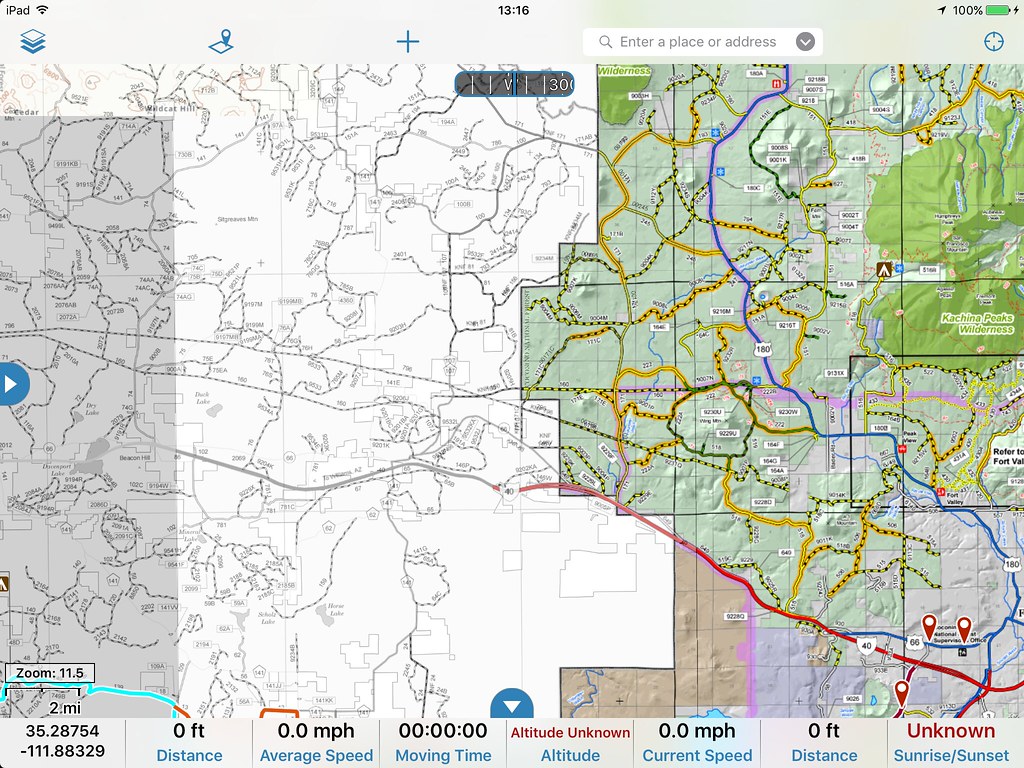
Here's an example of 2 custom maps layers. On the left is the Kaibab National Forest Williams District Map in black and white and the Coconino National Forest North map in color.
To get all of this to work and to get the highest resolution of maps available it will take purchasing some software which is not cheap. The other hope is Gaia will just eventually incorporate these layers into their app directly. Most likely these would only be available with a pro subscription.
So for those of you who use Gaia how valuable would these map layers be to you?
[ ] Only if they are free
[ ] Only if they are free from within Gaia GPS
[ ] Yes, I would pay $5-10 for the ability to access these maps from a 3rd party
[ ] Yes, I would be willing to pay for an annual pro subscription from Gaia
I don't work for Gaia. I am just a heavy user, product evangelist, and I am always trying to make the app even better.
My tutorial to learn how to import custom maps can be found here: http://www.4xoverlandadventures.com/import-custom-maps-gaia-gps/
Thanks,
Chris
Here is the current complete list of MVUM maps across the country.
http://www.fs.fed.us/recreation/programs/ohv/ohv_maps.shtml
They have just added Hunting Map layers and public lands identification overlays to the pro subscriptions. http://blog.gaiagps.com/
Last edited: