You are using an out of date browser. It may not display this or other websites correctly.
You should upgrade or use an alternative browser.
You should upgrade or use an alternative browser.
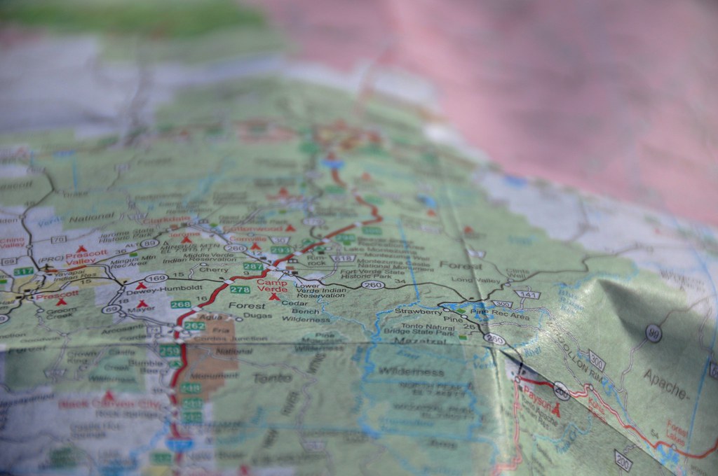
British Columbia to Baja; Winter Solstice in the Desert
- Thread starter rfoubi
- Start date
Yes, this is a good report. Amazing that I've covered a lot of the same ground over the years. Spencers. Organ Pipe. Rocky Point. El Golfo. Still haven't made it to San Felipe but your pics tell me I need to go.
Cochise. That looks like a great area that I'd like to explore.
Thanks for posting.
Cochise. That looks like a great area that I'd like to explore.
Thanks for posting.
rfoubi
Observer
Part 4: San Felipe to Punta Final
We stocked up on groceries, beer, ice, and supplies in San Felipe since it was the last large town we would be in, and we were keen to get off the beaten track and find some solitude.
Glad to be heading out of civilization, we rumbled south past the ubiquitous abandoned/partly completed resorts, and beach house after beach resort. We hadn’t been south of San Felipe in 10 years, and it has sure changed. Nothing like, say, Cabo area for development, but still a lot more built up than 10 years ago. Such is life though, people want to build in beautiful places.
We followed Mex 5, along some pretty rough pavement, with only one encounter with a vado that snuck up on us. The big BFGs fit under the van in most circumstances with no rubbing, but carrying too much speed into a vado with the van loaded down is not one of them. No damage, but we did smell some burning rubber from where the tires had bottomed on the fender wells. We kept a closer eye out for the dips after that!
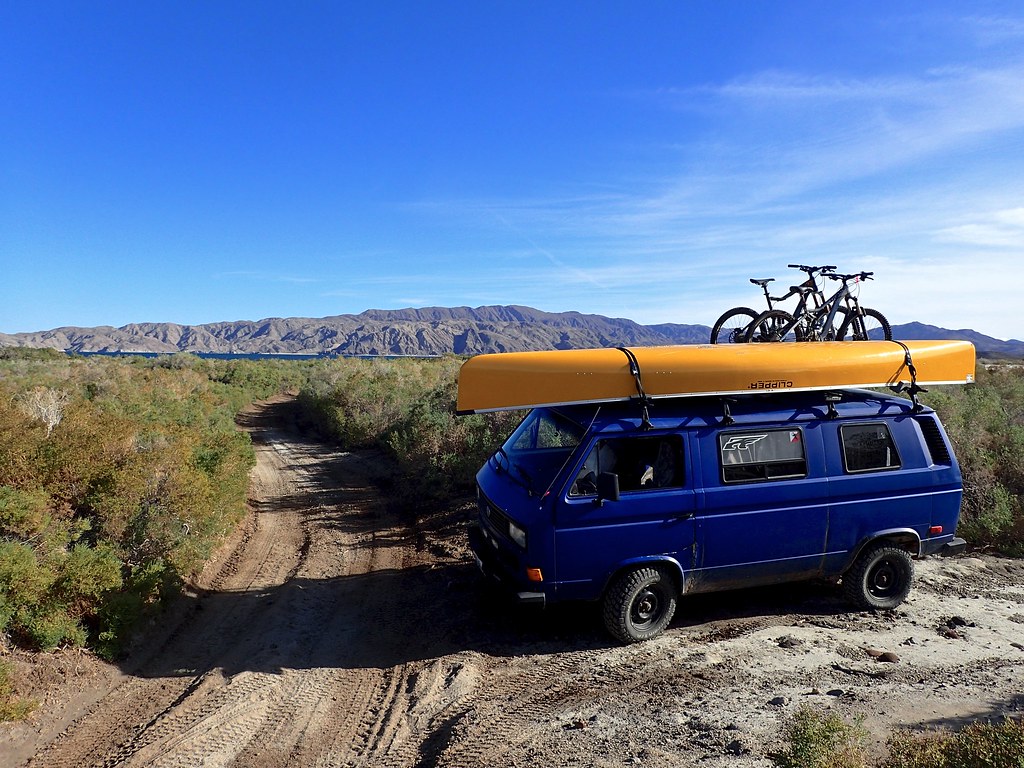
We pulled into a random dirt road north of Puertecitos looking for beach access. We were in luck! An abandoned foundation/house but no one else in sight. We parked right on the beach and enjoyed lunch, glad to be getting some dirt on our tires and sand in our toes! The freedom of quiet beaches, quiet roads, and dispersed camping. Now we are talking!
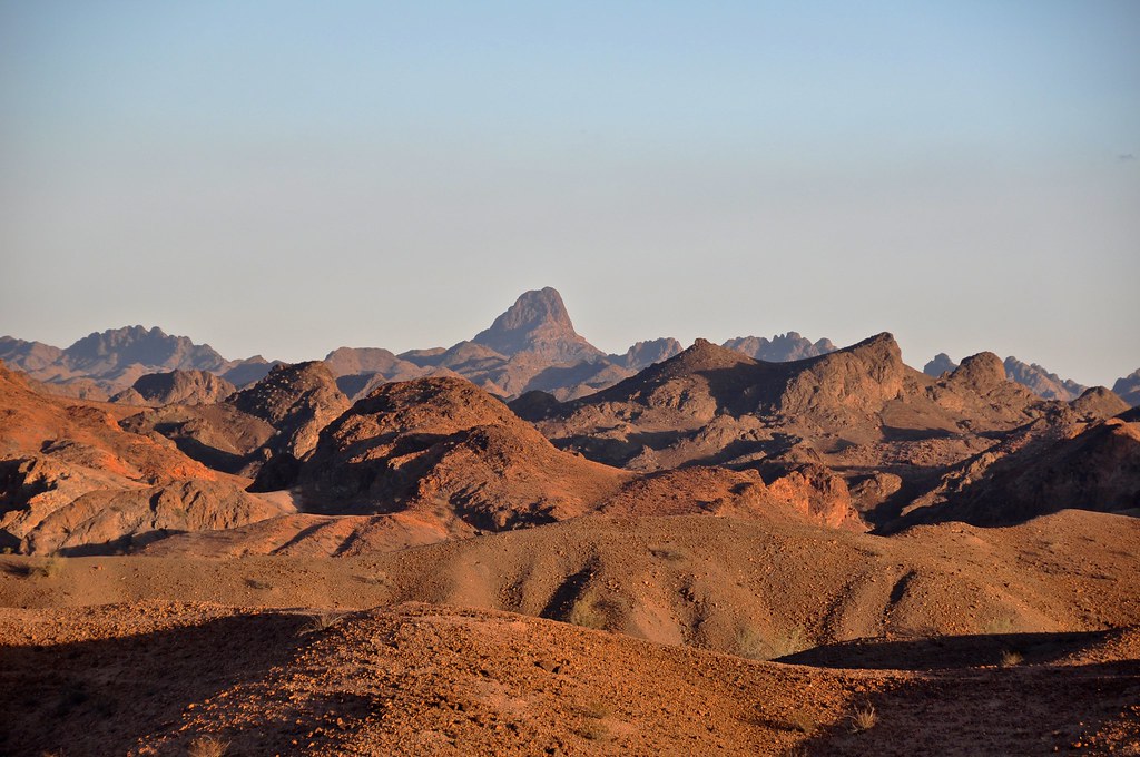
After lunch, we pushed on to puertecitos, which definitely wins no awards for beauty, and is a collection of ramshackle buildings that look like they are stuck in the 1960’s. There is, however, a nice natural hot springs (more on that later) but the tide was not in our favour at this time of day. So we decided to continue south on a starkly beautiful remote paved section of Highway 5. When I last drove this, it was fairly slow gravel, so the fresh pavement was a nice surprise.
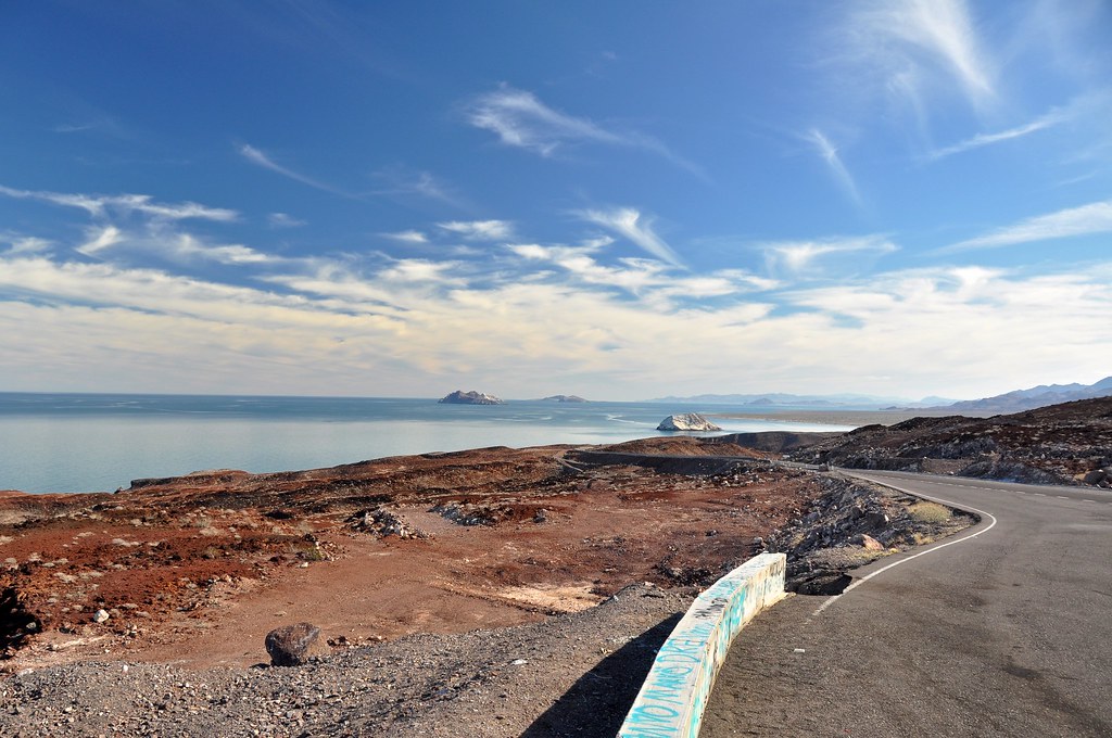
The view from the summit looking south towards El Huerfanito.
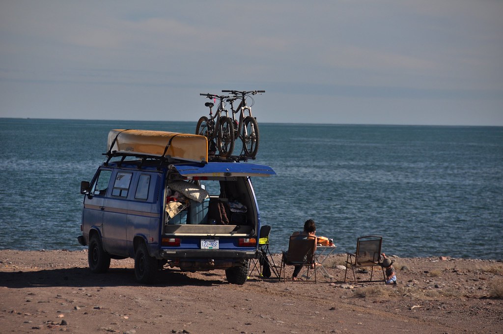
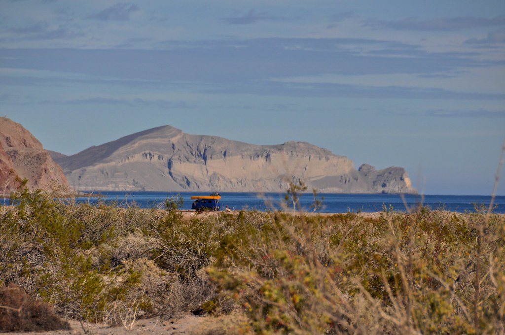
There were many places that looked decent to camp along gravel beaches, but we pushed along almost to Gonzaga bay and finally bumped down the dirt track to Playa el Faro. We pulled up to this spot, right on the beach with the bay to ourselves ( one house a mile to the north, and a few seasonal shacks a mile to the south).
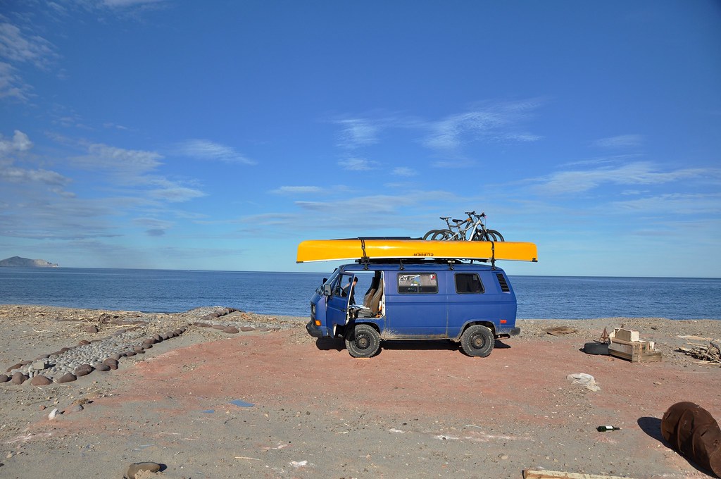
We camped at a site that clearly used to house somones trailer. It looked like it had been dragged out recently. It was the flattest spot around though so we elected to stay there next to the vaguely creepy giant cross made out of rocks (to the left of the van).
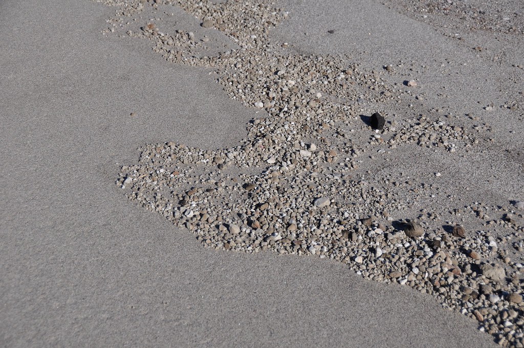
Ample firewood was available at the high tide line, which incidentally was littered with what at first looked like Styrofoam, but then turned out to be pumice. Pumice is an extremely porous, feather-light volcanic rock that will actually float on water. To see the collection of pumice pebbles that clearly marked the high tide or storm waves was pretty cool.
As you can tell, the weather closed in on us, and we actually had quite a stormy, windy night with some rain. We did vaguely worry about the washes we had driven down to get to our campsite, and the fact that we were perched on dry land only 5 feet above high tide mark, and 5 feet above the wash. Oh well, lets hope we don’t wake to the van floating away! Needless to say we were fine, and the next day we decided to check out the backroads to Papa Fernandez.
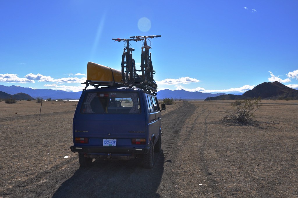
Aired down
Sandy tracks
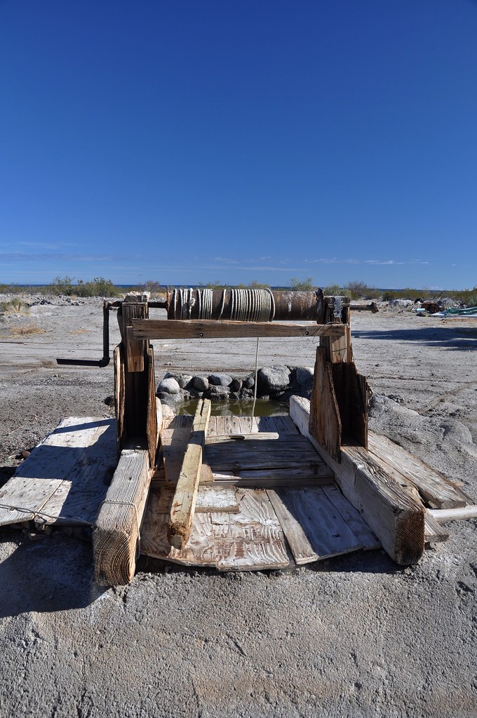
Old School well
Tons of cool backroads to explore. Some of them were a bit washboard but with low PSI and the right speed still pretty smooth. Nothing like the roads to come in the next few days.
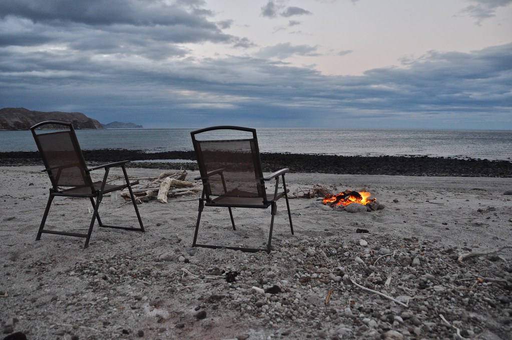
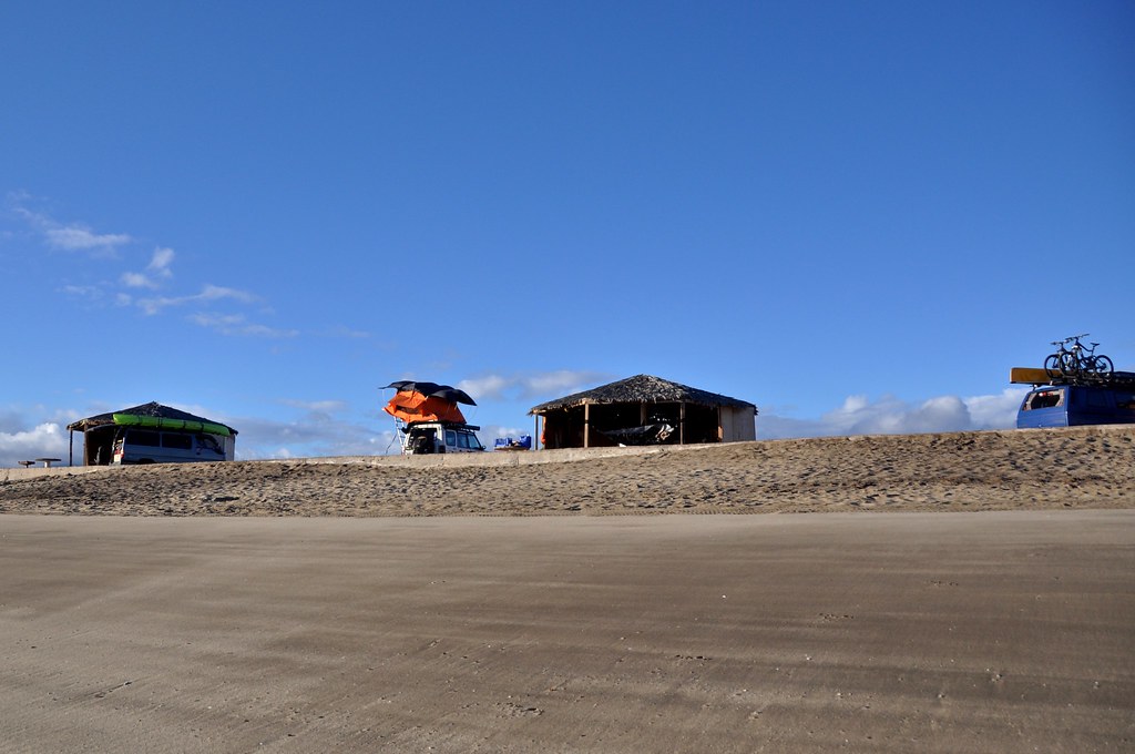
After checking out Papa Fernandez we decided to go see Bahia de San Luis Gonzaga (Gonzaga Bay). We hit the tarmac for a couple km, and then turned down the dirt road that runs along rancho grande airstrip. We met some cool folks from California in the van on the left, and decided this would be a great place to spend new years eve. Huge, spacious and spaced out palapas with windbreaks and tables, for 250MXN ($12 US/$16CAD). Barukinz and family (http://www.expeditionportal.com/forum/threads/167354-Baja-California-Photo-highlights-from-our-trip) rolled up in their sweet Discovery and we ended up with a great crew to have a beach bonfire and beers to celebrate the end of 2016.
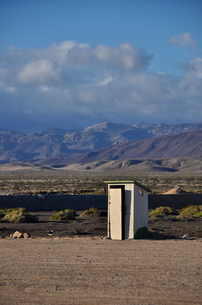
Oddly Picturesque outhouse. One for each campsite which was kinda cool.
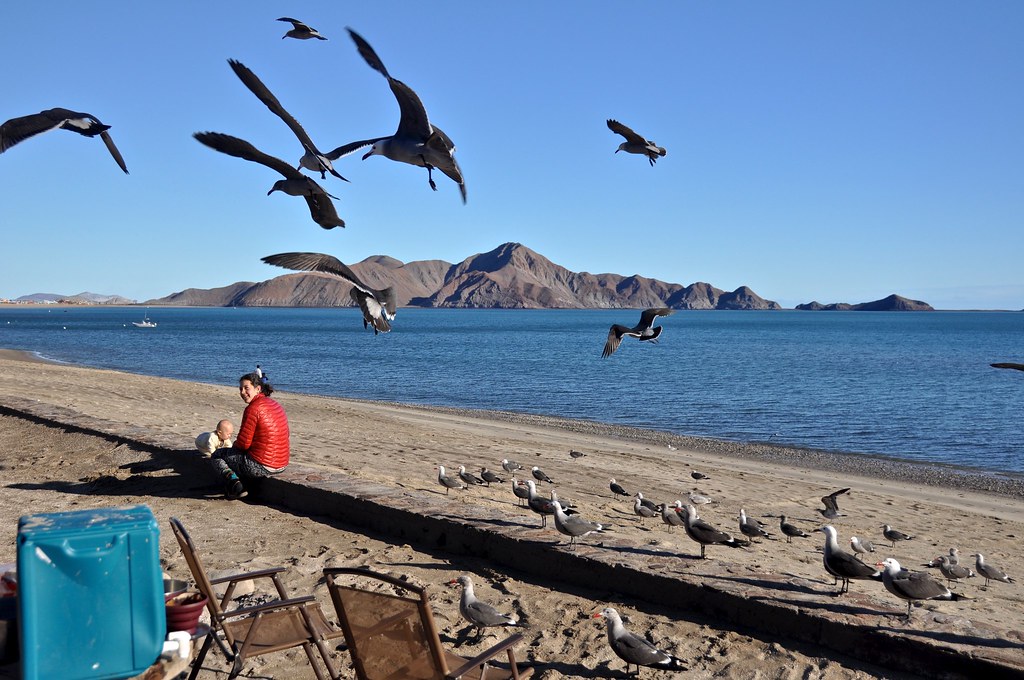
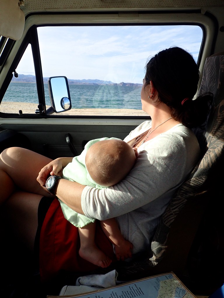
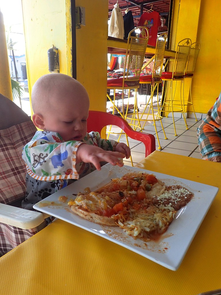
One thing about travelling with a baby, it sure doesn’t take long for the local wildlife to realize they have struck a gold mine of food being thrown onto the ground. In Gonzaga it was these gulls. Other places squirrels, jays, sparrows, pigeons, stray dogs, etc.
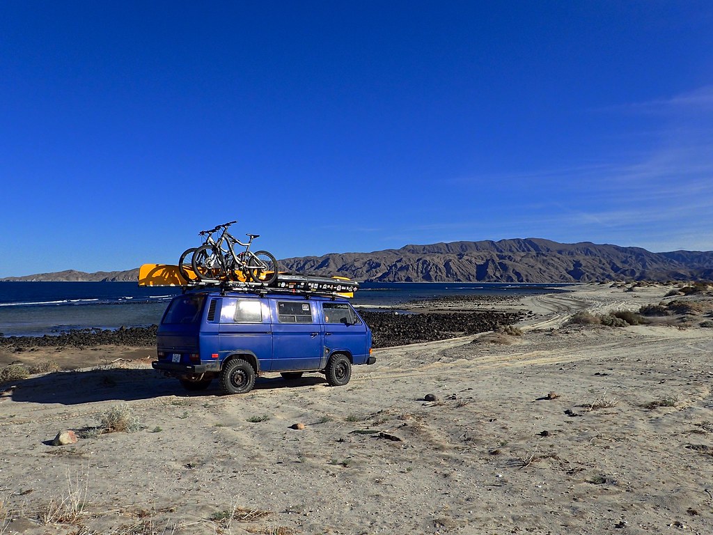
This is out past the restaurant at Alfonsina’s. We had ambitions of paddling in the lagoon, but the wind was too strong (the huge windbreaks at the campsite should have been our first clue that its always windy here). We did enjoy a good meal at the restaurant and enjoy some sunshine, then went back to Rancho Grande (Small store/market on Mex 5). Rancho Grande is one of the few stops along this section of highway with good (enough) groceries, reliable ice/beer/wifi, etc so most people heading north and south seem to stop here.
We met these two, Christian and Chelsea- http://www.travelingtuttles.com/ , travelling mexico in their dope tricked out Pinzgauer. Had a great chat with them and then parted ways. Its amazing the travelling and (I hate to use this word, but) “overlanding” community on the road in Baja. Whether you meet someone on the side of the road, a campsite, or just the parking lot as they crawl out from under their rig, the instant connection between like-minded travellers is amazing. Good luck on the rest of your trip guys!
Anyway, we decided to forgo the windy Rancho Grande campsite and forge off on some dirt tracks towards Punta Final and go exploring. Plenty of tight tracks heading down to the beach.
This one ended up being a bit too tight! So we turned around and stopped to enjoy this:
and this:
We arrived in the community of Punta Final, another gated/pay to access small, mostly gringo (from what we saw) community of vacation homes, all situated on a large land package that is locally owned. From what I gather, non-mexican nationals have to rent the land that their house is on. I think its similar to a trailer park kind of set up in Canada. Anyway, this place was no mere trailer park! It was beautiful!
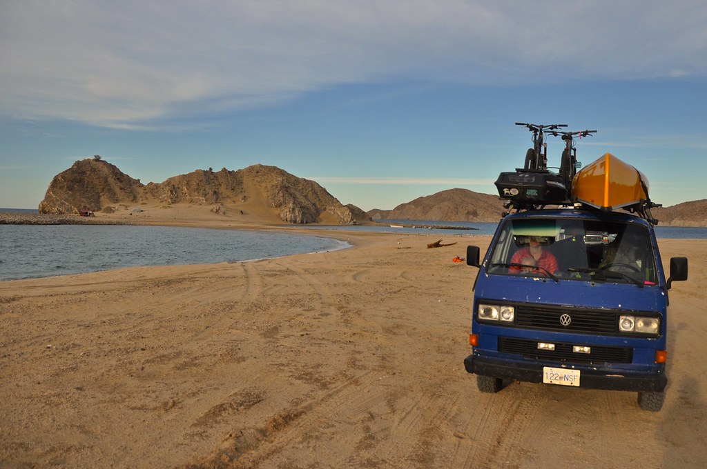
This is the open beach camping area. IF you look closely, you can see another VW van in the distance, with what we agreed was the best camp site we’d seen in Baja. Low tide access across a tombolo (non geology/geography nerd translation: strip of sand connecting an island to the mainland) to your own private island complete with mountain, steep sand dunes, flowers, and views in all directions. However, we didn’t have 4WD and were not going to attempt that crossing, especially after meeting the VW owners (awesome german couple travelling with a young kid) and they showed us where the 4x4 F250 had been stuck the night before. Sorry guys I forget your names! They had an awesome high top Joker Syncro that they imported from Germany and are travelling north America with. On a side note if you guys are on here, or anyone knows of them, I would love to follow a blog/trip report, even if its in German!
I think that’s where I will leave it for today. Stay tuned for part 5: Punta Final to Coco’s Corner and beyond!
We stocked up on groceries, beer, ice, and supplies in San Felipe since it was the last large town we would be in, and we were keen to get off the beaten track and find some solitude.
Glad to be heading out of civilization, we rumbled south past the ubiquitous abandoned/partly completed resorts, and beach house after beach resort. We hadn’t been south of San Felipe in 10 years, and it has sure changed. Nothing like, say, Cabo area for development, but still a lot more built up than 10 years ago. Such is life though, people want to build in beautiful places.
We followed Mex 5, along some pretty rough pavement, with only one encounter with a vado that snuck up on us. The big BFGs fit under the van in most circumstances with no rubbing, but carrying too much speed into a vado with the van loaded down is not one of them. No damage, but we did smell some burning rubber from where the tires had bottomed on the fender wells. We kept a closer eye out for the dips after that!
We pulled into a random dirt road north of Puertecitos looking for beach access. We were in luck! An abandoned foundation/house but no one else in sight. We parked right on the beach and enjoyed lunch, glad to be getting some dirt on our tires and sand in our toes! The freedom of quiet beaches, quiet roads, and dispersed camping. Now we are talking!
After lunch, we pushed on to puertecitos, which definitely wins no awards for beauty, and is a collection of ramshackle buildings that look like they are stuck in the 1960’s. There is, however, a nice natural hot springs (more on that later) but the tide was not in our favour at this time of day. So we decided to continue south on a starkly beautiful remote paved section of Highway 5. When I last drove this, it was fairly slow gravel, so the fresh pavement was a nice surprise.
The view from the summit looking south towards El Huerfanito.
There were many places that looked decent to camp along gravel beaches, but we pushed along almost to Gonzaga bay and finally bumped down the dirt track to Playa el Faro. We pulled up to this spot, right on the beach with the bay to ourselves ( one house a mile to the north, and a few seasonal shacks a mile to the south).
We camped at a site that clearly used to house somones trailer. It looked like it had been dragged out recently. It was the flattest spot around though so we elected to stay there next to the vaguely creepy giant cross made out of rocks (to the left of the van).
Ample firewood was available at the high tide line, which incidentally was littered with what at first looked like Styrofoam, but then turned out to be pumice. Pumice is an extremely porous, feather-light volcanic rock that will actually float on water. To see the collection of pumice pebbles that clearly marked the high tide or storm waves was pretty cool.
As you can tell, the weather closed in on us, and we actually had quite a stormy, windy night with some rain. We did vaguely worry about the washes we had driven down to get to our campsite, and the fact that we were perched on dry land only 5 feet above high tide mark, and 5 feet above the wash. Oh well, lets hope we don’t wake to the van floating away! Needless to say we were fine, and the next day we decided to check out the backroads to Papa Fernandez.
Aired down
Sandy tracks
Old School well
Tons of cool backroads to explore. Some of them were a bit washboard but with low PSI and the right speed still pretty smooth. Nothing like the roads to come in the next few days.
After checking out Papa Fernandez we decided to go see Bahia de San Luis Gonzaga (Gonzaga Bay). We hit the tarmac for a couple km, and then turned down the dirt road that runs along rancho grande airstrip. We met some cool folks from California in the van on the left, and decided this would be a great place to spend new years eve. Huge, spacious and spaced out palapas with windbreaks and tables, for 250MXN ($12 US/$16CAD). Barukinz and family (http://www.expeditionportal.com/forum/threads/167354-Baja-California-Photo-highlights-from-our-trip) rolled up in their sweet Discovery and we ended up with a great crew to have a beach bonfire and beers to celebrate the end of 2016.
Oddly Picturesque outhouse. One for each campsite which was kinda cool.
One thing about travelling with a baby, it sure doesn’t take long for the local wildlife to realize they have struck a gold mine of food being thrown onto the ground. In Gonzaga it was these gulls. Other places squirrels, jays, sparrows, pigeons, stray dogs, etc.
This is out past the restaurant at Alfonsina’s. We had ambitions of paddling in the lagoon, but the wind was too strong (the huge windbreaks at the campsite should have been our first clue that its always windy here). We did enjoy a good meal at the restaurant and enjoy some sunshine, then went back to Rancho Grande (Small store/market on Mex 5). Rancho Grande is one of the few stops along this section of highway with good (enough) groceries, reliable ice/beer/wifi, etc so most people heading north and south seem to stop here.
We met these two, Christian and Chelsea- http://www.travelingtuttles.com/ , travelling mexico in their dope tricked out Pinzgauer. Had a great chat with them and then parted ways. Its amazing the travelling and (I hate to use this word, but) “overlanding” community on the road in Baja. Whether you meet someone on the side of the road, a campsite, or just the parking lot as they crawl out from under their rig, the instant connection between like-minded travellers is amazing. Good luck on the rest of your trip guys!
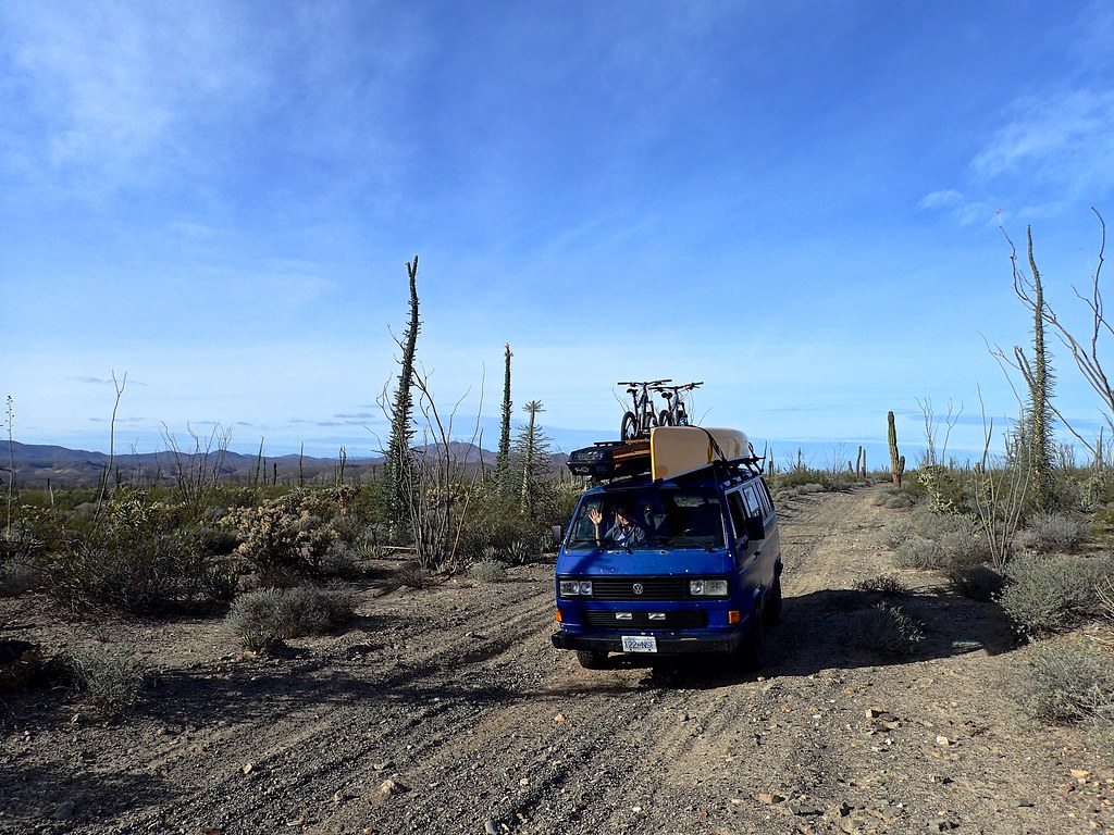
Anyway, we decided to forgo the windy Rancho Grande campsite and forge off on some dirt tracks towards Punta Final and go exploring. Plenty of tight tracks heading down to the beach.
This one ended up being a bit too tight! So we turned around and stopped to enjoy this:
and this:
We arrived in the community of Punta Final, another gated/pay to access small, mostly gringo (from what we saw) community of vacation homes, all situated on a large land package that is locally owned. From what I gather, non-mexican nationals have to rent the land that their house is on. I think its similar to a trailer park kind of set up in Canada. Anyway, this place was no mere trailer park! It was beautiful!
This is the open beach camping area. IF you look closely, you can see another VW van in the distance, with what we agreed was the best camp site we’d seen in Baja. Low tide access across a tombolo (non geology/geography nerd translation: strip of sand connecting an island to the mainland) to your own private island complete with mountain, steep sand dunes, flowers, and views in all directions. However, we didn’t have 4WD and were not going to attempt that crossing, especially after meeting the VW owners (awesome german couple travelling with a young kid) and they showed us where the 4x4 F250 had been stuck the night before. Sorry guys I forget your names! They had an awesome high top Joker Syncro that they imported from Germany and are travelling north America with. On a side note if you guys are on here, or anyone knows of them, I would love to follow a blog/trip report, even if its in German!
I think that’s where I will leave it for today. Stay tuned for part 5: Punta Final to Coco’s Corner and beyond!
rfoubi
Observer
Part 5: Punta Final, Calamajue Wash, and Coco's Corner
Part 5: Punta Final to Coco’s Corner
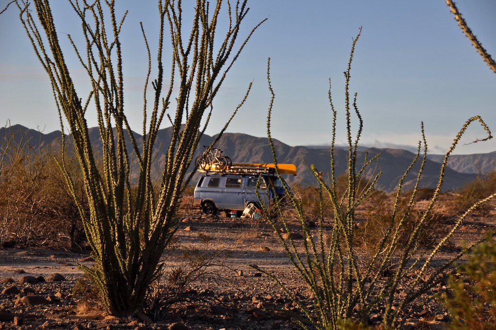
We decided to get back on our own path into the desert, and left Punta Final after a good hike/explore. We bumped along the huge expanse of Gonzaga Bay, and found our own little dirt road to follow:
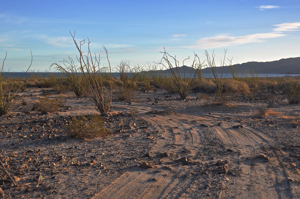
We found a cool spot amongst the Ocotillo with an ocean view, and set up camp for the night. We listened to the sounds of coyotes over the distant waves, with an amazing canopy of stars above. Life is good.
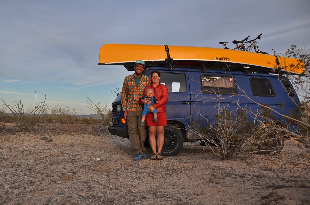
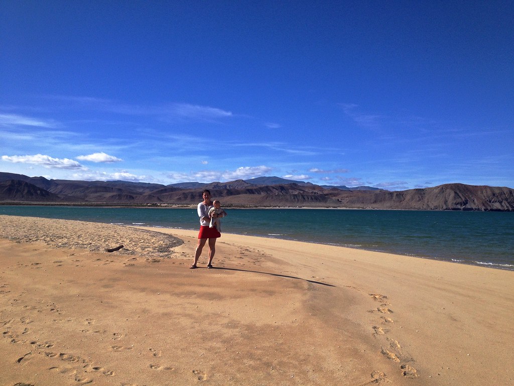
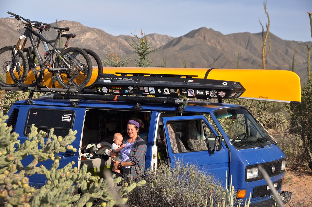
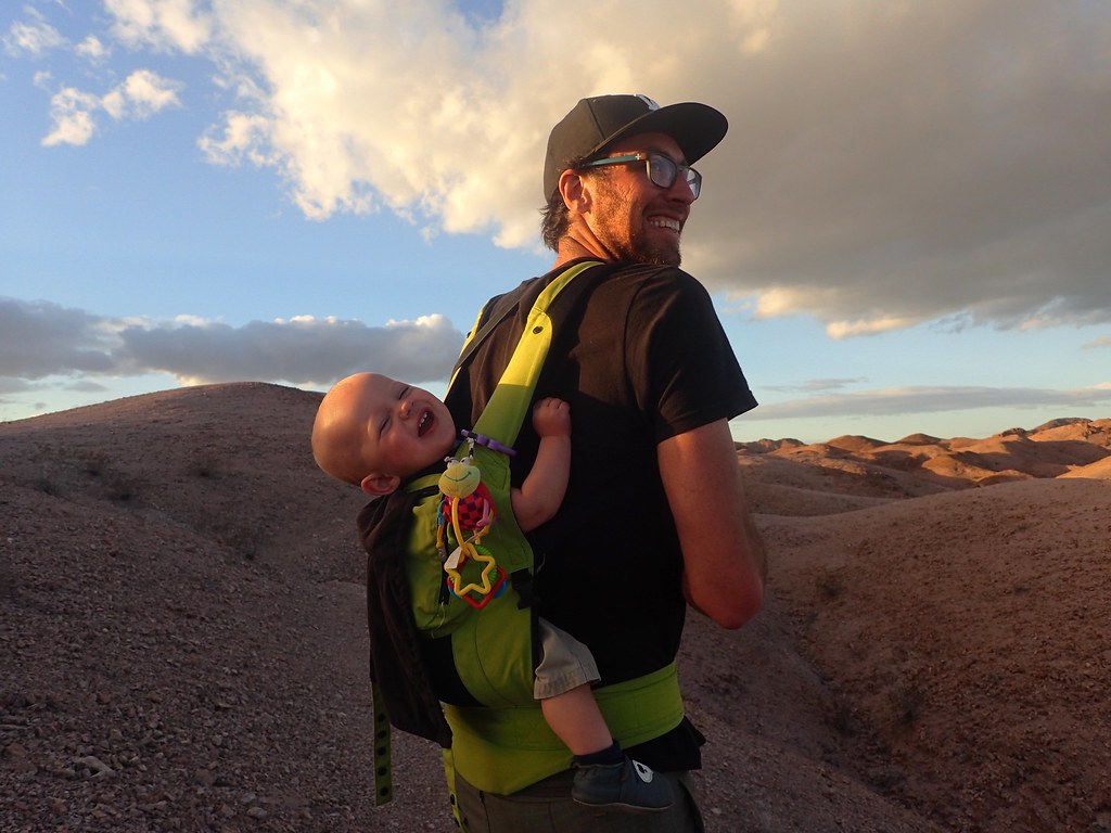
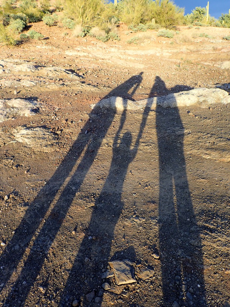
Token family photo
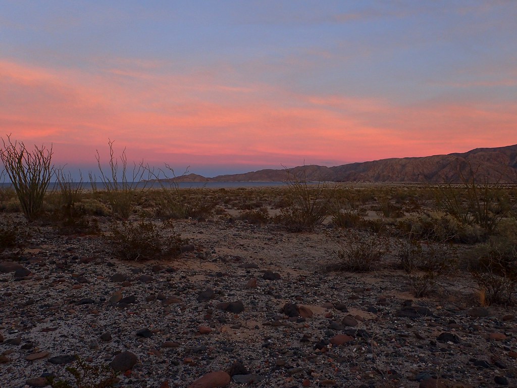
Sunrise View
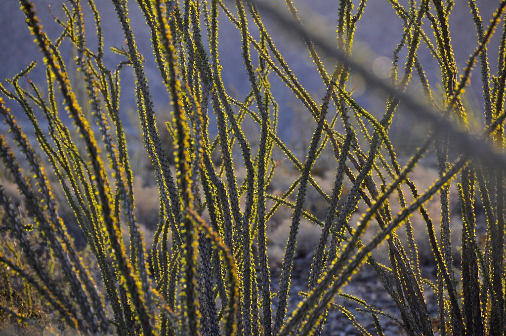
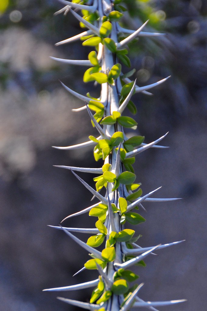
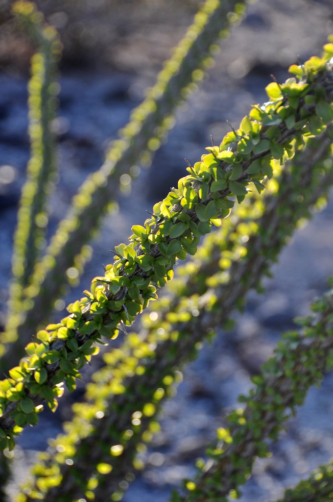
Although we were travelling south of 30 degrees latitude now, it was still the dead of winter, and most of the plants with greenery had lost it for the winter. However, around this area, the first signs of spring (or maybe just the rainfall of 2 weeks ago) were starting to show. The electric green of the tiny budding leaves on the Ocotillo was incredible to see.
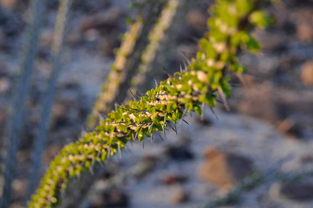
As denizens of the boreal forest of Canada, we just can’t get enough of the unique plants of the desert, even after 10+ trips to hot, dry places in North America. Something about the delicate, yet burly nature of the Ocotillo is so cool.
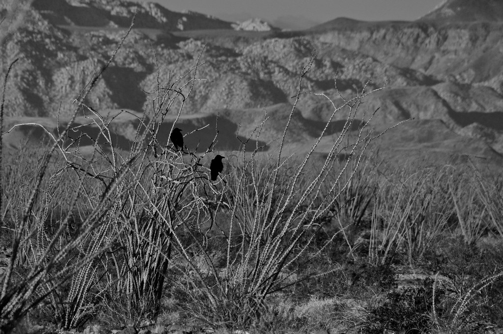
Our good friends the ravens.
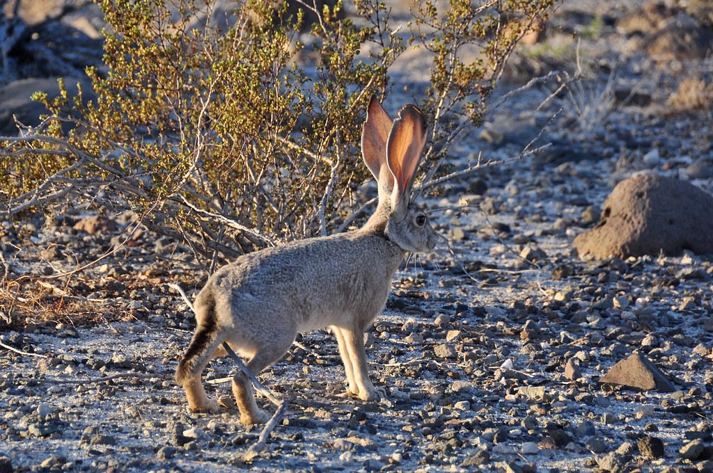
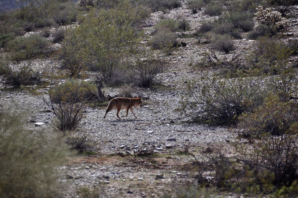
Saw a lot of these guys, usually too fast for my camera. Not this time buddy!
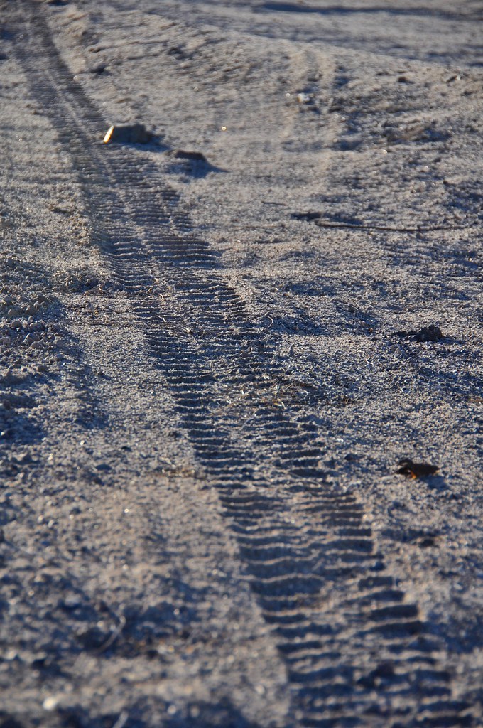
Tracks
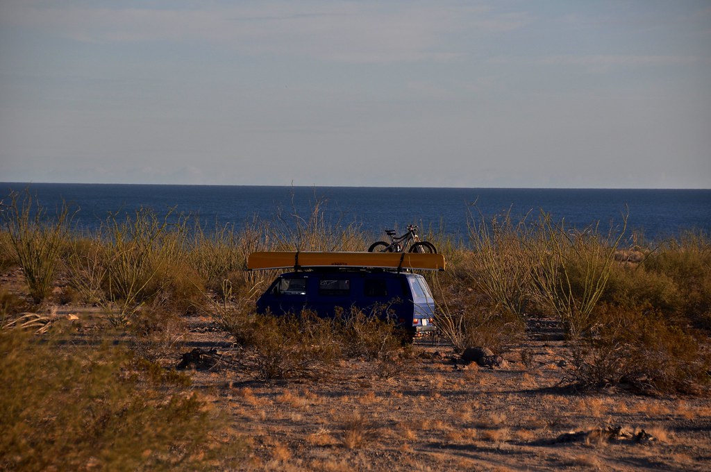
Another beauty campsite.
We packed up and stocked up on a few more supplies at Rancho Grande, and then followed the new pavement south. Currently its paved to about 20km north of Coco’s Corner. We bumped along the road to Coco’s, and then took a left on the road to Calamajue. We decided to drive up Calamajue wash with the idea of getting to an old mission and maybe checking out some mining ruins.
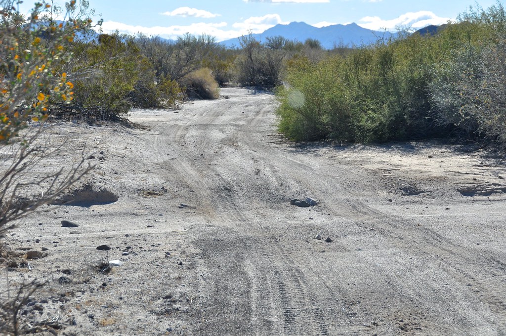
The first 5-10 km on the main Calamajue road (towards the town of Calamajue) were fairly smooth and fast. Then we turned onto the Calamajue wash road (not sure what its actually called, since it would be hours before we got into the wash itself. This road turned out to be an exercise in patience. It is used by baja race trucks and motos, and as a result has the type of high-speed (for them) whoops like I’ve never seen. Basically washboards where each dip was as long as the van and half as deep. The road was dead straight, and we could see in the distance where we were trying to go. However, our loaded VW is no trophy truck, and we were averaging 5-8mph for a good 2 hours straight. By the time we got to the wash I felt like I’d been on a horse for those 2 hours!
Life abounds, even in the most unlikely of places.
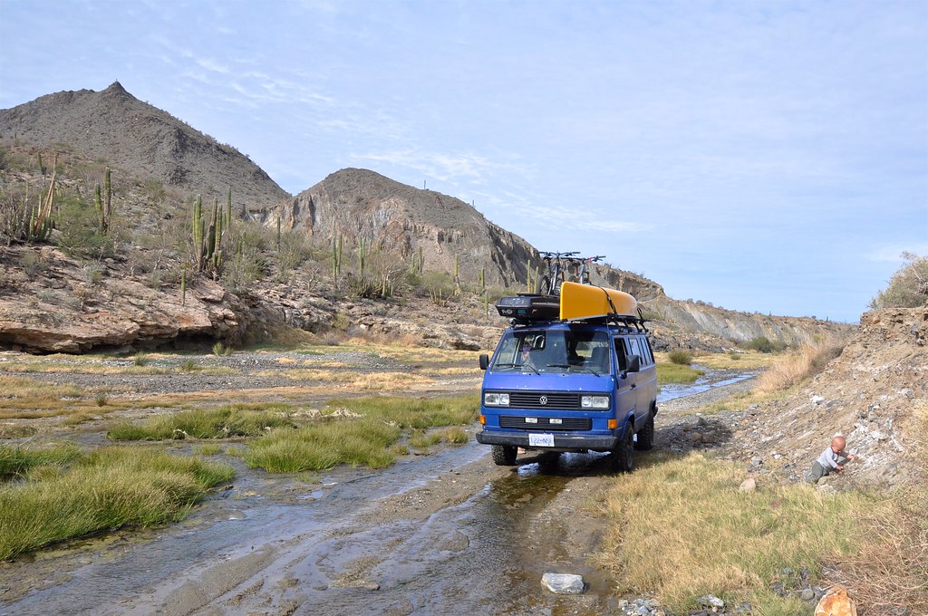
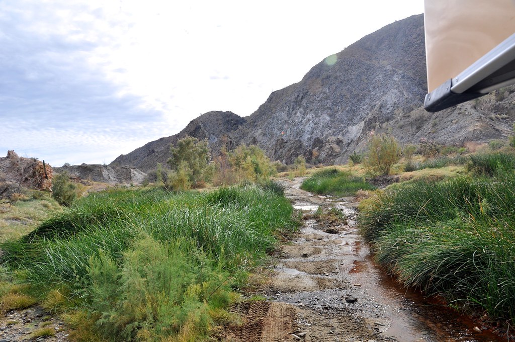
So, we arrived in the wash, where like a mirage out of the desert, we started to see green grass and flowing water. We stopped to assess before driving down the bank into it. We walked the road first, and made sure it would be repeatable coming back up in case we turned around. Questionable, but with a shovel it would work out I’m sure. So, onwards! Unfortunately no photos of the hill (and in fact a lot of this road) since we were focused on driving and seeing whats around the next bend.
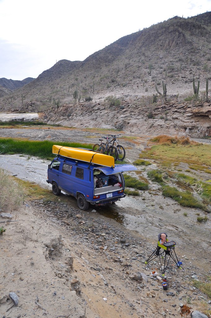
We stopped for lunch in the lush greenery in the wash.
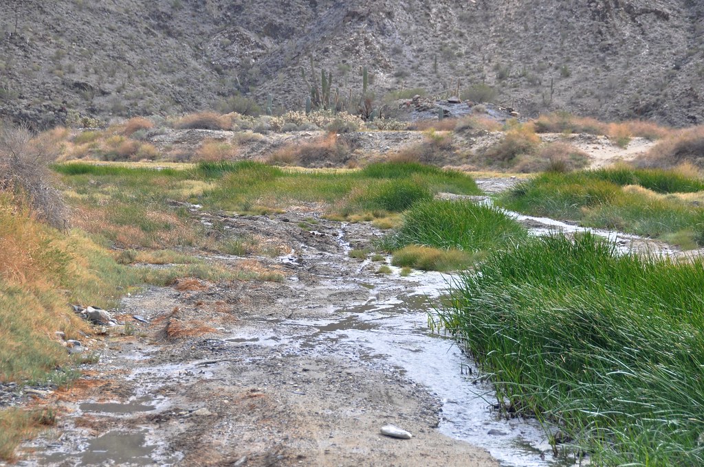
Some dodgy muddy bits, but we were always able to find other branches of the road that avoided the worst parts. Also, there was always a gravelly bottom to the mudholes, and they less sketchy than they looked once we walked through them.
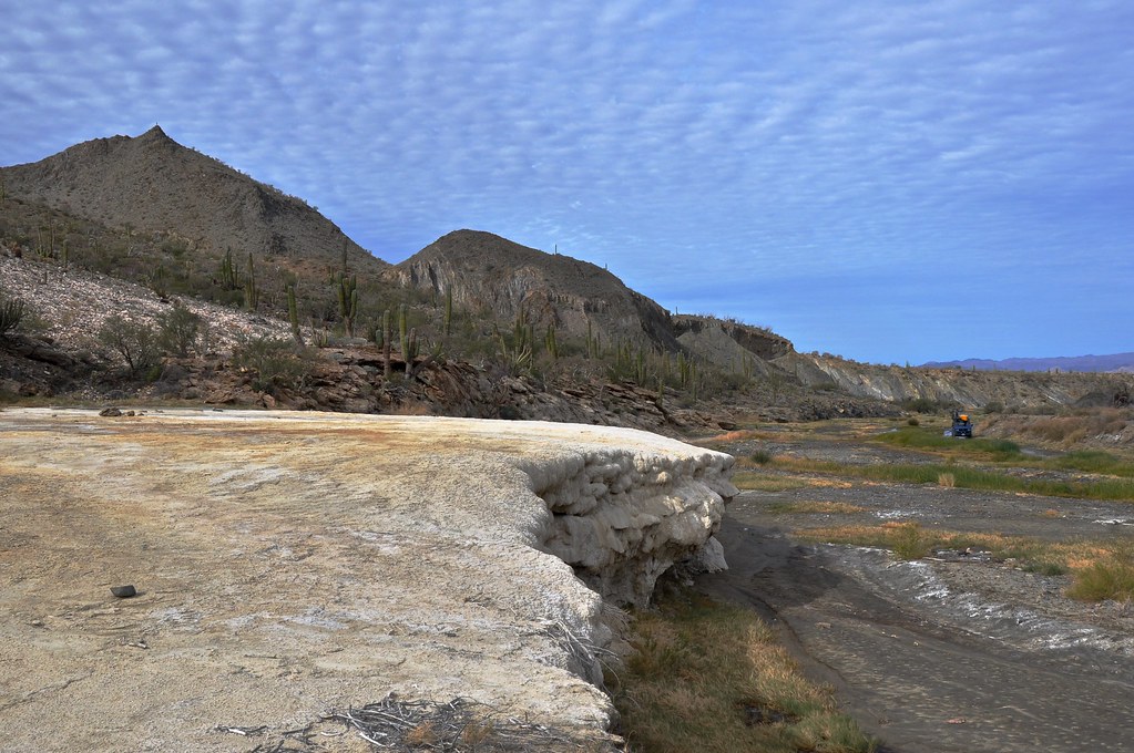
Cool travertine deposits around the springs
Part 5: Punta Final to Coco’s Corner
We decided to get back on our own path into the desert, and left Punta Final after a good hike/explore. We bumped along the huge expanse of Gonzaga Bay, and found our own little dirt road to follow:
We found a cool spot amongst the Ocotillo with an ocean view, and set up camp for the night. We listened to the sounds of coyotes over the distant waves, with an amazing canopy of stars above. Life is good.
Token family photo
Sunrise View
Although we were travelling south of 30 degrees latitude now, it was still the dead of winter, and most of the plants with greenery had lost it for the winter. However, around this area, the first signs of spring (or maybe just the rainfall of 2 weeks ago) were starting to show. The electric green of the tiny budding leaves on the Ocotillo was incredible to see.
As denizens of the boreal forest of Canada, we just can’t get enough of the unique plants of the desert, even after 10+ trips to hot, dry places in North America. Something about the delicate, yet burly nature of the Ocotillo is so cool.
Our good friends the ravens.
Saw a lot of these guys, usually too fast for my camera. Not this time buddy!
Tracks
Another beauty campsite.
We packed up and stocked up on a few more supplies at Rancho Grande, and then followed the new pavement south. Currently its paved to about 20km north of Coco’s Corner. We bumped along the road to Coco’s, and then took a left on the road to Calamajue. We decided to drive up Calamajue wash with the idea of getting to an old mission and maybe checking out some mining ruins.
The first 5-10 km on the main Calamajue road (towards the town of Calamajue) were fairly smooth and fast. Then we turned onto the Calamajue wash road (not sure what its actually called, since it would be hours before we got into the wash itself. This road turned out to be an exercise in patience. It is used by baja race trucks and motos, and as a result has the type of high-speed (for them) whoops like I’ve never seen. Basically washboards where each dip was as long as the van and half as deep. The road was dead straight, and we could see in the distance where we were trying to go. However, our loaded VW is no trophy truck, and we were averaging 5-8mph for a good 2 hours straight. By the time we got to the wash I felt like I’d been on a horse for those 2 hours!
Life abounds, even in the most unlikely of places.
So, we arrived in the wash, where like a mirage out of the desert, we started to see green grass and flowing water. We stopped to assess before driving down the bank into it. We walked the road first, and made sure it would be repeatable coming back up in case we turned around. Questionable, but with a shovel it would work out I’m sure. So, onwards! Unfortunately no photos of the hill (and in fact a lot of this road) since we were focused on driving and seeing whats around the next bend.
We stopped for lunch in the lush greenery in the wash.
Some dodgy muddy bits, but we were always able to find other branches of the road that avoided the worst parts. Also, there was always a gravelly bottom to the mudholes, and they less sketchy than they looked once we walked through them.
Cool travertine deposits around the springs
rfoubi
Observer
Part 5: Continued
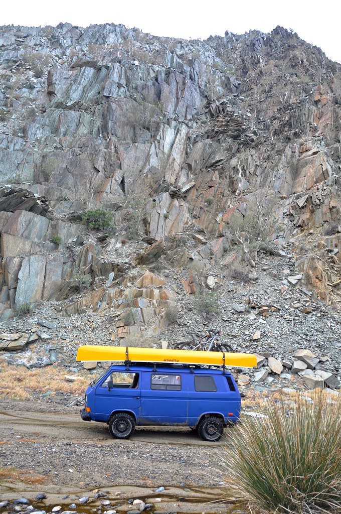
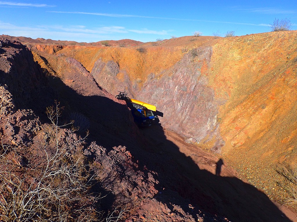
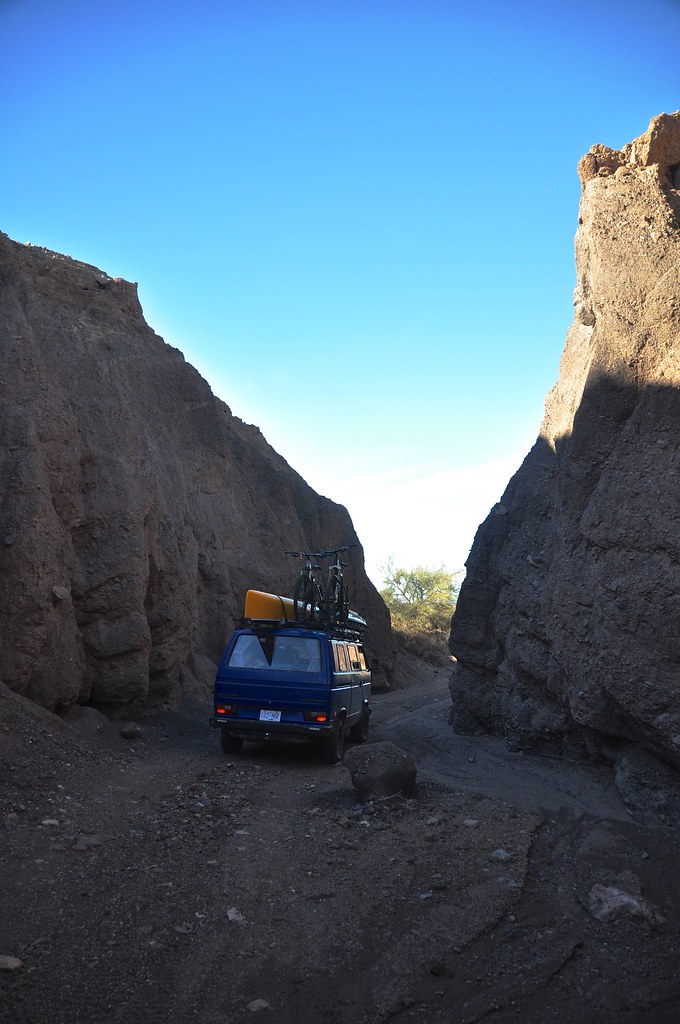
As we continued up the canyon, the walls got closer and closer, and soon towered above us. The “road” was still decent with sandy patches, some small water crossings, etc.
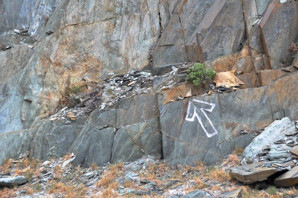
Keep following the arrows!
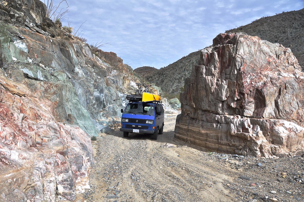
Narrower and narrower. One thing is for sure, you don't want to be up here when it rains. We were keeping a pretty close eye on the weather since it would be a long way back to get out of the wash.
After we climbed up through the tightest canyon (and passed 4 guys on motos ripping in the opposite direction, who oddly didn't stop to talk and gave us some strange looks) the canyon started to open up and it seemed feasible that we would make it out the top end. Prior to this, the canyon looked so impossibly tight that we were sure the road would turn into a rock crawl and we would be turned back. However by this point we had been 4 hrs on this road, and it was going to be a long day if we had to drive back. We definitely were feeling very very remote out here, since other than the 4 bikers, we hadn't; seen a soul. We decided to do a quick assessment of our gear and status and talk about whether to continue.
We knew that worst case scenario (blown engine, catastrophic parts failure) we had the mountain bikes on the roof. We could pop them off, load backpacks with food and water (and Orson!) and pedal back to cocos. Plus we had 4 days of food and water, a dry warm place to sleep, tons of spare parts (CV joints, axle, alternator, starter, fuel pump and filter, relays, wiring, ) jerrycans of fuel, spare tire, tire puncture kit, compressor, spare wiring, full toolbox, shovel, 2 jacks (including hi-lift that can be used to (very slowly ) winch with), sand ladders, recovery straps, chains, axe, saw, etc. Ok, I think we are good.
It was good to do a reality check and make sure we weren't being reckless, but then to realize also that even if things go really wrong, we will be ok, and that we came here for an adventure. Part of overland travel for us is getting outside of our comfort zone. So we climbed back in the van and continued.
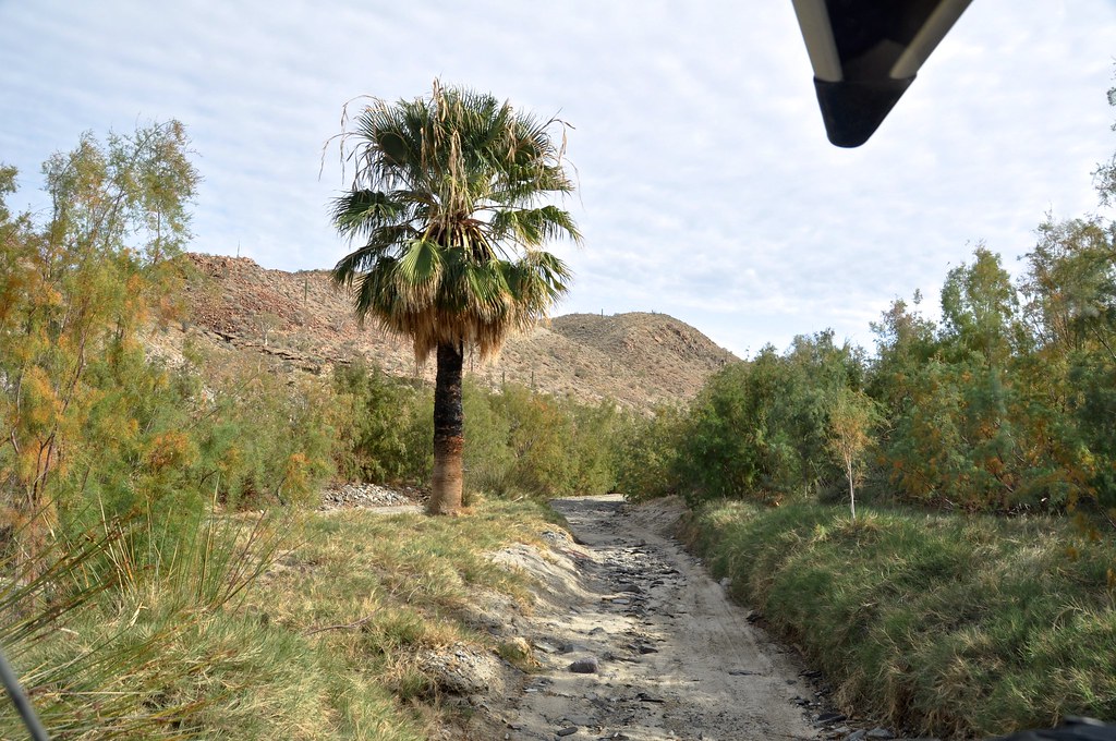
We started seeing more lush grass, even palm trees (I know there is one type of palm native to baja, I suspect this far from civilization that is what we were seeing).
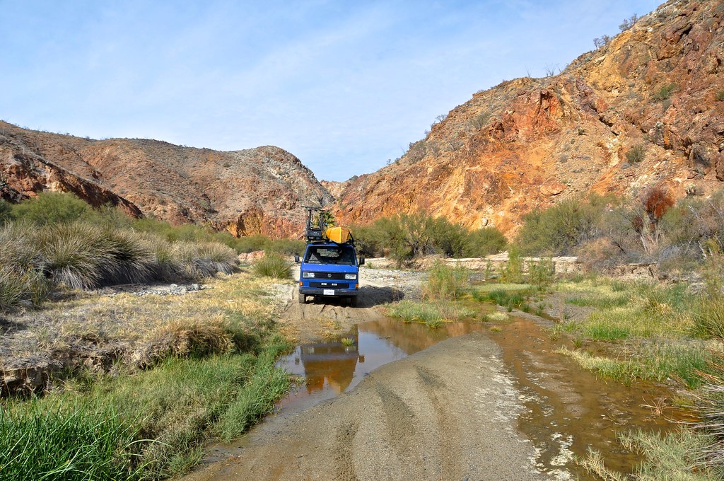
Amazing views around every corner. We kept waiting for the sand to get too deep, the rocks to get too big, or there to be an obstacle too gnarly for us to pass. But with a bit of blind faith and some careful driving, everything was going well so far. As the canyon opened up, and the walls got smaller, the road got sandier. While this ironically made for the fastest, smoothest driving of the whole drive (even hit 20mph! and second gear occasionally!), it was also the most nerve-wracking. Although we had big tires, low psi, and momentum on our side, there were several kms of pure, soft sand, and we were in a heavy 2WD vehicle. It was ok as we kept moving, but coming in blind meant that there was a chance we would come across and obstacle, have to stop and/or turn around, and then face the possibility of getting bogged in the sand. I feel like with the gravelly sand, and the sand ladders, that we would have not got super stuck, but nevertheless we were not stopping to take photos, and kept it pinned through the sandy parts.
So despite being white-knuckled for a while, it turned out fine, and we climbed out of the wash eventually and ended up on rocky, solid ground. Great success!
Just before this photo was actually the techiest part of the drive, some off camber whoops on a steep hill, with a big ditch running down the centre. We managed to bounce and scrabble our way up it (thank god for the limited slip diff - these 2WD vans came stock with 1WD aka open diff) with only one smash to the front corner of the bumper. If this had stopped us, I think we could have tuned it up with a shovel and filled in some holes to make it by, but we were very glad to make it up this hill, especially so close to the end of the drive.
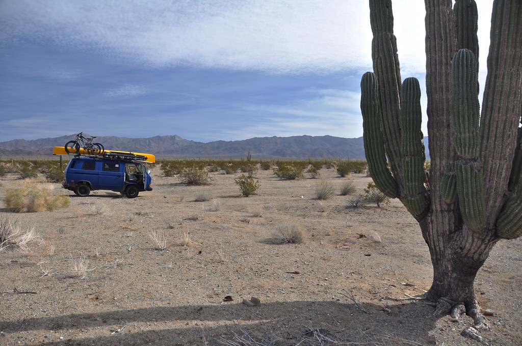
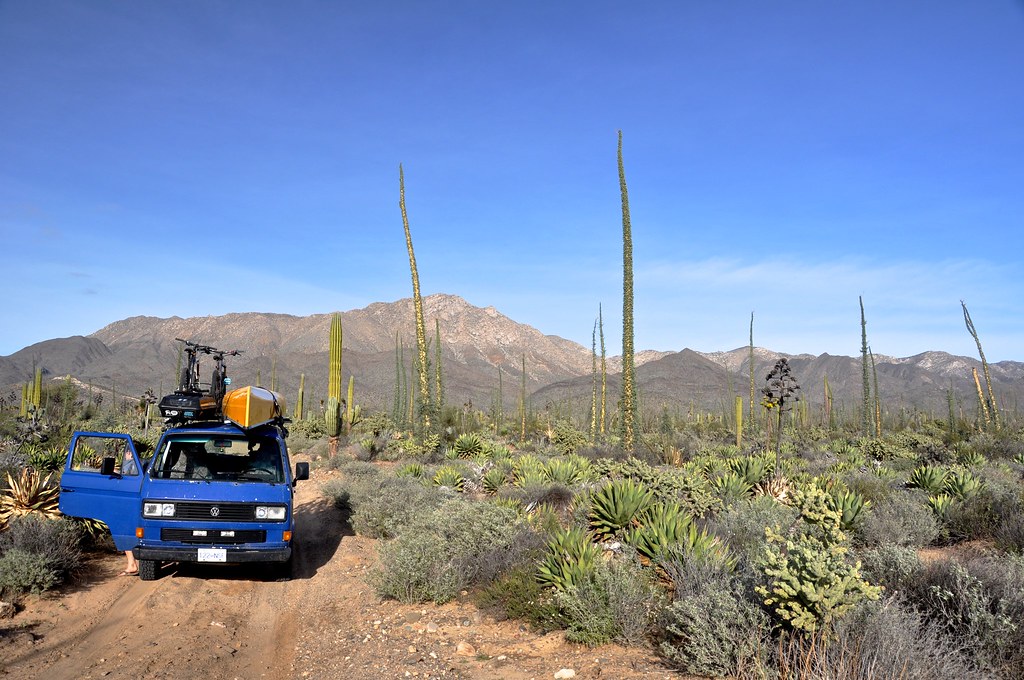
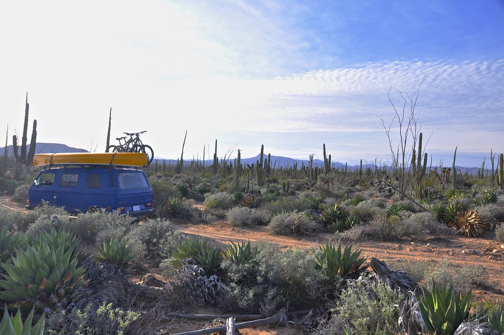
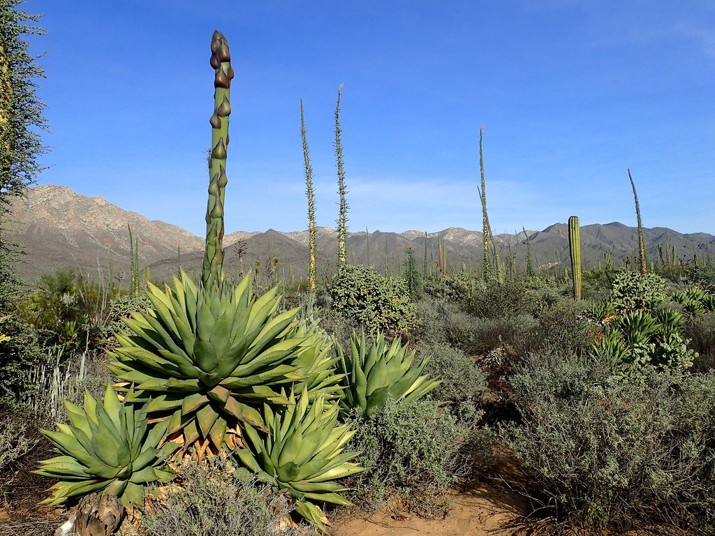
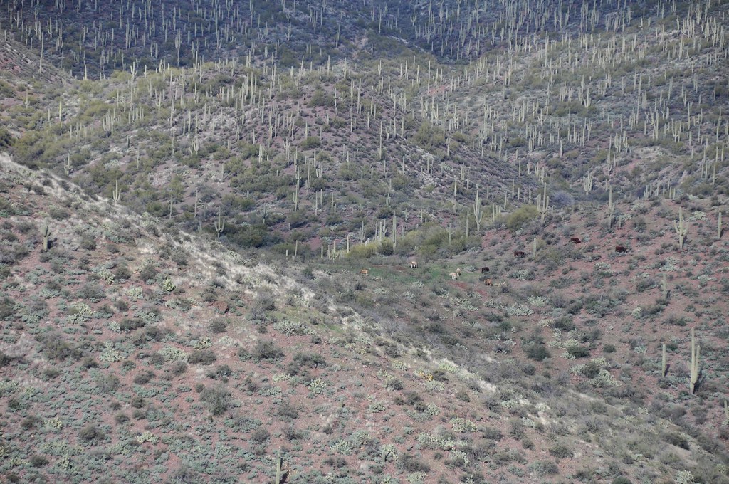
Each time we came around a corner, the scenery kept changing and getting more spectacular. As we climbed out of the wash, we left the palm trees and scrub brush behind, and started getting into scattered ocotillo, cholla, and cordon cacti. Just before the big hill, we had passed a big sign that basically said- federal land, no entry without permit. However it was in the middle of a very sandy straight stretch, and there was zero evidence of anyone turning back at that point. We figured to just keep going and hope it wasn't a big deal. We kept climbing in elevation, the views opened up more, and we started seeing the big boojum trees and giant agave/yuccas that this central part of baja is know for.
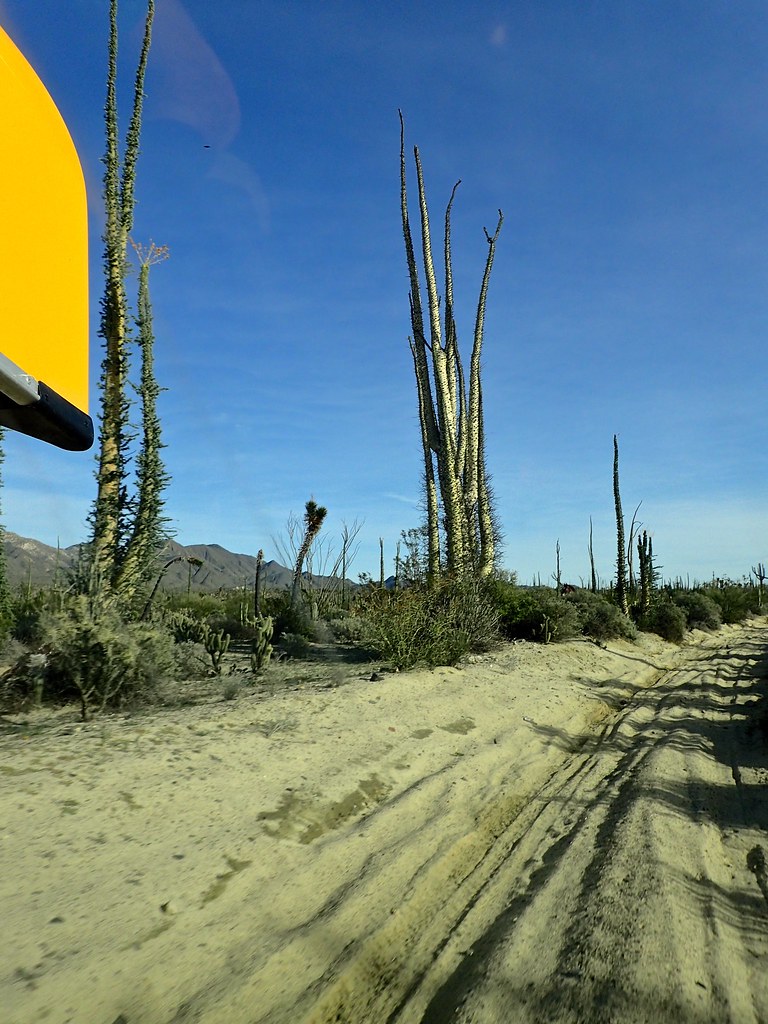
Typical sandy trail, giant Boojum trees, cacti, and dirt bike tracks
By now we are only a few km from the pavement at the end of our epic drive. We are feeling good and jump out to really soak in the incredible landscape.
Trail Carnage. Bent handlebars and tree bits after having no choice but to plow through some low hanging branches. Luckily the stem had just spun so the bars were fine.
It felt so surreal, like we had driven to another planet. The Dr Suessian giant plants, the late afternoon sun, the remoteness, and the beauty were unforgettable.
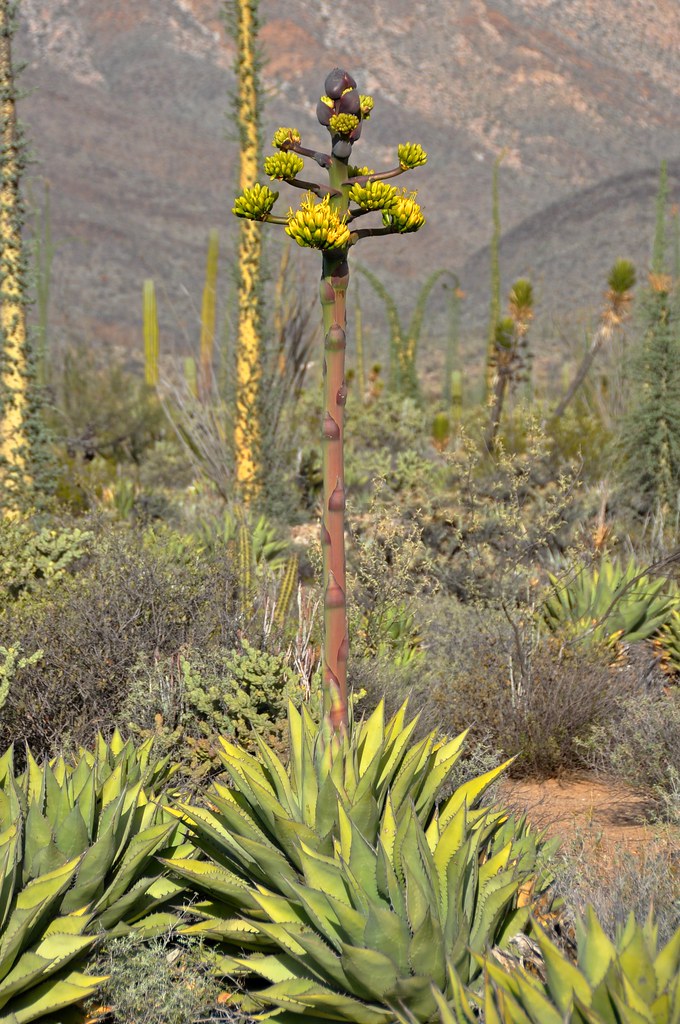
Some sort of yucca, starting to flower
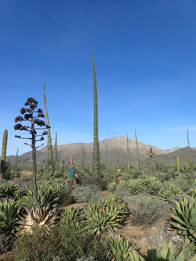
There's some perspective on the size of the Boojum trees. I'm 6'5”!
Finally after around almost 5 hours of mostly driving, with a few stops for photos, we had reached Mex 1 and pavement! It was a relief, but also sad to say goodbye to the most amazing landscape and to be done our most memorable backroad drive. It was around 45km from Coco's Corner to Mex 1, and if you have a high clearance capable 2WD or better yet 4WD, I would strongly recommend taking this route! Such an amazing drive.
Here's a quick video of ****ty POV footage handheld in a couple spots. Doesn't do it justice but it helps!
This would mark our furthest point south, as time constraints meant it was time to head north to Arizona. We hit pavement, and decided we had definitely earned a beer at Coco's. Having heard of this legendary place/person we were keen to go. We bumped along washboard gravel past the start of some big bridge and blasting projects. (For those that are wondering, as of Jan 2016 the new paved road ends 20km north of Cocos, and it is the old gravel road from Mex 1 to there. )
Turns out the hype is real, and Coco is the funniest, friendliest, most giving dude. Ex Caballero (Cowboy) but still a total Caballero (Gentleman). There is a reason this guy is a legend. We had a few beers with him, and he loved hanging out with Orson, whom he promptly gave the fitting nickname Cocito. He invited us to camp in the parking lot, and we made dinner as the sun set. We came back for another couple beers after we put Orson to sleep, and spent the evening sitting next to Cocos bed on old vehicle seats made into chairs, watching old western movies with Coco, and having funny Spanglish conversations about the plots. We were the only humans within at least an hour in either direction, and it was the most surreal way to end a surreal day.
Stay tuned for Part 6: Back to America
As we continued up the canyon, the walls got closer and closer, and soon towered above us. The “road” was still decent with sandy patches, some small water crossings, etc.
Keep following the arrows!
Narrower and narrower. One thing is for sure, you don't want to be up here when it rains. We were keeping a pretty close eye on the weather since it would be a long way back to get out of the wash.
After we climbed up through the tightest canyon (and passed 4 guys on motos ripping in the opposite direction, who oddly didn't stop to talk and gave us some strange looks) the canyon started to open up and it seemed feasible that we would make it out the top end. Prior to this, the canyon looked so impossibly tight that we were sure the road would turn into a rock crawl and we would be turned back. However by this point we had been 4 hrs on this road, and it was going to be a long day if we had to drive back. We definitely were feeling very very remote out here, since other than the 4 bikers, we hadn't; seen a soul. We decided to do a quick assessment of our gear and status and talk about whether to continue.
We knew that worst case scenario (blown engine, catastrophic parts failure) we had the mountain bikes on the roof. We could pop them off, load backpacks with food and water (and Orson!) and pedal back to cocos. Plus we had 4 days of food and water, a dry warm place to sleep, tons of spare parts (CV joints, axle, alternator, starter, fuel pump and filter, relays, wiring, ) jerrycans of fuel, spare tire, tire puncture kit, compressor, spare wiring, full toolbox, shovel, 2 jacks (including hi-lift that can be used to (very slowly ) winch with), sand ladders, recovery straps, chains, axe, saw, etc. Ok, I think we are good.
It was good to do a reality check and make sure we weren't being reckless, but then to realize also that even if things go really wrong, we will be ok, and that we came here for an adventure. Part of overland travel for us is getting outside of our comfort zone. So we climbed back in the van and continued.
We started seeing more lush grass, even palm trees (I know there is one type of palm native to baja, I suspect this far from civilization that is what we were seeing).
Amazing views around every corner. We kept waiting for the sand to get too deep, the rocks to get too big, or there to be an obstacle too gnarly for us to pass. But with a bit of blind faith and some careful driving, everything was going well so far. As the canyon opened up, and the walls got smaller, the road got sandier. While this ironically made for the fastest, smoothest driving of the whole drive (even hit 20mph! and second gear occasionally!), it was also the most nerve-wracking. Although we had big tires, low psi, and momentum on our side, there were several kms of pure, soft sand, and we were in a heavy 2WD vehicle. It was ok as we kept moving, but coming in blind meant that there was a chance we would come across and obstacle, have to stop and/or turn around, and then face the possibility of getting bogged in the sand. I feel like with the gravelly sand, and the sand ladders, that we would have not got super stuck, but nevertheless we were not stopping to take photos, and kept it pinned through the sandy parts.
So despite being white-knuckled for a while, it turned out fine, and we climbed out of the wash eventually and ended up on rocky, solid ground. Great success!
Just before this photo was actually the techiest part of the drive, some off camber whoops on a steep hill, with a big ditch running down the centre. We managed to bounce and scrabble our way up it (thank god for the limited slip diff - these 2WD vans came stock with 1WD aka open diff) with only one smash to the front corner of the bumper. If this had stopped us, I think we could have tuned it up with a shovel and filled in some holes to make it by, but we were very glad to make it up this hill, especially so close to the end of the drive.
Each time we came around a corner, the scenery kept changing and getting more spectacular. As we climbed out of the wash, we left the palm trees and scrub brush behind, and started getting into scattered ocotillo, cholla, and cordon cacti. Just before the big hill, we had passed a big sign that basically said- federal land, no entry without permit. However it was in the middle of a very sandy straight stretch, and there was zero evidence of anyone turning back at that point. We figured to just keep going and hope it wasn't a big deal. We kept climbing in elevation, the views opened up more, and we started seeing the big boojum trees and giant agave/yuccas that this central part of baja is know for.
Typical sandy trail, giant Boojum trees, cacti, and dirt bike tracks
By now we are only a few km from the pavement at the end of our epic drive. We are feeling good and jump out to really soak in the incredible landscape.
Trail Carnage. Bent handlebars and tree bits after having no choice but to plow through some low hanging branches. Luckily the stem had just spun so the bars were fine.
It felt so surreal, like we had driven to another planet. The Dr Suessian giant plants, the late afternoon sun, the remoteness, and the beauty were unforgettable.
Some sort of yucca, starting to flower
There's some perspective on the size of the Boojum trees. I'm 6'5”!
Finally after around almost 5 hours of mostly driving, with a few stops for photos, we had reached Mex 1 and pavement! It was a relief, but also sad to say goodbye to the most amazing landscape and to be done our most memorable backroad drive. It was around 45km from Coco's Corner to Mex 1, and if you have a high clearance capable 2WD or better yet 4WD, I would strongly recommend taking this route! Such an amazing drive.
Here's a quick video of ****ty POV footage handheld in a couple spots. Doesn't do it justice but it helps!
This would mark our furthest point south, as time constraints meant it was time to head north to Arizona. We hit pavement, and decided we had definitely earned a beer at Coco's. Having heard of this legendary place/person we were keen to go. We bumped along washboard gravel past the start of some big bridge and blasting projects. (For those that are wondering, as of Jan 2016 the new paved road ends 20km north of Cocos, and it is the old gravel road from Mex 1 to there. )
Turns out the hype is real, and Coco is the funniest, friendliest, most giving dude. Ex Caballero (Cowboy) but still a total Caballero (Gentleman). There is a reason this guy is a legend. We had a few beers with him, and he loved hanging out with Orson, whom he promptly gave the fitting nickname Cocito. He invited us to camp in the parking lot, and we made dinner as the sun set. We came back for another couple beers after we put Orson to sleep, and spent the evening sitting next to Cocos bed on old vehicle seats made into chairs, watching old western movies with Coco, and having funny Spanglish conversations about the plots. We were the only humans within at least an hour in either direction, and it was the most surreal way to end a surreal day.
Stay tuned for Part 6: Back to America
Last edited:
GR8ADV
Explorer
I love Baja. The last trip was all the way down on Moto's. I am looking fwd to a trip in the big FUSO. So much of the coastline was accessible on the moto, it will be an interesting shift to have a bigger vehicle. Looks like you all managed everything well. Great report and fun to read. Thanks so much for taking the time to post.
Justincredible
Adventurer
What a great trip, and equally great trip report.
Thank you for sharing.
Looking forward to part 6.
Thank you for sharing.
Looking forward to part 6.
parkkitchings
Adventurer
Nice report. Thanks for posting.
rfoubi
Observer
Part 6: Back to America: California and Arizona.
We woke to another beautiful day, cooked breakfast, and then walked over to say goodbye to coco and grab a coffee. It felt like saying goodbye to an old friend, even though we had just met the guy yesterday.
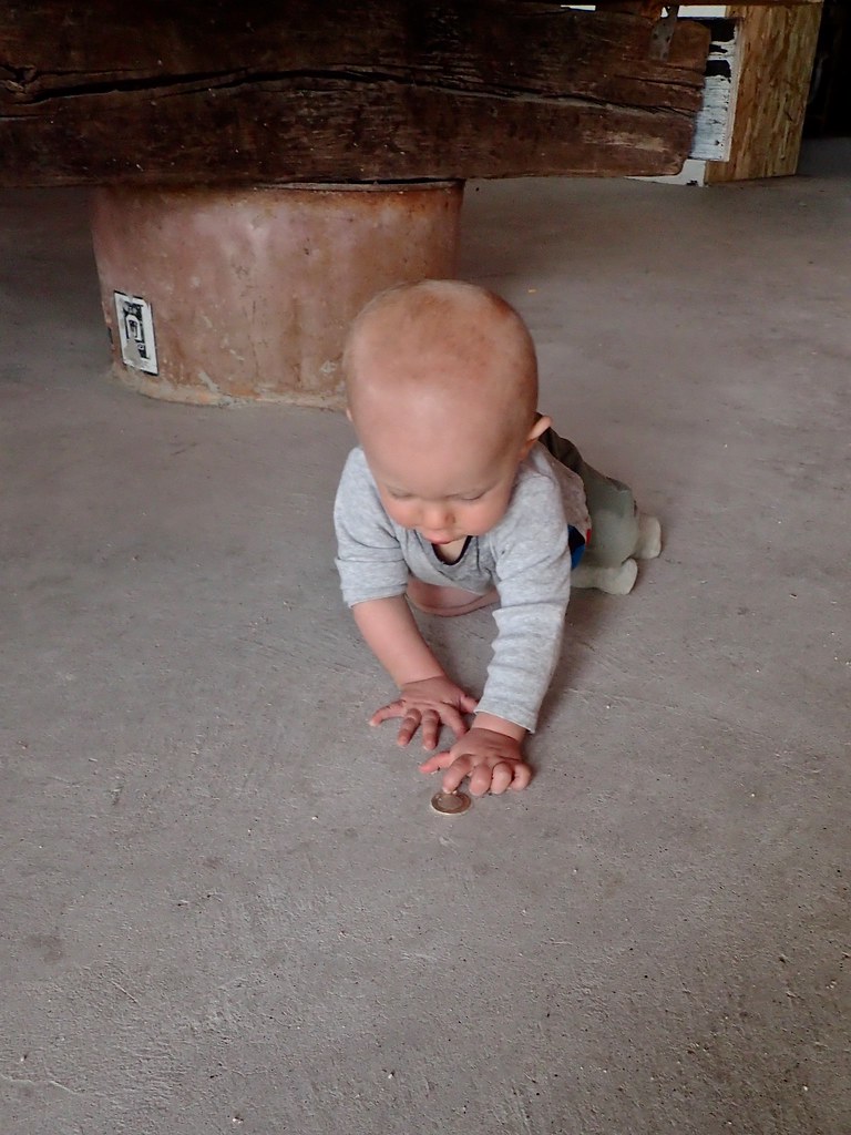
Orson trying to pick up change
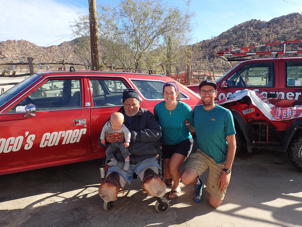
The man, the legend. And some pinche gringos.
We bid Coco adios and rolled north on the washboard Mex 5. After covering the 20km of unfinished road, we were back on brand new pavement.
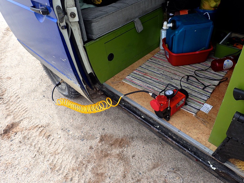
We stopped to air up, which was also bittersweet. This meant the end of our dirt track meanderings in Baja. We knew the next couple days would be pavement only, and our backroads adventures would have to wait until America. However, fresh brand new pavement rolled like marble under our rock hard tires, and it felt like we were flying as we sped north.
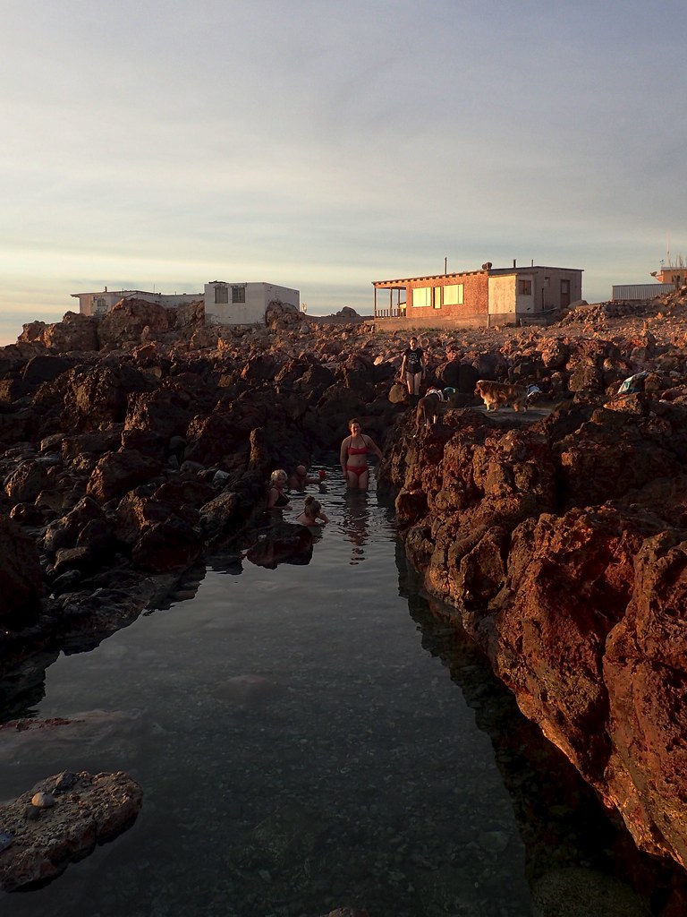
Since we had missed puertecitos hot springs on the way south, and we are hot springs fiends (our worldwide count of hot springs visited is >50), we pulled into puertecitos early in the day to enjoy the springs. We checked into the RV park/campsite and went out in the bay for a quick canoe to scope things out. That evening we wandered over to the hot springs at 5pm when they were supposed to start working with the tide.
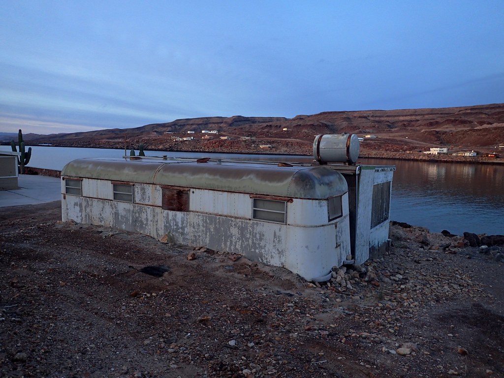
We walked past dilapidated, often abandoned houses, most built around 50/60s trailers. It was quite depressing, unique, and a bit spooky to walk through at dusk. The springs are located in some cracks in the rocks on the seashore, and are full of scalding hot water. Its too hot to sit in until the tide comes in and the cold seawater mixes with the hot spring water and it is possible to find the right temp and soak in the unique mix.
However the tide was too low, perhaps due to the new moon, which made it exceptionally dark as well. It was a bit dodgy wandering around the slippery dark rocks in the dusk, especially with one of us hanging onto the baby! We decided to pull the plug, walk the 10 mins back through the weird, deserted, dead quiet trailers and shacks. It didn’t feel sketchy, per se, but it was a strange vibe for sure. We were glad to get back to the van and cozy up for bed.
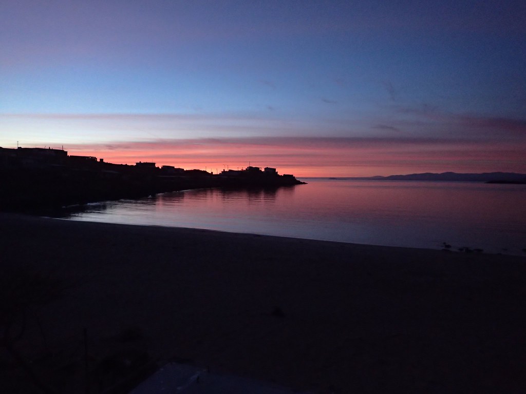
The next morning, the sunrise was amazing
We went back to the hot springs, and in the warm dawn light everything seemed nicer, and we met a bunch of other nice retired gringos that lived in town. They explained a bit about the town and the place, and we realized that it was just a bit neglected and not really sketchy. In any case sitting in the hot water next to the sea of cortez and watching the sun rise was quite sublime!
It was finally dead calm, and perfectly sunny. So while the weather had often been really windy and sometimes stormy, we got the classic “baja goodbye” of perfect weather to lure us back for another trip. On a side note, it was a good thing we had planned to stay the night, since the Pemex was closed yesterday and there was no gas until 8am today. With our jerry cans we probably could have made it to San Felipe but it just shows the unpredictability of small town mexico. Everyone says, never pass a Pemex without filling up! Good advice!
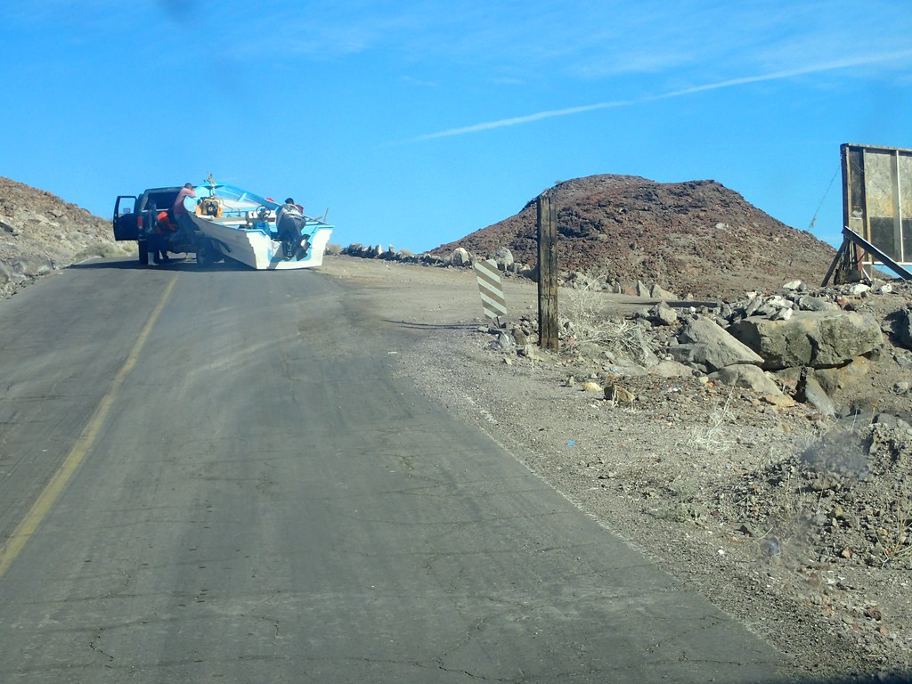
We hid the pavement heading north out of town, and saw this boat that had fallen off the trailer. I was going to help the fisherman lift it back onto the trailer, but they decided it was fine to just drag it several hundred metres and deal with it later.
We continued north back through san felipe and grabbed one last taco feast.
No real photos after that as we sped towards the urban sprawl of Mexicali. The border crossing took us around 1.5 hours but was uneventful. We continued on to El Centro and checked into our first hotel in 2 weeks. We were pretty pumped to head across the street, crush a few pints of microbrew and some burgers, and then relax hard in the hotel.
The next morning we headed east, through the sand dunes and into Yuma. I had worked in Yuma in the past, and knew of a few cool spots to explore. We gassed up and headed north around 20 miles on a washboard gravel road, past some ORV areas and down to the Colorado river at Picacho State Recreation area. The campground was completely deserted, but beautiful. We went for a late afternoon walk. The low light really highlighted the jagged, low-lying mountains
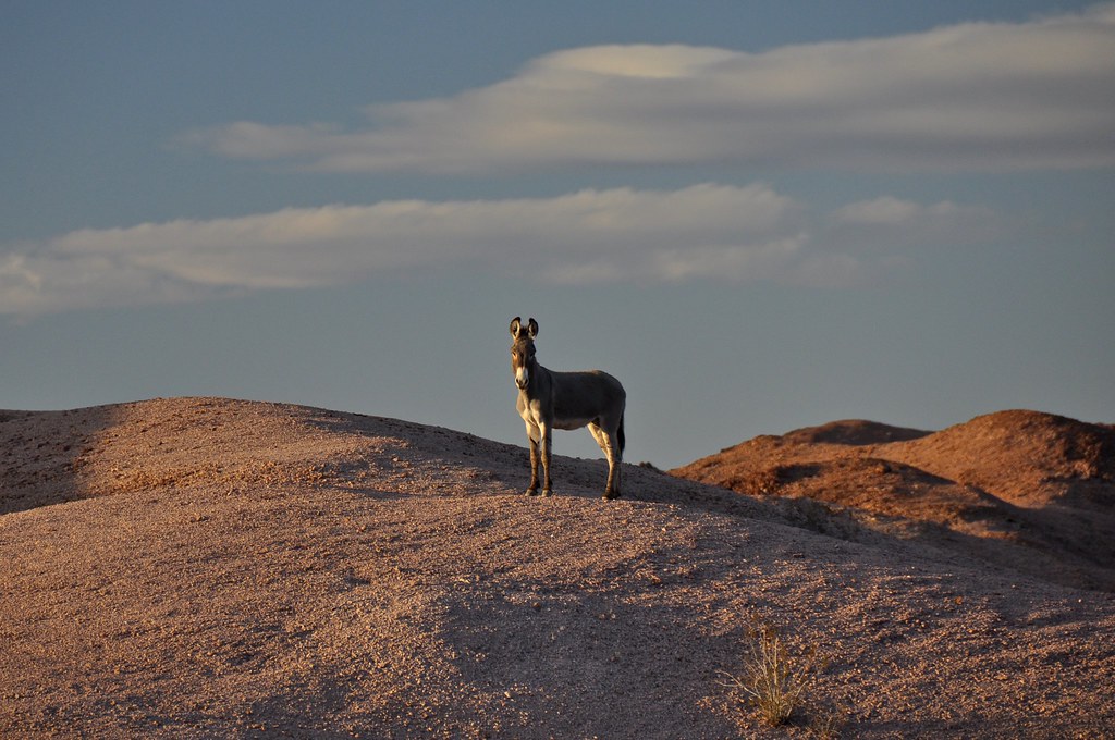
Wild (feral) donkeys were the highlight of the walk. These guys are all descended from work animals brought by the miners in the 1800s. The fact that they can survive in the dry, rocky desert in one of the hottest places in North America, is amazing.
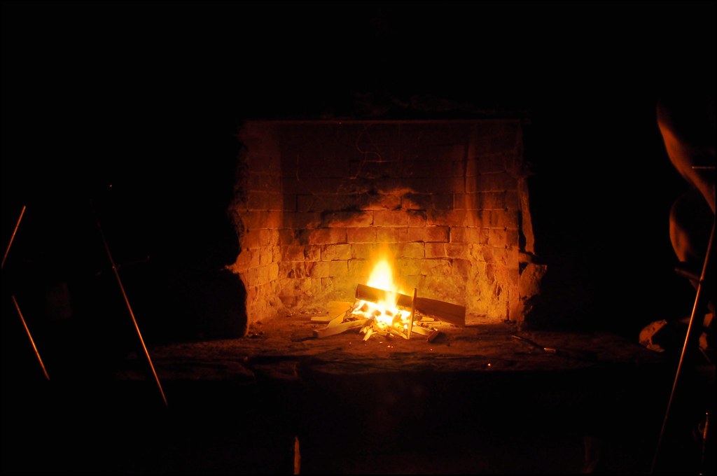
Another day, another great hike, another great sunset. We cooked dinner, but Orson to bed, and enjoyed a campfire in an old (restored?) free standing chimney that was a part of one of the camp sites.

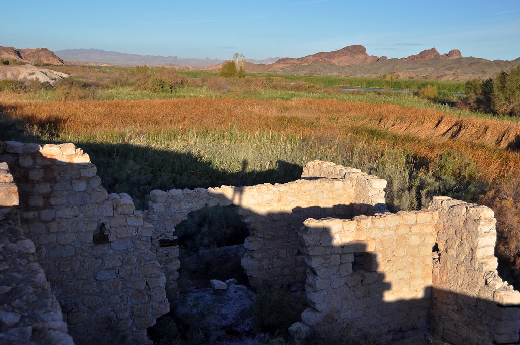
Beautiful area, even in the dead of “winter”.
 .
.
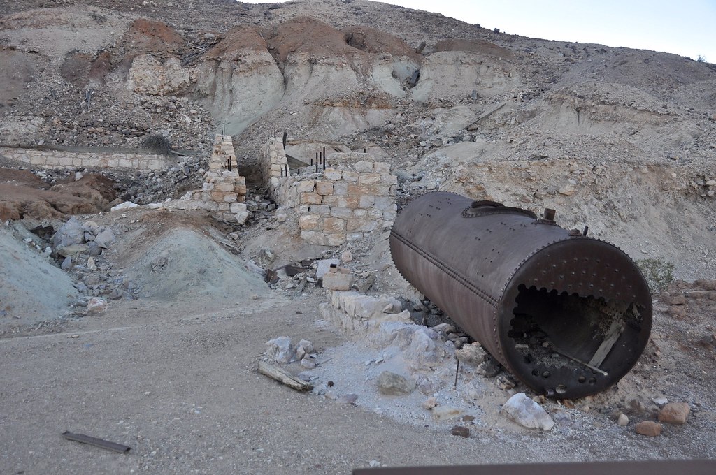
Old stamp mill ruins. Picacho was a town of 5000 people at the turn of the 19th century, and has a rich mining history (though supposedly this mill was built but either never processed ore or at least never made any money).

The Colorado River.
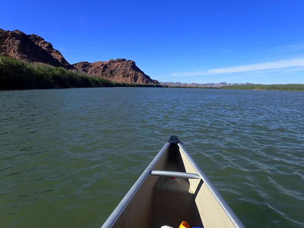
We took the boat out and paddled up the river. It was super windy, and between the headwind and the current, it was a struggle to make it very far upstream. We did find a nice beach to have lunch at though.
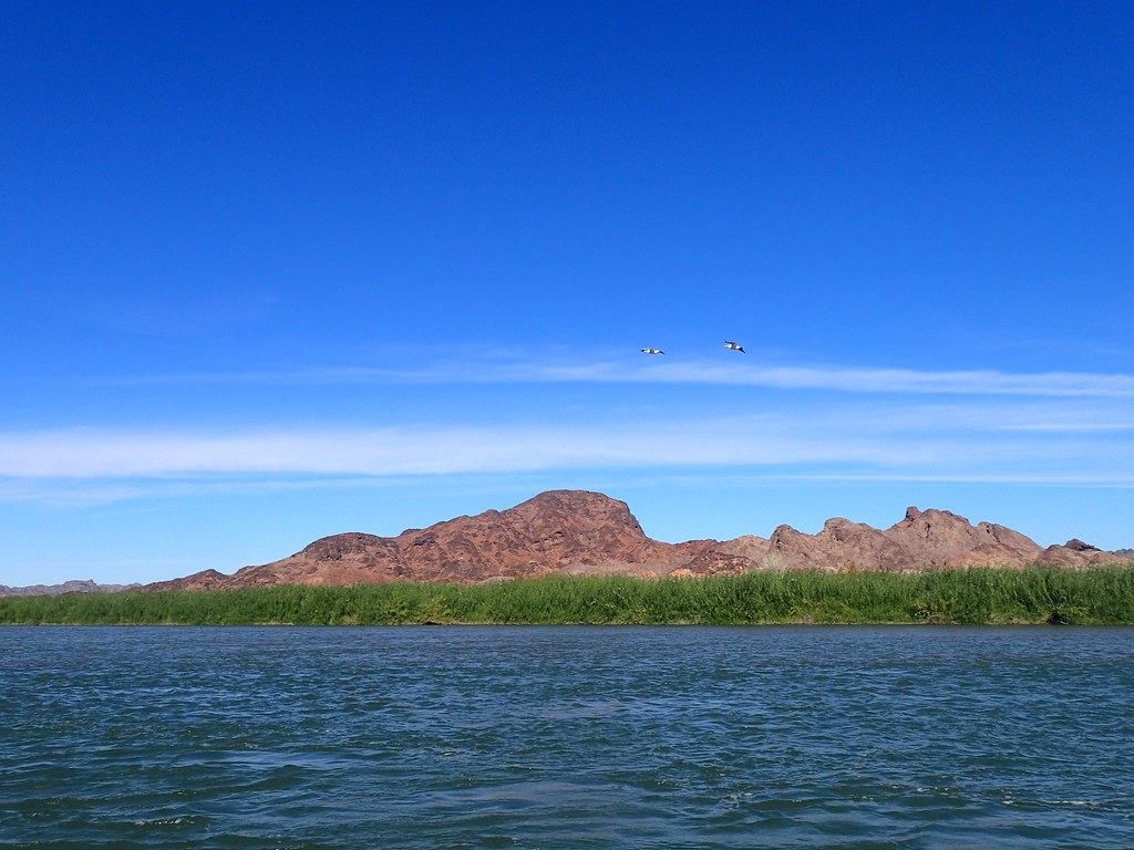
white pelicans
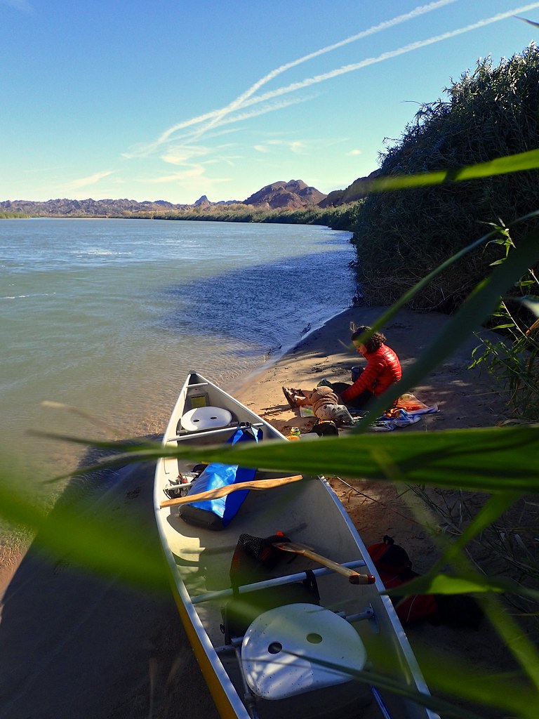
Nice spot for a picnic.
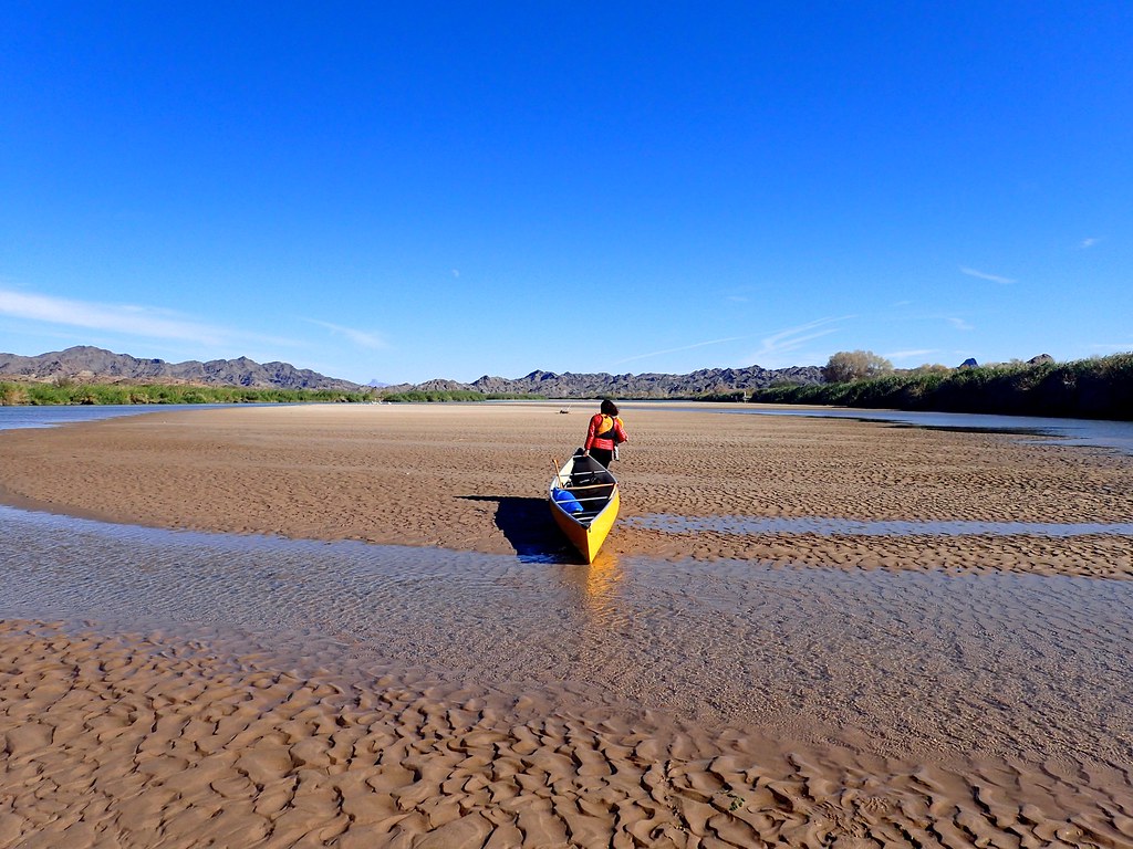
There is tons of sediment in the river, and the sandbars were enormous in places. We ended our paddle, glad to get out of the relentless wind, but also glad that we had taken the boat out. It’s such a beautiful river. However we couldn’t stay long, as we had friends to meet in Yuma.
We did, however, have time to explore some side canyons on the drive out. The road follows a gravel wash that is fairly wide, but in places it splits and smaller canyons take off up into the mountains. Many of these are driveable and we did some exploring.
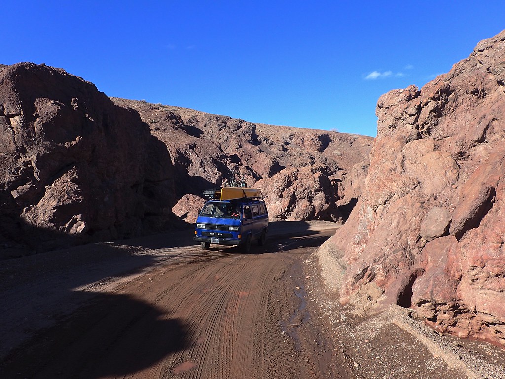
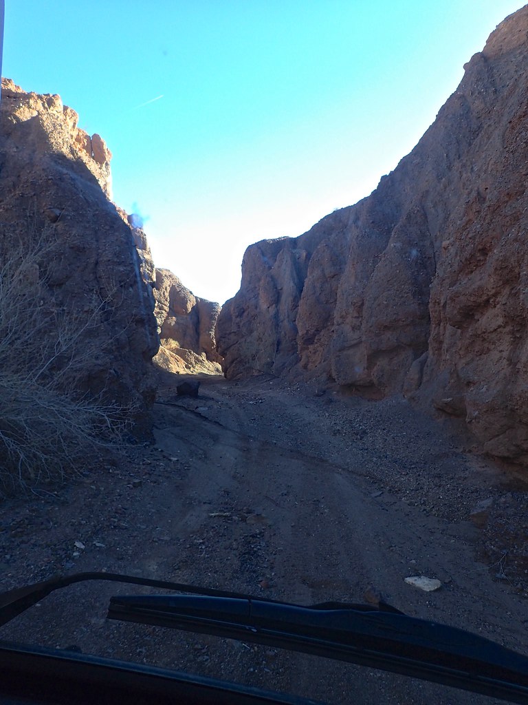
Eventually it got too tight to drive up, and we had to turn around. The walls were only a couple metres either side of the van, and it felt like the canoe was going to wedge sideways when we turned around! Made for a spectacular drive though, especially with the brightly coloured volcanic rocks. We eventually left the canyons behind for the sloping, rocky, wide-open desert around Yuma, and then rolled through the lush farmland.
We made it into Yuma, hit up Tacos mi Rancho for some delicious eats, and then went to our friends place for the night. A great night of eating and drinking was had by all. Tomorrow we will head northeast and onwards!
Stay tuned for part 7: Exploring the greater phoenix area (less outlet stores and golf course than it sounds like, I promise!)
We woke to another beautiful day, cooked breakfast, and then walked over to say goodbye to coco and grab a coffee. It felt like saying goodbye to an old friend, even though we had just met the guy yesterday.
Orson trying to pick up change
The man, the legend. And some pinche gringos.
We bid Coco adios and rolled north on the washboard Mex 5. After covering the 20km of unfinished road, we were back on brand new pavement.
We stopped to air up, which was also bittersweet. This meant the end of our dirt track meanderings in Baja. We knew the next couple days would be pavement only, and our backroads adventures would have to wait until America. However, fresh brand new pavement rolled like marble under our rock hard tires, and it felt like we were flying as we sped north.
Since we had missed puertecitos hot springs on the way south, and we are hot springs fiends (our worldwide count of hot springs visited is >50), we pulled into puertecitos early in the day to enjoy the springs. We checked into the RV park/campsite and went out in the bay for a quick canoe to scope things out. That evening we wandered over to the hot springs at 5pm when they were supposed to start working with the tide.
We walked past dilapidated, often abandoned houses, most built around 50/60s trailers. It was quite depressing, unique, and a bit spooky to walk through at dusk. The springs are located in some cracks in the rocks on the seashore, and are full of scalding hot water. Its too hot to sit in until the tide comes in and the cold seawater mixes with the hot spring water and it is possible to find the right temp and soak in the unique mix.
However the tide was too low, perhaps due to the new moon, which made it exceptionally dark as well. It was a bit dodgy wandering around the slippery dark rocks in the dusk, especially with one of us hanging onto the baby! We decided to pull the plug, walk the 10 mins back through the weird, deserted, dead quiet trailers and shacks. It didn’t feel sketchy, per se, but it was a strange vibe for sure. We were glad to get back to the van and cozy up for bed.
The next morning, the sunrise was amazing
We went back to the hot springs, and in the warm dawn light everything seemed nicer, and we met a bunch of other nice retired gringos that lived in town. They explained a bit about the town and the place, and we realized that it was just a bit neglected and not really sketchy. In any case sitting in the hot water next to the sea of cortez and watching the sun rise was quite sublime!
It was finally dead calm, and perfectly sunny. So while the weather had often been really windy and sometimes stormy, we got the classic “baja goodbye” of perfect weather to lure us back for another trip. On a side note, it was a good thing we had planned to stay the night, since the Pemex was closed yesterday and there was no gas until 8am today. With our jerry cans we probably could have made it to San Felipe but it just shows the unpredictability of small town mexico. Everyone says, never pass a Pemex without filling up! Good advice!
We hid the pavement heading north out of town, and saw this boat that had fallen off the trailer. I was going to help the fisherman lift it back onto the trailer, but they decided it was fine to just drag it several hundred metres and deal with it later.
We continued north back through san felipe and grabbed one last taco feast.
No real photos after that as we sped towards the urban sprawl of Mexicali. The border crossing took us around 1.5 hours but was uneventful. We continued on to El Centro and checked into our first hotel in 2 weeks. We were pretty pumped to head across the street, crush a few pints of microbrew and some burgers, and then relax hard in the hotel.
The next morning we headed east, through the sand dunes and into Yuma. I had worked in Yuma in the past, and knew of a few cool spots to explore. We gassed up and headed north around 20 miles on a washboard gravel road, past some ORV areas and down to the Colorado river at Picacho State Recreation area. The campground was completely deserted, but beautiful. We went for a late afternoon walk. The low light really highlighted the jagged, low-lying mountains
Wild (feral) donkeys were the highlight of the walk. These guys are all descended from work animals brought by the miners in the 1800s. The fact that they can survive in the dry, rocky desert in one of the hottest places in North America, is amazing.
Another day, another great hike, another great sunset. We cooked dinner, but Orson to bed, and enjoyed a campfire in an old (restored?) free standing chimney that was a part of one of the camp sites.
Beautiful area, even in the dead of “winter”.
. Old stamp mill ruins. Picacho was a town of 5000 people at the turn of the 19th century, and has a rich mining history (though supposedly this mill was built but either never processed ore or at least never made any money).
The Colorado River.
We took the boat out and paddled up the river. It was super windy, and between the headwind and the current, it was a struggle to make it very far upstream. We did find a nice beach to have lunch at though.
white pelicans
Nice spot for a picnic.
There is tons of sediment in the river, and the sandbars were enormous in places. We ended our paddle, glad to get out of the relentless wind, but also glad that we had taken the boat out. It’s such a beautiful river. However we couldn’t stay long, as we had friends to meet in Yuma.
We did, however, have time to explore some side canyons on the drive out. The road follows a gravel wash that is fairly wide, but in places it splits and smaller canyons take off up into the mountains. Many of these are driveable and we did some exploring.
Eventually it got too tight to drive up, and we had to turn around. The walls were only a couple metres either side of the van, and it felt like the canoe was going to wedge sideways when we turned around! Made for a spectacular drive though, especially with the brightly coloured volcanic rocks. We eventually left the canyons behind for the sloping, rocky, wide-open desert around Yuma, and then rolled through the lush farmland.
We made it into Yuma, hit up Tacos mi Rancho for some delicious eats, and then went to our friends place for the night. A great night of eating and drinking was had by all. Tomorrow we will head northeast and onwards!
Stay tuned for part 7: Exploring the greater phoenix area (less outlet stores and golf course than it sounds like, I promise!)
rfoubi
Observer
Part 7: Yuma to Phoenix
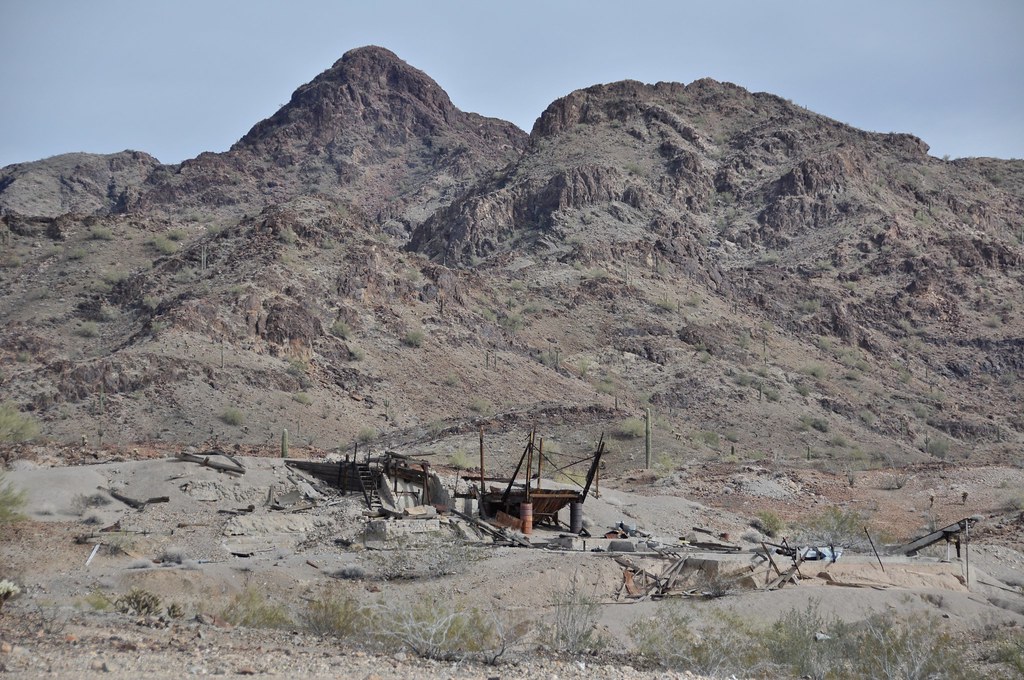
Since my wife and I are both geologists, we couldn’t pass up the opportunity to go visit Castle Dome museum which is based around the mines at Castle Dome City northeast of Yuma. We arrived to late to visit the museum, but did manage to find a nice camp spot. Its located within the Kofa Wildlife Refuge, so access is restricted to the main roads only, but there are plenty of quiet places to pull off the road and park for the night.
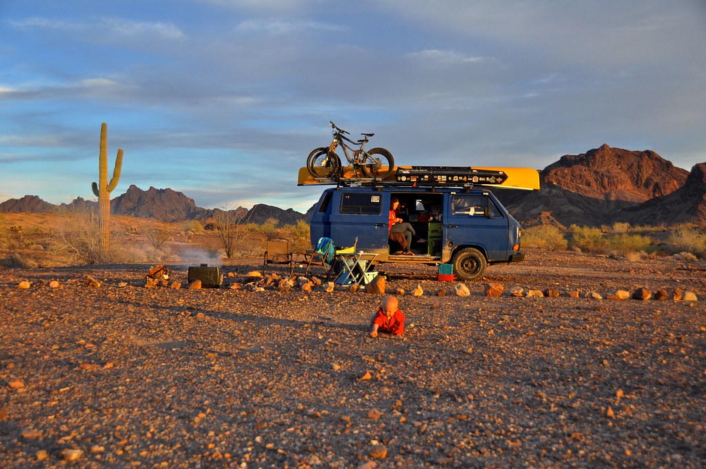
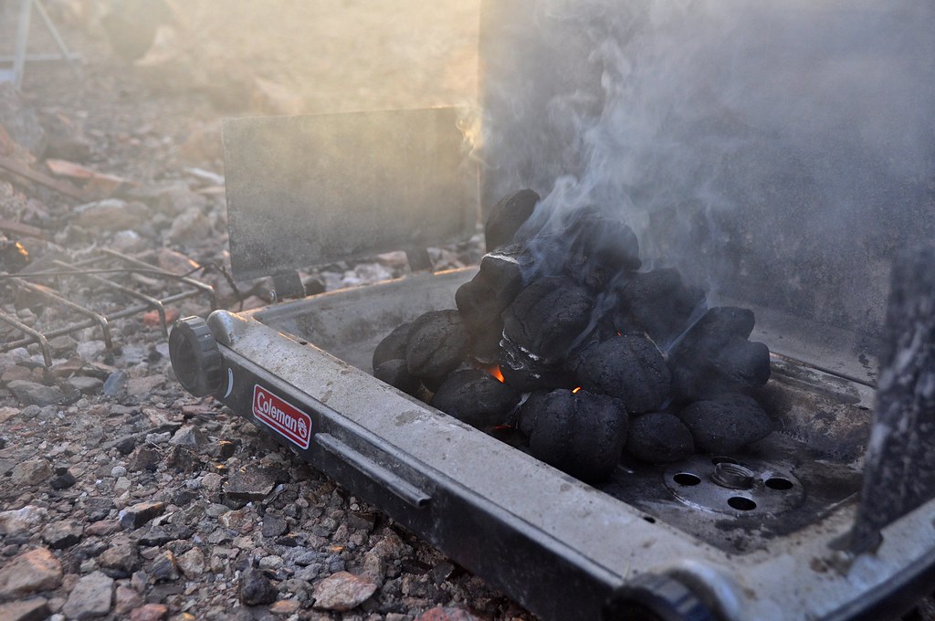
Earlier in the trip, our trusty Coleman finally died on us. We had been packing charcoal around for a while since many of the campgrounds around Tucson allow charcoal fires only. So, the logical next step was to turn the empty shell of the old stove into an improvised charcoal grill! It worked pretty decently actually!
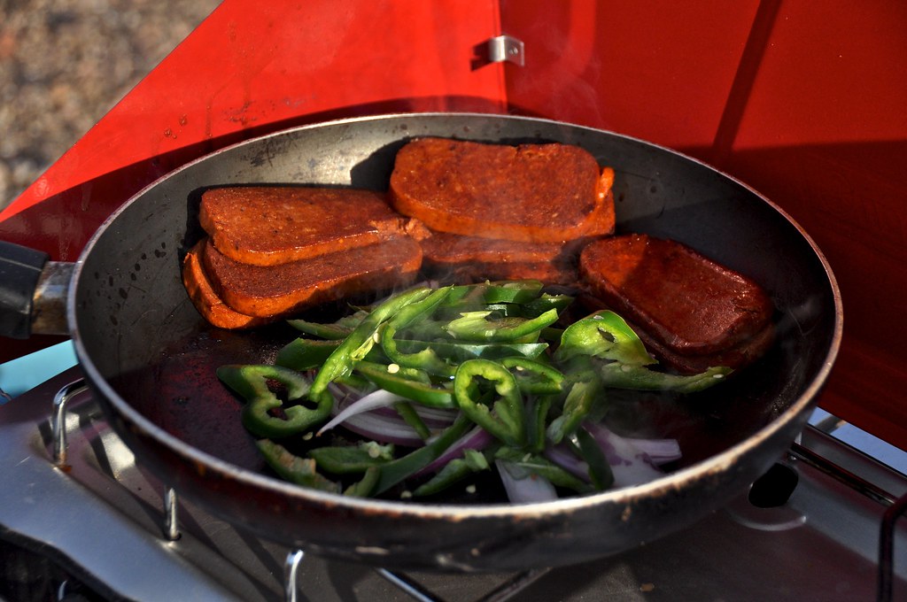
Of course we have a replacement Coleman too, which allowed us to cook up delicacies like this! Jalapeno Spam!
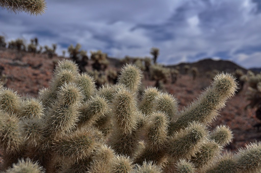
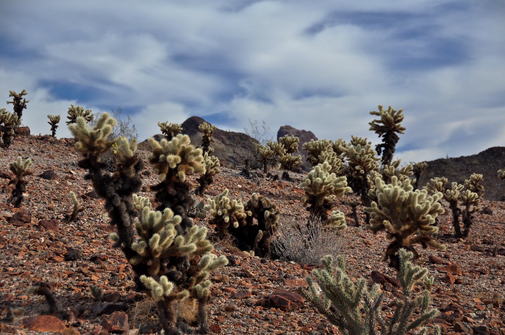
Teddy Bear Cholla
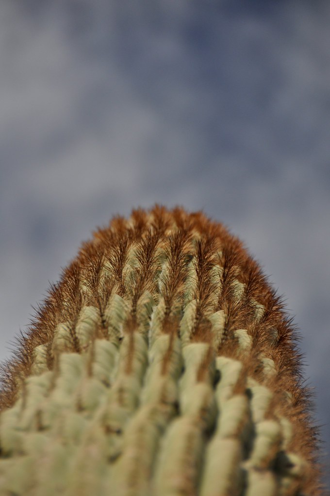
Saguaro
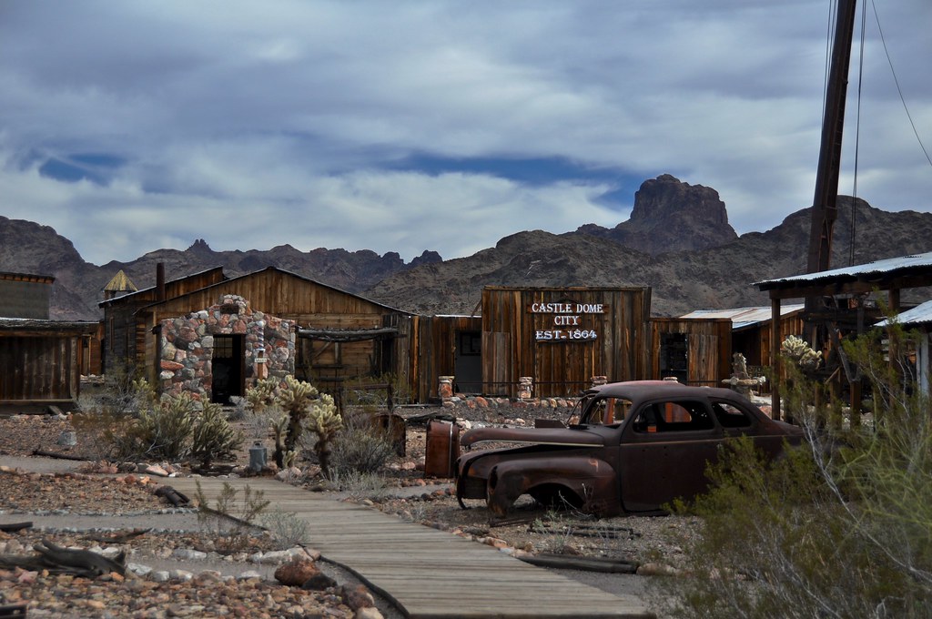
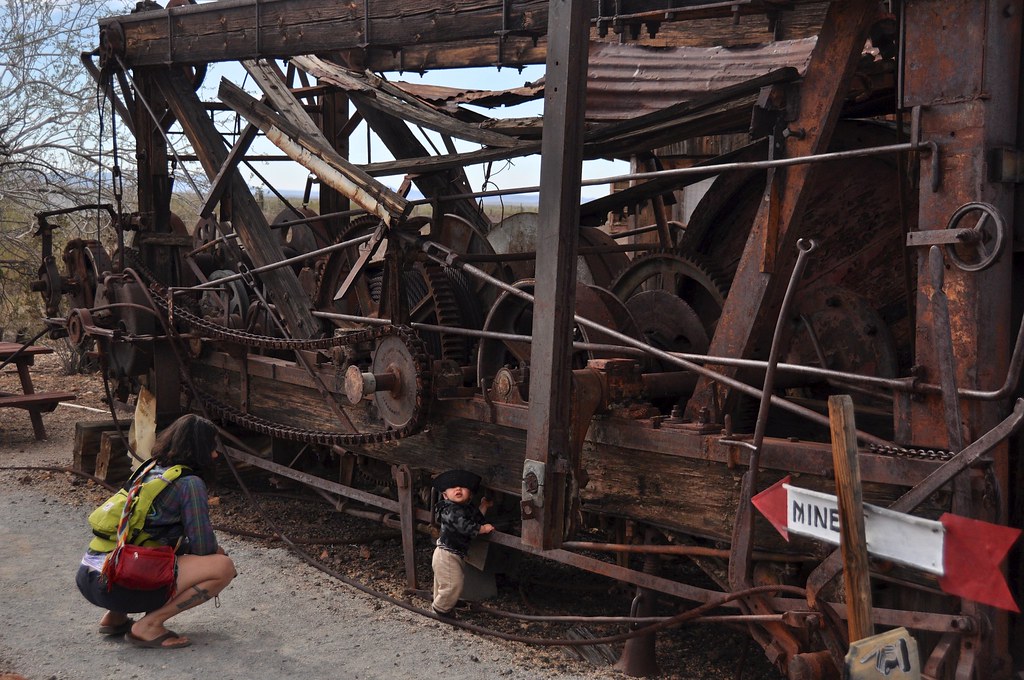
We made it to the museum the next day. Its located on the site of historic silver mines, and is a collection of buildings and artifacts from the whole region that were moved there and saved from destruction and disrepair elsewhere. Tons of cool stuff to look at for a few hours.
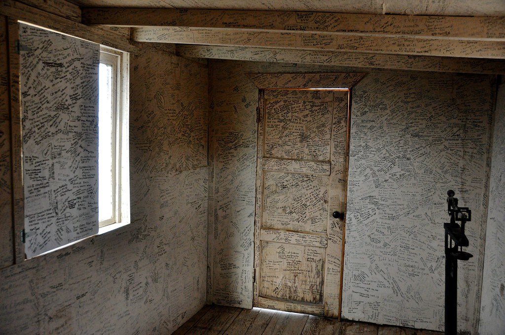
This is kind of a memorial wall for veterans, where people who have served, or their friends and family, have the opportunity to write something on the wall. It was quite moving actually, not to mention photogenic.
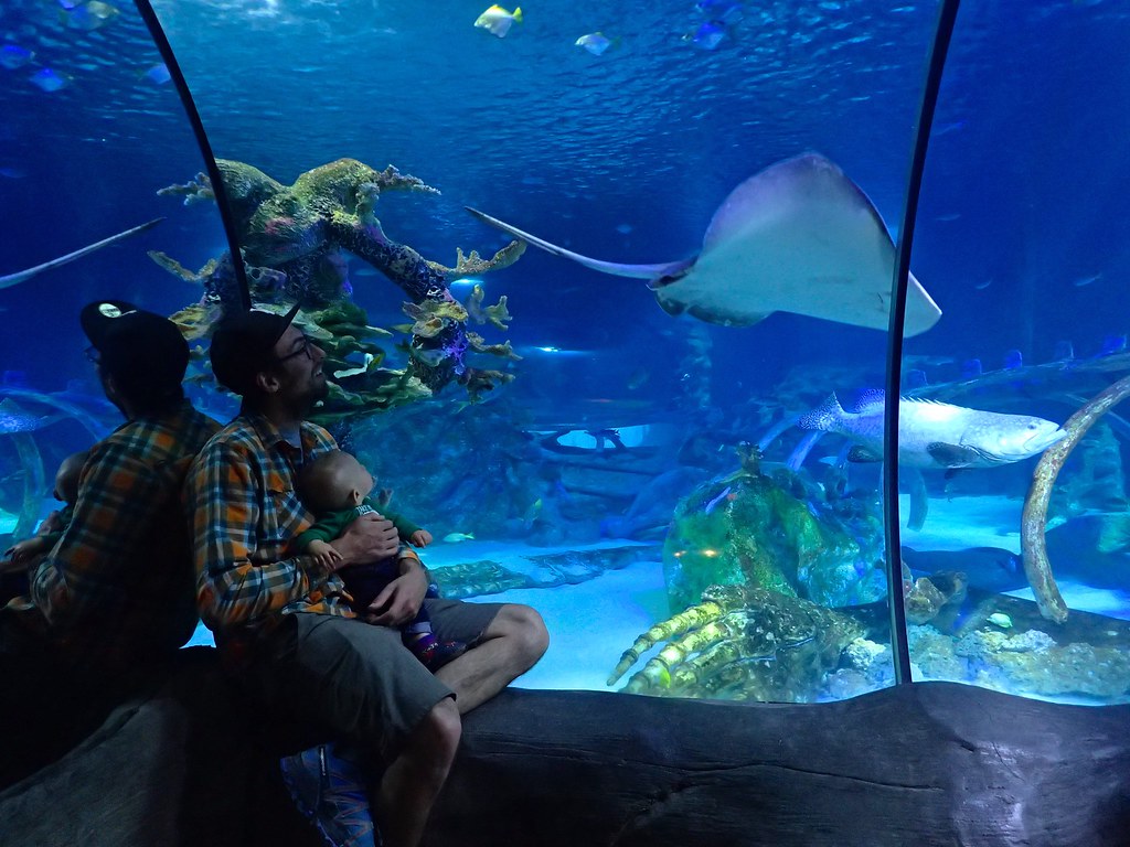
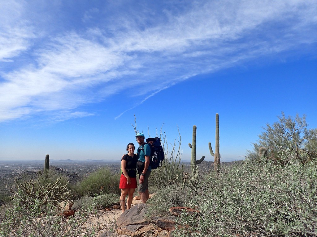
From here we were off to Phoenix to meet the in-laws for a few days at their condo timeshare. Lots of pool time, good eating, and spending way to long on the freeways crossing the urban sprawl of phoenix.
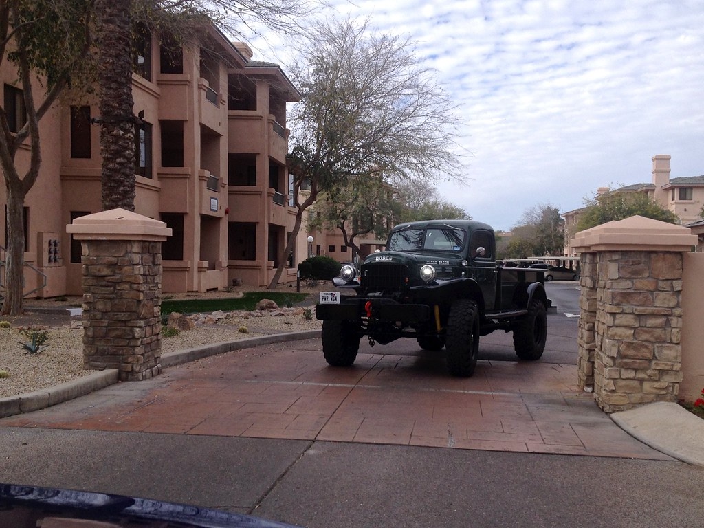
I feel silly even including photos like this on “expedition portal” but figured what the hell, it’s a cool photo!
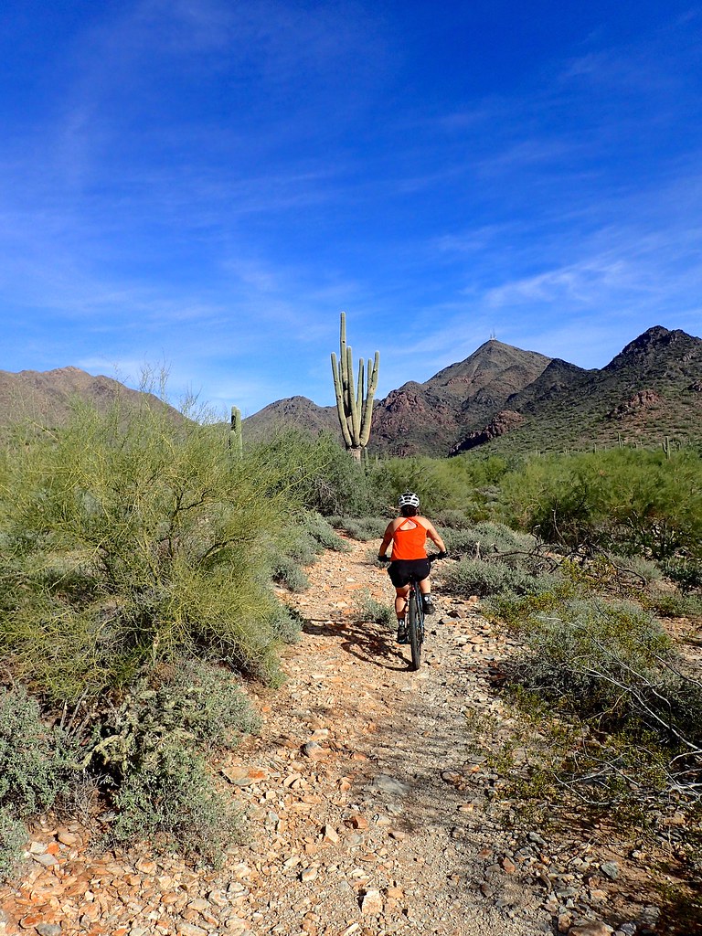
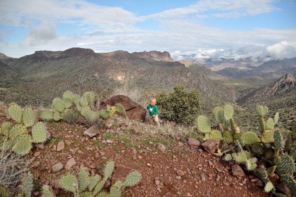
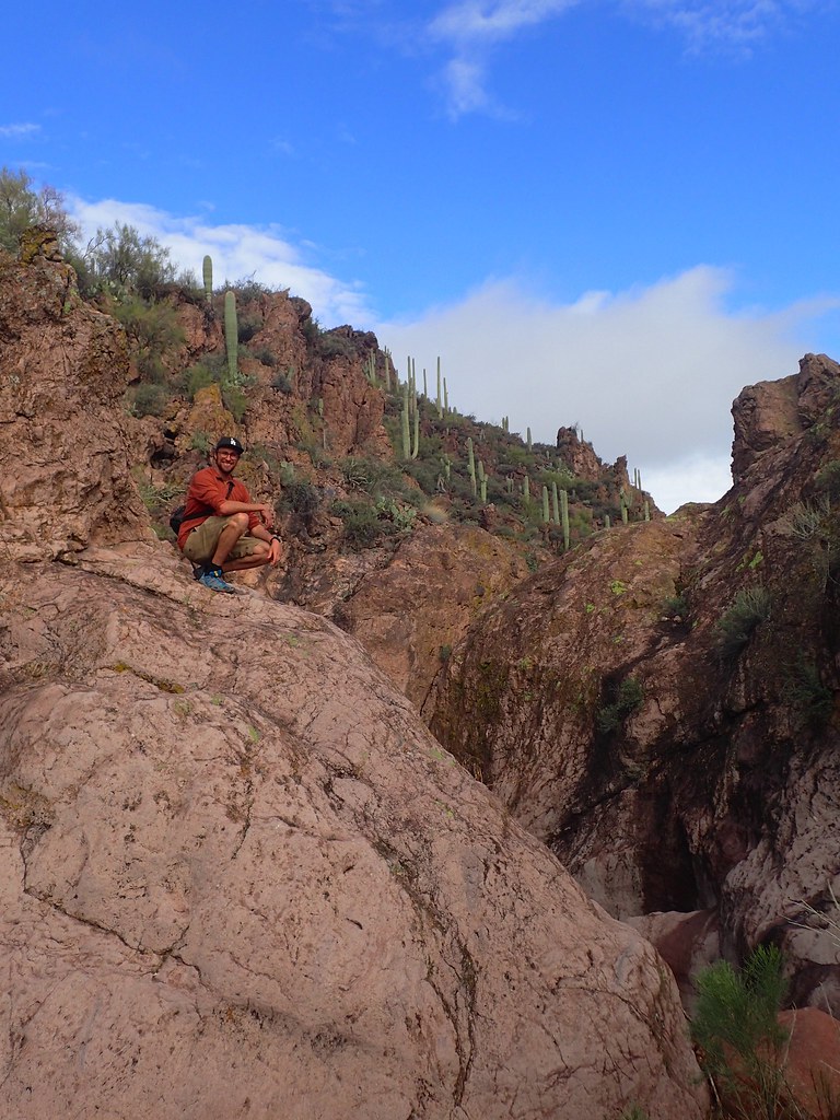
Ok back to the desert now. We took advantage of grandparents babysitting services and Kim and I got out for a couple bike rides in the Mcdowell Sonoran area in Scottsdale
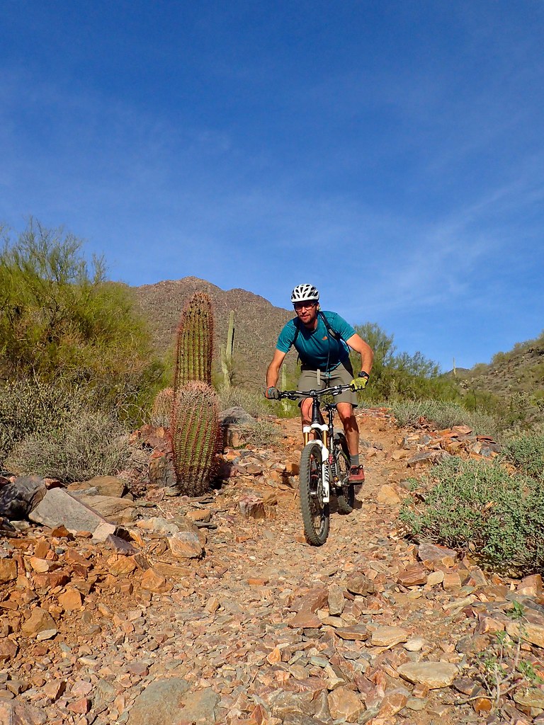
Although Phoenix is way way too big and way too sprawled out for our tastes, it’s still pretty cool how all it takes is a 15 minute hike up any of the mountain parks right in town to ditch the crowds and get away from it all
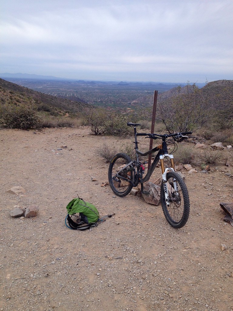
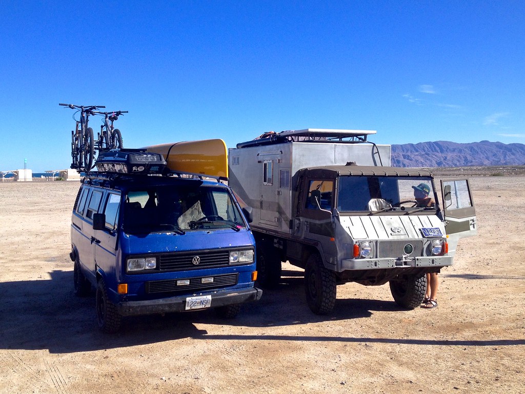
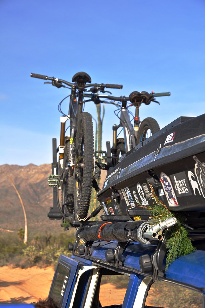
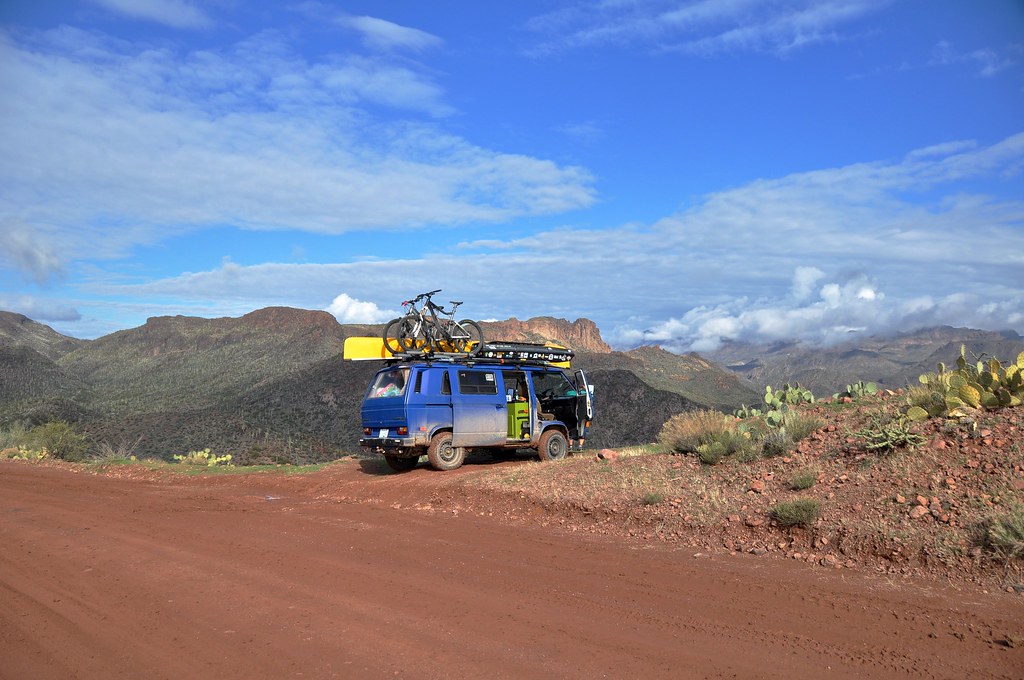
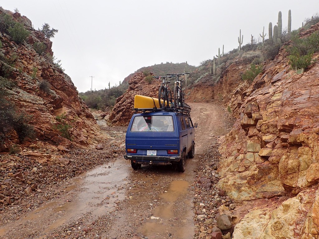
And, just in case anyone is getting bored without seeing any vehicle shots, heres a good one:
Since my wife and I are both geologists, we couldn’t pass up the opportunity to go visit Castle Dome museum which is based around the mines at Castle Dome City northeast of Yuma. We arrived to late to visit the museum, but did manage to find a nice camp spot. Its located within the Kofa Wildlife Refuge, so access is restricted to the main roads only, but there are plenty of quiet places to pull off the road and park for the night.
Earlier in the trip, our trusty Coleman finally died on us. We had been packing charcoal around for a while since many of the campgrounds around Tucson allow charcoal fires only. So, the logical next step was to turn the empty shell of the old stove into an improvised charcoal grill! It worked pretty decently actually!
Of course we have a replacement Coleman too, which allowed us to cook up delicacies like this! Jalapeno Spam!
Teddy Bear Cholla
Saguaro
We made it to the museum the next day. Its located on the site of historic silver mines, and is a collection of buildings and artifacts from the whole region that were moved there and saved from destruction and disrepair elsewhere. Tons of cool stuff to look at for a few hours.
This is kind of a memorial wall for veterans, where people who have served, or their friends and family, have the opportunity to write something on the wall. It was quite moving actually, not to mention photogenic.
From here we were off to Phoenix to meet the in-laws for a few days at their condo timeshare. Lots of pool time, good eating, and spending way to long on the freeways crossing the urban sprawl of phoenix.
I feel silly even including photos like this on “expedition portal” but figured what the hell, it’s a cool photo!
Ok back to the desert now. We took advantage of grandparents babysitting services and Kim and I got out for a couple bike rides in the Mcdowell Sonoran area in Scottsdale
Although Phoenix is way way too big and way too sprawled out for our tastes, it’s still pretty cool how all it takes is a 15 minute hike up any of the mountain parks right in town to ditch the crowds and get away from it all
And, just in case anyone is getting bored without seeing any vehicle shots, heres a good one:
rfoubi
Observer
Part 8: North of Phoenix
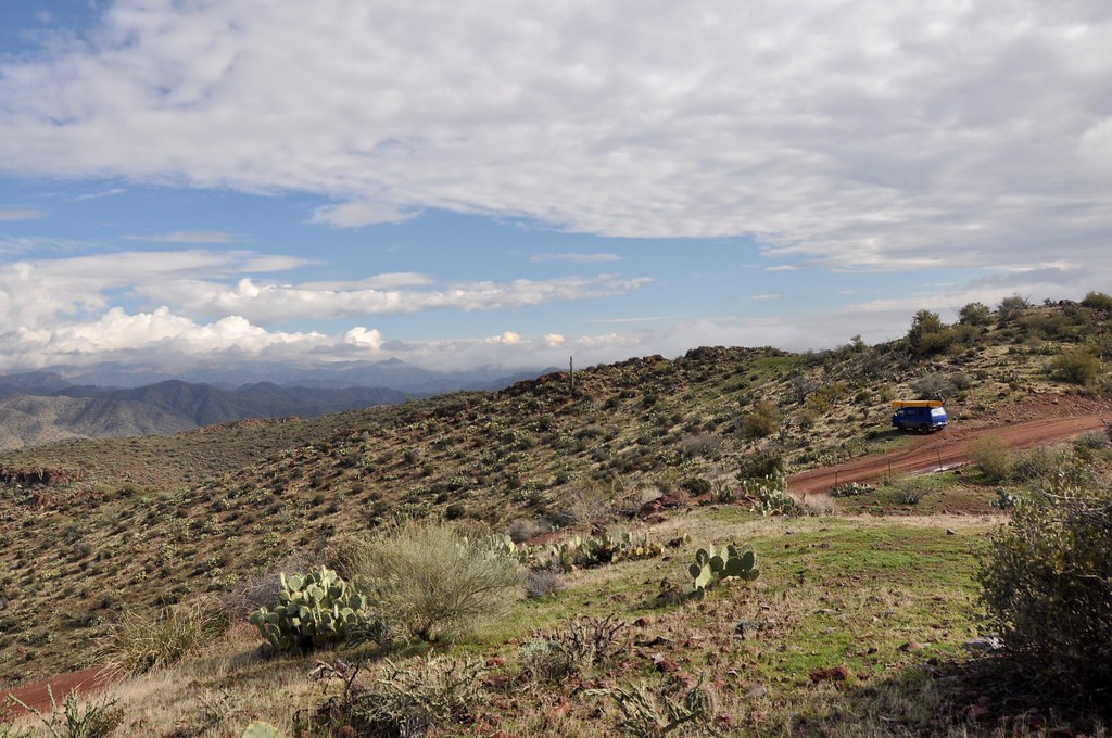
After 4 days of hanging with family and doing city stuff, we were ready for one last hurrah of some backcountry travel in the Phoenix area before Kim and Orson had to fly home. We packed up the van and headed for lake Pleasant, NW of Phoenix. Lake Pleasant is a dammed reservoir and as such the water level fluctuates. Anything below “high tide” is fair game to drive on and do shoreline camping for $12. Much better in our books than paying twice that to camp at the established sites. Especially when shorelines like this are available
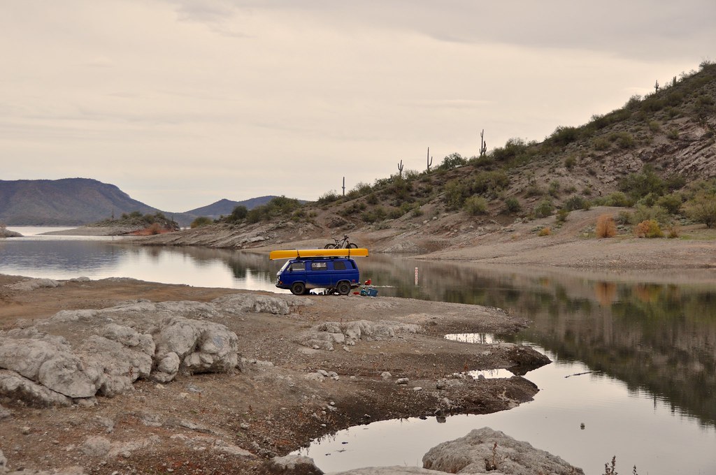
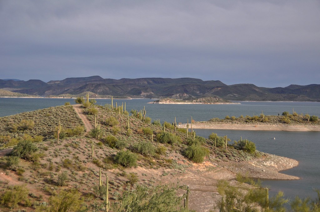
The undulating nature of the terrain around there meant that there were tons of small islands within the lake. It was quite a juxtaposition of giant saguaro cacti and the water.
Our little bay
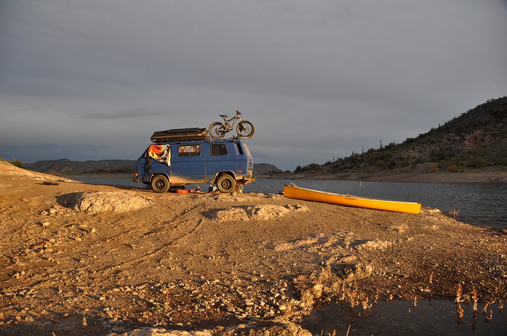
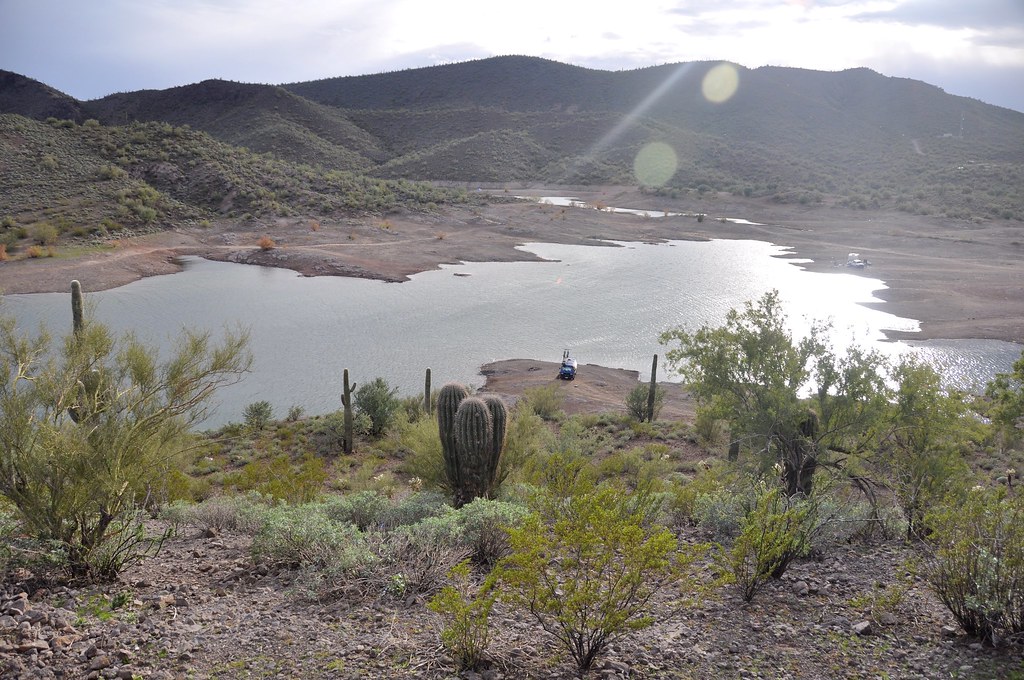
Great canoe access!
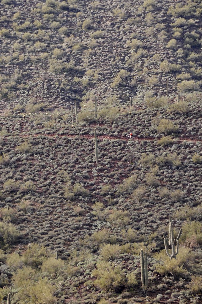
Where’s Waldo? Can you spot the biker? One of the perks of camping in this area was the easy access to not only the water, but to some pretty flowy and fun biking/hiking trails that contoured through the desert overlooking the lake. We took turns watching the baby and riding trails.

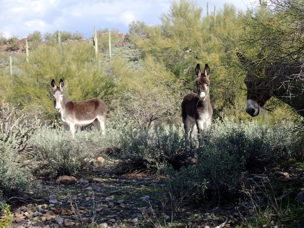
More donkeys. Young one in the middle has a funny afro/bangs. Cute
Drinking coffee and planning routes
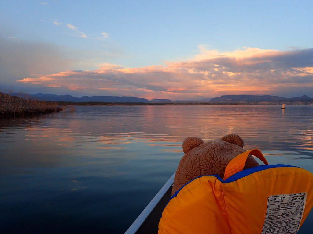
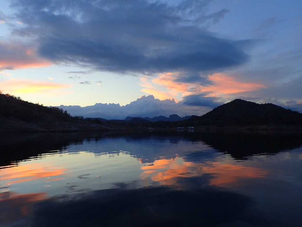
Sunset paddling
After a few days at lake pleasant we went exploring the dirt roads leading towards Castle Hot Springs.
It was raining pretty steadily, and the desert was actually looking super lush. It was pretty cool to see the fresh green grass and misty/foggy mountains. Reminded me of parts of Colombia and Ecuador.
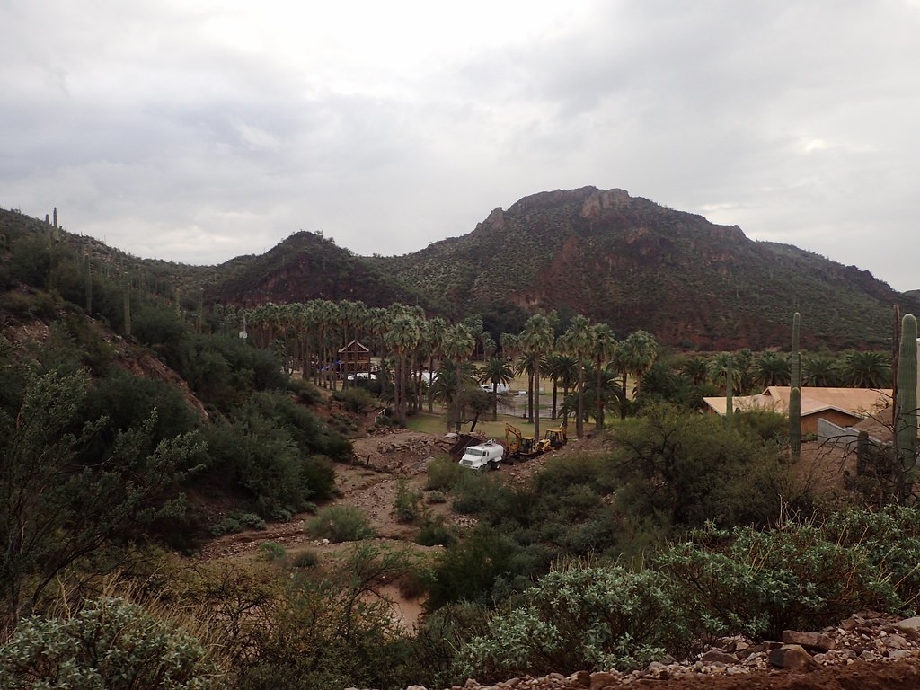
I think this is the hot springs. From what I read it used to be a popular resort 50 years ago and then kind of fell into disrepair and closed. It seems like it is being reno’d and reopened? Very cool spot and would be a nice oasis.
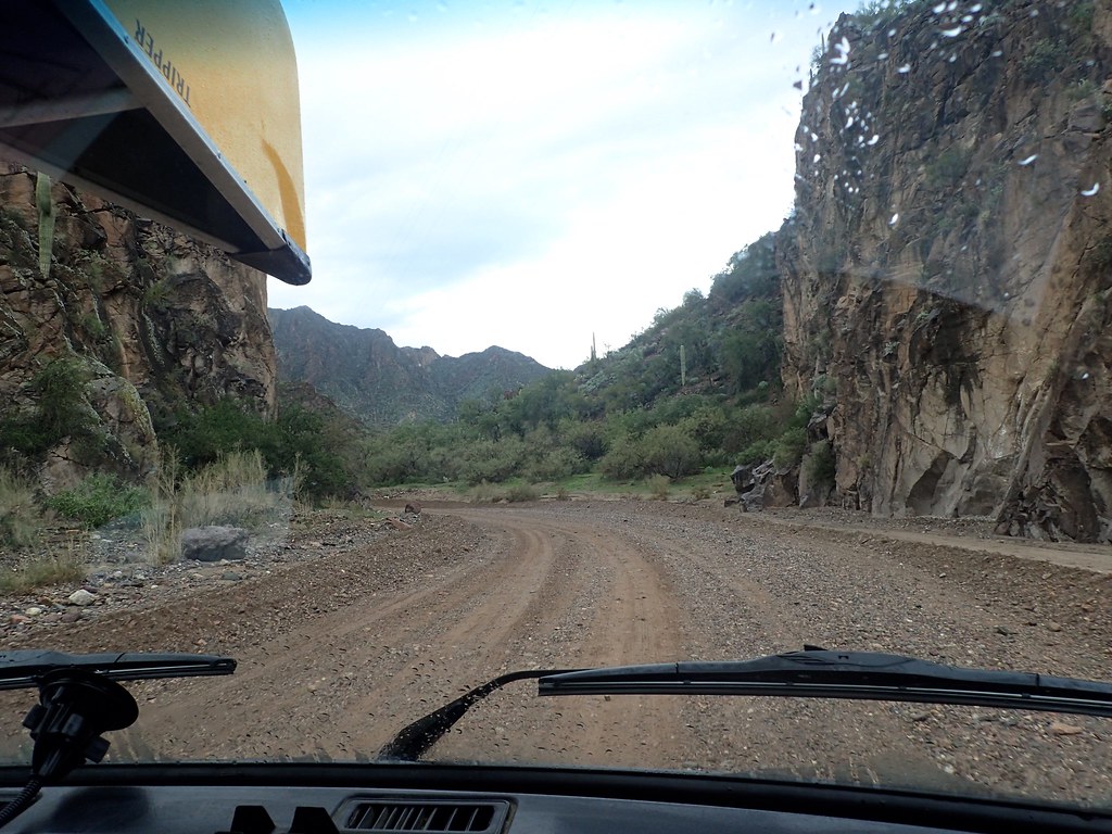
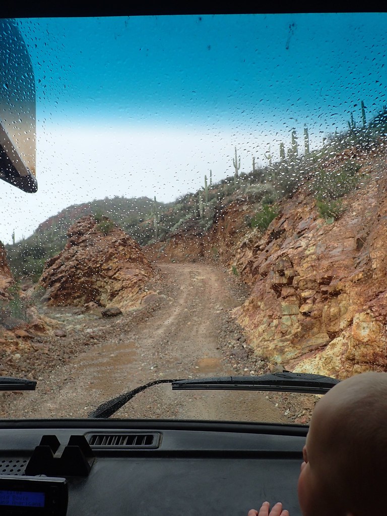
We continued past the hot springs and up into the hills. We decided to follow the road over the pass towards Morristown which would give us a nice 40 mile dirt road tour of the mountains and desert.
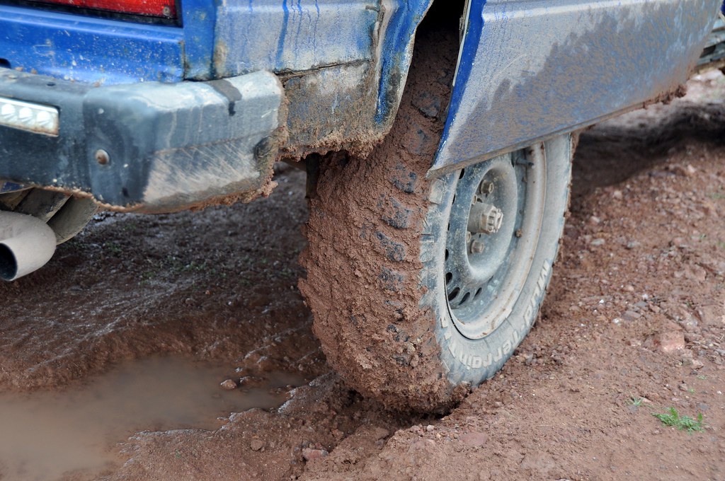
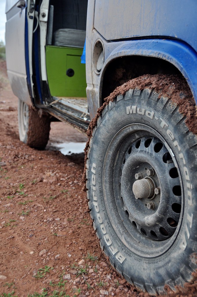
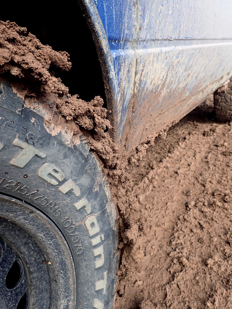
It got pretty greasy. Enough so that sometimes when I geared down on the steep downs the rear wheels would break loose and we’d drift a bit. Mucky stuff. Glad I had the mud tires. The 2WD needs all the advantages it can get!
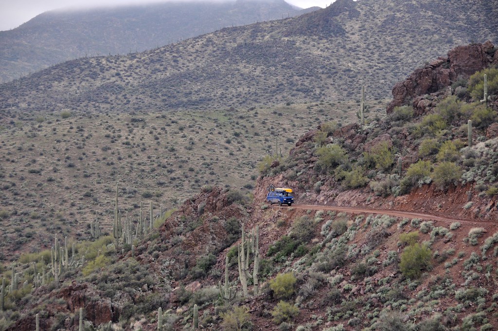
Beautiful roads climbed a few thousand feet up to some rolling plateaus.
Exploring some cool slot canyons. Didn’t want to venture far though with the rain.
Still Muddy
Stopping to check out more neat narrow canyons.
The road occasionally had some rock and soft gravel, and was a bit slick in the mud, but could be easily driven in a passenger car I think.
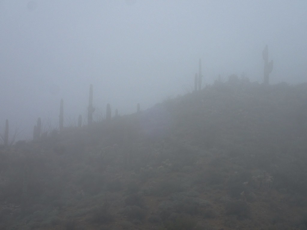
Moody weather. Cant say I’ve seen Saguaros in the fog before!
We eventually wound our way out of the fog and out of the mountains and down to Morristown. From there it was back through the sprawl of Phoenix and over to our VW friends to stay another night before Kim and Orson flew out the next day. It was awesome to end the trip with some more backroad adventures checking out a very scenic corner of the state.
Stay tuned for the final chapter: Part 9: North to Canada! Sedona, Grand Canyon, Utah, and back to the snow.
After 4 days of hanging with family and doing city stuff, we were ready for one last hurrah of some backcountry travel in the Phoenix area before Kim and Orson had to fly home. We packed up the van and headed for lake Pleasant, NW of Phoenix. Lake Pleasant is a dammed reservoir and as such the water level fluctuates. Anything below “high tide” is fair game to drive on and do shoreline camping for $12. Much better in our books than paying twice that to camp at the established sites. Especially when shorelines like this are available
The undulating nature of the terrain around there meant that there were tons of small islands within the lake. It was quite a juxtaposition of giant saguaro cacti and the water.
Our little bay
Great canoe access!
Where’s Waldo? Can you spot the biker? One of the perks of camping in this area was the easy access to not only the water, but to some pretty flowy and fun biking/hiking trails that contoured through the desert overlooking the lake. We took turns watching the baby and riding trails.
More donkeys. Young one in the middle has a funny afro/bangs. Cute
Drinking coffee and planning routes
Sunset paddling
After a few days at lake pleasant we went exploring the dirt roads leading towards Castle Hot Springs.
It was raining pretty steadily, and the desert was actually looking super lush. It was pretty cool to see the fresh green grass and misty/foggy mountains. Reminded me of parts of Colombia and Ecuador.
I think this is the hot springs. From what I read it used to be a popular resort 50 years ago and then kind of fell into disrepair and closed. It seems like it is being reno’d and reopened? Very cool spot and would be a nice oasis.
We continued past the hot springs and up into the hills. We decided to follow the road over the pass towards Morristown which would give us a nice 40 mile dirt road tour of the mountains and desert.
It got pretty greasy. Enough so that sometimes when I geared down on the steep downs the rear wheels would break loose and we’d drift a bit. Mucky stuff. Glad I had the mud tires. The 2WD needs all the advantages it can get!
Beautiful roads climbed a few thousand feet up to some rolling plateaus.
Exploring some cool slot canyons. Didn’t want to venture far though with the rain.
Still Muddy
Stopping to check out more neat narrow canyons.
The road occasionally had some rock and soft gravel, and was a bit slick in the mud, but could be easily driven in a passenger car I think.
Moody weather. Cant say I’ve seen Saguaros in the fog before!
We eventually wound our way out of the fog and out of the mountains and down to Morristown. From there it was back through the sprawl of Phoenix and over to our VW friends to stay another night before Kim and Orson flew out the next day. It was awesome to end the trip with some more backroad adventures checking out a very scenic corner of the state.
Stay tuned for the final chapter: Part 9: North to Canada! Sedona, Grand Canyon, Utah, and back to the snow.