shane4x4
Supporting Sponsor
As some of you know I've been helping Hema Maps for the last couple of years with their North American Explorer App (http://hema.li/explorer)
Last year we planned & executed an epic 6,500 mile expedition from the Mexican border to Prudhoe Bay, AK along the Continental Divide. While we had hoped to publish the tracks & waypoints a little sooner, we've finally pulled everything together and all 5 legs of the trip are now published =)
I'm happy to answer any questions about the trip, the gear, planning, etc =)
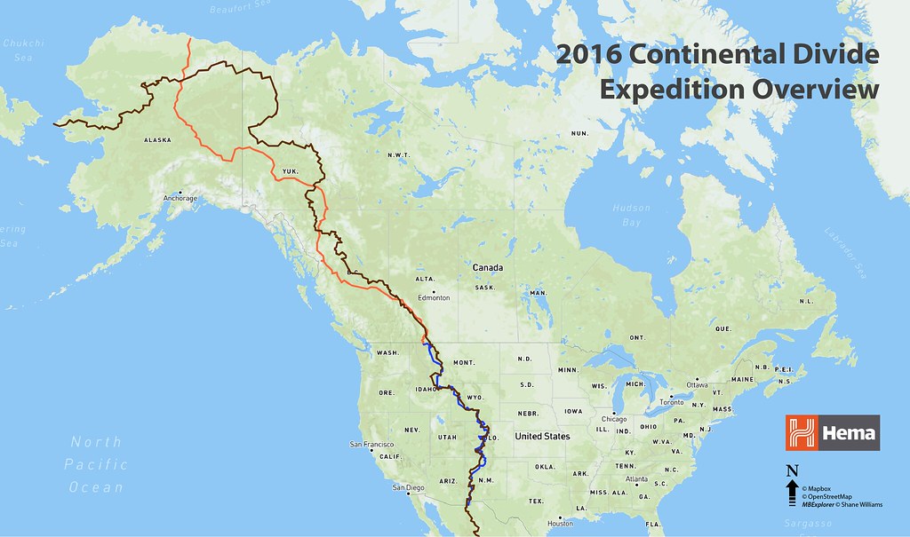
First, the totals:
6,569 tracked miles
31 Expedition Days over 7 months
24 Land Cruiser + Trailer Washings
2 Tires. 2 Bushings. 1 Trailer Jack Wheel.
The hardware:
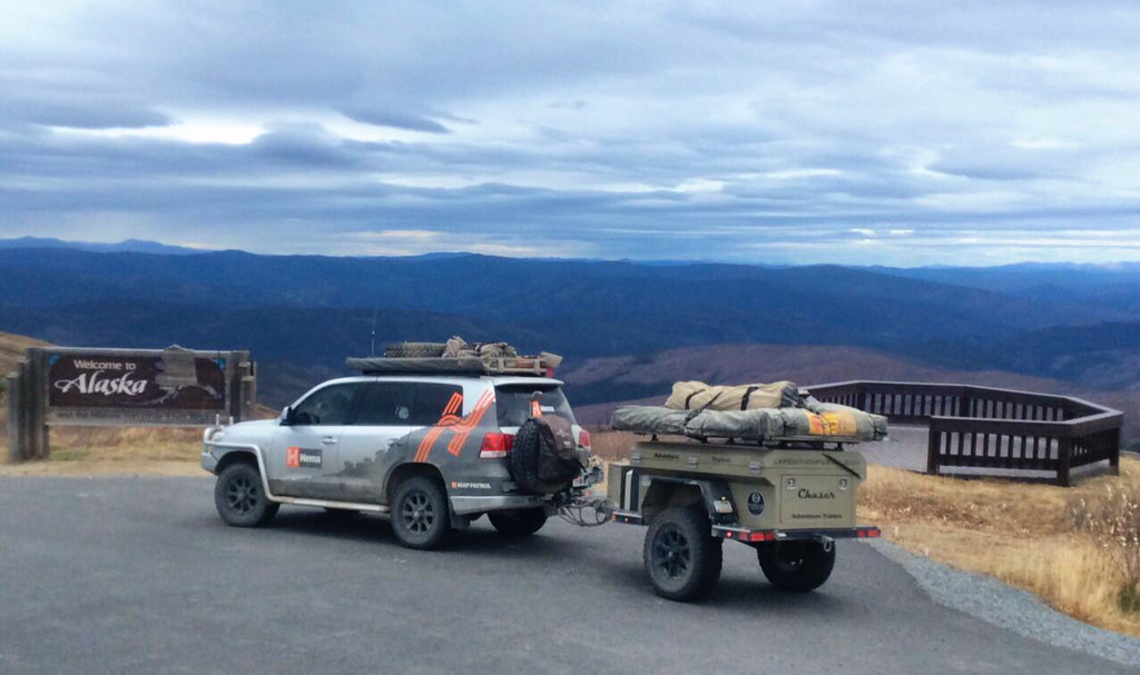
The 200 Series Land Cruiser was shipped from Australia to the US for the year as the expedition vehicle. We sourced an A/T Chaser Flatbed trailer thanks in large part to Scott Brady & Chris Cordes from ExPo.
The LC is fully setup and prior to this expedition ha mapped over 100,000km all around Australia - so it's more than proven that it can handle well, anything. Chris did a great write up on the LC:
http://expeditionportal.com/featured-vehicle-the-hema-maps-200-series-land-cruiser/
The main point of the expedition was to show that Hema Maps is more than just maps & apps, after exploring & mapping Australia for over 30 years…the company is ready to take on North America =)
We used two iPad Mini's + one iPhone 4 for the entire expedition, all running Hema Explorer North America (http://hema.li/explorer). Although the app runs on both iOS & Android, we chose the iPads mainly due to better cameras for documentation and easier full-device backups.

We also used various paper maps for planning and as backups. Our main go-to atlas was the Benchmark series for each US state. It provides enough detail to find some gems while not overloading with information that's not useful.
Each day we began a new track on all 3 devices, and took photos with at least two of the three while recording. We generally paused recording during extended stops, and finished & named each track at the end of the day. All the devices were synced to the Hema Explorer Cloud whenever we had good WiFi. We also did full-device backups to the iTunes Cloud whenever possible.
The Expedition:
While we know it's possible to do this expedition in one section, in order to get max exposure for both the AU and US teams, it was broken down into 5 legs. Each team completed at least one leg, so that's how it's published in the cloud (http://hema.li/cloud)
Note: You can read Rob Boegheims discussion of the expedition on The Frenchie Escapes: http://hema.li/cdrsummary
Hema Explorer CDR Expedition | New Mexico South
Rob Boegheim, Hema Maps
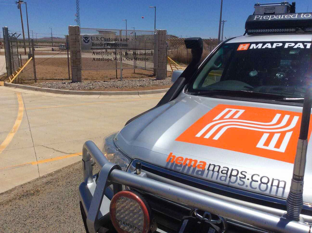
We were honored to work with Expedition Overland (http://xoverland.com) to film the beginning of the journey, see the finished video at: http://hema.li/cdrintro
Total days: 3 Total miles: 331
Hema Explorer CDR Expedition | New Mexico + Colorado
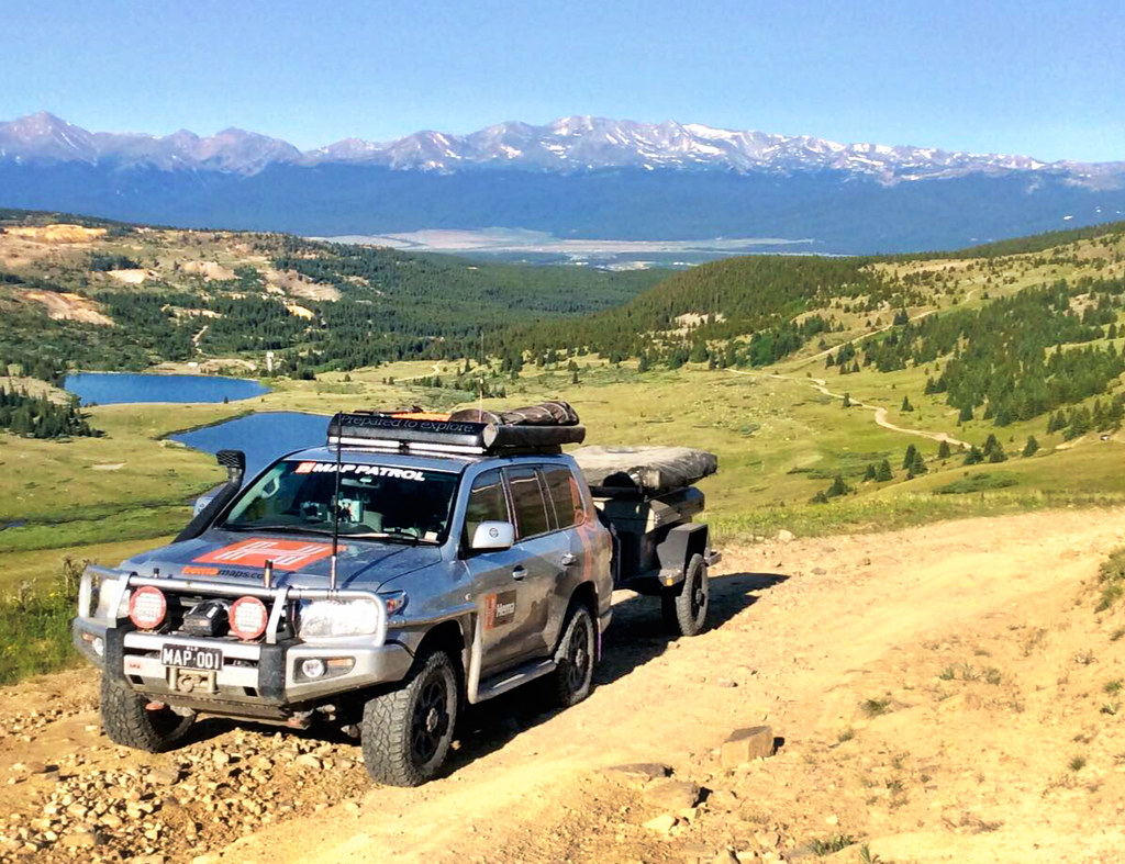
Chris Cordes, Expedition Portal
Sam Hayward & Rob Taylor, Hema Maps
Total Days: 7 | Total Miles: 1,196
Read about a portion of this leg on ExPo: (http://hema.li/expo36)
Hema Explorer CDR Expedition | Colorado + Wyoming + Montana South
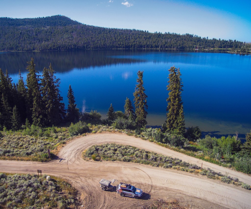
Shane Williams (and family) TCT Magazine / Hema Maps
We covered this portion of the journey in TCT Magazine: http://tctmag.us/6dayshema
Total Days: 7 | Total Miles: 1,044
Hema Explorer CDR Expedition | Montana + Alberta + British Columbia
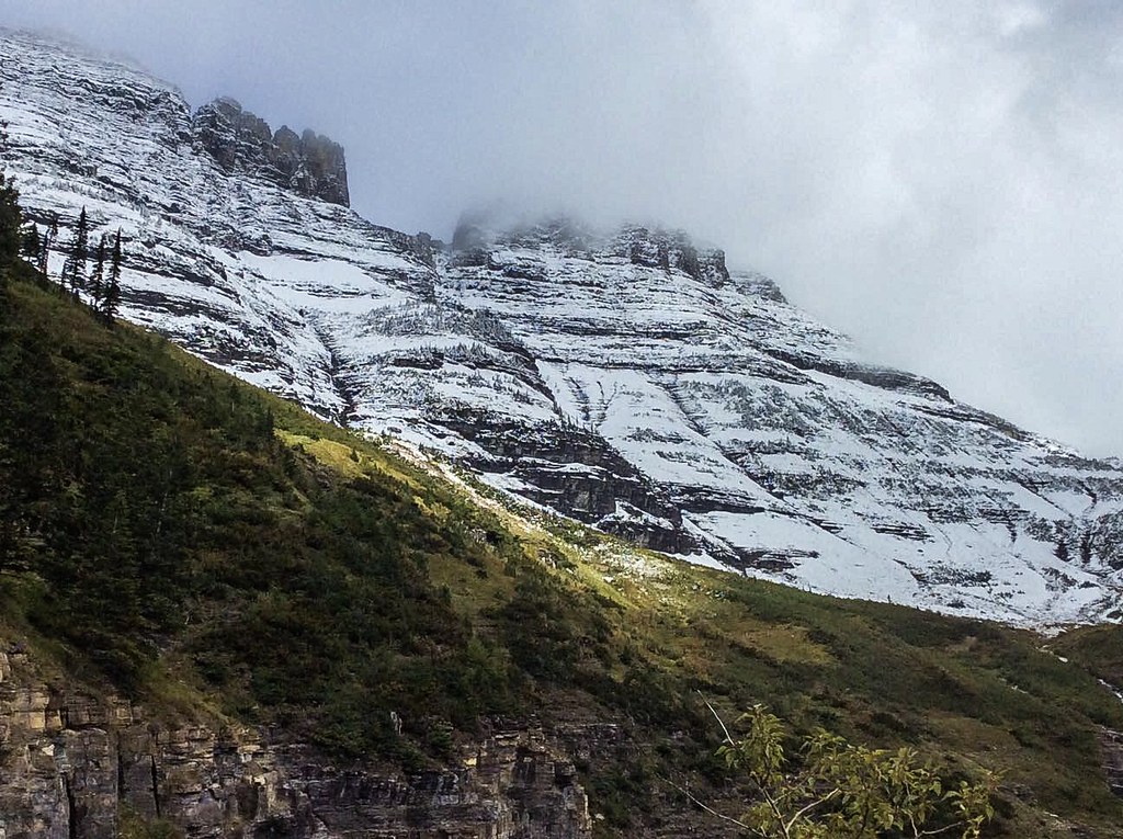
Rob Boegheim (and Family), Hema Maps
Total Days: 7 | Total Miles: 2,031
Hema Explorer CDR Expedition | Yukon + Alaska
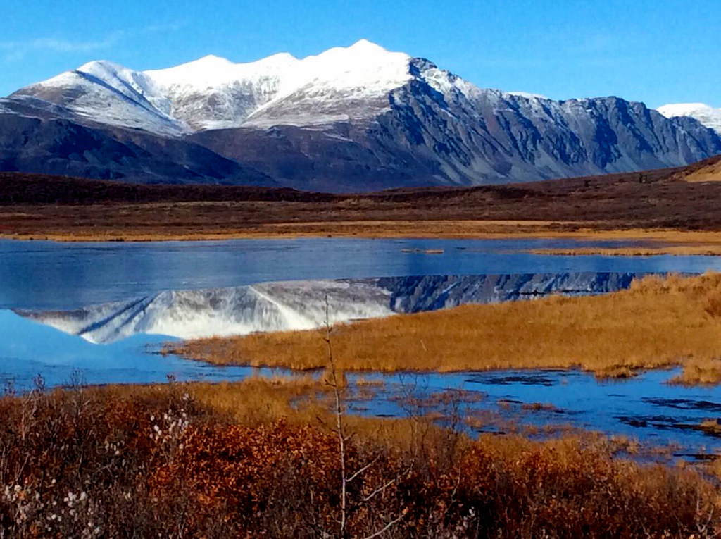
South of the Arctic Circle:
Rob Boegheim (and Family), Hema Maps
North of the Arctic Circle:
Chris Cordes, Expedition Portal
George Muratidis, Hema Maps
Total Days: 7 | Total Miles: 1,967

Last year we planned & executed an epic 6,500 mile expedition from the Mexican border to Prudhoe Bay, AK along the Continental Divide. While we had hoped to publish the tracks & waypoints a little sooner, we've finally pulled everything together and all 5 legs of the trip are now published =)
I'm happy to answer any questions about the trip, the gear, planning, etc =)

First, the totals:
6,569 tracked miles
31 Expedition Days over 7 months
24 Land Cruiser + Trailer Washings
2 Tires. 2 Bushings. 1 Trailer Jack Wheel.
The hardware:

The 200 Series Land Cruiser was shipped from Australia to the US for the year as the expedition vehicle. We sourced an A/T Chaser Flatbed trailer thanks in large part to Scott Brady & Chris Cordes from ExPo.
The LC is fully setup and prior to this expedition ha mapped over 100,000km all around Australia - so it's more than proven that it can handle well, anything. Chris did a great write up on the LC:
http://expeditionportal.com/featured-vehicle-the-hema-maps-200-series-land-cruiser/
The main point of the expedition was to show that Hema Maps is more than just maps & apps, after exploring & mapping Australia for over 30 years…the company is ready to take on North America =)
We used two iPad Mini's + one iPhone 4 for the entire expedition, all running Hema Explorer North America (http://hema.li/explorer). Although the app runs on both iOS & Android, we chose the iPads mainly due to better cameras for documentation and easier full-device backups.

We also used various paper maps for planning and as backups. Our main go-to atlas was the Benchmark series for each US state. It provides enough detail to find some gems while not overloading with information that's not useful.
Each day we began a new track on all 3 devices, and took photos with at least two of the three while recording. We generally paused recording during extended stops, and finished & named each track at the end of the day. All the devices were synced to the Hema Explorer Cloud whenever we had good WiFi. We also did full-device backups to the iTunes Cloud whenever possible.
The Expedition:
While we know it's possible to do this expedition in one section, in order to get max exposure for both the AU and US teams, it was broken down into 5 legs. Each team completed at least one leg, so that's how it's published in the cloud (http://hema.li/cloud)
Note: You can read Rob Boegheims discussion of the expedition on The Frenchie Escapes: http://hema.li/cdrsummary
Hema Explorer CDR Expedition | New Mexico South
Rob Boegheim, Hema Maps

We were honored to work with Expedition Overland (http://xoverland.com) to film the beginning of the journey, see the finished video at: http://hema.li/cdrintro
Total days: 3 Total miles: 331
Hema Explorer CDR Expedition | New Mexico + Colorado

Chris Cordes, Expedition Portal
Sam Hayward & Rob Taylor, Hema Maps
Total Days: 7 | Total Miles: 1,196
Read about a portion of this leg on ExPo: (http://hema.li/expo36)
Hema Explorer CDR Expedition | Colorado + Wyoming + Montana South

Shane Williams (and family) TCT Magazine / Hema Maps
We covered this portion of the journey in TCT Magazine: http://tctmag.us/6dayshema
Total Days: 7 | Total Miles: 1,044
Hema Explorer CDR Expedition | Montana + Alberta + British Columbia

Rob Boegheim (and Family), Hema Maps
Total Days: 7 | Total Miles: 2,031
Hema Explorer CDR Expedition | Yukon + Alaska

South of the Arctic Circle:
Rob Boegheim (and Family), Hema Maps
North of the Arctic Circle:
Chris Cordes, Expedition Portal
George Muratidis, Hema Maps
Total Days: 7 | Total Miles: 1,967

Last edited:
