Triplesnake
Adventurer
It was time to go to Big Bend. I’ve always heard people talk about how magical the area is and how it is majestic in its sparseness. I’ve never really felt the draw. Honestly, I’m more of a forest creature. The closest I’ve been to appreciating the desert has been at the beach, but even there my focus is on the water. Sure, I’ve been to Moab and Guadalupe Mountains, and had really appreciated those places when I was there, but for some reason the Big Bend area had been marginalized in my mind. We wanted a good place to go for a long weekend, so I acquiesced to the urging of my wife and even my neighbor, a long time adventurer in that area in his youth, and we planned a trip to Big Bend Ranch State Park. I was not prepared for we would find there.
We made our way through Austin on a Friday evening. A feat in and of itself. Finally breaking free of the traffic, we made our way through Fredericksburg and down toward I-10. Just before we got to Harper, I asked Joan, “Hey, did you grab propane cylinders for the stove?” “No, I thought you packed them”, was her response. Great, we had no propane to cook with. We made it to Junction before the Lowe’s grocery store closed, and with a short side trip we were fully equipped and would not starve in the desert.
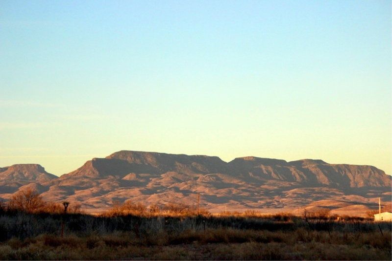
A couple of hours west our overnight stop was Balmorhea State Park. We got there around 1AM and threw down the tent and crashed. We woke in the morning just as the light was kissing the hills in the distance, made a quick cup of coffee with some cinnamon rolls, and packed camp to hit the road. Balmorhea is a nice park and really feels like the desert with a contrast that is accentuated when you arrive at night like we did. I’d like to come back here some time and swim in the spring fed pool.
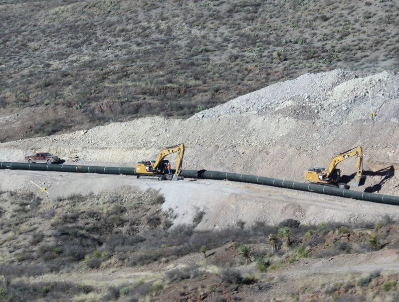
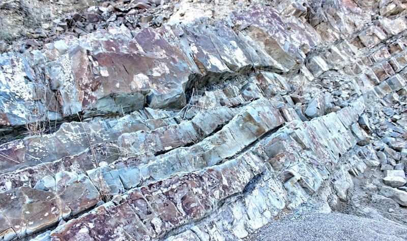
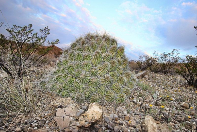
As we made our way south toward Ft. Davis on hwy 17 I was really enjoying the drive. The scenery got really interesting with some exposed rock faces and steep hills, and we even saw a group of javalina. Once we got south of Marfa we started seeing some of the sections of the pipeline they are putting in down here. I’m not sure the details of it but at least there were no protesters like in North Dakota.
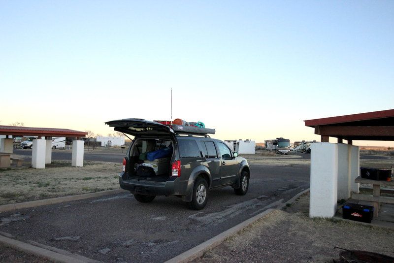
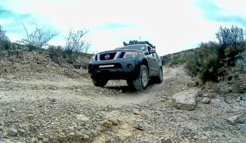
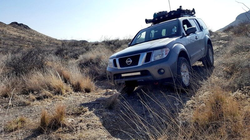
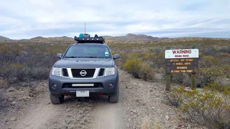
We got to Presidio and were really unimpressed with the town. It just felt gritty. We took the left on 117, which is like the last turn before you cross into Mexico and headed for the park. We stopped at Fort Leaton and picked up a map and talked to the ranger there about the road conditions. They said the last time they drove the road it was rough and badly washboarded. Great. We made our way to the Casa Piedra road and found that the ranger was right! Time to deflate the air bags and adjust the setting on the rancho shocks. Ahhh, that’s much better.
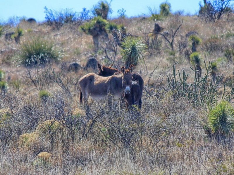
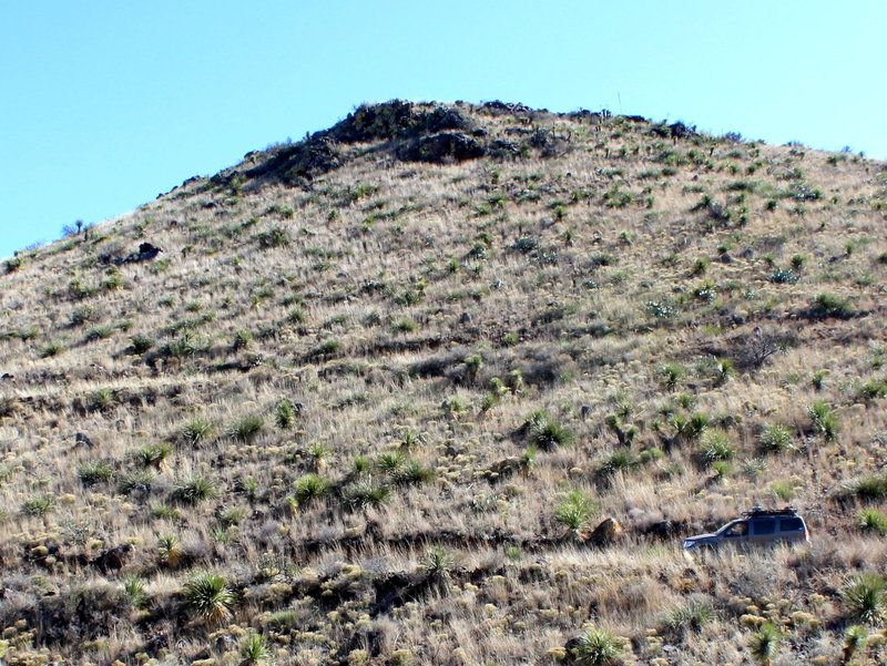
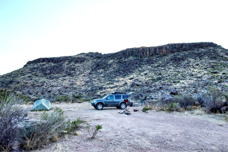
We had a few things in mind that we wanted to do while in the park, so when we checked into the ranger station we looked for a camp site close to some of our primary objectives. We wanted to drive the Road to Nowhere and hike some of the Lower Shutup. Tres Papalotes camp was booked so we chose Paso al Solitario instead. Once we were done at the ranger station, we headed out to check out our camp spot and start exploring. As we got further and further away from the ranger station the road got more and more rough, and I really started to appreciate the rugged scenery. As we rounded a bend, we saw a group of wild asses.
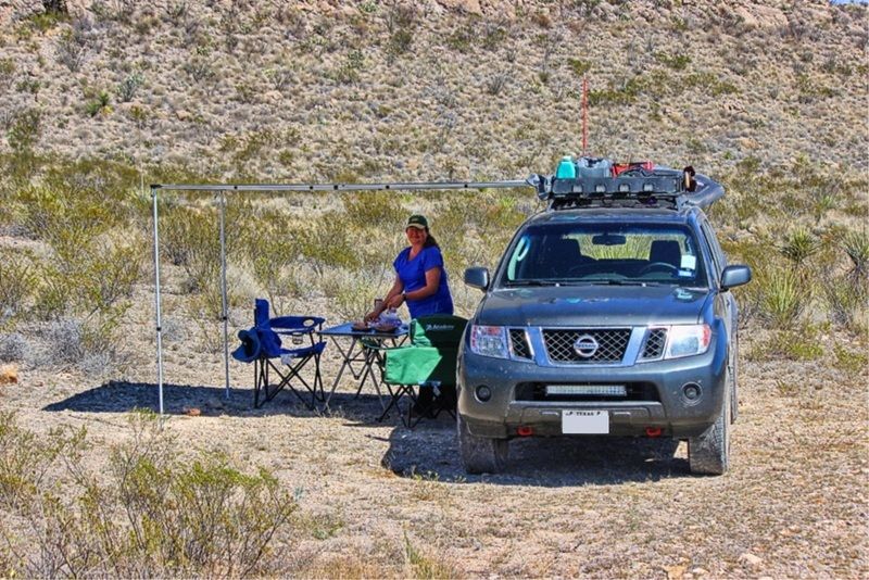
Paso isn’t a bad site, but if you go there be aware that you have to park a few yards away from camp itself. It wasn’t bad, but kind of annoying to have to schlep all of our camping gear from the Pathfinder to the camp area. We stopped for lunch under the shade of our awning and then decided to go drive the iconic Road to Nowhere.
Joan did not like the narrow downhill exposure at the beginning of the trail. At one point she had to get out and walk up a ways and take some pictures.
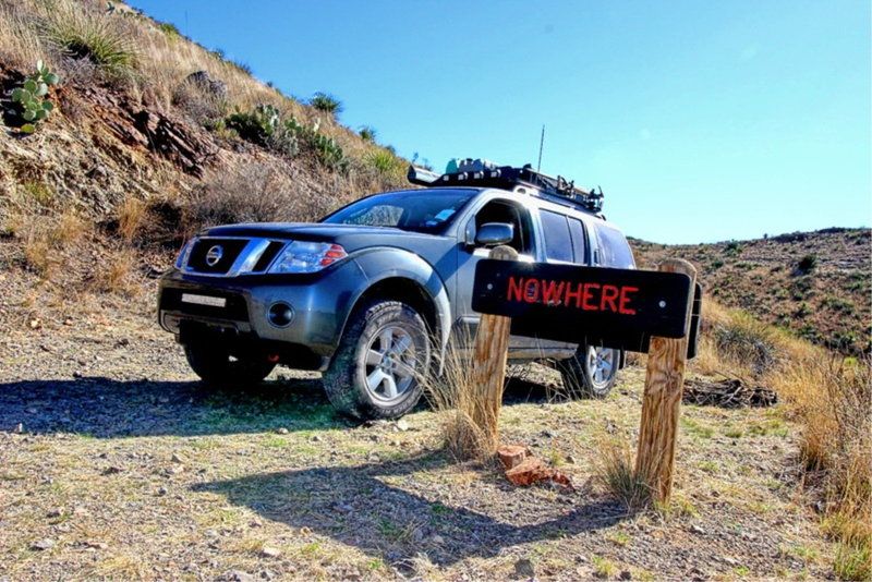
After picking our way along the trail, and avoiding a javalina along the way, we finally got to the end and posed for the ubiquitous shot with the sign at “Nowhere”.
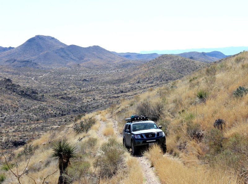
Driving down wasn’t nearly as bad, especially since Joan had the inside view instead of looking over the edge. I was really enjoying both the drive and the views across the valley.
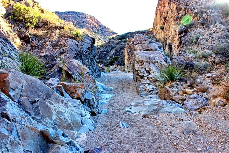
After completing the Road to Nowhere, we wanted to take a hike down the Lower Shutup to explore and get up close to some desert features. The drive to the trailhead was rougher and tighter than I was expecting, and we accumulated more desert pinstripes on the Pathfinder. The hike was hard and fun all at the same time. It had gotten kind of warm and the first part of the route is out in the open as you walk down the sandy wash. We saw many interesting rock formations and enjoyed the feel of the place we got into some of the tighter sections. We turned around, and about half way back to the truck we kicked up a group mule deer.
 [/URL]
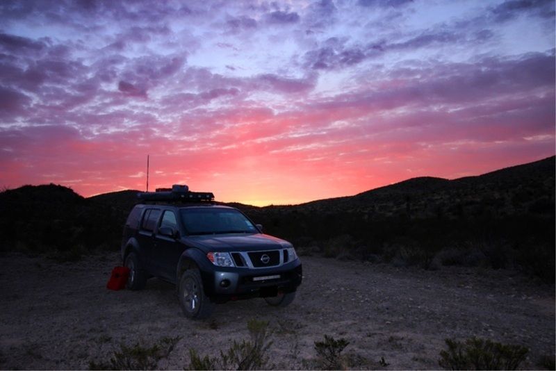
Back at camp, we got the tent pitched and started a nice fire to enjoy the amazing quiet of the desert night. The moon was almost full so it washed out many of the stars, but it was still amazing. The morning dawned with a sunset so full of color, the pictures really don’t do it justice.
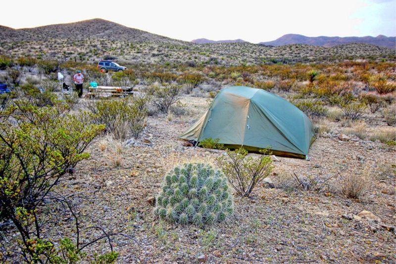
After an awesome start like that, we knew this was going to be a fun day. Joan made breakfast and I took some shots of camp.
On the way back to the ranger’s station we enjoyed more of the rugged driving.
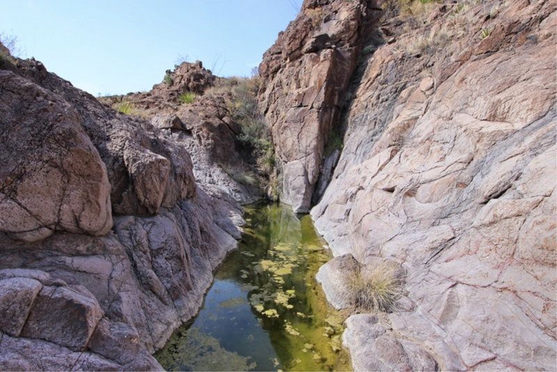
Once back at the ranger’s station, we made our selection for that night’s camp. Guale 2 was already taken, so we opted for Guale 1. We got some ice and dumped our trash, and using info we found there made plans for a couple of hikes to explore. First on the list was Cinco Tinajas. The volunteer told us there was a good bit of water there, so off we went. The hike starts out by leading you to the high point over the valley, which was a great vantage point. Then the trail leads you to pick your way down to the valley floor where the tinajas hold the water. It was such a stark contrast in the seemingly dry desert, and then you come down to these nice pools of water where you can see how the rock has been sculpted by eons of water flow. It was so unexpected to see that.
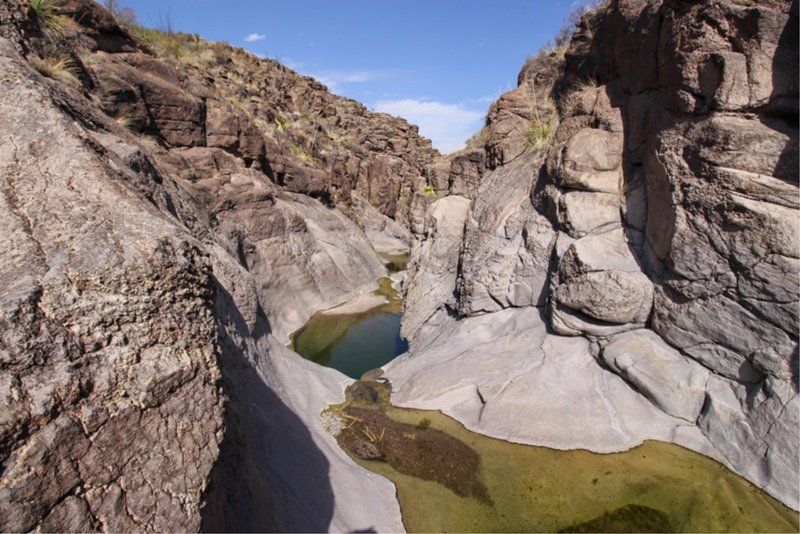
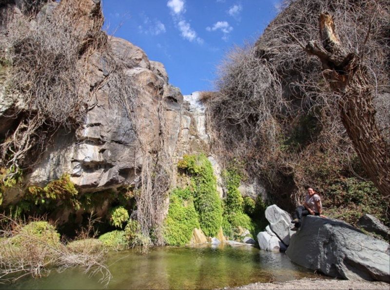
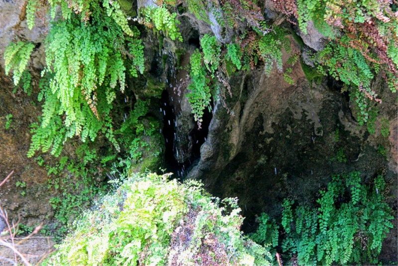
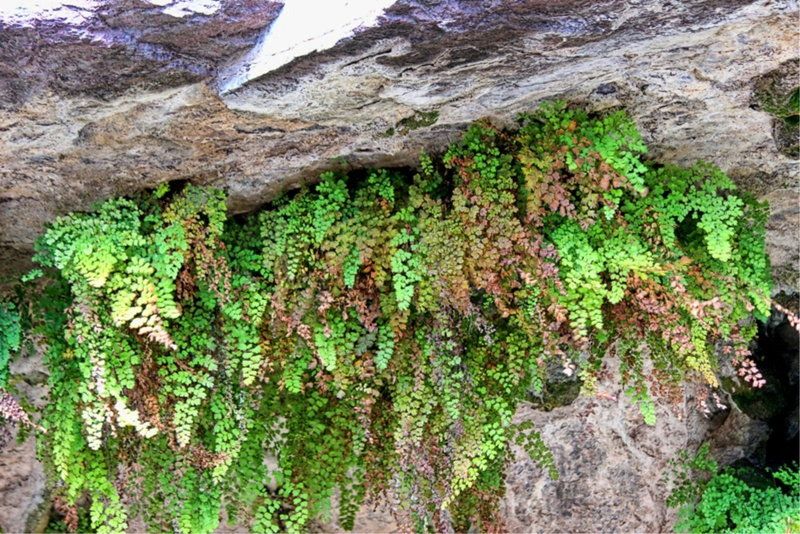
Next on our agenda was Ojinga Adentro. This was by far my favorite place in the whole park. The hike starts off from a high desert trail head but then drops down into a valley full of trees. As the trail winds around some fun and sometimes tricky rock formations, it leads you to the end of a box valley and a “secret” spring fed pool. The dripping water and ferns were so serene and seemingly out of place in the desert. We lingered here for a while and ate lunch and took many pictures trying to capture the magic of this place.
We made our way back to the truck parked in the high desert and decided that we would get to camp via the eastern section of the Oso loop from the Agua Adentro pens. This was more rugged driving. Not really technical, but some of the washes required attention to choose the right line, and some of the tight sections added to our pinstripe collection.
We were excited to check out Guale 1 and I thought it was much better the Paso Al Solitario, It is kind of tucked away in a valley at the point of two drainages.
We made camp and started exploring. Up one of the drainages there is an old dam that formed a stock tank which had been long silted in. The water pipes that lead down to the water trough at the camp sire are still visible as well. I can’t imagine how hard it would have been to try to run cattle in the environment.

Back at camp I started a fire but kept it low as the wind had picked up. We made dinner and smores and then slept well after the day’s exploring. In the morning we made quick work of breakfast and packing camp. The drive up to the main park road completed the Oso loop and then we headed back toward Presidio and then on to home. Knowing that we had barely scratched the surface of this park, I’m sure we will be back.
We made our way through Austin on a Friday evening. A feat in and of itself. Finally breaking free of the traffic, we made our way through Fredericksburg and down toward I-10. Just before we got to Harper, I asked Joan, “Hey, did you grab propane cylinders for the stove?” “No, I thought you packed them”, was her response. Great, we had no propane to cook with. We made it to Junction before the Lowe’s grocery store closed, and with a short side trip we were fully equipped and would not starve in the desert.
A couple of hours west our overnight stop was Balmorhea State Park. We got there around 1AM and threw down the tent and crashed. We woke in the morning just as the light was kissing the hills in the distance, made a quick cup of coffee with some cinnamon rolls, and packed camp to hit the road. Balmorhea is a nice park and really feels like the desert with a contrast that is accentuated when you arrive at night like we did. I’d like to come back here some time and swim in the spring fed pool.


As we made our way south toward Ft. Davis on hwy 17 I was really enjoying the drive. The scenery got really interesting with some exposed rock faces and steep hills, and we even saw a group of javalina. Once we got south of Marfa we started seeing some of the sections of the pipeline they are putting in down here. I’m not sure the details of it but at least there were no protesters like in North Dakota.

We got to Presidio and were really unimpressed with the town. It just felt gritty. We took the left on 117, which is like the last turn before you cross into Mexico and headed for the park. We stopped at Fort Leaton and picked up a map and talked to the ranger there about the road conditions. They said the last time they drove the road it was rough and badly washboarded. Great. We made our way to the Casa Piedra road and found that the ranger was right! Time to deflate the air bags and adjust the setting on the rancho shocks. Ahhh, that’s much better.
We had a few things in mind that we wanted to do while in the park, so when we checked into the ranger station we looked for a camp site close to some of our primary objectives. We wanted to drive the Road to Nowhere and hike some of the Lower Shutup. Tres Papalotes camp was booked so we chose Paso al Solitario instead. Once we were done at the ranger station, we headed out to check out our camp spot and start exploring. As we got further and further away from the ranger station the road got more and more rough, and I really started to appreciate the rugged scenery. As we rounded a bend, we saw a group of wild asses.

Paso isn’t a bad site, but if you go there be aware that you have to park a few yards away from camp itself. It wasn’t bad, but kind of annoying to have to schlep all of our camping gear from the Pathfinder to the camp area. We stopped for lunch under the shade of our awning and then decided to go drive the iconic Road to Nowhere.

Joan did not like the narrow downhill exposure at the beginning of the trail. At one point she had to get out and walk up a ways and take some pictures.

After picking our way along the trail, and avoiding a javalina along the way, we finally got to the end and posed for the ubiquitous shot with the sign at “Nowhere”.

Driving down wasn’t nearly as bad, especially since Joan had the inside view instead of looking over the edge. I was really enjoying both the drive and the views across the valley.

After completing the Road to Nowhere, we wanted to take a hike down the Lower Shutup to explore and get up close to some desert features. The drive to the trailhead was rougher and tighter than I was expecting, and we accumulated more desert pinstripes on the Pathfinder. The hike was hard and fun all at the same time. It had gotten kind of warm and the first part of the route is out in the open as you walk down the sandy wash. We saw many interesting rock formations and enjoyed the feel of the place we got into some of the tighter sections. We turned around, and about half way back to the truck we kicked up a group mule deer.

Back at camp, we got the tent pitched and started a nice fire to enjoy the amazing quiet of the desert night. The moon was almost full so it washed out many of the stars, but it was still amazing. The morning dawned with a sunset so full of color, the pictures really don’t do it justice.

After an awesome start like that, we knew this was going to be a fun day. Joan made breakfast and I took some shots of camp.


On the way back to the ranger’s station we enjoyed more of the rugged driving.

Once back at the ranger’s station, we made our selection for that night’s camp. Guale 2 was already taken, so we opted for Guale 1. We got some ice and dumped our trash, and using info we found there made plans for a couple of hikes to explore. First on the list was Cinco Tinajas. The volunteer told us there was a good bit of water there, so off we went. The hike starts out by leading you to the high point over the valley, which was a great vantage point. Then the trail leads you to pick your way down to the valley floor where the tinajas hold the water. It was such a stark contrast in the seemingly dry desert, and then you come down to these nice pools of water where you can see how the rock has been sculpted by eons of water flow. It was so unexpected to see that.


Next on our agenda was Ojinga Adentro. This was by far my favorite place in the whole park. The hike starts off from a high desert trail head but then drops down into a valley full of trees. As the trail winds around some fun and sometimes tricky rock formations, it leads you to the end of a box valley and a “secret” spring fed pool. The dripping water and ferns were so serene and seemingly out of place in the desert. We lingered here for a while and ate lunch and took many pictures trying to capture the magic of this place.


We made our way back to the truck parked in the high desert and decided that we would get to camp via the eastern section of the Oso loop from the Agua Adentro pens. This was more rugged driving. Not really technical, but some of the washes required attention to choose the right line, and some of the tight sections added to our pinstripe collection.

We were excited to check out Guale 1 and I thought it was much better the Paso Al Solitario, It is kind of tucked away in a valley at the point of two drainages.

We made camp and started exploring. Up one of the drainages there is an old dam that formed a stock tank which had been long silted in. The water pipes that lead down to the water trough at the camp sire are still visible as well. I can’t imagine how hard it would have been to try to run cattle in the environment.


Back at camp I started a fire but kept it low as the wind had picked up. We made dinner and smores and then slept well after the day’s exploring. In the morning we made quick work of breakfast and packing camp. The drive up to the main park road completed the Oso loop and then we headed back toward Presidio and then on to home. Knowing that we had barely scratched the surface of this park, I’m sure we will be back.

