Ouray, Colorado: Four days in the San Juans

SAS

Observer
A friend and I made a quick 4-day trip this week, Sunday through Wednesday, to Ouray, Silverton, and Telluride. The plan was to make reconnaissance for a larger club group going next month, and to produce tracks, waypoints, photos, and videos for trailsoffroad.com.

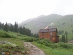
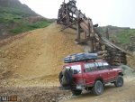
Sunday, we drove to Ouray and immediately up Yankee Boy Basin. Weather was wet, and the peaks were obscured in clouds most of the time.
Yankee Boy Basin with logo.jpg

Getting late in the afternoon, we headed south on U.S. 550 toward Ironton Park where we would make camp for the night.
 

SAS

Observer
Monday was overcast/hazy in the morning, and soon the sun was peeking through, if only briefly. We drove and photographed Corkscrew Gulch (Pass), Hurricane Gulch (Pass), and California Pass. Before completing this route and arriving at Animas Forks, the rain showers had returned--at times heavily!


From Animas Forks we drove County Road 2 south through Silverton to Highway 550, then north back to Ironton Park to camp again. Once we were established, it was only a short time before a friend and fellow trailsoffroad contributor arrived to join us for Tuesday's iconic trails.
 

Attachments

  • Duncan House at Animas Forks w logo.jpg
    Duncan House at Animas Forks w logo.jpg
    65.9 KB · Views: 30
  • Corkscrew Hurricane California .jpg
    Corkscrew Hurricane California .jpg
    114.1 KB · Views: 20
Last edited:

SAS

Observer
Tuesday, Day 3, the weather was shaping better than Monday; clear skies earlier in the morning. We drove south on Highway 550 to the trailhead to Black Bear Pass. Today's goal is to run Black Bear and Imogene Pass back into Ouray. We completed the trip including the creation of new GPS tracks with waypoints and photos, and lots of video clips. This is no easy task with every moment offering epic scenery and camera perspectives!


Once here, there is no turning back: begin the switchbacks. As the road descends, it passes several historic and natural points of interest such as Ingram Falls, the mine processing mill at the falls, Bridal Veil Falls (the tallest in Colorado), and the Powerhouse (Smuggler-Union Hydroelectric Plant).
Black Bear starting down with logo.jpg

Bridal Veil Falls w logo.jpg

2006-01-03 07.20.12.jpg

The view of Black Bear switchbacks from Imogene Pass.
Black Bear from Imogene w logo.jpg
 
Last edited:

SAS

Observer
Wednesday, our last day, we drove Governor Basin and found that it remains closed (to 4-wheel vehicles, bikes and motorcycles can pass).

Governor Basin w logo.jpg

Overall it was a great trip, we mapped/photographed seven roads and are ready to lead a larger group coming from the Springs later in August.
 

Richie

Adventurer
Love the video. Thanks for sharing. My wife and I just spent a few days up there. It's so gorgeous. We made it to Governor Basin on Saturday but it looked like it had just opened up.
 

Forum statistics

Threads
185,822
Messages
2,878,594
Members
225,378
Latest member
norcalmaier
Top