7 Days and 6 Nights Through New England

malibubts

Adventurer
Well I just got back from a pretty cool trip through the New England (NY, VT, NH) area and figured I would get a trip report started. I think the best format is to get a post for each day, but that may change as I get this going.

Right off the bat I'll speak to a few logistics of the trip and try to get everything framed out. I'd be leaving from Cleveland, OH and the girlfriend was only able to take 5 days of PTO; so I knew I was working with at maximum 9 days for the entire trip. I also wanted an extra day at the end to get things taken care of around the house before starting work on Monday or just as a safety net in case the trip didn't go as planned, so that brings me down to 8 days total. Working on this time line I came up with the rough plan of hitting the Adirondacks in NY, then working through VT, winding up in the White Mountains in NH. I was really most excited about the White Mountains and wanted to spend the most time there. Also realistically I can easily hit the Adirondacks on a weekend trip, not so much for the White Mountains. On the way back the Green Mountains in VT seemed like a good pit stop for driving. This won't be as large or intense as a good chunk of the trips here, but it's the longest trip for me and required the most planning, hopefully it's entertaining enough.

So I guess I'll get talking about the actual trip now. As I mentioned starting out in Cleveland gave me about 5 1/2 hours of solid pavement pounding on I-90E. Not the most ideal situation in the world, but given the timeline it was necessary. I took 90 all the way to the Rome, NY exit and then hopped off there to take some state routes the rest of the way to the Moose River Plains wildlife area. This has not too much to do directly with the trip, but man do I hate toll roads! The entire stretch of 90 in NY is a toll road and aside from spending close to $20 each way these things are a pain to get fuel and food on. It would be about another hour or so on these State Routes and then we'd enter into the MRP area and find a camp site.

All packed up and ready to roll on Saturday morning.

20170923_081312
by ebeiersdorfer, on Flickr

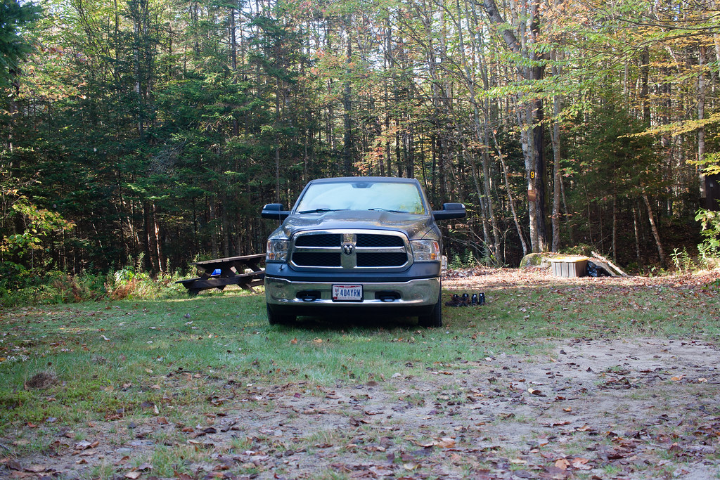
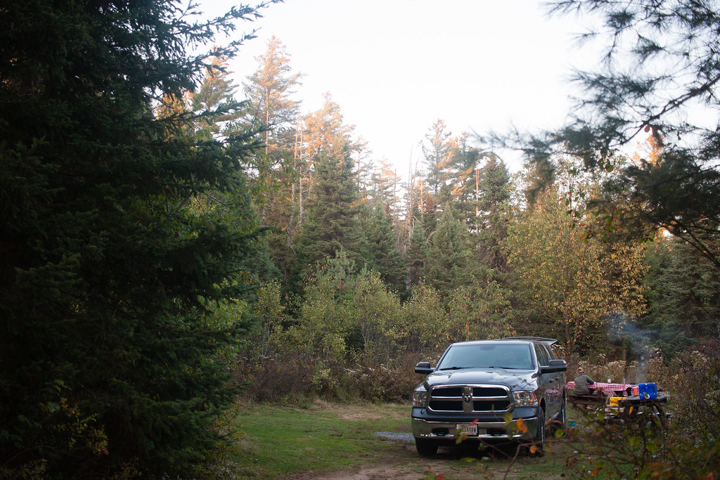
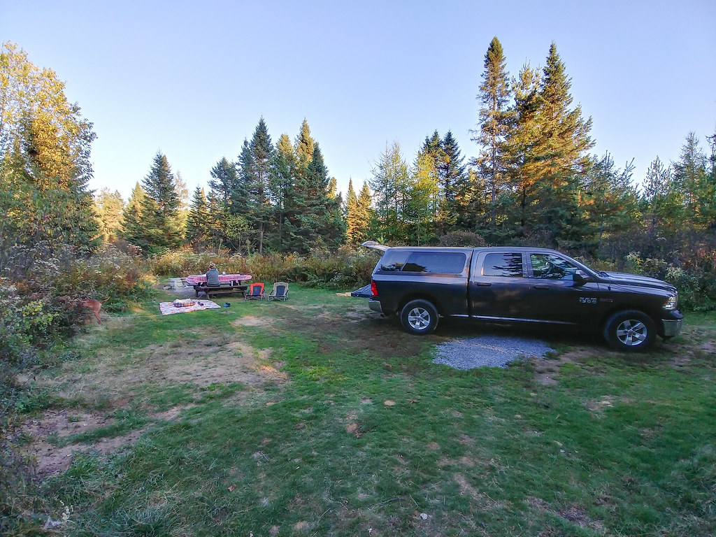
Once getting to the Moose River Plains around 6:00PM on Saturday, we found a campsite pretty quickly. I was a little concerned since these are first come first serve and we'd be getting there late on Saturday, but we didn't have any issues. But man are these the nicest 'primitive' camp sites I've ever seen in my life! Each site had at least 1 table, a concrete fire pit, and vault toilets. At any of the primitive campsites I've stayed at to this point, you're lucky if there is a pre-built fire pit. The sites are also secluded from each other as you'd expect. I honestly think I've paid to stay at camp sites that weren't even this nice.

The Route

9_23_Route
by ebeiersdorfer, on Flickr

Campsite Pics
IMG_1647
by ebeiersdorfer, on Flickr

20170923_180443
by ebeiersdorfer, on Flickr


IMG_1622
by ebeiersdorfer, on Flickr

Sleeping setup for the week.

IMG_1567
by ebeiersdorfer, on Flickr

Bonus Dog and Beer shots.

IMG_1594
by ebeiersdorfer, on Flickr


IMG_1651
by ebeiersdorfer, on Flickr

I think that about wraps up everything for the first day. I'll detail the next day/night in the MRP in another post once I get the photos all edited.
 
Last edited:

ramatl73

Observer
Envious of your bed setup. Man I wish I could use my bed of my Ram 1500 Crew for sleeping quarters. Even with a camper shell it's too short. Plague of being a giant. I'm 6'6" so even diagonal its too tight.
 

malibubts

Adventurer
VIZSLA!! WOO :) Subscribed :)
Good eye! It was actually pretty crazy how many foreigners (British, Australian, Hungarian, etc) we saw in the White Mountains that immediately recognized her. Usually I have to explain to people the breed and about them, but there were a lot of folks on point while we were out there.

Envious of your bed setup. Man I wish I could use my bed of my Ram 1500 Crew for sleeping quarters. Even with a camper shell it's too short. Plague of being a giant. I'm 6'6" so even diagonal its too tight.
Yeah I really like the setup, only thing I wish that would be different is that I got a mid rise cap or had the cash for a Flippac or Habitat. I'm right at 6' so it works great for me, but yeah any taller and I don't know that I'd recommend sleeping in the bed. I think you need to find yourself an 8' bed!

The tablecloth makes camp dining so much classier.
Yeah the table cloth is a girlfriend things, apparently some of the campground tables are 'nasty'. Don't think I could care less.

More please. :)
Day 2 photos are uploading!
 

malibubts

Adventurer
Day 2

So we woke up at camp in the Moose River Plains ready to do something other than sit in the car again all day. I did a fair amount of research on the area before hand to try and get a good idea of some trails to hit while we were there.

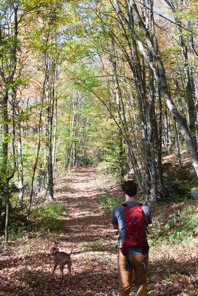
Pretty close to where we camped was the trail Mitchell Ponds and we decided to go with that to start the day. The trial apparently used to be an old logging road so it was a pretty easy 2 miles out and 2 miles back. Walking the trail I was almost wishing you could still drive it since the road was in a pretty cool state.


IMG_1807 by ebeiersdorfer, on Flickr

Walking out.

IMG_1679 by ebeiersdorfer, on Flickr

Not sure how well the panorama will show up here, but we'll give it a shot.

IMG_1731-Pano by ebeiersdorfer, on Flickr

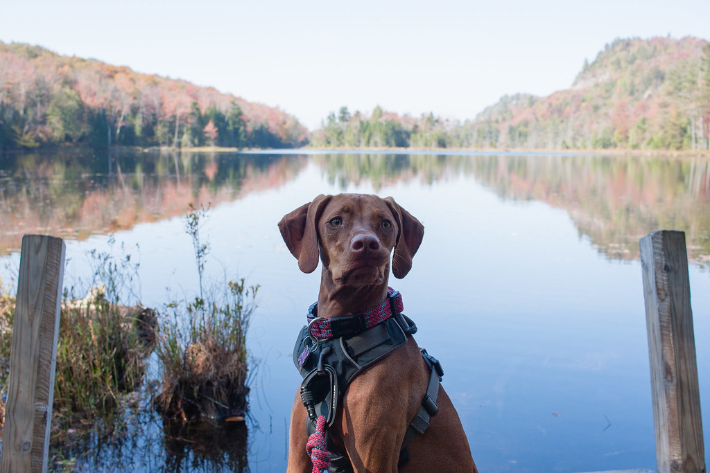
Already acting tired after just the walk there.

IMG_1739 by ebeiersdorfer, on Flickr

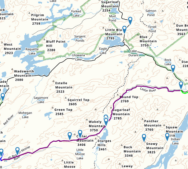
After Mitchell Ponds we drove the rest of the road out to the Cedar River Flow area.

9_24_Route by ebeiersdorfer, on Flickr

There were a number of smaller bridges scattered around the road.

IMG_1813 by ebeiersdorfer, on Flickr

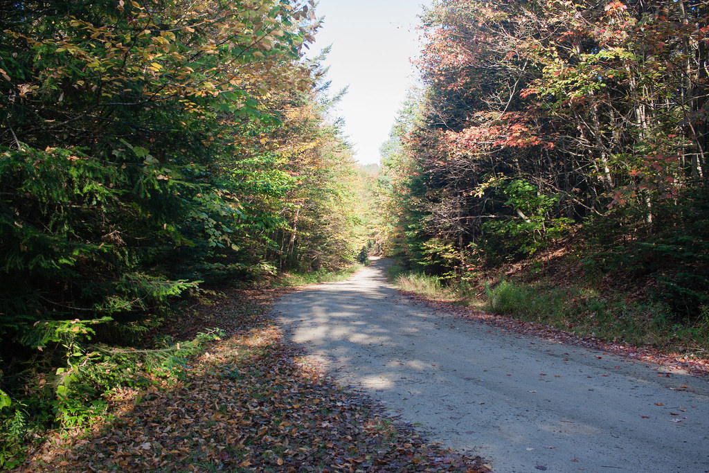
Good feel for what most of the road looked like.

IMG_1877 by ebeiersdorfer, on Flickr

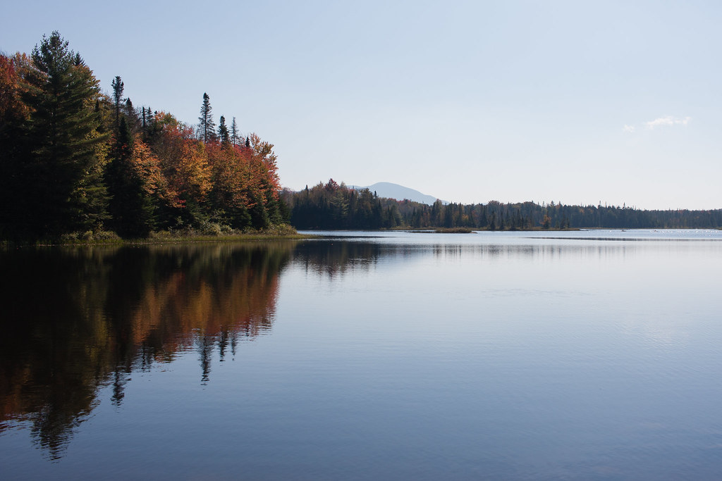
Cedar River Flow.

IMG_1827 by ebeiersdorfer, on Flickr

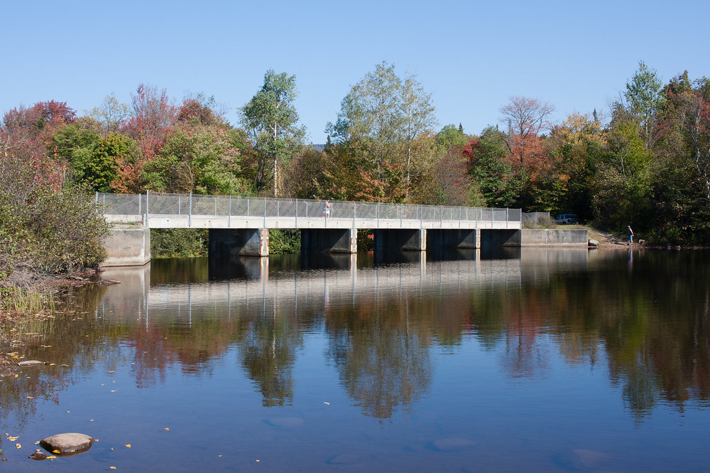
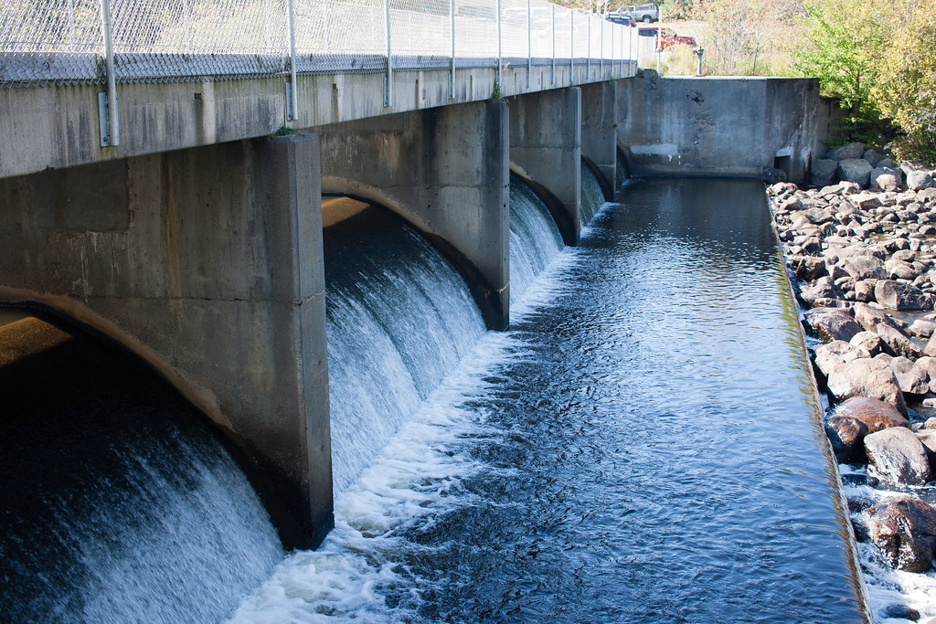
The Dam.

IMG_1840 by ebeiersdorfer, on Flickr


IMG_1871 by ebeiersdorfer, on Flickr

When I started planning the trip I found out about Wakely Mountain and that it had a fire tower at the summit. It looked like a fairy easy hike that wouldn't chew up a ton of time. I was pretty excited about it to be honest, but a few days before we left I found out they had closed the fire tower earlier this year due to it being damaged.

So we shot out of the MRP area and drove around on Route 28. There were a lot of cool views of this road and it made you want a personal photographer to take pictures while you were driving around. This was the first of many times I'd end up feeling like that on this trip.

We last minute decided we wanted to fit in a little more hiking after driving around for a bit. We thought we found a pretty easy trail to Rock Mountain lake, that was just under a mile each way so we decided to take that. Well we ended up walking about a mile and a half a doubled back after not really hitting the lake. It wasn't until later that we realized we parked in the wrong spot and took the Rock River Lake trail, which took a longer route that didn't really get any great views. This turned out to be really the only 'mistake'. I'll take it since the worst that happened was we walked around in the woods a little longer than expected and didn't get to see a cool view.

After the attempted hike we went back into the MRP area to camp again for the night as far East as we could on the road. Again it was a pretty awesome site for primitive camping with tables, concrete fire pit, and a vault toilet.


IMG_1896
by ebeiersdorfer, on Flickr

So I think that pretty much wraps up Day 2, stay tuned for more!
 

EZE

Observer
Sounds like a good trip! My wife and I just moved out to NY (just sound of Albany) with our Vizsla. We've done an overnight or two out in the New England and Penn but haven't gotten out nearly as much as we were back in WA. It'll be fun to follow along and live vicariously. If you ever come into the Albany area let me know, always fun to get multiple V's in one place.
 

2180miles

Endurance Adventuring
Good to see you got some foliage! MA/NH has been hit or miss so far this year, some areas are very much turned over, others as green as a mid-summer weekend!

Love the pup, too. My buddy has one and I constantly request photo updates. He's got her trained for pheasant hunting, and it's pretty cool to watch.
 

malibubts

Adventurer
Sounds like a good trip! My wife and I just moved out to NY (just sound of Albany) with our Vizsla. We've done an overnight or two out in the New England and Penn but haven't gotten out nearly as much as we were back in WA. It'll be fun to follow along and live vicariously. If you ever come into the Albany area let me know, always fun to get multiple V's in one place.

We actually routed pretty much through Albany on the trip home, but I'll keep that in mind if I'm over that way again.

Good to see you got some foliage! MA/NH has been hit or miss so far this year, some areas are very much turned over, others as green as a mid-summer weekend!

Love the pup, too. My buddy has one and I constantly request photo updates. He's got her trained for pheasant hunting, and it's pretty cool to watch.

Yeah, I'm pretty happy with when we went. I wanted to be early enough that the campgrounds were still open, a lot of stuff was closing early October. I also really wanted to see a mix of the fall foliage and it was a plus trying to avoid some of the crowds. Unfortunately it was unseasonably warm for the first half of the week in the high 80s.

It was really cool to see how elevation played a role in things changing too. When we were up in the Adirondacks we saw a ton of stuff changing. The next post is going to be on leaving the Adirondacks and heading out further east, but we routed through the Ft. Ticonderoga area and nothing had started changing.

And this will be a big year for field training for Maya. I had her out in the field about 3-4 times last year, but she was still pretty young so it was more about just getting her out there. I was able to get her gun broken last year as well too. So fingers crossed she'll be pointing some birds here soon. But I totally agree, watching a good dog work is a pretty cool thing to see.
 

malibubts

Adventurer
Day 3

Alright, now we're on to Day 3. The plan was to involve a decent amount of driving in order to get us as close as possible to the White Mountains from camp in the morning at the end of Moose River Plains. We were also going to route through Fort Ticonderoga since the girlfriend really wanted to check it out.

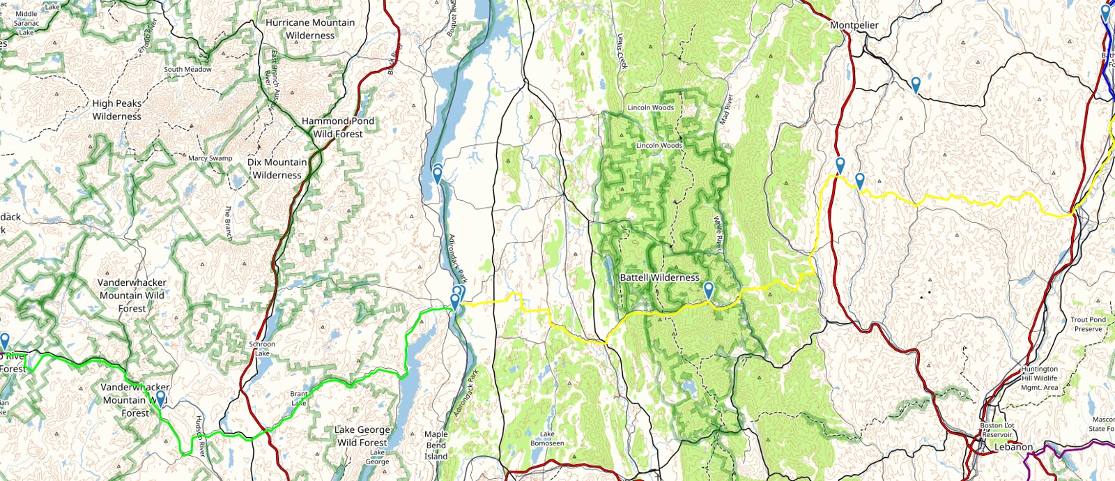
The Route

9_25_Route by ebeiersdorfer, on Flickr

Coming out of the MRP area we hooked up with Rt 28 and took that South until we met Rt. 8 and headed East on that. This whole drive was pretty cool as most of the road is right on the bank of the Hudson River. There were some pretty impressive views, but we were trying to get in some miles and didn't really stop for photos.

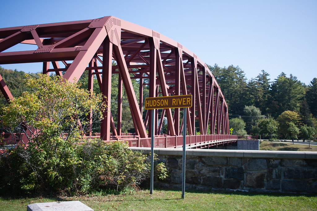
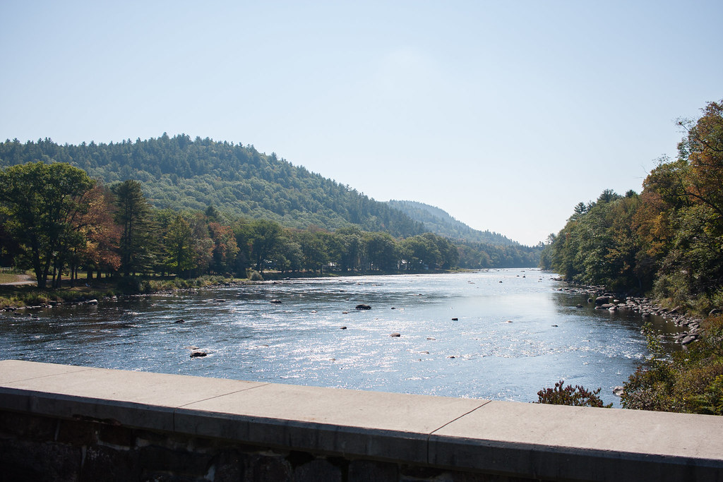
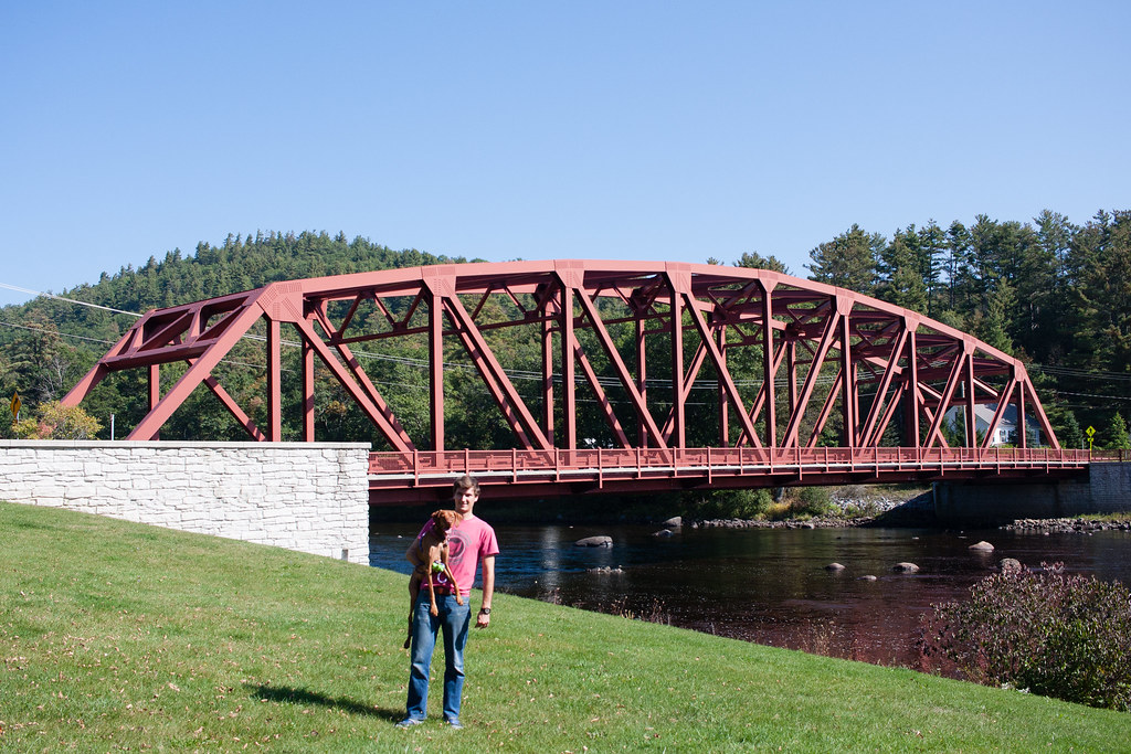
We did however come across a pretty cool bridge and some awesome views of the Hudson that we hopped out to take a look at. I didn't really recon this river crossing other than I knew that there was one and there'd be a bridge there so I was pretty happy when we got there and saw the thing.


IMG_1902 by ebeiersdorfer, on Flickr


IMG_1905 by ebeiersdorfer, on Flickr


IMG_1965 by ebeiersdorfer, on Flickr

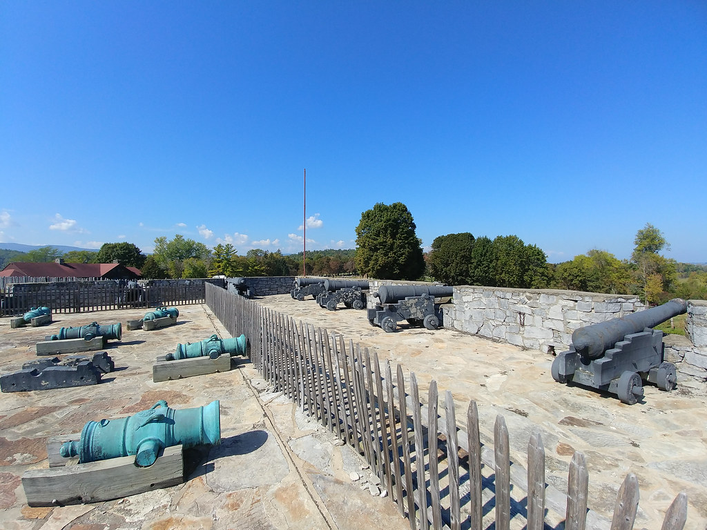
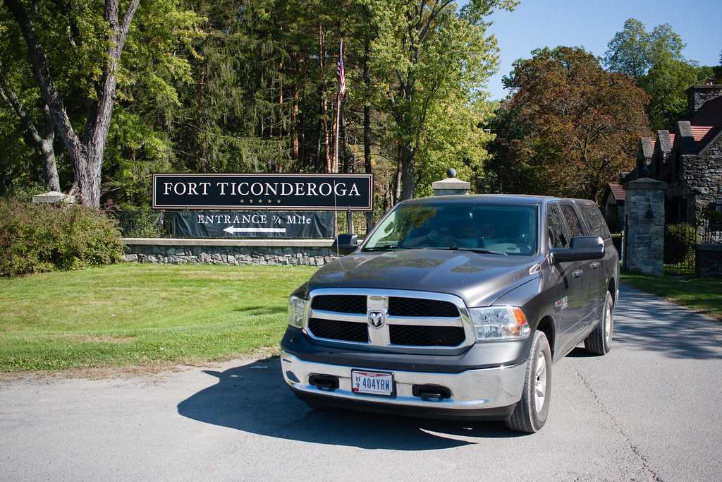
After the bridge along Rt. 8 was still a pretty cool drive. We passed right by a number of small and large lakes before dead ending into Lake George and hooking up with Rt. 9N to get into Ticonderoga, NY. Then as I said we spent a bit of time looking around the fort. Unfortunately we arrived on site around noon and it was pretty hot, so I felt like we rushed through a bit.

I think the last panorama turned out pretty OK, so here's one from the Fort.

20170925_130402 by ebeiersdorfer, on Flickr

More of Ft. Ti.

20170925_131433_HDR by ebeiersdorfer, on Flickr


20170925_131442 by ebeiersdorfer, on Flickr


IMG_1998 by ebeiersdorfer, on Flickr

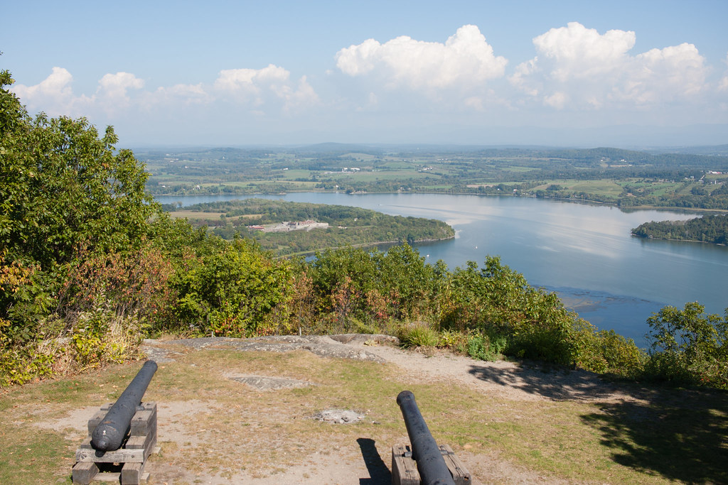
Also we didn't realize it at the time, but admission to Ft. Ti included admission to their road up Mt. Defiance. It was a little bit of a back track, but we decided to head back through town and take the road up. It was paved the whole way and just large enough for two cars to pass by. It was maybe a 700' elevation change and a pretty cool view overlooking the fort from up top. We took in the sights here and stopped to make lunch.


IMG_2009 by ebeiersdorfer, on Flickr

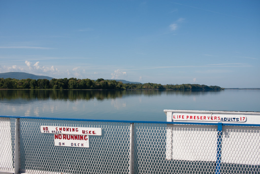
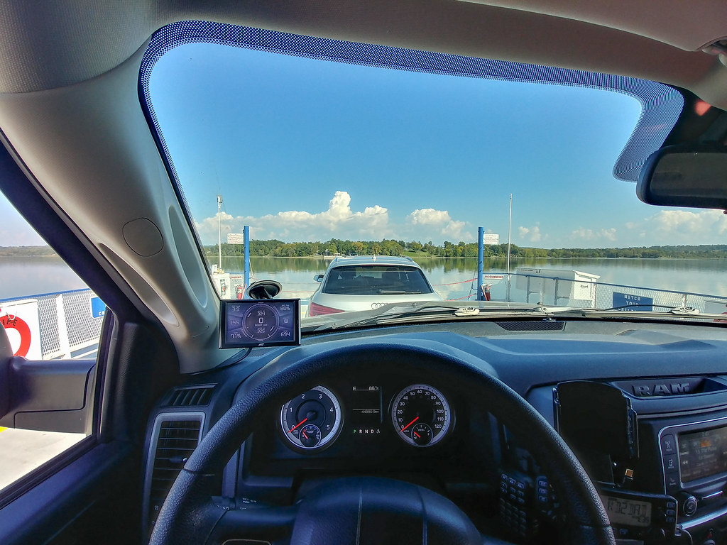
Having never been on a vehicle ferry before and learning that there was one right at Ft. Ti, I put that down as the way to cross into Vermont. Not the top experience on the trip by and means, but it was still a cool experience.


IMG_2022 by ebeiersdorfer, on Flickr


IMG_2027 by ebeiersdorfer, on Flickr


20170925_144333_HDR by ebeiersdorfer, on Flickr

I didn't think to get a shot of the truck until we were already at the end though, which was a bit of a bummer.

Once into Vermont we headed towards Barnet, VT. My girlfriend was really pushing to stay somewhere not outside at least one night on the trip. Since the MRP area didn't have showers and we were going to be putting in a pretty large amount of miles I decided it would be a good night to do that stay.

Crossing into Vermont we routed through some of their Clas IV roads to hook up with Rt. 73. I didn't do the best planning for this part of the trip however, and most of the roads I chose were not the most eventful or senic. However Rt. 73 through the Green Mountains was pretty awesome. Didn't really get any pictures but the road takes you between some mountain peaks and has a pretty decent ascent and descent. It's definitely a cool drive if you are in the area.

By this time we were pretty far behind schedule so we were trying to make up some time, I ended up deviating a bit from my planned route and followed Google Maps a bit, hoping to make up some time. We took some smaller back roads to get over the Rt. 12 N, which would get us to Brookfield, VT.

I saw the Floating Bridge on Mountain State Overlands videos and wanted to make sure that was on the route. When we got there I drove across and took in the scenery. The whole area was pretty packed even at like 5:00PM on a Monday. Again due to trying to make up some time we didn't really stop for very long and I didn't end up getting any photos.

I had some more back roads type of travel planned out of Brookfield, but I ended up following Google Maps and took some more state routes. Ultimately we ended up hopping onto the Highway to make our way North to Barnet. Again, not planned but we needed to make up some time.

In the end I was pretty happy we chose to go with the rental for the night on Monday after such a long day. It would have been a pain to make dinner and setup camp. I was also hoping to stop by a Vermont Flannel store and pick up a couple of shirts, but again on the timing thing. It was a pretty cool day, but was just busy. Given our time frame I'm not mad about taking the day to get in some miles, but I did wish we had more time to take in the journey. On another note it was pretty interesting to see some of Vermonts State Routes. Several seemingly decently traveled roads marked as state routes were not paved and were a gravel surface.

Day 4 will take us into the White Mountains area, not far from our night in Barnet, Vermont.
 

malibubts

Adventurer
Day 4

We woke up on Day 4 and were surprised to have breakfast brought to us by our AirBnB host, that was a pretty nice way to start the day. After eating we got everything packed up and got ready to head into the White Mountains. With the exception of Sunday we had been pushing pretty hard the past few days so I was ready to slow things down a bit.

The Route

9_26_Route by ebeiersdorfer, on Flickr

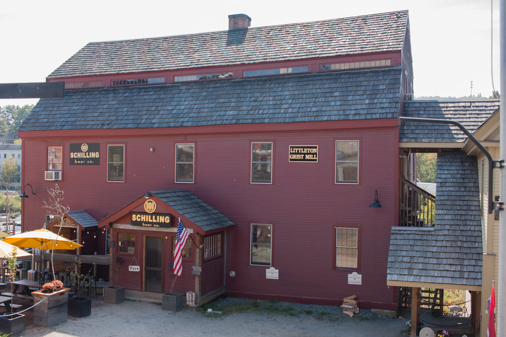
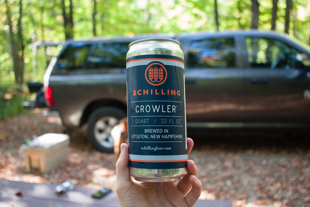
Heading out of Barnet, we routed our way over to Littleton, NH. For food storage I've just got a rotomolded cooler, so I planned on a few stops to restock on food to be safe. We stopped at a grocery store and picked up food for the next few days and then searched out a brewery to grab a few beers for the night. I ended up finding Schilling Beer Company and stopped in. It was a pretty cool little place right on the river and from talking to the staff there they had just started building a new facility next door. I picked up a couple of Crowlers and went on my way.


IMG_2037 by ebeiersdorfer, on Flickr

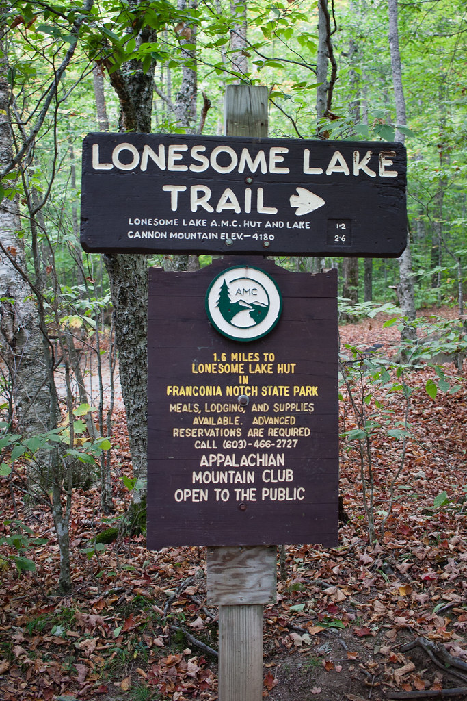
So the first fun stop of the day was Franconia Notch State Park to hike the trail for Lonesome lake. With our stops in the morning it was again around mid day by time we got to the parking lot and were ready to start hiking. Again man was it hot. The trail itself isn't terribly long but it did have around 1,000' vertical climb which wasn't the most fun thing to do when it was nearly 90 degrees. The views though were worth it.


IMG_2117 by ebeiersdorfer, on Flickr

Once you make it to the top you're great in with an awesome view of the lake. Here is looking across Lonesome Lake towards the AMC Hut.

20170926_144537 by ebeiersdorfer, on Flickr

From here you can either head back down or do a half mile or so loop around the lake. We chose to keep going and I think that was one of the better decisions made on the trip.

Views from the hike around to the halfway point of the loop.

IMG_2076 by ebeiersdorfer, on Flickr


IMG_2084 by ebeiersdorfer, on Flickr

At the halfway point for the loop there is an AMC Hut, as Lonesome Lake is on part of the Appalachian Trail. We stopped to eat lunch here and talked with a few folks staying at the Hut for the night that were hiking the AT.

The Mountains across the lake.

IMG_2106 by ebeiersdorfer, on Flickr

Better view of the lake and dock there for swimming.

20170926_151559_HDR by ebeiersdorfer, on Flickr

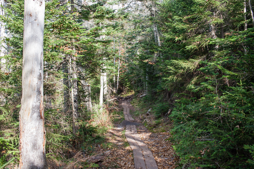
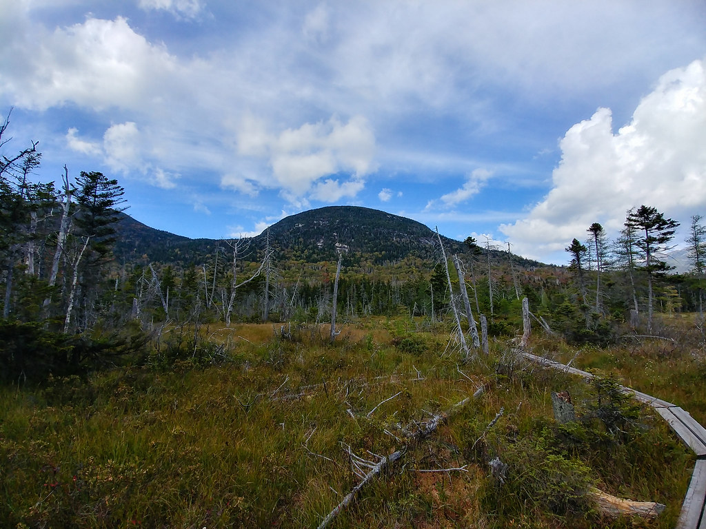
On the way back around we entered a more swampy area, I was glad they had the walkways on the trail.


20170926_152857_HDR by ebeiersdorfer, on Flickr

We finished up the hike and descending down into the parking lot. That was all of the hiking planned for the day and all that was left was to head Towards the Dolly Copp Campground, near the base of Mt. Washington.

We heading back North and took Rt. 3 East, then Rt 302, to Forest Rd 173. I'd heard good things about Jefferson Notch Road and wanted to take this road from early on in the planning stages. It worked out great since it was a good way to get to the campground and routed us essentially behind Mt. Washington.

A good portion of the road followed Jefferson Brook and there was a lot of good scenery on the drive. There weren't a ton of spots to pull of and get photos, also by that time it was starting to get later in the day.

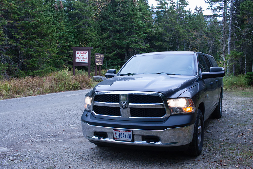
However we did come across a sign at the peak of Jefferson Notch that I wasn't expecting.


IMG_2124 by ebeiersdorfer, on Flickr


IMG_2133 by ebeiersdorfer, on Flickr

It was a pretty cool thing to have been on the highest public road in NH, the day prior to climbing the highest road in NH. The views along Jefferson Notch Rd continued and we kept getting glances of Mt. Washington, which continued to bring anticipation for the Auto Road the next day.

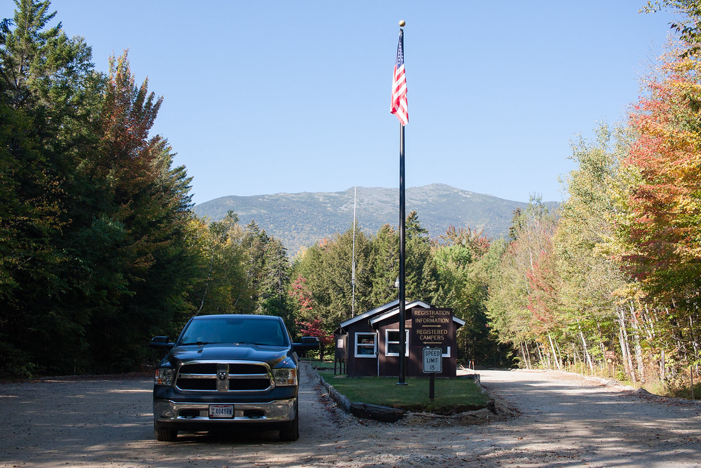
Leaving Jefferson Notch Rd, we turned East onto Rt. 2 and then hooked up with Forest Rd 207 which would lead us to Dolly Copp. I knew the campground would be under construction before we arrived and about half of it was closed. However being the largest campground in the White Mountains, there were a ton of sites still open.

Camp for the night.

IMG_2140 by ebeiersdorfer, on Flickr

At the entrance.

IMG_2220 by ebeiersdorfer, on Flickr


IMG_2227 by ebeiersdorfer, on Flickr

It was a pretty nice campground even with the construction going on. The only disappointment was the lack of showers, I had read online somewhere that the campground did have showers, but after arriving the showers were one of the things that were being added in the construction.

Testing out some of that NH beer while relaxing at camp.

IMG_2182 by ebeiersdorfer, on Flickr


IMG_2188 by ebeiersdorfer, on Flickr

Day 5 is next where we hit the Auto Road to the top of Mt. Washington and then head towards the Kancamagus Highway.
 

malibubts

Adventurer
Day 5 - Part 1

Day 5 was a pretty packed day and I took a ton of photos, after looking through everything I think I'm going to split this up into 2 posts.

This was probably my most anticipated day. The tentative plan was to hit the Auto Road in the morning, stop in town for lunch and supplies, and get in a little exploring around the Kancamagus Highway before camping at one of the sites right off the road there.

The Route.

9_27_Route by ebeiersdorfer, on Flickr

Taking a quick break up the Auto Road.

20170927_101851 by ebeiersdorfer, on Flickr


20170927_101931 by ebeiersdorfer, on Flickr

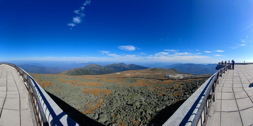
Views from the Summit.

20170927_105211 by ebeiersdorfer, on Flickr


IMG_2244-Pano by ebeiersdorfer, on Flickr


IMG_2251-Pano by ebeiersdorfer, on Flickr

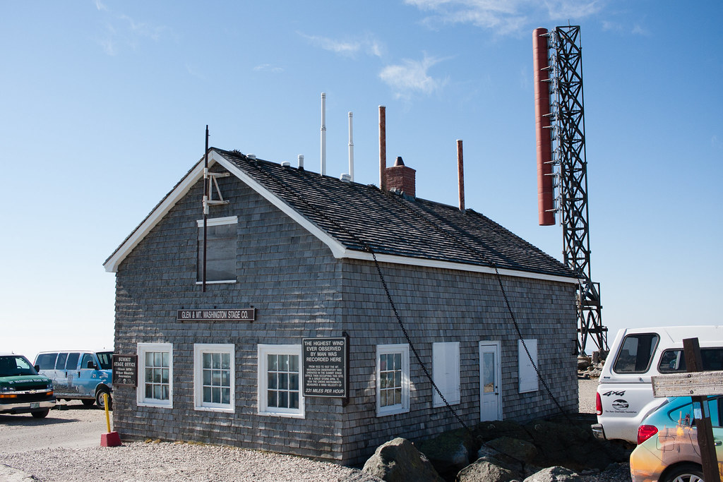
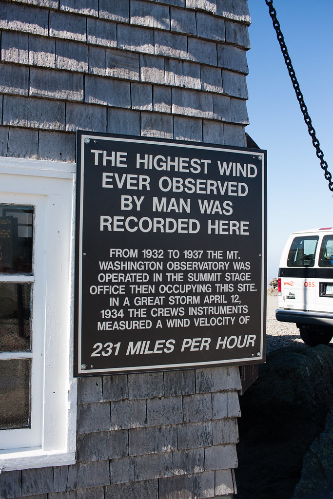
When you've got to chain down your buildings.

IMG_2293 by ebeiersdorfer, on Flickr


IMG_2290 by ebeiersdorfer, on Flickr

The Tip Top House.

IMG_2291 by ebeiersdorfer, on Flickr

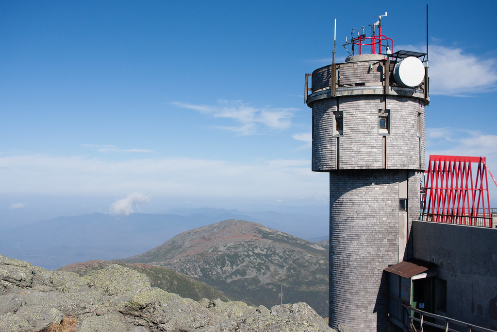
Tower.

IMG_2315 by ebeiersdorfer, on Flickr

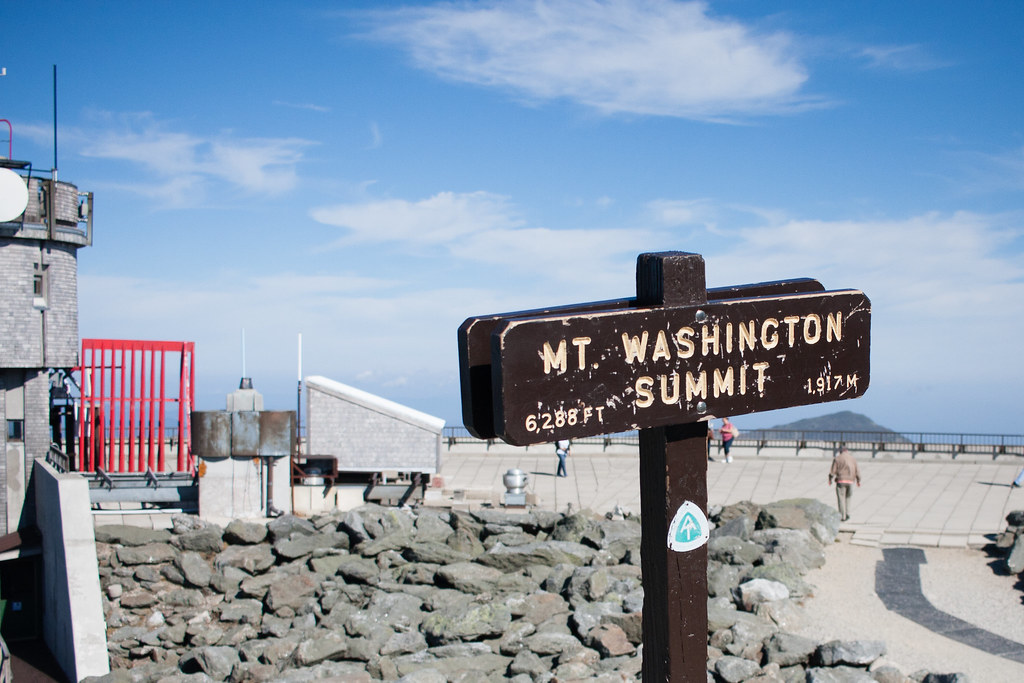
The Summit.

IMG_2310 by ebeiersdorfer, on Flickr

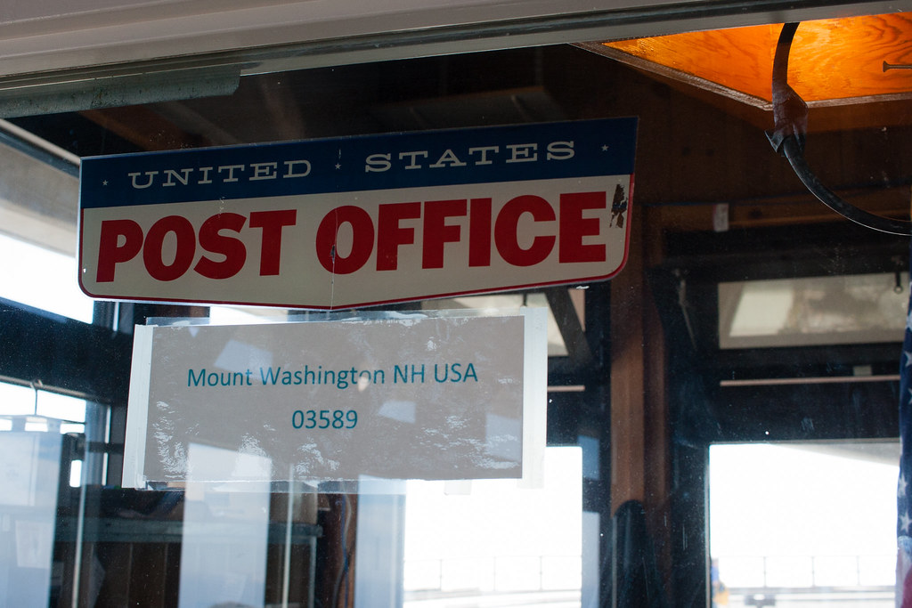
They have a Post Office inside the main building, thought that was kinda cool.

IMG_2345 by ebeiersdorfer, on Flickr

Down at the entry area it was around 80 degrees, but it was only 60 up at the summit. There was also virtually no wind, but at the Summit there was 20 mph steady and up to 30 mph gusts. We also had visibility out to 40 miles, with barely any clouds in the sky. We definitely hit the Auto Road on a great day, pretty happy about that.

IMG_2353 by ebeiersdorfer, on Flickr

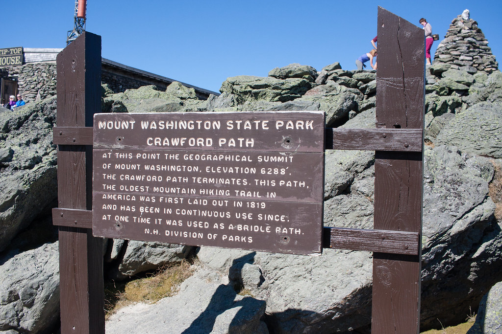
Crawford Notch Trail.

IMG_2355 by ebeiersdorfer, on Flickr

Cooling the brakes on the way back down.

IMG_2422 by ebeiersdorfer, on Flickr

All in all the Auto Road was pretty awesome, if you're in the area definitely check it out. The drive up and down was a bit challenging and you did have to be paying attention. I read around and some people suggested taking a bus up so you could see the sights, but we stopped enough that I don't feel like I missed out too much. I'm glad we drove it. We spent probably an 40 minutes each way up and down since we stopped a bit and maybe another 40 at the summit.

From the Auto Road we took Rt. 16 South, down through Jackson and Conway. We stopped at Dairy Queen and ate lunch, they had a pretty nice little outdoor area where we could eat with the dog. We also stopped at the grocery store and picked up some food. I didn't realize it before hand, but there was an LL Bean outlet in North Conway, since we had the dog I didn't want to deal with stopping but it would have been pretty cool to check out.

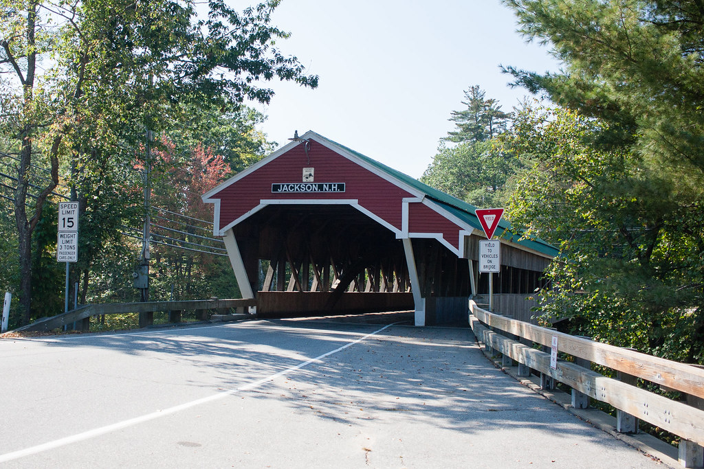
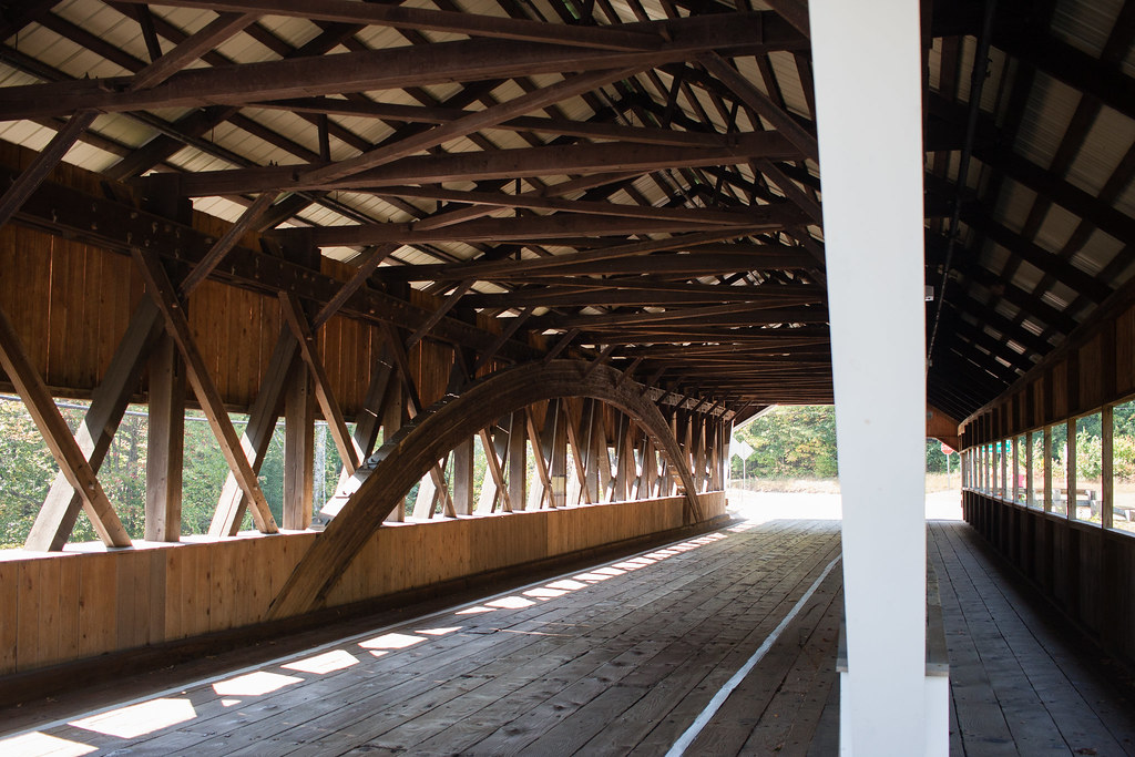
Stopped to check out a covered bridge in Jackson.

IMG_2431 by ebeiersdorfer, on Flickr


IMG_2439 by ebeiersdorfer, on Flickr

Our last stop before heading onto the Kanc was at Tuckerman Brewing Co to pick up some beverages for the night.
 

Forum statistics

Threads
188,391
Messages
2,906,599
Members
230,176
Latest member
Arcadia1415
Top