2010 OAUSA SummerFest @ Big Bear (June 25 - 27, 2010)

BorregoWrangler

Rendezvous Conspiracy
2010 OAUSA SummerFest & Field Day
June 25 - 27, 2010

Willow Creek & Dishpan Springs Run Report


This year's SummerFest was a blast and I was more than happy to lead a few trail runs over the weekend. On Saturday, the 26th my wife and I arrived at the Big Bear Discovery Center a little before 9am. A short while later, Braden showed up followed by Willie, Chazz and Jon. That made for three Jeep Wranglers (YJ, TJ & JK), one Toyota 4Runner and a Land Rover Discovery. Soon we were on the road heading west on Hwy 18 to the 173 and onto Willow Creek Road. The first part of the trail travels through some scenery burned over by the Willow Creek Fire in 1999. Recovery is slow and some parts of the landscape are still blackened and bare. After airing down at the OHV Pinnacles Staging Area we followed the rutted trail down to Willow Creek, which we had fun crossing while the girls took pictures.

Our route passed through forest and open meadows along one of the main routes through a popular OHV area in San Bernardino National Forest. The more difficult parts consist of weathered trails with severe holes, ruts, and off-camber sections. We ran into quite a few ATV's, or "sand fleas" as they were called. Some of whom passed by us rather recklessly. Dishpan Springs, the last black-rated section of our run, was extremely rocky and boulder-strewn. Halfway through this trail is a very steep, rocky climb often called the "waterfall". It was here where Jon had some issues getting his 4Runner through the boulders. So rather than risk breaking something he and Chazz turned back to exit the trail. The remaining three Jeeps continued on through some fairly deep ruts to the end of the trail. If time permitted, the plan was for everyone to regroup and run Gold Mountain. By the time we reached paved Green Valley Lake Road it was past 4pm so we decided to head on back to camp in time for the potluck.
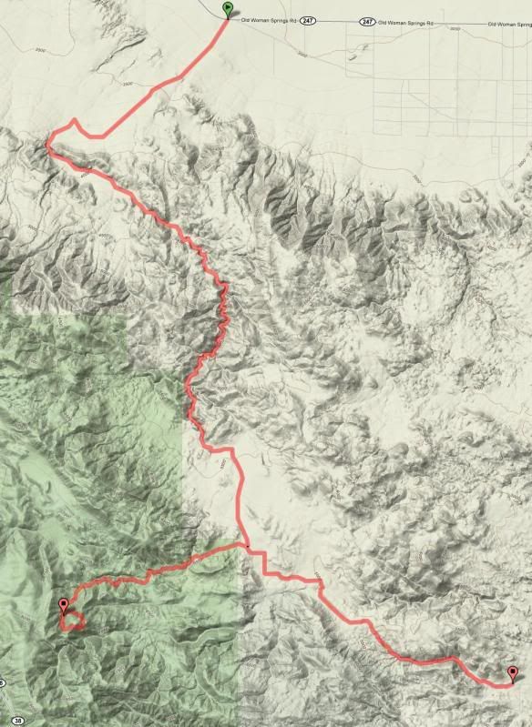

Route Overview

Run1.jpg


Lots of flowers along the way.
IMG_1883.jpg


IMG_1971.jpg


IMG_1875.jpg


Airing down at the staging area.
IMG_1885.jpg


Coming down 3N34.
IMG_1890.jpg


(Picture from Chazz.)
4743844952_644616842f_b.jpg


Willow Creek crossing.
IMG_1893.jpg


Willie
IMG_1901.jpg


Jon
IMG_1904.jpg


IMG_1910.jpg


Chazz
IMG_1911.jpg


IMG_1917.jpg


One of the hill climbs.
IMG_1921.jpg


IMG_1926.jpg
 

BorregoWrangler

Rendezvous Conspiracy
Continued...

Braden was the first up the waterfall in case anyone had any problems.
IMG_1928.jpg


He made it look easy.
IMG_1931.jpg


My turn.
IMG_1936.jpg


IMG_1946.jpg


IMG_1952.jpg


IMG_1955.jpg


IMG_1956.jpg


IMG_1959.jpg


IMG_1960.jpg


IMG_1973.jpg


Later that night we enjoyed the campfire at Coon Creek Camp.
IMG_1988.jpg


IMG_2014.jpg


Rattlesnake Canyon & Heartbreak Ridge (Pontiac Loop)

On Sunday we met up with Willie and Ollie in Big Bear for our run down Rattlesnake canyon and Heartbreak Ridge. I was planning to meet up at Coon Creek Camp but since the drive there took a little over an hour from our place we met up half way at one of the gas stations in town. From there it was down Hwy 18 to the 247 to reach the trail head. This remote trails passes through a non-wilderness corridor of the Bighorn Mountain Wilderness Area. The sometimes narrow, sandy, and often wet passage through Rattlesnake Canyon is susceptible to flash flood damage. Much of the route here was easy to moderate with some tight brush along sections of the trail. Although the temperature reached 100 degrees outside while running along the lower elevations, it still felt really nice out in our open air vehicle.

Rattlesnake Canyon Trail Information- http://www.rattlesnakecanyontrail.com/

"Rattlesnake Canyon, located in San Bernardino County California, runs from Hwy 247, 18.22 miles east of the four-way stop in Lucerne Valley to Burns Canyon Rd (Just east of Forest Service Rd 2N02). At the trail head on the desert floor at Hwy 247 the elevation is 3,102 ft. above sea level. The trail gradually climbs to 5,750 ft. above sea level."

Just before we reached Burns Canyon we turned west on 2N02 to 2N61Y towards Heartbreak Ridge. This difficult part of the route includes narrow canyons, steep shelf roads, large boulders and sharp rocks. This time around, Ollie and I were able to make it through without any carnage. Last time I tore up a tire and shock while he slashed a CV boot, lost an antenna and sprung a leak in his air lines. We stopped for lunch at the top, paid our respects at the marine memorial and explored around some of the mines. It was also nice not having to shovel snow to get through the backside of Pontiac Loop! Backtracking out along 2N02 we continued traveling down scenic Burns Canyon and exited the trail to paved Rimrock Road, where we aired up and headed home. Ollie and I stopped in Temecula for food and gas while Willie and Stephen continued on down the 15 to San Diego. This route consisted of some of my favorite trails in the area and I was happy to have some good company along the trail.


Route Overview

RattlesnakeCynHeartbreak.jpg


The sole remaining cattle rancher in Lucerne Valley operates a 29,000 acre ranch. ALL of Rattlesnake Canyon is within this ranch. The ranchers, Billy & Julie Mitchell, are generally pro-OHV, and have worked with BLM and Wilderness folks to keep the Canyon open.
IMG_2023.jpg


Mr. Mitchell has recently had to put down two cattle and one horse due to injuries created by OHV users going too fast through the canyon, and on the north end nearer his house.
IMG_2025.jpg
 

BorregoWrangler

Rendezvous Conspiracy
Continued...

Please do your part to educate others to slow down. Keep the dust and noise to a absolute minimum, give livestock the right of way, and don't scare them off the trail.
IMG_2030.jpg


IMG_2036.jpg


Stopping to see some of the sights.
IMG_2037.jpg


IMG_2039.jpg


IMG_2046.jpg


IMG_2048.jpg


Heading up a rocky section along 2N61Y.
IMG_2051.jpg


IMG_2056.jpg


IMG_2063.jpg


IMG_2073.jpg


IMG_2079.jpg


IMG_2086.jpg


IMG_2094.jpg


IMG_2101.jpg


IMG_2105.jpg
 

BorregoWrangler

Rendezvous Conspiracy
Continued...

IMG_2111.jpg


IMG_2120.jpg


IMG_2124.jpg


A strange creature emerges from the darkness...
IMG_2126.jpg


Lunch site.
IMG_2132.jpg


IMG_2135.jpg


IMG_2139.jpg


Ollie tore open a CV boot doing the same thing a few weeks ago.
IMG_2140.jpg


IMG_2146.jpg


IMG_2160.jpg


IMG_2166.jpg


IMG_2172.jpg


IMG_2187.jpg


IMG_2200.jpg


IMG_2203.jpg


We could have easily spent a few more days up there enjoying the outdoors but as always, needed to get home. It was great meeting everyone at camp and along the trails; old faces as well as new. Looking forward to BorregoFest!

2010 SummerFest / Field Day Event Reports- http://www.oausa.net/forums/viewforum.php?f=146

All my pictures can be viewed here- http://s970.photobucket.com/albums/ae188/BorregoWrangler/OAUSA SummerFest 2010/
 

SWbySWesty

Fauxverland Extraodinaire
Very nice! I wanted to make this trip. CruiserLarry told me about it a while ago! Hopefully next year!
 

BorregoWrangler

Rendezvous Conspiracy
Gold Mountain ate my HAM antenna. :elkgrin:

Yeah, i guess we lost a few of those out on the prerun too.

SWbySWXJ, don't forget that we'll have BorregoFest coming this October. Hope to see you there.

No FJC's on the Dishpan run but Ollie did better on Heartbreak Ridge this time around. On the Prerun he tore open his cv boot, lost an antenna and sprung a leak in his air lines. Nobody had any problems on this one.
 

Forum statistics

Threads
189,893
Messages
2,921,914
Members
233,083
Latest member
Off Road Vagabond
Top