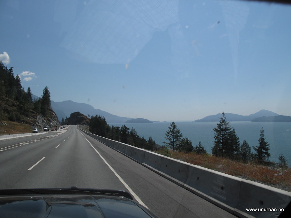
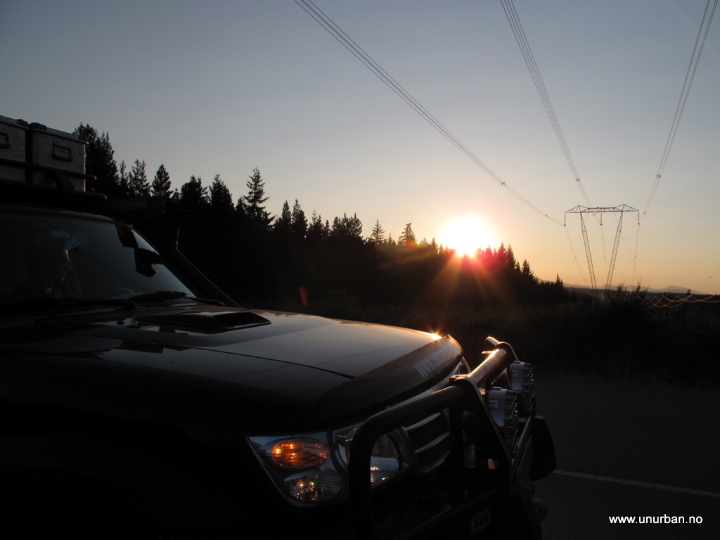
unURBAN Adventures - Alaska to Argentina to AFRICA!

unURBAN

Adventurer
Hi All!

unURBAN has been on the road for a couple of months, and as we drove out of Dead Horse, Alaska, a couple of days ago, we concluded that the "test drive" from Florida to Prudhoe Bay went okay, and that it is now time to launch "The Real Trip". The plan is to drive south when we feel it is time to move on, and we hope to end up in Ushuaia in a years time.

We have prepared a website, of course, but we also post pictures and stories on an exclusive selection (!) of relevant forums, so we'll try to post up here as we drive along.

Espen & Malin
 
Last edited by a moderator:

unURBAN

Adventurer
Denali Highway

*** this is a repost from our blog ***

Has been a little while since the last update. Sorry about that, and don’t jump to any conclusion of us being lazy… Alaska is a big state, and it is a loooong way between the internet access points! After McCarthy we drove the Denali Highway over to the Denali Park, then to Fairbanks, north towards the beginning of the James Dalton Highway, and had a detour into Manley Hotsprings that turned out not to be a detour at all. More about that later.

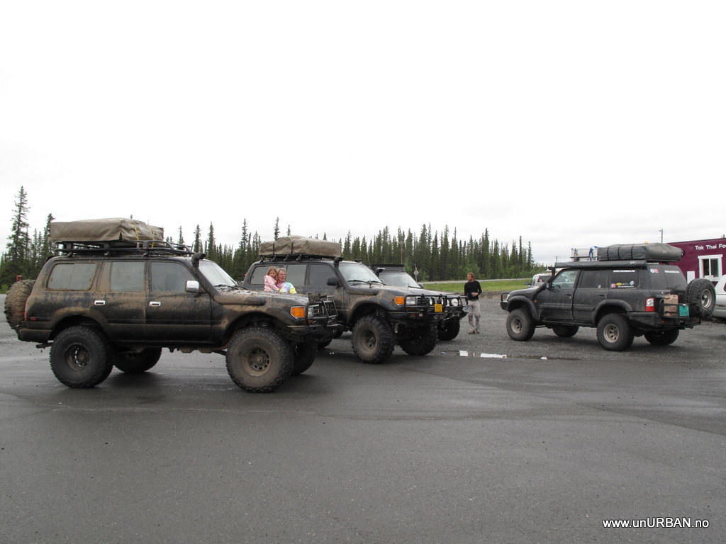
From the gravel road going back from McCarty, we got onto Highway 4 from Valdez, and drove north. We had a quick stop in Glennallen to fill up with fuel and food, and also got some Chicken Cashew and noodle dishes from a purple Thai food trailer next to the gas station. Delicious! If you see this trailer in or around Tok – go for it! Here we also bumped into some guys from Anchorage driving heavily modified Toyota Landcruisers. Turned out that they had been out scouting for a Landcruiser event in Tok the following weekend. Looked really muddy… We’ll see if we can coordinate driving through Tok this weekend. Would be fun to have a closer look.

4734875890_a05d896c3d_b.jpg


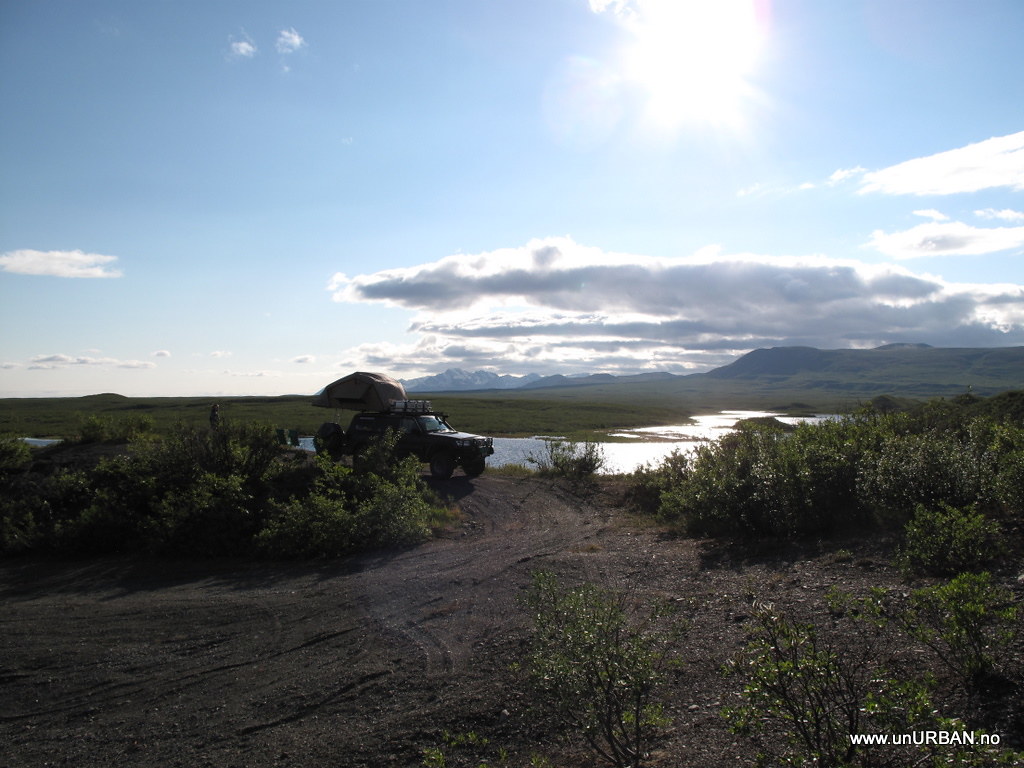
So! From Glennallen we headed north to the start of Denali Highway. It is a gravel road going west over the mountains from Paxon, and it ends up just a few kilometers south of the entrance to the Denali National Park. This is a beautiful mountain pass, and on clear days it is possible to see the Mount McKinley/Mount Denali (highest peak in North America) from parts of the road. That didn’t work out for us, though, but the landscape is breathtaking. When we crossed over it was still early in the season, and there were not too many other travellers on the road. This also meant that most of the turnouts were empty, and we camped on the most scenic of them all.

4734876042_84ef448724_b.jpg


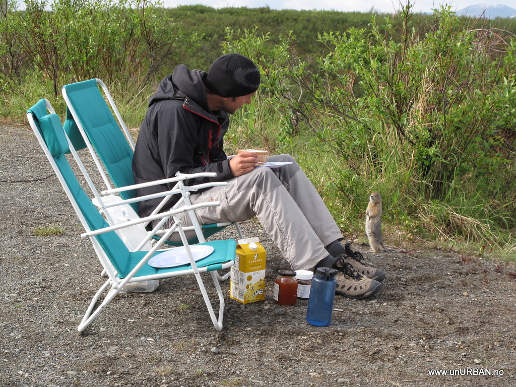
The evening was spent watching a couple of beavers doing their beaver-things in the small lake just next to our camp, accompanied with a couple of very good Alaska Ale. We also noticed a lot of moose dumps around the camp spot, but no encounters with big animals so far. The only wildlife bugging us (besides the bugs...) was a ground squirrel a little too interested in our breakfast the next morning.

4734876330_0e66433600_b.jpg


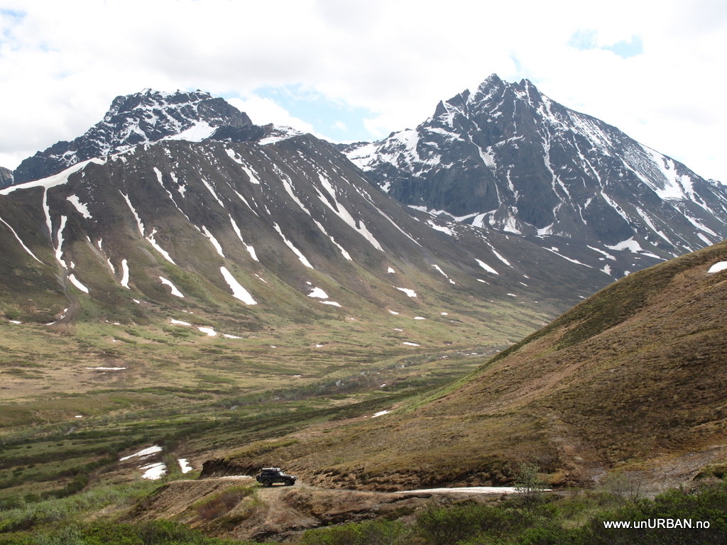
Closer to the west end of the road is a nice little gravel road going up into the mountains a little bit further north. This is a state road with public access, but mostly used by miners. It was an interesting drive, and we tried to shoot some video of the trip. If we can figure out our video editing software, there will be some posts with video clips on our page shortly.

4734876494_46845a3615_b.jpg


Spent the night in the “city” at the entrance of Denali Park (Denali Rainbow Village), by locals often referred to as Glitter Gulch, as it is mostly souvenir shops there. We also saw some rafting companies, motels, and RV parks. Noisy place, and the water tasted funny… Continued north from here the next morning, and decided to check out the Stampede Trail before heading up to Fairbanks for more supplies.

More soon!
 

unURBAN

Adventurer
Manley Hot Springs

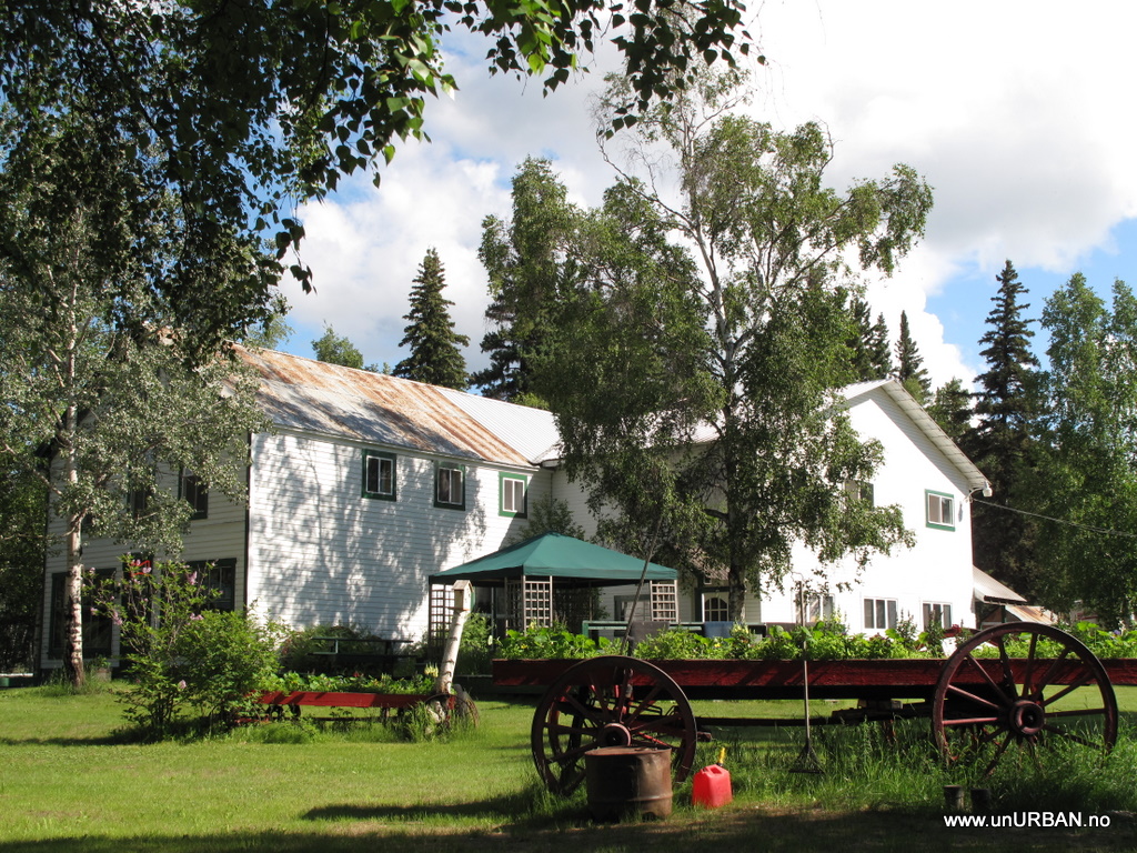
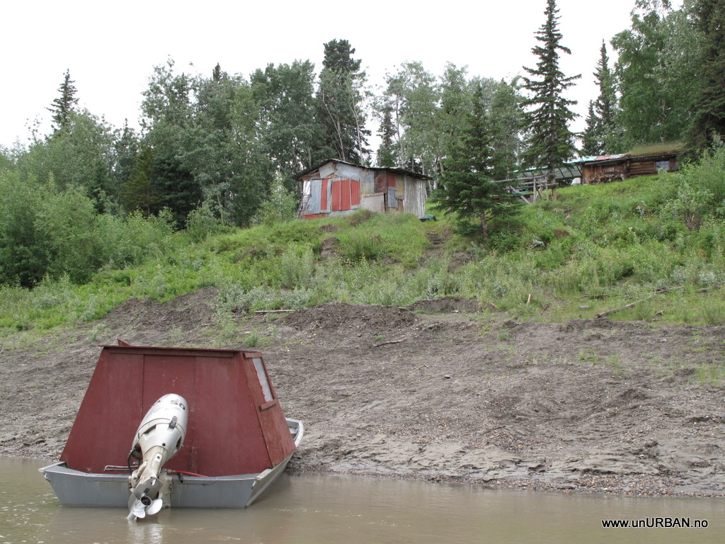
Espen and I were invited to come to Manley Hot Springs and to stay with Demaris and Art on our way up north in Alaska. So we did, and we had some amazing days meeting interesting people and see a bit of the Alaskan way of life. Manley Hot Springs, like many other places in Alaska, came into life supporting mining and the people involved in it. Today the community consists of about 60 people living there year round. Art and Demaris have cabins, http://www.alaskawilderness.net/index.html further out in the Alaskan wilderness were guests can come to stay for fishing, canoeing, hiking, and to do whatever they dream of doing in the Alaskan Wilderness. Guests come to stay for a few nights, a few weeks, or even for a year. There are no roads to the cabins, so Art, who is a pilot, will fly the guests out to the different cabins. When we got to Manley Hot Springs Art was flying up supplies to the cabins, and their first guests would arrive in July.

4737900274_094afcfbdc_b.jpg


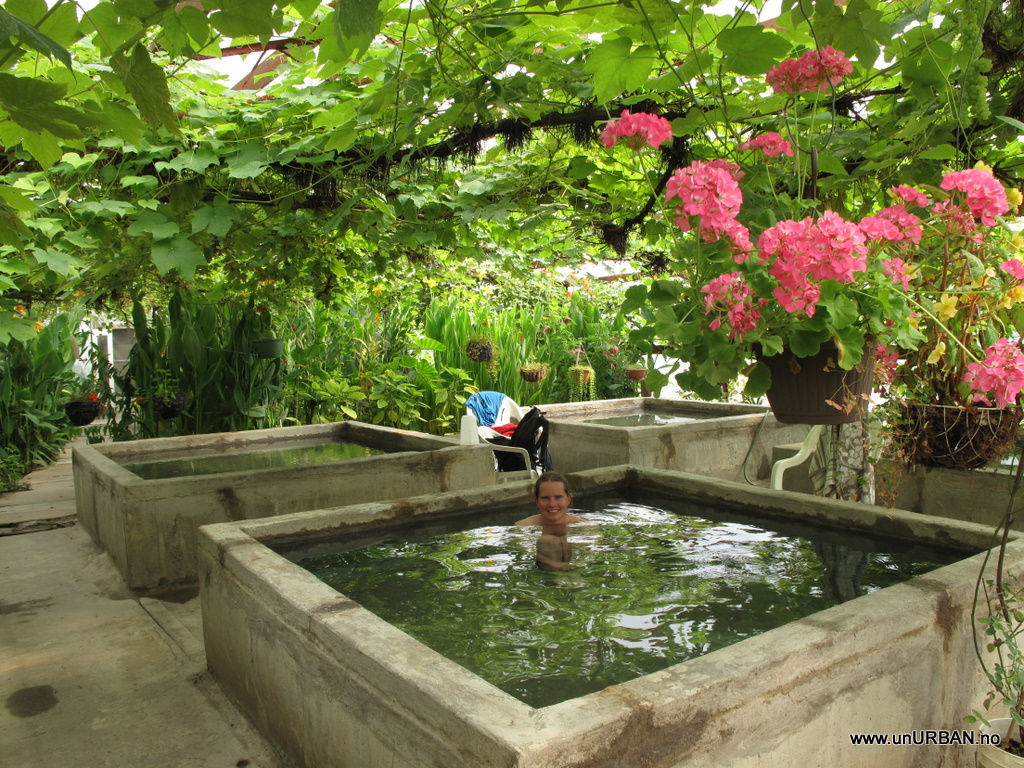
Manley Hot Springs got is name after Manley who built a hotel at the Hot Springs in 1906. The hotel burnt down in 1911 and today the hot springs is privately owned and there is a greenhouse on the site heated by the hot springs. Public is allowed into the greenhouse and the hot springs for a fee of $ 5 per person, but then you also have the greenhouse all to yourself. We had heard about the hot springs, but the surroundings took us by surprise. Who expect to be surrounded by tropical flowers and ripe grapes at 65 degrees north?

4737261667_445da509a7_b.jpg


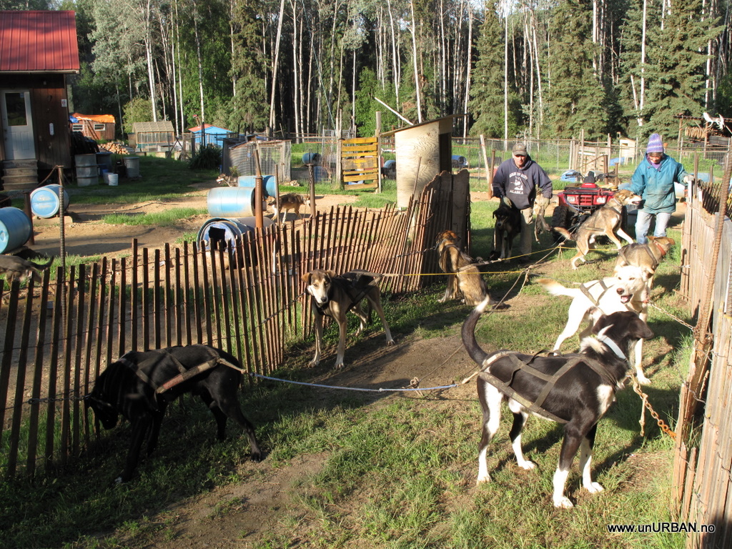
One day we visited Joe and Pam Redington at their Iditarod Kennel http://www.joeredington.com/ I have never seen so many dogs in one place my whole life, and we were told that that this was less than half of the amount of dogs they had at one point. I cannot even imagine how much work it is to look after and train so many dogs. From a cooks perspective it was a huge pot of food that had to be boiled with fish, chicken and rice to make a “lovely” stew to feed the dogs.

4737262675_0324481df5_b.jpg


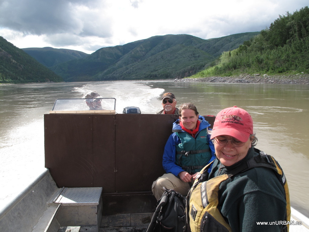
Espen meet his name brother Espen who lived in Manley, and Espen also happened to come from Norway… And it must be for that reason that Manley Hotsprings is the first place in America where everybody manages to pronounce and remember Espen’s name on the first try. He invited us for a boat ride down the Tanana River, and for us that has seen Alaska 98% of the time from the road, it was great to get out and see the nature from the river. Along the river we also saw two moose cows, but still no grizzly bear - where are they hiding?

4737901600_a536ce41af_b.jpg


On our last day in Manley Art took us out on a flight over to the Yukon River. I had never been in a smaller plane than a Twin Otter before, and for both Espen and me it was the first flight ever with floats. It was an amazing flight and beautiful views from the plane. It was incredible to fly over the Yukon River and to see how big this river is, and it has definitely changed since we last saw it in Whitehorse in Canada.
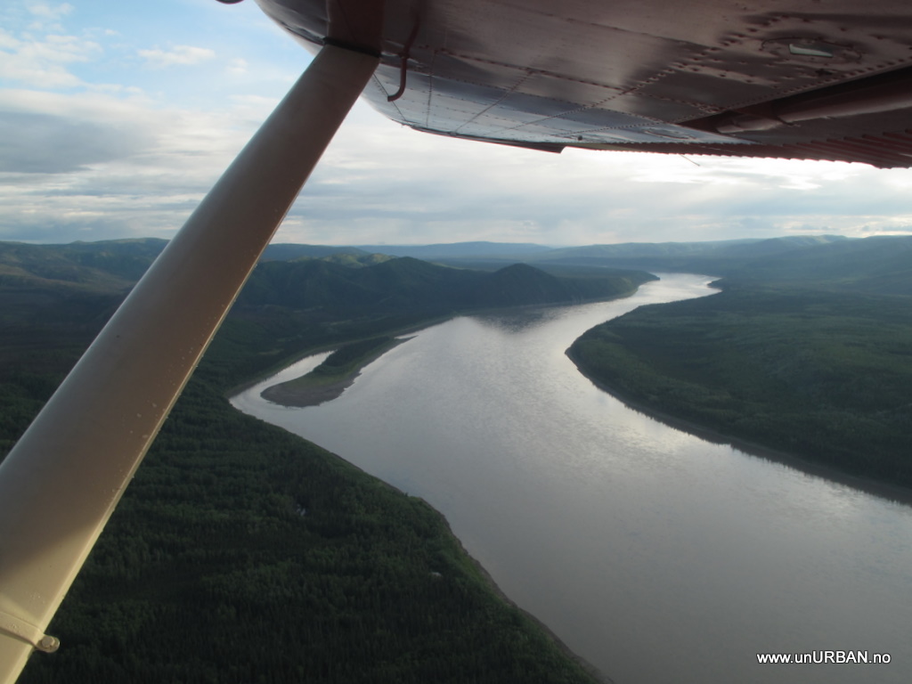
4737264397_9d2247224f_b.jpg


Art was bringing mail and a few other things to friends that stayed along the river in their fish camps. They had been in their camps for a little while preparing and waiting for the King Salmon to come up the river, and from reports further down the river they were expecting them one of the next days. Nets or fish wheels are what they use to fish the salmon. When the fish is caught then the work start to conserve it, and the fish camps that we visited all made smoked salmon strips that they would later sell. Salmons with lower quality meat were dried and used for dog food. The beginning of August is the end of the season and the fish campers move back to their homes.

4737265089_269afd17b6_b.jpg


Thanks to Demaris and Art and all the people we meet in and around Manley that made it to an incredible experience for us.
 

unURBAN

Adventurer
Dalton Highway - The Haul Road

To “start” our road trip we wanted to see the Arctic Ocean and travel from the northernmost point on the American continent to the southernmost point, and that meant driving north on the Dalton Highway. Dalton Highway or the Haul Road as it was called until the beginning of the 80’s, was completed in 1974. The road was built to get supplies and workers up the newly discovered oil field in Prudhoe Bay and to build the 800-mile long Trans-Alaska Pipeline that would transport the oil to the ice free harbor in Valdez. Before we started the drive we had heard about the bad road conditions, and again we think the road is not as bad as we had imagined it. Sometimes we had to stop for road work, or slow down when we meet other cars and trucks. The dirt on the road is the worst, especially after driving on the stretches of the road where they mix calcium chloride with water which is sprayed on the road for dust abatement. This stuff sticks! Plenty of time in a car wash has to be included in the budget if you plan to drive up the Dalton Highway.

4737905144_52065755cc.jpg


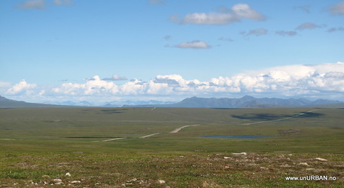
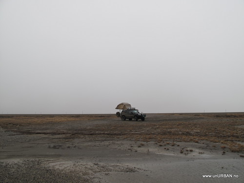
The drive up the Dalton Highway is beautiful and the landscape really changes from hills with boreal forest to the Brooks Range Mountains to tundra and to coastal plains up around Deadhorse. We were really lucky with the weather, and had great view almost all the way up to Dead Horse. The last couple of miles, however, we drove in to fog and rain, and the temp dropped significantly.

4737268593_a9ac440667.jpg


When we finally got close to Deadhorse, we saw caribou’s on the tundra, and muskoxen were grazing along the Sagavanirtok River. It was a bit chilly when we prepared our camp in 0 degrees Celsius and raindrops in the air, and pretty strong wind was blowing in from the Arctic Ocean. Not completely inexperienced with cold weather being from Norway, we pulled out our big sleeping bags for the night, and the only thing waking us up every now and then was the tent making noise in the wind gusts. Should probably have a talk with ARB about how to make tents for bad weather…

4737904480_d96eff655d.jpg


For normal people and tourists like us the road ends in Deadhorse witch is the industrial camp supporting the Prudhoe Bay oilfield. Our only way to access the Arctic Ocean is to go on an authorized 1 ½ hour tour that takes us the last 13 km to the ocean and cost 45 USD per person. It is really not worth the money, but it is the only way to get up to the ocean. The tour was taking us to the BP sites and we guessed it was their new method to make some extra bucks these days…

IMG_8874.JPG

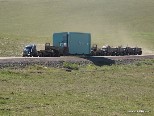
Looking around at all the equipment and machinery in Deadhorse we understood why the road is called the Haul Road. Everything up there has to be hauled up the road or shipped during the short summer. On our drive we meet a few really oversized trucks and some places support car stopped us on turnouts next to the road. The most extreme was one truck pulling something really oversized, and there were four trucks behind the trailer helping to push the load up hills. We meet them about 150 km south of Deadhorse and it had taken them 5 days!!! to get there from Fairbanks (about 650 km). I total we used four days up and down the road.

4737268283_ddce0b5692.jpg


Anyways!
That was far north as you can drive in Amerca! Now we aim south!

Espen&Malin
 

unURBAN

Adventurer
A holiday from the holiday...

People thought we sounded crazy when we said we went home for a holiday from the holiday, and I guess it is kind of crazy, but at home it was a 60th birthday to celebrate and friends and family to visit.

IMG_9494.JPG

First stop in Norway was Ålesund were we flew into the Vigra Airport. A friend picked us up at the airport early in the morning and while we waited for a café to open up we had a sightseeing trip in the area. On this short trip we spent almost half the time on the road in tunnels going through mountains or under the sea. I realized then that on our drive for two months from Calgary to Prudhoe Bay, all the way north in Alaska, and back south again to Whitehorse, we had not driven through a single tunnel. That is amazing coming from Norway were we have tunnels all over, and especially on the west coast, where Norway is almost like a Swiss cheese.

IMG_9504.JPG

In Ålesund the 60th birthday celebrations started with a good lunch and a local football match between Ålesund and Molde. From Ålesund we drove through a couple of tunnels, took a ferry across a fjord and drove a bit more before we got to Volda, where Espen is born and raised.

IMG_1813.JPG

The west coast of Norway has an amazing landscape with fjords and mountains – it is just too bad that the weather rarely cooperates. But on a sunny day I do not think you can find a more beautiful place. So we enjoyed some sun and rain while visiting friends and family and celebrating birthdays.

From Ålesund we had one night stop-over in Oslo staying with friends and eating good food. The next day we filled up a friend’s car with all our bags (two big carry on, three big backpacks and a ski bag), stuff we did not need on the road trip, and drove to Siljan were Malin is from.

IMG_9557.JPG

More friends and family to visit and it was good to see them all again. While in Siljan we went for a swim in a lake and it was certainly colder than the last few places we have been swimming, as that has been hot springs with a temperature of about 40 degrees Celsius.

IMG_9535.JPG

IMG_9548.JPG

On one of the last days we visited friends on a small Island, Sandøya, were they stayed in a cabin for their summer holiday. There we did not even dear putting our toes in the sea, as this was about 17-18 degrees. The summer was late in Norway this year.

It was really nice to be able to go home for a short time, but now it is time to get back to Canada and the Patrol!
 

unURBAN

Adventurer
Top of the world highway

***** and this was supposed to be posted before the "holiday from the holiday" part... can't always get it right....... *******


Top of the world highway!

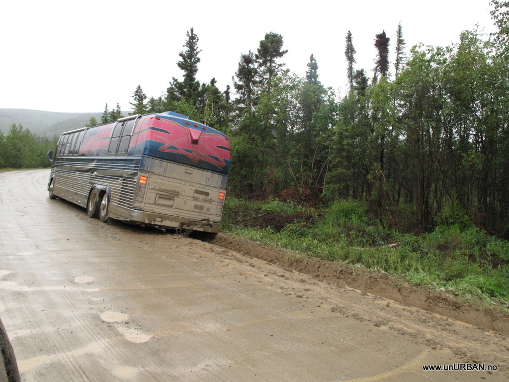
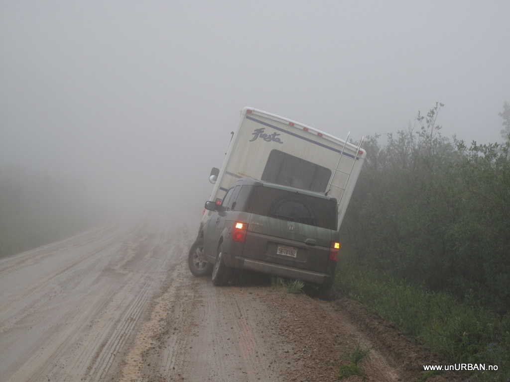
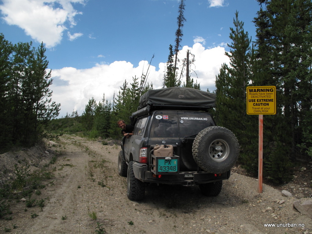
Going north we crossed into Alaska at Beaver Creek, so now we wanted to try another road and see Dawson City on our way south. Our only option was the Top of the world highway. We had been told the Top of the world highway is a beautiful drive, but we cannot really confirm that since we could only see 30 meters ahead of us. The most exciting part of the drive was passing RV’s that had driven off the road and needed help to get back up (but too heavy for our winch...).
4773217658_61089b58d6_b.jpg


4773217796_7cbbd8e785_b.jpg


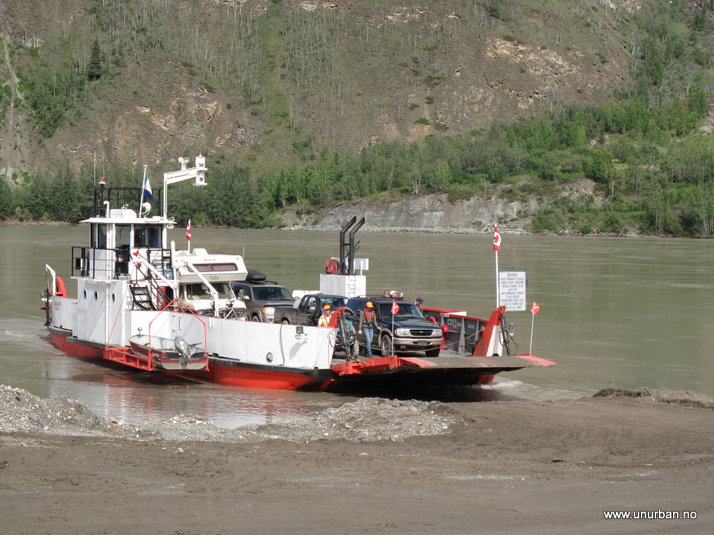
After a day in the fog we descended out of the fog and down to Yukon River were a small ferry took us across the river and into Dawson City.

4876586716_af8b7c3a90_b_d.jpg


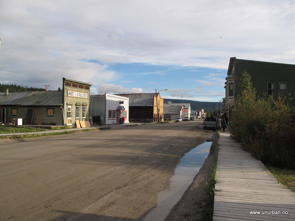
In Dawson we stayed at the campground in the city center so it would be easier to explore the really well preserved gold rush city. I like the detail about keeping almost all the streets as gravel roads.
4875978371_7f8a81cca9_b_d.jpg


The streets with wooden boardwalks and well restored houses gives the city a great atmosphere.
4875978081_0a5ba38d31_o_d.jpg


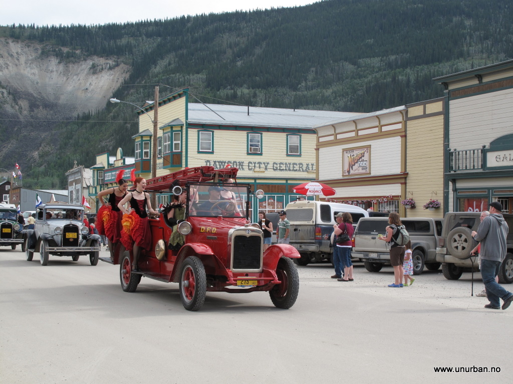
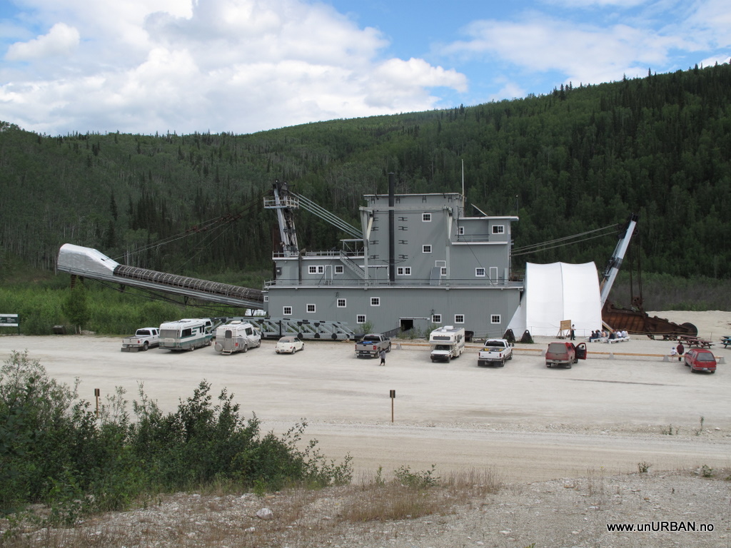
Our last day in Dawson was 1st of July, Canada Day, and there was a parade on Main Street, followed by a gold panning competition were the winner would travel to the gold panning world championship. While we were in Dawson, we had to see Bonanza Creek where the Gold Rush started. On the way to Bonanza Creek we passed Dredge number 4 that was the largest of all the dredged that was used to dig for gold.

4773321351_dc249736de_b.jpg


After a few days in the “city” we felt the need for some nature again and headed to Tombstone Provincial Park on Dempster Highway.

4876587996_da843a7298_b_d.jpg


We did a hike into Grizzly Lake were we spent a night before hiking out the same way again in changing weather (sun, hail, fog, and rain). On the way to Whitehorse we stopped by the Hot Springs were it was good to soak and relax after the hike. Back in Whitehorse it was time to give the car a good wash, sort out all the stuff we had brought with us that we have realized we do not need, packing our bags and fly home to Norway. In the summer it is a really good flight twice a week from Frankfurt to Whitehorse and Fairbanks, and for us it ended up to be the cheapest tickets and only 15 hours flight time to Norway, better than anything we could get from Calgary or Vancouver. To be continued....
 

unURBAN

Adventurer
Driving south!

And to get you up to date (almost..) on our trip south.... We are now back in Canada, and we will hopefully get our pics and bloggings under control :smiley_drive:

Driving south!
As you know, we went back home to Norway for two weeks for visiting family and friends, but are now back on the road. The 22nd of July we were back in Whitehorse, and kind of felt that the time home had been too short, but at the same time it was good to be back travelling again. We had scheduled some maintenance for our car at a local Nissan garage, mainly because I wanted to see if they could read the log of the engine’s ECU…which they couldn’t… They had the Consult3 reader, but the ZD30 engine was not in the database. S…! Really wanted to check the log after some sensor issues. The oil pressure switch is changed and dash warning light is gone, but I still haven’t figured out the loss in effect from a little altitude. Will definitely try the volt meter on the MAF one of the first few days.

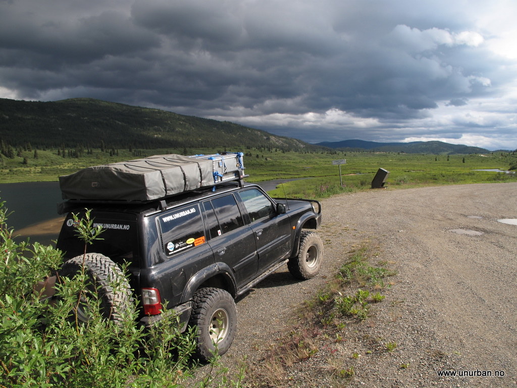
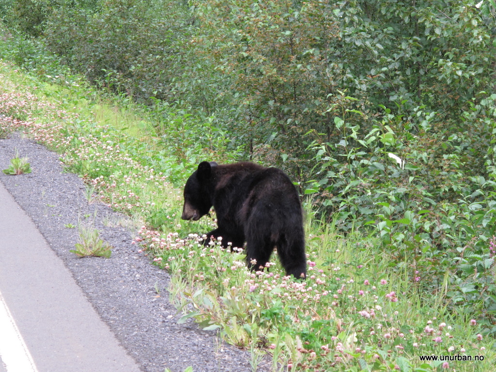
Well! From Whitehorse we drove pretty much as straight south as we could. Back east to Watson Lake, camped on the way, and drove south along the Highway 37. Saw 10 black bears along the way that day, even two cubs!

4861955091_3ed22f535c_b_d.jpg


4861953531_d573c2cebd_b_d.jpg


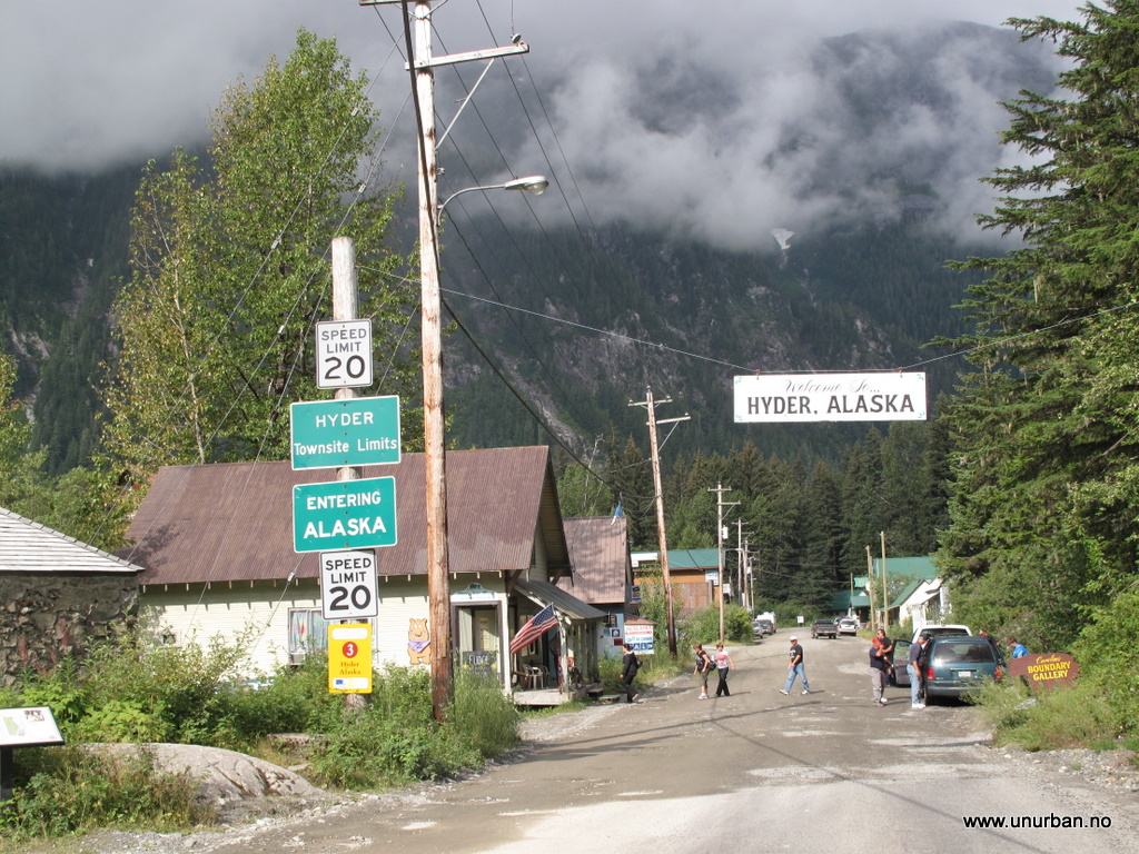
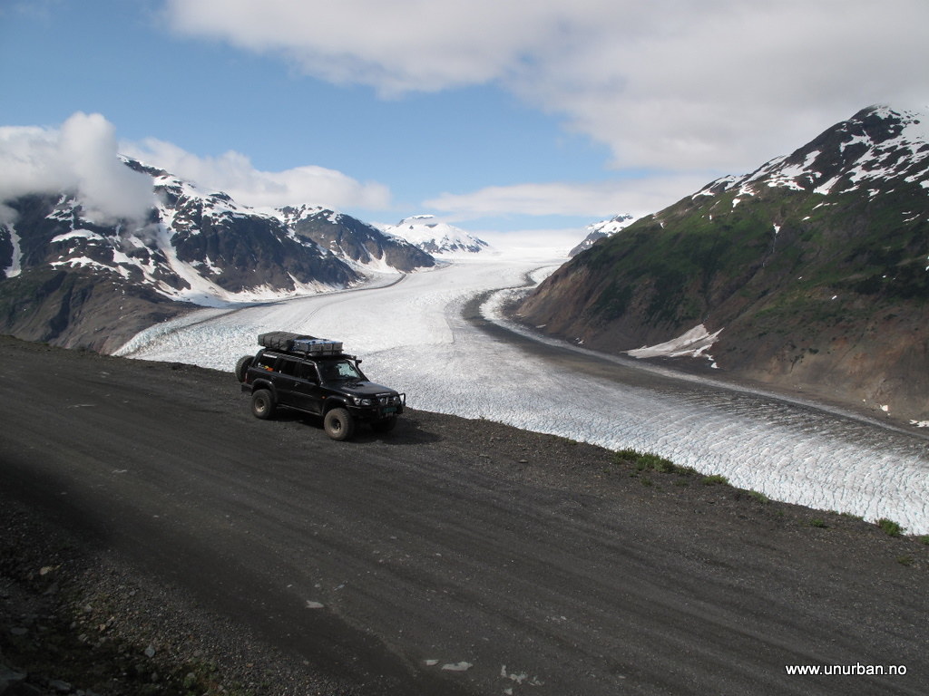
For the night we aimed for Stewart and Hyder on the coast, and got there quite late. We had read about Salmon Glacier and an excellent bear watching area, and the next day we went sightseeing. The glacier is fantastic, and there are a lot of possibilities for camping up past the glacier view point. We drove almost all the way down a dirt road to the glacier itself, but turned around where there was a piece missing from the road. Normally not a problem, but this missing piece was over a 30 meter cliff and the edge looked soft…

4861953843_87544cc336_b_d.jpg


4861953637_e5a23fa7af_b_d.jpg


4862573930_5cb214618f_b_d.jpg


Back down in Hyder we parked at the bear watching area, and as we parked a guy came over to us and said hi. It turned out that he was from Israel, and was on a holiday in US and Canada with his wife. The interesting part was that he told us that his friend from back home had asked him to keep an eye out for a black, Norwegian, Nissan Patrol, and where he had laughed it away with “US and Canada is big, I won’t see them”. And there we met. His friend is also a Nissan Patrol owner, and a well-known Patrol-enthusiast in Israel, and also on the Australian forum (patrol4x4.com) where I immediately recognized his name. Small world…

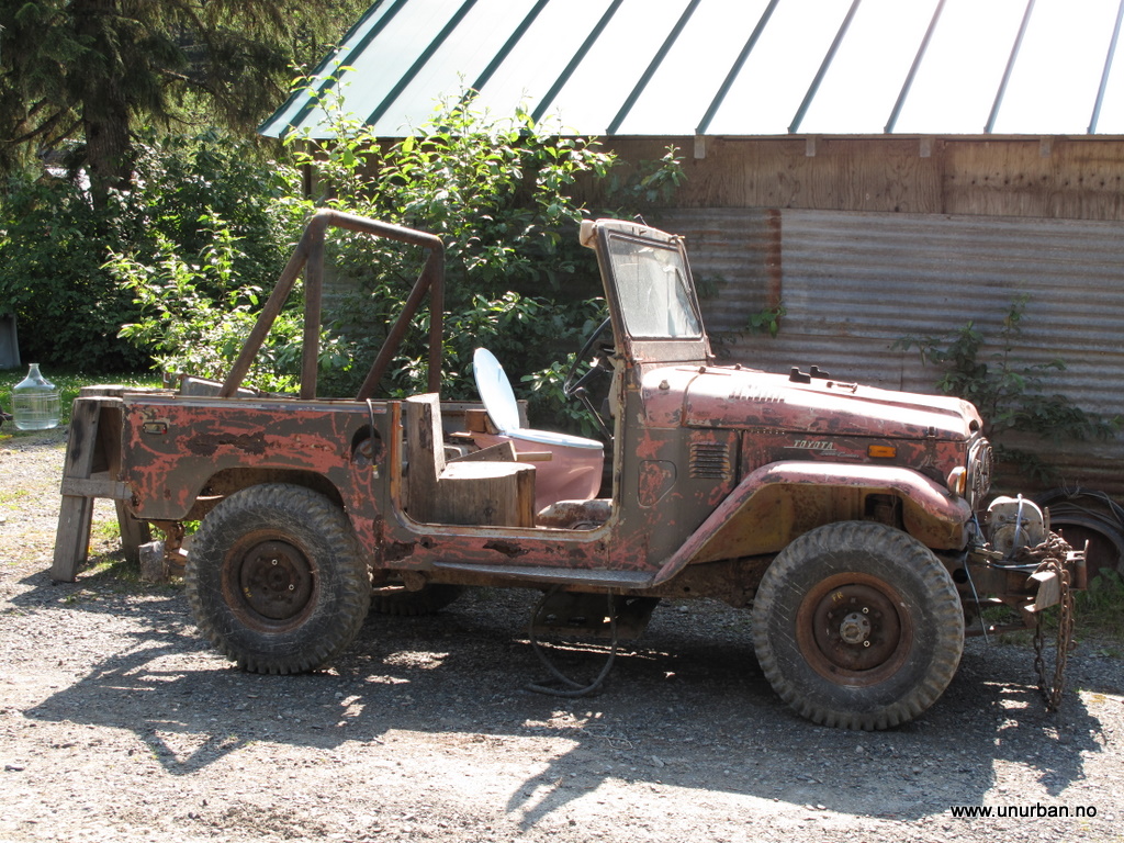
Came across this one in Hyder. Looked like it has had a long and interesting life. Was especially impressed with the drivers seat...

4862574332_46a779905f_b_d.jpg


Back in Canada (we actually crossed the border to Alaska to get into Hyder, before driving back into BC for a view of the Salmon Glacier) we kept going south, and we were quite fascinated of seeing the forest change from small “arctic-style” trees to the huge BC trees. We joined the highway coming from Prince Rupert, and suddenly we were back in the civilization. Cars and houses everywere. I think we felt a little claustrophobic… But we did manage to get away as we came across some old forestry maps! More about that in the next post!

E&M
 

98roamer

Explorer
wow, incredible trip report. We're glad to have to back on the road again.

The driver's seat is great, but they don't believe in lug nuts.
 

unURBAN

Adventurer
Backroads in BC

A big challenge for people travelling by car is that most maps, and all info in the Visitor Centers, are made with the average RV tourist in mind. In the long run, this gets really boring if you are driving a big Patrol with All- or Mud tires. Not that this would be an absolute requirement for most logging roads, but at least the view feels a little better. So, how to solve this little “problem”? By getting the old Forestry Maps! Not very accurate as the ones we got were discontinued in 1997, but that is part of the fun… Found the first maps in Burns Lake, and turned off the main road and headed for Francois Lake. Felt a little bad about going into active logging areas without a VHF, but had no problems. Another nice little detail about the Forestry Maps is that they show all the Forestry Camp sites, which are free!

4870199085_140953c28c_b_d.jpg


4870198761_b76eef0d62_o_d.jpg


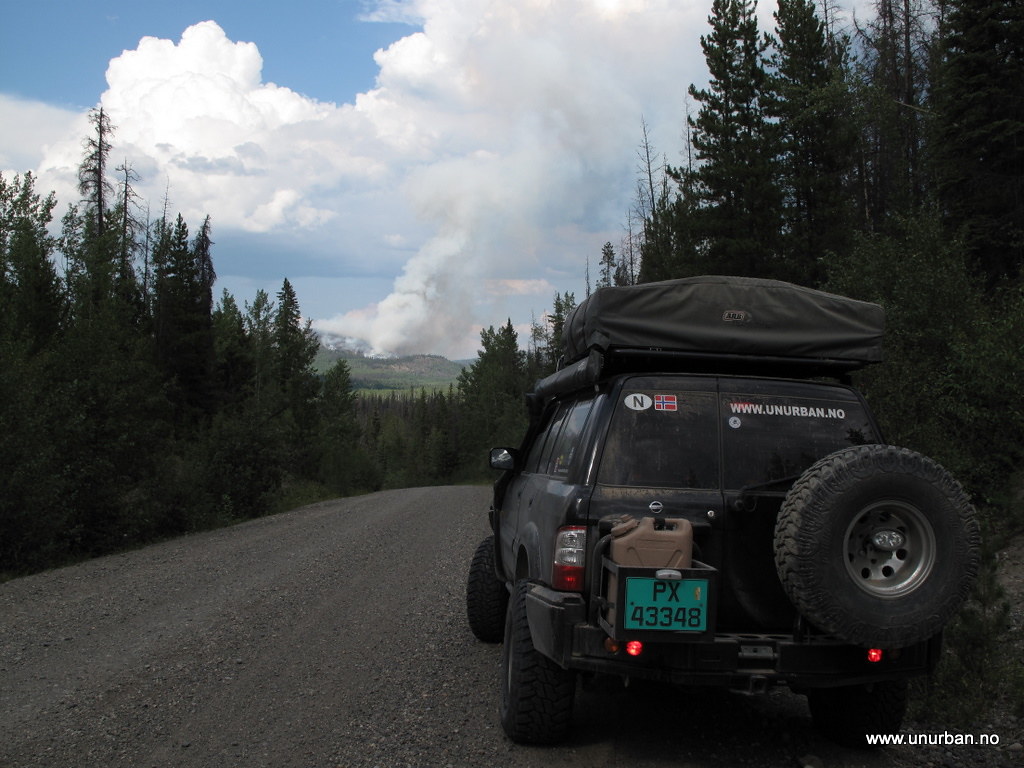
We spent the night at Ootsi Lake and studied maps and a thunderstorm passing the area. Missed the rain, and the view was fantastic! The next day we saw several places where black smoke came up from the forest where the lightning had hit and started fires. Still, it seemed that the local fire departments wasn’t too stressed out about it, and we heard that now the fires are not fought unless there is a risk for loosing people or infrastructure.

4870199719_5539499fd1_b_d.jpg


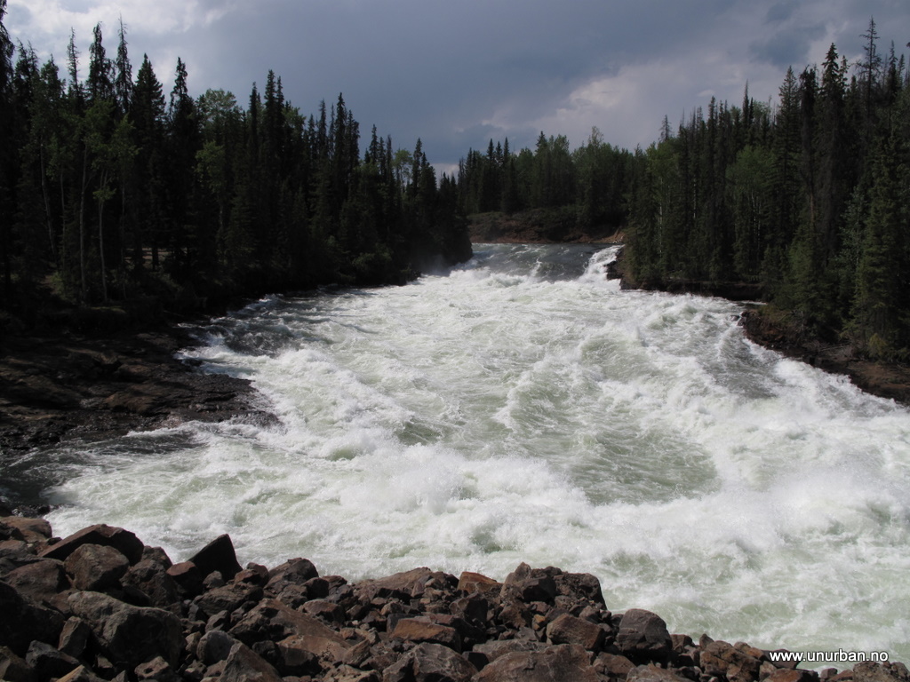
One of the things we wanted to see in the area was a man made water fall that runs out of the Francois Lake. After the Kenny Dam came up, a new “outlet” was made to be able to control the levels. Now the gates were wide open to provide cold water for the salmon moving up in the rivers downstream, and the amounts of water going through were massive! A retired fire fighter we met at the camp site told us that one inch drop in the water level, equaled about 2 billion liters of water (if I remember right…), and the level was down at least a couple of inches in the last 24 hours.


4870810608_882cfaf12a_b_d.jpg


4870810394_53fca2d979_b_d.jpg


Well! After poking around on logging roads between Burns Lake and Vanderhoof for a while, we got back onto the paved road and continued on to Lillooet, and there we took a detour going north up to Seton Lake and Anderson Lake. A fascinating scenery, and some incredibly steep switchbacks along the lakes in the area. I think the steepest was graded 18%. It was already dark when we came to Shalalth where we had planned to camp, and we could just not find the site. Drove on along Anderson Lake to D’Arcy and found a camp ground there. Glad I had the Cibies… The next morning we discussed going back up to have a look at the road and the area in daylight, but decided to push on towards Vancouver Island.

4870199945_267bcd4292_b_d.jpg


4870811716_dfbd94e831_b_d.jpg


4870811954_84fe4868fa_b_d.jpg


And that turned out to be a good decision. What we didn’t know was that it was a long weekend, and we showed up at Horseshoe bay for a ferry to Vancouver Island on an early Friday afternoon. The place was pretty much packed, but fortunately we didn’t have to wait too long. After about an hour we drove onboard the ferry. The problems started when we went looking for a camp site on the east coast of the island. Full, full, and full! Ended up close to Port Alberni where there was a Provincial Park with overflow camping in their parking lot. Finally on Vancouver Island!

4870812100_9420114c5e_o_d.jpg


More soon!
E&M
 

jpvm

Explorer
Marvelous pictures man !!
Love that Y61 , from the color up .... colleague !! :victory:

Keep us posted !
 

unURBAN

Adventurer
Thanks for comments!!
And thanks, JP, for inspiration ;-) Hope to look you up when we get to Chile. Drive safe!

Espen
 

joy

Observer
Hi Espen

Hi Espen,

Sent you a privet message earlier.
Was very excited to hear about your short meeting with my friend - Rami and Dorit.
It is a small world, and it is amazing to hear stories like these.
Keep having fun and updating us - you are having a great adventure.

Joy
 

Forum statistics

Threads
188,001
Messages
2,900,874
Members
229,233
Latest member
cwhit5
Top