I have been researching the trip and the mileage to the town of Deadhorse AK via the Dalton highway.
Connects: Elliott Hwy to Deadhorse, AK
Route#: Alaska Route 11
Length: 415 miles
Road Surface: 25% Paved, 75% Gravel
Season: Open all year
Highest Pass: Atigun Pass, elev. 4,800 feet
MILE 0 Junction with Elliott Highway .
MILE 56 Yukon River Camp; food, gas, lodging. BLM Visitor Contact Station and Yukon River viewpoint.
MILE 60.3 Hot Spot Café and Arctic Circle Gifts (email); food, lodging, gift shop. Mile 60 BLM campground and dump station.
MILE 98.1 Finger Mountain BLM Wayside; day-use only rest area with walking path to tors.
MILE 115.5 Arctic Circle BLM Wayside; picnicking, Arctic Circle monument, camping.
MILE 135.7 F 219.7 D 279.3 Prospect Camp, turnout with informal camping.
MILE 150.2 Grayling Lake Wayside; day-use only rest area.
MILE 174.8 COLDFOOT (pop. 12); gas, diesel, food, lodging at Coldfoot Camp. Arctic Inter-agency Visitor Center.
MILE 175 Coldfoot Airport. Alaska State Troopers and Dept. of Transportation to the west.
MILE 179.7 Marion Creek BLM Campground.
MILE 188.6 Turnoff for WISEMAN (pop. 16); Wiseman Historical Museum. Lodging at Arctic Getaway Cabin & Breakfast, Boreal Lodging (Boreal Coffee & Gifts) and Wiseman Gold Rush Camp B&B.
MILE 244.7 Atigun Pass, elev. 4,800 feet, in the Brooks Range, highest highway pass in Alaska.
MILE 274.7 Galbraith Camp (no services); undeveloped public campground with outhouse.
MILE 354.6 Last Chance Wayside; day-use only rest area.
MILE 412.8 Deadhorse Camp; lodging, restaurant, gas, tire repair. Arctic Ocean tours (24-hour advance reservation and ID required).
MILE 414 End of Dalton Highway at DEADHORSE/PRUDHOE BAY; food, gas, lodging. Deadhorse Camp offers lodging, restaurant and Arctic Ocean tours.
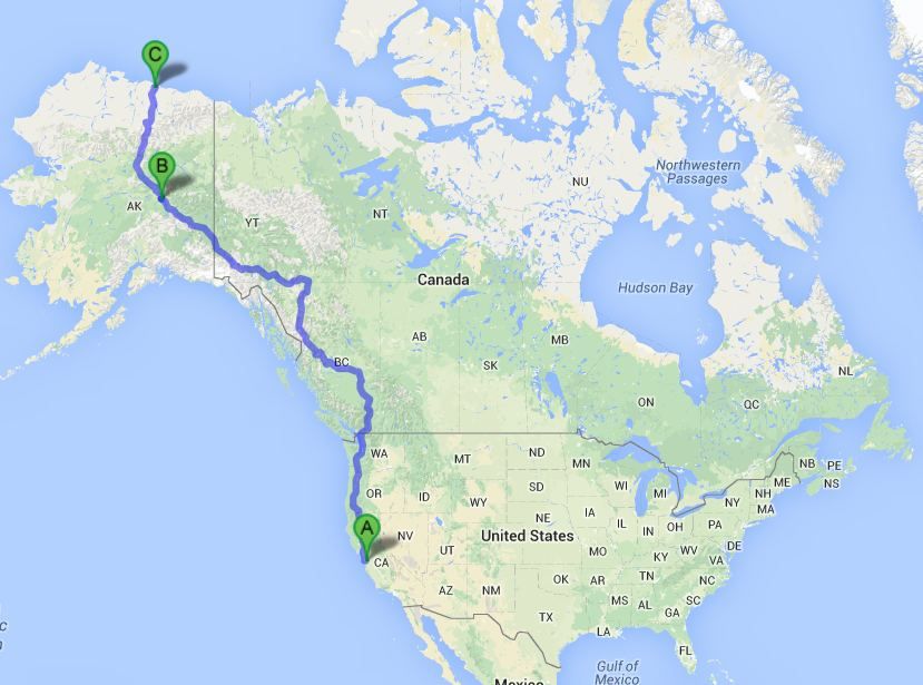
it is 3500 miles one way from San Jose CA to Deadhorse.
here are some of the resources I have found.
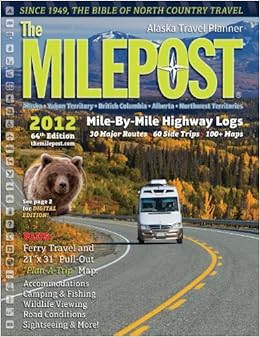
The milepost magazine
Dalton Highway - The MILEPOST
The magazine comes out yearly and list all mile post along the Alaskan highway.
I bought an older copy from eBay just for planning/dreaming purposes.
Great PDF's of the Dalton Highway can be found here.
It breaks the map onto two sections that are large.
http://www.blm.gov/style/medialib/blm/ak/fdo/maps_and_documents.Par.65162.File.dat/Daltonmaps.pdf
Here is a smaller map of the complete Dalton Highway.
Good driving tips for driving a rock and gravel Dalton Highway
BLM Alaska: Dalton Highway - Tips for hunters
What is the best time to drive the Dalton Highway?
June: a lot of mosquitoes, muddy and slick sections due to late breakup make it a little more challenging in May and June; long daylight is a plus already early in the season.
July: the road is drier, long daylight hours make driving easy; there are less mosquitoes by the end of July
August: less mosquitoes, it can be dry or rainy (August generally has more rainy days than July); fog in the early morning hours around Atigun Pass can be very thick be the end of August. Always check the road conditions before you drive.
September: conditions are usually pretty good until mid of September, although snow storms are possible, especially around Atigun Pass. Almost no mosquitoes anymore but it gets dark at night
October - April: winter conditions
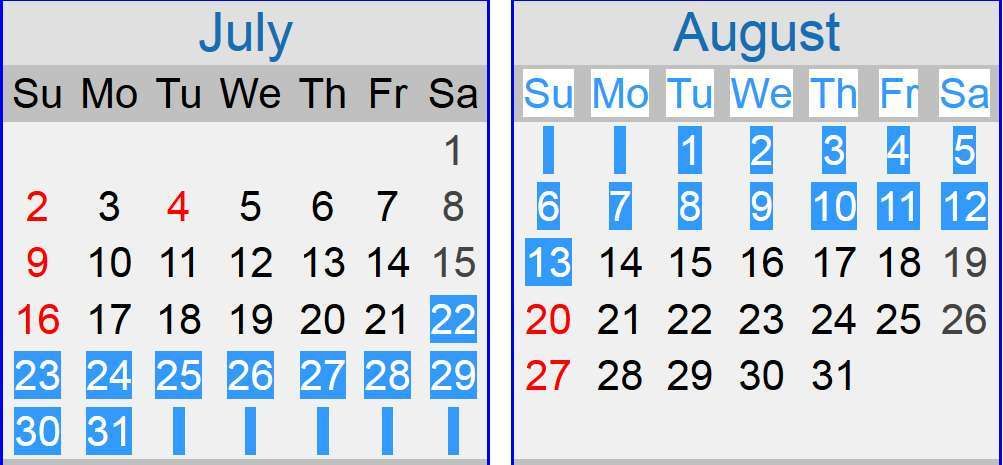
2017 Calendarhttp://www.thenewx.org/forum/usercp.php
23 days total
15 business days
mosquito's are on the wain.

Current List.
Contact/N0. NAME CITY STATE HAM license PASSPORT
C1 chrishaynesusa San Jose California yes YES
C2 snelltaylor Los Gatos California yes YES
C3 grelliott Sacramento California yes YES
C4 LNXPenguin Oakland California Yes ?
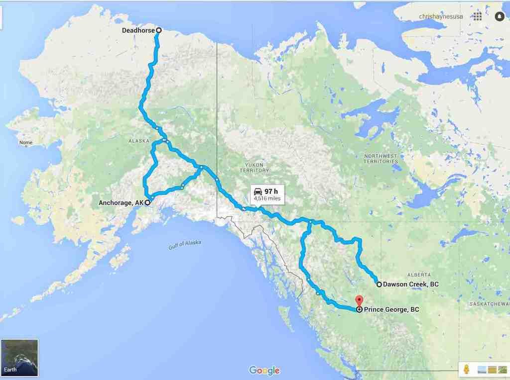
This is a proposed route.
I am still working on daily destinations but generally I want to do between 300-350 miles per day.
The proposed route has a length of 4516 miles total(excluding your access mileage to start and finish points).
4516 miles / 15 days = 301 ish...../ per day.....
MEETING PLACE: Dawson Creek, British Columbia. Canada
NorthernDestination: Deadhorse Alaska USA
Southern Destination: Anchorage Alaska USA
Finish point: Prince George, British Columbia, Canada
Dawson Creek starts the Alaskan highway and offers highway access from mid to south central United States of America.
Prince George as a finish point offers some new vistas while still offering access to the mid to south central routes that accessed Dawson creek, namely CA16 access to Edmonton, Alberta, Canada.
Daily destinations in rough form look like this.
First table is four days to get to Dawson Creek From my locati of San Jose California.
Your mileage may vary 
DAY Driving Mileage Location Activities
Saturday 22st July drive to Grants pass 424miles
Sunday 23nd Drive to Seattle 418 miles
Monday 24rd Drive to Prince George Canada 558 miles
Tuesday 25th Drive to Dawson creek Canada 250 miles
Second table is the trip itself.
still in work to smooth out daily mileages.
DAY Driving Mileage Location Activities
Wednesday26th Drive to Tetsa River Rgnl Park Canada 341 miles
Thursday 27th Drive to Rancheria Lodge Canada 334 miles
Friday 28th Drive to Kluane Lake Canada 351 miles
Saturday 29th Drive to Delta Junction Alaska 338 miles
Sunday 30th Drive to Fairbanks Alaska 95 miles
Monday 31st Drive to Coldfoot Aklaska 254 miles
Tuesday 1st August Drive to Deadhorse Alaska 241 miles
Wednesday 2nd Drive to Coldfoot Alaska 241 miles
Thursday 3rd Drive to Fairbanks Alaska 254 miles
Friday 4th Drive to Anchorage Alaska 358 miles
Saturday 5th Drive to Tok Aklaska 321 miles
Sunday 6th Drive to Haines Junction Canada 296 miles
Monday 7th Drive to Nugget City Canada 353 miles
Tuesday 8th Drive to Meziadin Junction Canada 351 miles
Wednesday 9th Drive to Prince George Canada 397 miles
Last four days is get back home time, for me this is to San Jose California.
Your mileage may vary 
DAY Driving Mileage Location Activities
Thursday 10th Drive to Kamloops Canada 327 miles
Friday 11th Drive to Seattle Washington 289 miles
Saturday 12th Drive to Medford Oregon 446 miles
Sunday 13th Drive to San Jose California 395 miles
another good read..
The Alaska Canada Highway | Guide | Road Trip Planner | AlCan | Photos
Alaska's Dalton Highway Road Trip | Fairbanks | Deadhorse | Driving
