maxingout
Adventurer
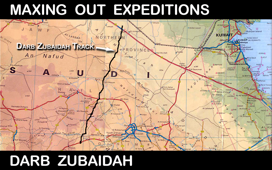
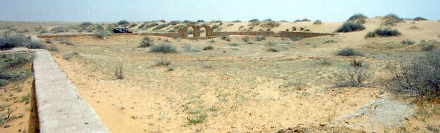
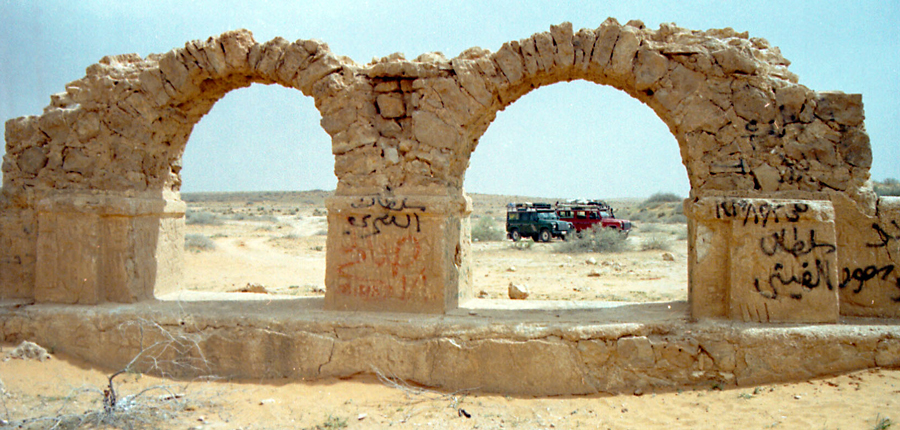
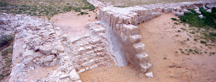
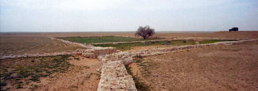
More than a thousand years ago, Queen Zubaidah from Iraq built an eighteen meter wide pilgrim road from Baghdad to Mecca. The road was called the Darb Zubaidah, and millions of pilgrims walked this road on their journey to perform Hajj in the holy city of Mecca.
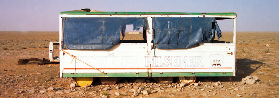
The trip to Mecca was arduous and fraught with danger. Pilgrims died of thirst and encountered hostile tribes during their overland trek. They paid tribute to tribes along the way in return for safe passage and fodder for their animals. It wasn't a journey for the faint of heart. Lucky pilgrims traveled in the company of military escorts, but for most it was a solitary adventure. You were on your own. There weren't any tour companies to guarantee a safe trip.
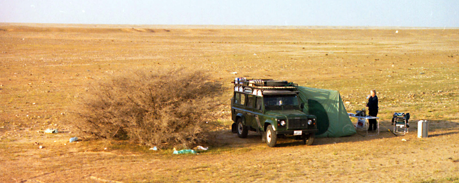
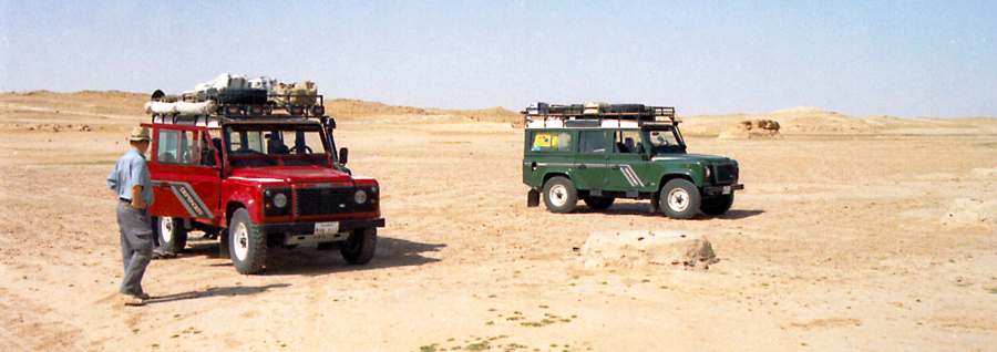
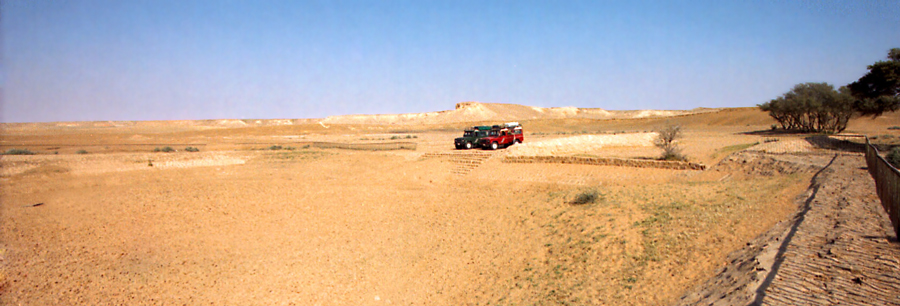
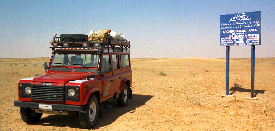
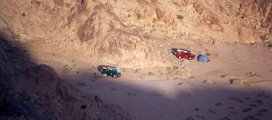
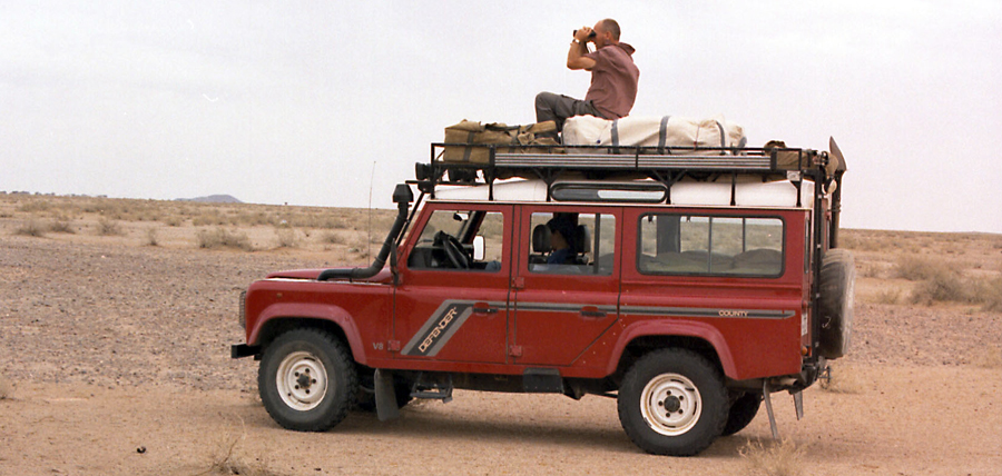
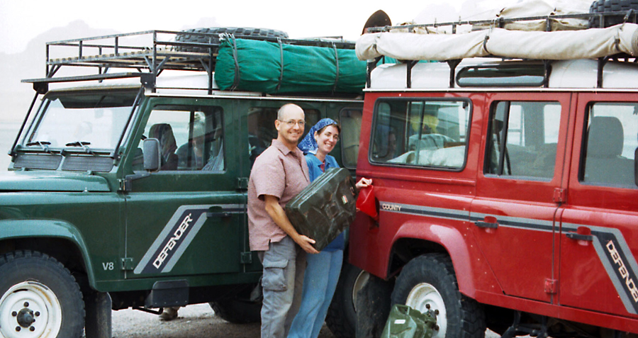
We decided to follow the Darb Zubaidah from the Iraqi border to Mecca. We calculated the distance and felt we could complete the trip in a week in our Land Rover Defender 110 expeditionary vehicles. We carried enough fuel and water for the entire trip. Our Defender carried 430 liters of fuel in long range fuel tanks and thirteen jerry cans. We had two hundred liters of water and enough food to last for weeks.
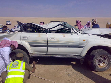
A trip of this nature requires at least two capable off-road vehicles to provide back up in the event of mechanical failure. I carried spare parts worth several thousand dollars - starter, water pump, belts, electronic spares, and lots of little bits and pieces.
After leaving Riyadh, we spent a day driving up to the Iraqi border close to the town of Rafha. We headed off-road just north of Rafha being careful to not cross over the border into Iraq.
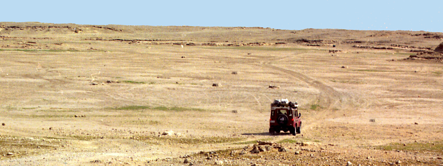
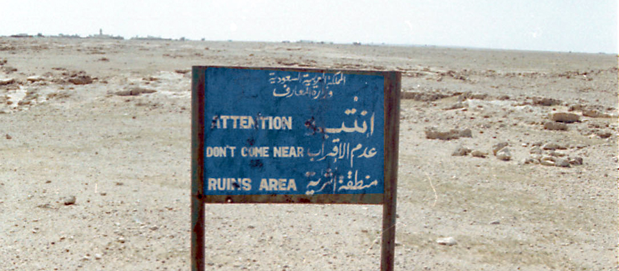
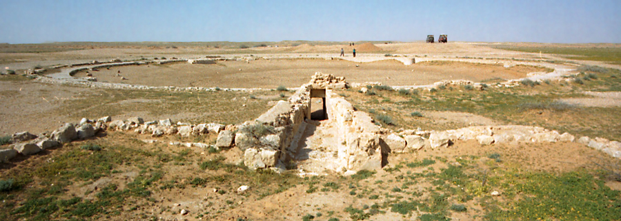
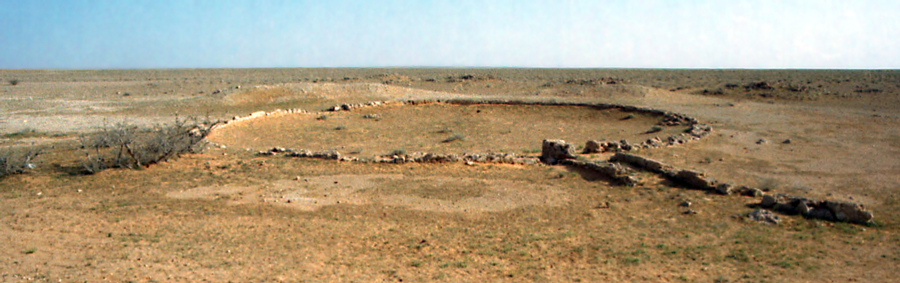
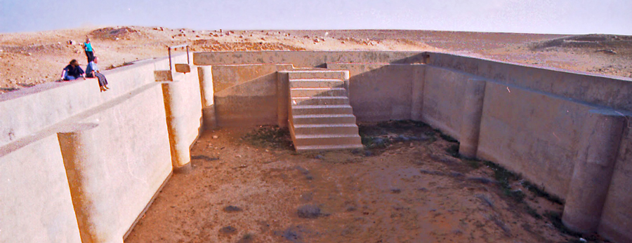
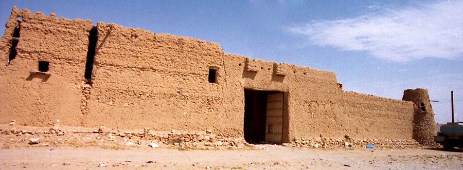
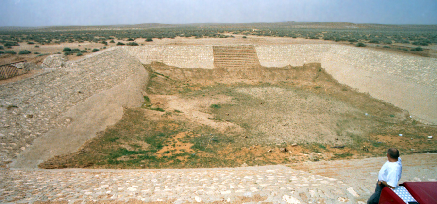
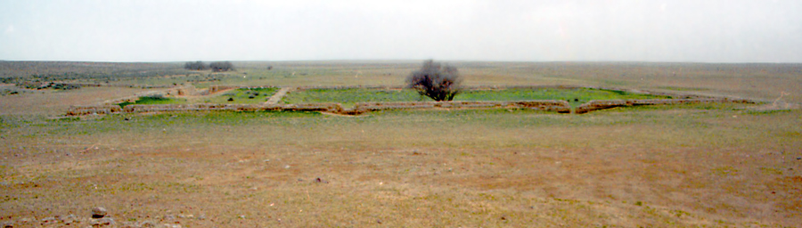
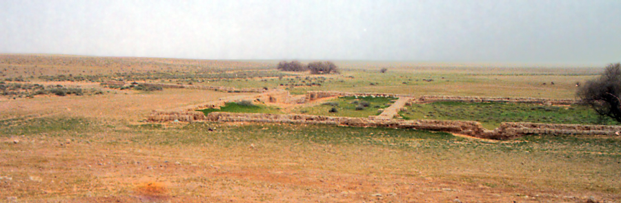
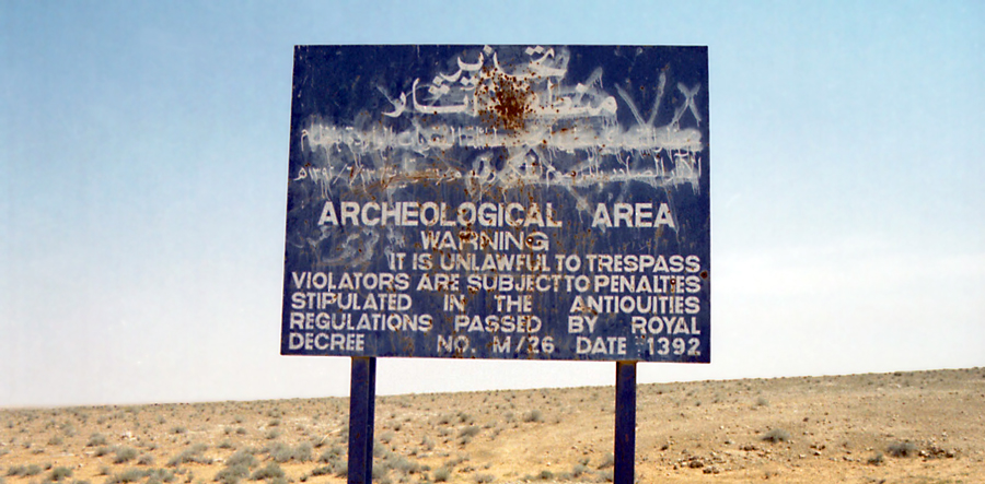
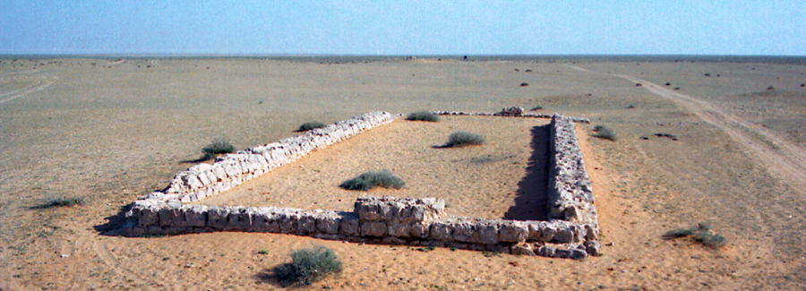
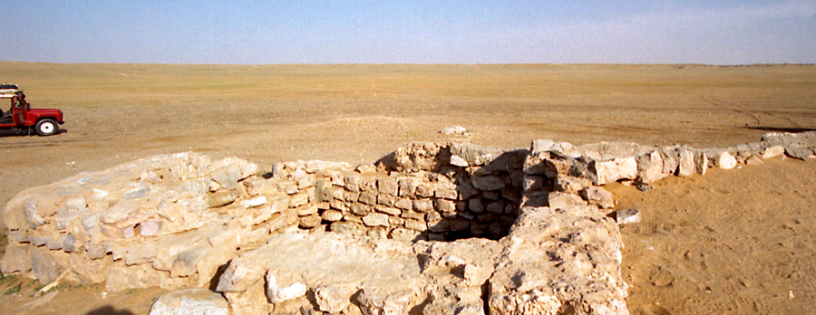
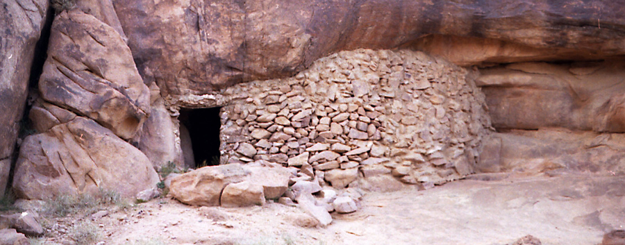
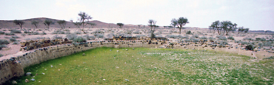
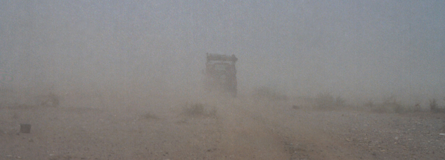
Driving the Darb Zubaidah presents significant challenges, not the least of which is the fact that there are no maps that show the exact route. We had a general idea of the location of the Darb, and we had some waypoints of dubious accuracy for a few stops along the way. A publication from the Antiquities museum revealed important details about the Darb. We read about the pilgrim stations and birqats along the way. What we did not know was their exact location.
Part of the adventure was using our navigational skills and common sense to follow the Darb. This was a make it up as you go exploration of the pilgrim route. It was an expedition worthy of the name. We didn't know exactly where we were going, and we didn't know what we were going to find, but we knew it would be a great adventure.
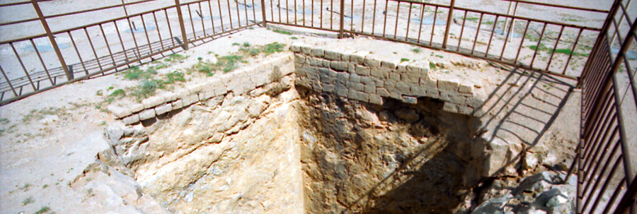
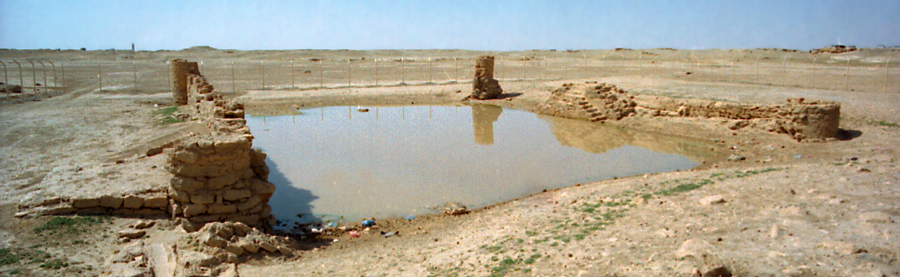
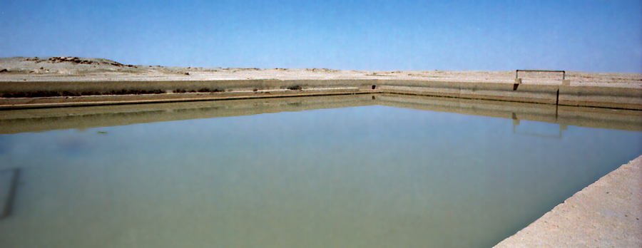
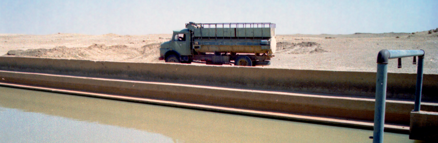
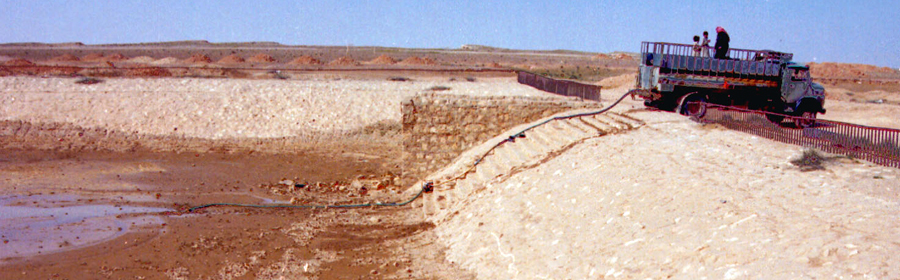
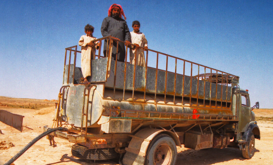
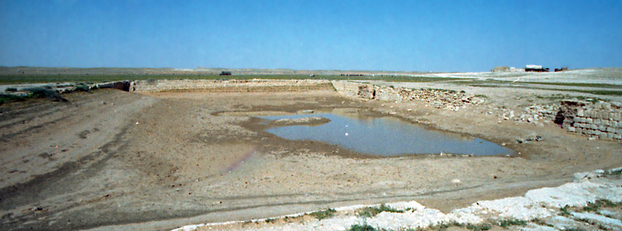
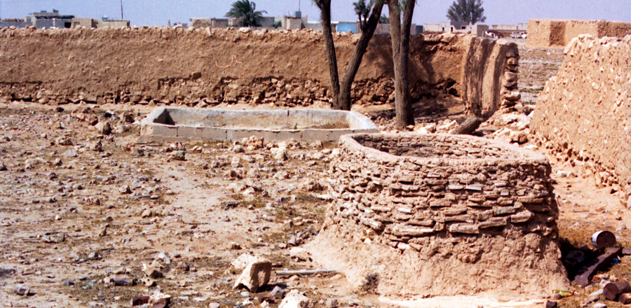
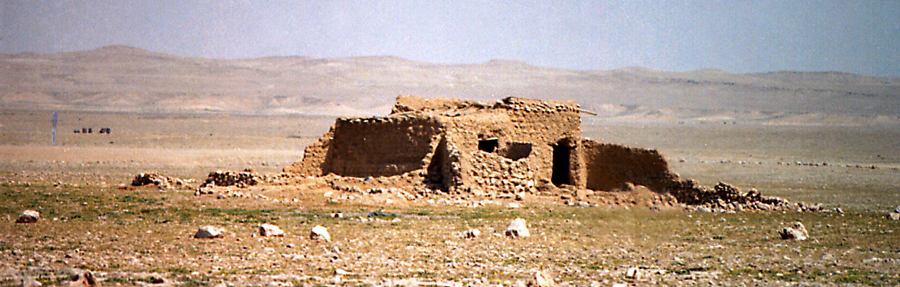
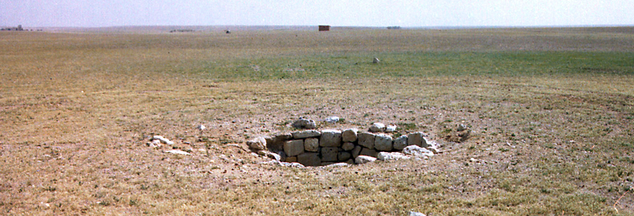
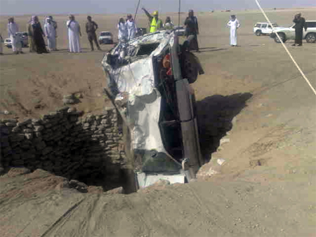
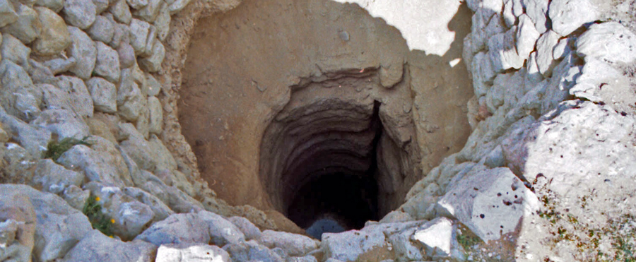
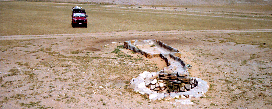
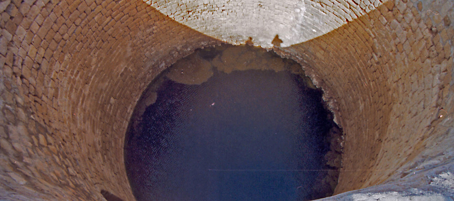
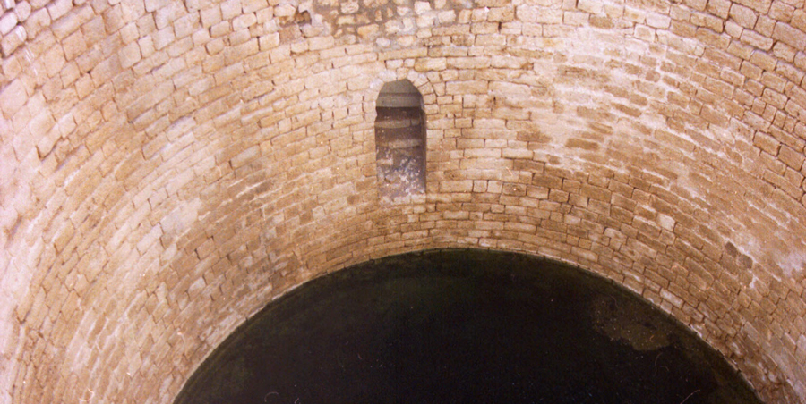
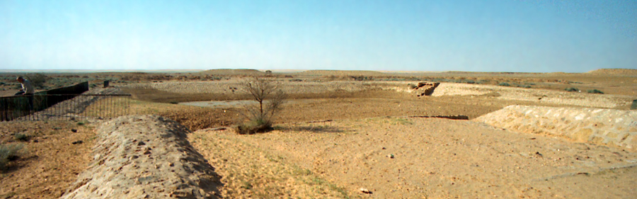
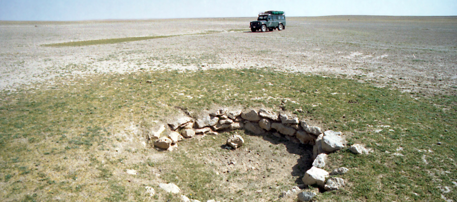
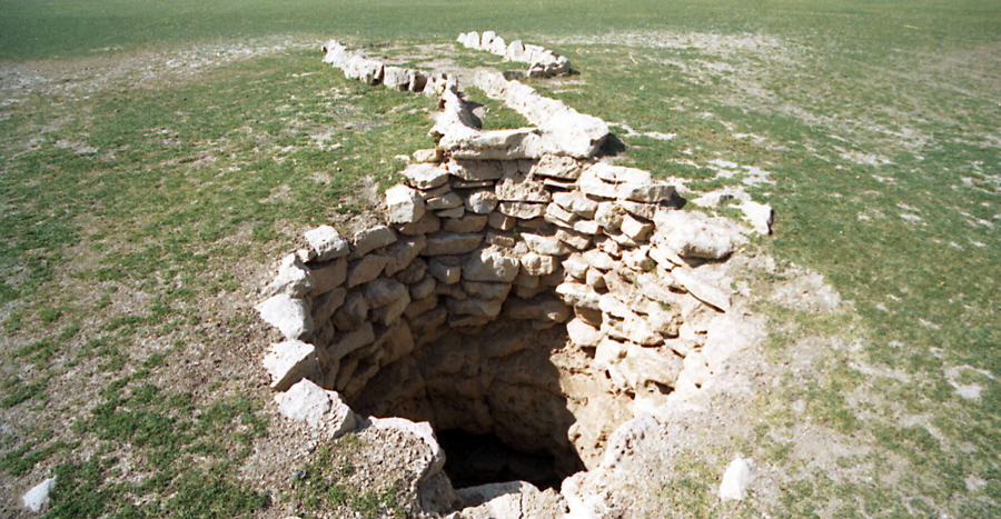
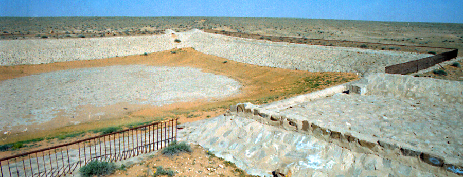
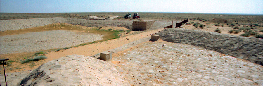
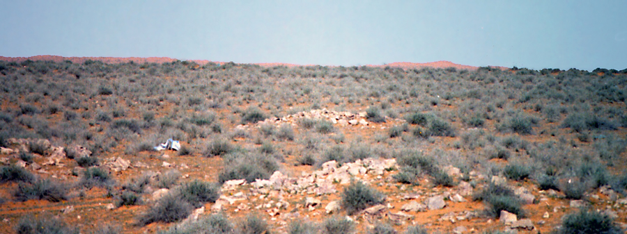
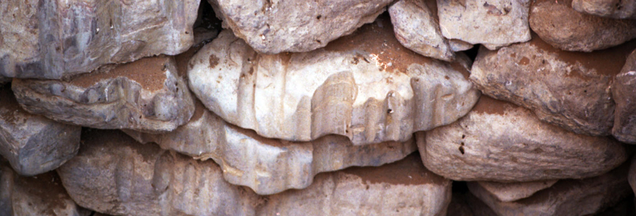
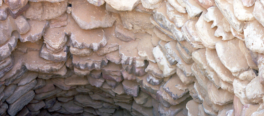
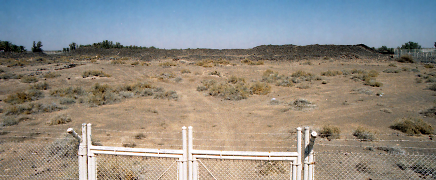
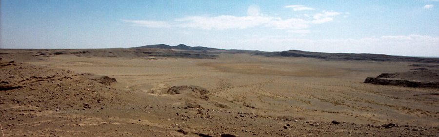
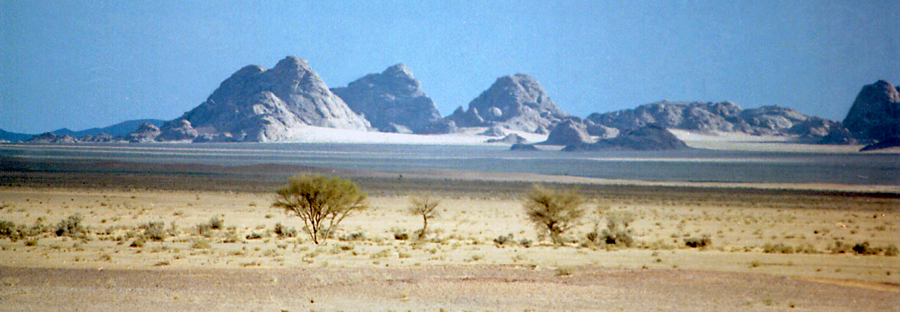
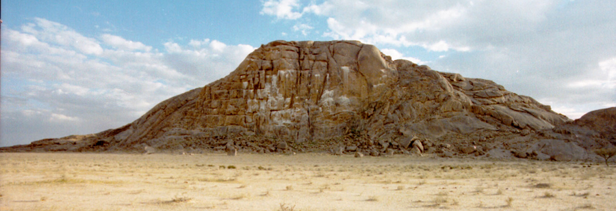
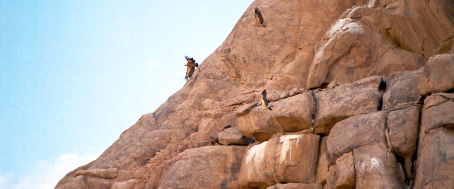
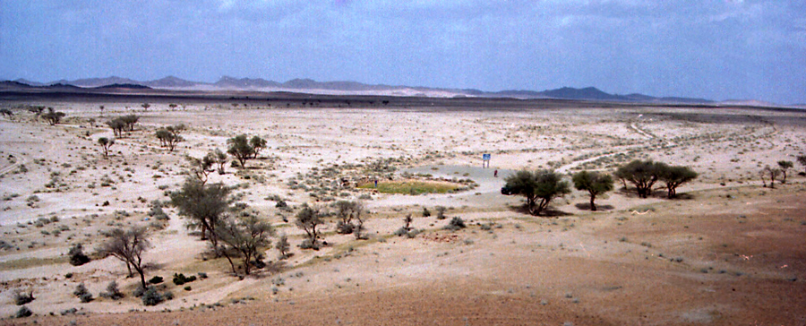
Even though we didn't know the route, we had one major factor in our favor. Pilgrims on the Darb Zubaidah could only survive by following the water trail. Most of them traveled on foot, and they had to reach a source of water every couple of days, or they would die. That meant that if we followed the wadis (dried up river beds), and found the low lying area along the route, we would also discover the shallow wells and birqats that supplied water to the pilgrims.
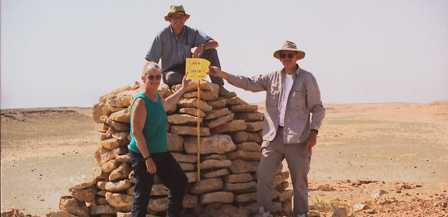
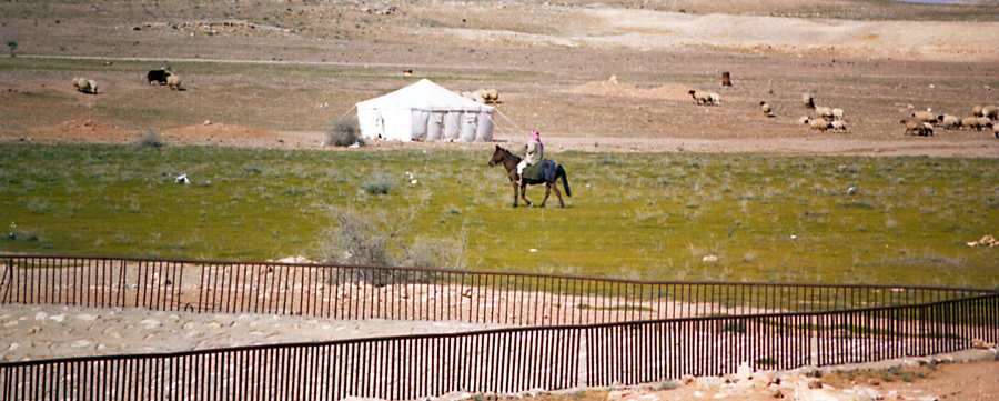
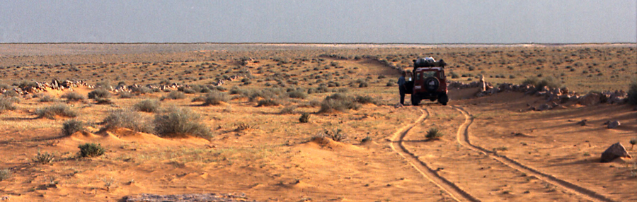
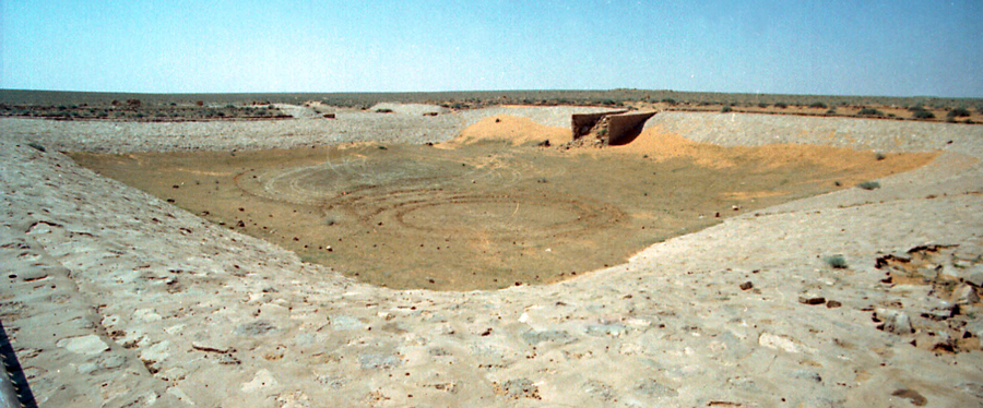
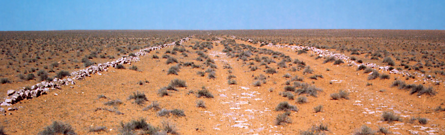
The Saudi department of antiquities placed blue signs intermittently along the route, and we often stood on our roof rack searching for blue signs with our binoculars. When we lost our way, the blue signs got us back on track. On lucky days, we actually drove down the eighteen meter wide Darb. It was awesome to actually drive on the same track that millions of pilgrims used for more than a thousand years.
Part of the fun of this type of expedition is solving the navigational problems associated with the journey. Most of the time, we followed desert tracks or navigated cross country going from birqat to birqat. Just because you don't know the location of the next pilgrim station or birqat doesn't mean you are lost. It simply means you must use your common sense and look at the lay of the land to figure out how to proceed in order to discover the next birqat.
Visit http://MaxingoutExpeditions.com to see the pictures and story.
Enjoy
The trip to Mecca was arduous and fraught with danger. Pilgrims died of thirst and encountered hostile tribes during their overland trek. They paid tribute to tribes along the way in return for safe passage and fodder for their animals. It wasn't a journey for the faint of heart. Lucky pilgrims traveled in the company of military escorts, but for most it was a solitary adventure. You were on your own. There weren't any tour companies to guarantee a safe trip.
We decided to follow the Darb Zubaidah from the Iraqi border to Mecca. We calculated the distance and felt we could complete the trip in a week in our Land Rover Defender 110 expeditionary vehicles. We carried enough fuel and water for the entire trip. Our Defender carried 430 liters of fuel in long range fuel tanks and thirteen jerry cans. We had two hundred liters of water and enough food to last for weeks.
A trip of this nature requires at least two capable off-road vehicles to provide back up in the event of mechanical failure. I carried spare parts worth several thousand dollars - starter, water pump, belts, electronic spares, and lots of little bits and pieces.
After leaving Riyadh, we spent a day driving up to the Iraqi border close to the town of Rafha. We headed off-road just north of Rafha being careful to not cross over the border into Iraq.
Driving the Darb Zubaidah presents significant challenges, not the least of which is the fact that there are no maps that show the exact route. We had a general idea of the location of the Darb, and we had some waypoints of dubious accuracy for a few stops along the way. A publication from the Antiquities museum revealed important details about the Darb. We read about the pilgrim stations and birqats along the way. What we did not know was their exact location.
Part of the adventure was using our navigational skills and common sense to follow the Darb. This was a make it up as you go exploration of the pilgrim route. It was an expedition worthy of the name. We didn't know exactly where we were going, and we didn't know what we were going to find, but we knew it would be a great adventure.
Even though we didn't know the route, we had one major factor in our favor. Pilgrims on the Darb Zubaidah could only survive by following the water trail. Most of them traveled on foot, and they had to reach a source of water every couple of days, or they would die. That meant that if we followed the wadis (dried up river beds), and found the low lying area along the route, we would also discover the shallow wells and birqats that supplied water to the pilgrims.
The Saudi department of antiquities placed blue signs intermittently along the route, and we often stood on our roof rack searching for blue signs with our binoculars. When we lost our way, the blue signs got us back on track. On lucky days, we actually drove down the eighteen meter wide Darb. It was awesome to actually drive on the same track that millions of pilgrims used for more than a thousand years.
Part of the fun of this type of expedition is solving the navigational problems associated with the journey. Most of the time, we followed desert tracks or navigated cross country going from birqat to birqat. Just because you don't know the location of the next pilgrim station or birqat doesn't mean you are lost. It simply means you must use your common sense and look at the lay of the land to figure out how to proceed in order to discover the next birqat.
Visit http://MaxingoutExpeditions.com to see the pictures and story.
Enjoy