Arizona Traverse: Who will be the first moto to complete the route?

RHINO

Expedition Leader
i am quite interested in riding the traverse, this oportunity is just icing on the cake. for me to seriously consider it i would need to get the route so i can plan fuel stops or go put fuel cashes out there, 140 mile dirt range is about max for my scoot.

it would be cool if the first moto to do it was from as unlikely a source as an ATK605.


photobucket-23372-1311480926377.jpg
 

Clutch

<---Pass

syke

Adventurer
Is that the official "traverse" route excluding Flag to the Grand Canyon?

"Should" only take 1.5-2 days on a bike. Might be cool to push on through the night see if you can do it in under 24 hours.:sombrero:

There are so many moto trails in that region, be a shame not to hit them...that I could see taking 7 days.

It shares the same name, but past that I'm not sure if it is official or not. Scott will have to speak to that.
 

LtFuzz

Explorer
Yeah, that's the one I assumed he was talking about.

I guess we're all waiting to hear from Scott and see who gets the nod (?) :sombrero:
 

rokklym

One Man Wolfpack
I would love to do this with my adventurized WR250R. I'm a photographer and have written articles for magazines before. Finding the time to do it might be tough, but not impossible. I'm pretty sure a small crew from this area could be organized for this ride.
 
Last edited:

Scott Brady

Founder
Hey all,

I am back in the office and am nursing a banged-up foot from riding this weekend- FUN!

This is a unique traverse, and was just completed for the first time a few weeks ago (by 4wd and we still did not cover every section). The route starts in Yuma and goes all the way to the MEX border wall in the Tinajas Altas. I really think it will take 7-10 days on a bike if you stop to take some nice photos and video and don't ride at night.

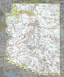
I have attached a map of the basic route. We are still compiling the tracks from the last run. Oct. or Nov. would be a perfect time to do this.
 

Attachments

  • AZ_Traversa.jpg
    AZ_Traversa.jpg
    787.2 KB · Views: 121

lstzephyr

wanderer
I would be all about this if I still lived in Tucson, Az but unfortunately I don't anymore. Too bad really, I always can find time, but money is hard to find sometimes.

Then I could say I had been paid for my photography/writing/traveling. Oh well, someone else will do it I'm sure.
 

Czechsix

Watching you from a ridge
Hey all,

I am back in the office and am nursing a banged-up foot from riding this weekend- FUN!

This is a unique traverse, and was just completed for the first time a few weeks ago (by 4wd and we still did not cover every section). The route starts in Yuma and goes all the way to the MEX border wall in the Tinajas Altas. I really think it will take 7-10 days on a bike if you stop to take some nice photos and video and don't ride at night.

I have attached a map of the basic route. We are still compiling the tracks from the last run. Oct. or Nov. would be a perfect time to do this.

Scott, bummer about the foot, but it's all part of the game..

Will be you posting the tracks or a .kml once you develop it? Looking at the rough map, I'm still interested, but I still need to see a definite track (like I'm sure everyone else does) before I'd pull the trigger and say yes, I'm in.

Looks like a great run though, so far!
 

toddz69

Explorer
The last segments of the Arizona Traverse are coming together and we finally completed the route to the Grand Canyon
299030_10150427020473275_640113274_10950671_5124595_n.jpg


Judging by the route map that was posted, I'm curious if this photo was taken near the South Bass trailhead? That was my guess when I first saw the photo but the Canyon view doesn't look quite right.

Todd Z.
 

Christophe Noel

Expedition Leader
What about a dude on a bicycle from Prescott.:bike_rider:

Seriously, what's the route like from say Williams. I could ride to Williams in no time at all.
 

Scott Brady

Founder
Will be you posting the tracks or a .kml once you develop it? Looking at the rough map, I'm still interested, but I still need to see a definite track (like I'm sure everyone else does) before I'd pull the trigger and say yes, I'm in.

That is part of the deal unfortunately. This route is still very raw and we need some feedback from those doing it. We have a 4wd team leaving in Oct for the Expoordition.

So we will not publish the full .kml / .gpx until we have a few runs on the completed route.

I think the map and mileage estimates should be enough for someone to be willing to commit the time.

There are really only 3-4 segments that will give the big bikes some grief. One is a boulder-strewed section of trail and the other includes some long, loose climbs with ledges. I have done most of it with the KTM950 and it kicked my tail pretty good, and that was with a tuned S suspension and full-blown knobbies.
 

Forum statistics

Threads
185,814
Messages
2,878,472
Members
225,352
Latest member
ritabooke
Top