The Map is Not the Territory: A Northern Maine Adventure

achampagne

Explorer
I love this pic of the Franconia Notch, I bet its taken from the last bridge crossing over Rte 3 right before you enter the notch.
franconia%252520notch.jpg
 

epicxcrider

Observer
The Wind Farm
Back out on the logging roads, there was another challenge ahead of us - where do we go? Nothing was marked and the GPS & Atlas were both wrong. Roads change so fast in logging country - what was a road on the map is now a skidder trail strewn with CV boot and brake line ripping sticks. .

slash.jpg

Dirt paths led in unknown directions. We tried heading North but the road ended in another skidder trail, Southeast it would have to be. Continuing down the “road” with the most recent traffic we seemed to be heading in the right direction - East. The new goal was to intersect with Phillips Brook Road which would wind us through the mountains to RT 26 - back on track.

IMG_7483.JPG

The logging road began winding left and right and gradually getting steeper downhill until we came around a sharp left hand corner... all we could say was WOW.

IMG_7478.JPG

Josh and I skidded to a stop to get out and take in the amazing view of the mountains in front of us. The logging road stretched out and down into the valley below, a small ribbon winding into the forest.

IMAG0443-1.jpg

My photos do not do justice to this view​

The view really was incredible and we all took the opportunity to snap a few photos before descending off the mountain.

IMG_7481.JPG


IMG_7486.JPG

Picking up a considerable amount of speed, Josh and I wound our way down the nicely graded logging road - slowing only for the blind corners and unknown intersections.

Wind%252520Farm.jpg

Eventually we found ourselves at an intersection with a heavily travelled construction road and were greeted with a confused look from a dump truck driver. A quick check of the Map and the GPS told us we were on the right road, so North we went. We weren’t following the dump truck for long when the giant structures on trailers clued us into the fact that we were in the middle of the new Coos wind farm project. There were signs instructing drivers to tune to CB 19, but only heard a few French Canadian truckers conversing.

Wind%252520Farm%2525202.jpg

It wasn’t long before we were greeted with another confused look from a truck driver. I asked this one if we could continue North... he explained (still confused as to how we got there) that the road was closed up North and had we come in from the south (not over the mountain to the East) that we would have seen the detour signs. We would have to head South and find another way around. We cruised south on the construction road checking out the staging area for the wind turbine pieces and the huge national guard trucks they were hauling them with - it was a pretty cool sight.
 

epicxcrider

Observer
We ended up on Rt 16 and headed North. Because of the unexpected re-route our new goal was to get to Colebrook NH, refuel and reassess our route there. I quickly tired of being on pavement and started looking for a new dirt route - and found that Millsfield Pond Rd would take us through the hills to Rt 26, skipping Errol altogether.

316896_939821957211_11014177_43716083_800484800_n.jpg

We had just started up the road and I got word over the CB that there was trouble in the LX - Josh smelled burning rubber.I backed up to where he had pulled off and got out to help assess the situation. Josh quickly determined two things:

A) His busted exhaust was making his bumper extremely hot, possibly causing the smell
B) A piece of the aforementioned couch spring was rubbing the inside of the tire - also possibly contributing to the smell.
We removed part of the couch spring and pressed on and I reassured Josh that “they make new bumpers every day”.

IMG_7484.JPG


IMG_7485.JPG

After about 30 minutes on the dirt, we were back on the pavement again heading West on Rt 26 towards Colebrook through Dixville Notch. I’ve driven through the Notch a few times and been greeted with the amazing view of The Balsams, but had never taken the time to stop in the state park. We pulled off on the North side just as the road started to climb. Right off the highway we were rewarded with a view of the falls.

308552_939822366391_11014177_43716091_1223392607_n.jpg


IMAG0446.jpg


After the requisite photos and exploration of the falls, it was back on the road to Colebrook. We arrived at the gas station around 5:00, aired up and filled up. Erek had also made a call to his in-laws - it looked like we would be able to spend the night under a roof in Pittsburg NH. That suited all of us fine since rain was in the forecast. I went back to the atlas and GPS to find a route that would bring us there on dirt :)
 

epicxcrider

Observer
I planned a route taking us North through Coleman State Park, around the South side of Diamond Pond and into unknown territory. Driving North we were treated with some nice sunset views of Northern New Hampshire and the mountains to the south.

As we drove around Diamond Pond we were greeted with a familiar sight to most ENH’ers: Private road signs posted on a public way. Cautiously ignoring the signs we continued on as the road turned to a washed out dirt road, crossed a bridge and dove South into the woods. There was nothing particularly challenging about this trail, but everyone seemed excited. It was new territory far from home and the light was fading quickly...
 

epicxcrider

Observer
Sorry, no pics for this update :/

After a short time there was a fork in the road - Jason was pretty sure left was the path we wanted and it was more travelled so left it was. Unfortunately as the sun was setting we found ourselves at a cul-de-sac, road had once continued but was now blocked by a felled tree and had not been travelled in quite some time. Disheartened, Josh and I conferred and decided we should backtrack and make for the cabin.

Driving South again, I decided to give the other fork in the road a chance thinking to myself “one last try”. As I made the sharp left I saw headlights on the horizon and we pulled up alongside a full size Chevy. Most (all?) of the occupants were having a road soda(read: beer) and after making sure we weren’t lost (I don’t think we looked lost...) they informed us that there was no path North to Pittsburg any longer. We made a quick u-turn and back-tracked past Diamond Pond and out to Rt 26.
 

epicxcrider

Observer
We arrived at the cabin at around 9:00 and Erek got us set up with gas and electricity while everyone unloaded the vehicles for the night. The musty smell told me right away that this cabin was a true hunting, fishing and more importantly - drinking cabin. Blown out speakers had been turned into cabinets, there were fading pictures plastered all over the walls of people in huge sunglasses with huge hair, giant perms, and denim jackets. It was awesome.
We cooked some food - Erek even made a salad - and enjoyed some beers before heading out to the tiki bar.

Cabin.jpg


Cabin%2525204.jpg

Nick B editing and Jason being mysterious

Cabin%2525202.jpg

True Dat

Cabin%2525205.jpg

Tiki Bar!​

Erek proved pretty adept at making a fire and despite all the wet wood, most of us were able to see / breathe. The trail choices of the day were discussed and everyone agreed that we had quite an adventure despite not having left New Hampshire yet. Maybe it was the beer talking.

Cabin%2525206.jpg

One by one everyone trailed off to bed until Erek Josh and I were the only ones left. We unanimously decided on a wake up time of 7:00 (since it was probably 1:00 now). We should be able to get out quickly as we didn’t have to break camp.

Cabin%2525203.jpg

The 5 star accommodations​
 

epicxcrider

Observer
Trip Carnage so far:

Nick:
- Both Upper Control Arms (aftermarket) Ball Joints AND bushings
-Muffler heat shield
-Driver's side mirror plastic


Josh
-Rear bumper plastic
-Exhaust system
 

epicxcrider

Observer
DAY THREE - Saturday 9.24.11
221 Miles​

Top tunes for the day: The XX

“Just a small town girl, livin' in a lonely world
She took the midnight train goin' anywhere”

7:00 Saturday morning I awoke to Journey blasting through the giant speakers in the tiny cabin, immediately putting a smile on my face. I jumped out of bed and ran downstairs with Chrip hot on my heels leaving the groans of Nick B, Jason, and Kevin behind me. Journey continued blasting well into the 6th song on the album until everyone had made it downstairs. By then the smell of coffee and oatmeal had permeated the cabin and things were moving along. I spent about an hour pouring over the atlas and the GPS, trying to find the elusive back way into Maine. Everyone enjoyed the use of the last flush toilet -for who knows how long- as we packed up and got ready to roll.

cabin%2525207.jpg

Really, I promise​

Josh thought it would be smart to top off fuel so we made a quick (way too long) trip to the gas station where everyone got lost inside. We each pumped about 4 gallons of gas which took 45 minutes, then took off North on Rt 3. We pounded pavement for approximately 10 miles until we reached the turn we were looking for - a small unmarked dirt road going east. I radioed Josh "this is it, we're in uncharted territory now". I had heard there was a way to get to Maine from Rt 3 in New Hampshire but I had not found a map, route, or any other evidence of this route existing. On the map there were some roads which connected but most were either gated or "impassable" once they reached Maine.

day%2525203.jpg


296028_939827081941_11014177_43716162_1462719025_n.jpg


Into the woods
Our small convoy headed West through the mist on the narrow gravel path, unsure of what would lie ahead and loving every second of it. I put it in 3rd, threw the center diff lock on and hit the gas reaching 50 MPH quickly for a fully loaded SUV. This road was a blast, winding up and down left and right around banked corners through the North country.

IMAG0449.jpg

Both Josh and I discovered locking the center diff countered some of the body roll we would normally experience and let the rear get a little loose in the corners, adding to the fun :) After an hour of banchin’ it through the woods we came to a point where my planned route broke from the well travelled road. With the spirit of adventure calling, I pulled off the main track and into the waist high grass where there was once a road....
 

McZippie

Walmart Adventure Camper
With the spirit of adventure calling, I pulled off the main track and into the waist high grass where there was once a road....

Darn Cliffhangers

Nice report, thanks... Hope there's more to 'read' real soon!
 

epicxcrider

Observer
296643_939826258591_11014177_43716156_959541606_n.jpg


I cautiously crept down the road (field) until reaching a bridge spanning a small brook. Hopping out to scope out the underpinnings of the bridge I was shortly joined by a surprised looking Josh, though he was not the least bit apprehensive about the road (field) ahead of us. The brook had washed into the trail ahead but the ground underneath seemed firm enough. I put the FJ in 4-Low and bumped up on to the bridge, crept over, and dropped down into the grass. Josh followed without incident. After splashing our way through the wet section the trail seemed pretty solid aside from being overgrown.

tall%252520grass%252520NH.jpg

The GPS showed this overgrown stretch of “road” going South for a mile, then turning due East for a total of 5 miles before the next intersection. Creeping in 4-Low through the hood-high wet grass, I hoped there would be no sink-holes or other large obstacles out in front. The map showed a number of small stream crossings but the first had been a bridge and the second a culvert. I wasn’t concerned until we came across a culvert that had been pretty well washed away...

First%252520Culvert%252520Out.jpg


Josh and I jumped out to take a look and found the culvert was still structurally sound. Without much delay we decided to simply drive over. The steel was slippery but keeping to the high side and stacking a few logs both vehicles made it over without incident.

It wasn’t long until we reached the next stream crossing. A culvert had been washed out but was now sitting proud of the ground, there was no way to go over it. There was a deep ditch on the high side of the road, and we would have to go low. It was going to be tight - especially for the LX - but I was confident we would be able to make it through.

With Josh spotting I drove up off the road to the left and started down into the washout below the culvert. Maneuvering down the side of the washout was made even trickier by the grass obscuring the sink-holes in the banking. The FJ got a little tippy as I descended further, but thanks to good spotting by Josh and backing up to re-orient I was able to get into a good position and down into the ditch. My bumper made first contact with the banking on the other side, but it was too late to back up. A little extra throttle and the FJ pulled up and out onto the firm roadbed.

Second%252520Culvert%252520out.jpg


Nick%252520x2.jpg

Josh’s Turn :)
The LX is significantly longer, making the transition up the banking a bit harder. He wasn’t afraid to push a little dirt around and in short order had scraped his way up with the front and down with the back. The rear bumper seemed a little dislocated but was still hanging on, so off we went!

Josh%252520Culvert%2525201.jpg


Josh%252520Culvert%2525202.jpg


Josh%252520Culvert%2525203.jpg
 

epicxcrider

Observer
There was about enough time to get comfortable in the driver’s seat again and we were at another washout. The road beyond the culvert was washed out leaving a section just wide enough for a vehicle to pass - carefully.

Too far left and the vehicle would have started slipping sideways off the roadbed and a rollover was certain. Too far right would have ended with a sunk wheel or entire rear axle. I looked around for a winch point but finding nothing, we would just need to be extra careful. I pulled forward and hard left, then cut hard right to get back on the road. Everything was fine until I felt the right rear start to sink.....

I hit the throttle and the FJ banged into a hole and bounced out thanks to the extra momentum. The road had collapsed under the weight of the vehicle leaving an even larger hole for Josh to get through! I got in position to spot him through and slowly he inched along swinging the front tires wide left, then hard right. The rears would have to go over the hole - there was no other way. Using the same tactic the LX surged forward and bumped over the hole, making it bigger in the process. We were through!

IMAG0449.jpg

Luckily, this would be the last obstacle on this road Half a mile later we rejoined the heavily travelled logging road and started picking up the pace. I was glad to be finished with the challenges. For now....


Maine
As the trail came to an end I took a quick look at the map and noticed we had just crossed into Maine! There had been a lot of effort getting here so far and this seemed like a big milestone for us - I felt pretty excited as I radioed Josh’s truck the good news.

IMAG0450.jpg

Back on the nicely graded dirt we started pushing the limits of the trucks a bit to make up some time. Locking in the center diff to help the turn in, Josh and I were reaching speeds of 55 mph on the windy loose dirt track.

Center Diff: Locked
Again I feel the need to stop and explain - this time about the center diff lock.
Both the FJ and LX-450 are all-wheel-drive vehicles, meaning all four wheels are getting power, but all four wheels can rotate at different rates. With the center diff locked the system behaves like a traditional 4WD - both front and rear axles rotate at the same rate.
Normally on dirt roads the center diff would be stay open and the Torsen diff does it’s job sending 60% torque rear and 40% front while allowing for better cornering and constant traction. Loaded down and at high speed Josh and I both found that locking the center diff kept the vehicle grounded over potholes and loose gravel where otherwise it would become unstable. Very quick turn-in and just a little slip in the rear end helped keep things fun - but still extremely stable - around the corners :)

IMAG0451.jpg

We rallied onward for a bit and ran into some like minded folks. I still had not found a viable route to bring us Northeast so I stopped to ask if they had any knowledge of the area. Unfortunately they knew little more than us so we started East without a sure plan....
 

epicxcrider

Observer
OK :)

312170_939830894301_11014177_43716249_265349410_n%252520%2525281%252529.jpg

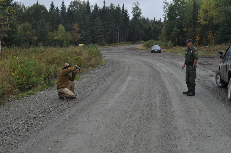
After rounding a wide sweeping right hand turn I found our tentative route to be blocked by a locked gate... that a Maine Warden had just unlocked! What luck!

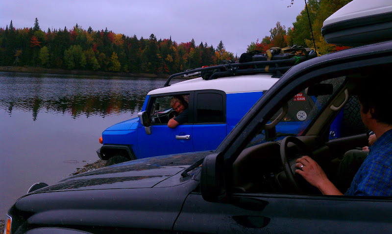
Quickly we parked and I ran up to ask “Hi! Do you think you could let us through?!” He replied rather seriously “Sure, do you have the keys?” I was a little taken aback but he explained the area was gated from all sides and I would need keys to leave. With proceeding out of the question I stepped out of the way to let a vehicle with Jersey tags pass through - he had been escorting them out of the locked area - and inquired about a route to Maine.

The Warden finished locking up and walked over to where we were waiting. I caught him looking inquisitively at both trucks and when I explained our origin and destination he was happy to show us a route. I spread the atlas open on the hood and using his pen he quickly marked a series of turns which would bring us to Eustis. He also informed us the road from Eustis to Jackman was in use for wind farm construction and we might run into security there.

ranger.jpg

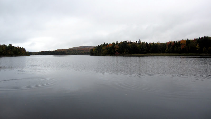
After a quick portrait and some expedition banter we sped Southeast along Lake Aziscohos towards Green Top Mountain and Tim Pond Rd.

The Maine Atlas
We obtained a valuable bit of information from the warden regarding the Maine Atlas - and why using the newest one is critical. See, the roads on the Atlas are labeled as highways, roads, local roads, dirt roads, and trails. gates on the roads and trails are marked by o----o meaning locked, or x-----x meaning gate or rock - sometimes unlocked. Other obstacles are marked by an O - Impassable or O with the bottom half filled in - sometimes passable (think flooded road). Game wardens each have their own territory, and every year Delorme gives each warden a map and asks them to mark each gate and impassable / sometimes passable points. The warden might not be able to check a certain area, or may not remember every road in his / her territory and therefore the map is inherently inaccurate. The Map is Not the Territory


Pond.jpg


IMG_7489.JPG


IMG_7493.JPG


IMAG0452.jpg


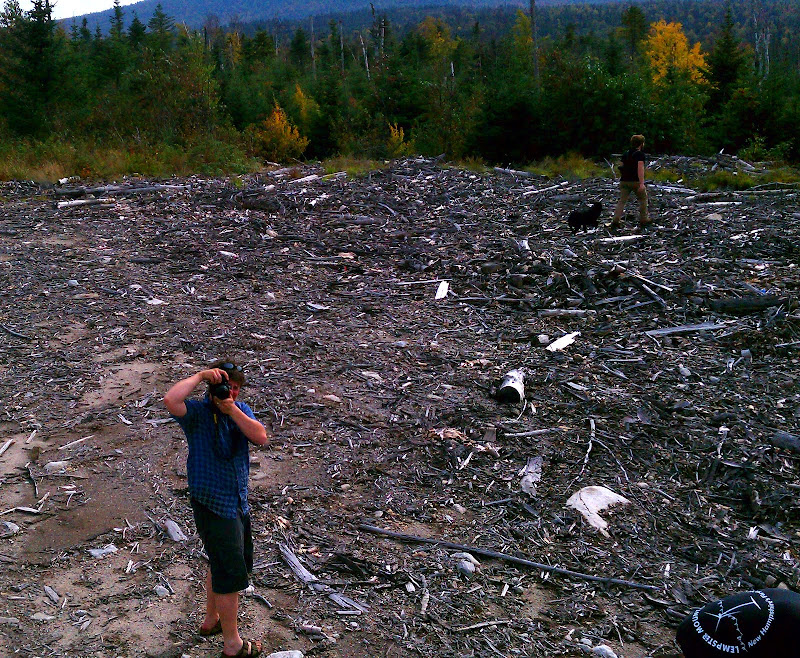
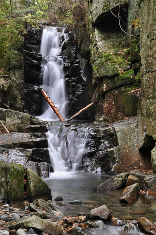
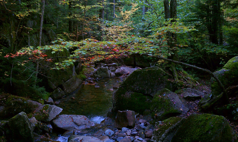
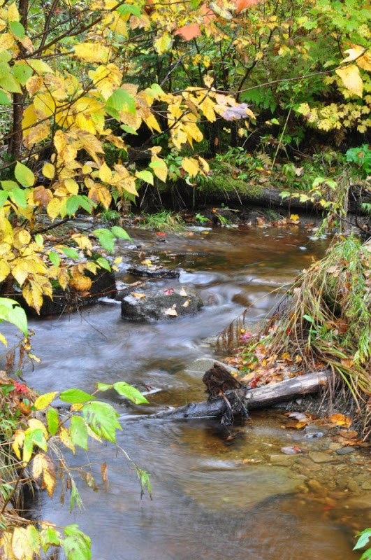
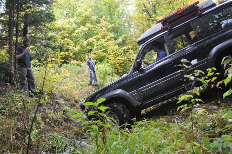
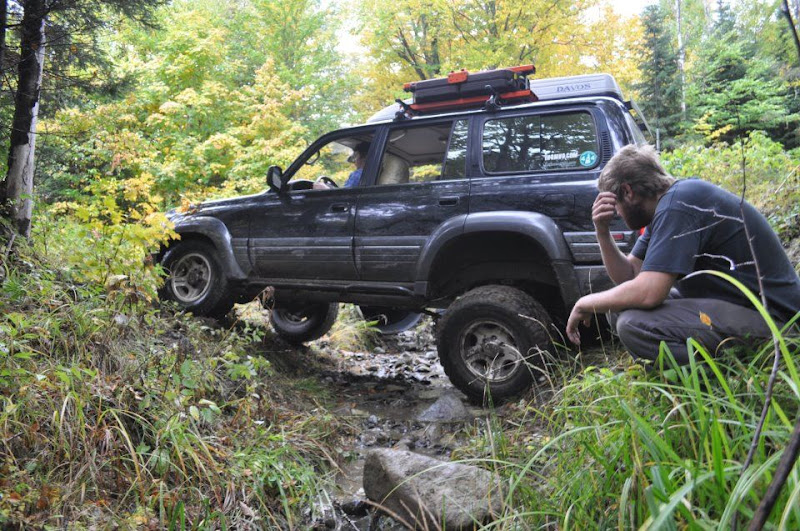
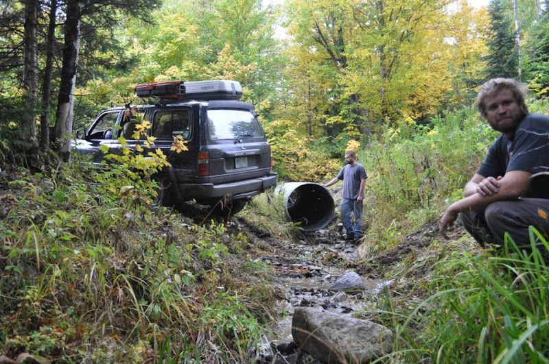
Stopping only for a quick view of Lake Aziscohos I led on quickly until about 11:00 when Josh radioed “It’s burrito time, let’s pull over here.” He quickly loaded the Lexus burrito cooker while everyone milled about and Chirp and I walked along the nearby stream. Shortly everyone was at battle stations and off we went, Chirp in the back using Jason to dry the water from the stream.

IMG_7491-1.JPG

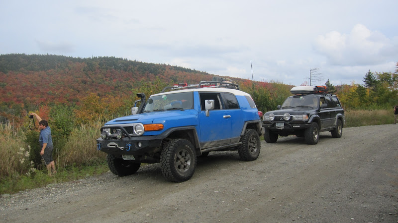
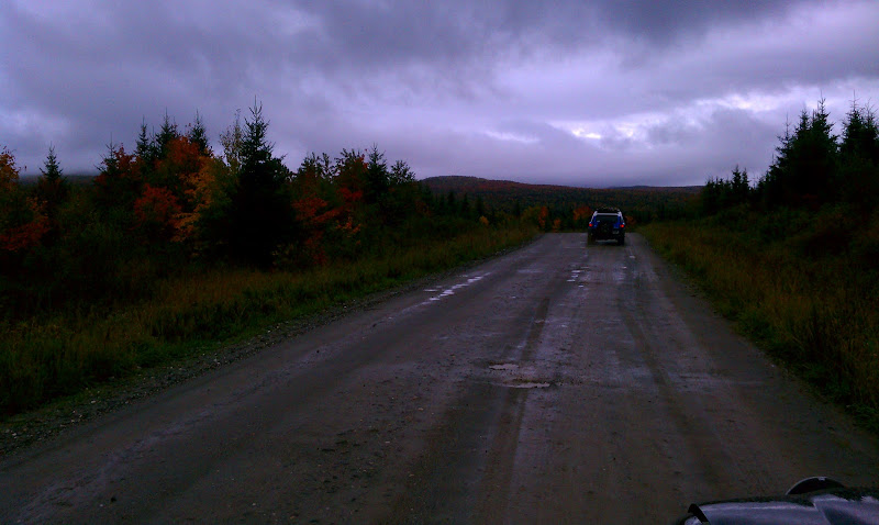
We made good time to Eustis, I still had half a tank of fuel and 12 gallons on the roof. After a quick check with Josh found he had the same, I turned left on Rt 27 looking for the road North: Goldbrook Rd.

IMAG0454-1.jpg

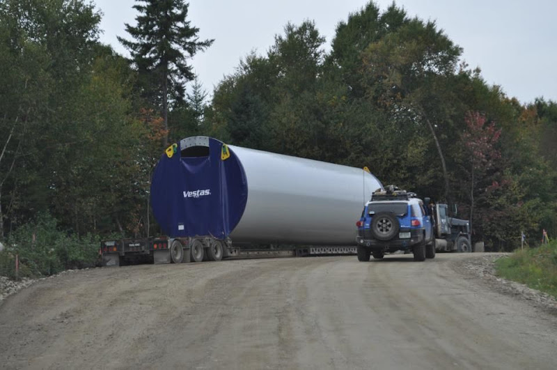
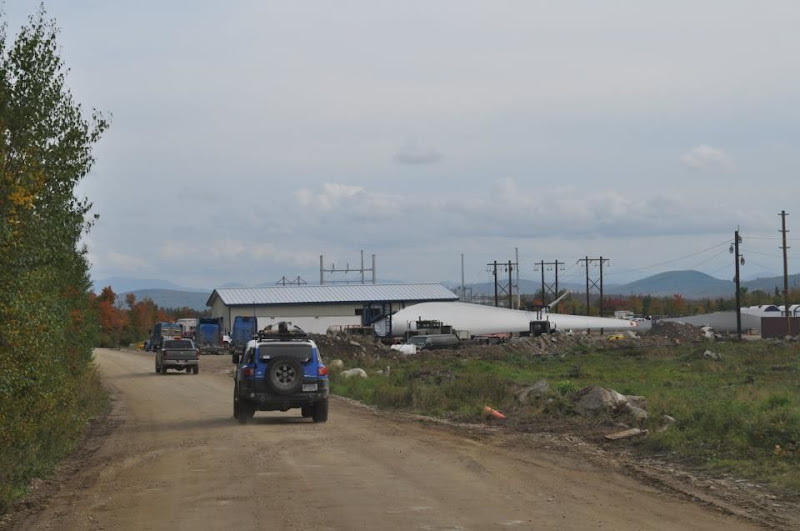
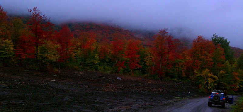
Starting up Goldbrook Rd it was very clear this was a wind farm installation. CB channels were clearly marked and there were signs directing drivers to Phase 1 and Phase 2 of construction. There was no gate or security - simply a sign that read “heavy construction traffic - pass at own risk”. So we passed. Right of the bat the road wound back and forth up out of view into the low, rolling mountains. Again locking the center diff I gassed the FJ and our small convoy began climbing, climbing, climbing. A few uphill miles quickly passed and out of habit I casually glanced in the rearview mirrror noticing the absence of headlights behind me. Not 5 seconds later Josh radioed “Hey we stopped back here.... we smell rubber again.”
 

Forum statistics

Threads
185,911
Messages
2,879,515
Members
225,497
Latest member
WonaWarrior
Top