Copper Canyon Trip Report - 2011

G_fresh

Adventurer
Who: Ryan (G_fresh), LeeWhay - my wife (Chickadee), and Adam - my brother.

When: 11/5/11 - 11/19/11

Why: We're not really sure why. We've been talking about it for years...

Plan: Travel to and from Copper Canyon over two weeks. We would get to Creel (the northern gateway to the canyon) and then firm up our itinerary and route. We did want to see Creel, Basaseachi(c) Falls, Urique, Batopilas, and Alamos or El Fuerte.

We would navigate by GPS, paper maps, and locally sourced knowledge. The main GPS system we used was the MotionX GPS app using an iPad and iPhones with an external Bluetooth Dual XGPS150 receiver. We had an old handheld Garmin Vista as a backup (never used). Paper maps were road and topo sourced from MexicoMaps.com. (Mark was a great guy and a big help!)

Chickadee and I would drive from Santa Barbara, CA to Tucson to meet my brother who was already in Tucson. (He did a San Jose to Death Valley to Grand Canyon to Sedona to Tucson trip the week before.)

We would carry all the gear/supplies we would need for a week (minus gas). Each party would sleep in the back of their own trucks on 3-4" of foam. Gear would either go in the foot wells if heavy (i.e. spare parts and canned food), be strapped down and moved to the front seats at night if moderate weight (i.e. cooking supplies and cooler), or stowed in our Yakima Rocket Box on the LX450's roof rack if lightweight (i.e. clothes and dry foods). We used this system for 2 weeks in Baja previously. It works well for short durations but I'm not sure I'd want to do a circumnavigation this way...
 
Last edited:

G_fresh

Adventurer
Vehicles:

- 1997, LX 450 (80 series Land Cruiser) for G_fresh and Chickadee
- basically stock drivetrain
- rebuilt axels and diffs (F/R)
- rebuilt cooling and ignition systems, and a lot of the vaccuum lines
- rebuilt calipers, new SS lines
- extended all breathers (diffs, tranny, and transfer case)
- upgrades:
- OME 2.5" lift from Slee, heavy/heavy springs
- Dual battery (2 X 31M-PC2150 Sears Platinum DieHard Marine)
- ARB locking diffs (F/R) and CKMA12 compressor
- ARB rear bumper with dual tire carrier
- BFG M/T KM2's, 255/85/16, so 6 total on vehicle
- Man-A-Fre 24 gal auxiliary fuel tank, so about 50 gal total!

- 1997 4Runner for Adam (my old truck)
- stock drivetrain
- partially rebuilt cooling system
- upgrades:
- 2.5" Sonoran Steel lift
- skid plate and belly pan, Bud Built
- extended all breathers
- plywood platform u-bolted to roof rack to carry 2 Jerry cans horiz.
- BFG A/T KO's, 285/75/16, 5 total on vehicle

Sorry so long on the vehicle description. I wanted to set the scene for what type of vehicles we had to be able to take the routes we did...

Both Trucks.jpg
 
Last edited:

G_fresh

Adventurer
DAY 1 - Santa Barbara to Tucson (11/5/11)

Took about 11 hours with about and hour looking for an aluminum roll up table at 2 REI's. This was a waste of time since we never found one and never needed one...

Met up with my brother.
 
Last edited:

G_fresh

Adventurer
DAY 2 - Tucson to Nuevo Casas Grande (11/6/11)

We had some last minute business to take care of and some supplies to buy. So, we didn't get out of Tucson until around 11am.

We had lunch in Bisbee, AZ. I wish we had more time to check out the town - it seemed to have real character. Chickadee thought it was cute...

The border crossing at Agua Prieta was reached around 2pm. As was to be the case with every checkpoint (border, military, or otherwise), we were searched. This delay, coupled with the usual amount of time it takes for the temporary vehicle import paperwork, meant we did not get back on the road until around 4pm. This meant night driving in Mexico was to ensure since Nuevo Casas Grande was still about 150 miles away. Not ideal, but not our first time doing this.

The all paved road drive from Augua Prieta on MEX10 was much prettier than we expected. Low, rocky, yet vegetated hills comprised most of the route. Kind of northern Arizona-esque. I would definitely recommend this route versus MEX15 if you are only going one way down.

Our destination was an RV park in the northern part of Nuevo Casas Grande that was made mention of by someone during our initial research of talking to a few parties who have made the trip at different times during the 2000's. Well, it didn't exist. We made three passes of the town searching for it to no avail. Asking locals yielded no help either.

The following six paragraphs are an aside but this seems like a natural point to discuss...

This first experience trying to find a specific place that WAS confirmed to exist will bring up two recurring themes for this trip: 1) Local Mexicans that we talk to don't typically know their own town's tourist offerings that well or how to explain how to get in/out of their town well either. 2) Tourism seems to have been hit so hard due to the internal "Drug War" that many tourist related businesses have folded.

Point one above was not a surprise to us since we've done anywhere from three to eight weeks of driving in Mexico. I am making this point so that less experienced overlanders in Mexico have the right expectation going in. It is not meant to be a harsh judgement on the locals knowledge either. Americans not knowing where the local RV Park or campgrounds in their own town is not surprising. How often do you camp in your hometown? I don't.

Navigating and driving from city to city within a region is not usually carried out by most Mexicans as far as I can tell. (When we visited our relatively affluent Mexican friends in their hometown, they did not drive city to city within their region even though they did this without thinking in the US. They would have a family friend who was a part-time taxi driver take them around...)

The ability to read maps is also a skill most locals do not posses. I read somewhere that this is due to the historical lack of good maps that have been available for Mexico. This lack of maps is getting much better as far as I can tell. So, I recommend not even pulling out your maps when asking for directions since it seems to confuse things even more...

We were recently made aware of a cultural specific issue by another Mexican we know who lives in the US now. She told us that locals like to be "helpful" and give directions even if they are unsure or simply don't know. This was insight I did not have previously!

Again, I am not trying to be judgmental or controversial here. I just want to share our experiences to make it easier for others. We could discuss the above five paragraphs in another thread since it is off topic...

Moving right along, we stayed at Hotel Piñon (430MXN or ~30USD) since it was late and dark and we still needed to get dinner. It was a pleasant, newer looking hotel with a gated, monitored courtyard that afforded decently secure parking. The desk clerk spoke English well. The reason for pointing this out is that this would be our last communications with any Mexicans in English for almost the entire time we were in the canyons.

I promise that most of the subsequent days will not be this long!
 
Last edited:

Scott Brady

Founder
Enjoy Copper Canyon. I have many great memories from that region.

The trip to Urique from either Batopilas or Cericahui (sp?) is fantastic
 

1leglance

2007 Expedition Trophy Champion, Overland Certifie
I really want to visit Copper Canyon so I am holding on tight waiting to hear more.
Oh and I welcome any and all comments you have as it is great insight, thanks!
 

G_fresh

Adventurer
DAY 3 - Nuevo Casas Grande to La Junta (11/7/11)

The plan for Day 3 was to drive down to the Basaseachi Falls. This did not happen.

The issue was the road that looked to be a "secondary" road as marked on our "Mexico: Sonora & Chihuahua" Map from Matachic (about 110mi due south of Nuevo Casa Grande on MEX37 or CHIH23) to MEX16 (about 30mi SSW of Matachic) turned out to be a disappearingly small dirt track. This was the beginning of trusting the MotionX road map we downloaded at home since it did not show this road.

The first half of this dirt road from Matachic was a fast, well-graded dirt road and a really pretty drive. It was pretty high country, about 6000ft? A moderate amount of pines existed. It kind of looked like the Eastern Sierra Nevadas with older, less jagged rocks.

PB080025.jpg

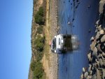
When we got to a small town about 12mi in, it was readily apparent that the second half of this road would not go as quickly as the first half. First of all, we took the wrong track out of the small town. Looking back, the track was used by the local ranchers. Again, it was an awesome drive: a steep several hundred feet climb to a ridge top followed by a gradual descent to a river valley, and a river crossing. We think the river was the Rio Papigochic or the Sirupa? Relatively speaking, this would turn out to be our most difficult crossing (it was by no means difficult though). The depth was not much more than a foot and a half. This was the first of only four times I locked my diffs. This action was likely not required. I did so since the river bottom and ascent out of the riverbed was loose, fist-sized rocks. Soon after this point, we decided we were indeed on the wrong track and began to retrace our tracks back to Matachic.

PB080029.jpg

In retrospect, since we lost hours of daylight to this "wrong turn" and it was twilight, we should have just found a spot off the main road to make camp. But, at this point of the trip we were more worried about boondocking in remote locations. (More on our rethinking later). This was due to advice on other forums and from other people we spoke to directly to that we could end up in drug growing areas that were all over the Copper Canyon system.

As it turned out, we ended up finding a hotel around 8pm in La Junta about 30 miles West of Cuauhtemoc which is about 50 miles West of city of Chihuahua. The hotel was pretty new, clean, and basic. It was called Victor Inn (550MXN or ~40USD). This was our second, but thankfully last, night of driving.

Oh, and what was that creaking noise from the right front of the LX450 that we heard back on the non-graded dirt road?
 

Attachments

  • PB080029.jpg
    PB080029.jpg
    899 KB · Views: 34
Last edited:

G_fresh

Adventurer
DAY 4 - La Junta to Basaseachi to Creel (11/8/11)

Since Day 4 was to be a lot of mileage, we arose early.

LaJunta to the Basaseachi Falls was along the twisty, mountainous, and scenic MEX16. This was our first real look at the Copper Canyon; we liked what we saw. Again, the upper elevations were sparse pine forests and rock. We came upon a few panoramic vistas of the smaller valleys, but nothing to rival the US's Grand Canyon as we were told the Copper Canyon would...

We got to the Basaseachi National Park late that morning. We were the only tourist vehicles at the parking lot. We got our things together to hike a couple of hours to the top of the falls and partway to the bottom. The falls had especially low water volume due to the really light rainy season that was just experienced. This is obviously bad for admiring falls, but boded well for our upcoming river crossings.

Basaseachi Falls (halfway down).jpg Basaseachi Falls (looking out from top).jpg

We got back to our vehicles around 1pm and decided to eat lunch at the small restaurant off the parking lot. The only noteworthy experience to relay about lunch is that the burritos were really small, used a wheat tortilla, and contained only meat. They were still larger than a traditional Mexican taco but nowhere near the size of an American burrito. When we have seen burritos (only in mainstream tourist towns) in Mexico, they were more akin to the American sized ones. We saw the small sized ones throughout the canyon areas. Maybe these only exist in this area?

Also, when we got back to the lot, we were immediately greeted by an older, less well dressed man. He hung out near us while we ate lunch and engaged us in small talk. We were trying to figure out what his angle was amongst ourselves. Our best theory was he operated one of the trinket booths that lined the lot. We were wrong. As we were packing back up to leave, he requested we each pay him 20MXN for watching our cars.

If his service was presented to us before we left, I would have had no problem paying this. Since we believe he probably did watch our cars for at least some portion of the time we were away and he answered some questions about the area, we decided to pay him 40MXN (3USD) total for an after-the-fact car watching. I'm sure some (many?) people would not have. It is always a tough call as to what to do in these situations...

We left the Basaseachi park, retracing our tracks on MEX16 back towards La Junta. About 10 miles before La Junta, we turned off MEX16 and took a new road (MEX127?) south to Creel. This was not the most direct route to Creel. Taking the road from Basaseachi to San Juanito (about 40mi to the WSW or about 15mi N of Creel) would have been more direct. The reason we did not choose this way is that the night before in La Junta, we were told by a local restaurant owner not to take this route due to bandits. He told us men with masks held travelers on the road gunpoint and robbed them. For what it's worth, he said it was not drug related.

We pulled into Creel at twilight. We found the Hotel Villa Mexicana which was a RV park as well. We stayed in their RV park within our vehicles the next two nights.
 

Attachments

  • DSC_6134.jpg
    DSC_6134.jpg
    1.1 MB · Views: 45
  • DSC_6151.jpg
    DSC_6151.jpg
    1.3 MB · Views: 40
Last edited:

1leglance

2007 Expedition Trophy Champion, Overland Certifie
thanks for updating this report...
I am really looking forward to more, great work
 

Scott Brady

Founder
Great report so far, enjoying the updates. There are some fantastic routes in that part of the world.

Love this photo:
attachment.php
 

LexusAllTerrain

Expedition Leader
We pulled into Creel at twilight. We found the Hotel Villa Mexicana which was a RV park as well. We stayed in their RV park within our vehicles the next two nights.

Nice restaurant to have some Margaritas,

looking forward to the start of your adventure!
 

G_fresh

Adventurer
Yep, it was a cool place to stay. More on that in the next post...

Thanks so far for all the comments!
 

G_fresh

Adventurer
DAY 5 - Creel (11/9/11)

Hotel Villa Mexicana was a very pleasant stay. Even though we stayed in their camp/RV grounds, we still had access to their commons area which included a lounge, a restaurant, gift shop, and, most importantly, a bathroom facility with hot showers! This really made it feel as if we were in a hotel instead of a RV park. They charged us 250MXN (18USD) per night for the three of us. We told the receptionist that we had two vehicles but she must not have heard us. After we paid, she came out to show us where to set up camp. When she saw we had two cars, she said she should have charged us more but never asked for any more money. So, it may actually be 250 MXN per car...

We showered up, sat in their lounge and planned out the details of the rest of our trip, ate dinner, and hanged out until we were dry. Why did this matter? Because, it was below freezing every night in Creel. To illustrate how cold, our 7 gallon water jugs that we left out every night began to freeze at the water line and we had frost on the inside of our windows. Although we were not mentally prepared for the cold, we had proper clothes and adequate bedding (by chance) since we had an extra sleeping bag that my brother's girlfriend left in his truck!

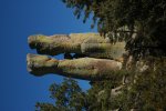
We woke up at a reasonable hour, made breakfast, loaded my brothers truck with all of the camping gear, and the three of us set out in the Lexus to view the sights around Creel within the Valle de Piedras. These included: Mission San Ignacio, Valley of the Mushrooms (Valle de Ongos), Valley of the Frogs (Valle de Ranas), Valley of the Monks (Valle de los Monjes), and Lake Arareko.

Summary of the sights: mission was cool, mushrooms were unique, only one rock formation looked like a frog, the monk rocks were phallic, and the lake seemed more like a livestock watering hole. Don't get me wrong, it was worth spending a half of a day especially since we had been covering a lot of miles to this point.

Mission San Ignacio.jpg Valley of the Monks.jpg Valley of the Mushrooms.jpg

The only other point to note is that the inhabitants of the valley seemed to be really poor. They did charge a park entrance fee and were selling trinkets to tourists. So, at least some money was coming in. Although, we only saw about ten other tourists the whole four hours or so we were there. We talked to a couple of local girls who followed us around for an hour after they tried to sell us some crafts. They were 12 and 14 years old and told us they only went to school one day a week. I hope this was not true and that we simply misunderstood them...

We got back to Creel for a late lunch at Restaurant Tio Molcas. The proprietors were nice people, had good food, and was conveniently located near the zocalo. We ended up eating there agin later in the trip.

We spoke to the guys at "The 3 Amigos" tourist information booth (www.amigos3.com). They were helpful in answering our route questions without pushing their tours too much. They also had some decent, hand-drawn, local sights maps and some Creel to Batopilas route maps.

Some notes on Creel that were not known at the time:
1) They had the only ATM (at least that we could find) until we got out of the canyons. We found none at Batopilas, Urique, or San Rafael. We only, finally, found one in Alamos - well out of the canyons. There may have been one in Chinipas - I can't remember...
2) The bank had only one ATM that only intermittently had cash. It seemed that the cash would come along late in the morning.
3) Creel had the only Pemex in the area (i.e. none in Batopilas, Urique, or San Rafael) which supplied regular (Magna) only. A new Pemex with premium looked as if it were being built on the way out of Creel towards San Rafael. So, this may be an option soon? We finally did come across a Pemex a bit before Chinipas. Although there was gas available from small store fronts in most of the small towns we came across, we did not need to buy any so I can't advise on the quality. (As an aside, I've never had an issue with Pemex gas in all my 10 weeks cumulative driving in Mexico since 1999. So, I try to use them exclusively.)

I thought I promised each day's write up was not supposed to be this long!???!
 

Attachments

  • Valley of the Monks.jpg
    Valley of the Monks.jpg
    1 MB · Views: 14
Last edited:

G_fresh

Adventurer
DAY 6 - Creel to Batopilas (11/10/11)

Woke up early, but did not get on the road early. We had to wait for the ATM to be stocked with cash. Due to the delay, we didn't end up leaving Creel until around 9:30am.

About a half of an hour after leaving, we happened upon the really small town of Cusarare. The waterfall of the same name was our first diversion. It took us a couple of turn-offs to figure out which dirt road led to the falls. We drove about 10-15 minutes, had a small river crossing, and ended up in a picturesque, wide bank.

Cusarare Falls Wide Bank.jpg

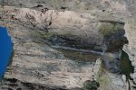
We had a short 5-10 minute walk to the falls. As expected, they had a low water volume. Judging from some of the pictures we've seen, I bet this would have been an awesome sight in the rainy season...

Cusarare Falls.jpg

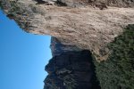
Continuing down the windy, paved road offered our first view of the scale of the canyon. This was one of several vistas that rivaled the views that we have seen of the Grand Canyon!

Grand Canyon-esque.jpg

Eating lunch here seemed like a great idea. So, we did.

After another hour or so down the road, we saw a Pemex sign. It was apparent that the gas station was closed - no need to slow down. Wait! We're those two dual sports? Let's go see...

We ended up talking to Gary (UK, early 90's BMW GS) and ??? (US, KLR650) for an hour. They were returning to Creel after two days in Batopilas. We got the "lie of the land" for the city of Batopilas which was down at the bottom of the Batopilas Canyon. We discussed things like the conditions of the steep route down to the bottom, places to stay, and sights to see. Of course, the five of us talked about our travels thus.

The most interesting discussion item was the "new road" to Urique. I got excited!

Here's why: Batopilas to Urique is only about 14 miles apart (the way he crow flys). Since each town is on its own river of the same name, that means up and over a mountain range. I did as much research as I could before we left to find out if a drivable route even existed. Unfortunately, Expedition Portal was of no help and the Copper Canyon tourist websites catered to tour packages. I did look at Google Earth and it seemed there were ranching roads that would go most of the way. But the tracks disappeared under trees, so I was still uncertain.

More web searching yielded some hits on Thorn Tree (Lonely Planet's travel forum). One guy from Oregon who lived in Urique part-time and owned an organic farm/hostel/guest house for rent (Entre Amigos, home.comcast.net/~ramsay52/), wrote that there was no direct route connecting the two towns in a two year old post. Even though two of the maps I had did show that a route existed, two other maps did not. At that point, I figured we'd just have to get down there to see...

Gary and ??? said they scouted the road but did not take it. Since it was so new (read as not yet hard packed) and Gary was a novice dirt roader, they bailed on that route. Hence, our meeting on the pavement. This is why I was excited - a new road that (presumably) very few non-locals had taken and one that was not easy to traverse!

It was about 2pm that we parted ways with the DS riders. Soon enough, we were to the dirt road that would lead down from about 7400 feet to the 500 feet elevation of the Batopilas River. As there was active, heavy construction occurring on the road, we had to wait about 10-15 minutes while the road was built before us before the construction crew would allow us to pass.

The road down was neat. Many switch backs were visible from the top. Only one car at a time was able to traverse the narrow road in many locations, so care had to be taken to look far ahead for oncoming traffic. The vistas on the way down coupled with the setting sun made for some good pictures.

It took over an hour to descend the almost 7000 feet. After that, it was another 15 miles and another hour following the river. La Buffa - a petrified sand dume for lack of a better analogy - was worth a ten minute rest and a few pictures. The couple of times we had to cross the river, there were bridges which were basically a steel superstructure with wooden planks.

Batopilas Bridge - Small.JPG

Remember that front-end noise from the PS side on day three? We started hearing it again. It sounded like the coil spring's rubber pad had fallen out and there was a metal-to-metal creaking noise. We got out to look. I looked over all of the suspension joints, wheels hubs, axels, steering knuckles, and tie rods. Nothing looked loose or out of place. So, we kept going. I figured if it were a problem within the front axel that we just had rebuilt a few weeks earlier, it would take more than a creaking noise to get me to tear I to it in that setting...

We made it to Batopilas with about an hour of daylight left. The most striking aspect of the city was its narrowness. For a good portion of the town, houses on each side of the road defined it width. At its widest, it was two blocks. The roads were also narrow. In more than a few sections, another vehicle and my truck could not pass each other. Could a Unimog make it? I wouldn't want to try, but probably? I say this since I think that some earth moving trucks had to get through the city at some point to get to the towns beyond. A small trailer (like an AT Chaser) would probably make it with some skill and if a place could be found to turn around. Please note I have never driven either a Unimog or with an over landing trailer.

When we pulled into the Zocalo area, we immediately met a guy named Lino. We were able to figure out he was a guide. We tried to ask him about the new road and if he could guide us, but we're unsuccessful in our communications. He told us there was one guy in town who ran the museum, Rafael, that was able to speak English. We went on a quick search for him. No luck - the museum, was closed. Since it was now twilight, we attended to the more pressing matter of finding a place to stay.

We were told by Lino it was ok to park and stay in the vehicles at the zocalo near the church. It would have offered no privacy nor bathrooms. So...

Batopilas Zocalo.jpg

We ended up staying at Hotel Mary. It was located right across from main church, a block north of the zocalo. It was really inexpensive at 300MXN (22USD) per night for the three of us for three beds. It had secure (fenced in) parking for the trucks, a shady little courtyard, and a basic, but tasty restaurant. OK, now the bad: It was not very clean (i.e. a few dead cockroaches and mouse droppings on the floor). We think the brown shower/lavatory water was the same for every place in town. Maybe it was straight river water?

It did seem that at least some waste water drained directly into the river. As we walked along the bank, we'd see some white PVC piping suddenly shoot out a column of water and then stop. I not recommend setting foot into the river without more information on its sanitation!
 
Last edited:

Forum statistics

Threads
185,842
Messages
2,878,776
Members
225,393
Latest member
jgrillz94
Top