Explorer 1
Explorer 1
After one of these exploring adventures it hard for me to sit down and write about it, I would rather get out the maps and books and start planning for the next one, but family and friends like to know where I went and what I did so before I get my dates and events mixed up, here goes.......
My wife and I have been meeting our daughter, son-in-law and now grandson once a year in Moab for what I call "Disneyland off-road rides". Each year in route we quickly pass through the San Rafael Swell on Interstate 70. I decided this year to leave early and do some exploring of this beautiful and historic area.
Instead of traveling the main highway, I took the road less traveled, enjoying several new adventures along the way and adding to my list places to return later and explore further in some future trip.
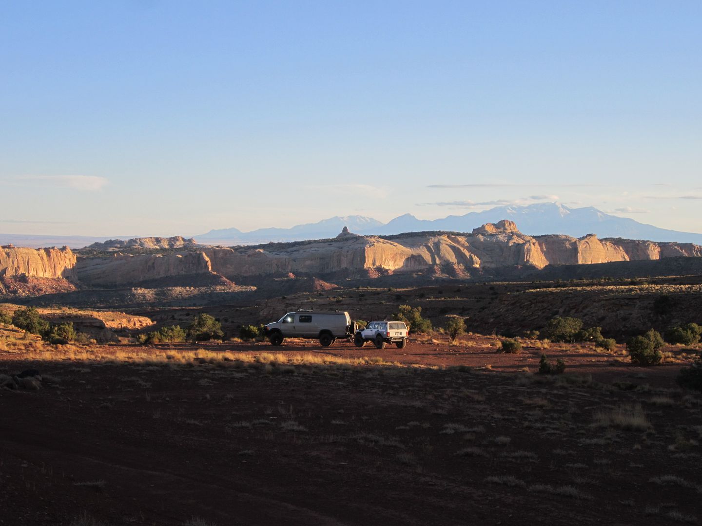
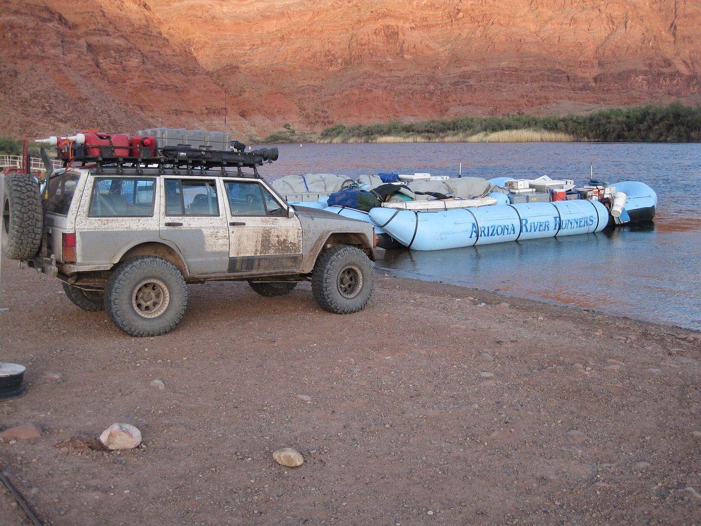
Our Sportsmobile (SMB) acted as our towing and base camp vehicle. Accommodation are just right for the two of us. My Cherokee (Explorer 1) in tow was our ticket to Moab's tougher trails and also our faster exploring vehicle once we set camp in the "Swell".

With an early start we were out of California in 5 hours and into the land of diesel fuel under $4.00 a gallon. Shortly after entering Utah we were off the Interstate on Hwy 9 heading for Zion National Park. I'm not going to write or show pictures of this wonderful place because so many have already done a much better job than I could, enough to say if you haven't been here before, move it up toward the top of the list.
From Zion we then traveled south on Hwy 89 through Kanab eventually coming to the Paria Canyon Vermilion Cliffs Wilderness located in the Grand Staircase - Escalante National Monument, where one of our planned destinations laid. My wife had recently seen an article and pictures of an area called the Paria Canyon Wave.

Needless to say this went to the top of our list, unfortunately the canyon walk is VERY regulated and only 10 individuals were allowed each day to make the hike into the canyon. This was done by lottery and today's lottery had already happened. (40 had applied that particular day) If you work ahead and have a bit of luck you can make an internet reservation 6 months to a year in advance and then there is a matter of right timing as there are more requests then permits.
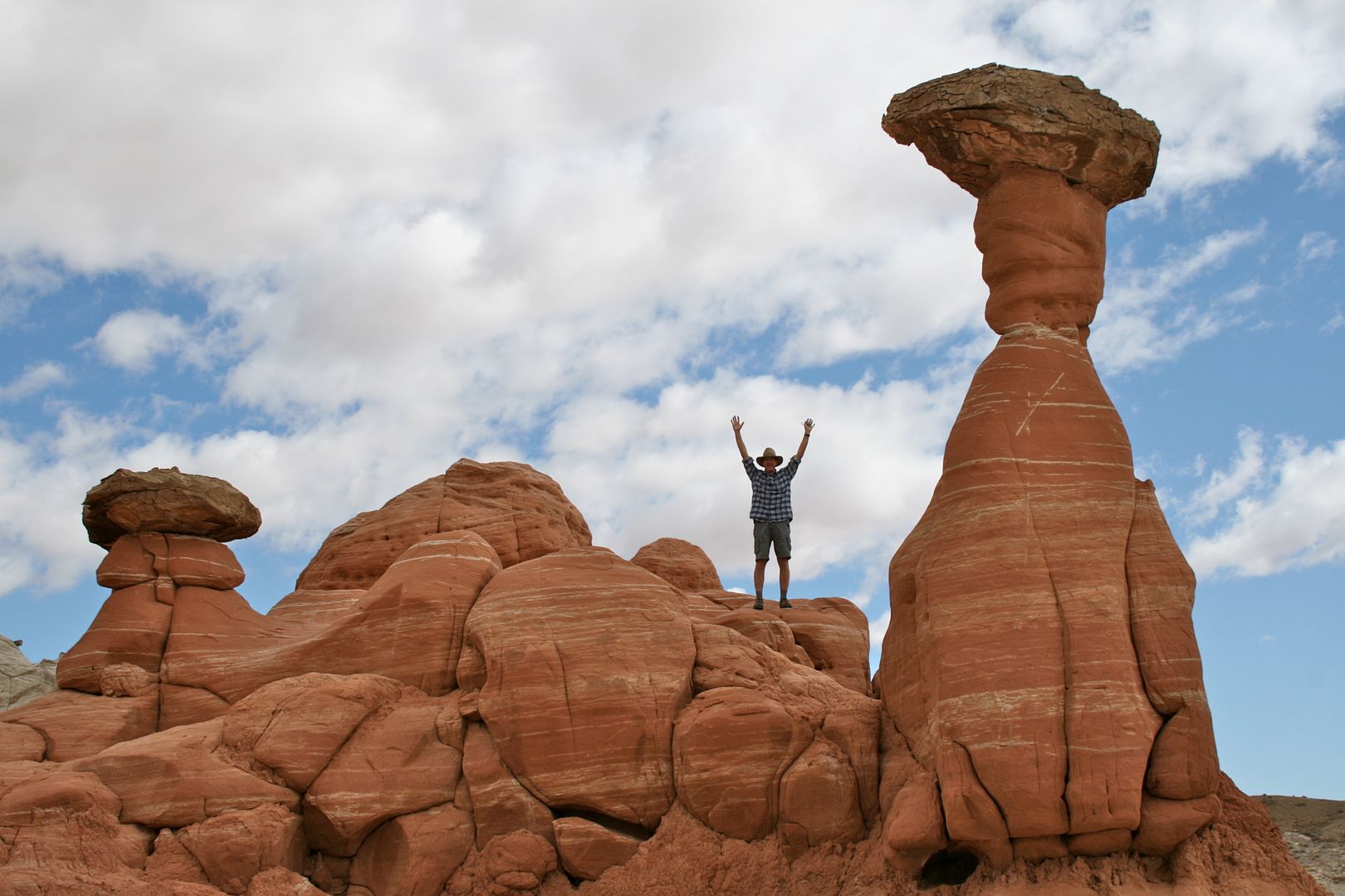
So with some disappointment we decided to check out a couple of other nearby natural "wonders". We started with the short hike to the "Toadstools":
Here I am next to one, ( don't ask why I doing a Superman imitation, I was just following my wife orders)
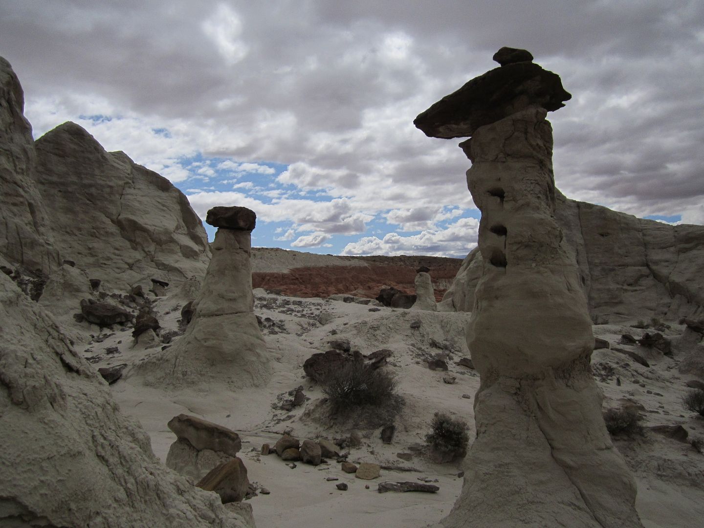
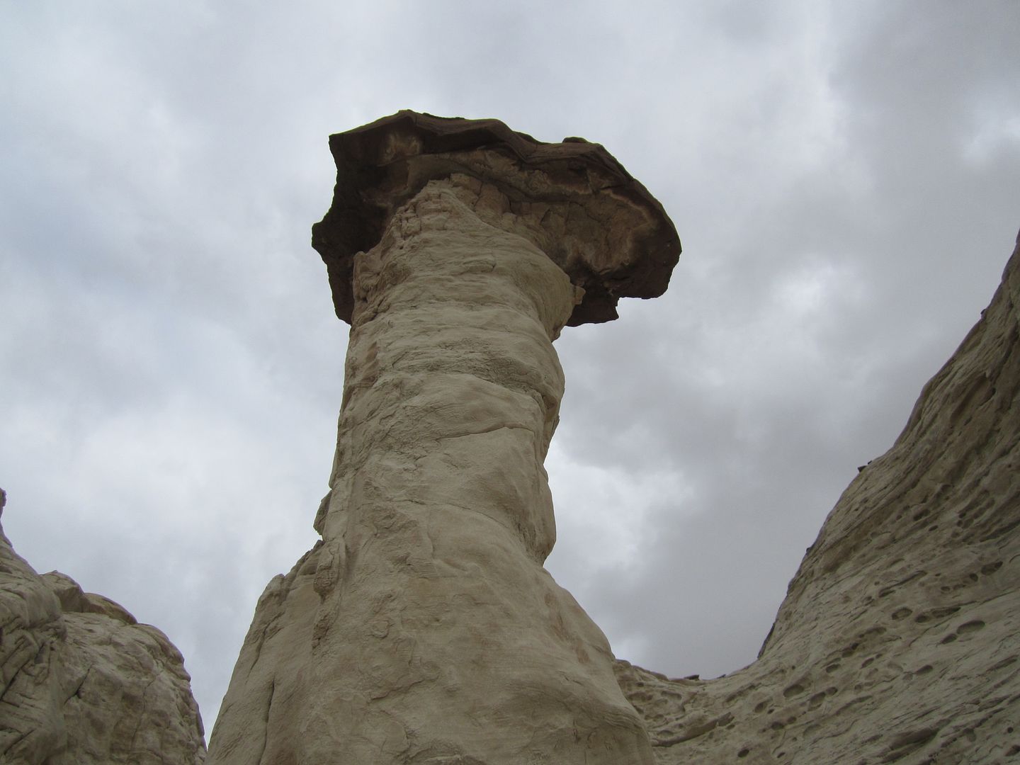
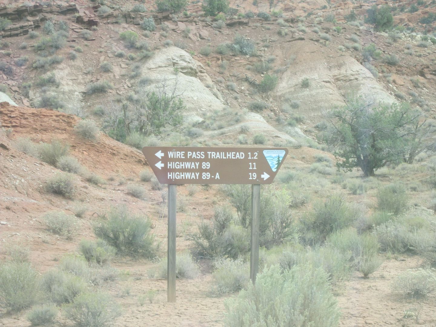
We followed this up with a drive south on House Rock Valley Rd to hike Wire Pass. This was my first experience where I was requested to pay a fee to hike in a rather remote location. It was $6.00 per person to hike the 1.7 miles in and out of the canyon. What's next, self-serve pay stations to pay for taking a picture?????
Wire Pass trail takes you into a slot canyon which was fun but I would hardly say it was worth $6.00 to walk it.
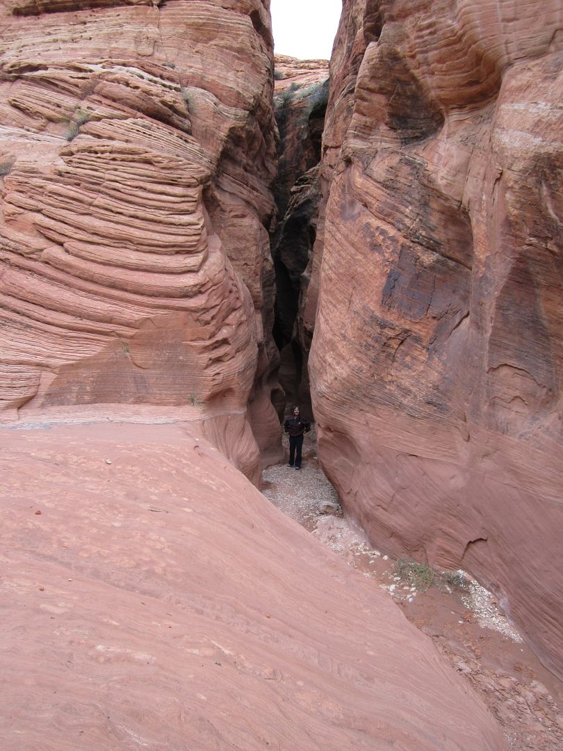
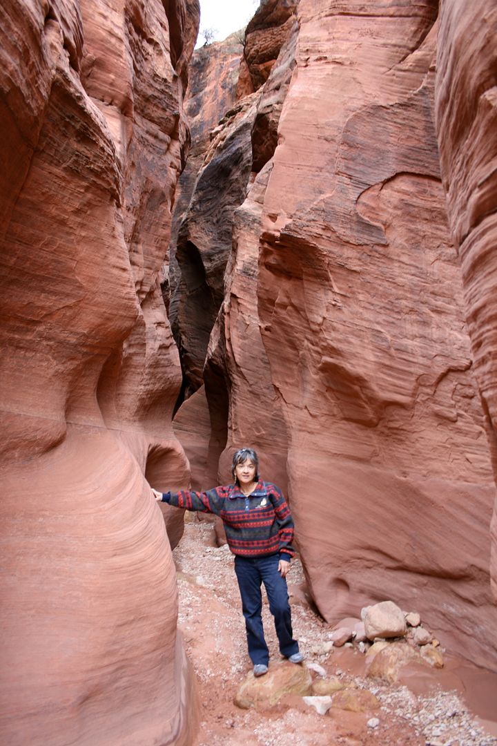
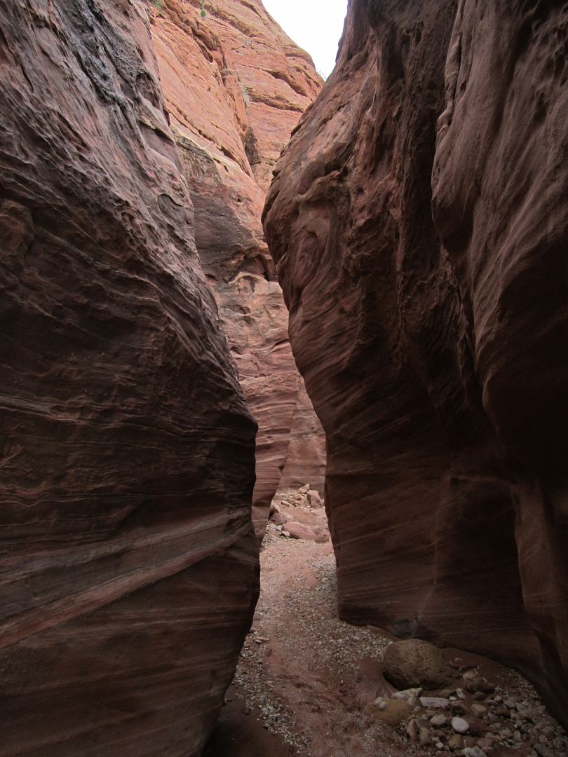
Most of the water that forms these slot canyons makes it way into the Paria River which begins just a little north of here. The Paria then travels south and empties it's muddy water into the clear running Colorado River at Lee Ferry.
After our brief hike we were on the road again. We needed to get ourselves north to Hwy 12. The shortest route would be to take Cottonwood Canyon from Hwy 89 north to Cannonville. I had driven this clay road a few years ago in the SMB.
http://www.youtube.com/watch?v=iNaRCxeJkZk
Because of the recent rain/snow I decided not to push my luck as this time I was also pulling a tow vehicle.
So we had to back track on Hwy 89 back to Kanab and then north following along the back side of Cedar Breaks. Often when driving in rural areas one sees the posted sign warning about range cattle that may be in the roadway. I have even seen cows on the pavement on occasion.
Today I met this cow in the middle of the road. As I approached I hit the horn several times but it seemed that the cow was deaf. She seemed to be staring at something to the left of the roadway. I continued to slow down almost to a stop a few feet from this beast before she looked up at me and slowly moved off to the right. As I passed I too looked to the left and there saw what had her attention, it was a large coyote about 25 yards away.
A right on Hwy 12 took us toward Bryce Canyon (which should also be on the top of your list). While one can drive through Zion, you must make a deliberate effort to see Bryce as there is only one road in and you must take the same road out. Ahead of schedule and being on vacation (I thought schedules weren't supposed to be important on vacation!), we took the turn on Hwy 63 and checked out Bryce once again.
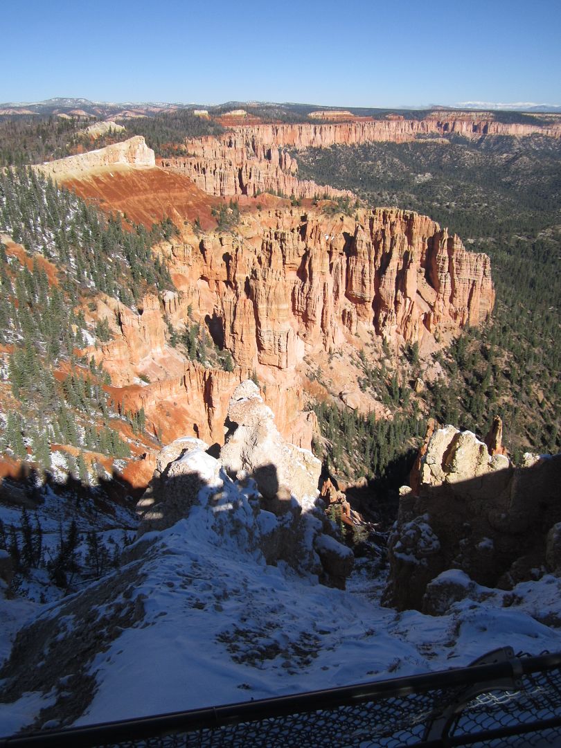
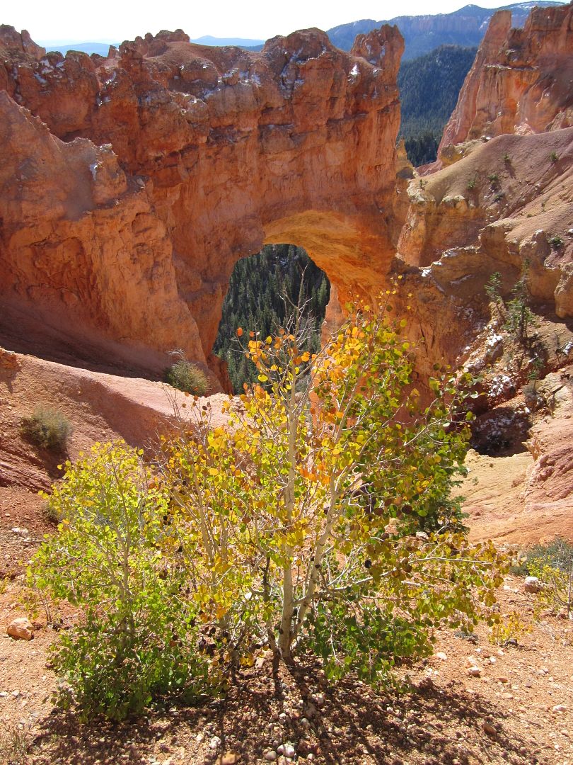
Bryce, like Zion is one of those places that has been photographed by many a professional so forgive my amateur photos.
From Bryce we continued to head east on Hwy 12 and once past the small community of Cannonville I was now on a stretch of road I had never traveled.
Many places are worth visiting several times but for me, there's just something about a new road that calls me to an undiscovered adventure.
More later:
My wife and I have been meeting our daughter, son-in-law and now grandson once a year in Moab for what I call "Disneyland off-road rides". Each year in route we quickly pass through the San Rafael Swell on Interstate 70. I decided this year to leave early and do some exploring of this beautiful and historic area.
Instead of traveling the main highway, I took the road less traveled, enjoying several new adventures along the way and adding to my list places to return later and explore further in some future trip.
Our Sportsmobile (SMB) acted as our towing and base camp vehicle. Accommodation are just right for the two of us. My Cherokee (Explorer 1) in tow was our ticket to Moab's tougher trails and also our faster exploring vehicle once we set camp in the "Swell".
With an early start we were out of California in 5 hours and into the land of diesel fuel under $4.00 a gallon. Shortly after entering Utah we were off the Interstate on Hwy 9 heading for Zion National Park. I'm not going to write or show pictures of this wonderful place because so many have already done a much better job than I could, enough to say if you haven't been here before, move it up toward the top of the list.
From Zion we then traveled south on Hwy 89 through Kanab eventually coming to the Paria Canyon Vermilion Cliffs Wilderness located in the Grand Staircase - Escalante National Monument, where one of our planned destinations laid. My wife had recently seen an article and pictures of an area called the Paria Canyon Wave.
Needless to say this went to the top of our list, unfortunately the canyon walk is VERY regulated and only 10 individuals were allowed each day to make the hike into the canyon. This was done by lottery and today's lottery had already happened. (40 had applied that particular day) If you work ahead and have a bit of luck you can make an internet reservation 6 months to a year in advance and then there is a matter of right timing as there are more requests then permits.
So with some disappointment we decided to check out a couple of other nearby natural "wonders". We started with the short hike to the "Toadstools":
Here I am next to one, ( don't ask why I doing a Superman imitation, I was just following my wife orders)
We followed this up with a drive south on House Rock Valley Rd to hike Wire Pass. This was my first experience where I was requested to pay a fee to hike in a rather remote location. It was $6.00 per person to hike the 1.7 miles in and out of the canyon. What's next, self-serve pay stations to pay for taking a picture?????
Wire Pass trail takes you into a slot canyon which was fun but I would hardly say it was worth $6.00 to walk it.
Most of the water that forms these slot canyons makes it way into the Paria River which begins just a little north of here. The Paria then travels south and empties it's muddy water into the clear running Colorado River at Lee Ferry.
After our brief hike we were on the road again. We needed to get ourselves north to Hwy 12. The shortest route would be to take Cottonwood Canyon from Hwy 89 north to Cannonville. I had driven this clay road a few years ago in the SMB.
http://www.youtube.com/watch?v=iNaRCxeJkZk
Because of the recent rain/snow I decided not to push my luck as this time I was also pulling a tow vehicle.
So we had to back track on Hwy 89 back to Kanab and then north following along the back side of Cedar Breaks. Often when driving in rural areas one sees the posted sign warning about range cattle that may be in the roadway. I have even seen cows on the pavement on occasion.
Today I met this cow in the middle of the road. As I approached I hit the horn several times but it seemed that the cow was deaf. She seemed to be staring at something to the left of the roadway. I continued to slow down almost to a stop a few feet from this beast before she looked up at me and slowly moved off to the right. As I passed I too looked to the left and there saw what had her attention, it was a large coyote about 25 yards away.
A right on Hwy 12 took us toward Bryce Canyon (which should also be on the top of your list). While one can drive through Zion, you must make a deliberate effort to see Bryce as there is only one road in and you must take the same road out. Ahead of schedule and being on vacation (I thought schedules weren't supposed to be important on vacation!), we took the turn on Hwy 63 and checked out Bryce once again.
Bryce, like Zion is one of those places that has been photographed by many a professional so forgive my amateur photos.
From Bryce we continued to head east on Hwy 12 and once past the small community of Cannonville I was now on a stretch of road I had never traveled.
Many places are worth visiting several times but for me, there's just something about a new road that calls me to an undiscovered adventure.
More later:
Last edited: