An Adventure to find a Ghost Town **updated**

Raw7s

Adventurer
**updated with a second trip in post #9**


An adventure to find a ghost town, and lots of pics for you guys :D

The ghost town is Graysonia, wiki: Graysonia,Arkansas

I've been out to the forest looking for remains of this ghost town over the course of a few years now. Each time I found a little more.


I'll start with pictures from past trips:


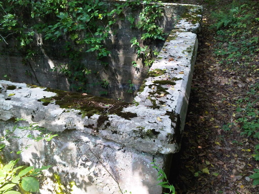
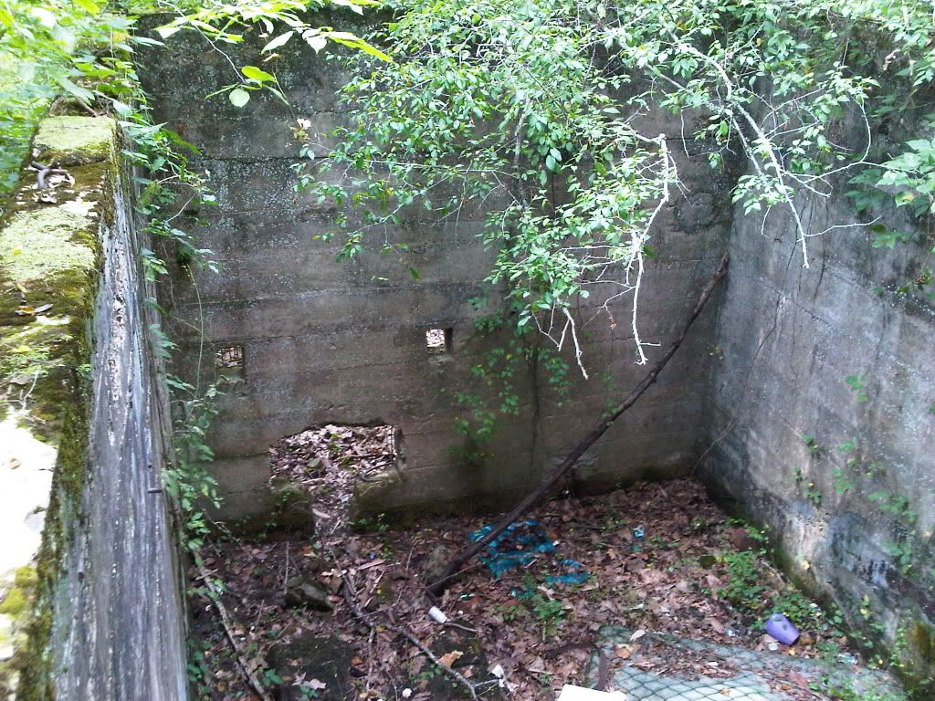
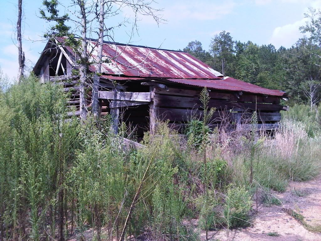
I think this was a building for a water pump, the holes in the wall are facing the river. And I reference later in the thread to the possible base of a water tower about 20 yards up the hill from this building.


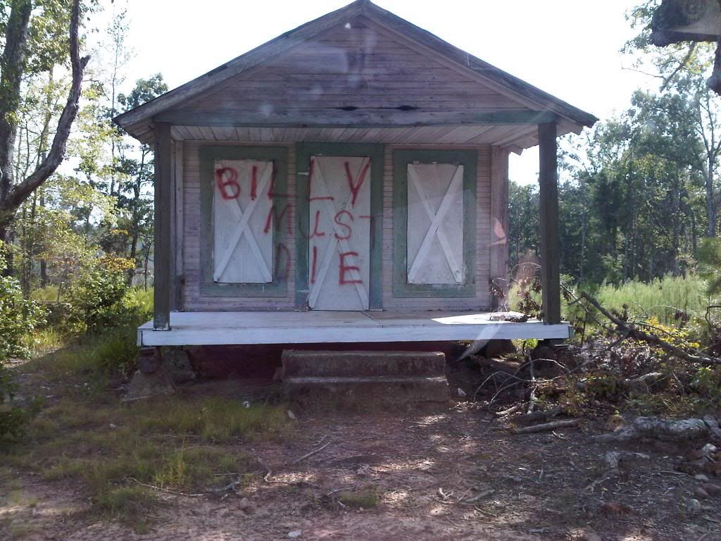
Not a very nice message someone left

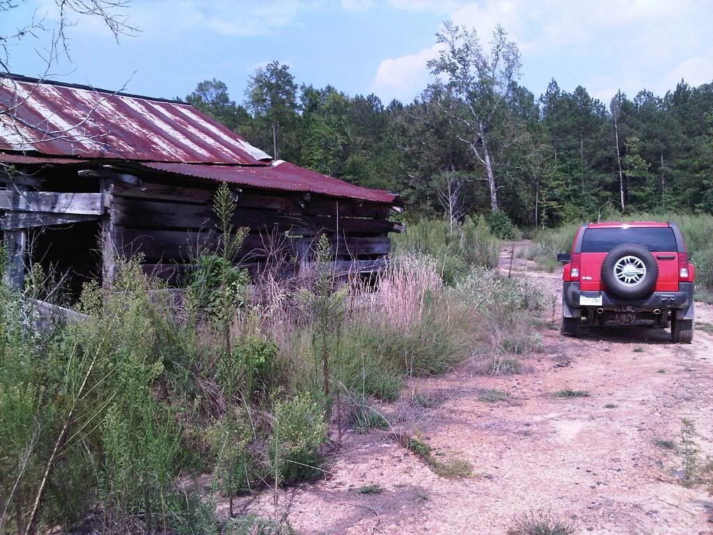
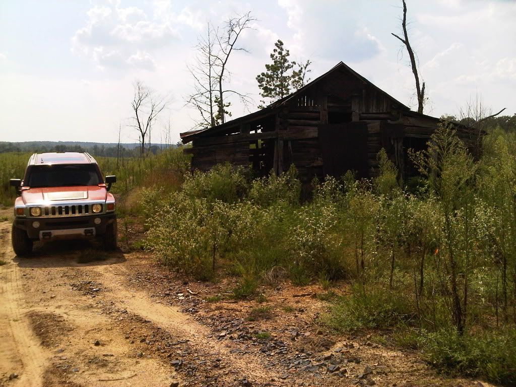
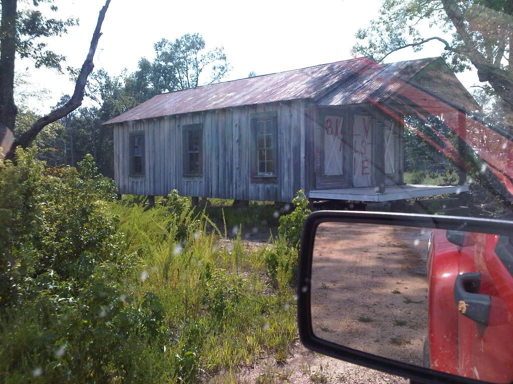
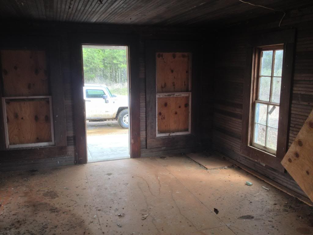
Now pics from this past weekend, and from inside "Billy's" house


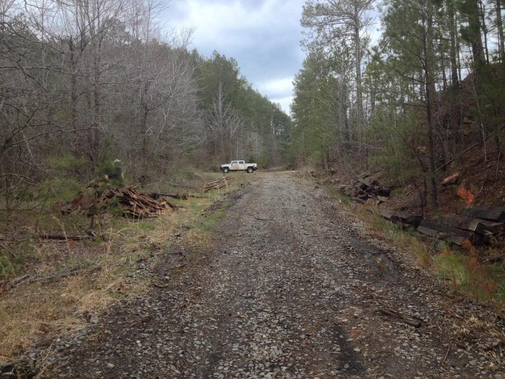
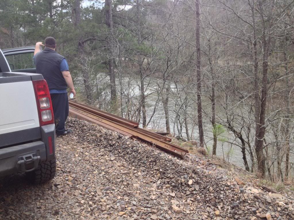
Finally found the rail road tracks we've searched years for. They've been recently pulled up and everything piled to the side. I figure it's for the hunting clubs to have a road in and out.

And of course we had to see where the tracks would take us, hoping it would be to the old logging mill.


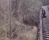
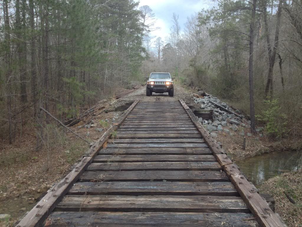
We first came upon a bridge. Took this picture in case it was the last time we're both in one piece! We walked across the bridge first, and noticed all of the railroad ties were solid and also had HUGE steel beams underneath. Also the tracks left over from a bull dozer or track hoe on the bridge made me feel a little better on it supporting my truck.
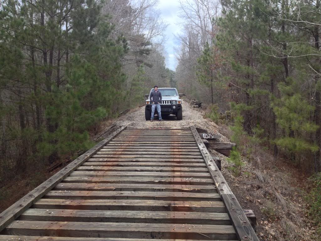


I started across...


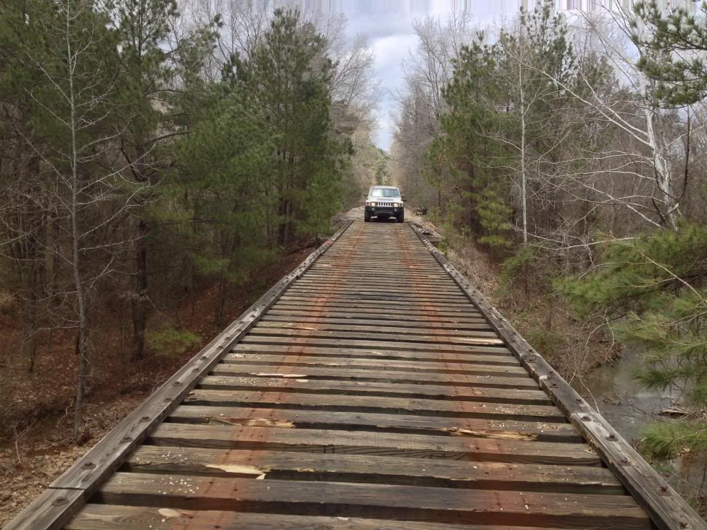
And it wasn't bad at all


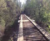
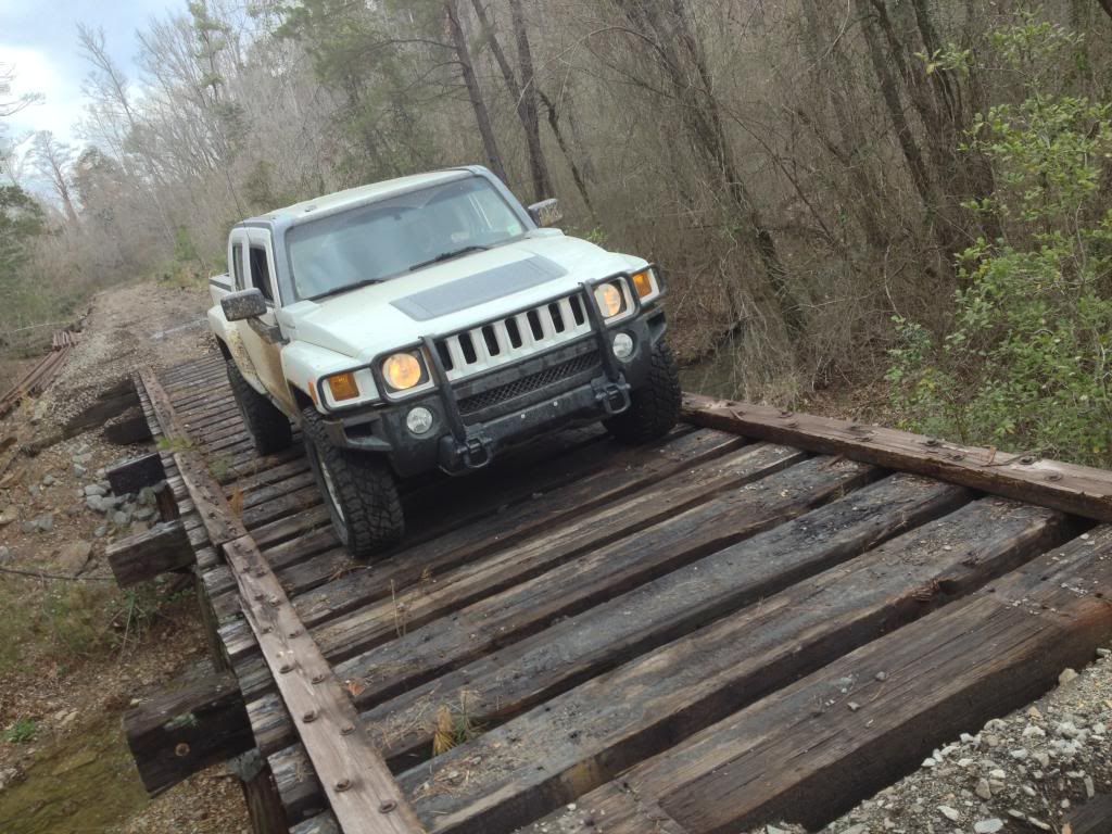
Then came upon another bridge...


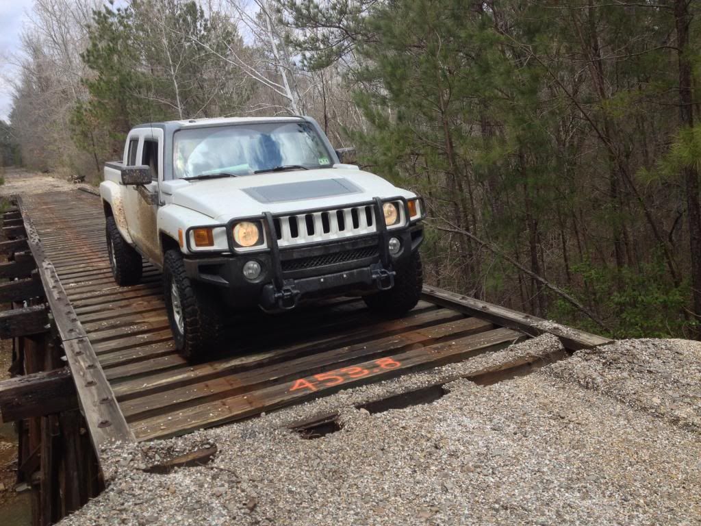
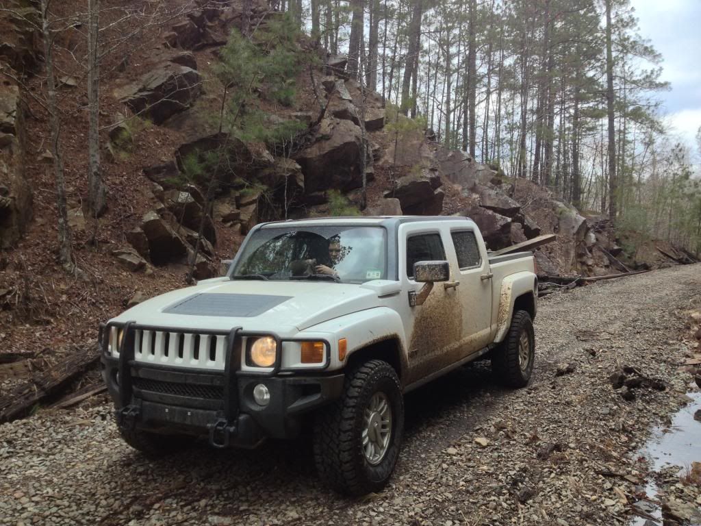
Some nice scenery I had to pose the truck in front of


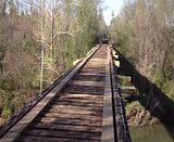
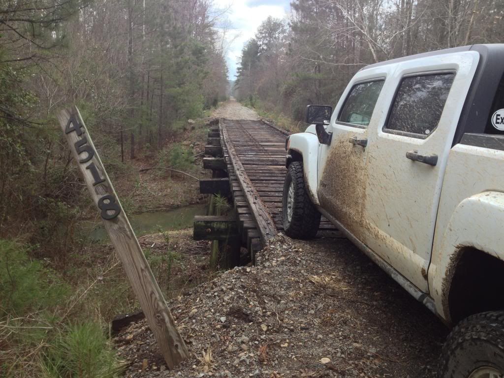
And another bridge...


Some rapids on the Antoine River


Took this after a quarter mile long mud pit I thought we'd never get out of


contiued........
 
Last edited:

Raw7s

Adventurer
Then we came upon the highest bridge yet, and narrowest!


Had no idea I was that close to the left side. I couldn't even see the bridge while driving, I thought my friend/spotter would have said something


That was the last bridge and we eventually came to the very small town of Antoine where we ate lunch.

We came back to his house in Arkadelpia before deciding to head out on the trails in the Ouachita Mountains.


He grew up in the area and was able to show me a way to the top of one of the highest points in the National Forest.

On top of Hickory Nut Mountain


And a random side trail that we wanted to explore. It actually ended after a few hundred feet. It also had a bunch of mounds I'm guess to keep 4x4 trucks out! Glad I had UCP! hahaha


It was a cold and VERY windy day, but was an awesome trip. The adventure included getting scared and lost, just the way I like it :D
 
Last edited:

Martinjmpr

Wiffleball Batter
Nice pictures and writeup. Very interesting to see "ghost towns" in places other than the arid West. Of course, buildings that are unattended don't last long in that kind of environment, so that's one reason why you don't see many "ghost towns" in the Eastern or Southern parts of the US - it's not that they aren't there, it's just that the earth reclaims them pretty quickly!

I'm only familiar with Northwestern Arkansas, my grandmother lived in Bentonville until she died in 1997.

Is that area private land? I looked it up on Google Maps and it doesn't seem to be in a national forest - is it some kind of state park land? Somebody built (rebuilt) those bridges, was it the state?

Also from the width of the road you're driving on and the gentle slopes it looks like it was once a railroad grade.
 

Raw7s

Adventurer
Nice pictures and writeup. Very interesting to see "ghost towns" in places other than the arid West. Of course, buildings that are unattended don't last long in that kind of environment, so that's one reason why you don't see many "ghost towns" in the Eastern or Southern parts of the US - it's not that they aren't there, it's just that the earth reclaims them pretty quickly!

I'm only familiar with Northwestern Arkansas, my grandmother lived in Bentonville until she died in 1997.

Is that area private land? I looked it up on Google Maps and it doesn't seem to be in a national forest - is it some kind of state park land? Somebody built (rebuilt) those bridges, was it the state?

Also from the width of the road you're driving on and the gentle slopes it looks like it was once a railroad grade.

It was the tracks that carried timber in and out of the area. Most of it is owned by International Paper or Weyerhauser. Then there's scattered land leased out to hunting clubs.

We were traveling on the bed of railroad tracks that had been recently pulled up.

I was wanting to make one last trip out before the vegetation turned green and covered everything up. I've found lots of pictures online of more buildings in the area, but the brush and trees are so thick you can't see much from the roads. If I find out where exactly they are, I'll hike to the buildings.
 
Nice report. Ghost town hunting. What a fantastic idea. Not so difficult here in CO, but still fun to explore with the kids I'm sure.
 

Raw7s

Adventurer
Headed back out to Graysonia yesterday, this time with some friends and their atv's. I towed the 4wheeler, and my friend in his v8 Sierra towed the heavier trailer with the 900 Rzr on it. I definitely had a hard time making it up long hills on the interstate towing the 750 lb atv, and the 6x12 trailer.

We went with the plan of asking a resident near Graysonia if we could park the Sierra and trailers next to his property while we ride, so they will appear to be his and no one would steal them. From the many trips I've taken out there I knew the house I wanted to stop at. The one with the old couple that sits on their porch and waves at me each time I've passed through. At the intersection of Graysonia and Bobo roads. So we got there and rolled up real slow and parked. This is miles from civilization remember, and miles from any neighbors, zero cell phone service. And as I'm walking to the front gate, the old man comes out of the house walking kind of heavy, I say loud and clear, "hello! how you doing?" A common greeting around here. He turns with out ever looking up and heads the other direction along side the house. I said, "excuse me sir?" Still no answer, he continues stomping back around his house. At this point I don't know if he's headed to the garage for his shotgun or what. My friends were scared and stayed back in their truck. They said they didn't want to appear threatening as a big group showing up. So I follow the old man and notice he's headed back to a garden where another old man is working in the dirt. I knew then he was just hard of hearing. As I approached their garden I notice old man #2 has his radio headphones on, and old man #1 is 6 feet in front of me and near deaf, both facing away. I just know that when #1 turns around he's going to be scared. #2 eventually see's me and I take my sunglasses off and raise both my hands in an old western non-threatening welcome kind of way. No telling how long they go without seeing other people out there. But I tell them what we're there for, and asked if we could park our trucks and trailers out front of their property and they were completely cool with it. Whew!


go right and you get to a couple old buildings, including "Billy's" house
go left and you get to the railroad tracks


random Christmas decorations
turn right for the RR tracks, don't know what's left yet, save that for next time


admiring this sexy beast while we eat lunch


found the bridge if you head north, this is the one I wanted to find, it crosses the river instead of small creeks. It had to have been 40 feet above the water, and maybe 50 yards long. I definitely had to have a spotter for this one.


*click for videos*


Found these in the woods up the hill from the pump station or something next to the river I posted a pic of in the OP. There were four in a square, I'm guessing foundation for a water tower. Wondering if it's the base to the water tower in one of the old pictures above...?


After hours of aimless wandering and exploring, we headed back just before sunset. Actually got to talk the old guy this time and asked him about the ghost town. He was real cool, and wanted us kids to have fun out there. He said the huge mill is still standing on the other side of the tracks. We didn't explore much over there, figured most of the town was east of the tracks and the river. But again, next time...
 
Last edited:

duckhunter71

Adventurer
I know Antoine and the Antoine River very well. Some family friends' family owns several thousand acres in Pike County and part of it borders the Antoine River. Ya'll ought to try Pinky's in Delight sometime when you're hungry. They used to be known for their burgers! It also lies where the Antoine and Little MO meet. Such a cool place. We hunted there most of my childhood and college years. I sure miss it!

I also have a picture of that barn toward the first of your post. If I can dig it up, I'll post it. I took it while interning for Farm Credit during the summer of 2007 before my senior year of college.

I sure miss SW Arkansas (I grew up in Nashville) and it will always be home. I wish I had thought to do the kind of exploring that you're doing when I lived down there!
 

Rattler

Thornton Melon's Kid
I looked up Graysonia on Google Earth and several pics popped up of some other buildings plus the stuff you saw. Looks like a neat place to explore. That is what I love about Michigan's Upper Peninsula. There is a ton of old mining stuff around up there ripe to explore.
 

Forum statistics

Threads
189,794
Messages
2,920,935
Members
232,931
Latest member
Northandfree
Top