Streakerfreak
Jan-Kee
With Christmas coming up and no one to spend it with I decided to go riding for the holiday weekend. My plan was to spend all of Christmas day exploring the back country of AZ, but thankfully several other options fell into my lap over the next few days. As I was picking up a few bottles of Franziskaner Weissbier for Christmas Eve dinner at Clark Whites house when I get a call from Clark himself telling me to meet him up the road with a few other riders for a quick ride before dinner. Off I went for a few miles of fun in the dirt. All I had for a camera was my Android since my DSLR finally died while in Panama.

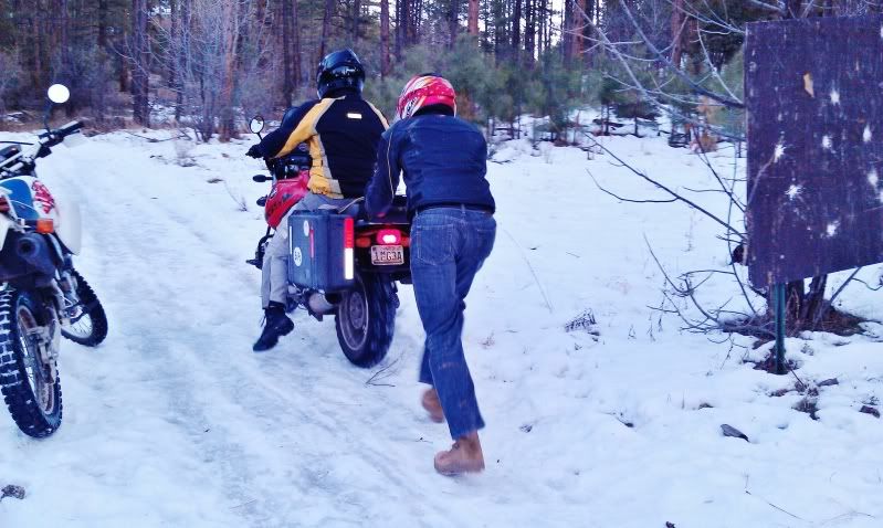
Little did we know, the roads on that side of Prescott were still snowed covered with thick patches of ice that stopped us in our tracks. After only a few hundred feet and an hour of pushing and dropping motorcycles we gave up and headed for dinner. All of us still enjoyed our little trip.
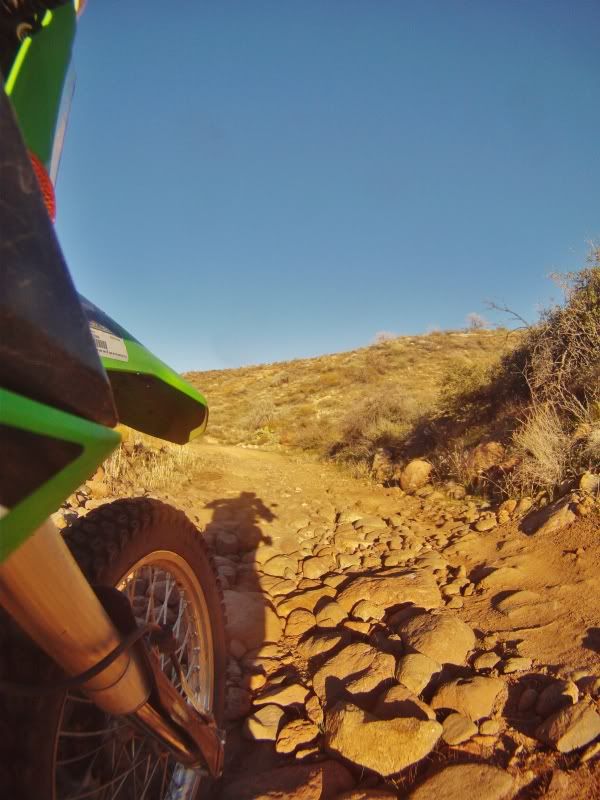
On Christmas Day, it was time for my solo ride. I had asked for route ideas from several other people who have explored the region extensivily, but in the end it was Scott Brady's route suggestion that seemed like the perfect fit for what I was looking for. I grabbed my phone and my GoPro. After reviewing maps and other data I knew I would not be able to finish the route without extra fuel and supplies so upon reaching Mayer, Az and the start of the dirt portion of my ride I filled every MSR bottle I could find. Thankfully, this gave me time to warm my frozen hands back up in the bathroom sink as it was 20 degrees on this Christmas Day in AZ.

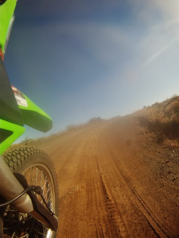
A half mile later and I was riding on dirt heading for the little "town" of Cordes on Antelope Creek Road.

One of the difficulties I am finding at least in this area of AZ, is that the roads are always changing names or numbers. Sometimes they are marked with their forest service number sometimes they are not. Planning out a trip in this area does require extra checking the names and numbers.

This is me playing with my phone
Antelope Creek Road ends in Cordes and while logically the road in front of me should just be Antelope Creek Road, it was not.

This is where the road turns into Crown Kind Rd (259). The road to the left of me was 259 and the road in front of me was also 259. Not an issue, as I was planning on doing a loop and ending in this same exact spot. I just had to decide if I wanted to start the loop going left or straight. Since I had been riding directly into the blinding sun, I thought it would be best to give my eyes a break so I started the bike back up and turned left onto 259.

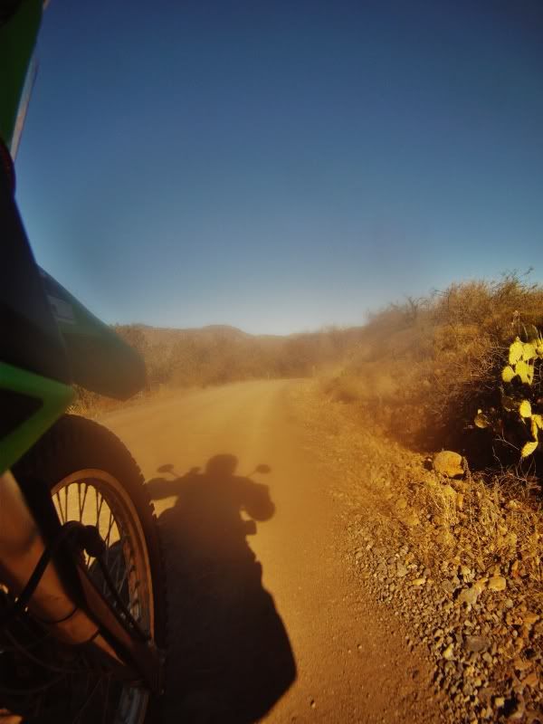
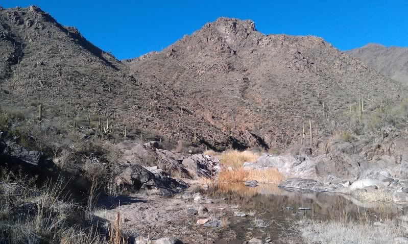
After a wonderful and relaxing ride I reached Aqua Fria National Monument where I was still riding blindly into the rising sun.

Not a soul was around as I rode deeper into the national monument which upon reaching this section the road is now called Bloody Basin which consists of breath taking vistas, forests, cacti, and switch backs. Bloody Basin road is very much doable in a high clearance 2wd vehicle which made this ride very relaxing instead of balls out single track riding.

I was averaging 50-60mph on these wide open forest roads, but with every turn I found something new to stop and check out.

I was having a blast and realizing this was turning out to be a great Christmas weekend so I continued to ride mile after mile, enjoying everything this area had to offer.

Around mid day I turned on to Cave Creek Rd (FR24) in search of Table Mesa Road (Fr41), but stopped for lunch and to empty all the MSR bottles into my 1.9 gallon tank.

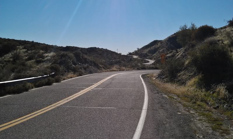
After reviewing my maps I knew I had a few more miles to go to reach my next turn so I began my look out. The miles kept racking up and I started to realize I might have missed my turn, but I could not figure out where I was. That was until I started seeing signs for Tonto National Forest and my bike hit pavement. Uh, oh. I knew I was not suppose to hit pavement so I had to figure out where I was.
The next turn off I would check my maps. That next turn off happened to be Sears-Kay Ruins. Never one to pass up history, I hiked the 1 mile trail in full moto gear.

Not much is left of the site, but for someone like me I don't care. I love it none the less.
Little did we know, the roads on that side of Prescott were still snowed covered with thick patches of ice that stopped us in our tracks. After only a few hundred feet and an hour of pushing and dropping motorcycles we gave up and headed for dinner. All of us still enjoyed our little trip.
On Christmas Day, it was time for my solo ride. I had asked for route ideas from several other people who have explored the region extensivily, but in the end it was Scott Brady's route suggestion that seemed like the perfect fit for what I was looking for. I grabbed my phone and my GoPro. After reviewing maps and other data I knew I would not be able to finish the route without extra fuel and supplies so upon reaching Mayer, Az and the start of the dirt portion of my ride I filled every MSR bottle I could find. Thankfully, this gave me time to warm my frozen hands back up in the bathroom sink as it was 20 degrees on this Christmas Day in AZ.
A half mile later and I was riding on dirt heading for the little "town" of Cordes on Antelope Creek Road.
One of the difficulties I am finding at least in this area of AZ, is that the roads are always changing names or numbers. Sometimes they are marked with their forest service number sometimes they are not. Planning out a trip in this area does require extra checking the names and numbers.
This is me playing with my phone
Antelope Creek Road ends in Cordes and while logically the road in front of me should just be Antelope Creek Road, it was not.
This is where the road turns into Crown Kind Rd (259). The road to the left of me was 259 and the road in front of me was also 259. Not an issue, as I was planning on doing a loop and ending in this same exact spot. I just had to decide if I wanted to start the loop going left or straight. Since I had been riding directly into the blinding sun, I thought it would be best to give my eyes a break so I started the bike back up and turned left onto 259.
After a wonderful and relaxing ride I reached Aqua Fria National Monument where I was still riding blindly into the rising sun.
Not a soul was around as I rode deeper into the national monument which upon reaching this section the road is now called Bloody Basin which consists of breath taking vistas, forests, cacti, and switch backs. Bloody Basin road is very much doable in a high clearance 2wd vehicle which made this ride very relaxing instead of balls out single track riding.
I was averaging 50-60mph on these wide open forest roads, but with every turn I found something new to stop and check out.
I was having a blast and realizing this was turning out to be a great Christmas weekend so I continued to ride mile after mile, enjoying everything this area had to offer.
Around mid day I turned on to Cave Creek Rd (FR24) in search of Table Mesa Road (Fr41), but stopped for lunch and to empty all the MSR bottles into my 1.9 gallon tank.
After reviewing my maps I knew I had a few more miles to go to reach my next turn so I began my look out. The miles kept racking up and I started to realize I might have missed my turn, but I could not figure out where I was. That was until I started seeing signs for Tonto National Forest and my bike hit pavement. Uh, oh. I knew I was not suppose to hit pavement so I had to figure out where I was.
The next turn off I would check my maps. That next turn off happened to be Sears-Kay Ruins. Never one to pass up history, I hiked the 1 mile trail in full moto gear.
Not much is left of the site, but for someone like me I don't care. I love it none the less.
Last edited:


")