Brisbane to Waterfall Way and back

Rumpig

Adventurer
As i wrote in another thread i posted up late last year, i'm going to post up some of my old trip reports on this forum that i've previously posted up on local forums here in Australia. So here's one we did about a year ago some of you hopefully may enjoy reading. The first part of the report involves a friends wedding we attended before leaving on our trip, so if your just interested in the travel / exploring side of things, you may want to skip the first few days of the report....Happy reading.

DAY 1
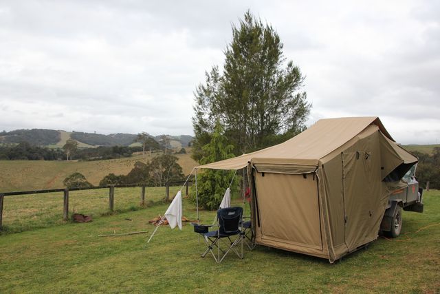
Ok so this trip was taken in the now just completed September school holidays, it's a big change for our family going away in the school holiday period, as we normally do everything we can to avoid such timing due to the crowds and idiots that tend to be associated with such events. We hadn't planned to take a holiday during this time frame for a few reasons, # 1 being mentioned already, and # 2 being the wifes work usually has holidays during these periods booked up already, but when the wifes boss asked if she wanted a week off of work during this time frame, we decided what the heck why not. I put a thread out a while back on a 4wd forum i frequent looking for suggestions of where we should go on this trip, the idea was to stay away from the coastline and beaches as we plan to head there at some stage during Xmas and i knew the crowds would be crazy also. In the end i decided we'd head South out of Brisbane on some back roads and end up down along the Waterfall Way that runs from Coffs Harbour to Armidale, and then possibly end up at Mt. Kaputar National Park where we'd visit Sawn Rock and then make our way home again. It's here that'll i'll admit that's pretty much as far as my planning ever got, i asked the same question on another forum and got some handy info also, but in truth i really couldn't be bothered planning the holiday and decided i'd make it up as we went along....lol. One thing i did know though, was our holiday would start on the Friday and we'd head about 45 minutes from home to camp at the Canungra showgrounds for a couple of nights. A bit of strange start to our holiday i know, but we had good friends Jay and Wombat (that's his nickname by the way) getting married at the showgrounds that weekend, and my wife and kids were to be part of the bridal party, so come Friday morning we packed up the camper trailer and headed off to Canungra just before lunch time.
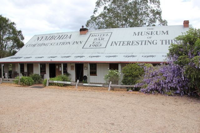
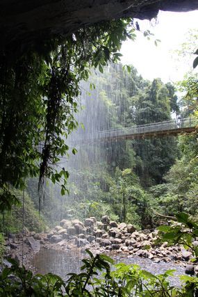
Arriving at the showgrounds just after midday i quickly went about setting up the camper trailer for the weekend, i was really surprised at how many people were already here camping and thought jeez it's a popular place at school holiday times. Making the same remark to the caretakers of the showgrounds, i was then informed that there was an annual week long hang gliding event being held at Tamborine Mountain this week, so many of the people i was seeing were here for that event. For those who don't know Canungra, it sits at the foot of Mount Tamborine and up on top of the mountain (a 15 minute drive away) is a dedicated hang gliding area that people can just pull up at on the side of the road, and watch people launch themselves from the side of the mountain into the air. Tamborine Mountain is one of those places people love to get out of the city from to visit on weekends, it has small craft shops the women all seem to love to visit, plenty of eateries and they also have a big market at the showgrounds up there once a month. Lots of people like to visit the mountain for the walks through the rainforests there also, so it gets a big range of visitors most weekends.
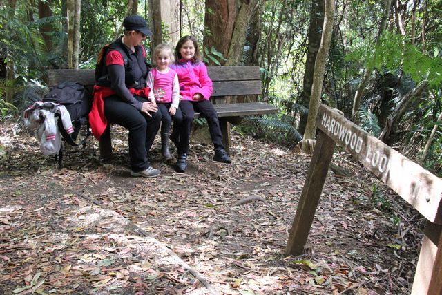
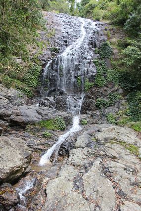
Anyhow, back to our trip....the plan for tonight was that i'd be sleeping in the camper with our 2 girls whilst my wife (and the other women in the bridal party) stayed at the motel in Canungra, we'd all meet up at the pub and have dinner, and then i'd get to watch the Storm take on Manly in the knockout semi final of the NRL (Rugby League) on the pubs telly. So with this in mind the wife headed off with some of the other girls to get wedding crap organised and drop her bags at the motel, whilst the rest of us there for the wedding sat around having a few drinks and doing not much else other then relaxing. Actually i tell a small lie, i wasn't happy with where i'd set the camper up, so with the help of Wombat and Rick, we quickly packed it up and moved it onto the main field and parked it closer to where the wedding would be held, that way it would be closer to all of our friends who'd be there that weekend. I walked around taking some pics of the campground area with the kids, but later on when the wife returned to the showgrounds she reformatted the memory cards on the camera as they were all nearly full, so any pics i'd already taken were wiped.....i couldn't be bothered taking them again. For anyone looking for a relaxed weekend getaway, Canungra showgrounds is a great little spot, they have flushing toilets and hot showers, powered sites (aswell as unpowered) available also and a great little creek and swimming hole areas down the back for people to cool off in when it gets too hot, they also allow fires :wings:
The afternoon rolled by and soon enough we all got ready to head down to the pub for dinner.... yes... yes... i hear you...but you've been drinking all arvo.... it's no worries, the pub has a courtesy bus that you can call up and they came down to the showgrounds and did the shuttle run for us :cool: The pub was pretty busy (i'm guessing in part to all the hang gliders in town), but dinner didn't take too long to get considering it was almost a full house, and i don't recall any complaints from anyone about their meals...so all good on that front. After dinner most of the ladies sat around the table chatting and having dessert, whilst one of the ladies (a mad Storm supporter) and all the guys moved into the public bar of the hotel to watch the footy be played. I think we may have been a touch more vocal then everyone else at the pub watching the game on the screen, but we didn't care as we all hated Manly and wanted the Storm to win, which they did :cool: After the game we said goodnight to the women in the bridal party, and we jumped back onboard the mini bus for the 5 minute run back to camp. Back at the campground i put my 2 girls to bed whilst one of the guys got a small fire going, we then sat around the fire chatting for a few hours and having a few more quiet drinks before everyone finally called it a night.

DAY 2
Saturday morning dawns and it's a lazy start to the day, the wedding isn't until the afternoon so all we have planned to do today is help set up the tables and chairs etc. and relax some more. Around 10.30 a.m i drop my 2 daughters off at the motel so they can start getting ready for the big day also, then return to camp and chill out some. At around 1.00 p.m the clouds start to build up and before long the heavens open up and it's bucketing down. Not a big deal really, about half an hour later it's stopped raining and we finish setting stuff back up again that was pulled inside for the rain. The rain was really a blessing in disguise, it was terribly hot in the mroning and the rain has cooled the afternoon off nicely. The rest of the afternoon stays rain free and the wedding goes off without a hitch :cool:

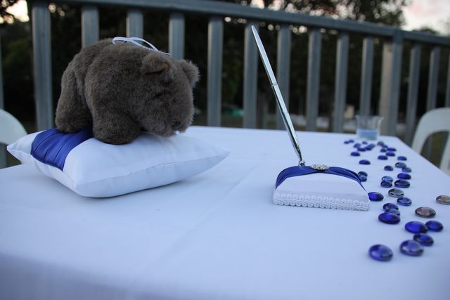
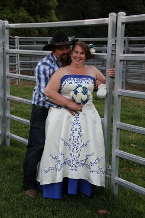
COUPLE OF WEDDING PICS FROM THE DAY

tn_IMG_4553.jpg


tn_IMG_4557.jpg


Inbetween the wedding reception speeches and what not, we duck back to one of the guys camper trailers to watch the nights NRL knock out final game on his telly, it's one way traffic to the Doggies, so we don't feel like we missed that much by not seeing the whole game. It was a great day which had the band wrapping up just after 11.00 p.m, and a while later we all make our way off to bed for the evening.

DAY 3
Todays original plan has us leaving to start our holiday proper, neither Leanne or myself are feeling all that energenic today, so after a lazy breakfast of bacon and eggs cooked by some of the guys who attended the wedding, we decide to not bother packing up today and we'll stay for another night before leaving. This pretty much sets the pace of this entire holiday, previous holidays have had us planning when and where we'll be each day, but this trip was going to be more about relaxing, and we'll get to where ever we end up when ever we get there....maybe...lol
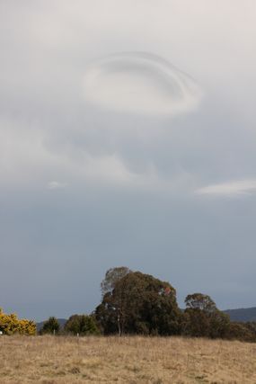
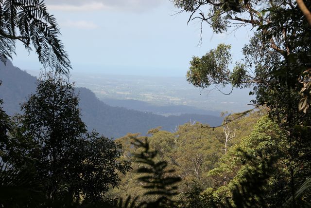
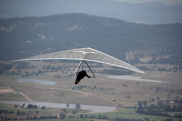
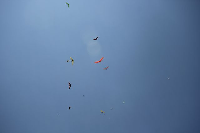
A few of our other friends aren't in a rush to go anywhere either, so we decide to head up the mountain and see if the markets are on this weekend. We get up there but this weekend isn't the weekend they are on, we continue driving and we soon come across all the people who are on the mountain for the hang gliding event. Cars are parked everywhere on the side of the road and we struggle to find a spot to stop at, turning back around we soon jag a spot and spend about the next hour watching them take off and soar above us. It's interesting listening in to the organisers as to when the wind conditions are appropriate to take off and when they aren't, the "runway" opens and closes several times whilst we are there, ensuring it's safe for everyone as they lauch off the side of the mountain.

HANG GLIDING PICS

tn_IMG_4790.jpg


tn_IMG_4802.jpg


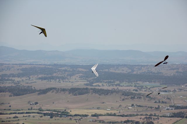
THIS WASN'T ALL OF THEM IN THE SKY ABOVE US EITHER :eek: :eek:

tn_IMG_4811.jpg


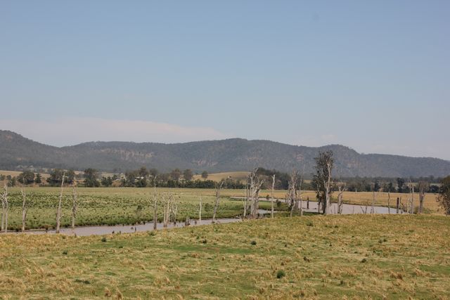
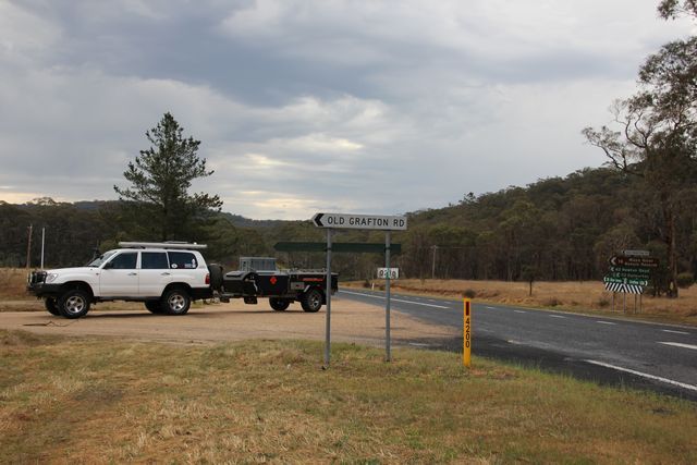
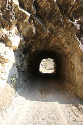
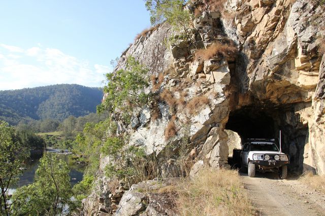
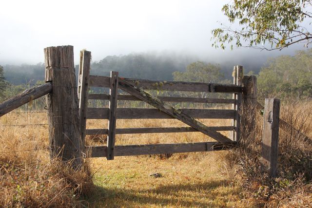
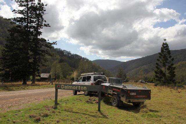
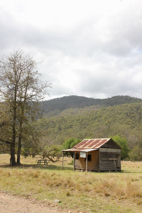
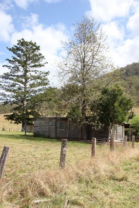
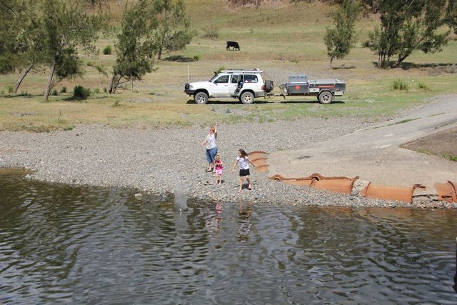
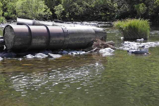
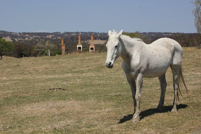
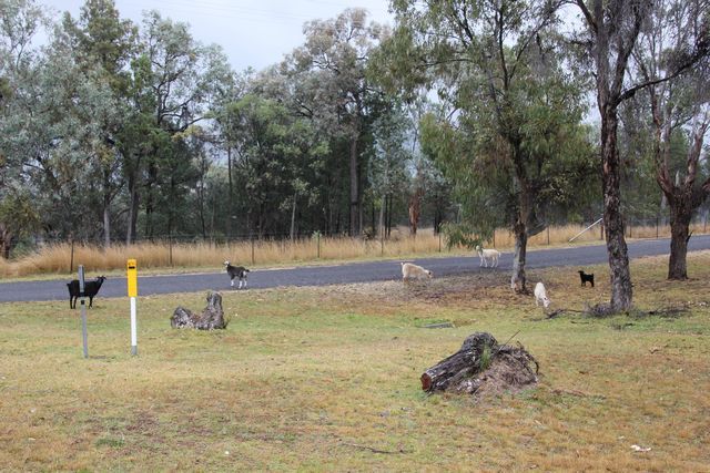
We return back down the mountain to Canungra for lunch and everyone that is left from the wedding finally packs up and leaves us on our own at camp (other then all the other campers there on the weekend). Another warm day today so later in the afternoon we head down the creek where our girls have a play in the water. We return back to camp around 5.00 P.M and i start looking at where we will end up tomorrow. I kid you not, right up until then i had no idea where we would go tomorrow..... searching on a map i find a campspot marked at a rough distance i am happy to drive for the day, and then i search on our IPad what's there. It's a place called Dalmorton which is about halfway along The Old Grafton to Glen Innes Rd and is a ghost town apparently, i tell the wife where we are going and it's agreed that shall be tomorrows destination :cool: after a big day yesterday we are in bed at a reasonable hour tonight, so we can be up and on the road at a decent hour tomorrow.
 
Last edited:

Rumpig

Adventurer
DAY 4
Waking up around 6.00 a.m we eventually drag ourselves out of bed, have brekky and get ready to leave. The canvas on the camper trailer is saturated thanks to the heavy dew, so we give it a bit of time to dry out as best we can, before eventually giving it a quick wipe down to get most of the droplets off, and then pack it up still damp. I think it's around 8.30 a.m by the time we eventually leave, we head out of Canungra and make our way inland towards Beaudesert. Beaudesert i hear you say :Wow1: yeah i know it's not the shortest route to get to where we are going, but i decided to take the scenic route to tonights destination via Beaudesert, Rathdowney, Woodburn, Bonalbo, onto Tenterfield and down to Glenn Innes before hitting the old road to Dalmorton for the evening.
Not long after leaving Canungra we stop in at the shops at Beaudesert to get some final supplies, that quick shop done and we are back on the road again. From Beaudesert it's a good run through to Bonalbo along the bitumin where we continue on to hook up with the Bruxner Hwy and turn West for Tenterfield. Coming into Bonalbo i spot a dead snake on the road, as we leave the town i soon spot another one, another couple of minutes up the road and i spot a large black coloured snake on the side of the bitumin also, but this one is definately alive..... there seems to be a few of these slithery things around these parts by the looks of it, the recent bout of warm weather would have them up and about also i guess.
Turning right onto the Bruxner Hwy and we are soon climbing up and down the Great Dividing Range, there's some decent hills about these parts and an old problem i noticed on our trip up North to Darwin last year soon rears it's ugly head once again. The temperature gauge is quickly rising as i climb a very long steep hill, i did labour in 4th gear a touch long as i started the climb and i wonder if this has something to do with it a touch. Knocking back to 3rd gear and quickly turning the air con off i back right off on the climb, taking it very easy up the hill the gauge stops climbing and i start to settle down a touch with my worry, there's nowhere to safely stop here due to all the blind corners and blowning a motor is not something i need to worry about thank you very much. For the rest of the drive into Tenterfield the air con stays off and i baby the Cruiser up the big hills, changing down through the gears early and backing right off the revs to take it easy up the hills, it seems to do the trick and we make it into Tenterfield for lunch without anymore problems. This problem with the temperature rising happens once again on the run home, once again it's a very large hill up a range and i have the aircon going at the same time also. I am putting the problem down to the fan hub needing more silicone oil in it, i have slight problems with the aircon at times not getting as cold as it should also, and i will start by adding more silicone oil and then seeing if it makes a differance.
anyhow back to the trip.....
Along the way we cross the Clarence River and stop for a quick pic of the landscape before continuing off again

CLARENCE RIVER AND SURROUNDS

tn_IMG_4822.jpg


As we enter Tenterfield for lunch a storm is brewing about the area, a strange circular cloud formation gets my attention and my wife takes a pic out the window as we cruise down the road at about 90kph.

STORM A BREWING

tn_IMG_4827.jpg


Entering Tenterfield the trees that line the street there give the town a lovely feel, if you get the chance to drive through here in Autumn you'll love the colours that these trees put on display for all to see, but currently the leaves were all gone due to the current season.

ENTERING TENTERFIELD

tn_IMG_4829.jpg


Pulling up at a park for lunch our youngest is complaining her tummy hurts, she hops out of the fourby and then preceeds to throw up the strawberry milk drink she has just consumed earlier....how's that for timing :cool: We have lunch and the kids play on the playground for a while whilst i keep an eye on the clouds above. After a short while we leave Tenterfield and head South down the New England Hwy to Glenn Innes, along the way it buckets down raining and at stages i have the wipers on full bore to see where i'm going. As we come into Glenn Innes the rain has eased but some good ground strikes of lightning are being seen about the area, it's still fairly early in the afternoon and radio reports have the weather clearing early this arvo, so i'm not concerned with what's happening at the moment. From Glen Innes we turn East onto the Gwydir Hwy and proceed about 35klms towards Grafton before turning right onto the Old Grafton to Glenn Innes Rd

TURNING ONTO THE OLD ROAD

tn_IMG_4830.jpg


The road starts off as dirt but quickly turns to bitumin again as we are soon winding our way down a very steep road, i can see we have long way to go before we reach the bottom, so it's 2nd and 3rd gear most of the way with me trying to stay off the brakes as much as possible. After quite some time we eventually reach the bottom of the hill, even with my attempt to use the brakes as little as possible, i can still smell the brakes as we pull up at a small water crossing on a concrete causeway for a quick pic.

WINDY ROAD TO THE BOTTOM....go slow it's a long way down

tn_IMG_4833.jpg


Not knowing exactly how far it was to go to Dalmorton due to my lack of research (i should have looked at the sign at the turn off also) we soon come across the 1st camp ground along this section of our route, i just had a quick look at my road atlas and i'll take a guess it's called the Mann River Reserve (though i could be wrong, i'm happy to be corrected), we stop in for a look and it's a nice spot right by the water with some roos about on the grass camp area, i think it's free to stay at as i couldn't see where you'd pay when your there whilst we looked around the place. We nearly stop here for the night but decide Dalmorton was our destination for the evening so that's where we'll head for, in hingsight this spot was nicer and i wish we'd stayed here the night instead....oh well :( From here we push on through an ever changing landscape, the road opens up in parts and then closes back in in other areas, there's a heap of roos about the area and we see well over 30 on the roadside in a not so long stretch of klms ::)

EVER CHANGING SCENERY ALONG THE WAY

tn_IMG_4843.jpg


tn_IMG_4844.jpg


tn_IMG_4847.jpg


Looking back at the pics now i see Dalmorton was about 75 klms from the turnoff, 10 klms before reaching there is the old "convict" built tunnel that was carved through the rock for the road, that would have been an effort for them to build that. i put "convict" in itallics because apparently it wasn't built by them at all, it's just a common thought mistake perpetuated by many who don't know it was actually built by a goverment funded road crew.

"CONVICT" BUILT TUNNEL

tn_IMG_4855.jpg


tn_IMG_4861.jpg


With pics taken here we push on and soon and arrive at tonights destination, you enter into the old town of Dalmorton before turning right and heading a short drive of about 800 mtrs up the road to a campground. The campground is nothing special in my view but could be a lot worse also (ok to stop at i guess i'm saying, but there's plenty of free camp areas about the area if you know where to look), most areas allocated for a camper trailer are on massive slopes and small in size making it impossible to set up in there. The one spot that is flat and large has someone set up there with a small dome tent, i roll my eyes as there is a large bollarded off green grassey area allocated here for people with tents, i'm not sure why old mate would set up where he did when there is a much nicer area about 100 mtrs away from where he set up his camp. Being we are the only people around and it's about 5.00 p.m by now, i pull into the carpark area for people with tents and proceed to take up most of the entire carpark to set my camper trailer up in, if someone comes along (which is highly unlikely considering where we are) we can still park their car about here, so it's really not a big issue what i did. The campground itself has 2 toilet blocks and fire place facilities aswell, it also supplies firewood and cost us $16 for the nights stay, which you pay at the self registration booth.

CAMPED AT DALMORTON CAMPGROUND

tn_IMG_4865.jpg


Later in the night i grabbed the camera and had a play with some night shots, i should have asked my wife how to do it as she knows what to do, but i managed a grainey shot that looks ok at a small size...lol

NIGHT SHOT

tn_IMG_4880.jpg


We sat around the fire for a while relaxing before calling it a night and heading off into the camper trailer where i studied some maps to see where we'd go tomorrow. I went to sleep without a final decision on where to go tomorrow, and decided to worry about it in the morning...lol.
 

Rumpig

Adventurer
DAY 5
Waking up around 7.00 a.m i look out the camper trailer window to see what the day is like, it's pretty foggy outside so i grab the camera to see what pics i can take. The sun is starting to burn the fog off pretty quickly and i don't manage to take a pic of anything all that special i think to myself. I take a pic of a nearby gate that shows some of what's left of the fog in the back ground.

PLAYING WITH CAMERA IN THE MORNING

tn_IMG_4891.jpg


I wander back to the camper and eventually everyone starts getting up so we can have brekky. Like yesterday morning the canvas is soaked on the camper from the heavy overnight dew, we decide to stick with the relaxed pace of the trip and let it dry before packing up this morning, so we opt for a hot brekky :cool: the kids want pancakes so that's what we go with.

BREKKY IS SERVED

tn_IMG_4896.jpg


Whilst having breakfast we finally decide where to go today, we decide to head to the town of Dorrigo and have lunch there, and then we'll decide where to stay tonight. We've chosen to base ourselves at one spot and tour out of there rather then drag the camper around with us where ever we go. First up we plan to look around Dalmorton some, then continue East along the Old Grafton Rd, where we'll eventually turn right onto some track on the map that brings us out a touch North of Nymboida somewhere. I'd like to head through Chaelundi Nat. Park on the trail that passes through there that i see on the map, but at Canungra the other night i remember reading on the parks website that a key was required to get through some locked gates that are in the park, not being sure if it was still the case or not we didn't want to risk it so chose another track (i've since found out this is still a locked gate area you need the key for).
Around 9.30 a.m we have the camper packed up and we set off, we turn right out of the campground (instead of left to Dalmorton) and head up the road a few hundred metres to go look at an old historic slab hut that is supposed to be down by the river somewhere here (according the info. at self registration hut). There are no signs of where the track is to the hut, so we pull up at a locked steel gate that at a guess is about the right distance from the campground to what the map showed it would be. With no idea how far away the hut is we start walking down a steep loose rocky 2 wheel track, hopefully to where the hut might be. We get about 150 mtrs down the steep hill and i look off into the distance to see where the hut is, it was shown by the river bank on the map back at camp and i can see something in the trees a long way off that might be it. It's stinking hot right now and we aren't sure if we are even at the right place, we say bugger walking all that way on a guess with 2 young kids in tow, so turn around and walk back up the hill to the fourby. We jump in the vehicle and head back down the road past the campground to Dalmorton itself. We spend a while reading the information board and looking around here, the kids (and ourselves aswell) try and work out where all the buildings used to be in this town, some are still here but many are also not here anymore, though look closely and you may see their old foundations.

DALMORTON

tn_IMG_4897.jpg


tn_IMG_4908.jpg


tn_IMG_4903.jpg


tn_IMG_4901.jpg


Leaving Dalmorton we continue East along the Old Grafton Rd, it's pretty windy with plenty of blind corners, a lot of the time we are lucky to be doing 40 - 50 kph along here as going any faster is a sure fire way to have a head on with someone coming the other way (not that we encounter anyone). The road follows the path of the Boyd River which is constantly beside us along the way, about 10 - 15 klms out of Dalmorton i see some great free campspots on the bank of the river, someone is setup here already so i assume you are allowed to camp there, there's a heap of spots you could choose to stay at in this area if you chose to do so. About 20 klms out of Dalmorton and we come to a bridge that crosses the Nymboida River, down the river to our right about 150 mtrs is a large group of people free camping on the river bank, this also would make a great location to camp at if you chose to do so also, local knowledge of the area or some more research would be a great thing...lol. We pull off the road to take some pics and the kids have some fun throwing rocks in the water.

NYMBOIDA RIVER CROSSING

tn_IMG_4917.jpg


WHAT'S LEFT OF THE OLD BRIDGE PILLARS HERE

tn_IMG_4912.jpg


tn_IMG_4914.jpg


We push on and soon turn right onto Glens Creek Rd, there's a sign pointing to Nymboida this way so all looks good for where we intend heading. Just like the Old Grafton Rd, this dirt road is good smooth gravel and eventually it turns to bitumin. We turn right onto the main Hernani - Nymboida Rd and are soon going through Nymboida itself, i'd recently read elsewhere about stopping in at the Coaching Station Inn and being sure to visit the Museum of Interesting Things that is next door. Leaving Nymboida we soon see the Inn on the righthand side of the road, i tell Leanne we need to stop here for a look so we pull up and start exploring the place. The pub and the museum (and i assume motel that is here) are owned by Russell Crowe (the famous actor for those saying...WHO!!!), inside the pub has plenty of autographed memorobillia on the walls, but the best stuff IMHO is inside the museum itself. We walk up to the museum first up and are disappointed to read it's closed today, as we start to walk off over to the pub itself, another couple walk up saying they just paid the entrance fee inside the pub and the people said it's ok to go inside the museum to look around. (EDIT....on a recent visit here we were informed by staff behind the bar counter thatRussell has now sold the pub and the museum was to be closed, so check to see if it's there before going to see it)

COACHING STATION INN

tn_IMG_4926-1.jpg


SOME OF INSIDE THE PUB

tn_IMG_4925.jpg


IGNORE THE SIGN AT THE MUSEUM, GO SEE THE PEOPLE INSIDE THE PUB AND PAY THE ENTRY FEE IF IT'S "CLOSED"

tn_IMG_4923.jpg


We walk into the pub and pay the $12 to enter the museum, we have a look at some of the stuff autographed on the walls inside here at the same time, and then walk back over to look through the museum itself. Now when they say a museum of interesting things, it's a bit of everything really, inside the first thing you come across as you enter the room is a line up of motorbikes. There's a custom chopper on display that was done by the guys from East Coast Choppers in the South Sydney Rabbitohs NRL football team theme, for Russell who owns the football club. Beside that is also a line up of restored old bikes that would get many an older bikers heart a racing.

CUSTOM CHOPPER IN RABBITOH'S THEME

tn_IMG_4928.jpg


LINE UP OF OLD BIKES ALSO

tn_IMG_4931.jpg


Aswell as the bikes, inside is a large array of custumes and props from many of the movies Russell has starred in over the years. There is his stuff from the movies Gladiator, Romper Stomper, aswell as Robin Hood and many other other movies also. Getting pics was a touch hard due to the reflections of the boxes they are stored in, but i took some pics anyway to give an idea of what's inside this place (excuse the poor quality). There's plenty more then what i've shown here inside the museum, there's even a full size chariot with horse on display from the Gladiator movie aswell.

PROPS FROM MOVIES

tn_IMG_4932.jpg


tn_IMG_4938.jpg


tn_IMG_4940.jpg


Aswell as the bikes and movie stuff there is some great Australiana stuff on display here, the largest thing you will see on display is the "Leviathan" stage coach, a replica of the largest ever Cobb and Co coach that was in Australia. The info card was missing at the display, but i'm sure i have read somewhere that this coach required something like 22 horses to pull it along :Wow1: . Aswell as the coach there is an autographed Don Bradman cricket bat on display (he's a legend of the game), their was an old racing car that i can't remember where it was from, aswell as some great little displays showing old mining gear and aboriginal heritage, etc, etc from around the surrounding area. You can easily spend an hour or 2 walking around inside here looking at stuff.

THE LEVIATHAN STAGE COACH...with my kids in front to give an idea of size.

tn_IMG_4933.jpg


Leaving here we continued onto Dorrigo, the roads are pretty windy and steep in places from here to Dorrigo, but with the aircon turned off and taking it easy up the hills there weren't any temperature gauge problems with the vehicle to worry about. We arrived in Dorrigo without issue and visited the information centre in the main street town to see what was about the area to stay at. Unlike Qld National Parks, the NSW National Parks don't seem to have a set price for camping at, some places charge a vehicle entry fee whilst others don't, some charge $5 an adult and others $10 and adult, it really is a stupid system IMHO. With most places looking to cost between $20 and $30 a night to camp at in the surrounding National Parks, the lady at the information centre tells of us of a place right next door to Dangar Falls (2 minutes drive out of Dorrigo) that has powered camping with hot showers and flushing toilets for $25 a night, so we make a phone call to check availability before making our way there to see what it looks like. The place is basically a private property with a large house on it (that you can rent) looking over the beautiful country side surrounding the area. Out the back of the house is a grassey area that has a couple of power poles and town water fed taps placed around it to allow people to camp there in comfort, under the house is 2 toilets and a shower with hot water for campers to use also. You don't need to book here, just pick a spot and set up and Bill the owner will come around each afternoon and morning to collect your camping fees from you. With 1 other camper trailer set up here already, a relatively cheap fee to pay (considering what you get) and a great view of the surrounding country side to be had, we quickly start setting up what will be our base camp for the next couple of nights.

CAMPED NEXT TO DANGAR FALLS

tn_IMG_4946.jpg


We have a late lunch and then head back into town to look around, we grab an ice cream from the shops and head back to camp afterwards to relax for the rest of the afternoon. I notice some bags of firewood on the verandah of the house for $10 each, so i grab one of them and when Bill arrives to collect the fees i pay him for 2 nights accomodation and the firewood. That afternoon we chill out by the fire having a few drinks and a chat with a lovely couple we met at the campground who arrived in the afternoon with their caravan (bound for Bathurst for the famous car race), before us then having dinner and calling it a night and heading off to bed.
 

Rumpig

Adventurer
DAY 6
A bit of a miserable day today, it's not really raining but it's very overcast and looks like it could rain on and off at times today. I start the morning by taking pics of our neighbours who have wandered up the hill for a morning drink

THE NEIGHBOURS

tn_IMG_4967.jpg


tn_IMG_4970.jpg


After brekky the plan first up today is to head a few minutes up the road back into town to go take some pics of all the old trains and carraiges that are on a property on the Northern outskirts of town. Coming over the range from Nymboida direction yesterday the first thing you see as you look down into Dorrigo is a mass of old train carraiges and locomotives. Now i'm not talking just a couple of trains here, it is down right mind blowing how many carraiges and locos have been collected here in the one area :Wow1::Wow1: . Later on when we visit the property i find a sign saying it is the Dorrigo Steam Railway and Museum, it's a privately owned collection and not open to the public yet. There is a mail box on a gate that has information sheets for you to take that tell you what's on the property and how to get in contact with the owners, aswell as how to make donations to the group if you like.
TAKEN FROM A PAMPLET I GOT AT THE FRONT GATE....
The collection in the Museum's care.... currently 67 Locomotives, 280 Passenger Carriages and Freight Wagons, 19 Railmotors / Trailers, a Silver City Comet set, Sydney Suburban and Interurban Electric trains, plus thousands of smaller items, is the largest in the World...........
The 37 Steam Locomotives range from a 27 ton, 4-wheel saddle tank to a 260 ton, 32 wheel BEYER GARRATT type (the largest locomotives in the Southern Hemisphere), the Steam Locomotives date from 1877 to 1956. 26 Diesel and 4 Electric Locomotives are also preserved, dating from 1952 to 1986......................
A very large display of locomotives, rolling stock and thousands of smaller items, is being established on 53 acres of land owned by the museum and will eventually all be placed undercover. The items that are visible from the street are only a small part of the total collection

SOME PICS FROM THE RAILWAY COLLECTION

tn_IMG_5049.jpg


tn_IMG_4983.jpg


tn_IMG_4974.jpg


After taking a heap of pics from outside the fence of the property, we jump back in the fourby and head about 10 minutes drive away to the Dorrigo Rainforest Centre to get some exercise. We start off by walking out onto the "Skywalk" that is there, it's basically a boardwalk / lookout that overhangs the rainforest below, it has you looking out into the surrounding valley from 70 mtrs in the air.

SKYWALK AT THE RAINFOREST CENTRE

tn_IMG_4991.jpg


One neat little thing out on the viewing platform was a pole that allows you to mount your camera onto whilst you take a photo, i myself have never seen one previously, but it certainly makes it easy for you to get yourself in a family photo. It has a threaded bolt at the top of the pole the same as if you were fitting the camera on a tripod, just attach the camera, line the shot up, hit timer and run into that perfect family photo without fear of your camera falling off of the handrail 8) 8)

FOTOPOL

tn_IMG_4992.jpg


Now the fun begins.... from here we have a 6.2 klm Wonga loop walk infront of us to visit a couple of waterfalls, it says it takes roughly 2.5 hrs to do the walk, but we know with a 4 year old child it is going to take us longer then that, so we guess somewhere closer to 3 hrs maybe. You don't have to do the entire loop if you don't want to, there is the option to drive 1 klm down the road to the Glade picnic ground and hop out there to start the walk to visit the falls, you can then return back the way you got there and at a guess it'd reduce the entire walk to maybe 3 klms, but we say what the heck we'll do the whole thing instead. The entire walk is mostly on a bitumin track with a section of elevated timber boardwalk also, we do the loop anti clockwise and looking back now this has the advantage of us going down the steepest part of the walk instead of up it on the last leg of the loop if you were to go clockwise. The one downside to going anti clockwise is that you visit the best parts of the walk in the first 4klms of the loop, the last 2 klms are just rainforest (which we've seen plenty of over the years), and doing the loop the opposite direction would have more for you to see and break up the last leg of the walk a touch, though also has the downside of a steeper climb back up to your start point. From the Skywalk Centre it takes us around an hour to an hour and a half to get to our first major waterfall (you do pass a small one beforehand), along the way we pass over a suspended boardwalk and then eventually reach a big suspension bridge that has us thinking the walk thus far was well worth it.

CHRYSTAL SHOWER FALLS

tn_IMG_5003.jpg


tn_IMG_5005.jpg


From the suspension bridge you can then walk down behind the waterfall also, which we did before then stopping for a snack to eat so the kids could rest up a touch. We knew we still had a long way to go, so i told the kids when we get to the next waterfall we'll stop again for another snack, atleast this gave them an incentive to get there...lol.

LOOKING OUT FROM BEHIND THE WATERFALL

tn_IMG_5015.jpg


We continue on along the walk and soon find oursleves at Hardwood Lookout, we let the kids rest up again and i take the opportunity to take a few more pics

tn_IMG_5027.jpg


tn_IMG_5023.jpg


It's only a short break and we are soon back under way again. Before long we are at our second major waterfall of the walk, the kids have been going fantastically well so far and they have surprised me with the fact they haven't whinged once yet :Wow1: The pic doesn't really do this waterfall justice, it's much bigger in real life then it looks in the photo, and without climbing down to the creek bed, you can't really photograph all of it due to it iscontinuing to fall under the bridge you walk across here. I take a few pics and the kids get the snacks they have been waiting for, from here on we know it's still a few klms back to the Rainforest Centre (turned out to be closer to 2.5 - 3 klms i reckon) and when we get there we'll have a late lunch at the cafe :drool:

TRISTANIA FALLS

tn_IMG_5028.jpg


Towards the end of the walk our 4 year old starts to whinge ever so slightly, she (aswell as our eldest daughter) has done remarkably well and in a time of around 2 hrs 45 minutes she completes the Wonga walk entirely on her own 8) 8) Once back at the Rainforest Centre we walk into the cafe and sit down to have lunch, the rain started to sprinkle as we walked the last few hundred metres, but whilst having lunch in the cafe it started raining fairly heavily, so we were very lucky with the weather indeed.

ALONG THE WONGA WALK

tn_IMG_5038.jpg


With a late lunch eaten we head back to camp, we decide that one walk isn't enough today so we duck next door and do the short walk down to the bottom of Dangar Falls also. The track down here gets very slippery in places, there's a safety chain running beside the track and a few times i grab it to steady myself as my feet begin to slip from beneath me. We take a few pics at the base of the waterfall and as the rain begins to fall again we make our way back up the hill to camp. The afternoon and evening are a bit dreary due to the weather, so tonight there is no fire and we are content to lock ourselves inside the camper to stay warm, we plan tomorrows adventure and go to sleep relatively early after todays workout.

DANGAR FALLS

tn_IMG_5050.jpg


tn_IMG_5056.jpg
 

Rumpig

Adventurer
DAY 7
A much nicer day today then yesterday was, which was good to see as i peaked out the camper trailer window after waking up :cool: :cool: The plan today was to go for a drive that is listed in a book i was given from a guy called Kev Smith, Kev works at TJM at Coffs Harbour and has put out a fantastic book called Coffs Coast 4wd Destinations, it's "A complete guide on 4wding around the Coffs Coast" and is available to purchase from TJM at Coffs Harbour if you ever find yourself there. The book listed tours that range from mild touring to the more hardcore tracks you find around the area, a handy item to own indeed. In the book there is some fantastic photography from around the Coffs area, my aim for today was to visit some of these locations and try to replicate some of those great pics that are in the book as best i could, the main aim being to replicate a pic of some old train carriages that were at the small town of Lowanna.

PLEASE NOTE... MUCH OF THE INFORMATION I WILL GIVE ABOUT TODAY'S DRIVE IS TAKEN STRAIGHT FROM THE BOOK I GOT FROM KEV, AT TIMES I WILL BE COPYING WHAT HE HAS WRITTEN IN HIS BOOK AS HE IS A WEALTH OF KNOWLEDGE ABOUT COFFS AND THE SURROUNDING AREA (though i may have changed some wording also). IT'S A FANTASTIC BOOK AND ALL I'LL SAY IS, IF YOU PLAN TO VISIT THIS AREA, I SUGGEST YOU DROP INTO TJM AND GRAB A COPY FOR YOURSELF, MAYBE YOU'LL EVEN GET TO MEET KEV IN PERSON
i have no affiliation with Kev or the book by the way.


Leaving Dorrigo we headed South East towards Bellingen, the plan is to head to Coffs first up as it's the start location for this trek in the book, and then follow the exact route listed where we'll end up North of Dorrigo in the Nymboida Binderay Nat. Park, before exiting the park at it's Western side and heading back to Dorrigo again, so basically a big loop drive. Leaving Dorrigo and heading for Bellingen it's not hard to see why they call this the Waterfall Way, we bypass the turn off to the Rainforest Centre we visited yesterday on our left and soon are making our way down a steep mountain range. It's slow going for us due to it now being single lane road each way and we are stuck behind a large bus, trucks and buses need to use low gear down this range but i don't mind as it gives me heaps of time to check out the scenery whilst i'm driving. We pass 2 beautiful waterfalls and couple of lookouts going down the range, the waterfalls literally fall right down by the roads edge and go underneath the road your driving on :cool: . There's nowhere to stop at the first waterfall, but the second one has a small carpark area and rest stop area where you can stop and take some pics, we don't stop due to just having gotten past the bus (thanks to him pulling over for us on a dirt shoulder), and we push on towards Bellingen. Due to our usual relaxed start to the morning (time frame wise) we continue straight through Bellingen and continue on to Coffs Harbour, according to old mates wife in the caravan back at camp, Bellingen is a lovely town to look around, we didn't have time today to do so ourselves so will get back there one day and see what we think for ourselves.
Coming into Coffs Harbour and the first thing i notice is the traffic, it's been very quiet where we have been so far considering it's the first week of school holidays at the moment, and i'm instantly happy i gave the Eastern coastline a miss at this time of the year. From Coffs we head West through Coramba, as we leave Coramba we take a left turn onto the Eastern Dorrigo Way and we start to work our way up onto the Great Dividing Range. It's 15 klms of winding bitumin road and according to the book we are 600mtrs above sea level as we reach the top, you get glimpses of the view through some of the breaks in the trees on the side of the road, but look out the side window too long and you'll miss the next sharp bend in the road. Continuing on we soon turn off this road to the right for the small town of Lowanna, coming into town it's a quick stop at the toilet block for the kids and i get to talking to a local who is at the park walking his dog. I quiz old mate about the train carraiges i've come to photograph and he tells me he's pretty sure they have been scrapped due to locals concerns over lead paint and asbestos as the carraiges are not far from the local school. He tells me the train station has been revamped, but that's all that is there these days, i get directions and we are soon at the old station having a look around.

LOWANNA TRAIN STATION

tn_IMG_5069.jpg


We spend nearly an hour here looking around and taking pics, i notice where the carraiges used to be on the tracks there is alot of debree that looks like it's old timber and possibly even some asbestos laying about, to me it looks they simply crunched the carraiges up here where they sat, and it's no better for the local kids with them gone then if the old carraiges were still here. I could be wrong on this, but this is how it looked to me with all the small bits of debree between the tracks.

NO WORRIES ABOUT GETTING RUN OVER HERE

tn_IMG_5072.jpg


ABOUT ALL THAT'S LEFT OF THE OLD CARRAIGES

tn_IMG_5079.jpg


We leave Lowanna and head back towards the main road we were on earlier, turning right we continue along that road and soon pass by the town of Ulong, we continue straight through and soon come to a sharp lefthand bend in the road, the bitumin road continues left to Dorrigo but we drive straight ahead onto a dirt road. As with all the dirt roads we travelled on this trip so far this one is in good condition also, several kilometres up the road we cross over a small causeway at the Bobo River, looking to your left as you cross the causeway you'll see a large metal bridge that was part of the old railway system that once ran here many years ago.

OLD RAILWAY BRIDGE

tn_IMG_5083.jpg


Continuing on from here we are soon passing through pine forestry, there has been some recent logging going on here and the clear felling doesn't look pretty, but that's the way it is in that business. Pushing on and we soon find ourselves in the tiny town of Cascade (there's lucky to be half a dozen building here), taking the right fork in the road as we come into town and we stop a few hundred metres further up on the righthand side of the road. There's a small National Parks type board here and it doesn't really mention what is hidden less then 100 mtrs down the 2 wheel track that is here to the boards right. I'm not sure if i'm even in the right place due to no decent signage, but Kev's book mentions a Cascade Heritage Trail where The Old Case Mill was built, the mill operated between 1939 to 1945 during the Second World War milling rainforest timber for ammunition boxes. There's another great pic in the book i want to try and replicate here, but as i walk up to the location i'm after i notice something isn't the same as in the pic in the book.... the pic in the book shows a rusting old boiler surrounded with lush green foilage that contrasts the bolier just nicely, sadly for me someone (i'm guessing National Parks people maybe) has recently poisned all the surrounding foliage off with something like round up, and it just looks awful to me....Grrrr. There's still some great stuff to look at here, but it's just not what i was hoping to see in the way of taking a certain picture of the place, we do the walk around here and take a few more pics before continuing on once again.

CASCADE HERITAGE TRAIL / CASE MILL SITE

tn_IMG_5088.jpg


tn_IMG_5094.jpg


From Cascade we follow the road towards a place called Platypus Flat, this is a National Parks campground we originally planned to stay at on this trip, but looking at the website Nat. Parks says no trailers on their web page. From memory i'm sure i've read Kev say previously that you can stay there with a camper trailer, so for this very reason we are headed here to have lunch and suss out if we can return one day to stay here at a later date. Along the way we bypass a small carpark on our left that has a 800 mtr long (return) walking track leaving from it called Tramline Walking Track, it doesn't look much as we drive past and being it's lunchtime and i'm hungry i am keen to get to Platypus Flat for lunch. It's only about 5 minutes drive past the Tramline Walking Track and we find ousrselves at todays lunch spot, i can immediately see why Kev has raved about this place in threads he has posted in on another forum. The first thing i notice is the large bollarded off grassey camping area right beside the river, there's plenty of picnic tables and pit fire places dotted about for campers with tents to use and there's a large covered area aswell that has free gas bbq's. Driving past this area i continue about 100 mtrs to the end of the track and notice 4 or 5 campsites that are not bollarded off and perfectly suitable for someone with a camper trailer to set up in, i'm a bit peeved that National Parks have wrong information on their website, but also slightly happy at the same time knowing i can return here one day and be able to set the camper up for a stay. Platypus Flat is where several local rafting companies start their rafting adventure from, there's a large water hole here and you'd be hard pressed to find a nicer place to get away too and relax IMHO, we'll definately come back here to camp at some stage. I pull the fourby up near a picnic table and we stop here for an hour or so relaxing and enjoying the view.

PLATYPUS FLAT

tn_IMG_5109.jpg


THE AREA SUITABLE FOR CAMPER TRAILERS

tn_IMG_5112.jpg


During the lunch break i start reading Kev's trip notes of the drive, i remember reading previously something about a "must do" on the day, and i'm keen to make sure we don't miss out on whatever it was. I notice we have already driven past the attraction Kev mentions in the book, but luckily for us it was the Tramline Walking Track that is only about 5 minutes drive back up the road :cool: . With lunch finished we back track to the carpark we passed previously and do the walk. This short walk takes you around a loop track that was the site of an old logging camp, there used to be a 90cm gauge rail track here once upon a time, and there was a system used where by they would load the cut logs onto rail trollies using around a mile of steel cable that was run through pullies slung from a 90ft high main centre pole, the trollies then went from here to the Mill at Briggsvale. We start the loop section of walk going anti clockwise and struggle to make out any of the stuff mentioned on the information boards dotted along the walk, we notice some of the old cable laying on the ground and also notice plenty of evidence of the logging that happened here prior to the invention of chainsaws.

TRAMLINE WALKING TRACK

tn_IMG_5127.jpg


tn_IMG_5130.jpg


tn_IMG_5141.jpg


Continuing on along the walk we soon come to one of the biggest trees i have ever seen, the tree disappears high into the rainforest canopy above us and i have no idea how it survived not being cut down all the years ago. We take a quick pic for size comparrison and continue along the walk.

THIS TREES A MONSTER

tn_IMG_5133.jpg


To be honest, up until now we didn't really get what was so "must see" about this walk, we've loved seeing the massive tree aswell as some minor evidence of what used to be here, but so far it was a touch underwhelming for what we were hoping to see. As we continue walking we pass by more tree stumps with the notches cut into them that used to hold the planks the axe men would stand on whilst they chopped down the tree, you can see these notches everwhere on tree stumps throughout this National Park if you keep your eyes open for them. We see some fungi on a log and stop to take some pics before we continue walking, and come to something that really stands out in the foilage that is slowly retaking what used to be here all those years ago. It's an old log bridge complete with timber sleepers and rail spikes all easily seen, and for the first time we really get a feel for the place and start to understand why Kev says it's a "must see" on the drive. As we finish the last section of walk we note the walking track is running where the old rail track used to run, under foot if you look close enough (not hard to see really) you'll notice more old timber sleepers with the rail spike still in them. We finish the walk and head back up the fourby where it's getting time to start heading back towards Dorrigo.

FUNGI

tn_IMG_5142.jpg


LOG BRIDGE

tn_IMG_5158.jpg


LOOK CLOSELY AT THE TRACK YOU WALK ON

tn_IMG_5160-1.jpg


In the fourby again and we back track down towards Platypus Flat and make our way out of the National Park heading for home, we stop to take some more pics along the way and pretty much right on 10 klms out of Dorrigo we come across our friends in the caravan who were camped with us and sat around the fire with a few nights previous. They had moved to a great little free campsite which i think is located right beside The Little Murray River, there's no facilities at all here so you'd need to be fully self sufficent if you were to stop here. I give them a toot of the horn as we come down the windy road past their campsite and we are waved in to come and join them for an afternoon drink, not wanting to offend ...lol...we pull in and have a quick drink with them before heading back into Dorrigo before the butcher shop closes. Our friends in the caravan raved about the meat they got from here a couple of days ago, so we take their advice and grab some steak and sausages for tonights dinner and we aren't disappointed that night come dinner time.
Back at camp the kids want to visit the playground at the Dangar Falls carpark, we head over there and are suprised to see a small overhanging viewing platform for the falls that we didn't see the other day due to walking down the track from our campsite. The view from this platform is much better then from down below the falls, you get a much better idea of the falls size from up here and you can also see another smaller waterfall further upstream.

DANGAR FALLS FROM THE CARPARK PLATFORM LOOKOUT

tn_IMG_5183.jpg


We head back to camp and old Bill that runs the place lets me chop up a log he has lying about for a fire tonight, i grab the log splitter and axe and make short work of the log before starting a fire and sitting back for the evening relaxing once again. Whilst splitting the log a large funnel web spider comes out from inside the log, being it's quite venomous i was startled about the fact i'd been sitting on the long minutes earlier. We make plans to head towards Wollomombi Falls tomorrow and possibly stay the night at Green Gulley campground, it's not set in stone and we'll see what it's like when we get there.

LOG SPLITTING SAFETY 101 ;) ;D ;D

tn_IMG_5227.jpg
 

Rumpig

Adventurer
DAY 8
Another relaxed start to the day and we pack up camp as it's time to leave Dorrigo, we've really enjoyed our stay here and it's a beautiful little country town with a relaxed atmosphere that i'm sure we'll come back to one day to stay at again. It's about 9.30 a.m before everything is dry and packed up and we stop in at the bakery before leaving town to grab some bread. The bakery still does a traditional wood fired oven style of cooking, we've been told the owner sometimes takes people out the back to show the food being cooked in the oven which would have been great for the kids to see, but we didn't have time for this (if it been offered) so push on out of town for tonights new destination.
Heading West along the Waterfall Way you travel through some beautiful rolling country side, there's a few places to pull over and admire the stunning views from a top some of the hills we climb over along the way, but we choose to just enjoy by looking at the window as we travel along. It's only about 50 klms to our first stop of the morning, we pass through the tiny town of Ebor and just as you exit the town it's a righthand turn off of the highway to the aptly named Ebor Falls which is in the Guy Fawkes River National Park.

TURNING OFF THE HIGHWAY

tn_IMG_5235.jpg


Once you turn off the highway it's less then a kilometre up the bitumin and you come to the carpark area of Upper Ebor Falls. From the carpark area it's a very short walk (about 50mtrs) out onto a viewing platform to see the upper part of the waterfall, here the water drops 115 mtrs (according to Wiki) to the rocks below.

VIEWING PLATFORM AND UPPER EBOR FALLS

tn_IMG_5240.jpg


From the upper falls you can then go and visit the viewing area of the lower section of the waterfall, if your feeling energetic you can walk along a track that follows the edge of the gorge down to the viewing area (roughly 600 - 800 mtrs from memory one way, downhill there and obviously uphill coming back), but we choose to be lazy and jump back in the fourby and drive down to the lower viewing area instead. Whilst at the lower section i notice there's a lot less vehicles come down here then at the upper area, i guess a lot of people think they have seen the best part of the waterfall from the upper carpark, but the lower section is every bit as stunning so be sure and pay it a visit whilst your here. I'd love to tell you how far the lower section of the falls drops to the rocks below but i can't seem to find that information, suffice to say it's a darn site bigger drop then the upper falls section is. Like the upper carpark area, there's picnic tables and toilet blocks here and it's another short 50 mtr walk out onto 2 different viewing platform areas that are here, one looks over the falls and the other out over the surrounding valley area below.

LOWER EBOR FALLS (you can see the upper falls in the top of this pic also)

tn_IMG_5254.jpg


VIEWING PLATFORM OVERLOOKING THE VALLEY BELOW

tn_IMG_5260.jpg


Whilst back at the Dorrigo bakery the wife was nice enough to grab some morning tea for everyone, so we take this opportunity to sit down at the picnic tables and have a quick bite to eat and something to drink. Morning tea eaten we jump back in the fourby and head for what should be tonights destination, the plan is that if we like the Green Gulley campground we'll set up camp first and then go do some walking in the afternoon, if we don't like the place we'll rip out the road atlas and choose another destination instead.
It's an uneventful run to the Oxley Wild Rivers National Park and we are soon driving through the Green Gulley campground, we are a bit disappointed with what we see and make the decision to find somewhere else to camp the night instead. Now don't get me wrong here, there's nothing really wrong with this campground, but there's nothing really special about it either if you get my drift. About half the campsites here are unsuitable for camper trailers (retaining walls stopping you driving into the sites for example) which isn't a big deal as there were still places for us to set up if we wanted to, but the place is very dry and dusty, there's no timber in the firewood area, and it's just a campsite in some scrub land that doesn't have a view to appreciate, so i can't understand how they want to charge us $30 to camp here when all it has is a pit toilet and not much else in my eyes. We drive out of the campground and turn right to visit Edgars Lookout, it's only a couple of hundred metres down the road from the campground and the carpark is right at the viewing platform area, so no walking required.

OUR GREETING PARTY AS WE ENTER THE NATIONAL PARK

tn_IMG_5291.jpg


EDGARS LOOKOUT ......(pic does it no justice, it was very steep looking down into here and gave you the feeling you were falling down into it. It's hard to explain, but i felt that feeling and my daughter made the same comment to me about it also)

tn_IMG_5263.jpg


Back in the vehicle and we soon stopped again at The Falls Lookout and Picnic Area (once again only a few hundred metres from campground area, but in another direction), there's a beaut shelter here for people to use aswell as more seats and tables about the area also. We grab the cameras and do the short walks to Woolomombi Falls Lookout and Checks Lookout also.

WOOLOMOMBI FALLS

tn_IMG_5266.jpg


CHECKS LOOKOUT.... I THINK IT WAS? (Woolomombi Falls in background)

tn_IMG_5284.jpg


DIFFERENT VIEW OF WOOLOMOMBI FALLS ALONG THE CHANDLER WALK

tn_IMG_5286.jpg


Back to the vehicle after the walk and we jump back in the fourby and crank the aircon up, it's bloody hot outside today and a cold drink from the fridge and the aircon cranking certainly feels good at the moment. Looking at the road atlas i spy Copeton Dam outside of Inverell as a possible location to stay at tonight, we make plans to head to Armidale for lunch where we'll have phone reception to ring Copeton Dam and find out more about the place. From where we are at the falls to Copeton Dam is somewhere between 200 - 250 klms, so we don't muck around and high tail it to Armidale where we find a large park for the kids to play in whilst we have lunch. The call to Copeton Waters State Park http://www.copeton.com.au/ has us finding there's plenty of room in the unpowered area and it's $20 a night for 2 adults and 3 kids (U15 yrs age), looking on their website on the IPad it's much like a Big 4 caravan park with a playground that has a jumping pillow etc there for the kids to enjoy, so we decide we'll head here for the night now.
With lunch eaten we head straight up the highway to Glenn Innes as we reckon the 100kph zone will be quicker to Inverell and then Copeton Dam, but with roadworks and traffic (Friday arvo of a long weekend) in hindsight we should have headed West out of Armidale and came into Copeton Dam the back way on Bundarra Rd out of Bundarra. We get to Copeton Dam around 4.00 - 4.30p.m, checked in at reception and quickly find a spot by the water to stay the night, there's plenty of people here camping but being the place is absolutely massive, it most certainly wasn't crammed in either. It's a touch windy by the water, evident in the fact small waves are breaking on the shoreline :Wow1: but it dies down just before sunset and i get a fire going for the night. We take a few sunset pics and sit back to relax once again with a few drinks around the fire that night :cool:

COPETON DAM CAMPSITE

tn_IMG_5334.jpg


tn_IMG_5322-1.jpg


tn_IMG_5342-1.jpg
 

Rumpig

Adventurer
DAY 9
During the night the wind picked up quite a bit, i had to get up around 1.00 a.m to tighten up the tropical roof on the camper that was flapping away keeping us all awake. We wake around 7.00 a.m and it's raining, the forecast for the entire area of the tablelands wasn't great but we had hoped to make it home before the rain came, t'was not to be unfortunately. We make the call to pack up the camper in the rain and go have a hot shower before heading into Inverell where we'll find a cafe and have a nice hot brekky this morning. After chucking the kids in the car i don my drizabone and start packing the camper up with the rain still falling fairly decently, i notice plenty of water pooling in the canvas and i know when i open the trailer later this afternoon at our next destination, that heaps of stuff will be wet, it's just a matter of how much is the question. I reckon i packed up in a record time, we head over to the shower block up the road a touch to have our showers before leaving the campground to go have breakfast (there's hot showers and flushing toilets by the tennis court, but at the non powered camp areas it's just old tin shed non flushing toilets...pretty basic). We stop at the dam wall on the way out to take some pics, but with rain still falling i make a hasty return to the vehicle and we drive into Inverell.

COPETON DAM STATS

tn_IMG_5357.jpg


GLORIOUS DAY FOR CAMPING...NOT!!!

tn_IMG_5348.jpg


LOOKING LEFT ACROSS FROM THE ROAD YOU DRIVE OVER THE DAM ON

tn_IMG_5353.jpg


LOOKING RIGHT ON SAME ROAD....THE DROP HERE IS MASSIVE AND HAD THE WIFE FREAKING OUT A TOUCH...LOL...it's amazing the pressure that must be on this section of road with the amount of water it holds back.

tn_IMG_5354.jpg


PLENTY OF GOATS ABOUT THE DAM WALL AREA

tn_IMG_5358.jpg


Heading off from Copeton Dam and it rains on and off all the way back to Inverell where we have brekky, aswell as rains all the way back to Glen Innes also. I get out of the vehicle at Glen Innes for a minute to get a drink from the fridge in the back of the fourby and it's icey cold outside with the wind howling through the area and rain lightly falling, i can't get back into the fourby quick enough....lol.
The plan for today is to drive to a nice little free camp we know of on the banks of the Clarence River called Paddys Flat, we have previously made plans to meet up with some friends who will be there camping already for the long weekend. Paddys Flat isn't really near any towns, it's basically on a dirt road that runs from the Bruxner Highway through to the town of Urbenville. We continue our drive North towards Tenterfield and i make comment to the wife that if the weather stays like this as we get closer to home, then we'll abandon tonights plan of camping with friends at Paddys Flat and just push on for home instead. We'll still stop by and say gidday to our friends and let them know what's happening if it's raining (as there's no phone reception there to call them), but should the weather still be miserable we feel it's better to get home late tonight rather then be miserable camping in the wet.
As we near Tenterfield the weather is on the improve and things are looking up for another night of camping, when we do finally arrive in Tenterfield we grab some fuel to get us home and some more supplies and head straight off again.... hard to believe cartons of Bundy Rum cans are heaps cheaper here then back home :mad: Whilst in Tenterfield i notice an old building that has been burnt out, seeing we are in Tenterfield and it once was a saddlery place, i wonder to myself if it had anything to do with the song Peter Allen wrote tenterfield saddler- Peter allen ...once at home i have searched the song it would appear probably not though as it's in a different street to what is mentioned in the song, it would be a shame to hear otherwise though.

BURNT OUT BUILDING

tn_IMG_5359.jpg


Leaving Tenterfield and heading East it's a pretty uneventful run back along the Bruxner Hwy to were we turn left off of the hwy at a sign saying Paddys Flat Road. Once you turn off the hwy it's roughly 30 klms until you reach the old wooden bridge that crosses over the Clarence River, it's a free camp with no facilities here so you'll need to be fully self sufficent, pick a spot along the river bank somewhere (up high just incase it rains upstream) and set up and relax. To be honest there's not a lot to do here and it's all about relaxing, there's some great shallow spots in the river for the young kids to play in, but this afternoon we'll just sit back and relax around a fire and have some drinks whilst we chill out. Being on a river bank it is very sandy here, whilst we are set up on some nice grass at our location, other areas have very soft sand and may require tyre pressures being lowered to stop you getting bogged.
With the camper set up we look inside to see what's gotten wet, it's not as bad as i expected it to be, but one of the girls self inflating matresses is pretty wet and a section down one side of our bed is also wet. I fire up our diesel heater and stand the self inflating matress infront of where the hot air comes out of to dry it, i zip all the windows up and close the camper door and give it an hour to see how it's going. On return to the camper an hour later i find the self inflating matress is completely dry so do the same thing with our queen size matress from our bed, an hour later and once again all is good, so everything is completely dried out and we'll all have a good nights sleep tonight :cool:
The weather keeps pretty good for the most part whilst we stay here, there was one passing sprinkle of rian that had us under the annex of our friends camper for 10 minutes tops, but once it past we were back outside and enjoyed a night around the fire talking the usual BS....No idea what time we went to bed but it wasn't that late and it wasn't real early either...lol

CAMPED AT PADDYS FLAT...ignore the road, it gets minimal traffic during the day and practically none at all during the night. What traffic does come has to slow right down to about 5 - 10 kph due to the condition of the old bridge and the right angle turns in the road here.

tn_IMG_5361-1.jpg


LOOKING UPSTREAM FROM THE BRIDGE

tn_IMG_5363.jpg


THE FINAL DAY...DAY 10

Nothing to really report here, we had brekky and sometime around 10.30 a.m i think it was i started packing the camper up. We plan to drive home today and that will give us tomorrow to clean stuff and do washing etc before heading back to work on Tuesday. After the camper is packed up i wander down to the river to meet up with my wife and kids, and our friends who are down at the river playing in the water, the kids skim rocks and jump in and out of the water for a while before i make the call that it's time to get going. We walk back the campers and say our goodbyes to our friends before heading off for home, i get maybe 500 mtrs up the road and need to stop to let a snake slither off that is laying right in the centre of the track, it's in no hurry and we continue off again having to swerve several times to avoid goannas that run out in front of us. With no more kamikazi animals to avoid we reach the bitumin and then Urbenville before a fairly uneventful run back to Brisbane. Not too far before reaching Beaudesert we had to keep to the left on the road to avoid hitting yet another snake that was sitting curled up on the centre line striking out at the vehicles going past it, the fact it didn't slither off had me assuming it had already been run over once, but it's angry behaviour had me giving it a wide berth and i wasn't going anywhere near it. Getting home just after lunchtime i walked in the door in time to watch the kick off of the U 20's NRL grandfinal, and see The MIGHTY WEST TIGERS (the team i follow) give Canberra and absolute lesson in footy :cool: , and it was good to be home in time to watch the main NRL grandfinal game later that evening also.
All in all it was a great trip away, there's plenty more to see and do around the areas we visited, so we are bound to be back around these parts one day to finish seeing all the stuff we missed seeing this time around.
 

PKDreamers

Adventurer
Mate nice pics and a good report.
If you do that trip again yet me know i know a few other camp spots around that area.
 

Rumpig

Adventurer
Mate nice pics and a good report.
If you do that trip again yet me know i know a few other camp spots around that area.
Cheers PKDreamers.... will be sure and get in touch with you before i head to that area next time. i have never really been down around those parts before, so it would be good to hear of some spots to visit next time we head in that vicinity.
 

Forum statistics

Threads
189,769
Messages
2,920,631
Members
232,886
Latest member
AZXPLOR

Members online

Top