Central Oregon road trip/backcountry adventure June 2011

teddyearp

Adventurer
Well, not all offroad, but it does seem pretty much just like what a lot of you other folks have posted here. This is kind of an indtroduction as well. I have posted this elsewhere, and though there are some who post at the other places, not everyone does, so hope y'all don't mind.

So without further ado, here I go.


The lighting and my choice of camera settings didn't make for really good pictures on this trip; really I have taken better.

For years now I have been in the habit of leaving early from work and getting a few miles on in the afternoon/evening instead of leaving in the morning. It feels like I get quite a 'jump start' on my trip. First night camping in a dispersed area west of Goldendale, WA:

RoadTrip001.jpg


Day One. Next day I got out on the road again heading south. Most of this day was on pavement. Here is a fair picture of Shaniko:

RoadTrip014.jpg


Here's a couple more of Shaniko:

RoadTrip012.jpg


RoadTrip013.jpg


More Shaniko:

RoadTrip017.jpg


This old house south of Shaniko:

RoadTrip018.jpg


Here's a good one from Antelope:

RoadTrip023.jpg


On the way out of Antelope:

RoadTrip025.jpg


I am still on pavement and won't leave it until much later this day. So I had better try to skip forward more. I am heading east on OR 218. Here's a quick shot of Fossil, OR. Hehe, Fossil fuel:

IMG_20110531_114156.jpg


I stopped in Fossil for some provisions as I knew that would be the last town of any size I would pass through on my way to second night camp.

Another shot of Fossil:

RoadTrip059.jpg


Here's a really bad picture of the `shoe tree' on US 26 in Oregon:

RoadTrip088.jpg


Here's a picture or two of the Painted Hills in Oregon:


RoadTrip103.jpg


RoadTrip112.jpg


Finally, on my way to camp, DIRT!:

RoadTrip123.jpg


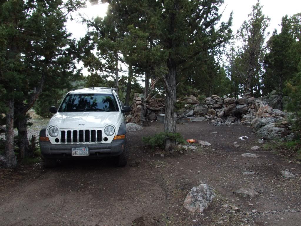
And second night camp. This is in the Ochoco NF, the campground is Wildwood:

RoadTrip137.jpg


I'm going to throw a note in here. I usually camp dispersed, `cowboy' style on the ground with the sky as my roof, however with the upside down wetness the last few years in the Northwest, I find I need to have a table to sleep with a tarp overhead so my bag doesn't get wet. But for the record, everywhere I stayed in a developed campground on this trip was totally vacant except for me. If it wasn't, I moved on.

This day’s track should be here on Everytrail:

http://www.everytrail.com/view_trip.php?trip_id=1121581

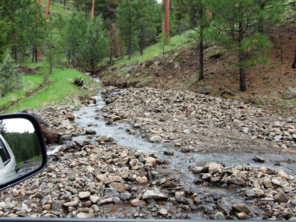
Day Two. I took the dirt roads towards the Ochoco Reservoir as there is a rockhound site on the north side. That was one of my many goals on this trip; exploring, rockhounding, ghost towning, camping; with as many dirt roads as I could fit into my busy schedule! However this day was again mostly highway, as I headed straight down towards Christmas Valley; but stopped short and camped near Green Mountain. Pretty much no pictures until after I went east from La Pine, OR.

Got caught in a hail storm on the way to Fort Rock:

RoadTrip147.jpg


Fort Rock:

RoadTrip156.jpg


The wind was terrible and the lighting stank. I think I have a better pic of the "Crack in the Ground" on my PC, but this is all I have of it on Photobucket:

RoadTrip163.jpg


I went up on Green Mountain, but as I said the wind was terrible. Even though I saw no warnings, I wasn't about to chance a fire so I found this place to cold camp in a little draw somewhat shielded from the wind:

IMG_20110602_112656.jpg


Day Two's Everytrail, but I didn't start it until I got to Fort Rock and some of it is out of order:

http://www.everytrail.com/view_trip.php?trip_id=1143175

con't.
 
Last edited:

teddyearp

Adventurer
Day Three. Now for this day I had pretty ambitious plans. Yeah buddy; this day is 90% dirt! So I left my dry and cold camp near Green Mountain and headed to Christmas Valley to provision and then take some backroads to the Glass Butte rockhounding area. Here is the campsite at Christmas Valley sand dunes where I left some firewood and a hat for the pnwadventures.com group who were coming through the next weekend:

IMG_20110602_132650.jpg


Pressing on through the Lost Forest:

RoadTrip188.jpg


Nothing' but dirt for most of the day:

RoadTrip189.jpg


Got flowers?

RoadTrip194.jpg


Now my Google Nav route had me taking some pretty small roads, but I was solo and the weather still wasn't looking all that good so I didn't take this road:

RoadTrip216.jpg


As it ended up, the `main' or more traveled road I took ended up having about three mud `pucker' holes with the mud puddles all the way across the road, so I couldn't concentrate on taking pictures, just concentrate on getting through. This is at the end of the `mud' road looking back:

IMG_20110602_164327.jpg


Poser shot of my stock Libby on a little crack at Glass Butte (don't laugh at me too much you hardcore folks):

RoadTrip217.jpg


Two shots of HFTN (Home for the night):

RoadTrip219.jpg


RoadTrip221.jpg


Day three's Everytrail:

http://www.everytrail.com/view_trip.php?trip_id=1141327


Day four, I decided to hit the highway again and pass through Burns, OR head up US 395 and go to John Day, OR. Here's a shot going through Burns:

RoadTrip227.jpg


Here's a shot going up the canyon on US 395 from Burns to John Day/Canyon City:

RoadTrip231.jpg


Saw this lonely shack along the way after leaving the canyon, nice photo OP, but again lighting not optimal:

RoadTrip236.jpg


Canyon City (where I stopped at the meat shop and reprovisioned):

RoadTrip239.jpg


I got some more provisions and gas in John Day, and it was time to find a place to camp. I went east to Prairie City and checked out Slide Creek CG, a free campsite that I had planned on south of there, but for some reason it just didn't suit me, didn't have the right `feel', and a bit out of the way for my plans the next day. So I went back up and through John Day and then to the west and then south of Mount Vernon to find my home for the night, Oregon Camp. A pic or two along the way:

RoadTrip254.jpg


RoadTrip255.jpg


Home for the night, Oregon Camp:

RoadTrip260.jpg


And here is where I took a couple of pics of my plunder from North Ochoco Res and Glass Butte:

IMG_20110603_161815.jpg


IMG_20110603_161904.jpg


Day four Everytrail:

http://www.everytrail.com/view_trip.php?trip_id=1142128

con't
 

teddyearp

Adventurer
Day five. Today I wanted to go down mostly forest roads to Maury Mountain, through Izee and Paulina, stopping at a rock hound site south west of Paulina. Now I knew some of the road was paved through Paulina, but all of it was paved until I left pavement to go towards Congleton Hollow.

Wildlife:

RoadTrip267.jpg


RoadTrip269.jpg


Nice meadows with cattle, similar to the White Mountains:

RoadTrip275.jpg


Izee:

RoadTrip276.jpg


Paulina:

RoadTrip283.jpg


Little fixer upper at the turn off to Dendrite Butte (though I ended up checking out Congleton Hollow instead):

RoadTrip287.jpg


HFTN at Elk Horn campground:

RoadTrip294.jpg


What was interesting about camping there was I thought all along about camping more primitive, say near one of the rockhounding sites, but 'something' kept pushing me to camp at this campground instead. Well, soon after I arrived a lone person came walking up the road from further back in the forest. I was wary a bit at first, but when he got closer he looked `ok' and asked if I had cell phone service. I replied that I did, so I let him use my phone. Turns out he had gotten stuck in some snow further up a few hours ago and had already hiked about five miles to where we were, and would have had to hike at least that much more to get service and it was getting' nigh onto dark. So he called, got a ride, and I knew why I 'had' to camp at this spot this night.

Day five's Everytrail:

http://www.everytrail.com/view_trip.php?trip_id=1141258


Day six. This day I had on the mind a little road going north from Paulina up on the forest somewhere. Now this one just HAD to be dirt. Side note. As far as I can remember, down in Arizona when you're on a road with a "FS" designation it is for the most part unpaved. Not so here in the Northwest. Here it's almost a 50/50 chance that it will still be paved. Today I was not disappointed, but I did end getting a little something extra. So I drove on back to Paulina, provisioned and then headed up the hill on Paulina Valley road.

Mmmmm, dirt:

RoadTrip302.jpg


The valley, looks like ranching country:

RoadTrip307.jpg


Mmmm, more dirt:

RoadTrip313.jpg


Y'all can have your Lowrance or Garmin and laptop mounts and such. Me, I'll just take my Droid and Oruxmaps:

RoadTrip315.jpg


An obligatory flower shot:

RoadTrip332.jpg


After traveling up the hill and then going down some other side roads I thought I had found a perfect campsite at the edge of a meadow. The only problem was that there were as boatload of mosquitoes, but that is why God had us invent Deet, right?:

IMG_20110605_172810.jpg


However, God did not intend on it staying very dry. It started to sprinkle a bit after I got my fire started:

RoadTrip351.jpg


And then it started to get a bit worse, doesn't look like the fire might survive:

RoadTrip353.jpg


I had a tiny bit of service and from checking weatherbug it looked like a fairly good sized storm was developing right over me. Here's a video of the end of my fire. Hope it satisfied Smokey:


Oh well. Looks like a cold camp again. And since on the road to this meadow had crossed a couple of draws from the main road, I thought I had better hightail it back closer to a main road. On the way, I held my camera out upwards in front of me shooting movies so I could try to capture some lightning. Of course I missed the closest hit, but here's the best I did get:

Untitled-2.jpg


Day six Everytrail:

http://www.everytrail.com/view_trip.php?trip_id=1129130

con't
 

teddyearp

Adventurer
Day seven. Well after all this camping and such and with a pretty dismal weather forecast for this day I figured it was motel time. After all, I was getting pretty ripe and my hair didn't need any extra grease. So I pretty much took the paved FS roads back to Prineville, but did head to the south for a bit to try check out some more rockhounding sites, but without any good finds.

On the way, some storm runoff/damage:

RoadTrip354.jpg


RoadTrip355.jpg


RoadTrip356.jpg


Blue Ridge mine:

RoadTrip372.jpg


Prineville reservoir on the way south for a bit:

RoadTrip391.jpg


HFTN was at a motel in Prineville near this intersection:

RoadTrip398.jpg


Day seven Everytrail:

http://www.everytrail.com/view_trip.php?trip_id=1129133


Day eight. Well this is pretty much my last full day to go and have fun. I am now cleaned up, got re-provisioned in Prineville and headed out for as much dirt as I could. And as fate would have it, this was about the best weather day during the whole trip.

This is one of the old ranger stations on US 26:

RoadTrip399.jpg


On a paved FS road, this store was probably a going concern maybe not too long ago:

RoadTrip403.jpg


Mmmmm, Ponderosas:

RoadTrip404.jpg


Mmmm, dirt:

RoadTrip418.jpg


Wildlife:

RoadTrip427.jpg


Actually, I saw more antelope than anything else on this trip.

Another obligatory flower picture:

RoadTrip432.jpg


Close-up of some of the critters in Peterson Lake:

RoadTrip440.jpg


Don't ask, just know that at this tiny snow patch I did everything stupid, got about an hour of quality shovel time, then wised up and got out the Jeep easy way, so the pic was significant to me at the time. Please don't laugh:

RoadTrip450.jpg


More big views:

RoadTrip452.jpg


RoadTrip458.jpg


RoadTrip465.jpg


HFTN:

IMG_20110607_191252.jpg


The Earp's preferred camp site style:

RoadTrip466.jpg


"Notice the lean silhouette, eyes closed by the sun. . . ." Hehe, NOT me. But really if I can find a few stumps to set stuff on, yes, but not necessary. Campsite menu is always cooked over an open fire (using choice hardwoods, i.e. mesquite or oak if nothing else) with meat as the primary entree. Throw the sleeping bag on the ground over a pad with the sky as my roof. Have a dual fuel lantern for light just in case and I'm good to go.


Day eight Everytrail:

http://www.everytrail.com/view_trip.php?trip_id=1140691

con't
 

teddyearp

Adventurer
Day nine. Headed for home, all highways. Really nothing significant, but maybe a couple of pics.

Not going this way:

RoadTrip471.jpg


Another obligatory flower pic:

RoadTrip477.jpg


John Day River still in flood stage:

IMG_20110608_105344.jpg


And that is it, and why I plan on going back to Arizona in May 2012. The last few years here in the Northwest have produced in my mind 'upside down' weather. We have had almost more dry days in Dec-Jan-Feb than we get in April-May-June. Al Gore, go to Heck.


Just in case, here are all the pics at Photobucket:

http://photobucket.com/teddyearp2011

And here's the original thread I posted at pnwadventures.com:


http://www.pnwadventures.com/forum/...30-june-8-2011-teddyearps-solo-road-trip.html


Thanks,

Ted
 

teddyearp

Adventurer
Thanks. And again the reason I really wanted to post here is that I think I might have finally found a 'catch all' site for what I try to do every year. Find an area in the US I want to visit some backroads on, road trip there and then explore.
 

mhiscox

Exp. Leader Emeritus
I really enjoyed your pictures and seeing the places you went in your stock Liberty. Shows the merit of just packing up and going. Thanks for taking the time.
 

Forum statistics

Threads
189,830
Messages
2,921,416
Members
232,931
Latest member
Northandfree
Top