GPS problems

Zeiderman

Adventurer
I'm working on a layout for my Jeep and have been doing dry runs in my work truck as I travel a lot and I have run into a GPS situation:

I started out using my Tom-tom Via 1500 freshly updated, I like the set up a lot, especially since it's stand alone, the only problem I have run into is the routing options, which there are 4 of, but neither the shortest or the quickest are neither, and once I go off trail it will have me doing u-turns for a while before updating to new route, and then again not always the most efficient. Also my destinations have been off from 100yds to a mile or so.

I tried my tablet briefly which can only get internet if tethered. So I tethered it put in my destination, found the route I wanted and took off using Google maps. I then turned off the internet, GPS was still on, and went off the route, well then I lost voice guidance, and route correction, went back to the route which was still marked and voice guidance came back on. But as with my Tom-tom, my final destination was off, in this instance 100yds.

Google maps with internet on, on my phone seems to work the best, and I don't know what it is but it's very intuitive, as if I drive a different way than suggested a couple times, it will show that route as an option. This is on my work iPhone with Google maps, haven't tried on my personal which is a Galaxy.

So what do I do, I don't really want to use my phone or my tablet for Google maps, and I certainly don't want to have to be tethered to the internet as well. I would consider my tablet but not tethered, but I also will using that for BCN. Also I really don't want to purchase another GPS, as reviews I have read show they pretty much are capable of the same, just with different options. What I'm looking for is something I can run without internet, destinations are excellent, route options are manageable and realistic, and if want to get off track, it will correct accordingly by going forward with me. I know it's long winded, I appreciate any help I can get.
 

leucadiacruiser

Beach N Toys Chapter TLCA
I have never used BCN - I was an early adopter of Gaia and it has just gotten better and better over the years and I continue to watch friends struggle with their Garmin or other GPS. Here is a link that compares the two. I use Gaia on my phone and iPad when off road and just on my phone when backpacking. I pay for the annual premium for Gaia Pro so that I can upload and share across devices when wifi enabled - I rarely use it on the grid. I've used it from Baja to the Sierras without any hiccup whatsoever. They now have folders in the pro version so I can easily save and locate maps I use frequently - baja or Anza Borrego. In addition, the ability to upload and utilize maps from other websites - AllTrails being one - has been seamless as well. Can't recommend it enough.
 
Last edited:

Zeiderman

Adventurer
So it seems like Gaia is mostly for back-country (haven't looked at the others yet), which is fine, but I also need something that can do city as well, and as far as my Tomtom, is that just out, I could look into a new/different GPS, but don't want the same problems in a prettier, more expensive package.
 

dlh62c

Explorer
When there's a route that I want to specifically follow, I'll plan it out in Garmin's Basecamp software. Basecamp will allow me to define the route using via points inserted by me.

Does TomTom have an offline route planning software package?

When I use my GPS, I set the ' Off Route Recalculation' to 'Prompt'. I want to have the option to recalculate the route or not.

Turning tracking on and displaying my track overlayed on my planned route, I can see where I'm at, where I've been and where I'm going all at the same time.
 
Last edited:

dlh62c

Explorer
.... but I also need something that can do city as well, and as far as my Tomtom, is that just out, ....

Does the Tomtom give you the ability to define routing profiles?

Have you tried breaking the trip up into sections?

One route for driving back roads that will take you to the trail head. The second being from the trail head following your off-road route and the third bringing you home via all interstates.
 

Zeiderman

Adventurer
I guess I didn't make myself clear, and after rereading my post I didn't. My tablet will be used offroad, I need something that will get me there, and there in lies the problem. I would prefer to use my phone as my phone, and for music, the tablet for Torque and BCN (or whatever program I end up with, I checked out all the suggestions you all posted, thank you).

So the real easy question is, am I just screwed with my TomTom Via? Using my other devices as GPS was just a way to gauge the quality of directions for non offroading.

Sent from my SM-T230NU using Tapatalk
 

tarditi

Explorer
Can you DL the google maps in advance so it doesn't need a persistent internet connection?

I preload the google maps in my area of travel in advance.
(I also will use any of BCNpro, Locus Map Pro, Roadtripper, and iOverlander and have a Garmin with lots of topo maps pre-installed)
 

dlh62c

Explorer
So the real easy question is, am I just screwed with my TomTom Via? Using my other devices as GPS was just a way to gauge the quality of directions for non offroading.

Its important for you to know the benefits and drawbacks of having a smartphone for your GPS or having a stand alone GPS unit. Knowing every aspect of these devices can help you choose the best GPS technology for yourself and your traveling habits.
 
Last edited:

theksmith

Explorer
copilot usa to get to the trail, then BCN or whatever you like for topo

to elaborate (i was on my phone earlier)...

Copilot downloads all the maps after install, so it requires no data connection beyond the first time download (unless you want traffic updates). all of the US & Canada including lane-assist and POI info is around 2GB (or you can just pick East Coast, etc.). it does full navigation with spoken instructions and allows you to choose from multiple routes or add random stops when planning a trip. you can also just default to "fastest" or "shortest" route. it has options to avoid toll roads and tunnel/bridge height restrictions, show over-speed-limit warnings, etc.

Sygic and TomTom are the main commercial competitors to Copilot for an on-road mapping/nav app. there are a variety of free alternatives as well of course, but most of them are going to use the free mapsforge maps and so it's just a matter of UI preference there. no map or app is going to always be 100% accurate.

Locus is worth noting as it's the only popular app i am aware of that integrates vector road maps, navigation, and raster topo maps into a single app. it is better suited for topo/offroad use though IMHO.

i actually use Google maps with a cellular data connection when in-town since it seems to have the freshest road data, POI and traffic info. Copilot gets launched only for longer trips where cell coverage is going to be spotty. then BCN, Locus, or Alpine Quest are my tools of choice for topo/trail use.

once you find apps you like and get used to a tablet/phone as your primary GPS device, you'll never want to go back to a dedicated GPS unit (TomTom, Nuvi or hand-held)!
 

rayra

Expedition Leader
I'm puzzled by what the OP seems to be trying to achieve. Where's the recreation and fun in having a box squawk at you for a 'wrong turn', when you are OFF-roading. The whole point on being out there is to take the road less traveled. To explore. I would think off-road nav is so you can see where you are, see where you want to wind up, and see what is in between. Not lay down a route and rigidly adhere to it. Or have a machine nag you about it.

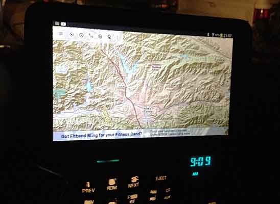
dashtablet06_zpsqmuxbamq.jpg
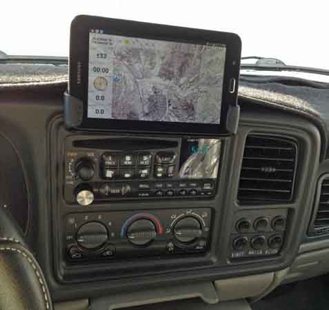
tabletbracket14_zpsj3ruub4g.jpg
 

MOguy

Explorer
I have running game "here" and just downloaded maps.me a couple days ago. I am in a rural area and maps.me can't find any addresses out here but here can but maps.me shows more roads then here. Searches are better with here wether you have Internet connection or not.
 
Last edited:

Forum statistics

Threads
189,959
Messages
2,922,684
Members
233,207
Latest member
Goldenbora
Top