July Trip - Summer Escape from Tucson to the San Juans

hobietony

Explorer
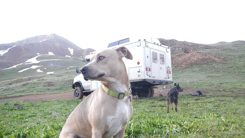
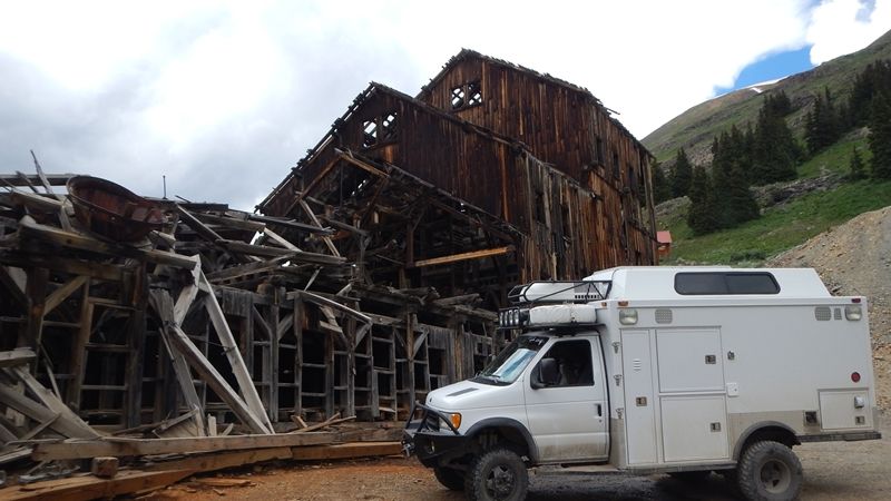
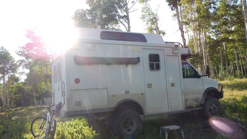
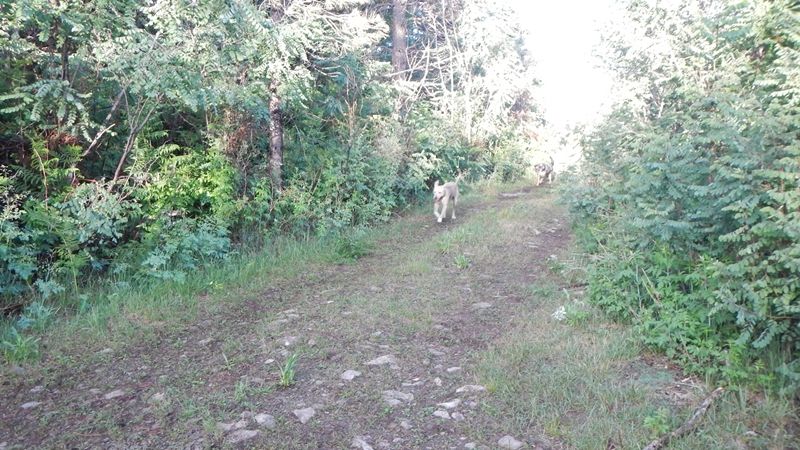
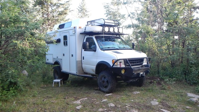
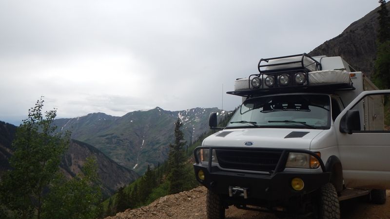
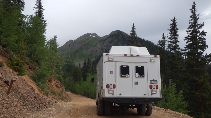
Well, I've had a build thread on my 4wd ambulance project going for a few years, here - http://www.expeditionportal.com/forum/threads/63380-AmboVan-Restarted - but I figure it is time to post a bit of me using it.
-
July in Tucson kinda sucks, and it is a great time to head north to someplace cooler, left Friday, July 4th, got back Sunday July 13 - 9 nights, 10 days on (and off) the road. It went a little like this...
-
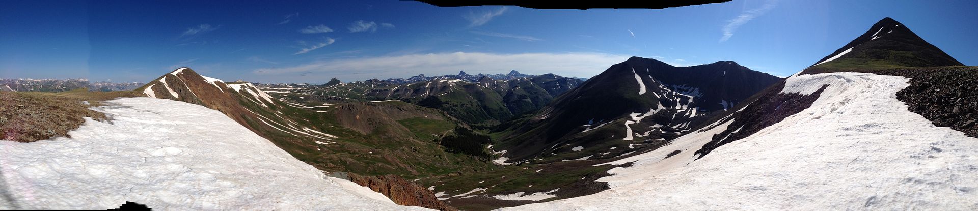
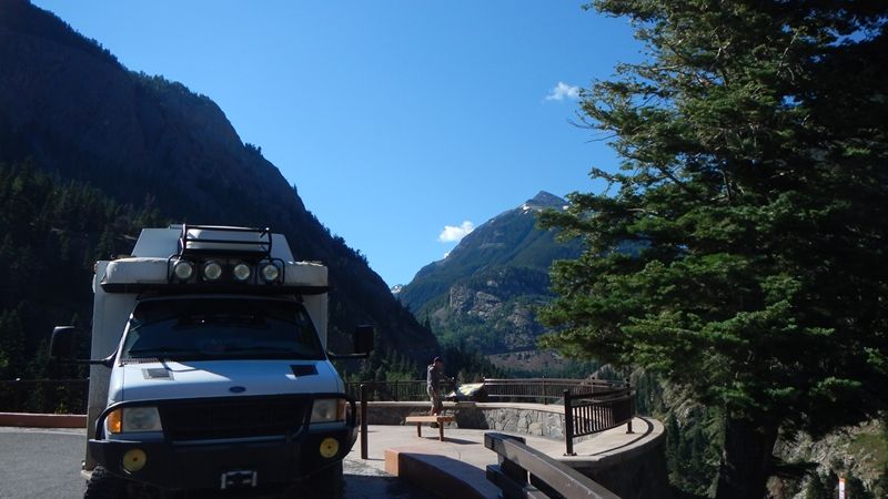
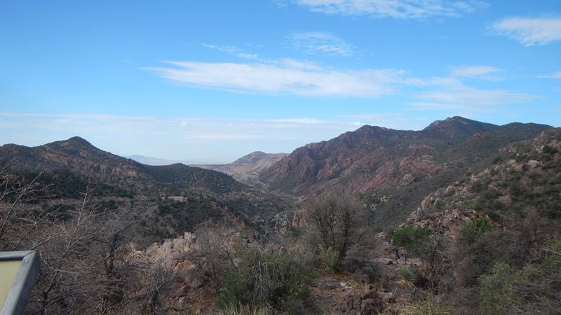
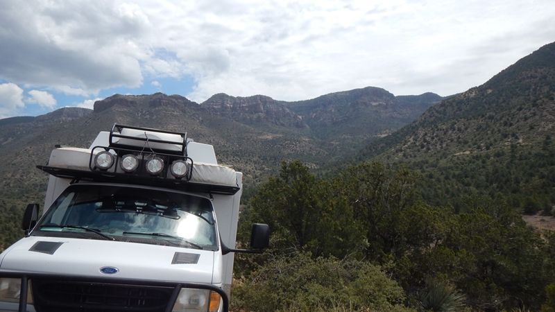
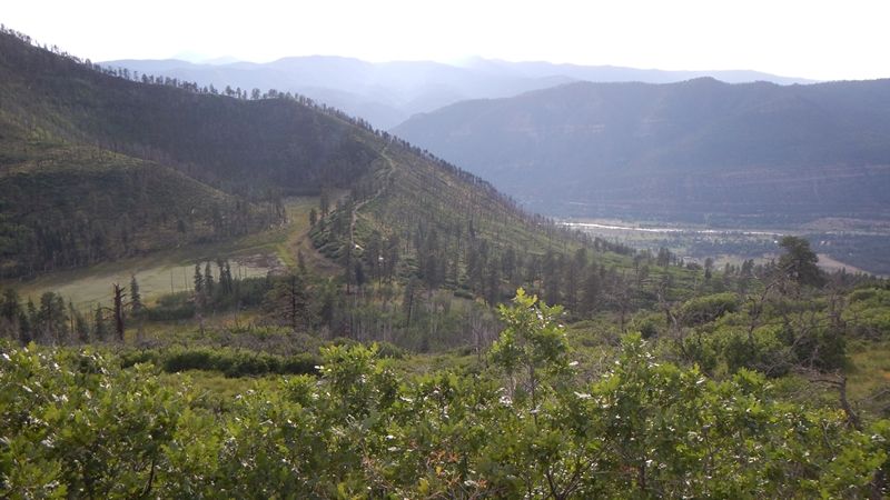
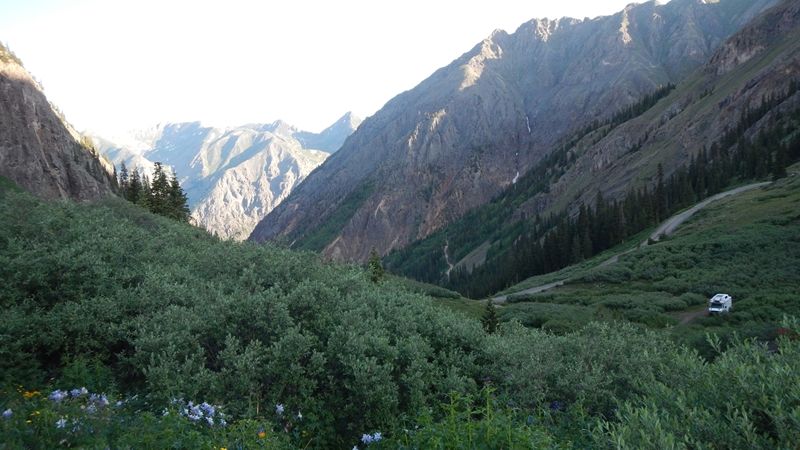
DAY 1 - Tucson to the Mogollon Rim, past Roosevelt Lake and up through Young
-
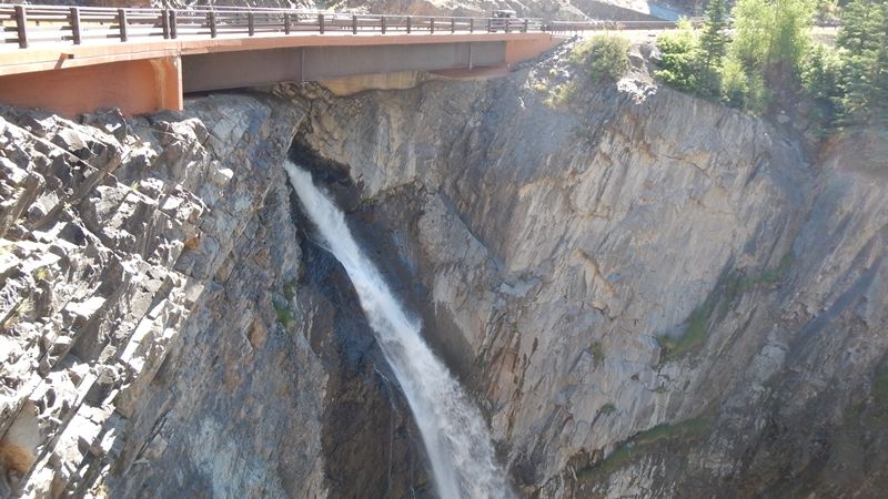
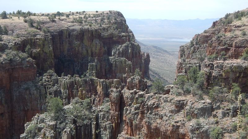
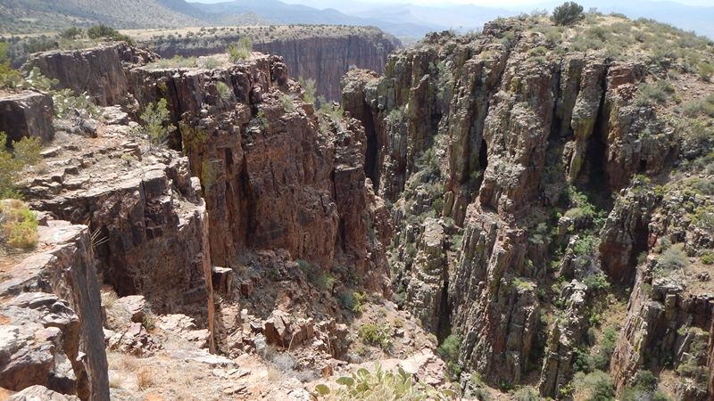
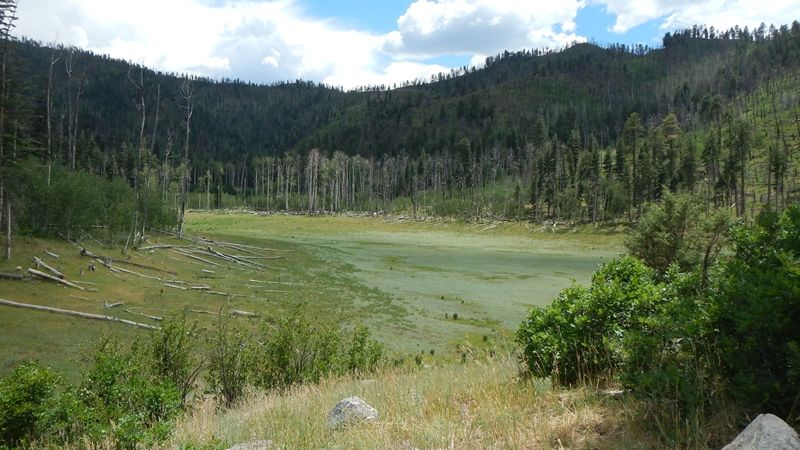
Pretty sure this is 'parker creek' on the map, forest road 488 - pretty cool canyon, vertical walls, not surprised to find a climbing bolted anchor at the top of one of them.
Looking towards Roosevelt Lake
m_DSCN1228_zps8d4c43e4.jpg

Looking up towards the Rim
m_DSCN1225_zps43299d24.jpg

Careful of the edge!
m_DSCN1230_zps1df2ece9.jpg

m_DSCN1236_zps087461db.jpg

-
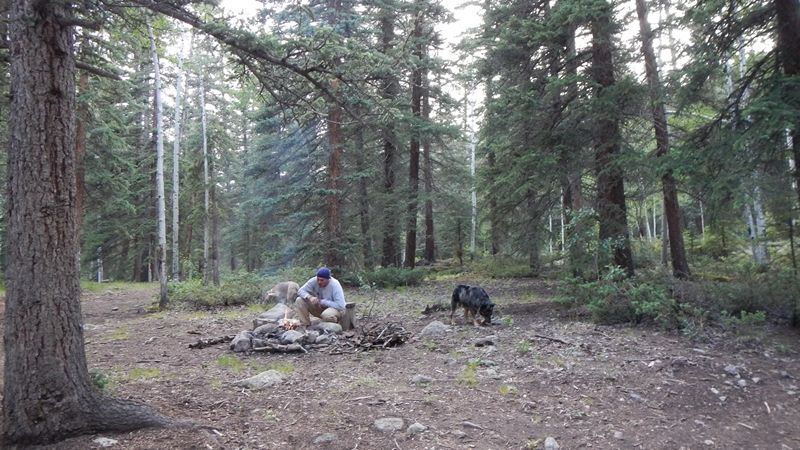
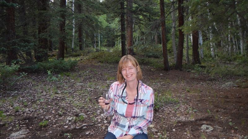
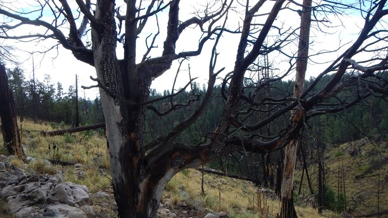
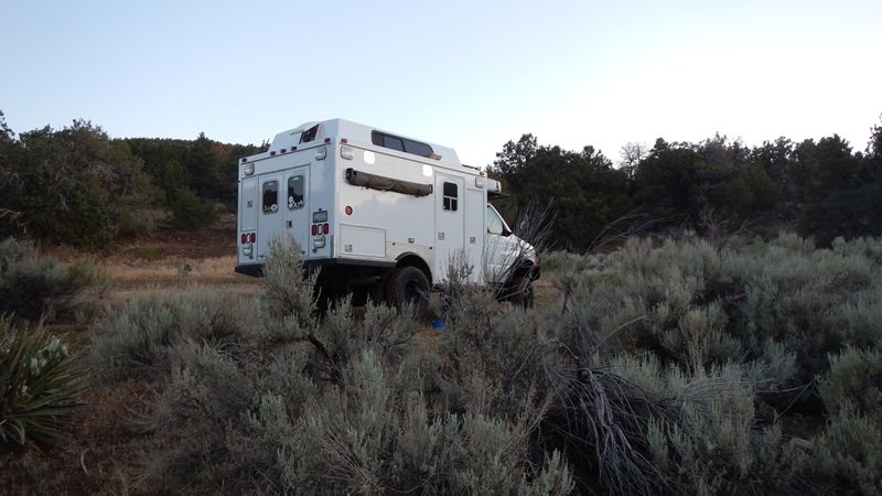
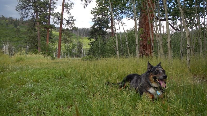
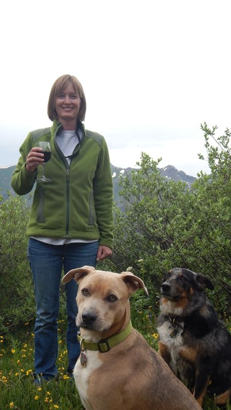
Camped on the rim toward Heber, in a re-growth area, burned a while back.
m_DSCN1245_zps90028e88.jpg

m_DSCN1249_zpsa6e432be.jpg

m_DSCN1250_zps259711f0.jpg

-
DAY 2 - Mogollon Rim to Cortez, CO - Via Pertified Forest and Canyon de Chelly
-
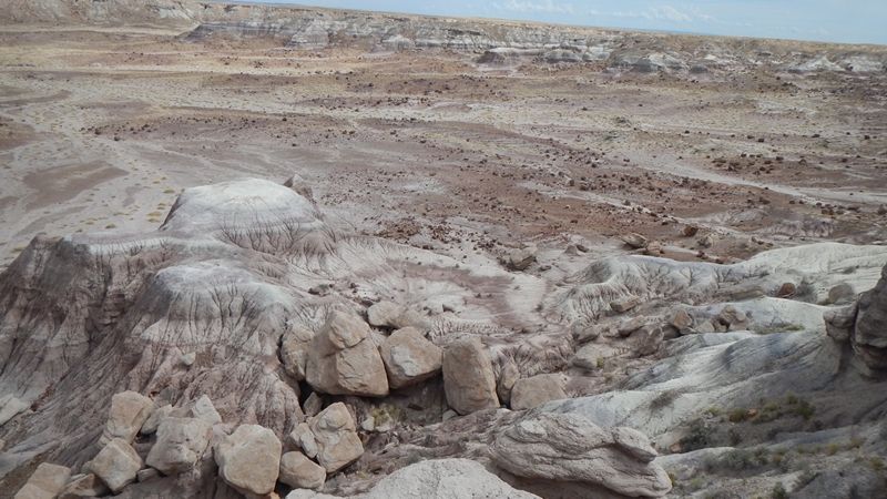
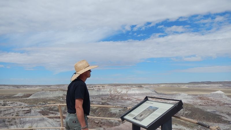
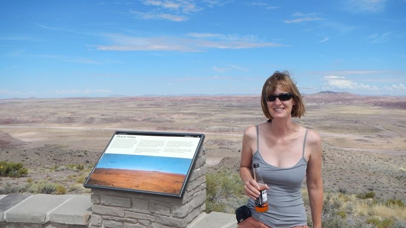
Petrified Forest was a bit stark, cool to read about how the logs got there, and it probably should have been expected that the petrified forest area was protected in the early 1900s as a response to the full-scale removal of the biggest deposits of petrified wood - Story of America, I suppose
-
This valley was full of logs in the 1800s
m_DSCN1255_zps63e23e17.jpg

m_DSCN1256_zpsef417b94.jpg

m_DSCN1259_zpsa5da280c.jpg

Keep hustling north...
-
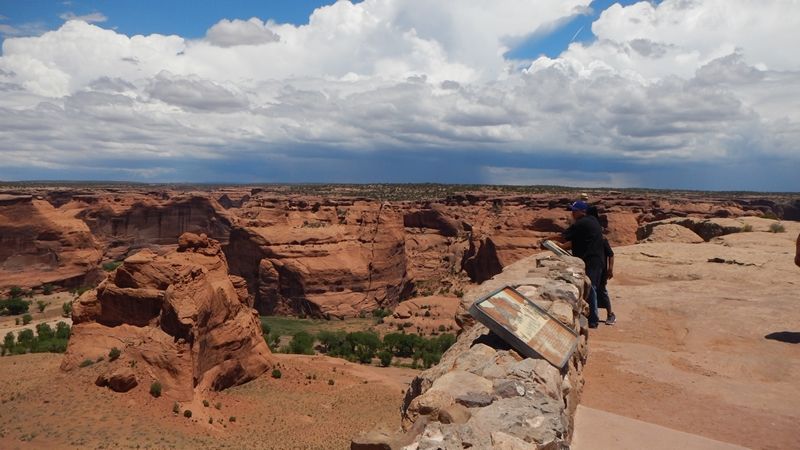
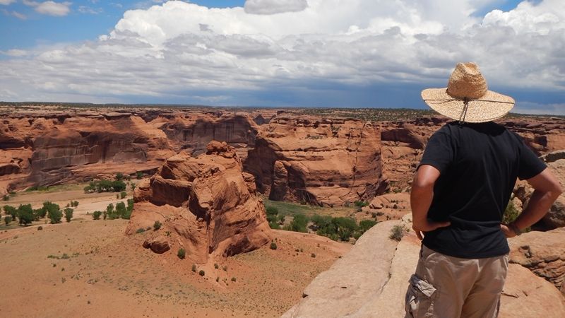
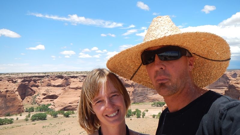
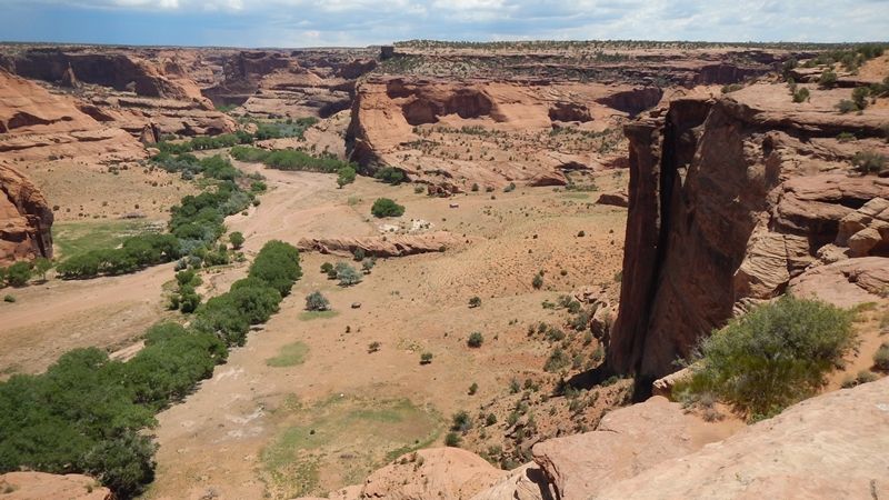
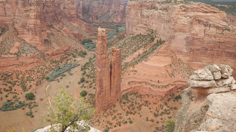
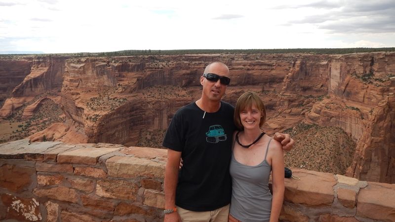
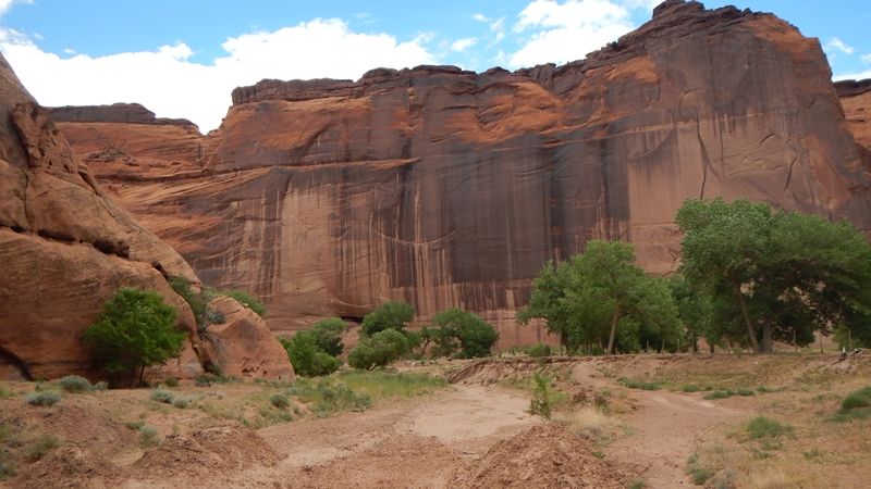
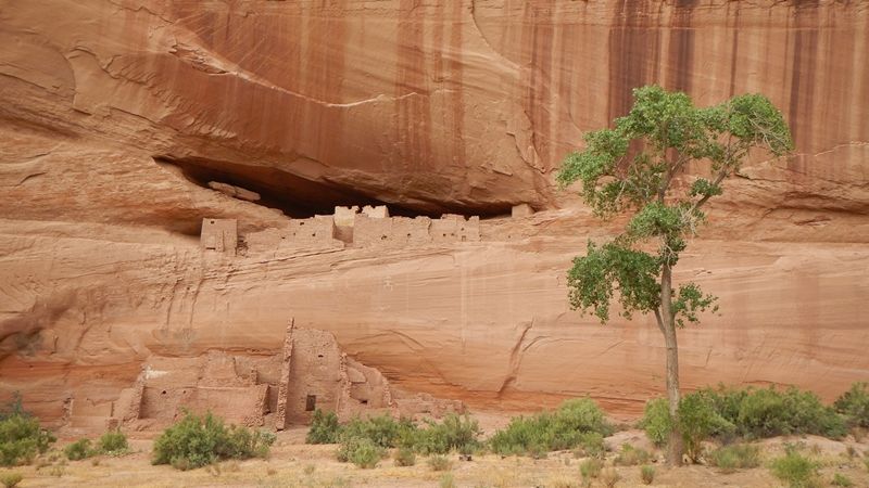
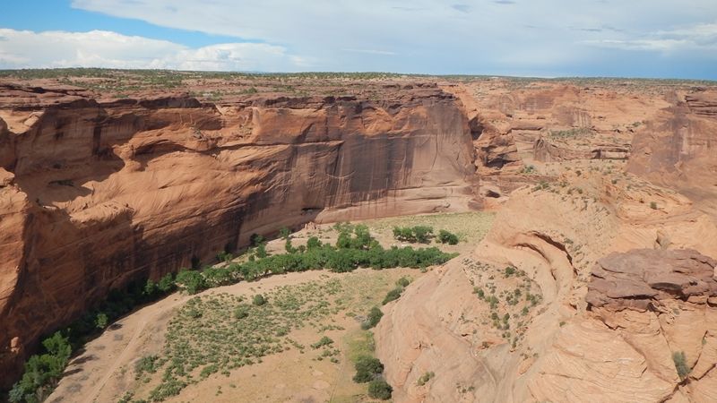
Took the driving tour of lookouts on the South Rim of Canyon de Chelly, and took the hike down to the White House Ruins (I believe). Would like to take an extended tour of the canyon bottom sometime, but no time this trip
m_DSCN1263_zps58fd2f8c.jpg

m_DSCN1265_zpsffdaef77.jpg

m_DSCN1268_zps8c049247.jpg

m_DSCN1276_zpsa95fb554.jpg

-
Spider Rock, pretty sure
m_DSCN1281_zps92f33884.jpg

m_DSCN1284_zps9208d904.jpg

-
Hike down to the ruins. This is the only one that we were allowed to go on without a guide - lots to see here, next time.
m_DSCN1286_zpsf95a493d.jpg

m_DSCN1300_zpsc449ecc0.jpg

m_DSCN1305_zpsc42eef2e.jpg

m_DSCN1307_zps0b2800b1.jpg

m_DSCN1315_zps34d2f87d.jpg

-
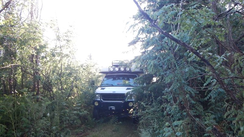
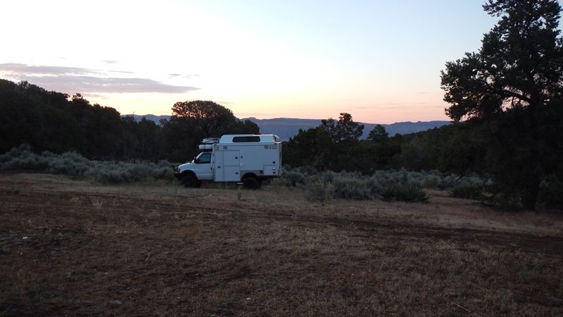
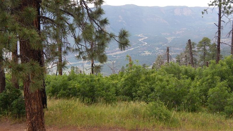
Pressing on, looking to get into Colorado by the end of the day. Made it to the Ute Indian town of Towawoc, south of Cortez (and, of course, the associated casino). Pressed up into the hills above town, got camp set up just a night was falling. Bonus was a view of the Saturday night fireworks show put on by the Casino, it went on longer than any municipal firework show I've ever seen!
m_DSCN1329_zpsf6951d4b.jpg

m_DSCN1326_zpse2e1ea39.jpg

-
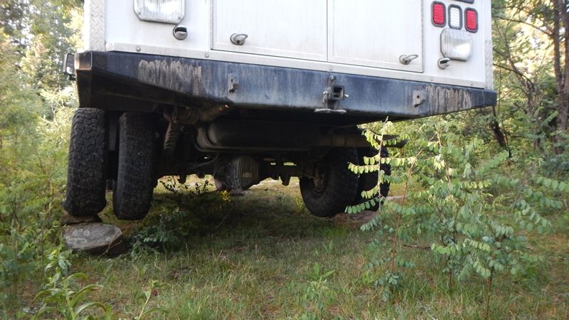
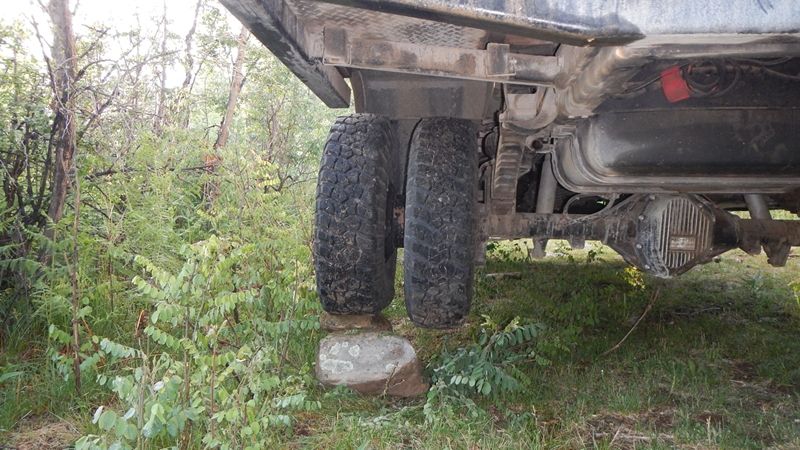
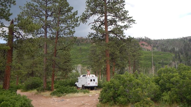
Creative leveling, beer helped.
m_DSCN1331_zps7c3b132a.jpg
 

hobietony

Explorer
DAY 3 - Cortez to Durango. Easy day, watched the train in Durango, walked around downtown, got some groceries, did town stuff.
m_IMG_0514_zps22476f4d.jpg

We needed to find a camp spot close to town, we were meeting some friends from town the next morning, so we wanted to be a bit efficient with where we set up camp. A local suggested Missionary Ridge, we found a great spot a 'few' switchbacks up, and at what the map sez is Wallace Lake - More of a potential lake than an actual one, very cool.
m_DSCN1335_zpsec155e36.jpg

m_DSCN1336_zps81a74df3.jpg

m_DSCN1343_zps23c0a89f.jpg

Looking down into the valley
m_DSCN1351_zps9640e00f.jpg

Just sitting around
m_DSCN1352_zps6b0b0e1b.jpg

Went for a good bike ride on the ridgeline that surrounded the lake - Find the truck!
m_DSCN1356_zps74590b3b.jpg

This picture was a bit after I ripped of my derailleur, luckily it was all downhill to the truck, great ride anyway
m_DSCN1357_zpsbbc87948.jpg

Set up the Solar Shower, Lani got a great shower, I was doing pretty good until the monsoon/hailstorm hit while I was trying to get the soap out of my personal regions - Good times!
-
DAY 4 - Durango to Silverton. Met with our friends John and Julie from Tonto Trails - http://www.tontotrails.com/ - Met them at Expo, awesome couple, living the dream with a fleet of rental expo vehicles, including sportmobiles. We had planned on a bike ride on Engineer Trail, but I needed to get to the bike shop first - bike shop opened at 9, bought it and installed it in the parking lot, and still made our meeting time at 10. My wife Lani took the dogs, John, Julie and I shuttled to the upper trailhead - I'm not proud, I'll take a shuttle over a long road ride anytime.
-
Dogs and Flowers
m_DSCN1368_zps3372f8e6.jpg

m_DSCN1369_zpsec90489c.jpg

Ozzie Dog, the Tonto Trails mascot
m_DSCN1372_zpsfd53d1b6.jpg

Columbine
m_DSCN1375_zps8bfd0a53.jpg

Mud bog
m_DSCN1384_zpsfd7bbf19.jpg

-
Back to the van early afternoon, hit the road to get to Silverton. Coal Bank and Molas passes, into Silverton, and pressing on to get to a camp spot in the high country. On Johns recommendation, we hit Stony pass first, a bit less travelled, and it was still near July 4th weekend - I had no idea how busy Silverton is in the summertime - Jeeps and Razrs and ATVs, oh my!
-
Real Mountains
m_DSCN1394_zpsa7bfb7c6.jpg

m_DSCN1395_zpsc5ef4dd4.jpg

m_DSCN1398_zps610f6fa1.jpg

High country streams and flowers
m_DSCN1406_zps23fa61de.jpg

m_DSCN1408_zps667fbb46.jpg

Getting Higher
m_DSCN1410_zps60b6c949.jpg

Made it
m_DSCN1412_zpsf3e5275b.jpg

Maybe a mile down from the pass summit, found an awesome camp spot, near the entrance to an old mine shaft - although everything in the San Juans is near an old mine shaft
m_DSCN1415_zps362ae087.jpg

m_DSCN1430_zpsdaa18dc2.jpg

Family shot
m_DSCN1417_zps6bd64acd.jpg

Flowers and a dog
m_DSCN1427_zpsd0d0ea2f.jpg

To be continued...
 

mph

Expedition Leader
great trip....great photos! Was there in June. Awesome country!

Your rig looks sweet and capable!
 

hobietony

Explorer
DAY 5 - Silverton to almost Engineer Pass
-
In the morning, we went for a short hike, then headed back down Stony to Silverton to do some laundry and buy a shower at one of the RV parks, and decide where we were going next. Tranny felt a bit wonky on the way down, and I'm sure this is the biggest thing I would want to drive on this road - Pretty sure my heart rate was a bit above normal.
m_DSCN1435_zpsd683f509.jpg

m_DSCN1439_zpsfe64f4d0.jpg

m_DSCN1441_zpseb22cb90.jpg

m_DSCN1444_zpsd76a132d.jpg

m_DSCN1446_zps147cd335.jpg

-
Got to town, got our cloths and ourselves clean, and had a rum drink at Montanya's while the monsoons built up. Decided to push towards Lake City via either Engineer or Cinnamon passes, and see how far we got that day. Took off from town, tranny still felt funny, a lot of 'lash' in the torque converter, kinda. Rains rolled in too. We pressed on through Eureka towards Animas Forks, and had a talk with a Ranger patrolling in a little RZR side-by-side. He expressed some concerns about the off-camber-ness of the crux switchbacks on both Engineer and Cinnamon, and didn't seem impressed by the fact that I had been over Stony the day before. We continued towards Engineer, where I was definitely the largest and slowest vehicle out there. Even though it was a Tuesday and the holiday weekend was over, there were still a load of jeeps and RZRs and ATVs, and all of them were travelling faster than me. Much of this part of the trip was about leapfrogging to wide enough spots in the road to allow other vehicles past.
-
We got to the last fork before the road up Engineer itself starts, and had a moment of reflection on the conditions around us - Mid-afternoon, recent rainfall, active monsoon patterns in the whole area, transmission that still didn't quite feel right, and a Ranger who is worried about us flopping over. Do we really want to set out on the highest exposure part of the route right now? Maybe we look for a place to camp instead? Good idea.
-
The road up Engineer is in the background in the first pic
m_DSCN1452_zps5a3a5b5a.jpg

m_DSCN1456_zps65f1431c.jpg

Noble Dog
m_DSCN1460_zps8c97b768.jpg

-

To be continued
 
Last edited:

RYOUNG

Observer
We spoke to you on Tuesday near Engineer Pass. We were in the Black LJ hope you made it to the top OK. Our whole group thought your rig was Awesome.

IMG_0163.jpg
 

hobietony

Explorer
DAY 6 - Lets call it a tactical retreat back to Silverton.
-
Camp was at the base of what the map sez is Denver Hill, near a small lake, a bit off the main road. Took some pics from camp, and set off on a good hike up what the map labels as Denver Pass.
m_DSCN1462_zps9cb6ccd2.jpg

m_DSCN1464_zps81bd0fec.jpg

Partway up to the saddle
m_DSCN1471_zps2ccbc7bf.jpg

m_DSCN1472_zps8ce27166.jpg

Cirque above Horseshoe Lake (I think - the map calls the creek out of the lake Horseshoe Creek...)
m_DSCN1474_zpsfc313b46.jpg

m_DSCN1476_zpsd7fbf405.jpg

At the saddle. Those logs we are sitting on are poles that appear to have supported phone/power/telegraph/whatever wires going up and over the other side, to Hurricane Basin. Looks like there is still an active mine site there too.
m_DSCN1478_zpsd6708558.jpg

m_DSCN1485_zps050aceba.jpg

A few panos from the Iphone
IMG_0524_zps5a2b7b49.jpg

IMG_0531_zps6c0701e7.jpg

IMG_0530_zpsb0182976.jpg

Hurricane Basin
IMG_0533_zps992c1195.jpg


Back at the Lake, still had a few icebergs floating - Dogs swam anyway
m_DSCN1486_zps72f9bd29.jpg

m_DSCN1491_zps7bcb24e5.jpg

Suck in that Gut!
m_DSCN1493_zpseca2ef10.jpg

m_DSCN1496_zpsd017f9c3.jpg

Mining remains on the way down
m_IMG_0540_zps96d5e233.jpg

m_IMG_0542_zps32ff95d6.jpg

Tough hike
m_DSCN1501_zps596d7ad9.jpg
 

hobietony

Explorer
Day 6 continued
-
So, a retreat back towards Silverton. Figured we would head to Animas, and talk to some folks about California/Hurricane passes on the way back to Silverton, so we didn't fully slink back with our tail between out legs. Found the same Ranger as the day before, he said if we could get past the first switchback on California pass, we should be home free. We gave it a whirl...
-
Animas
m_DSCN1502_zps1c2088eb.jpg

m_DSCN1508_zpsbd42627f.jpg

m_DSCN1503_zpsfc1d9d67.jpg

m_DSCN1513_zps62c89df5.jpg

m_DSCN1518_zpsac895362.jpg

m_DSCN1520_zps0edfa154.jpg

California Pass
m_DSCN1522_zpsd13ebea2.jpg

m_DSCN1524_zps97c814ed.jpg

m_DSCN1525_zps3f091984.jpg

m_DSCN1528_zpsb626ff5e.jpg

m_DSCN1534_zps28495b7b.jpg

m_DSCN1536_zps725e7fa3.jpg

m_DSCN1537_zps9b327cfd.jpg

The only shot of Hurricane, I was running for the barn at this point
m_DSCN1541_zps75b36443.jpg

Down from Hurricane
m_DSCN1545_zps6ac456cd.jpg

Parking lot of Silverton Ski Area
m_DSCN1546_zps3024c9d8.jpg

m_DSCN1548_zps5c17f214.jpg

Decided we really needed someone to feed us that afternoon, went straight to Grumpy's at the Grand for a big fat burger and some Ska IPAs. Went back up past the ski area for a camp spot, for those familiar with the area we set up right between Waterfall and Mandatory Air, looking straight up 2 Smokes
m_DSCN1550_zps6f0eb4b2.jpg

m_DSCN1551_zps7ca3b0e0.jpg

More to Come...
 
Last edited:

hobietony

Explorer
That camp site on the backside of Silverton was pretty perfect, we had pretty well relaxed into the upcoming evening, when our dog came back covered in fully ground-in human feces. Why do they do that? More good times! Off to the stream for a very cold bath, once we got over our initial horror. Buzzkill.
-
DAY 7 - Silverton to Lake City
-
Via pavement, unfortunately. Red Mountain Pass, stopped in Ouray to spend a couple hours in the public hot springs, and take a real shower. Right at Montrose, Hwy 50, took the Lake City Cutoff road to 149, north to Lake City. Great town, good vibe from everyone we talked to. Got a couple grocery items at the general store, and got a suggestion from one of the employees/guides at the great outdoor store who's name I don't remember, and went to find a camp off of Nellie Creek road.
-
Looking through my pictures, it is clear that we used out usual picture taking strategy - Long periods of forgetting that we even have a camera, interspersed with lots of pictures of the same thing.
-
Red Mountain Pass
m_DSCN1553_zps1c1b94ef.jpg

m_DSCN1555_zps266dbdc1.jpg

Camping on Nellie Creek
m_DSCN1559_zpsbde663b1.jpg

m_DSCN1561_zps1b62a864.jpg

-
Day 8 - Lake City to Durango
Hiking/biking up the road from camp, it looked like this for a while. steady climb on the bike, and whoo-whee, what a fun run back to the truck.
m_DSCN1571_zps73e8b679.jpg

Waterfalls
m_DSCN1576_zpse53f29c4.jpg

Camp
m_DSCN1577_zps37d78788.jpg

-
Pictures start to get a bit more sporadic now, we are starting to realize that at 55 MPH, (and way slower on the passes) we have a lot of driving if we want to get home by Sunday. Longer periods now between when we remember we have a camera. Break camp and hit the road - 149 through Creed to South Fork, 160 over Wolf Creek Pass, through Pagosa Springs, through Durango, and find a spot to camp just before we drop out of mountains before Mancos.
-
I think these mine pics are of the Ute Ulay Mine, east of Nellie Creek, and before we hit pavement getting away from camp and towards Lake City
m_DSCN1578_zps95da301f.jpg

m_DSCN1582_zps7bf2b89b.jpg

m_DSCN1583_zps80b8cad0.jpg

Driving is tiring
m_DSCN1587_zps398eb719.jpg

And, last picture until we stopped for the day.
-
Found a spot off of Forest Road 316, on the slopes of Madden Peak
m_DSCN1588_zpsfa217ef0.jpg

m_DSCN1594_zps30f25a4e.jpg

m_DSCN1595_zpsc5c5886d.jpg

Another area of fairly recent burn activity, lots of dense shrubby little aspens
m_DSCN1597_zps94d8fd80.jpg

No real bike rides or big hikes from here, we chilled around camp that evening, slept early, and high tailed it out of there first thing in the morning to get back on the road
-
DAY 9 - Durango/Mancos to Hannagan's Meadow, south of Alpine, AZ, Cortez>Shiprock>Gallup>Cross the Zuni Reservation to Hwy 191 north of St Johns>Alpine>Hannagan's Meadow. Put on a Joe Nesbo murder mystery book-on-tape, went on auto-pilot across the Rez, and didn't take a single picture until we set up camp in Hannagan's meadow. Sorry, I wasn't considering my internet friends on this leg of the trip.
-
Bad fires in this area a few years back, lots of evil Locust trees now with spikes to rival cactus thorns.
-
A little brushy getting to our camp spot
m_DSCN1607_zps265ce5c2.jpg

-
Creative leveling
m_DSCN1603_zps45ecfc0a.jpg

m_DSCN1605_zpse4104ca9.jpg

-
No sweeping , expansive views from this camp site, just a wide enough swath through the regrowth to drive on, and maybe chuck a ball to keep the dogs happy
m_DSCN1600_zps34fd4cd3.jpg

m_DSCN1606_zps86baddf2.jpg

-
Once again, early to bed, early to rise, we have to drop out of the cool country for the last time tomorrow, and make the last leg back to Tucson
 

hobietony

Explorer
DAY 10 - Hannagan's meadow to Tucson. The section of 191 from Alpine to Morenci is one of the most consistently curviest pieces of hiway I've been on, it would be super awesome on a motorcycle, or in a Miata with the top down
-
191 south through Morenci/Clifton, east through Safford, keep dropping down 191 to I-10, interstate back into Tucson, pull into the driveway maybe 1pm, where is, refreshingly, only a few degrees above 100. You think I was a slacker on pictures yesterday? This was the only picture taken on this leg, looking south from a viewpoint to the mines at Morenci.
m_DSCN1610_zpsb0518b97.jpg

-
And that it! Great trip, thanks for following along...
 

Forum statistics

Threads
189,828
Messages
2,921,371
Members
232,931
Latest member
Northandfree
Top