Kokopelli Trail Report

uphill

Observer
IMG_2448.jpg

Six Toyota FJ Cruisers crossed the Kokopelli Trail (Grand Junction, CO to Moab, UT) between Sunday, July 20 and Tuesday, July 22.

DSCF0058.jpg

Portions of the trail appeared to have been seldom traveled and were more eroded than I found them in the past. Other portions of the trail are (as many of you know) graded county roads or in a few places, paved roads where the four-wheel vehicles bypass bicycle portions of the trail.

IMG_2497.jpg

SHADOW-WARRIOR's FJC at the bottom of Rose Garden Hill.
IMG_2495.jpg


IMG_2457.jpg

Exploring the Yellowjacket Canyon area.

DSCF0325.jpg


IMG_2420.jpg

Camping on slick rock several miles off the main trail. We took an old mining road until it ended and it looked like a likely place to sling hammocks and pitch tents.
DSCF0096.jpg


The Top-of-the-World is a great place to relax and take photos.

DSCF0263.jpg

And if you fall over the edge and manage to land like a cat 2000 feet later there on the canyon bottom.

DSCF0262.jpg

It's a long climb back to the top!
 

uphill

Observer
Miss R2FJ said:
Larry did someone happen to take gps tracks of this yet? This is on my list for 09!

FJ-OLLIE has the GPS track. I have it in my head.

There are a number of options when you take this trail. We did what in my mind is the most fun route, cutting off some boring stuff and condensing it into the best possible route. When I ran the Kokopelli trail in October 07, I ran it from beginning to end and took a third day/night camping. I think that it's more fun cutting off about 40 miles of the more mundane part of the route and spending an extra day in Moab.

:camping:
 

FurthurOnTheFly

Glamping Society
uphill said:
FJ-OLLIE has the GPS track. I have it in my head.

There are a number of options when you take this trail. We did what in my mind is the most fun route, cutting off some boring stuff and condensing it into the best possible route. When I ran the Kokopelli trail in October 07, I ran it from beginning to end and took a third day/night camping. I think that it's more fun cutting off about 40 miles of the more mundane part of the route and spending an extra day in Moab.

:camping:

Very good, I will get in touch with him! I have a track but its from a moto guy, so I'm curious how it will compare with yours. I'm all for more fun and less mundane! Thinking about hitting this one up next year on the way in to the Summit.
 

targa88

Explorer
uphill said:
FJ-OLLIE has the GPS track. I have it in my head.

There are a number of options when you take this trail. We did what in my mind is the most fun route, cutting off some boring stuff and condensing it into the best possible route. When I ran the Kokopelli trail in October 07, I ran it from beginning to end and took a third day/night camping. I think that it's more fun cutting off about 40 miles of the more mundane part of the route and spending an extra day in Moab.

:camping:
Larry,
Great shots - wish I could have joined you.
Would like to get the GPS tracks - for when I go.
 

RunninRubicon

Adventurer
Kokopelli Trail

Thanks Uphill,
I believe I'll to try this one out next month. I hope to run this on my way back from Black Bear and Imogene above Telluride. Great pics and great idea.
:088:
 

Saline

Adventurer
Great pics! Looks like a good time was had by all. Sweet FJ's!
Even better when you bike it though!:victory:
 

uphill

Observer
RunninRubicon said:
Thanks Uphill,
I believe I'll to try this one out next month. I hope to run this on my way back from Black Bear and Imogene above Telluride. Great pics and great idea.
:088:

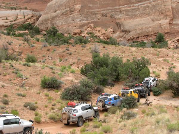
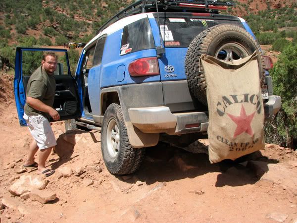
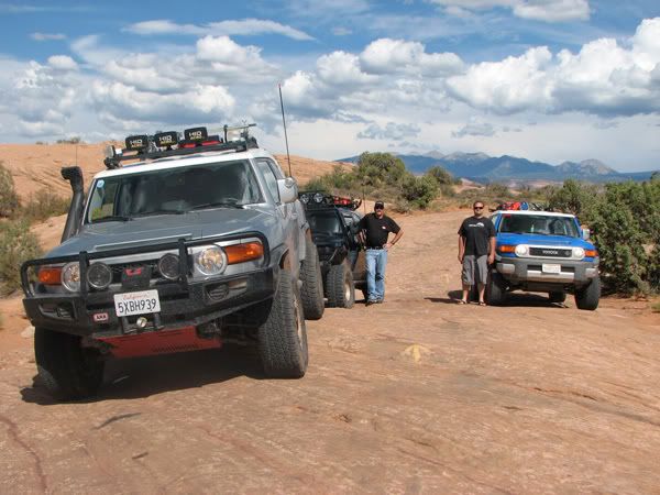
That's precisely what we did. This group ran the trails out of Ouray/Teluride, CO for a week and then hit the Kokopelli and following that, Moab. Members of this particular trail run were from SoCal, Missouri, Illinois & Arkansas. It's not a bad way to spend a couple of weeks.

IMG_2303.jpg

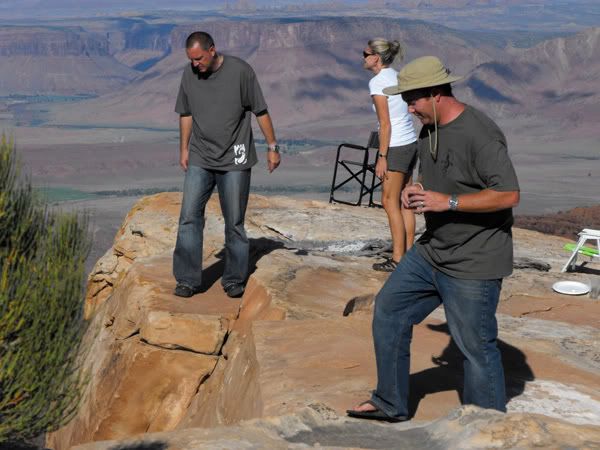
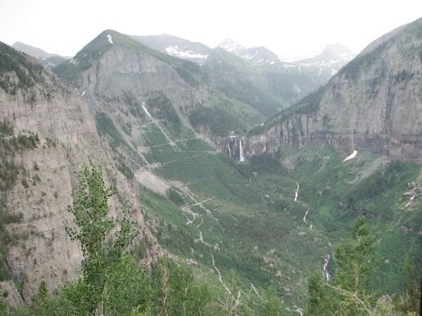
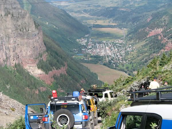
Black Bear and Imogene, for example, are not a lot more than county-maintained roads and while SPECTACULAR, are roads widely traveled by people who rent Jeeps.

IMG_2317.jpg

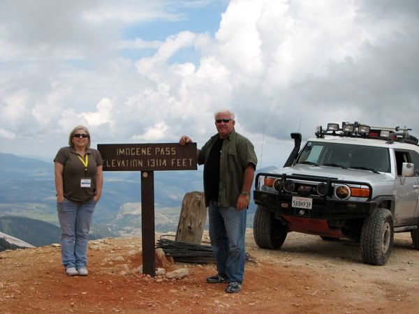
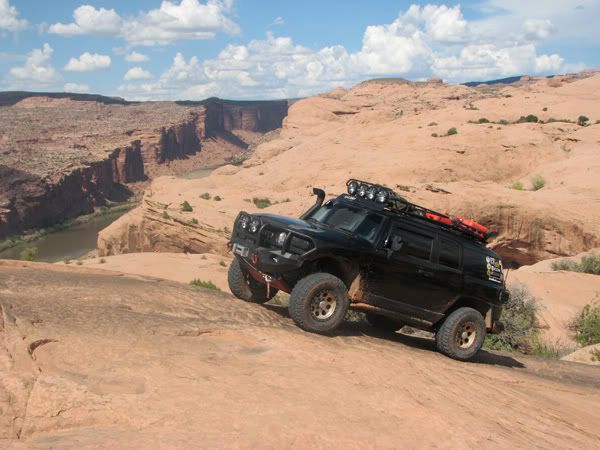
(photo of Black Bear taken from Imogene)

IMG_2348.jpg

Black Bear, reputed to be difficult, has that first steep turn where you're looking down on Teluride, but isn't really "difficult".

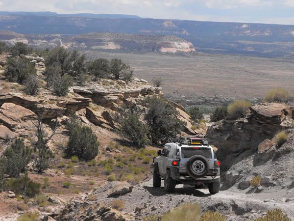
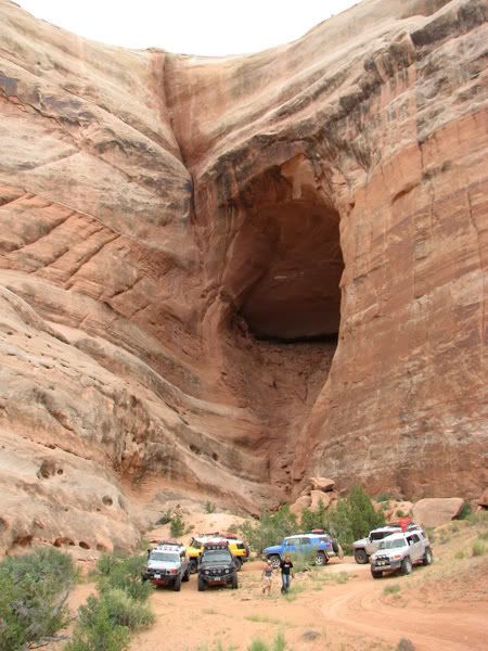
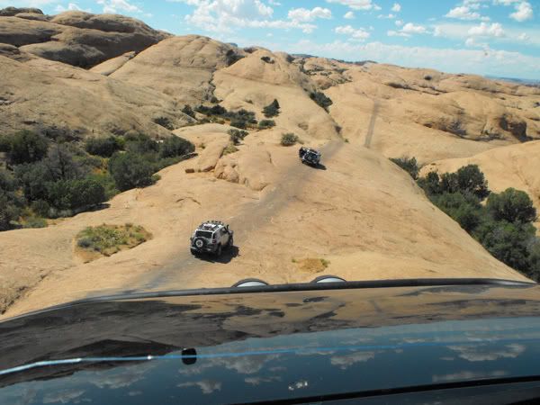
The nice think about the Kokopelli Trail is that it's not beaten down by tourists. As mentioned, we never saw another rig or bicycle. The road from Top-Of-The-World to the end of Rose Garden Hill is considerably more challenging than anything offered on the trails around Teluride (but the scenery there is breathtaking). Having said that, nothing on the Kokopelli Trail is "difficult", but there are challenging spots.

On the road from T-O-W to the Rose Garden we had to do some trail building because the road had washed out in one area where it was quite steep and in another where there was a cliff face where the road cut into it. Even after throwing rocks, my tires were still 2/3 overhanging oblivion on the outside of the road when I traversed the wash-out. It's the sort of place where you need spotting and have to be prepared to throw rocks.

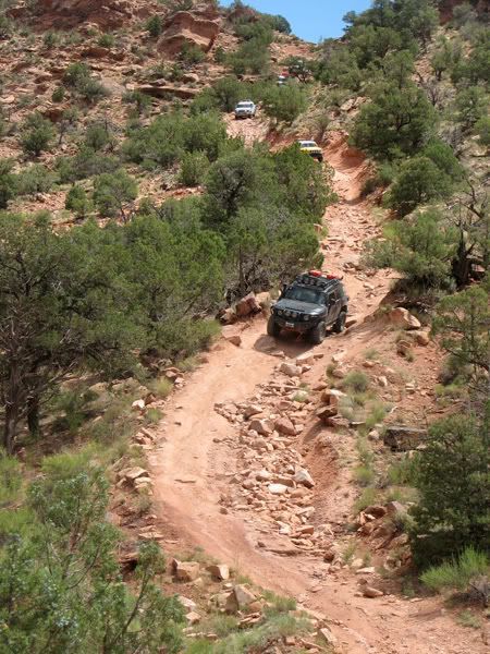
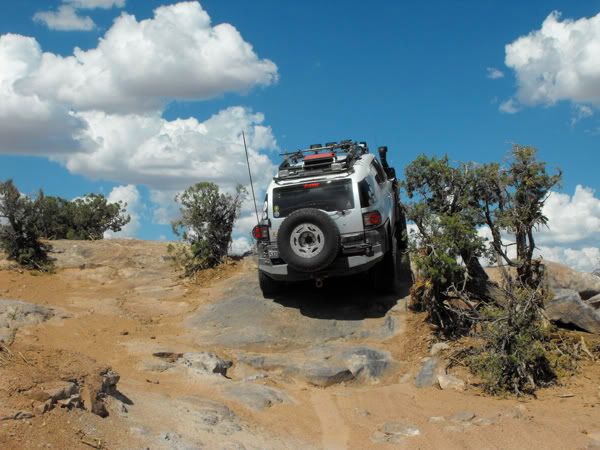
On the Rose Garden, gravity, loose boulders and shelves you drop over remind you why you have skids and sliders. The trail changes subtly with each passing truck because of the way the rocks are re-laid after rigs roll through them.

IMG_2503.jpg


One of our number high-centered and had to be winched back off the rock. The degree of incline of the principal road bed would have made using a hi-lift to jack him up and stack rocks very challenging/dangerous. Fortunately he wasn't the last rig in the procession down the hill.

IMG_2475.jpg


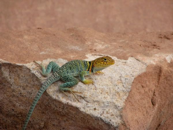
The Kokopelli lizard looked on impassively.
 

uphill

Observer
After the Teluride/Ouray, Colorado & Kokopelli Trails, we hit Moab. One of our number fell ill and had to be taken to ER. Once stable and sleeping, some of the rest hit a few trails.

DSCF0304.jpg


IMG_2537.jpg

Shadow-Warrior near Hell's Gate.

DSCF0368.jpg

This obstacle is called the "tip-over-challenge". It's aptly named because in this photo (not clearly visible) I have three wheels in the air. I asked my spotter why he took me up the toughest line. He smiled...

IMG_2531.jpg


Even though there was room for a bit of pucker on that particular spot, running Moab trails was a perfect end to two weeks on the trail.

IMG_2523.jpg


Shadow-Warrior's expedition-built rig on slickrock overlooking the Colorado River.

DSCF0313.jpg


Moab is just too cool.
 

RunninRubicon

Adventurer
Great report

Thanks for the idea guys. I will be doing this just next month from the 11th thru....23rd or so. I expect to be leaving Grand Junction on the Kokopelli the 18th. I am looking forward to this.:bowdown:
 

Dragon

Adventurer
6 FJCs on the Kokopelli Trail

More photos

Camp the first night.

59129263lq8.jpg


A traveler (Shadow Warrior) prepares for the day

40590461cv0.jpg


Hanging out at Yellow Jacket Canyon (myself and my gf)

99593748eg0.jpg


My rig at the Top of the World

19804091zr2.jpg


No need for words here

57426678ne9.jpg


Frogeye in a tight spot

67763001aq2.jpg


FJ Ollie getting it done as Uphill choreographs the dance.

80680564cr9.jpg
 
Last edited:

Dragon

Adventurer
Uphill and Shadow Warrior (and myself) getting ready to descend the Rose Garden

63119851pl5.jpg


Jeshua in some scenic canyonland

12377038rx2.jpg


Jeshua coming down the Rose Garden

55958148is1.jpg


The Kokopelli adventurers unwind in a land drawn by the fingertip of God Himself.

65244735ur2.jpg
 
Last edited:

Forum statistics

Threads
189,287
Messages
2,915,134
Members
232,078
Latest member
Babbert
Top