Offroad Adventurer
New member
Lost City of the Kalahari Expedition
It all started in 1967 when I was in grade 1, sitting on the floor at school listening to a story out of a “Look and Learn” comic. The story described a group of boy scouts in a Land Rover looking for the Lost City of the Kalahari.
In my mind I had always pictured the dunes, the Land Rover and one day after cresting a dune the Lost City would lie before us in all it’s splendour.
I do not know where this love of adventure and desolate places comes from but after many years of other adventures, deserted places and golden sunsets I still dreamt about the Lost City of the Kalahari.
I awoke one morning and staring my 40th birthday in the face I decided that this was it and I started planning my expedition to look for the Lost City.
In life we meet many people who want to steal our dreams and on my announcing to the “world” that this was my next quest the dream stealers started “but it does not exist”, “it was only a figment of his imagination”. This just made me more resolute.
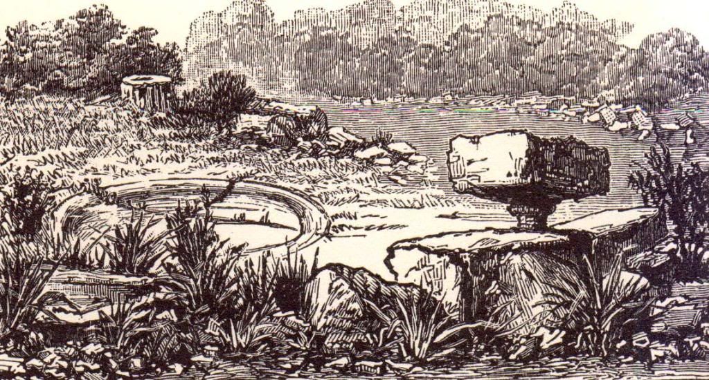
There have been a number of expeditions whose main purpose has been to find the Lost City of the Kalahari that Farini reported to the Berlin Geographical Society on the 7th of November 1885 and to the Royal Geographical Society of England on the 8th of March 1886.
There was an expedition in June 1956 led by Major D.C. Flower, his team included Alan Paton, author of “Cry the Beloved Country”. In July 1957 Dr J.N Haldeman led an expedition and used an aircraft, it’s callsign was ZS-DEN a Bellanca Cruisair 14-13-2 with a 150hp 6 cylinder Franklin engine to undertake an aerial survey of the area and then in October 2002 our expedition led by myself, Greg van der Reis.
There were a number of sightings of the Lost City after Farini reported finding it. These sightings were made by a pilot and by a policeman, both respected members of the community and every sighting had been after a sandstorm.
Since Farini first reported his sighting in 1885 and the subsequent expeditions people have always disputed his writings.
“A half buried ruin – a huge wreck of stones,
On a lone and desolate spot;
A temple – or maybe a tomb of human bones” G.A Farini
Lawrence Green, the author, met a Dr Borcherds in Upington in June 1947 who told him of a police sergeant who while patrolling on camel back had found an ancient stone quarry in the desert and the policeman reported finding the remains of a boat.
The rivers used to flow south from Lake N’gami to join up with the Orange River. Farmer’s Weekly of July 1956 also mentioned the fact that the rivers had been swallowed by the sand and so the report of a boat is not that strange.
If we take a step back we find reports of skeletons of “Bushman-like” people being found in the Nile Valley dating back 12000 to 14000 years. Modern translations of ancient documents give evidence that explorers and traders were sailing the oceans 4000 years ago. Engravings on the obelisk at Karnak by Queen Hatshepsut of Egypt (1500 BC) refers to long sea voyages and when Pharaoh Necho was in power around 600 BC Egyptian sea trade was brisk. The discovery of the Pedra Lavrada inscription in Phoenician script engraved on a stone in Brasil in 1886 states that (abbreviated) “This monument has been cut by Canaanites of Sidon who, in order to establish trading stations set out on a voyage in 536 BC and after a two year voyage got separated from the fleet and ended up in Brazil”. In 470 BC King Xerxes gave orders that Africa should be circumnavigated.
That early morning in October 2002 my dream was coming true! Would we find the Lost City of the Kalahari?
I had spent months applying for research permits and getting two way radio licences for Botswana. Stewart and I had found Fay Goldie’s book “Lost City of the Kalahari” in a second hand book shop in Long Street and after studying it in detail had managed to find a photocopy of Lawrence Greens Book “To the Rivers Edge”. After reading as much as we could it was off to the library in Gardens to undertake more research.
None of us have slept much - packing always seems to be a last minute event and at Vanrynsdorp we decide we need some coffee, it's bloody cold outside and the thermometer in the 4x4 is showing a chilly 7 degrees. It is drizzling as we climb the pass towards Calvinia and there is constant chatter on the radio. I swop passengers with the film crew and Dirk De Villiers (of Arende fame) our director joins me for a few hundred kilometers.
Dirk has had a psychedelic life and at 79 years old is the oldest member of the team. We chat about old times and he tells of the movie industry, people he has met and the good and bad times. Time flies as I listen to Dirk.
Molopo Lodge is convenient but that's about all. While sitting at the fire two bushmen arrive, one in western garb and the other in traditional dress. He tells us that he is David Kruiper's son and yes he had heard of some ruins near Union's End. They danced and sang for us and then disappeared into the night.
The road is rather corrugated but we are all excited and soon we get to Tshabong. Andrew Austin from Selebi-Phikwe is already there as is Mark Johnstone and David who travelled from Johannesburg . The roadside exchange rate varies and at the garage it is excellent, in Cape Town it was R1.67 for 1 Pula, but here we have paid R1.80 and at the garage only R1.55 . We wait next to the road and soon Andrew tells us that Joe Holmes (towing the two microlight aircraft) is only a few kilometers away. It is amazing that in Africa where goats wander in the streets we have celphone signal.
We have a research permit from the Botswana Government and this entitles us to take the "roads less travelled" and as dusk is approaching we leave the main road and make camp for the night. The night is quiet, no animals seem to be around, probably the lack of surface water. The microlight pilots assemble their aircraft and we spend the evening around the fire again, dreaming, chatting, will we find it? The evening was cool but soon the camp was quiet - except for the snorers!
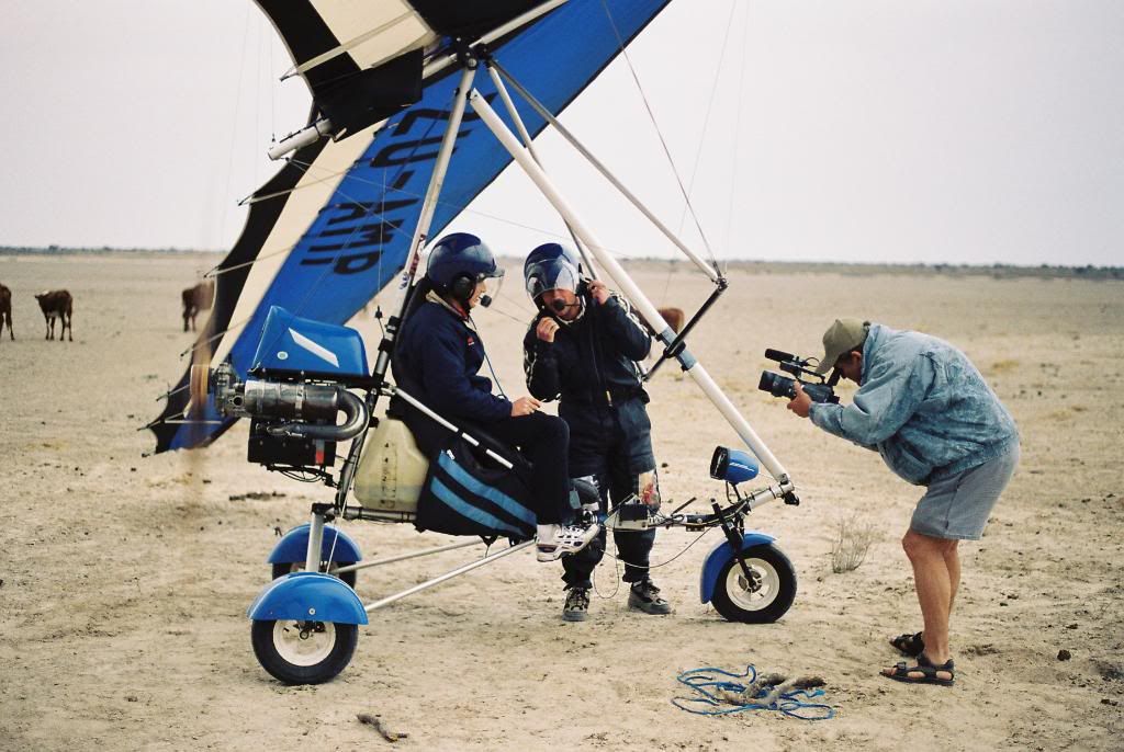
7am and after some coffee we all pack up. Joe and Richard check their aircraft again and again, if something goes wrong here there are no hospitals nearby. Finally clad in their flight gear they start the engines and taxi down the sandy track. Joe leads the way and soon he is racing towards us and is airborne. Richard follows and they are on their way. We agree to meet them in Hukuntsi, Andrew is driving Joe's Cruiser with an enormous trailer and off we go. I am contantly in contact with Joe via an airband radio and we listen to the banter between the two pilots.
While driving towards Hukuntsi we see two cheetah crossing the road in the distance, but they soon disappear into the bush.
The wind was picking up and the pilots make an rough landing and have to decide whether to dismantle the planes and tow them further or wait for the wind to drop. Andrew who lives in Botswana tells us that August is the windy month - bad choice. Paul, Gary, Mike and Andy wait behind to help dismantle the microlight aircraft. Gary ZR1VET and I ZS1GD are radio hams so we have reasonable communications and so I leave with the rest of the expedition members and continue to Hukuntsi. We refuel once again and travel towards Ngwatle looking for access to the Kwakai Pan. We find an old track and set up base camp on the southern side of the camp with a small tree covered dune behind us.
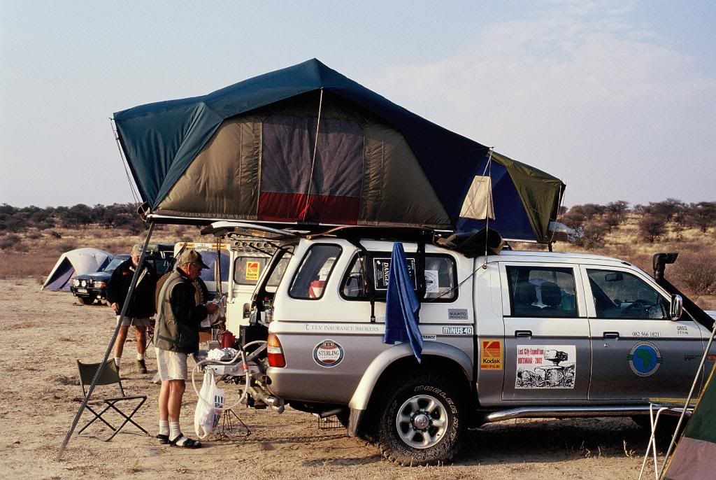
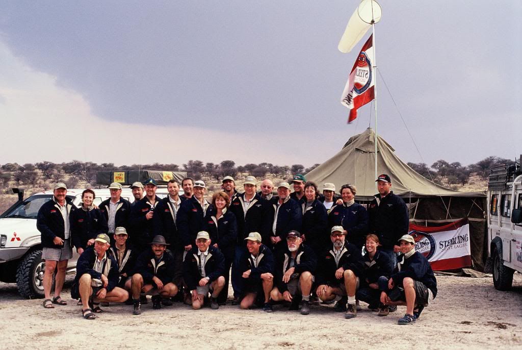
We set up camp, put up the wind sock, sponsors flags and erect the 5x5 meter army tent. I had not had communications with Gary for a while and then through the crackle we heard them. The road out of Hukuntsi is not marked at all and they had taken a wrong turning.Finally we saw their headlights and the team was complete.
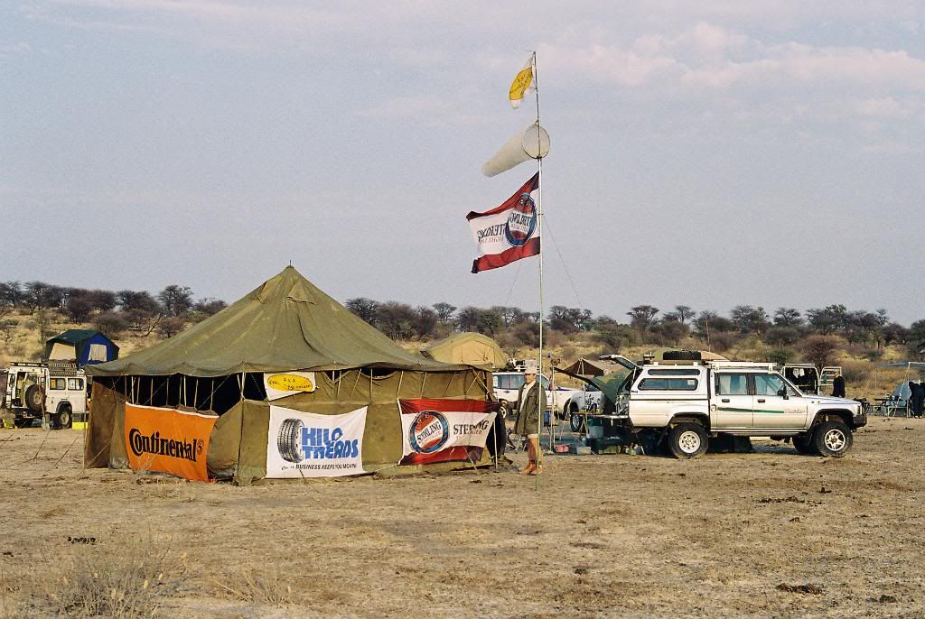
Buildin the runway
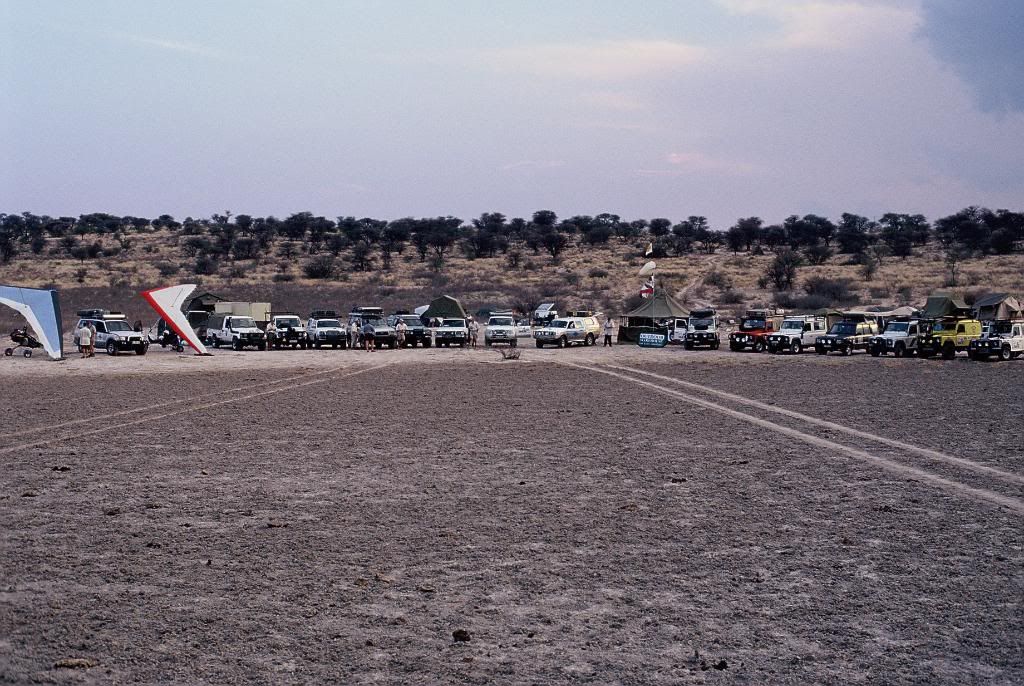
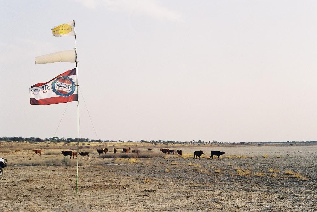
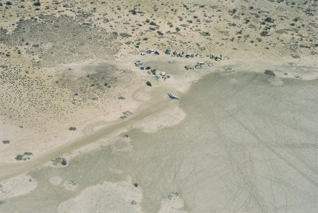
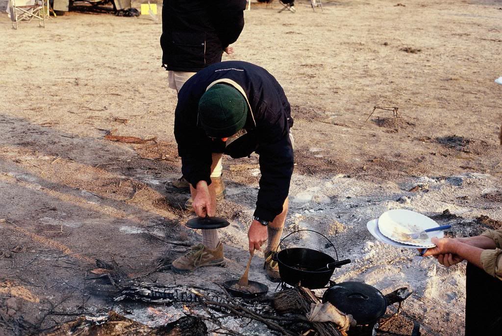
As dusk fell cattle congregated on the pan, bad news! There are no dams or water troughs nearby and the animals are in desperate need of water. They seem to know the tricks, wait until dark and then move in and lick the moisture off the vehicles. You start dozing and then under the roof top tent Mooooooooo! By know you are awake. The cattle rubbing up against the vehicles, and the bloody mooooing just got too much for some. Picture the film crew's tent, zzzzzippppp, and a figure in underpants shouts *&^((*(*))^ cows and he starts chasing them, the stampede starts and the cattle leave the camp only to return a little later.
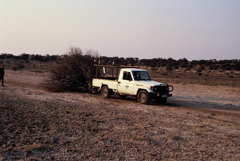
The next morning the microlights were reassembeld and Joe found an old tree and towed it up and down the pan to smooth out the bumps and make a runway. After the tree he got a few of the vehicles together and they drove, up & down over and over until Joe was happy.
10am was briefing time and each team (two vehicles with two people in each) were given their grid for the day. The grid squares were 20 x 20km and each team departed. The film crew, Mark and my team left for the coordinates that Farini mentioned in his notes. Yes, we knew that Farini's coordinates were incorrect but I believe that it is the best place to start.
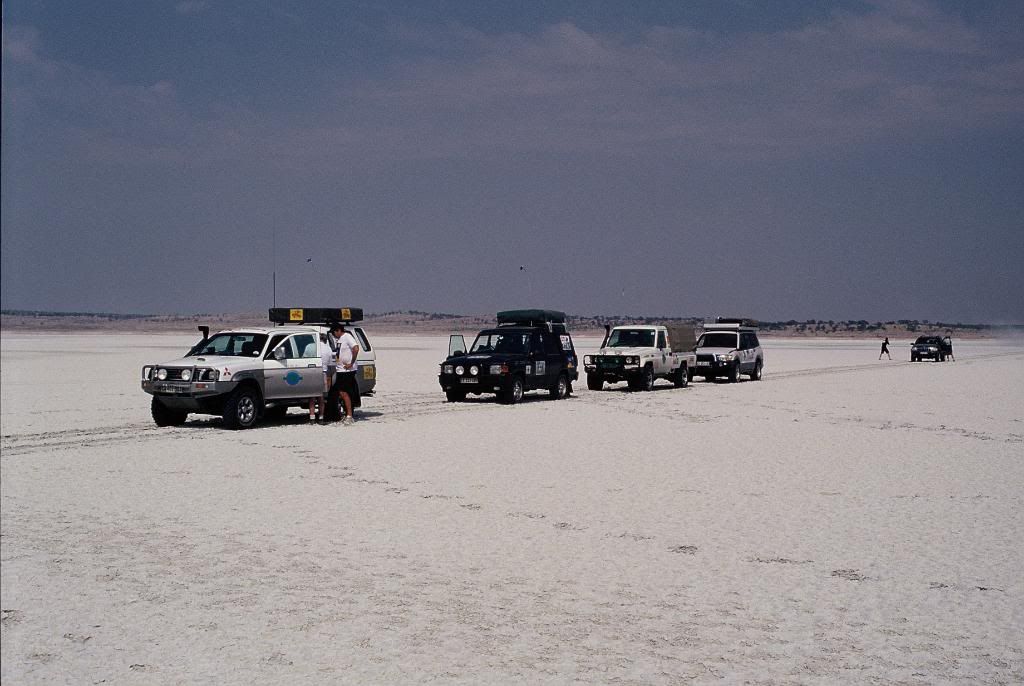
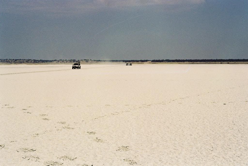
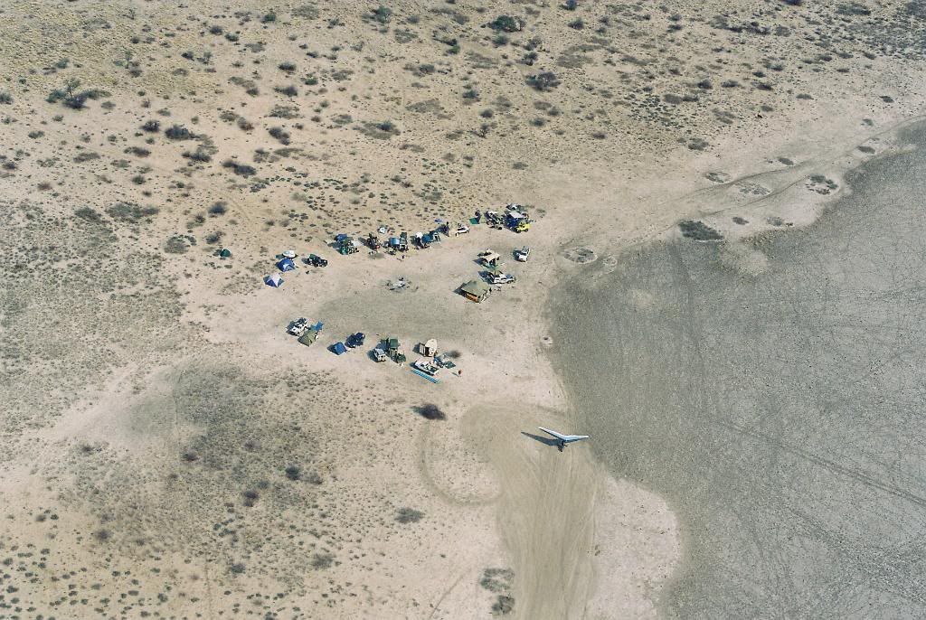
There are fire breaks everywhere and none are indicated on any maps, so we turned north towards the coordinates 21deg 30 minutes East and 23 deg 30 minutes South. Gary and Mike travelled with us until we reached a vast pan which formed the southern boundary of their grid and we carried on. Two hours later we were had managed to get to within a few kilometers of the coordinates and now had to travel through the bush to the coordinates. The bush had been burnt by lightening and the sharp sticks worried us but we continued on. Arriving at Farini's coordinates we found ourselves on the eastern side of a red dune with all the vegetation burnt, we could see for miles and there were definitely no ruins. Paul and Bob's grid square lay next to ours and we searched in grid patterns firstly together and then they moved off to their grip square.
We assumed that if a civilisation had been in the area they would have set us camp near a pan or a well and so we located and searched about 15 pans in our area. The area was deserted and we saw nobody, a few tire tracks here and there showed that there had been other traffic on the track but I estimated that the track was at least a week old. The bush around the pans is thick and there was a constant scratching noise as we negotiated routes to the pans. The pans themselves were either barren or covered with very fine grass and we were surprised when a small heard of Springbok were seen in the distance. The buck were skittish and moved away rapidly when approached.
We finished our grid as the sun was setting and managed to find our way to another fire break and driving purely on GPS directions we managed to find our way back to camp. In the head lights we saw many Steenbok and a porcupine. We turned onto our now well used track and crossed the pan to our base at about 9.30pm. Denise and Melanie had made us supper and by that time we were ravenous.
That night the jackals cried from the edge of the pan, soon the night was very quiet and then the wind and rain started. The rain lasted only an hour but as dawn broke with a reddish sky we saw that our runway was mud.
Sitting around the fire the previous evening Joe and Richard told of a well they had found on a pan about 25km from us and then on the adjoining pan about 10km further that had seen typical geometric patterns of civilization. This is when we realised that a search of this nature is impossible without aircraft.
While Joe, Richard and Andy started making a new runway on the edge of the pan we headed off to investigate the well and the patterns that they had reported. Was this our lucky break?
The pilots were not the only expedition members to find some proof of previous human habitation. Gary and Mike had found an ancient fish trap on one of the pans in their grid, but alas no buildings. David and Arber found some stone age chipping and cutting tools on a pan about 20km from our base, but yet again no ruins.
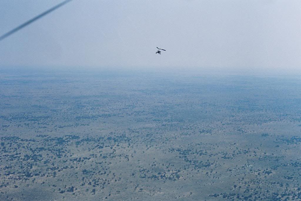
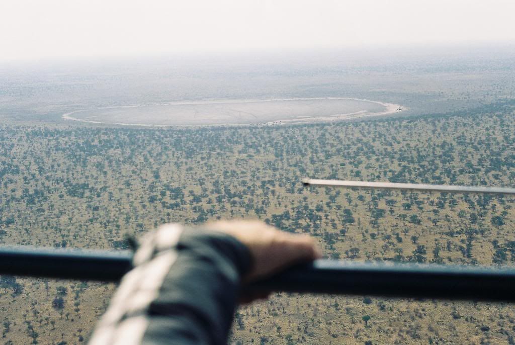
We departed for the well. This time there were no fire breaks or tracks and we covered the 30 km in approximately 3 hours. The well was deep but dry and some owls had chosen the walls as their new home, we travelled south west again towards the main area on interest, namely the geometric patterns. As we crossed that last dune we were all wondering if this was it, the Lost City of the Kalahari but after 25 previous expeditions we did not expect the Kalahari to give up it's secrets that easily. We searched the whole crescent shaped dune and all we found was an area where someone had planted some small trees in a rectangular pattern, some 1500mm apart, nothing else. We searched on.
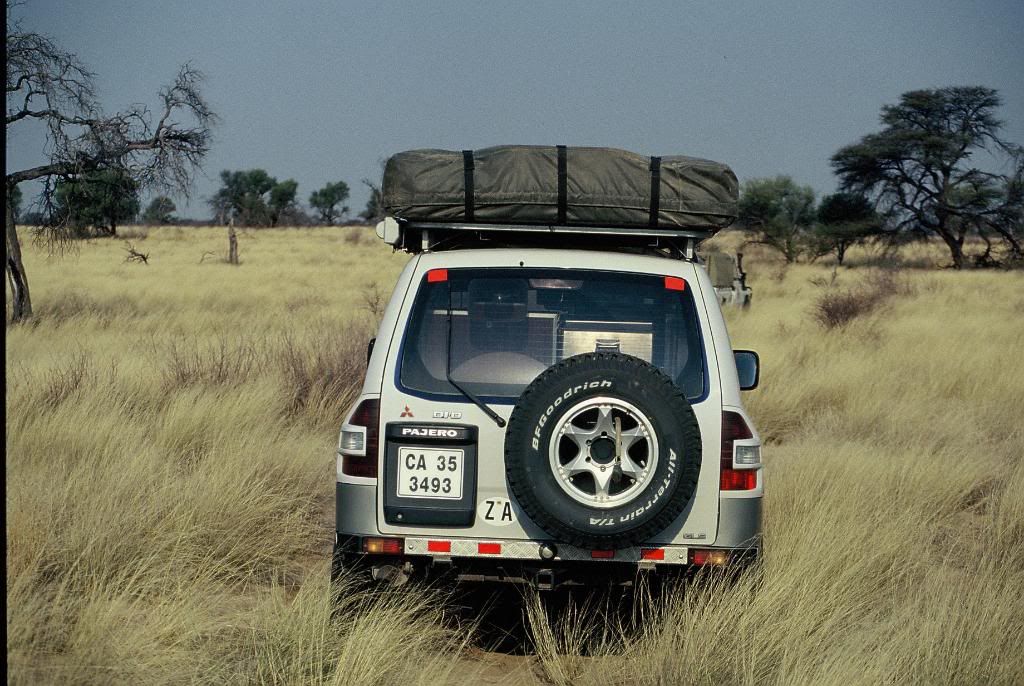
By now most of us had, had punctures but driving through high grass we were more worried about damaging a differential on an old stump. Punctures are quick to repair but a differential is not. Malan had bad luck, he called on the radio, a burnt stick had gone right through the sidewall of his tyre. After repairing the tyre we were on our way again. After a few hours of this we gave up and made our way through the grass back to camp. I decided that I would rather fly up with Joe on the following day to investigate from the air.
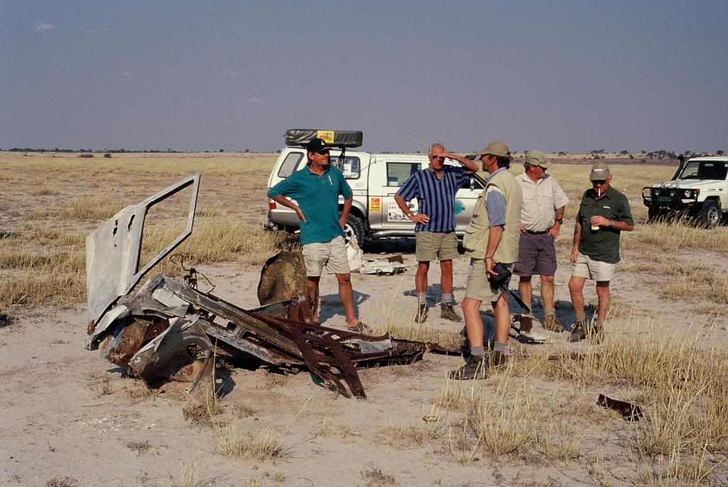
Farini had been very descriptive of what he had seen and therefore if the were no ruins then it was not the correct site. We travelled on and Stewart and I joined Paul and Bob's team (both Bobs) at the site of David and Arber's find. We searched all over the pan and there was no evidence of any structure (other than a bit of old Land Rover that had been there for probably 50 years).
On returning to camp we were happy to see that Johan and his wife were recovered and would be joining us as a search team the following day. Johan and Mare had been feeling sick for three days and had offered to look after the camp while we were out searching.
Brian and David returned from their grid and reported finding nothing. This was a disappointment as with the modern knowledge available and the adjustment to Farini's coordinates David and Brian had the best chance of being in the right area. Brian reported thick bush and he and David had driven for two full days to search their 20 x 20km block. Dylan and Jan had likewise being searching an area known as the Kwang forest (an area mentioned by Farini) and had opted to stay in the search area overnight instead of returning to the base camp. This area also gave away no secrets and after two days they returned to the pan.
Early the next morning Joe and I, and Richard and Paul (cameraman) took off to investigate the geometric patterns. It is ideal to take off into the wind but as the pan was still muddy Joe did the best he could and we were launched into the air with a wind blowing 45 degrees off the left. We flew over the well and then onto the pan. As Joe pointed the features out I noticed our tracks running through the geometric patterns, we had searched on the ground and seen nothing! The patterns indicated an old kraal or a number of smaller kraals within a larger kraal, but the structures were long gone and again they were nothing like the ruins Farini described. Approaching Kwakai Pan we noticed from our wind sock that the wind was now 90 degrees off the approach and that we would have to land with a strong cross wind. On finals we were coming in with the aircraft at almost 30 degrees off the bearing, Joe reduced power and just before touch down he turned the aircraft straight and we had made a good but bumpy landing. The wind over the wing creates lift and with the wind 90 degrees off the pilot has to know his story.
On returning to the camp I decided to move the search further south and so we packed up the camp. While packing up the 5m x 5m army tent a gust of wind grabbed the tent and with white knuckles we held on to the ropes. I peered through the dust in disbelief as an empty braai grid came cart-wheeling past me like a tumbleweed. Then just as quickly as it had started the wind died, we continued packing getting ready for daybreak with an ETD of 6.30am.
We continued searching any interesting looking rocky outcrop while making our way to the western junction of the Gemsbok Park. We detoured to Union’s end where the bushmen had mentioned a lost city, but once again we found nothing.
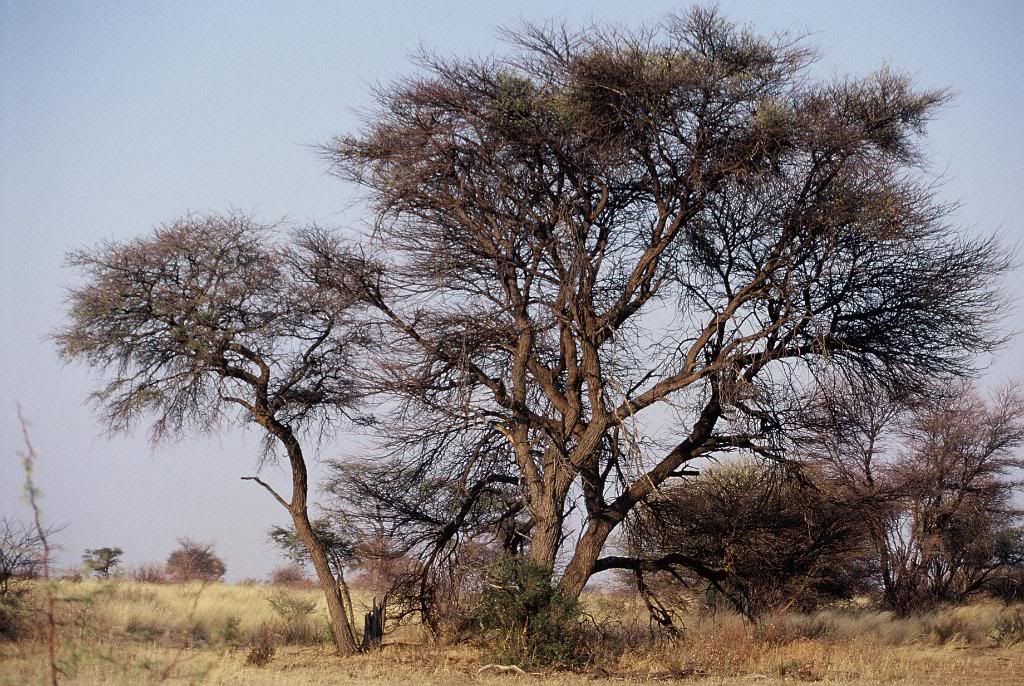
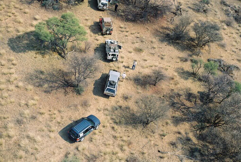
That night we slept at Molopo Lodge and early the next morning we made our way to Eierdop koppies the place that Michael Main and Alec Campbell believe to be the Lost City. We crossed the Haakskeen pan and found piles and piles of rocks, no walls, no paved areas, no Maltese cross and no columns. Even if Farini was tired and depressed it is hard to see the ruins in the Eierdopkoppies.
The quest is not over! I believe that there is a Lost City in the Kalahari - somewhere, maybe partly under the sands and probably not what Farini described. Farini only started elaborating on the Lost City after the Royal Geographic Society had shown interest in it. If traders were sailing the oceans 4000 years ago and the obelisk at Karnak with it’s inscriptions about the "Great Encircling Sea", the archeological finds that point to the Egyptians mining gold and diamonds in Africa at the times of the pharaohs. Is it not possible that a city such as the one described by Farini could have been built in the diamond rich Kalahari? The "blocks cemented together", pavements, Maltese cross and fluted columns point to a culture from North Africa. I believe that in time the Lost City of the Kalahari will be found and it will prove that people from Egypt (called the "strange ones" in African legends) travelled to these parts in search of gold and diamonds.
My quest continues!
Greg van der Reis
Total area searched 16,000 sq kilometers
Expedition total cost R350,000 ($50,000 in 2002)

It all started in 1967 when I was in grade 1, sitting on the floor at school listening to a story out of a “Look and Learn” comic. The story described a group of boy scouts in a Land Rover looking for the Lost City of the Kalahari.
In my mind I had always pictured the dunes, the Land Rover and one day after cresting a dune the Lost City would lie before us in all it’s splendour.
I do not know where this love of adventure and desolate places comes from but after many years of other adventures, deserted places and golden sunsets I still dreamt about the Lost City of the Kalahari.
I awoke one morning and staring my 40th birthday in the face I decided that this was it and I started planning my expedition to look for the Lost City.
In life we meet many people who want to steal our dreams and on my announcing to the “world” that this was my next quest the dream stealers started “but it does not exist”, “it was only a figment of his imagination”. This just made me more resolute.
There have been a number of expeditions whose main purpose has been to find the Lost City of the Kalahari that Farini reported to the Berlin Geographical Society on the 7th of November 1885 and to the Royal Geographical Society of England on the 8th of March 1886.
There was an expedition in June 1956 led by Major D.C. Flower, his team included Alan Paton, author of “Cry the Beloved Country”. In July 1957 Dr J.N Haldeman led an expedition and used an aircraft, it’s callsign was ZS-DEN a Bellanca Cruisair 14-13-2 with a 150hp 6 cylinder Franklin engine to undertake an aerial survey of the area and then in October 2002 our expedition led by myself, Greg van der Reis.
There were a number of sightings of the Lost City after Farini reported finding it. These sightings were made by a pilot and by a policeman, both respected members of the community and every sighting had been after a sandstorm.
Since Farini first reported his sighting in 1885 and the subsequent expeditions people have always disputed his writings.
“A half buried ruin – a huge wreck of stones,
On a lone and desolate spot;
A temple – or maybe a tomb of human bones” G.A Farini
Lawrence Green, the author, met a Dr Borcherds in Upington in June 1947 who told him of a police sergeant who while patrolling on camel back had found an ancient stone quarry in the desert and the policeman reported finding the remains of a boat.
The rivers used to flow south from Lake N’gami to join up with the Orange River. Farmer’s Weekly of July 1956 also mentioned the fact that the rivers had been swallowed by the sand and so the report of a boat is not that strange.
If we take a step back we find reports of skeletons of “Bushman-like” people being found in the Nile Valley dating back 12000 to 14000 years. Modern translations of ancient documents give evidence that explorers and traders were sailing the oceans 4000 years ago. Engravings on the obelisk at Karnak by Queen Hatshepsut of Egypt (1500 BC) refers to long sea voyages and when Pharaoh Necho was in power around 600 BC Egyptian sea trade was brisk. The discovery of the Pedra Lavrada inscription in Phoenician script engraved on a stone in Brasil in 1886 states that (abbreviated) “This monument has been cut by Canaanites of Sidon who, in order to establish trading stations set out on a voyage in 536 BC and after a two year voyage got separated from the fleet and ended up in Brazil”. In 470 BC King Xerxes gave orders that Africa should be circumnavigated.
That early morning in October 2002 my dream was coming true! Would we find the Lost City of the Kalahari?
I had spent months applying for research permits and getting two way radio licences for Botswana. Stewart and I had found Fay Goldie’s book “Lost City of the Kalahari” in a second hand book shop in Long Street and after studying it in detail had managed to find a photocopy of Lawrence Greens Book “To the Rivers Edge”. After reading as much as we could it was off to the library in Gardens to undertake more research.
None of us have slept much - packing always seems to be a last minute event and at Vanrynsdorp we decide we need some coffee, it's bloody cold outside and the thermometer in the 4x4 is showing a chilly 7 degrees. It is drizzling as we climb the pass towards Calvinia and there is constant chatter on the radio. I swop passengers with the film crew and Dirk De Villiers (of Arende fame) our director joins me for a few hundred kilometers.
Dirk has had a psychedelic life and at 79 years old is the oldest member of the team. We chat about old times and he tells of the movie industry, people he has met and the good and bad times. Time flies as I listen to Dirk.
Molopo Lodge is convenient but that's about all. While sitting at the fire two bushmen arrive, one in western garb and the other in traditional dress. He tells us that he is David Kruiper's son and yes he had heard of some ruins near Union's End. They danced and sang for us and then disappeared into the night.
The road is rather corrugated but we are all excited and soon we get to Tshabong. Andrew Austin from Selebi-Phikwe is already there as is Mark Johnstone and David who travelled from Johannesburg . The roadside exchange rate varies and at the garage it is excellent, in Cape Town it was R1.67 for 1 Pula, but here we have paid R1.80 and at the garage only R1.55 . We wait next to the road and soon Andrew tells us that Joe Holmes (towing the two microlight aircraft) is only a few kilometers away. It is amazing that in Africa where goats wander in the streets we have celphone signal.
We have a research permit from the Botswana Government and this entitles us to take the "roads less travelled" and as dusk is approaching we leave the main road and make camp for the night. The night is quiet, no animals seem to be around, probably the lack of surface water. The microlight pilots assemble their aircraft and we spend the evening around the fire again, dreaming, chatting, will we find it? The evening was cool but soon the camp was quiet - except for the snorers!
7am and after some coffee we all pack up. Joe and Richard check their aircraft again and again, if something goes wrong here there are no hospitals nearby. Finally clad in their flight gear they start the engines and taxi down the sandy track. Joe leads the way and soon he is racing towards us and is airborne. Richard follows and they are on their way. We agree to meet them in Hukuntsi, Andrew is driving Joe's Cruiser with an enormous trailer and off we go. I am contantly in contact with Joe via an airband radio and we listen to the banter between the two pilots.
While driving towards Hukuntsi we see two cheetah crossing the road in the distance, but they soon disappear into the bush.
The wind was picking up and the pilots make an rough landing and have to decide whether to dismantle the planes and tow them further or wait for the wind to drop. Andrew who lives in Botswana tells us that August is the windy month - bad choice. Paul, Gary, Mike and Andy wait behind to help dismantle the microlight aircraft. Gary ZR1VET and I ZS1GD are radio hams so we have reasonable communications and so I leave with the rest of the expedition members and continue to Hukuntsi. We refuel once again and travel towards Ngwatle looking for access to the Kwakai Pan. We find an old track and set up base camp on the southern side of the camp with a small tree covered dune behind us.
We set up camp, put up the wind sock, sponsors flags and erect the 5x5 meter army tent. I had not had communications with Gary for a while and then through the crackle we heard them. The road out of Hukuntsi is not marked at all and they had taken a wrong turning.Finally we saw their headlights and the team was complete.

Buildin the runway


As dusk fell cattle congregated on the pan, bad news! There are no dams or water troughs nearby and the animals are in desperate need of water. They seem to know the tricks, wait until dark and then move in and lick the moisture off the vehicles. You start dozing and then under the roof top tent Mooooooooo! By know you are awake. The cattle rubbing up against the vehicles, and the bloody mooooing just got too much for some. Picture the film crew's tent, zzzzzippppp, and a figure in underpants shouts *&^((*(*))^ cows and he starts chasing them, the stampede starts and the cattle leave the camp only to return a little later.
The next morning the microlights were reassembeld and Joe found an old tree and towed it up and down the pan to smooth out the bumps and make a runway. After the tree he got a few of the vehicles together and they drove, up & down over and over until Joe was happy.
10am was briefing time and each team (two vehicles with two people in each) were given their grid for the day. The grid squares were 20 x 20km and each team departed. The film crew, Mark and my team left for the coordinates that Farini mentioned in his notes. Yes, we knew that Farini's coordinates were incorrect but I believe that it is the best place to start.


There are fire breaks everywhere and none are indicated on any maps, so we turned north towards the coordinates 21deg 30 minutes East and 23 deg 30 minutes South. Gary and Mike travelled with us until we reached a vast pan which formed the southern boundary of their grid and we carried on. Two hours later we were had managed to get to within a few kilometers of the coordinates and now had to travel through the bush to the coordinates. The bush had been burnt by lightening and the sharp sticks worried us but we continued on. Arriving at Farini's coordinates we found ourselves on the eastern side of a red dune with all the vegetation burnt, we could see for miles and there were definitely no ruins. Paul and Bob's grid square lay next to ours and we searched in grid patterns firstly together and then they moved off to their grip square.
We assumed that if a civilisation had been in the area they would have set us camp near a pan or a well and so we located and searched about 15 pans in our area. The area was deserted and we saw nobody, a few tire tracks here and there showed that there had been other traffic on the track but I estimated that the track was at least a week old. The bush around the pans is thick and there was a constant scratching noise as we negotiated routes to the pans. The pans themselves were either barren or covered with very fine grass and we were surprised when a small heard of Springbok were seen in the distance. The buck were skittish and moved away rapidly when approached.
We finished our grid as the sun was setting and managed to find our way to another fire break and driving purely on GPS directions we managed to find our way back to camp. In the head lights we saw many Steenbok and a porcupine. We turned onto our now well used track and crossed the pan to our base at about 9.30pm. Denise and Melanie had made us supper and by that time we were ravenous.
That night the jackals cried from the edge of the pan, soon the night was very quiet and then the wind and rain started. The rain lasted only an hour but as dawn broke with a reddish sky we saw that our runway was mud.
Sitting around the fire the previous evening Joe and Richard told of a well they had found on a pan about 25km from us and then on the adjoining pan about 10km further that had seen typical geometric patterns of civilization. This is when we realised that a search of this nature is impossible without aircraft.
While Joe, Richard and Andy started making a new runway on the edge of the pan we headed off to investigate the well and the patterns that they had reported. Was this our lucky break?
The pilots were not the only expedition members to find some proof of previous human habitation. Gary and Mike had found an ancient fish trap on one of the pans in their grid, but alas no buildings. David and Arber found some stone age chipping and cutting tools on a pan about 20km from our base, but yet again no ruins.


We departed for the well. This time there were no fire breaks or tracks and we covered the 30 km in approximately 3 hours. The well was deep but dry and some owls had chosen the walls as their new home, we travelled south west again towards the main area on interest, namely the geometric patterns. As we crossed that last dune we were all wondering if this was it, the Lost City of the Kalahari but after 25 previous expeditions we did not expect the Kalahari to give up it's secrets that easily. We searched the whole crescent shaped dune and all we found was an area where someone had planted some small trees in a rectangular pattern, some 1500mm apart, nothing else. We searched on.
By now most of us had, had punctures but driving through high grass we were more worried about damaging a differential on an old stump. Punctures are quick to repair but a differential is not. Malan had bad luck, he called on the radio, a burnt stick had gone right through the sidewall of his tyre. After repairing the tyre we were on our way again. After a few hours of this we gave up and made our way through the grass back to camp. I decided that I would rather fly up with Joe on the following day to investigate from the air.
Farini had been very descriptive of what he had seen and therefore if the were no ruins then it was not the correct site. We travelled on and Stewart and I joined Paul and Bob's team (both Bobs) at the site of David and Arber's find. We searched all over the pan and there was no evidence of any structure (other than a bit of old Land Rover that had been there for probably 50 years).
On returning to camp we were happy to see that Johan and his wife were recovered and would be joining us as a search team the following day. Johan and Mare had been feeling sick for three days and had offered to look after the camp while we were out searching.
Brian and David returned from their grid and reported finding nothing. This was a disappointment as with the modern knowledge available and the adjustment to Farini's coordinates David and Brian had the best chance of being in the right area. Brian reported thick bush and he and David had driven for two full days to search their 20 x 20km block. Dylan and Jan had likewise being searching an area known as the Kwang forest (an area mentioned by Farini) and had opted to stay in the search area overnight instead of returning to the base camp. This area also gave away no secrets and after two days they returned to the pan.
Early the next morning Joe and I, and Richard and Paul (cameraman) took off to investigate the geometric patterns. It is ideal to take off into the wind but as the pan was still muddy Joe did the best he could and we were launched into the air with a wind blowing 45 degrees off the left. We flew over the well and then onto the pan. As Joe pointed the features out I noticed our tracks running through the geometric patterns, we had searched on the ground and seen nothing! The patterns indicated an old kraal or a number of smaller kraals within a larger kraal, but the structures were long gone and again they were nothing like the ruins Farini described. Approaching Kwakai Pan we noticed from our wind sock that the wind was now 90 degrees off the approach and that we would have to land with a strong cross wind. On finals we were coming in with the aircraft at almost 30 degrees off the bearing, Joe reduced power and just before touch down he turned the aircraft straight and we had made a good but bumpy landing. The wind over the wing creates lift and with the wind 90 degrees off the pilot has to know his story.
On returning to the camp I decided to move the search further south and so we packed up the camp. While packing up the 5m x 5m army tent a gust of wind grabbed the tent and with white knuckles we held on to the ropes. I peered through the dust in disbelief as an empty braai grid came cart-wheeling past me like a tumbleweed. Then just as quickly as it had started the wind died, we continued packing getting ready for daybreak with an ETD of 6.30am.
We continued searching any interesting looking rocky outcrop while making our way to the western junction of the Gemsbok Park. We detoured to Union’s end where the bushmen had mentioned a lost city, but once again we found nothing.


That night we slept at Molopo Lodge and early the next morning we made our way to Eierdop koppies the place that Michael Main and Alec Campbell believe to be the Lost City. We crossed the Haakskeen pan and found piles and piles of rocks, no walls, no paved areas, no Maltese cross and no columns. Even if Farini was tired and depressed it is hard to see the ruins in the Eierdopkoppies.
The quest is not over! I believe that there is a Lost City in the Kalahari - somewhere, maybe partly under the sands and probably not what Farini described. Farini only started elaborating on the Lost City after the Royal Geographic Society had shown interest in it. If traders were sailing the oceans 4000 years ago and the obelisk at Karnak with it’s inscriptions about the "Great Encircling Sea", the archeological finds that point to the Egyptians mining gold and diamonds in Africa at the times of the pharaohs. Is it not possible that a city such as the one described by Farini could have been built in the diamond rich Kalahari? The "blocks cemented together", pavements, Maltese cross and fluted columns point to a culture from North Africa. I believe that in time the Lost City of the Kalahari will be found and it will prove that people from Egypt (called the "strange ones" in African legends) travelled to these parts in search of gold and diamonds.
My quest continues!
Greg van der Reis
Total area searched 16,000 sq kilometers
Expedition total cost R350,000 ($50,000 in 2002)

