FortyMileDesert
Adventurer
Land Rover Trek 150 – Black Warrior Peak – 8 May 2009
Yep, this one is kind of special; my one hundred fiftieth off-road trek since becoming a Land Rover owner. One hundred seven of them in the Discovery. So I thought that I might try to see how close I could get to the top of Black Warrior Peak, which is about 24 miles, due north of Fernley, as the crow flies. Its a few more miles following roads and trails.
I had breakfast at the Pioneer Crossing and was on the way towards Nixon, on the Pyramid Lake Paiute Indian Reservation by about 7:45. After 20 odd miles and thirty minutes later I was on dirt trails heading north east towards Black Warrior. After just a few miles I was thru a ratty gate in the reservations perimeter barbed-wire fence and on BLM lands.
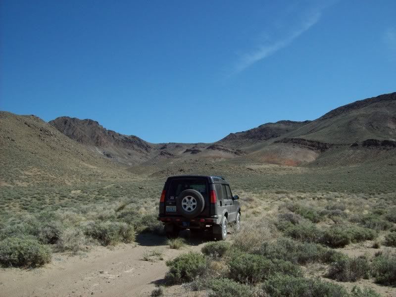
The first few miles of the trail are sandy thru tall sagebrush. As I reach an elevation of about 4600 feet the trail becomes rockier. Now I’m winding up an un-named dry wash through the foothills of the peak. At about 5200 feet I reach what appears to be a fork in the trail. To the left it is sandy, broad and flat; to the right it is narrow, rocky, bumpy and full of boulders. After some scouting around, it appears that the bad trail is the correct one.
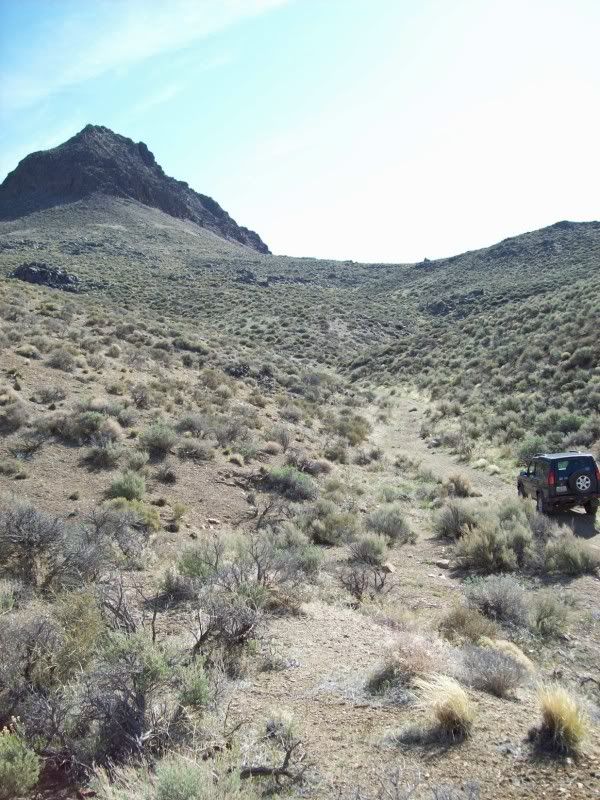
The trail is now running almost due east but there are lots of choices to make. There are old prospector trails and modern ATV trails going every which way. I keep stopping to re-check the gps every few hundred feet to make sure I’m still on a trail. The most useful navigating aid for me is the peak itself: a gigantic volcanic plug looming just ahead and more than 1000 feet above me.
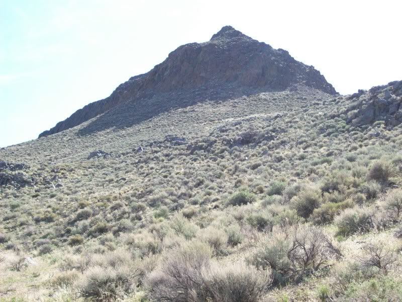
Eventually I find that I’m no longer on any trail that is on the map. I’m winding up a narrow ravine that is going north east and towards the peak. Pretty soon it just ends at a bunch of large boulders. According to my gps the top of the peak is about 2000 feet to the east-north-east and exactly 907 feet higher than I am. My location is 39º 54.62’ N, by 119º 15.15’ W and an elevation of 5431 feet. There is no way that I’m going to climb to the top. The first few hundred feet is at a 45 degree angle and the final few hundred feet is a sheer cliff with a pyramid on top!
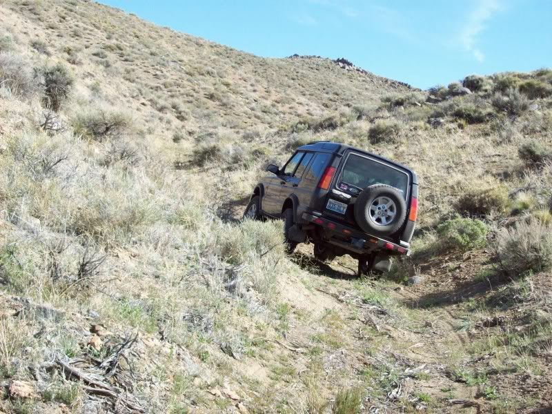
The next thing to do is to get the rig turned around and head back down the way that I came for the last 1/3 of a mile. I eventually find the trail that turns north, passes over a steep saddle and then drops down towards Creel Spring Canyon and then on to Winnemucca Lake. The steep drop from the saddle must be the trail that my friend Tom calls “50 Mile per Hour Trail” because it is so steep. No problem; the Hill Descent Control and the combination of Low Range and 1st gear handle it OK.
About 1000 feet down the trail a wash exits to the west. Getting out and investigating: it looks as if I can follow the wash back towards original trail that I came up. It’s not a real trail but there are some ATV tire tracks in it. This will take me to a junction that will allow me to head towards a trail that goes up a narrow valley to the east of the peak.
It’s about a mile of winding back and forth down the wash. In some spots it’s sandy and in others it’s rocky. Once I reach the real trail I continue another ¾ of a mile until I find the road that will take me south east. This road is fairly smooth sand and gravel for about a mile and a half. Then the road turns north and becomes a bit more primitive again. It only goes for another mile and ends in a box canyon just about a mile south of the peak.
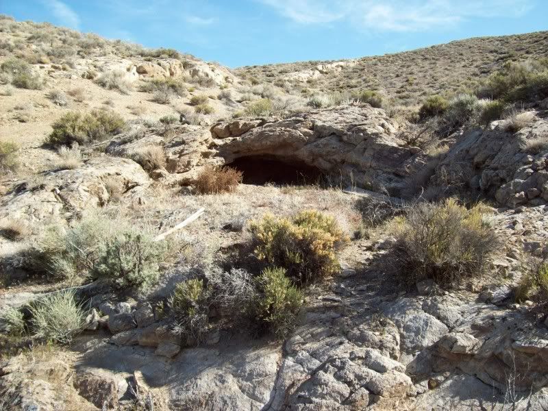
At the end of the trail there are dozens of old water heaters, small boilers and steel drums. The only thing that I can think of is that maybe at one time this was the site of a still. After turning around and starting back, I notice a faint trail that heads south east. Perhaps it will take me to the pole line road that runs along the crest of the long tall thin ridge that runs north-south just east of the Black Warrior.
This new trail appears to peter out after about 500 feet on top of a small hill. I notice some tracks going down a steep gravel berm and then seem to enter a rocky wash. Well; here goes nothing! If this isn’t a trail it’s going to be a challenge getting back up the berm.
The trail is hit or miss mostly in the wash but not always. It follows along the west side of the cliffs for more than a mile and then ends. Not quite; it maybe goes north east back up another wash and maybe around the south end of the cliffs. The trail becomes a boulder field. It’s not quite as bad as on top of Bald Mountain. It’s about another ¾ of a mile along the bottom of a very rocky wash and I finally reach the north-south pole line road. It’s now 11:30 and I’ve travelled about 20 miles since leaving the reservation.
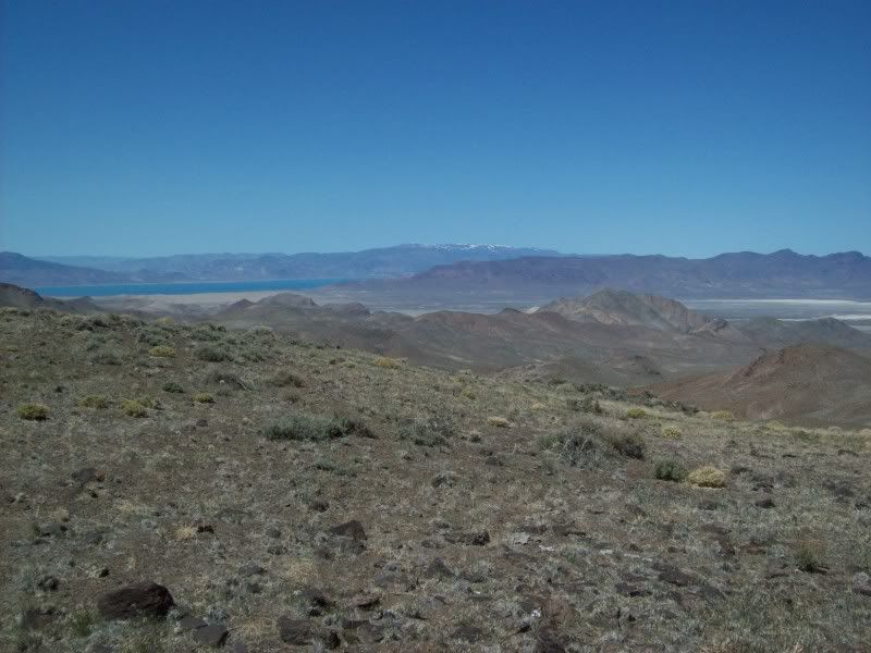
The pole line road is fairly straight for the next four miles. In those four miles it climbs about 1500 feet and has a few excursions passing around the heads of deep ravines. I stop where the road is closest to the western cliffs and hike up to the ridge top where I can see Black Warrior to the south about two miles and Pyramid and Winnemucca Lakes to the west. Amazingly, where I have climbed to the top of the ridge I find an old US Public Land Survey Bench Mark on a short steel post. It’s dated 1911 and has a warning that there is a $250 fine for disturbing it. Can you imagine? $250 in 1911? Wasn’t that like a years pay?
Eventually I reach the high point on the road and it starts to descend towards the Nightingale Mines and Sage Hen Valley. I flip a coin at the top of Coyote Canyon to decide whether to return via Winnemucca Lake and Nixon or to go east and then south to come out at Brady’s Hot Springs. Brady’s wins. After another 20 some miles I reach Interstate 80 at about 2:00pm.
It has been a great day!
Yep, this one is kind of special; my one hundred fiftieth off-road trek since becoming a Land Rover owner. One hundred seven of them in the Discovery. So I thought that I might try to see how close I could get to the top of Black Warrior Peak, which is about 24 miles, due north of Fernley, as the crow flies. Its a few more miles following roads and trails.
I had breakfast at the Pioneer Crossing and was on the way towards Nixon, on the Pyramid Lake Paiute Indian Reservation by about 7:45. After 20 odd miles and thirty minutes later I was on dirt trails heading north east towards Black Warrior. After just a few miles I was thru a ratty gate in the reservations perimeter barbed-wire fence and on BLM lands.
The first few miles of the trail are sandy thru tall sagebrush. As I reach an elevation of about 4600 feet the trail becomes rockier. Now I’m winding up an un-named dry wash through the foothills of the peak. At about 5200 feet I reach what appears to be a fork in the trail. To the left it is sandy, broad and flat; to the right it is narrow, rocky, bumpy and full of boulders. After some scouting around, it appears that the bad trail is the correct one.
The trail is now running almost due east but there are lots of choices to make. There are old prospector trails and modern ATV trails going every which way. I keep stopping to re-check the gps every few hundred feet to make sure I’m still on a trail. The most useful navigating aid for me is the peak itself: a gigantic volcanic plug looming just ahead and more than 1000 feet above me.
Eventually I find that I’m no longer on any trail that is on the map. I’m winding up a narrow ravine that is going north east and towards the peak. Pretty soon it just ends at a bunch of large boulders. According to my gps the top of the peak is about 2000 feet to the east-north-east and exactly 907 feet higher than I am. My location is 39º 54.62’ N, by 119º 15.15’ W and an elevation of 5431 feet. There is no way that I’m going to climb to the top. The first few hundred feet is at a 45 degree angle and the final few hundred feet is a sheer cliff with a pyramid on top!
The next thing to do is to get the rig turned around and head back down the way that I came for the last 1/3 of a mile. I eventually find the trail that turns north, passes over a steep saddle and then drops down towards Creel Spring Canyon and then on to Winnemucca Lake. The steep drop from the saddle must be the trail that my friend Tom calls “50 Mile per Hour Trail” because it is so steep. No problem; the Hill Descent Control and the combination of Low Range and 1st gear handle it OK.
About 1000 feet down the trail a wash exits to the west. Getting out and investigating: it looks as if I can follow the wash back towards original trail that I came up. It’s not a real trail but there are some ATV tire tracks in it. This will take me to a junction that will allow me to head towards a trail that goes up a narrow valley to the east of the peak.
It’s about a mile of winding back and forth down the wash. In some spots it’s sandy and in others it’s rocky. Once I reach the real trail I continue another ¾ of a mile until I find the road that will take me south east. This road is fairly smooth sand and gravel for about a mile and a half. Then the road turns north and becomes a bit more primitive again. It only goes for another mile and ends in a box canyon just about a mile south of the peak.
At the end of the trail there are dozens of old water heaters, small boilers and steel drums. The only thing that I can think of is that maybe at one time this was the site of a still. After turning around and starting back, I notice a faint trail that heads south east. Perhaps it will take me to the pole line road that runs along the crest of the long tall thin ridge that runs north-south just east of the Black Warrior.
This new trail appears to peter out after about 500 feet on top of a small hill. I notice some tracks going down a steep gravel berm and then seem to enter a rocky wash. Well; here goes nothing! If this isn’t a trail it’s going to be a challenge getting back up the berm.
The trail is hit or miss mostly in the wash but not always. It follows along the west side of the cliffs for more than a mile and then ends. Not quite; it maybe goes north east back up another wash and maybe around the south end of the cliffs. The trail becomes a boulder field. It’s not quite as bad as on top of Bald Mountain. It’s about another ¾ of a mile along the bottom of a very rocky wash and I finally reach the north-south pole line road. It’s now 11:30 and I’ve travelled about 20 miles since leaving the reservation.
The pole line road is fairly straight for the next four miles. In those four miles it climbs about 1500 feet and has a few excursions passing around the heads of deep ravines. I stop where the road is closest to the western cliffs and hike up to the ridge top where I can see Black Warrior to the south about two miles and Pyramid and Winnemucca Lakes to the west. Amazingly, where I have climbed to the top of the ridge I find an old US Public Land Survey Bench Mark on a short steel post. It’s dated 1911 and has a warning that there is a $250 fine for disturbing it. Can you imagine? $250 in 1911? Wasn’t that like a years pay?
Eventually I reach the high point on the road and it starts to descend towards the Nightingale Mines and Sage Hen Valley. I flip a coin at the top of Coyote Canyon to decide whether to return via Winnemucca Lake and Nixon or to go east and then south to come out at Brady’s Hot Springs. Brady’s wins. After another 20 some miles I reach Interstate 80 at about 2:00pm.
It has been a great day!