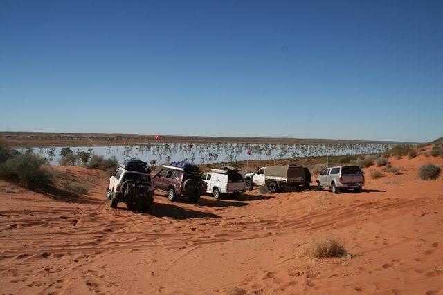
Motley Desert Adventure

Rumpig

Adventurer
Thanks for the great right up.

I have been following along on google maps when you name locations. Really fun!

Subscribing for more.
nice to read your following the trip via goggle maps, i only wish i'd written down the klms we drove each day to give people an idea of the scale of the drive we did, we certainly racked up some decent klms driving in the 3 weeks of the trip
 

Rumpig

Adventurer
awesome report. Thanks for sharing!
cheers, hopefully i'll finish adding the rest tonight.
i thought my original copy of this report was ok, but the amount of spelling mistakes i'm finding and correcting as i repost it up here is quite embarrassing...lol...i'm also trying to reword some stuff so it makes sense to non Australians, so it's taking longer to repost then i expected it would.
 

Rumpig

Adventurer
Day 13:-

Today we had the short drive to Dalhousie Springs, we decided lastnight that instead of being in the desert tonight, we would get into Dalhousie early and enjoy the afternoon lazing around in the swimming hole and just doing bugger all. Originally we were supposed to be here lastnight, but after the previous days events we made Mt. Dare our overnight stop in order to give Carl and Barney a chance to catch us up. With time to spare i wondered around Mt. Dare taking some pics.

COUPLE OF PICS OF OLD VEHICLES

tn_IMG_0022-1.jpg


tn_IMG_0044-1.jpg


i'll mention here for those not familiar with Australia, Mt Dare is the last place to get fuel or any vehicle repairs done before crossing The Simpson Desert for anyone doing a West to East crossing. There's not really a lot here, it's not a town, just an old cattle property (they no longer run cattle though, it's part of a National Park these days) with a small Hotel, workshop area, some cabins and a camp area. Fairly similar in size to Cameron corner that i showed a picture of earlier (maybe a touch larger).

Leaving Mt. Dare we were soon turning left towards Dalhousie, before long we were driving on gibber plain and we stopped to let our tyres down some more, this had the desired effect we wanted and was a much more comfortable drive from here on. Stopping along the way to collect firewood, the short drive was uneventful and a pleasant change from previous days driving.

TIME TO LET TYRES DOWN

tn_IMG_0047-1.jpg


Arriving just before lunch we set up camp, and quickly had a bite to eat before making our way down to the water for a swim. The water was certainly warm, almost abit to warm really, but oh well it was definately relaxing (this spot is an Artesian Spring, a quick goggle of Wiki says Spring water temperatures range from 38 to 43 degrees C.). If you stood still long enough, the small fish in the water would come and nibble on your legs, the kids thought this was hilarious. Leaving the water we returned to camp for some no holds barred, games of botchy (sp?) or whatever the game is called, aswell as starting the fire for cooking tonights dinner. Dinner tonight would be cooked by Esther and it would be Roast Rack of Lamb stuffed with Tomato, Cheese & Prosciutto cooked in the camp oven, easily the best meal we had all trip, a shame Esthers husband Pete was too sick to have any of it. Dinner was had, more drinks consumed and we all slowly made our way back to our tents to get some sleep before we hit the desert tomorrow.

DALHOUSIE SPRING

tn_IMG_0049-1.jpg


SPORT AT IT'S BEST

tn_IMG_0055-1.jpg


RELIC IN THE PADDOCK

tn_IMG_0067-1.jpg


BEST DINNER OF THE TRIP BEING COOKED AT THIS FIRE

tn_IMG_0081-1.jpg


Day 14 :-

Today was the big day, time to enter into The Simpson Desert 8) . Packing up camp i couldn't resist having one last dip in the water, the wife had already been down and taken some pics with the mist rising up over the water, so now it was time for me to have a look. Whilst it was quite chilly this morning (it's winter after all) i knew the water would be really warm, only problem would be come when it was time to get out, i knew it would be freezing, oh well, no pain no gain as they say.

MORNING MIST AT DALHOUSIE SPRINGS


tn_IMG_0092-1.jpg


Exiting the water it was icy cold as expected, a quick walk back to the fourby for some dry clothes and then it was time to leave. Departing camp we stopped just up the road at the rubbish dump, and made sure we had plenty of room in the rubbish bag for the next few days travels. Before long we were travelling along sandy tracks and then it was time to stop and lock the hubs in for when 4wd would be needed. Now here's where the landscape should start looking somewhat like a desert, but alas it looked alot more like prime grazing country due to the recent big wet. Rounding a corner, a look over to the right had us seeing grass that was so green, you'd swear it'd glow in the dark, it really did look out of place for being in the middle of Australia.

THE GREEN GREEN GRASS OF CENTRAL AUSTRALIA

tn_IMG_0105-1.jpg


Before long we were at Purni Bore and it was morning tea time, Purni Bore had a flushing toilet and even hot water....if you wanted to wait the 10 minutes the sign said it takes to arrive to the tap :wink: Purni Bore is the result of drilling by a French Petroleum company in 1963, the well was capped but eventually the wellhead coroded and water flowed out over the ground at 18 ltr a second, before long forming a lake. With such a large volume of water flowing out of the Great Artesian Basin, water flow at Dalhousie Springs was being effected, so in 1987 they capped the bore again and left just enough water flowing to sustain a much smaller lake for the wildlife that had come to depend on the water source.

PURNI BORE


tn_IMG_0121-1.jpg


tn_IMG_0125-1.jpg


Leaving Purni Bore it wasn't long before we stopped for another photo opportunity, a camel was walking up the track towards us all :shock: As it got closer the camel decided it was time to head bush and started to make abit of a run for it.

FUTURE CURRIED CAMEL PIE AT BIRDSVILLE BAKERY


tn_IMG_0127-1.jpg


A little bit futher down the track and we were officially in The Simpson Desert 8) 8) time for a group pic.

GROUP PIC AT SIMPSON DESERT SIGN


tn_IMG_0131-1.jpg


Back on the track again and making good time, so far today we were yet to see any other vehicles, this would soon change as we neared the turn off to the Rig Road and we found ourselves stopped on the side of the track as a group of 5 other vehicles came the opposite way. Mobile again and we were all finding the going really easy, before long it was lunchtime and we found a large flat open area to stop at, main problem was finding somewhere free at prickles :wink: Lunch consumed, and back on the French Line we found ourselves at the Colson Track intersection, here we would turn right and travel to about the turnoff for the Oolarinna Oil Well where we would make camp for the night. Camp set up for the night and plenty of daylight still left, we walked up a nearby sand dune to take some pics of the abundant wildflowers we had been seeing all day. Most of the flowers were white in colour, but occasionally you'd get the odd yellow batch aswell. Walking along the dune top i spotted a hawk of some type sitting on a dead tree branch amongst the wildflowers, how i'd kill for a bigger zoom lense right about now.

DESERT.....WHAT DESERT?

tn_IMG_0140-1.jpg


tn_IMG_0142-1.jpg


I SO NEED A BIGGER ZOOM LENSE!!!!


tn_IMG_0151-1.jpg


WILDFLOWERS IN BLOOM


tn_IMG_0160-1.jpg


tn_IMG_0167-1.jpg


By now the sun was starting to set, so we made our way back to our camp and sat around the fire waiting for dinner to be cooked and enjoying a beverage or 2. Dinner was had, and not wanting to burn all our firewood in one night we were soon all off to bed and tucked up in the sleeping bags where it was alot warmer then being outside.
 

Rumpig

Adventurer
Day 15:-

A nice cold morning to start the day, it really is hard to get out of bed and pack up camp in these temperatures :( Brekky consumed and camp packed up we were off driving again in the desert. Continuing South along Colson Track we soon made a righthand turn onto the WAA Line and then a little further up this track we then made a lefthand turn into the Rig Road where we were heading for The Lone Gum Tree. The Rig Road was much slower going then the previous days driving, not really hard to drive, but just so many dunes to go over had us travelling alot slower. The flowers today were alot more abundant then yesterday, we found ourselves stopping a few times to take pics along the way.

I SAY AGAIN...WHAT DESERT?


tn_IMG_0186-1.jpg


PRETTY FOURBY PIC

tn_IMG_0195-1.jpg


MORE FLOWERS

tn_IMG_0200-1.jpg


Eventually we made it to The Lone Gum for our intended lunch stop, it had taken about 2 hours longer then we expected it would, and with tonights intended camp spot being Poeppel Corner, we were going to have to make up some time somewhere. Looking at the map whilst having lunch, we decided we'd skip doing the Knolls Track (our intended route) and just head North, straight back up to the French Line from where we were. Whilst the Knolls track would be alot more scenic route, we knew it was alot slower going, so this track was skipped in favour of a much quicker route back to the French Line. Back on the French Line we soon found ourselves crossing a big salt pan, all vehicles stopped in the middle and it was time for another group pic

SALT PAN GROUP PIC


tn_IMG_0211-1.jpg


Back on the go and the sand was now becoming alot softer, all the previous dunes had been easy going, but now there was the chance of actually getting yourself bogged if you weren't alert enough. The afternoon was getting on and we were still about 20 klms from Poeppel Corner, at the rate we were travelling it would be dark before we got there. It was now we had our first bogging in the desert, Barney had tried to come up a steep section of a dune and not quite made it to the top, instead of waiting to be towed over he thought he'd reverse back and give it a second attempt. As Barney reversed back he slid sideways and wedged the back of his vehicle against another dune, he now couldn't go backwards or go forwards...time for a recovery. It took a few attempts with a snatch strap and some shovel work, but after about 15 - 20 minutes Barney was towed up and over the dune from where he was stuck. We all quickly then pressed on in the vain hope we would make Poeppel Corner tonight, but as the sun began to set and with still 10 klms to drive, we knew we had atleast another hour before we would get there. The decision was made to find a flat spot and make camp for the night, i'd hoped to be in camp earlier though, as tonight it was our 2nd and final time to cook dinner for everyone. Setting up camp, some of the other guys gave us hand to prepare dinner, as it was getting late and many hands made light work. Dinner had we enjoyed a couple of drinks and trundled off to bed. Tucked up in bed tonight would be quite a cold night indeed.

Day 16:-

It was definately a cold night lastnight, we woke to find the washing up water we'd left out had a thin layer of ice across the top of it. then looking around we noticed it was one of the most spectatcular sunrises we'd seen all trip (though i did try and avoid alot of them :wink: :lol: ), i quickly grabbed the camera and went for a short walk down the track to take a pic over the nearby saltpan.

SUNRISE IN THE SIMPSON

tn_IMG_0226-1.jpg


A few pics taken and i returned to camp to have breakfast and pack up camp, we then had the short 10 klm drive to Poeppel Corner where we would then have morning tea. For those who don't know, Poeppel Corner marks the spot where Queensland, South Australia and the Northern Territory all meet up at.

POEPPEL CORNER MARKER


tn_IMG_0244-1.jpg


MY KIDS AT THE REPLICA OF ORIGINAL MARKER POST AT POEPPEL CORNER

tn_IMG_0251-1.jpg


Back on the road again and we weren't sure where we'd end up tonight, we hoped to cross Eyre Creek on the Northern Bypass Road and then find somewhere to camp, but only time would tell just how far we'd get today. Leaving Poeppel Corner we were soon viewing another large salt Pan, this one just like the one on the Western Side of Poeppel Corner had quite abit of water sitting in it, the contrast of the water and the white salt pan really did look spectacular, my photography skills could never do it justice.

EASTERN SIDE OF POEPPEL CORNER SALT PAN WITH WATER IN IT


tn_IMG_0264-1.jpg


THE DESERT IS A MYTH I TELLS YA'S!
!!

tn_IMG_0271-1.jpg


FLOWERING PLANT


tn_IMG_0279-1.jpg


As the day went on we soon found ourselves having lunch in the middle of nowhere, once again we found a large open flat area, and tried to stay away from the prickles. Lunch had and we were on our way again, we had come across a couple of vehicles today just after Poeppel Corner, but the traffic so far was very light, the previous day we had passed only 4 vehicles all day. After lunch we could hear chatter on the radio of oncoming vehicles, it was a group of 5 4wd's and they were kind enough to pull over and let our group of 7 vehicles pass by. As the afternoon wore on we once again heard talk on the uhf and found out we had another 7 vehicles coming in the opposite direction towards us, though this group had encounter some breakdowns with a vehicle and were spread out over about a 10klm distance. The first 2 vehicles approached us and i was amazed and astounded at the stupidity of some people, sitting on the roofrack of the 1st 4wd was 2 young kids as the vehicle travelled along, inside the vehicle was another 5 people, and one of them was half hanging out the window aswell :shock: :roll: :roll: :roll: Further up the track we passed another 2 vehicles and then abit further along we encountered the last 3 of the group. Hearing the last vehicles talking on the radio and then seeing them, we radioed we had a visual on them, and could they stay where they were whilst we came down from ontop of the dune we were on which is the normal protocol. Much to our amazement, halfway down the dune, Glen who was infront of me almost had a head on accident with the oncoming group, as they ignored our message and came flying up the dune :shock: :roll: :roll: Not wanting to wait for us, the 3 vehicles then plowed their way through the scrubland and went around us, whilst they didn't respond to our first message to stay where they were, they certainly did respond to the next one we gave them. Lets just say it can't be printed on a family friendly forum like this :wink: From this point it was an uneventful drive to the Eyre Creek bypass track. We turned left and headed the 30 odd klms North along a track in really good condition, there was only the odd washout to lookout for, but the rest of the track was pretty smooth going (we needed to take this bypass as the usual track was stil flooded and closedafter the recent big wet). Reaching Eyre Creek we expected it to be about 700mm deep and fast flowing as all reports had it, instead we found it about 500mm deep and not flowing all that quickly, certainly flowing, but nothing dangerous.

EYRE CREEK NORTHERN BYPASS CROSSING


tn_IMG_0291-1.jpg


CLOSED EYRE CREEK CROSSING ON QAA LINE looking from the Eastern side doesn't look much, but it's deep and closed to traffic

tn_IMG_0322-1.jpg


Crossing over the rocky creek bed we were now on the Eastern side of Eyre Creek, following the track we found numerous campers had set up along the creek and there wasn't alot of room for a big group like ours left. We decided we'd head along the Eastern side of the bypass, back to the QAA Line and see what we could find there. Reaching the QAA line there really wasn't anywhere suitable to camp, most of the flat areas were still water logged, so we continued East over a few dunes before finding a spot to make camp for the night, by now the sun was setting and it wouldn't be long before it got dark. Camp set up we did the usual and enjoyed a few drinks along with our dinner before eventually going to bed.
 

Rumpig

Adventurer
Day 17:-

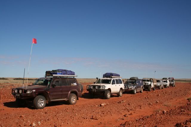
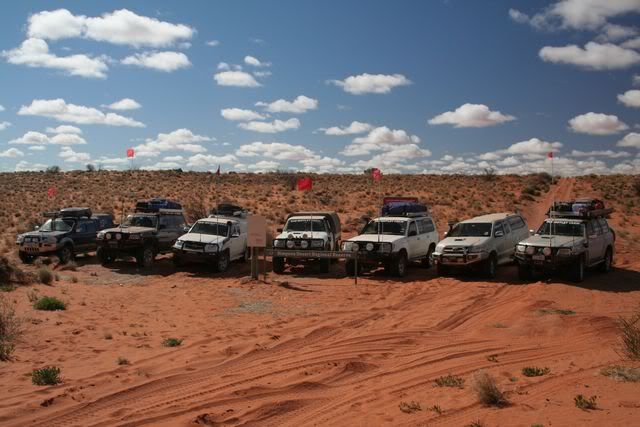
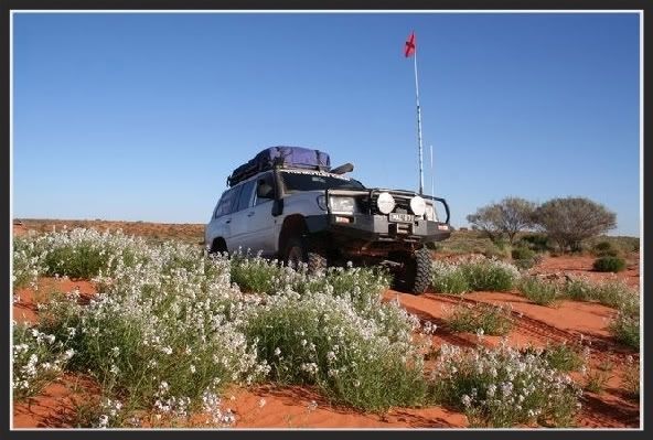
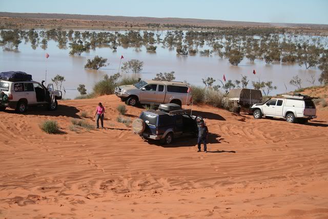
A short drive today, tonights stop over would be in Birdsville and our completion of crossing the desert, so it meant a not to early of a departure from camp for us all. As we left our campsite, a convoy of 5 vehicles passed by us heading towards Birdsville aswell, we tucked in behind them and made it a full on convoy of 12 vehicles heading to Big Red (a well known sand dune), luckily nobody came the other way towards us. Not quite reaching the Western side of Big Red we stopped and looked at the water still about, the track almost looked drivable, but everyone else had been doing a short detour over Little Red instead, due to the track being not passable.

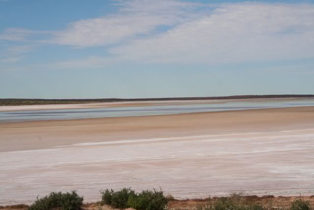
BIG RED INFRONT US, LOOKING EAST

tn_IMG_0334.jpg


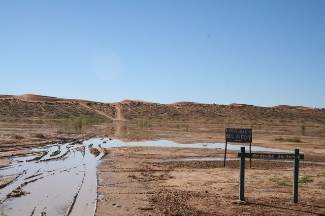
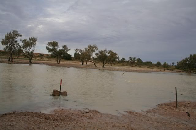
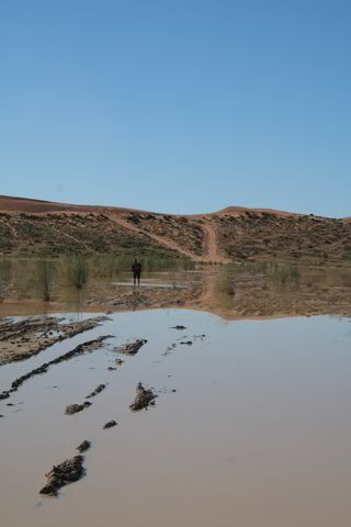
Not happy with having to detour, we all considered having a go at getting through the stretch of water that remained before Big Red, it only looked about ankle deep, but nobody was sure what it was like out in the middle. After much too'ing and fro'ing of "you go first..no you go first, i reckon you'll make it.... from everyone standing about, i removed my double pluggers (flip flops for the rest of you) and set about for a walk through the water to see just how deep it was out in the middle. First thing i'll say is that water was like ice, my feet were numb within about 30 seconds of walking in that water, next thing i'll say is, i didn't want to go ******** up in the mud and have everyone laughing at me :wink: Slowly making my way across the muddy water i had a few close calls with slipping over, one of which i really thought i was gone...lol. The water for the most part was about a bit over ankle deep, but as i neared the middle it started to get about knee deep in some old wheel tracks, and i was also starting to sink a bit in the mud at the bottom, so it meant no chance really that a 4wd would be likely to get through without getting bogged. I reckoned if you got stuck where i was, then you'd need all the recovery gear we had on hand between us all to reach where you would be, and it just sounded like to much work, so we decided to go around instead.

CHECKING THE DEPTH

tn_IMG_0345.jpg


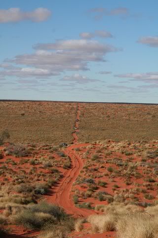
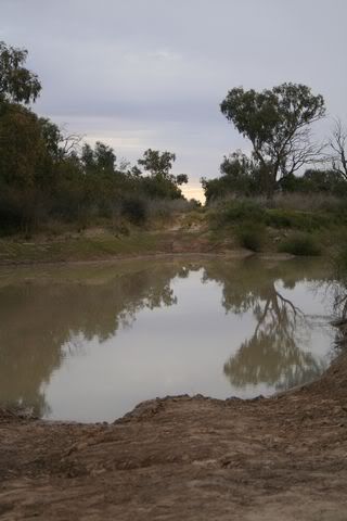
Turning right onto the short detour track, we were soon parked on top of Little Red and looking at alot more water then what was on the Western side of the sand dunes.

VIEW LOOKING EAST FROM LITTLE RED i'll mention here that we've just visited the same area 3 years later (see my Brisbane to Birdsville trip report in this section) and water was still sitting here, though nowhere near as much

tn_IMG_0364.jpg


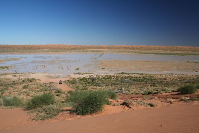
A couple of pics taken we then ventured down to the water line where you could turn right and head for Birdsville along a pretty rough detour track, or you could turn left and head for a play on Big Red instead, so we turned left of course. From here it was only a couple of minutes and we were on top of Big Red, the climb up the Eastern side was really easy going, and we parked the vehicles to watch Glen and another fella from the previous group of 5 mentioned earlier try their best to get up the Western side of Big Red. With tyres down to 12 psi at the rear and 10 psi at the front, both Glen and the other guy tried numerous times to conquor Big Red, but all to no avail. By now several other vehicles from ours and their group had joined in to try and get over the sand dune, but nobody was successful. Watching their attempts, i said to those also watching, "they need to change back a gear at that point where it kicks abit and just give it to it until they get over the top, but i was thinking they would go from 3rd gear to 2nd gear. At this point, one of the guys in our group says, "well go on big mouth, show them how it's done".

ONE OF GLENS MANY FAILED ATTEMPTS
....looking West off top of Big Red (that's the water i checked the depth of also)

tn_IMG_0375.jpg


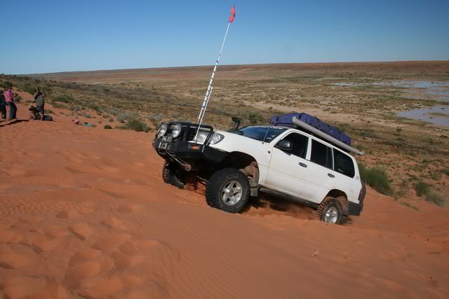
Hopping into my cruiser i drove down the bottom and let my tyres down to 12psi rears and 10psi fronts. I took the small run up and quickly realised that this dune is bloody steep, i was in 1st gear and only ever going to get into 2nd at best, so that 3rd back to 2nd idea of a gear change, was about to be 2nd back to 1st gear at the kick. Hitting 2nd gear i neared the point i wanted to change gears back at, and instead of selecting 1st gear, i accidentally put it into 3rd :oops: so killed my speed immediately. Reversing back down i gave it a 2nd try, and this time hit 1st gear at the point i wanted to. With the revs up i climbed to the top, only to stop inches from getting completely over, the front wheels were there, back the backs were buried :evil: Reversing all the way back down, i thought i'd give it one more go before considering lowering tyre pressures even lower. This time i hit the gear change right again, and as i neared the top, i realised i had the speed to conquor Big Red, and i made it over on the 3rd try...yeah Mal...lol. Not wanting to be out done, Glen drove back down the bottom and let his tyres down to 8psi rears and 6 psi fronts, he then easily drove straight over the dune, where he'd previously failed numerous times earlier. Thinking it was really easy, Glen then drove back down the bottom and tried again, this time with no run up at all where as all previous attempts were done with as long of a run up as possible. Slowly Glen took off and drove up the dune, he continued straight up and over the top without a problem what so ever, showing to all it was all about getting the right tyre pressure to make the climb easily.

CONQUORING BIG RED

tn_IMG_0451.jpg


LOOKING EAST FROM ON TOP OF BIG RED

tn_IMG_0476.jpg


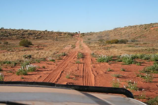
Play time over we pumped the tyres up a touch and set off for Birdsville. The detour track was a bit ordinary, it was quite rough and probably took about 30 - 40 minutes to negotiate, but after that point we rejoined the main track once again and enjoyed a freshly graded dirt road the rest of the way into Birdsville.

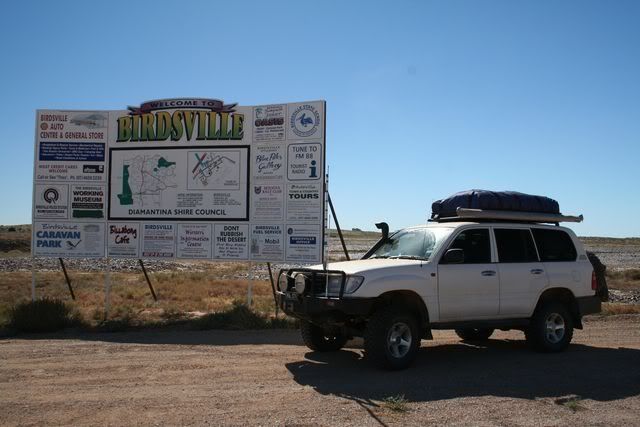
WELCOME TO BIRDSVILLE

tn_IMG_0488.jpg


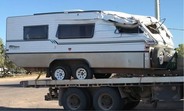
By now it was lunch time and we headed straight to the bakery, i had to try a curried camel pie of which the bakery was famous for. My pie consumed i cosidered having a second one, so i guess that meant i quite liked it :wink: , but i decided not to fill up to much before dinner tonight at the pub. From here we made our way to the caravan park where we would set up camp and have our first shower since leaving Mt. Dare a few days earlier. Across the road from the van park is the service station, and it was here we were reminded of how dangerous the driving can be for some in the outback, a Bushtracker caravan was on the back of a truck, all mangled after a roll over. Speaking to the lady behind the counter at the servo later on, i found out the occupants of the fourby towing the van were ok, as the fourby itself didn't roll :shock:

NOT WHAT YOU WHAT TO HAPPEN


tn_IMG_0489.jpg


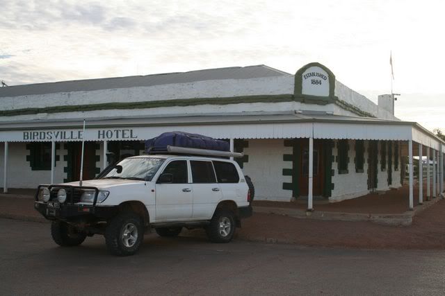
OUTSIDE THE ICONIC BIRDSVILLE HOTEL

tn_IMG_0491.jpg


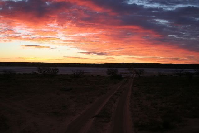
As the sun set, we made our way to the pub for dinner and a couple of quiet drinks, before heading back to camp and sleeping in our tent for what would be, the last time this trip. For us it was a good nights sleep, for others, not so...lol
 

Rumpig

Adventurer
Days 18, 19 and 20:-

Waking fairly early i noticed both Glen and Peter were already up. Speaking to them both i found that Peters matress had deflated during the night, and then speaking to Glen he said the same thing had happened to 2 of their matresses aswell. Glen had 4 matresses at the start of the trip, he'd had one get holed already along the way, and now he'd lost 2 more, not only that, but one of his kids had a slight accident all over the remaining one, so he'd been up since 3 a.m doing laundry :shock: :lol: Feeling lazy we all packed up camp and hit the pub for breakfast, before departing for tonights stop at Windorah. Nothing much happened along the way, other then passing through Betoota where i remarked how last time i was here many years ago, i had a drink at the pub and refueled the fourby here. This pub is long since derilect, and neither fuel nor a quiet ale is available anymore.

BETOOTA PUB

tn_IMG_0498.jpg


Arriving in Windorah, and with several people with no matresses to sleep on, we got rooms at the pub instead of camping. Another pub meal and several drinks, and we retired to our beds for the night. Waking in the morning we said goodbye to 2 vehicles in our group, Carl and Barney were leaving early to head for home, whilst we had breakfast at the pub and left abit later. For us we would soon say goodbye to everyone else for we would stay the night in Charleville (to visit some friends we hadn't seen in ages), whilst they continued on to Roma, and then we all headed home to Brisbane the next day. Before hitting Charleville we saw plenty more wildlife, some big roos tried to jump infront of our vehicles, aswell as seeing more emus and goats aswell. Along the way we also got the feeling that wild dogs / dingoes weren't really welcome in the area.

DOGS NOT WELCOME

tn_IMG_0499.jpg


MOTHER GOAT AND HER KIDS

tn_IMG_0500.jpg


Reaching Charleville, we said our goodbyes and preceeded to spend the afternoon and evening with friends we hadn't seen for a few years, before spending the next day driving all the way back home to Brisbane (approx. 740klms away). All in all it was a fantastic trip. a few breakdowns along the way aswell as a visit to a hospital, but all dramas completely overshadowed by the great scenery, aswell as the good friends we enjoyed the trip with along the way.
 

Forum statistics

Threads
189,812
Messages
2,921,164
Members
232,931
Latest member
Northandfree
Top