Nevada Expedition (ok, more like a wander) September 2008

Echo_29

Observer
Planning
In 2005 my wife Mary-Austin and I drove from Los Angeles to Ketchum, Idaho via Las Vegas (for gas only please) then north along the eastern edge of Nevada via Highway 93. We returned through Twin Falls, ID then south reentering Nevada through Jarbidge (reported to be the least urbanized location in the lower 48). From Jarbidge we continued on to Wells, Austin, Eureka and finishing up with three days in and around Tonopah.

Images from that trip can be found here: Part I and Part II

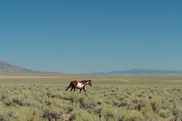
Impressed with the state’s natural beauty we returned this year throwing a broad net over central and northeast Nevada. The intent was to revisit some places we'd seen before while moving into some new areas to check out the topography, the landscape and historical features. From this survey we’ll plan future trips. Once we'd set aside two weeks for our wander I began plotting our path. On our prior trip we'd come through in the middle of August, this time we decided to push those dates back to early September, not to avoid the heat but the thunderstorms that wrecked havoc on us in 2005.

The initial route turned out to be a little more ambitious then I'd planned. I wanted two things that are usually mutually exclusive, to see a fair amount of country and to have a fairly relaxing trip both in a relatively short amount of time. I also wanted to share Nevada's amazing subtle landscapes with friends.

To plan the trip I consulted the following: The Complete Nevada Traveler by David Toll, Hot Springs and Hot Pools of the Southwest by Marjorie Gersh-Young, Stan Paher’s Illustrated Nevada Ghost Towns & Mining Camps- Volumes One and Two, 50 Classic Hikes in Nevada by Mike White, Geology Underfoot in Central Nevada, Nevada DeLorme Atlas and Gazetteer, Nevada Map Atlas-17th Edition by the Nevada Dept of Transportation, GoogleMap and GoogleEarth.


Day 1 – Friday – 8.29.2008
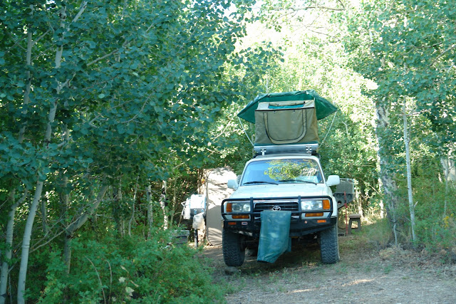
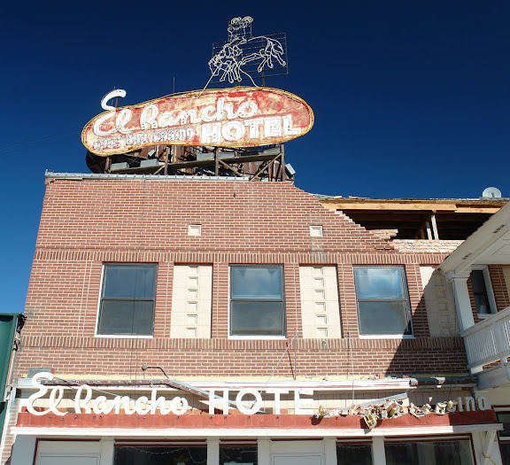
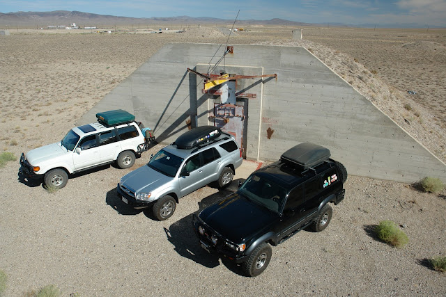
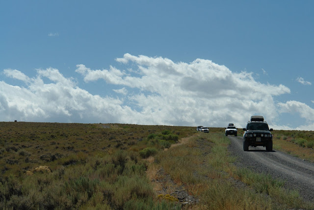
Finally, after months of anticipation, we departed Los Angeles for Tonopah, Nevada where we’d be meeting up with James and Michelle from Pasadena in their 80 Series Land Cruiser and Stacy, George and Ivy and Graham from San Mateo in their 120 Series 4Runner.

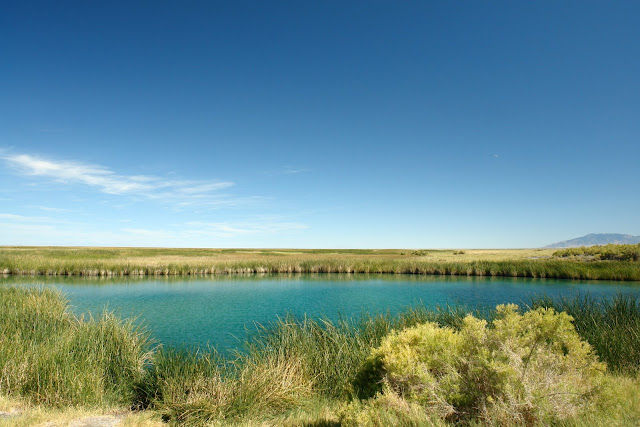
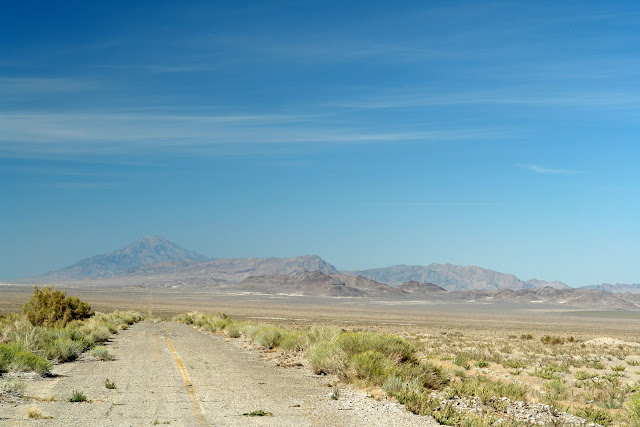
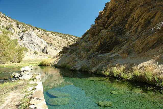
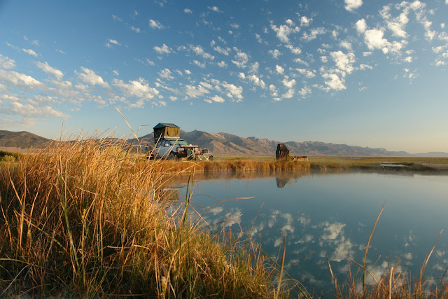
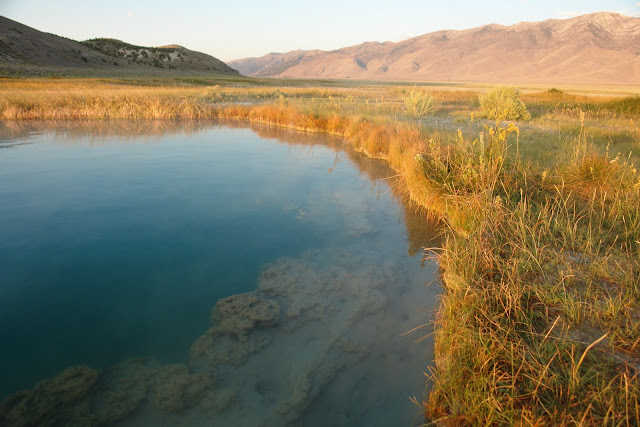
Sixty miles outside of Tonopah we turned south off U.S Route 6 and onto State Route 264 then east off pavement and into Fish Lake Valley for a soak at the Fish Lake Hot Springs.
DSC01441.JPG


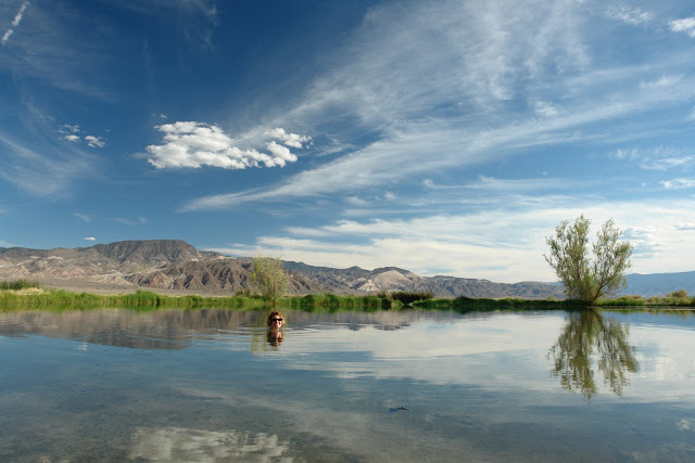
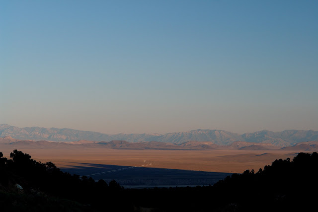
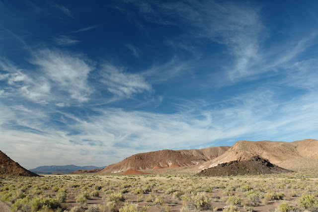
The Fish Lakes were created in the 1880s when a rancher drilling for oil struck hot water instead. The 103 degree water flows at a rate of 50 gallons per minute from a well casing into a concrete soaking tub which then overflows into two large yet shallow lakes. Departing the springs we had a magnificent dusk lit drive north through the multi-hued volcanic landscape of Fish Lake Valley.
DSC01459.JPG


Day 2 – Saturday – 8.30
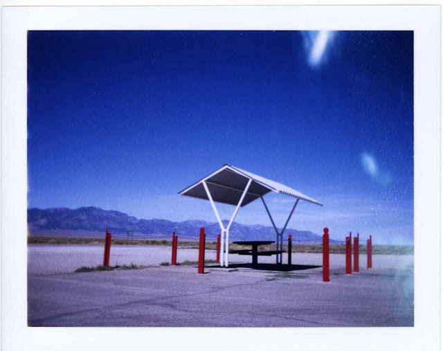
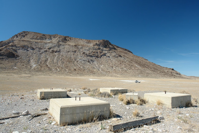
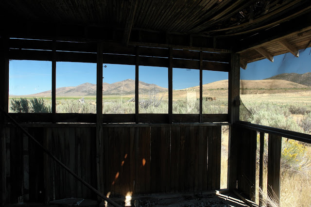
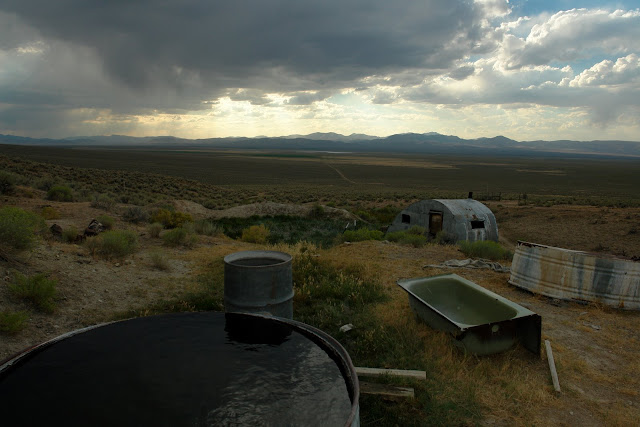
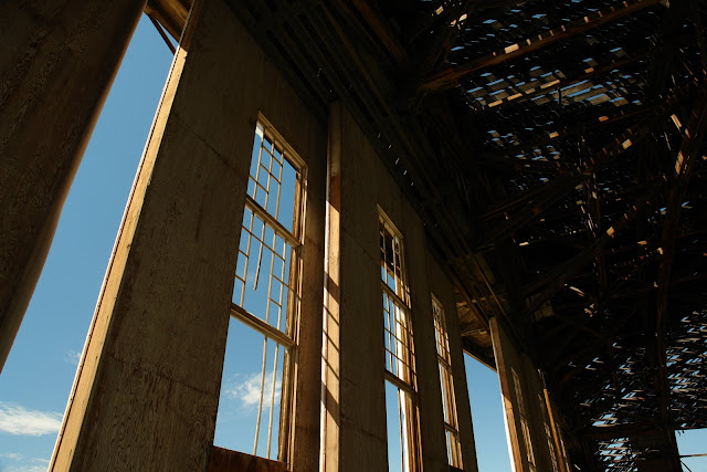
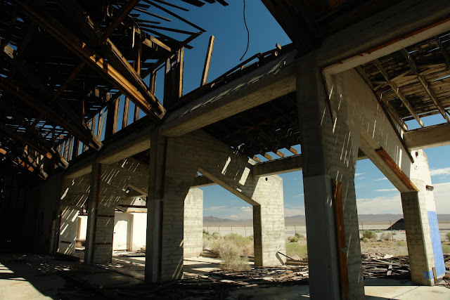
Departing from Tonopah we headed out of town to investigate the WWII era munitions bunkers and hangers at the Tonopah Airport.
DSC01499.JPG


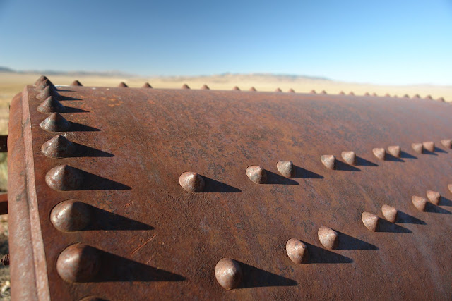
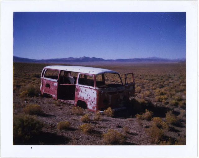
Built as an Army Air Field training base, and now municipally owned, it houses an odd assortment of elements: a local raceway, a refinery works reminiscent of something out of Mad Max, groves of transplanted Joshua Trees, and three large wooden and concrete aircraft hangers abandoned to time, the elements and at least one large Great Horned Owl.
DSC01564.JPG


DSC01569.JPG


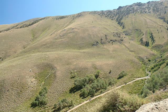
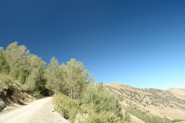
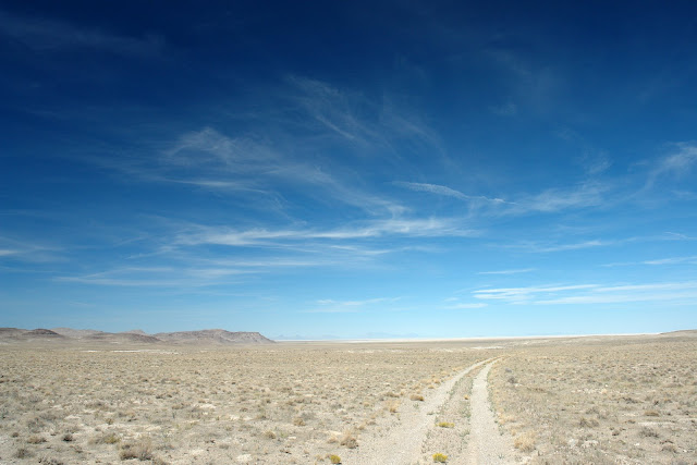
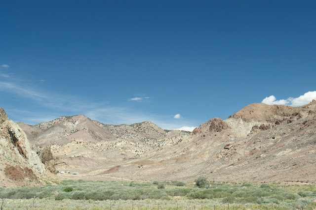
Leaving the airport we drove north up Ralston Valley on State Route 376 until we entered the Big Smokey Valley then turned off pavement and entering the Humboldt-Toiyabe National Forest.

From Wikipedia:
The Humboldt-Toiyabe National Forest (HTNF) is the principal U.S. National Forest located in Nevada. With an area of 6.3 million acres (25,000 km²), it is the largest National Forest of the United States outside of Alaska. It does not resemble most other National Forests at all, with numerous fairly large, but non-contiguous sections scattered about most of the state of Nevada and eastern California.

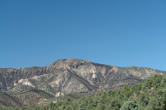
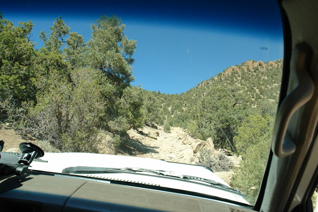
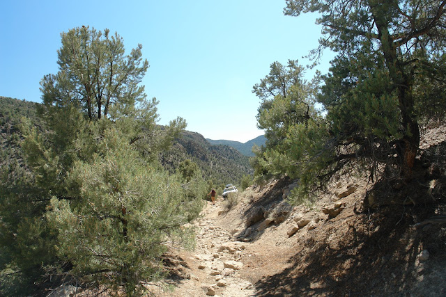
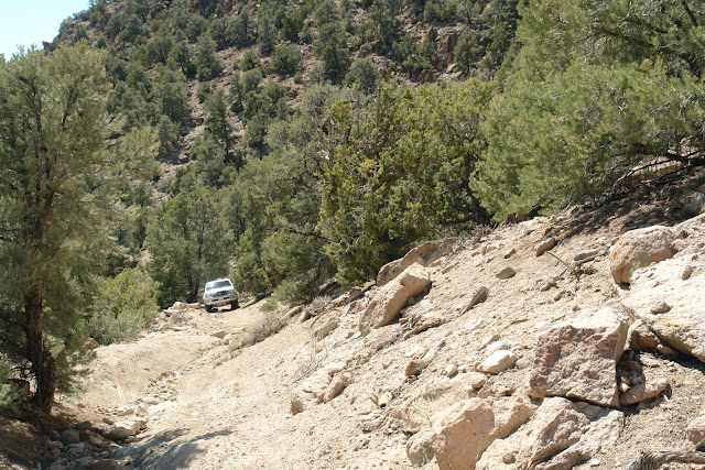
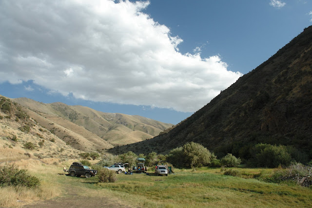
After entering the National Forest we climbed Peavine Canyon to its end at Tom’s Canyon south of the jutting Arc Dome (elevation 11,361’) then returned back down the canyon to the shaded Peavine Campground for lunch.
DSC01601.JPG


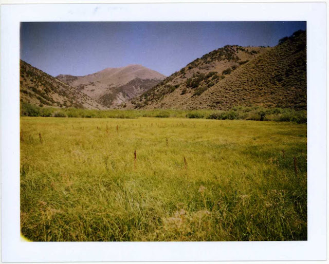
Running later than expected and needing to meet the last party of our group, we skipped our planned climb into Indian Valley and instead circled around the south end of the National Forest then north up Ione Valley to the Berlin-Ichthyosaur State Park campground. Campsites were tucked in between pinion pines and junipers with views overlooking Ione Valley to the west.

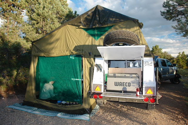
Not long after our arrival Rick, Tracy, Griffin and Leland from Pasadena arrived towing their new South African built Conqueror Conquest safari trailer pulled by their new Tacoma 4x4 (more on both later).

DSC01652.JPG


Day 3 – Monday – 9.01
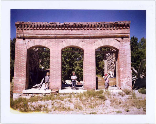
After breaking camp we made our way to the Berlin-Ichthyosaur fossil shelter for an excellent and enthusiastic presentation on the Ichthyosaurs entombed there.

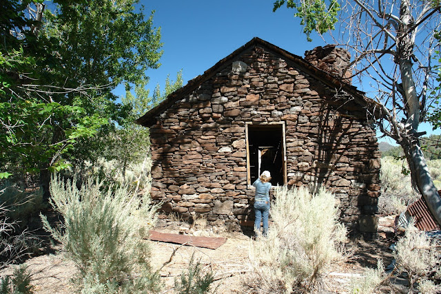
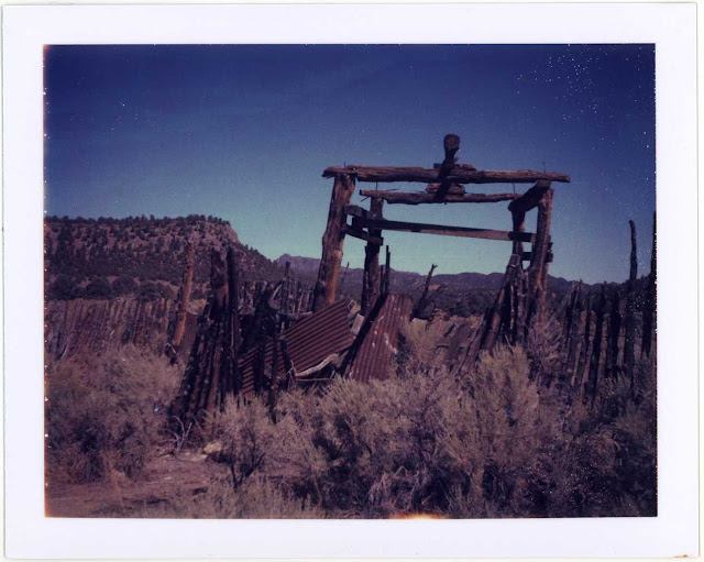
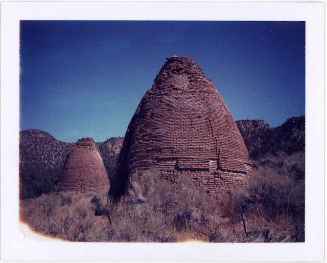
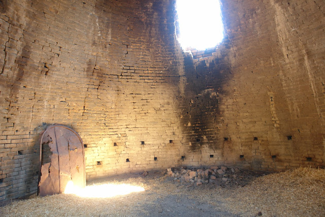
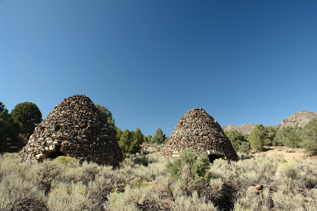
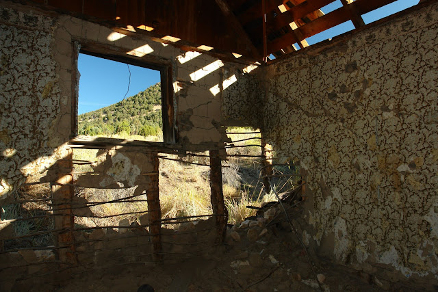
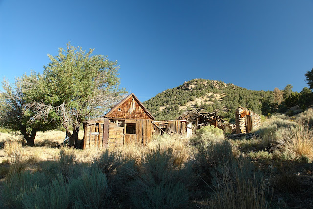
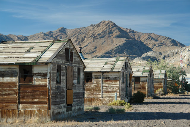
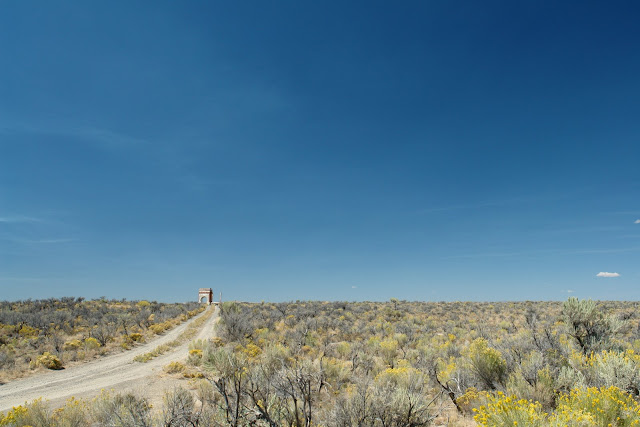
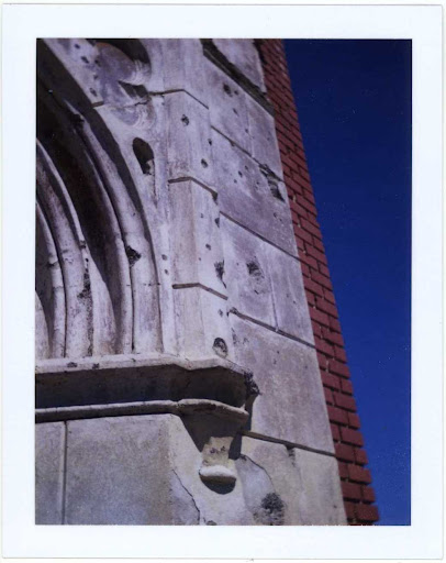
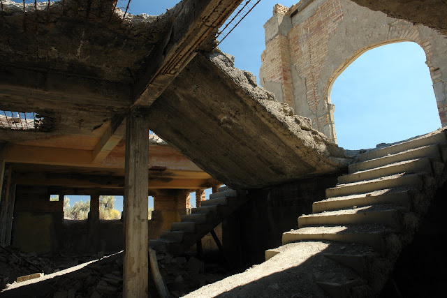
Down the hill we stopped at the stabilized ruins of the Berlin Stamp Mill for a short explanation of its operation by a volunteer docent who was a wealth of knowledge about the onetime mining operation.
DSC01657.JPG


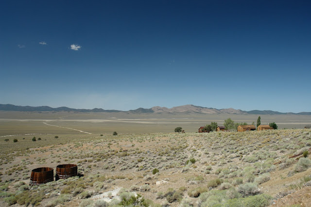
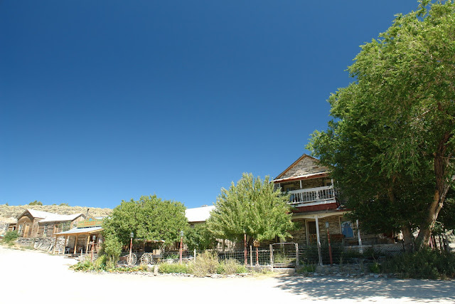
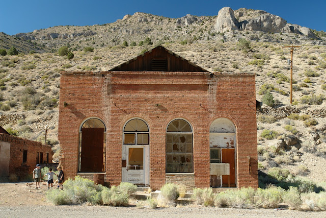
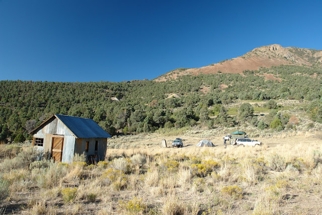
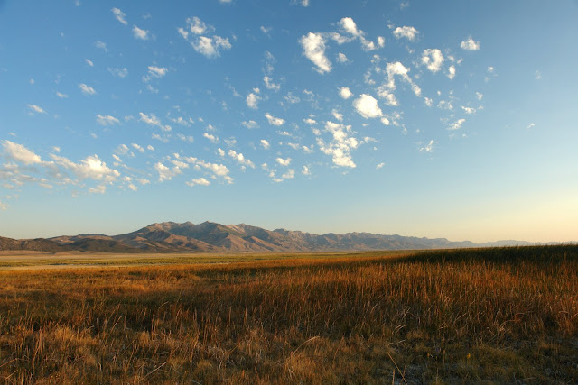
Heading north we lunched in the white picket fenced "central park" of the semi-inhabited town of Ione, where we saw more dogs than people, before continuing up Smith Creek Valley.
DSC01659.JPG


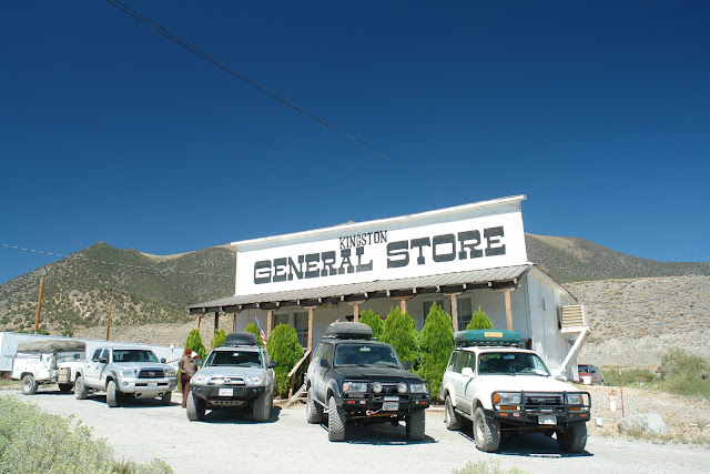
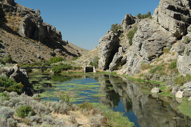
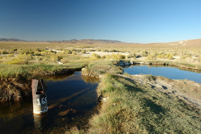
Our next intended destination was the Smith Creek Ranch Hot Springs but as we traveled closer the entire valley adjacent to the springs was enveloped by the alkali dust of a windstorm off the nearby dry lake. Abandoning that stop we continued north to Austin for gas and soft-serve ice cream before turning back to the southwest down Big Creek Road and then west reentering the national forest. Having found a nice size campsite on Big Creek the three boys in the group exploded out of the trucks and straight into the creek.
DSC01672.JPG
 
Last edited:

Echo_29

Observer
Day 4 – Tuesday 9.02.2008
After thawing out from a night in the high 20s (an Alaskan cold front blew in for one night then thankfully it was gone the next) we climbed up the steep and scenic grade out of camp until we reached the 8694–foot Kingston Summit over the Toiyabe Range and descended into Kingston Canyon to the east.
DSC01686.JPG


DSC01684.JPG


img013.jpg


After numerous photo ops along the way we stopped at the Kingston Store. The General Store seems frozen in time, operated by an elderly couple and their son; they were very friendly and accommodating of their customers needs. It’s a fun place to pick up some basics, beer, ice, milk and ice cream.
DSC01699.JPG


At this point we said adios to Michelle and James who had to head home for work.

Departing Kingston we drove several miles east to State Route 376 then just a thousand feet short of Highway 50 we turned right off-pavement and out to Spencer Hot Springs for a quick dip that wasn’t meant to be. When we arrived our timing was all off! Burned out Burners had decamped from the Black Rock Desert and descended on the highway-close springs. Put off by the playa dust covered masses, we skipped our dip, had lunch and headed east over the Toquima Range and made a beeline for a dip at Pott’s Hot Springs only to be denied again when a pickup truck slipped into the site moments before us and asked to have it to themselves! With dusk approaching we charged off to find camp before it got too late. Strike three!

Continuing south down the magnificent Monitor Valley we made our way to Pine Creek Campground and set ourselves down for two nights in the shade of Aspens next to the bubbling Pine Creek.
DSC01811.JPG


Day 5 – Wednesday –9.03
Having decided to spend two nights at Pine Creek, we had a relaxing morning before heading out of camp for sights, fuel and supplies.
On our decent out of camp we came across this trips first herd of wild horses numbering around 30.
DSC01703.JPG


Hitting the valley we turned south past the verdant Pine Creek Ranch before arriving at the inhabited ghost town of Belmont.
img014.jpg


After about 20 years of life, Belmont died. But while it lived, it enjoyed life to the fullest. Born about 1865, Belmont produced $15 million of silver and lead ore before its demise. It also was the seat of Nye County. Not every mining town could boast of its palatial Music Hall where stars of the entertainment stage would perform. But Belmont could.

DSC01720.JPG


After our wander around the ruins of this former county seat and lunch on the porch of the shuttered Bar (For Sale, since our last visit in 2005), we drove west through Manhattan and north to the Round Mountain Mine suburb of Hadley (complete with golf course) for gas, groceries, and root beer floats.
 
Last edited:

Echo_29

Observer
Day 6 – Thursday –9.04
Once again we pointed south down Monitor Valley before turning east towards Barley Creek Ranch. Climbing the scenic and well maintained Forest Road 324, we were soon surrounded by dense pines before suddenly dropping into a zone of devastation. Forest fires had claimed patches of the landscape all around us and blackened the surrounding mountains.
DSC01823.JPG


DSC01837.JPG


img019.jpg


After exploring the long abandoned Daugherty Ranch we turned south and entered Stone Cabin Valley then east, where seemingly in the middle of nowhere, our path was blocked by a road grader and water truck working away maintaining Nevada’s excellent network of graded roads.
DSC01849.JPG


After passing the diligent Nevada DOT staff we crossed Hot Creek Canyon Road then began a modest accent to Kiln Canyon. What started out as a two track, little used road soon became a pine tree flanked slalom course no wider, and often less than the width of our trucks.

Clearing the trees we came to a T-intersection, we turned north and were greeted by two magnificent red brick charcoal kilns! The kilns bases and the road beneath us were littered with little bits of charcoal while the insides were coated with a thick layer of soot.
img020.jpg


The greatest concentration of charcoal ovens in Nevada was in the Hot Creek Range east of Tonopah, where mining activity centered at Tybo. In several locations, a total of 24 kilns produced charcoal in the area. New kilns were built in new areas as the supplies of wood were depleted. Fourteen of these were built in 1877 by Henry Allen, a Eureka contractor, for the Tybo Consolidated Co. They still stand in small groups in Kiln Canyon, Four Mile Canyon, and three different places in Six Mile Canyon. Allen employed 20 men for three months to fill his contract. Measuring 25 feet in diameter at the base, the kilns used up 600,000 bricks. Each produced 1,400 bushels of coke with each burn.
Source

DSC01864.JPG


After a lunch break at the kilns we loaded up, proceeded about 100 feet, turned a corner and then I got a little worried. I radioed the others that I was going to check the trail ahead. I jumped out and walked a good 800-1000 feet to check what had suddenly become a steep, narrow and twisty exposed sandstone route. My concern wasn’t so much for the Land Cruiser or the 4Runner, which climbed the grade easily, but the bone stock Tacoma pulling the 2000 pound trailer.
DSC01889.JPG


Several weeks prior to the trip I spoke to the author of Nevada Ghost Towns & Mining Camps and asked him about the map in his book of Kiln Canyon that showed a dashed line to the ghost town of Tybo. He seemed surprised that it was dashed and said it was open. I thought I remembered him saying he'd gone through recently, and that it required 4x4. Well, having walked the trail I didn’t think anything larger than an ATV had been through all season. I knew there'd be no turning back or backing down with the trailer, so I told the group we’d press on. Note: This was all at my wife’s urging, even though I kept reminding her of the trailer, she was un-phased, it's just a mining road, she repeatedly proclaimed.
DSC01890.JPG


What we pressed onto was a fun afternoon up a very narrow, stacked-rock mining road that was lined with trees, rutted in the center with the occasional jutting rock that forced us to stack many rocks for the Tacoma to clear. While this was no Rubicon it did seem to get worse with every passing mile that the entire time left us wondering if it indeed went through to the other side of the range.
DSC01893.JPG


DSC01900.JPG


Day 6 Continued Below
 
Last edited:

Echo_29

Observer
Day 6 Continued
Spotting the Tacoma and the trailer was easier than I anticipated. The trailer had no issues with clearance and tracked perfectly behind the truck. I know Rick was wishing the entire time that he was driving his Dusy-Ershum tested 80 Series Land Cruiser!

When we finally reached the summit we hoped that things would get easier, but on initial decent it didn’t look like that was going to be the case. After a pass through a narrow cut we were presented with a nice dry waterfall in front of us—fortunately there was a bypass and the Tacoma and trailer were able to make it the next ½-mile, to the graded road and two granite charcoal kilns, without a spot.

Thinking we might make camp in Tybo we departed the second set of kilns and had a gentle decent into another ghost town. Rolling into town we took a look around the easily accessible ruins before deciding to press on to greener pastures to camp.
DSC01928.JPG


DSC01943.JPG


Since our day had become much longer than we anticipated (surprise!) we very reluctantly dumped our planned wander through Hot Springs, Fish Lake, Four and Six Mile Canyons and steered north up Big Sand Springs Valley.

Finding this valley much drier than the previous valleys we decided to continue north to the ghost town of Morey, a site we'd visited before and where we knew an appealing camp was to be had.

We arrived at the ghost town of Morey just as the sun was getting ready to set behind Mahogany Peak (9825') that spread sharp purple shadows across the desert valley floor below.
DSC01952.JPG


DSC01972.JPG


DSC01988.JPG


DSC01996.JPG
 
Last edited:

Echo_29

Observer
Day 7 – Friday –9.05
img021.jpg

Morey at Dawn

DSC02039.JPG

Petroglyph Butte

Our next stop after leaving Morey was the site of UC-4.
DSC02018.JPG


UC-4 is the +3000-foot deep filled and capped shaft originally designed to receive a nuclear weapon for testing. While the Nevada Test Site north of Las Vegas would ultimately host 928 nuclear test the Central Nevada Test Site would fortunately only host a single test, Project Faultless.

In the early years of atomic testing, the Las Vegas community was quite small, and most of the residents and tourists who visited there accommodated atomic testing as part of the overall Las Vegas experience. Visitors even scheduled special trips to the area during "bomb season" to drink "atomic cocktails" while they awaited the dramatic spectacle of an exploding atomic bomb.

The move to underground testing, while reducing fallout danger, produced ground motion which could be felt in Las Vegas. The larger the test the greater the ground motion: the swaying earth and occasional shattered glass window were making tourists, residents, and casino operators quite nervous. At the same time, in the mid 1960s, the military was developing a Spartan anti-ballistic missile, capable of carrying and delivering a multiple megaton warhead, and they planned to test the effectiveness of even larger nuclear weapons than had been tested before.

So, with some urgency, the search for a supplemental test site was launched. By 1965, the potential sites had been narrowed to Amchitka, Alaska and Central Nevada. However, before the Central Nevada site could be granted full status as a Proving Ground, the Atomic Energy Commission (AEC) wanted to determine how the geology of the area would respond to multi-megaton underground explosions.

UC-4 was never used as will be explained below.

Next up was the test site that was actually used code named Project Faultless. Mary and I had originally visited the Project Faultless in 2005 after finding it on the Center for Land Use Interpretations website. That day, seemingly in the middle of nowhere we ran into a crew conducting ground water testing nearby and at the site a lone photographer/artist Walter Cotten who was photographing the location for the upcoming Overlook: Exploring the Internal Fringes of America with the Center for Land Use Interpretation.

DSC02059.JPG


Walter was one of those amazing travelers you meet that is full of knowledge that he was more than willing to share. Walter also became a fan of Mary-Austin's paintings, attended all of her openings and was waiting to select the right painting for his collection. Unfortunately just as Mary-Austin had found what she thought was the right source material for a painting for Walter he passed away this year of a heart attack. Turn to page 212 of the Outlook for his image of Faultless that day.

The code-name assigned to Faultless reflects the "scientifically-based" prediction made by the planners of the test that the site would prove geologically stable, literally fault-less, under the pressure of a megaton blast.
Much was riding on the success of the Faultless Test. Three deep emplacement holes were drilled on the Central Nevada site, one for Faultless and the other two in anticipation of tests which would immediately follow a successful calibration of the site. A second test was even assigned the code-name, Adagio. The size of the Adagio drillhole suggests that it was planned to be a test in the multi-megaton range, three or perhaps 4 megatons. (The largest underground test ever conducted by the U.S. was 5 megaton Cannikin, in 1971, at Amchitka, Alaska.)

On January 19, 1968, the Faultless Test commenced, with observers from the public stationed, as planned, out of the line of sight. What they would have witnessed was a dramatic fifteen foot upheaval of the earth above ground zero. Then, the earth collapsed north and south of ground zero, leaving massive fault blocks extending for thousands of feet. In some places the drops measured 10 feet. Eighty-seven miles away from the explosion, windows broke at White Pine High School in Ely.

The surface damage was dramatic proof that the experiment to calibrate the site had overreached itself. The Central Nevada Test Area was eventually declared unsuitable for further underground nuclear tests. Adagio was canceled.

The above excerpts are from an excellent write up that can be found here

DSC02072.JPG


Below us is a huge cylindrical underground cavity, a so-called nuclear rubble chimney. It is approximately 820 feet in diameter, and 2,460 feet in height. At its bottom lies over 500,000 metric tons of highly radioactive rubble, with radiation levels similar to the core of a nuclear reactor. Source

Having absorbed the site we launched ourselves down the unpaved super highway, created to access the site in the late 60s then drove to the Lunar Crater National Natural Landmark for lunch. After lunch at the large crater and the short hike into the Easy Chair Crater we aired up, jumped on State Route 6 and drove up Railroad Valley to White River Campground just south of Ely.

DSC02082.JPG


DSC02088.JPG
 
Last edited:

Echo_29

Observer
Day 8 – Saturday –9.06
Packed and ready to go we headed back to civilization, civilization being the mining town of Ely, Nevada. First stop, the expansive Nevada Northern Railway Museum.

DSC02119.JPG


Day 9 – Sunday – 9.07
After an early rise we all headed back to the Big Apple Family Restaurant for a hearty breakfast then everyone but Mary-Austin and I headed back to their respective homes many hundreds of miles away.
DSC02303.JPG


On our own, we began our second leg by heading north out of Ely on State Route 93 on our way to Wendover and the Bonneville Salt Flats.

img028.jpg


Our original route was to take us into Great Basin National Park then due east along the Utah border, but concern about running out of time later in the trip, drove us north 70 miles before we turned east towards Utah.
DSC02330.JPG


Finally, 10 miles down the road we once again turned north off pavement and drove along the eastern edge of Nevada in the far western edge of the Great Salt Lake Desert.
DSC02319.JPG


Wandering our way along dusty two-track roads we eventually reached a hard packed salt encrusted road that hugged and then bisected the Wendover Air Force Base Bombing Range. Several miles later the bleak whiteness turned to large blue pools of water surrounded by tall green reeds. We’d arrived at the local scuba dive spot Blue Lake, conveniently carved out of the bombing range and open to the public.
DSC02333.JPG


Turning northwest we were heading towards the highway into Wendover (and around the bombing range) when we crossed a slim line of pavement, barely one and one-half cars wide with a faint yellow line down the center, we’d stumbled on a remnant of the old Lincoln Highway. We continued on this path for several miles until the road began to dissolve into the desert before hopping back onto the highway to Wendover.
DSC02353.JPG


Once in Wendover we headed into Utah and out to the old Wendover Air Force base, home to the Enola Gay hanger and the Center for Land Use Interpretation (CLUI) remote base.
DSC02360.JPG


In 1945 the Enola Gay bomber was based at Wendover where the crew laid over the B-29 on its way to its mission to drop Little Boy on Hiroshima.

Now with the airport under municipal ownership the hanger and a majority of the buildings have been left to decay. Private operators run businesses out of some of the facilities and CLUI has refurbished a number of the buildings for an interpretive center and galleries where the works of resident artist are displayed (yes in Wendover open to those that call the L.A. office to get the combination for the lock and code for the doors). The Interpretive center, new since our last visit, provides an excellent overview of the landscape altering infrastructure that surrounds the Wendover area: from chemical weapons disposal plants, military infrastructure, and salt processing plants.

Next up was a visit to the Bonnaville Salt Flats for some high-speed runs in the Land Cruiser. Arriving late in the day during one of several Speed Weeks, the salt flats were groomed and striped for speed runs and the pit area was filled with trailers and support trucks, deserted but awaiting the next day’s runs. After an hour of driving around I took a look under the truck--yikes! Inches of salt was caked everywhere and it was straight back to Wendover to the salt saturated carwash for a delousing.
DSC02383.JPG


DSC02393.JPG
 
Last edited:

Echo_29

Observer
Day 10 – Monday –9.08
Departing Wendover we began our migration back to the west with a stop in Wells, NV which was struck on February 21, 2008 by a 6.0 magnitude earthquake only 4 miles from its historic downtown, which is now shattered.
DSC02430.JPG


Heading north out of town we drove 12-miles due north before turning into Bishops Canyon and jumping into Twelve Mile Hot Spring for a long overdue soak. The springs are up a narrow and sometimes muddy canyon (use the route above the pastures and adjacent to the irrigation ditch). The hot springs weep from the canyon walls at 104 degrees and fill a concrete enclosed, 30-foot long pool adjacent to the nicely flowing Bishops Creek.
DSC02438.JPG


DSC02442.JPG


DSC02454.JPG


Next we headed west 7-miles to the abandoned agricultural community of Metropolis.
DSC02486.JPG


In 1911, a city of graded streets, cement sidewalks, fire hydrants and street lights was laid out with a four square block commercial district, which included a showcase 3-story brick hotel. In anticipation of many coming here, the Southern Pacific Railroad built a spur to town with a large depot and tree shaded park.
Click over to Ghosttowns.com for the fate of Metropolis.

img029.jpg


DSC02471.JPG


After lunch among the ruins of Metropolis we drove back into Wells for fuel and then proceeded south 75 miles to our Shangri-La, the Gardner/Ruby Lakes Hot Springs.
DSC02515.JPG


Driving south on Route 93 we made a quick stop at the bone dry Snow Water Lake then down to Route 229 where we turned west to face the Ruby Mountains before navigating south on Ruby Valley Road. Finally off pavement we wove our way along cattle fencing that delineates the Ruby Lakes Wildlife Refuge, turning due south with the springs in sight we approached some deep ruts then everything turned grey. Instantly the Cruiser was enveloped in a dust storm of pumice, or as I've heard it called in the Owens Valley, moon-dust! This was dust on a scale we've only experienced once before, crossing the Borrego Sink in Anza Borrego Desert State Park, except this time we were traveling at 10 MPH and not 30 MPH! Making our way blind, following the ruts, we finally escaped our self created dust storm to arrive at the edge of a tufa rise about 30-foot taller than the surrounding landscape. We wove our way up the rise, trying to stay on some sort of undetermined path to a camp and off the green areas in order to stay out of the numerous depressions that formed the more than twenty hot springs that make up the rise.

Finally reaching the top of the rise we were greeted with the largest Hot Springs we've ever seen, easily 80 feet across and almost perfectly round! Exiting the truck we noticed that the 1980s era Winnebago that we'd passed several miles back, was making its way toward us and was just about to enter the dust-storm. We stopped everything to watch and see what would happen next and to see if we'd need to get back into the truck to attempt to rescue the beast out of the ruts it was just now entering. Surprisingly, after being devoured by the moon-dust the RV emerged safe and sound, motoring our way. We waited to meet the new arrivals before we got too comfortable, to see how they'd be and where they'd set up. After quick greetings we soon realized that retirees Jackie and Dino were going to be good camp mates and set about coordinating where we'd be camping and getting in the 106-degree springs!
DSC02518.JPG


Well for the next two and one half days we didn't do much except float around, talk to our camp mates, read and hike around the wildlife refuge. We had one night of weather when the tail end of a hurricane off of the Gulf of Mexico blew through with strong warm winds, so strong that in the middle of the night we had to reorient the truck to put the tent into the wind to avoid the buffeting the sides and rain fly were receiving. Our timing was good, not less than 30-minutes later, the tent of a father and son that had arrived on the second day, completely collapsed in the wind. Note: I hope to write a review of our Technictop tent soon, we love it in so many ways, except in the wind!

DSC02509.JPG
 
Last edited:

Echo_29

Observer
Day 11 – Tuesday –9.09
After two nights we decided we needed to get a move on and very reluctantly said our goodbyes to Jackie and Dino and the Ruby Hot Springs and headed south along the eastern side of the Ruby Lakes. Little did we know that today would be one hell of a drive.

Our original plan was to cross the dike that splits Ruby Lake then cross the Ruby Mountains over Harrison Pass. Unfortunately the pass was being paved and was closed during the day, forcing us to detour south to the end of the Ruby's, cross the Overland Pass then head north to Elko via Huntington Valley. We'd also originally planned on visiting Lamoille but decided to save it for a future trip.

Arriving in Elko we gassed up and lunched, then headed west to the ghost town of Palisades where we waited for one train to thunder through this wide box canyon then climbed our way north to Interstate 80. By this time it was almost 4PM, the weather was starting to act up, dark brooding clouds, and intermittent rain was all around us. Our plan was to wander until we found a place to camp, and it was getting to the point where we'd need to find something fairly soon.

Ten miles later we jumped off the Interstate and onto Route 21 and headed south into the storm. An hour later we decided to take our chance and head into the Cortez Mountains in search of a possible camp and the Crescent View Hot Springs. Finally arriving at the springs we found a crazy assortment of tubs, a trailer and bits of detritus that a serial killer might have found comfortable. The springs had been left running into the tub, which was far to hot to soak in and wouldn't be cool for many hours. At this point we decided not to camp here or anywhere tonight since the wind was whipping about from every direction and we were concerned about the RTT. (I've built a platform in the back of the Cruiser, an alternate to a drawer system that will double as a backup sleeping location for windy nights, but prior to this trip I ran out of time to complete the sleeping extension or we would have camped here).
DSC02597.JPG


Having decided we'd drive into Eureka for the night we figured we might as well keep wandering, so it was south to the immense tailings of Gold Acres mine then southeast across Cortez Canyon, past Cortez and into the beautiful dusk lit Grass Valley and down to Walti Hot Springs. Unfortunately it turns out that the springs, located on a working ranch operated by the University of Nevada, have been closed to the public. Now dark I was very thankful that prior to the trip I'd routed the path to Eureka (and over twenty potential routes) on MapSource because it would have been quite a task making our way there in the dark via the multitude of roads that appeared in front of us or on the GPS (or not on the GPS or map)! We finally arrived in Eureka at 9PM greeted by pouring rain. We were lucky enough to get the last motel room left in town and had cold cereal in our room for dinner as the town was closed up tight for the night.


Day 12 – Wednesday –9.10
The next morning we had a hearty breakfast and then spent several hours pouring over our maps and debating various routes that would lead us back to L.A. We finally decided we'd head west back to Spencer Hot Springs and give it another go before moving on. Unlike the week before, the springs were almost empty. There were some trailers at one spring, the lower spring was empty and three people at the middle spring. We decided to stop and talk to the trio to see what their plans were and to see if we could camp there. One of the three was on his way out and the other couple invited us to stay. We set up camp and moved into another lazy stay.
DSC02643.JPG


Day 13 – Thursday –9.11
Having gotten into a comfortable rhythm around camp: soak, lounge about and talk, soak, lounge about, soak, we got to know our camp mates fairly well and it turns out they are the real campers/expeditionary force! Nan and Bud out of Arizona have the ultimate routine, travel 6-months, work 6-months. In reality the travel for them is part of the work. Pud, an excellent landscape photographer (film please), is working while on the road then turns around a sells his work when they're back in Arizona. Experts on all things hot springs and middle of nowhere vehicle repair, the two of them regaled us with tales of traveling the southwest, Alaska and Australia where they purchased a used 60 Series Land Cruiser and wandered the country for an entire year! I can't think of the last time we spoke at such length, to initially, such complete strangers!
DSC02626.JPG


img034.jpg


Day 14 – Friday –9.12
Not wanting to, but realizing the weekend might bring crowds, we slowly started to pack up camp. While in the tub for a final soak a dust plume was slowly approaching us; to us one more sign that the weekend had come and the masses were approaching (I think we've spent a little too much time at hot springs waiting for our tranquility to end). As the vehicle grew closer we realized who it was, fellow travelers Jackie and Dino from Ruby Lakes Hot Springs. Having said our goodbyes to Nan and Pud we headed out, planning on staying at Benton Hot Springs at the recommendation of Jackie and Dino. Heading south to Tonopah we finally got cell service and learned that Benton was full up so we wimped out and crashed back in Tonopah at the Jim Butler Inn (our recommendation for Tonopah).

Day 15 – Saturday –9.13
Drive day and up early we headed out early, after Mary-Austin purchased some lamp shades at a second hand furniture store.

img039.jpg

We made a photo stop at the ruins of Coaldale then decided to head south on Route 773 to Route 264 south between the White Mountains on the west and the Silver Peak Range to the east then southwest on Route 166, over the Gilbert Pass and into Deep Springs Valley, home of the recognized Deep Springs College. Cresting Westgard Pass and the White Mountains we into the magnificent Owens Valley just in time for lunch in Lone Pine at the Alabama Hills Cafe before an uneventful drive back to L.A.

Additional images from this trip can be found here.
James' photos.
Stacy & Georges photos.
Rick's photos...
 
Last edited:

yubert

Explorer
Echo_29 said:
Thanks yubert. Yes that's us but I don't think I've been on there in 3-4 years...

Well nice to see you on here and read about your trips. I'm not active on VT anymore as well, lost interest 2 or 3 years ago.

Anyway, it looks like some of your photos are scanned prints while others are original digital images. Are the scanned prints from an earlier time?

--Yubert
 

Forum statistics

Threads
189,619
Messages
2,918,957
Members
232,571
Latest member
Psyph
Top