Northern Baja trip

geoffff

Observer
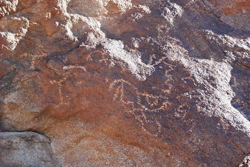
Here's a northern Baja trip I just took at the beginning of this month. I accomplished my mission of investigating some new secluded spots! As you can see, the trip was through the Laguna Salada area, down the gulf coast through San Felipe & Puertecitos, again down that coast southeast of Bahía de los Angeles, and finally a peek at the Pacific coast near Bahía Santa Rosalillita. (After that I just cruised home on pavement north to Ensenada & over to Tecate.) Baja 2009


-- Geoff
 

cpg

Adventurer
Great report and photos! How many days across the border?
About 2.6 miles into the road to Bahia San Rafael did you notice a cross marking on the north side of the road?
 
Last edited:

geoffff

Observer
Great report and photos! How many days across the border?
About 2.6 miles into the road to Bahia San Rafael did you notice a cross marking on the north side of the road?

Thanks! I was in Mexico for 8 days.

Heading south out of Bahía de los Angeles? No, I was a bit preoccupied -- it was late on drizzly afternoon, and I was just driving hard to make it to the San Rafael area to camp on a beach before nightfall.
 

LexusAllTerrain

Expedition Leader
Congratulations on a great trip, i been following your trips thru Baja and Mexico since you had your black Grand-Cherokee.

Welcome to the forum!:victory:
 

cpg

Adventurer
Thanks! I was in Mexico for 8 days.

Heading south out of Bahía de los Angeles? No, I was a bit preoccupied -- it was late on drizzly afternoon, and I was just driving hard to make it to the San Rafael area to camp on a beach before nightfall.

No after that. The road from Panchos place to El Barrill/San Francisquito were you turned left to the sea.
 

Attachments

  • x.jpg
    x.jpg
    212.5 KB · Views: 57

geoffff

Observer
No after that. The road from Panchos place to El Barrill/San Francisquito were you turned left to the sea.

I did see that! From the ground it looked kind of like a big "right turn" arrow pointing to the right painted up there on the hilltop. (I could only see the bottom and right arms of the 4-arm cross at the time, the other two must've been hidden from me on the road.) I didn't get out of my vehicle to walk up to it (since I just thought it was an old arrow).

Here's a photo of it from my windshield camera. Click on this photo below for a full-size version:


I did wonder a bit about it.

There is some mining activity going on around there, so perhaps it's related to that.

-- Geoff
 

cpg

Adventurer
I did see that! From the ground it looked kind of like a big "right turn" arrow pointing to the right painted up there on the hilltop. (I could only see the bottom and right arms of the 4-arm cross at the time, the other two must've been hidden from me on the road.) I didn't get out of my vehicle to walk up to it (since I just thought it was an old arrow).

Here's a photo of it from my windshield camera. Click on this photo below for a full-size version:


I did wonder a bit about it.

There is some mining activity going on around there, so perhaps it's related to that.

-- Geoff

Yea that is it. Next time I will have to check it out does not look like much from the trail. That is a cool set up on the window camera.

Did you explore much south of El Barrill after the old road washout?
 

geoffff

Observer
Did you explore much south of El Barrill after the old road washout?

I had promised my wife I'd turn around and start heading home that evening. I went as far south as I could, but the road got rough and slow-going (rocky instead of smooth sand) at about mile 8, and I ran out of time and just camped when it got dark (green dot):

-- Geoff
 

cpg

Adventurer
I had promised my wife I'd turn around and start heading home that evening. I went as far south as I could, but the road got rough and slow-going (rocky instead of smooth sand) at about mile 8, and I ran out of time and just camped when it got dark (green dot):

-- Geoff

Looks like you just got on the new path to Los Corralles. What kind of range do you have with the sportsmobile?

232471714_g2YJi-L-1.jpg
The old path is down that wash.
 
Last edited:

geoffff

Observer
What kind of range do you have with the sportsmobile?

With the 47 gallon (Transfer Flow aftermarket) tank, and estimating something like 10 MPG on trails, that's theoretically 470 miles. It's enough that I don't bother bringing extra gas cans anymore.
 

geoffff

Observer
Looks like you just got on the new path to Los Corralles. ...
The old path is down that wash.

Those smooth boulders do look familiar! The "road" split just before I camped for the night, and I went a few hundred yards along the right fork to camp because it looked a bit less used. I had assumed that left fork would continue, and be the road marked by the dotted line on my map.
 

Forum statistics

Threads
189,830
Messages
2,921,415
Members
232,931
Latest member
Northandfree
Top