XPEDBC
Adventurer
Had two nights to go out and explore an area I've only seen from a distance - Pasayten River Valley. The turn off from Hwy 3 is just east of Eastgate and the road heads south almost to the US border. I had just washed the truck but was happy to get it dirty again. There's a bunch of room when I only pack for one! Don't mind my camera, its all over the place and I could use a new one... I've also included a few phone pics that are grainy but help share the experience.
Quick stop at my favourite place in Hope -The Blue Moose Cafe. Yum.

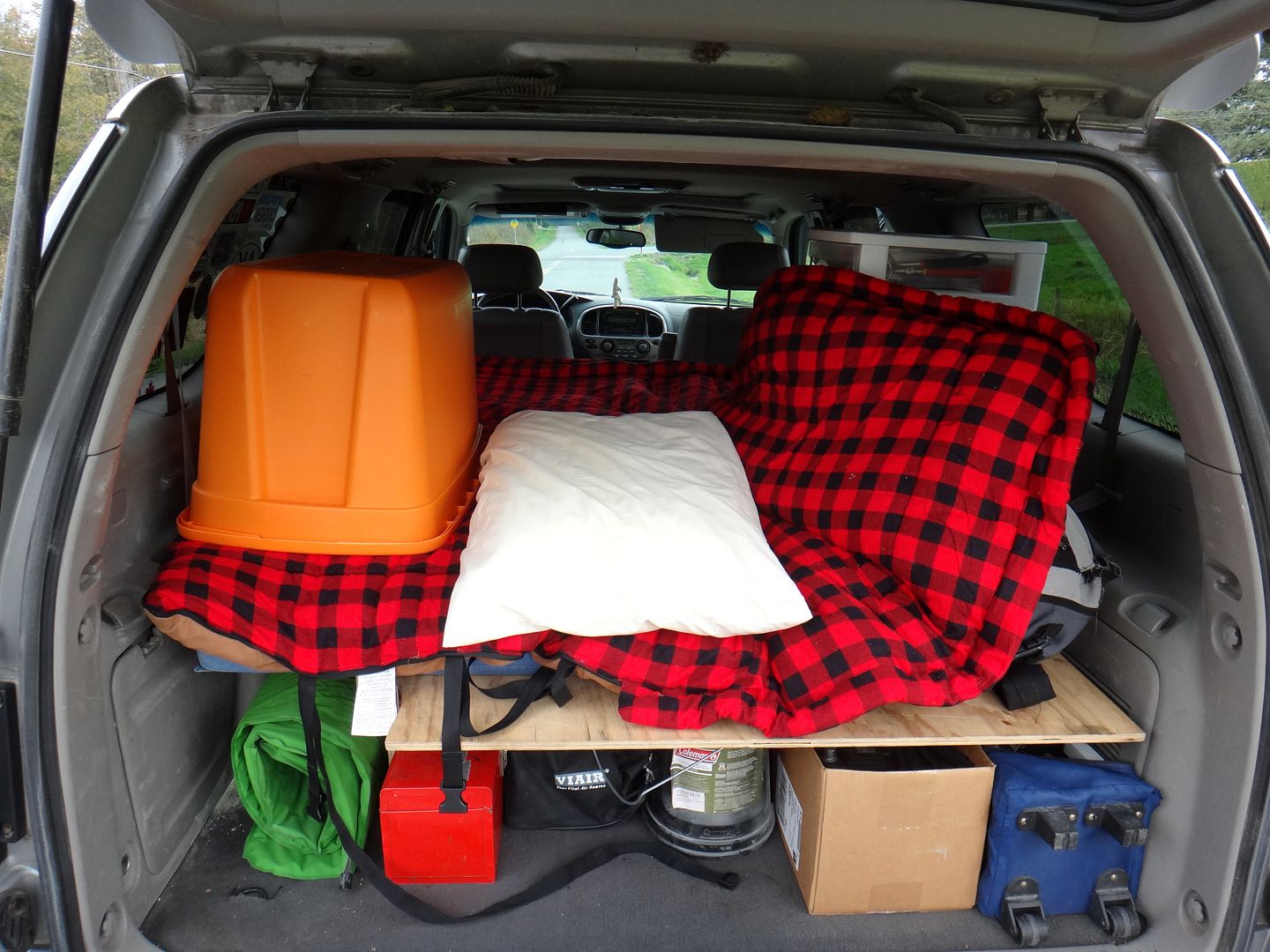
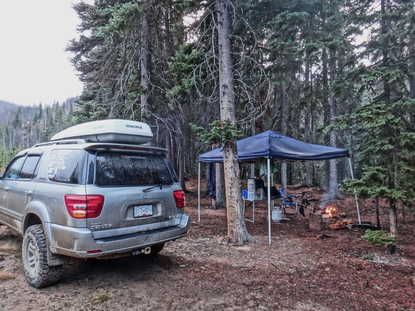
I didn't arrive until after dark so I only went a few km's on gravel before setting up camp on a side road with a view back toward the highway. Camp consisted of a fire, 10x10 canopy for the forecasted rain, camp chair and table, old coleman propane stove and water jug. Also, "home sweet truck" with the sleeping platform set up inside the back.


Before bed I got to listen to a barred owl and yell back and forth at some coyotes which was cool.
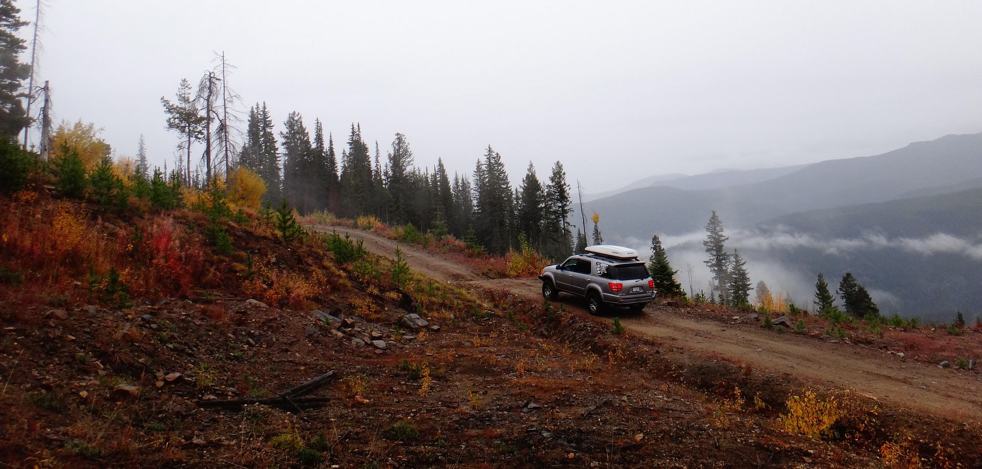
There was a grater and some road building/fixing going on here and there so some sections were muddy but all the washouts had been fixed. I only saw one person for the whole two days and only at a distance so it felt remote.

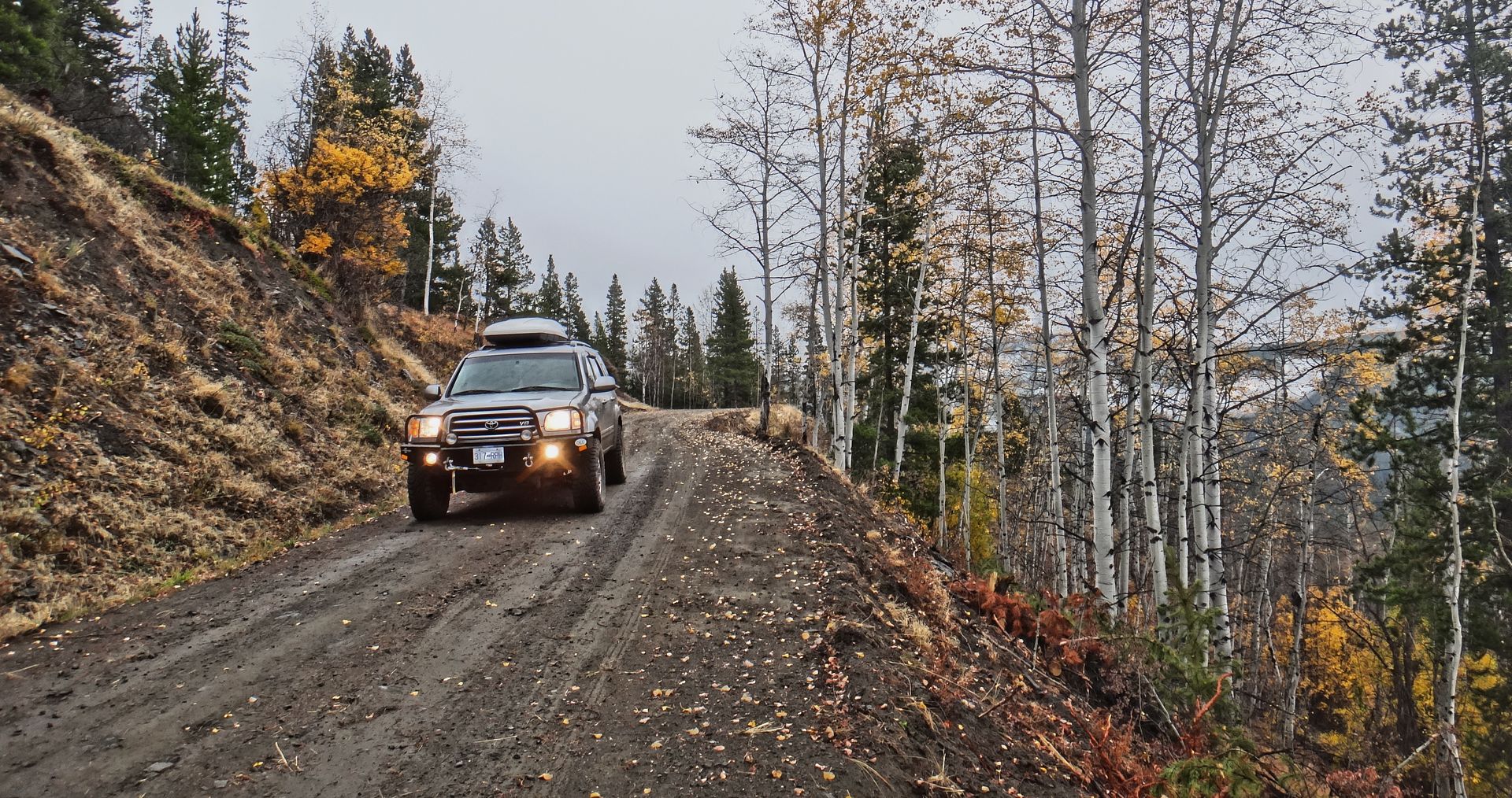
The fall colours were excellent though

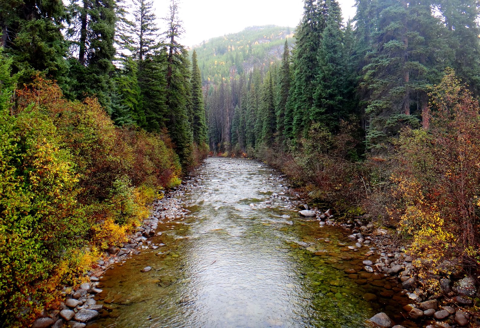
The river was just right. I always imagine living in a cabin beside a river just this size...

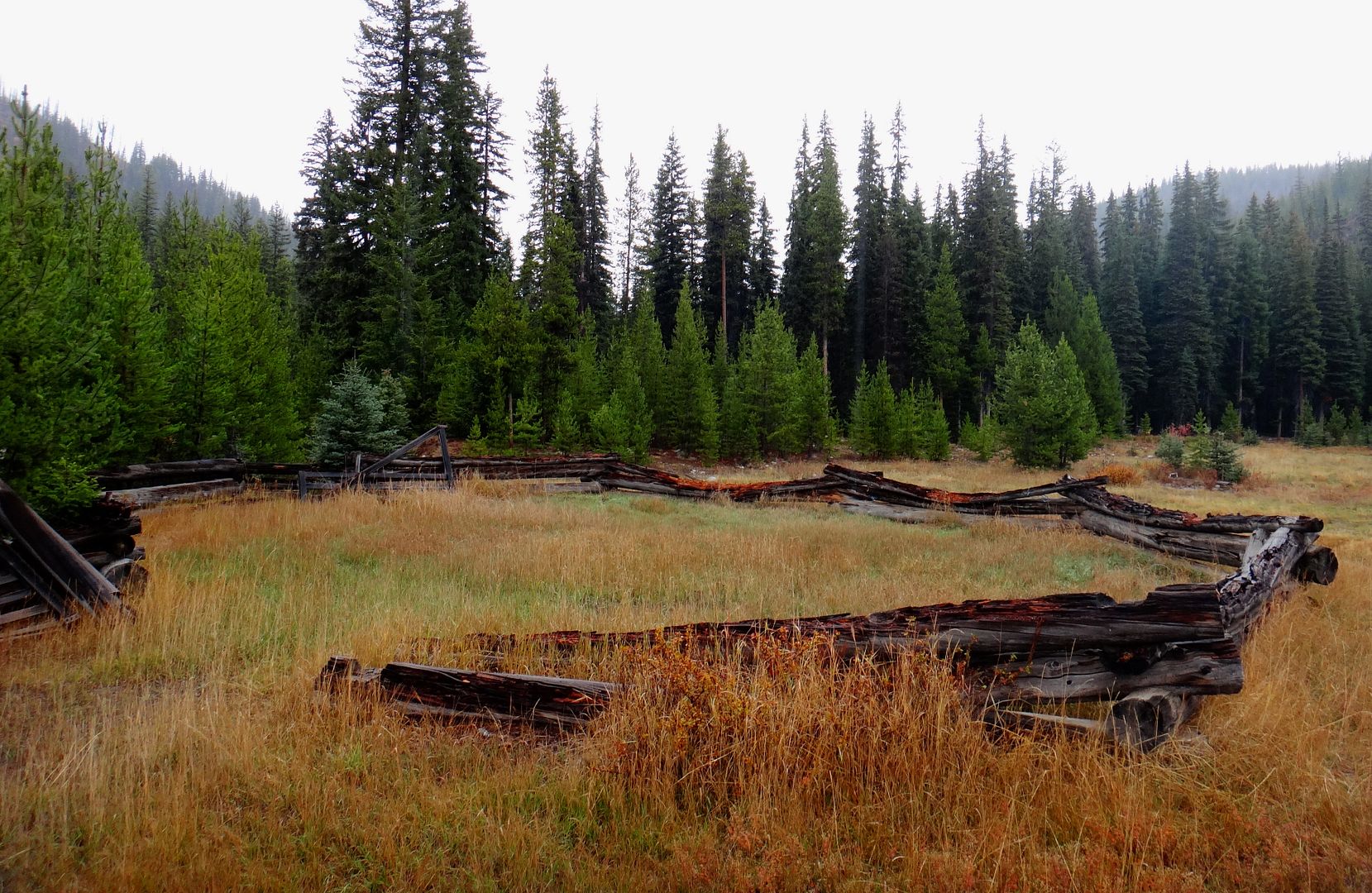
After exploring around a bit I found a nice meadow for my campsite. This was right where the FSR crosses the Pasayten River and enters the 'Placer Mountain to Border Lakes Motorized Closure' (except on certain existing trails). There was a really old horse corral which was in rough shape:
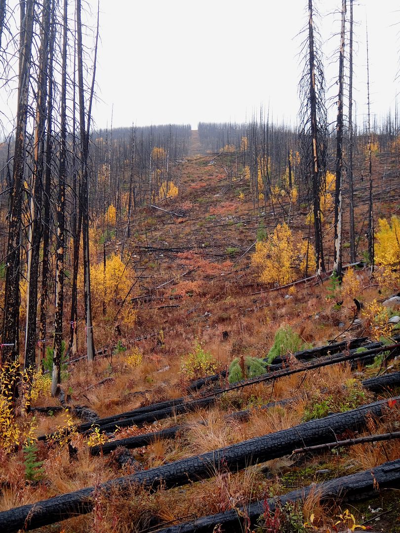
It was lightly raining but I wanted to work up an appetite prior to cooking my cheddar/bacon smokies on the fire for dinner. I decided to go for a walk/hike which ended up being about 4km total over easy ground. I could have driven this section but because of the forest burn there were too many trees across the road in areas to make it worth it.


I wanted to check out something that I've only seen in pictures:
Looking EAST:
Looking WEST:

The slash that separates USA and CAN! Was pretty cool... I made sure not to cross the middle as I didn't know if some drone would blow me away or some ghillie suit-clad DEA agent would pop up to say hello. The Centennial Trail goes along here somewhere but with the fires in recent years, it may be hard to find/follow.
After taking some more photos I hiked back to set up camp by the river. The rain stopped and I picked a nice sheltered spot about 20 ft above the river in the trees. Despite the earlier rain I was able to get the fire going without using the chainsaw or gasoline which was nice.


Had a great fire, coffee and fire-roasted smokies. Also managed to read my latest copy of OutdoorX4 by the fire. This night I was yet again serenaded by another owl. Plus I heard some loud crashing/banging noises off in the distance which was spooky but it never came too close.
In the morning I went for a stroll along the river on a faint trail and just sat to enjoy nature before heading back home (had to take a "selfie" or whatever for my wife's benefit haha).

Definitely a cool area, I'd like to go back and hike and explore more on foot.
Quick stop at my favourite place in Hope -The Blue Moose Cafe. Yum.
I didn't arrive until after dark so I only went a few km's on gravel before setting up camp on a side road with a view back toward the highway. Camp consisted of a fire, 10x10 canopy for the forecasted rain, camp chair and table, old coleman propane stove and water jug. Also, "home sweet truck" with the sleeping platform set up inside the back.
Before bed I got to listen to a barred owl and yell back and forth at some coyotes which was cool.
There was a grater and some road building/fixing going on here and there so some sections were muddy but all the washouts had been fixed. I only saw one person for the whole two days and only at a distance so it felt remote.
The fall colours were excellent though
The river was just right. I always imagine living in a cabin beside a river just this size...
After exploring around a bit I found a nice meadow for my campsite. This was right where the FSR crosses the Pasayten River and enters the 'Placer Mountain to Border Lakes Motorized Closure' (except on certain existing trails). There was a really old horse corral which was in rough shape:
It was lightly raining but I wanted to work up an appetite prior to cooking my cheddar/bacon smokies on the fire for dinner. I decided to go for a walk/hike which ended up being about 4km total over easy ground. I could have driven this section but because of the forest burn there were too many trees across the road in areas to make it worth it.
I wanted to check out something that I've only seen in pictures:
Looking EAST:
Looking WEST:
The slash that separates USA and CAN! Was pretty cool... I made sure not to cross the middle as I didn't know if some drone would blow me away or some ghillie suit-clad DEA agent would pop up to say hello. The Centennial Trail goes along here somewhere but with the fires in recent years, it may be hard to find/follow.
After taking some more photos I hiked back to set up camp by the river. The rain stopped and I picked a nice sheltered spot about 20 ft above the river in the trees. Despite the earlier rain I was able to get the fire going without using the chainsaw or gasoline which was nice.
Had a great fire, coffee and fire-roasted smokies. Also managed to read my latest copy of OutdoorX4 by the fire. This night I was yet again serenaded by another owl. Plus I heard some loud crashing/banging noises off in the distance which was spooky but it never came too close.
In the morning I went for a stroll along the river on a faint trail and just sat to enjoy nature before heading back home (had to take a "selfie" or whatever for my wife's benefit haha).
Definitely a cool area, I'd like to go back and hike and explore more on foot.