IntrepidXJ
Explorer
Arizona Strip & Southern Utah Wanderings | Day 2
Sunday, October 2, 2011
The Original Trip Report on ADVENTR.CO
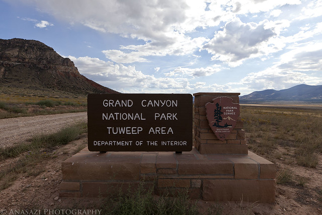
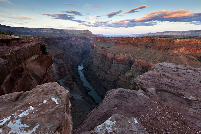
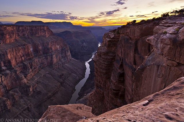
After an awesome night camping under the stars in perfect weather near Little Black Mountain, we were up early, had a little breakfast and were soon on our way back into Utah. Our ultimate destination for the day would be Toroweap on the North Rim of the Grand Canyon, but we would have a lot of exploring to do on our way there.
After entering Utah again, we quickly found ourselves in Warner Valley. As we headed east, we took the short detour to Fort Pearce which is located along the old Honeymoon Trail.
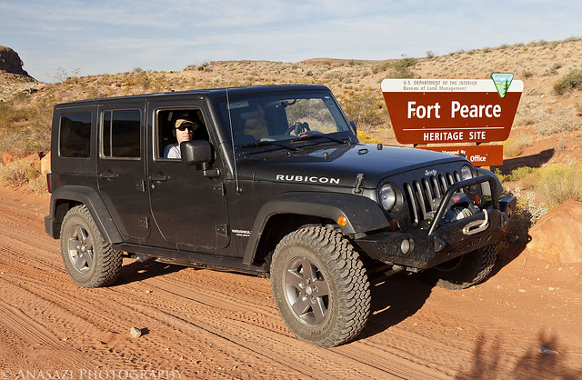
Fort Pearce Heritage Site by IntrepidXJ, on Flickr
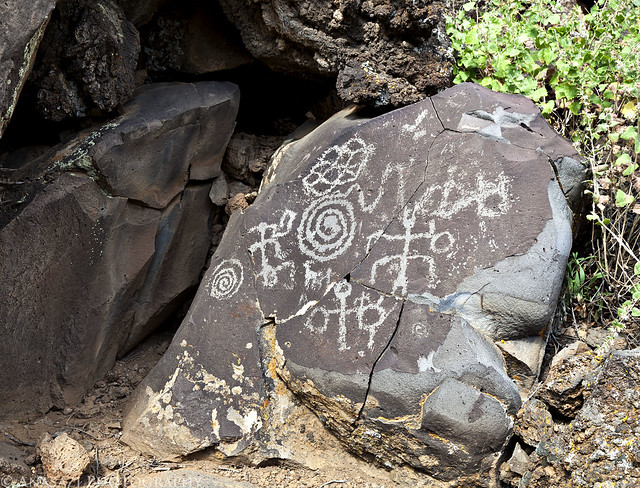
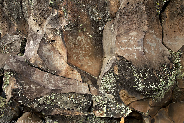
Of course, our first objective at the site was to find the petroglyphs located near the fort. They were easy to find and the area offered a nice view.
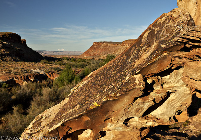
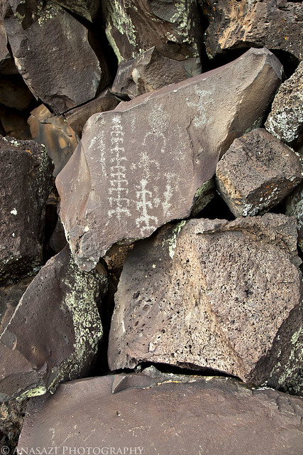
Fort Pearce Petroglyphs by IntrepidXJ, on Flickr
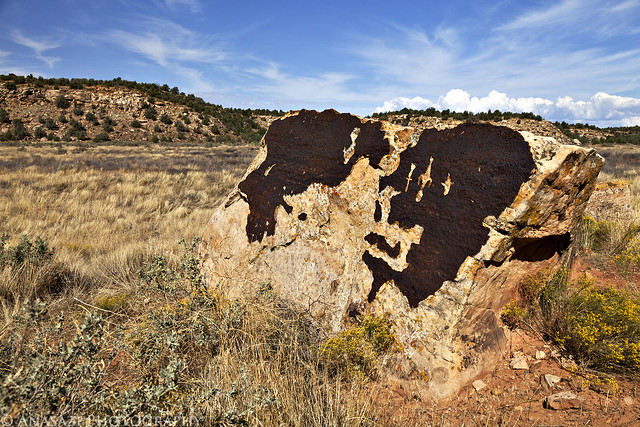
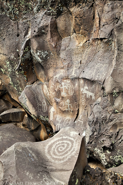
A closer look at the petroglyphs on the slanted boulder.
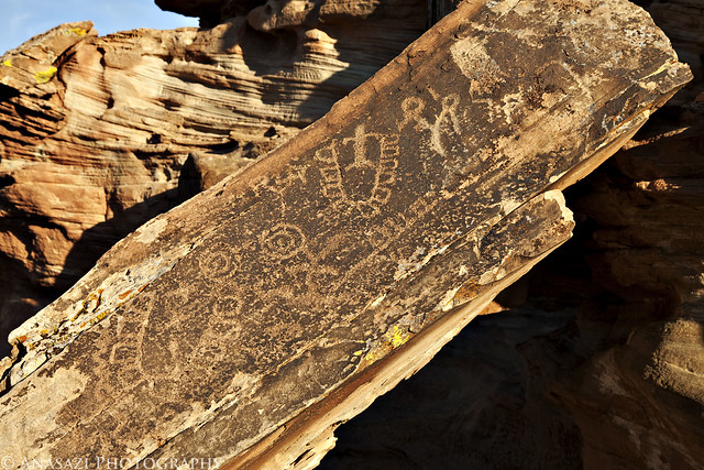
Fort Pearce Boulder by IntrepidXJ, on Flickr
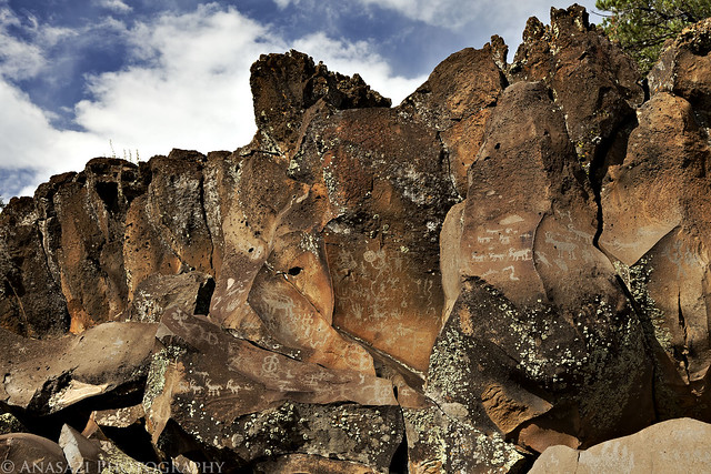
After hiking down into the wash and finding some more petroglyphs and historic signatures, we went back up and visited Fort Pearce. This small structure is one of only three remaining stone guard posts built during Utah’s Black Hawk War. The “war” was actually period of intermittent raiding between 1865 and 1870. During this time period the Ute Tribe, led by Chief Black Hawk (Antonga), and other Native Americans allies attempted to drive the Mormons from the Ute traditional homelands.
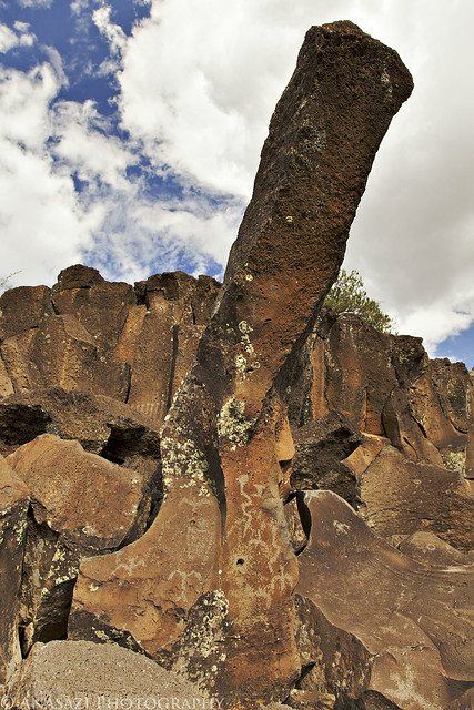
To protect their herds and homes, local Mormon militia constructed a series of protected guard or sentry posts, called ‘forts’, along major trails and travel corridors in central and southern Utah. Four to six armed men with horses were stationed at each post, to attack and delay the Indian raiding parties, while a rider raced to the nearest settlements with a warning. Fort Pearce Wash was one of the primary routes along which Ute-Navajo horsemen traveled to raid the livestock herds and settlements of the St. George Basin.
No armed conflicts are known to have taken place at Fort Pearce, but the guard post was manned, at least intermittently, from 1866 until 1873, when peace negotiations and U.S. Army actions ended the raiding that was known in Utah as the Black Hawk War.
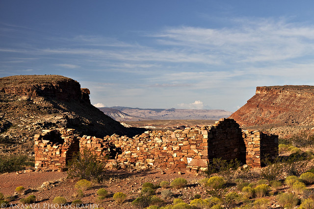
Fort Pearce by IntrepidXJ, on Flickr
Next up was a stop at the Warner Valley Dinosaur Trackway. There were a lot of tracks here....both large and small. Apparently, there are estimated to be about 400 tracks in the area, though many are covered with sand. Here are some of the better and larger tracks found at the site.
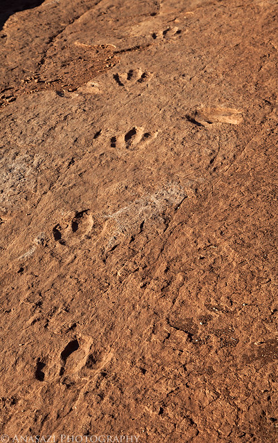
Dino Trackway by IntrepidXJ, on Flickr
Paleontologists cannot tell what specific dinosaur left a track, but they can be tied to a general group of them. Two types of tracks have been identified here belonging to the Grallator and Eubrontes groups, tracks ranging from 10-16 inches and about 7 inches respectively. Here's a closer look at a few larger tracks.
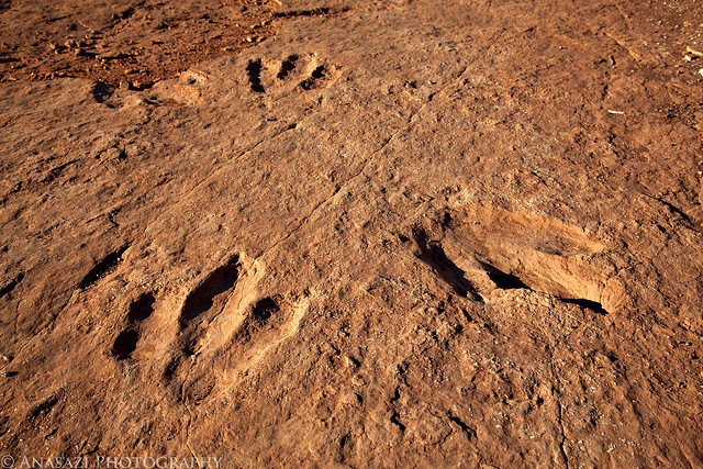
Dinosaur Tracks by IntrepidXJ, on Flickr
Here's my foot for a little scale. I wear a size 15 shoe.
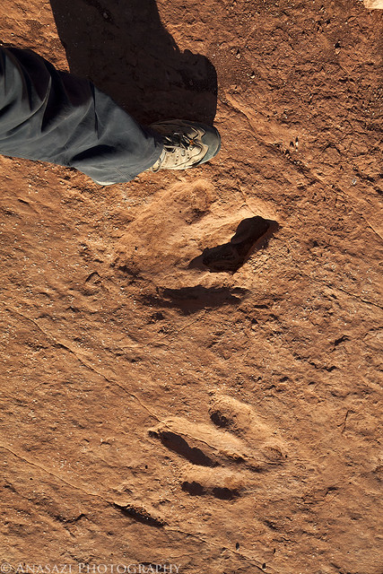
Size Comparison by IntrepidXJ, on Flickr
From Warner Valley we headed further north to Hurricane. This photo was taken along the way.
Red Cliffs by IntrepidXJ, on Flickr
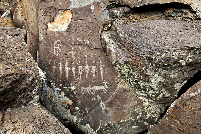
Soon we were heading south towards Colorado City and Arizona again. Just before reaching the state line we turned off to visit one more site in Utah....Canaan Gap. I wasn't planning on fining too much at this site, but we were pleasantly surprised to find many interesting and unique petroglyphs here. These are some of the most interesting because of how deep they are. I do not believe that they were originally carved this deep and that they have eroded out over the years to become deeper.....but I might be wrong about that? However it happened, it's a pretty cool site!
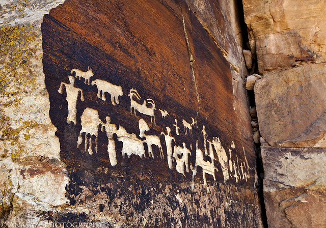
Canaan Gap Petroglyphs by IntrepidXJ, on Flickr
Here's a closer look at the right side of the panel I posted above.
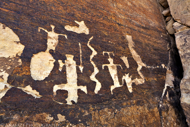
Canaan Deep Glyphs by IntrepidXJ, on Flickr
A closer look to see just how deep they are.
Deep by IntrepidXJ, on Flickr
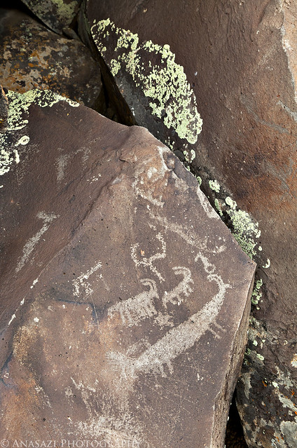
Here's another very cool panel located at Canaan Gap. There is a lot going on in this one. It kind of reminds me of the Great Hunt Panel in Nine Mile Canyon because of the way all of the figures are grouped together. If you look at the very left side of the panel, there is even an upside-down anthropomorpic figure.
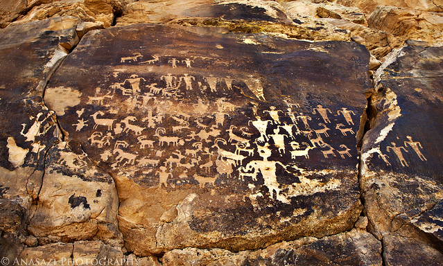
Busy Sheep Panel by IntrepidXJ, on Flickr
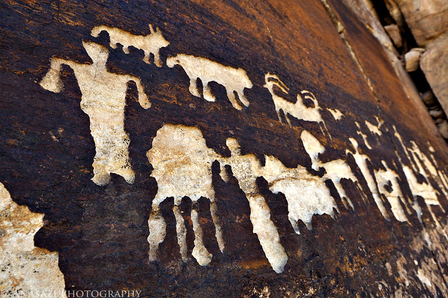
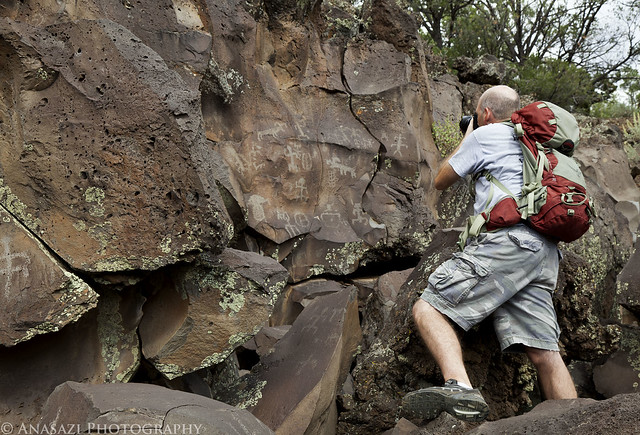
Before hiking back to the Jeep, Jared spotted a boulder that he thought we should check for more petroglyphs. It turns out his instinct was right, since we did find a few more deep petroglyphs located there.
Boulder-Glyphs by IntrepidXJ, on Flickr
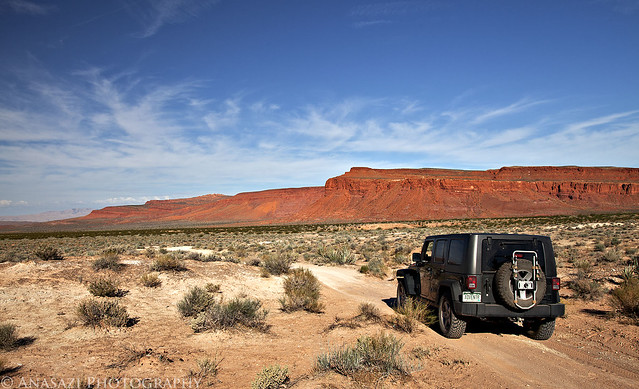
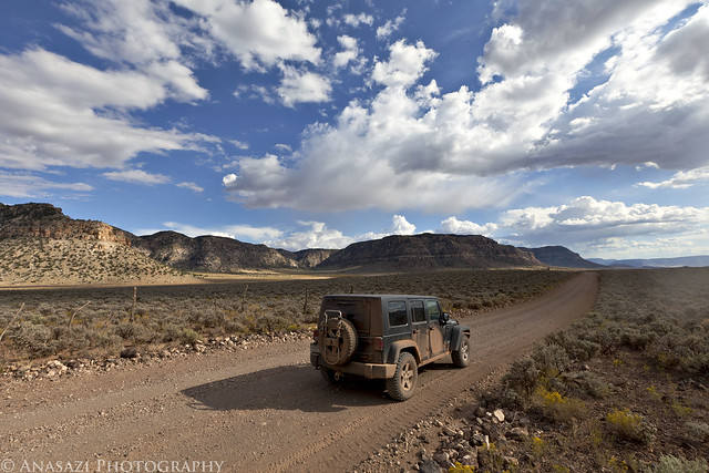
We fueled up the Jeep on the border and then were headed south into the Arizona Strip and towards the Grand Canyon and Toroweap.
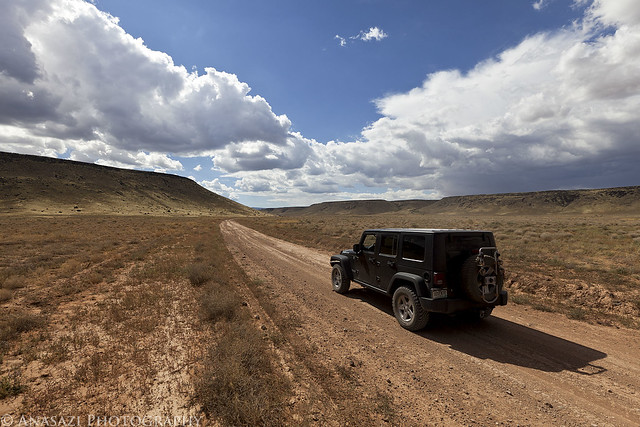
Arizona Strip Road by IntrepidXJ, on Flickr
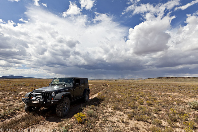
More than half-way to Toroweap. I have always heard horror stories about how bad the roads are to Toroweap and that many people get two flat tires on their journey.....however, I was actually surprised at how well maintained the main roads were. Lots of high speed gravel road driving and kicking up dust.
28 Miles by IntrepidXJ, on Flickr
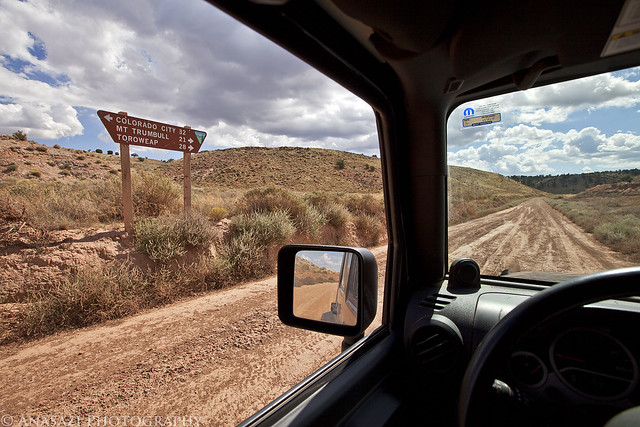
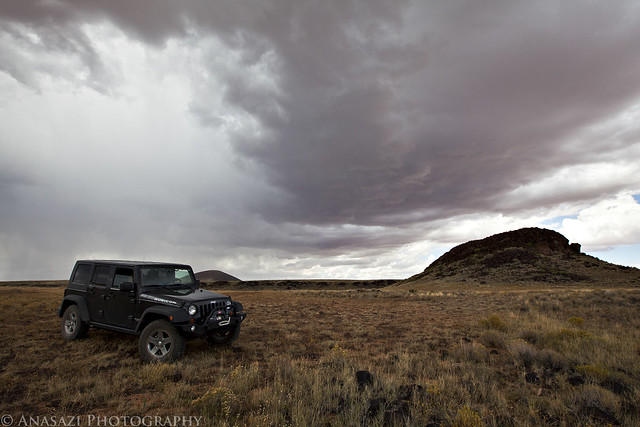
We turned off the main road onto a little-used two-track so that we could visit another pictograph site. A storm is approaching in the distance.
Two-Track & Storm by IntrepidXJ, on Flickr
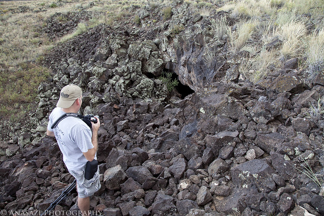
Pretty soon we had reached Paiute Cave...a collapsed lava tube. This is the entrance. The trail down into it was over some rather large boulders and once inside the cave, there were plenty more loose boulders to scramble over as we explored the cave. It was pretty dark inside so a tripod was necessary for these photos. Unfortunately, getting the tripod setup in the jungle of boulders was challenging and frustrating at times......but worth it.
Paiute Cave by IntrepidXJ, on Flickr
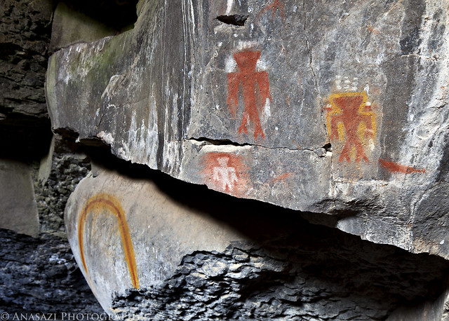
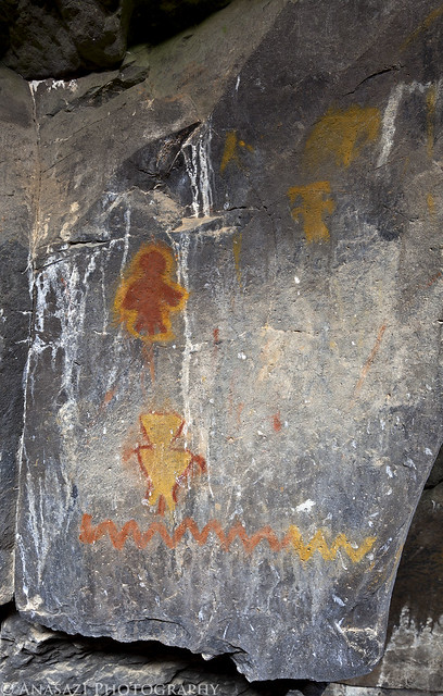
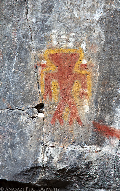
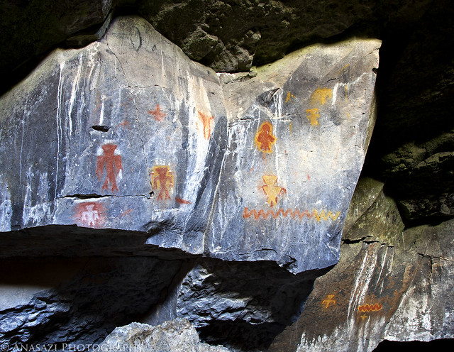
Inside Paiute Cave are some of the most vibrant pictographs I have ever encountered...so far. While the cave is named after the Paiute, the amazing pictographs found hidden inside were actually created by the Virgin Kayenta Anazasi at least 600 years ago. I've posted a few photos below from this site.
Three Colorful Anthropomorphs by IntrepidXJ, on Flickr
Neon Snake Panel by IntrepidXJ, on Flickr
Paiute Cave Anthropomorph by IntrepidXJ, on Flickr
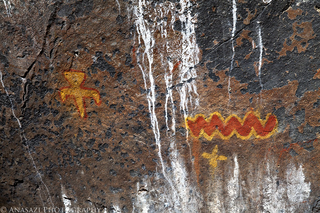
Red & Yellow by IntrepidXJ, on Flickr
Paiute Cave Pictographs by IntrepidXJ, on Flickr
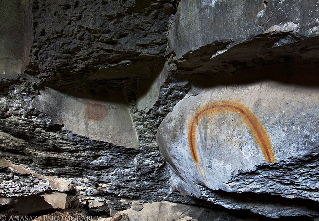
Hidden Rainbow by IntrepidXJ, on Flickr
Sunday, October 2, 2011
The Original Trip Report on ADVENTR.CO
After an awesome night camping under the stars in perfect weather near Little Black Mountain, we were up early, had a little breakfast and were soon on our way back into Utah. Our ultimate destination for the day would be Toroweap on the North Rim of the Grand Canyon, but we would have a lot of exploring to do on our way there.
After entering Utah again, we quickly found ourselves in Warner Valley. As we headed east, we took the short detour to Fort Pearce which is located along the old Honeymoon Trail.
Fort Pearce Heritage Site by IntrepidXJ, on Flickr
Of course, our first objective at the site was to find the petroglyphs located near the fort. They were easy to find and the area offered a nice view.
Fort Pearce Petroglyphs by IntrepidXJ, on Flickr
A closer look at the petroglyphs on the slanted boulder.
Fort Pearce Boulder by IntrepidXJ, on Flickr
After hiking down into the wash and finding some more petroglyphs and historic signatures, we went back up and visited Fort Pearce. This small structure is one of only three remaining stone guard posts built during Utah’s Black Hawk War. The “war” was actually period of intermittent raiding between 1865 and 1870. During this time period the Ute Tribe, led by Chief Black Hawk (Antonga), and other Native Americans allies attempted to drive the Mormons from the Ute traditional homelands.
To protect their herds and homes, local Mormon militia constructed a series of protected guard or sentry posts, called ‘forts’, along major trails and travel corridors in central and southern Utah. Four to six armed men with horses were stationed at each post, to attack and delay the Indian raiding parties, while a rider raced to the nearest settlements with a warning. Fort Pearce Wash was one of the primary routes along which Ute-Navajo horsemen traveled to raid the livestock herds and settlements of the St. George Basin.
No armed conflicts are known to have taken place at Fort Pearce, but the guard post was manned, at least intermittently, from 1866 until 1873, when peace negotiations and U.S. Army actions ended the raiding that was known in Utah as the Black Hawk War.
Fort Pearce by IntrepidXJ, on Flickr
Next up was a stop at the Warner Valley Dinosaur Trackway. There were a lot of tracks here....both large and small. Apparently, there are estimated to be about 400 tracks in the area, though many are covered with sand. Here are some of the better and larger tracks found at the site.
Dino Trackway by IntrepidXJ, on Flickr
Paleontologists cannot tell what specific dinosaur left a track, but they can be tied to a general group of them. Two types of tracks have been identified here belonging to the Grallator and Eubrontes groups, tracks ranging from 10-16 inches and about 7 inches respectively. Here's a closer look at a few larger tracks.
Dinosaur Tracks by IntrepidXJ, on Flickr
Here's my foot for a little scale. I wear a size 15 shoe.
Size Comparison by IntrepidXJ, on Flickr
From Warner Valley we headed further north to Hurricane. This photo was taken along the way.
Red Cliffs by IntrepidXJ, on Flickr
Soon we were heading south towards Colorado City and Arizona again. Just before reaching the state line we turned off to visit one more site in Utah....Canaan Gap. I wasn't planning on fining too much at this site, but we were pleasantly surprised to find many interesting and unique petroglyphs here. These are some of the most interesting because of how deep they are. I do not believe that they were originally carved this deep and that they have eroded out over the years to become deeper.....but I might be wrong about that? However it happened, it's a pretty cool site!
Canaan Gap Petroglyphs by IntrepidXJ, on Flickr
Here's a closer look at the right side of the panel I posted above.
Canaan Deep Glyphs by IntrepidXJ, on Flickr
A closer look to see just how deep they are.
Deep by IntrepidXJ, on Flickr
Here's another very cool panel located at Canaan Gap. There is a lot going on in this one. It kind of reminds me of the Great Hunt Panel in Nine Mile Canyon because of the way all of the figures are grouped together. If you look at the very left side of the panel, there is even an upside-down anthropomorpic figure.
Busy Sheep Panel by IntrepidXJ, on Flickr
Before hiking back to the Jeep, Jared spotted a boulder that he thought we should check for more petroglyphs. It turns out his instinct was right, since we did find a few more deep petroglyphs located there.
Boulder-Glyphs by IntrepidXJ, on Flickr
We fueled up the Jeep on the border and then were headed south into the Arizona Strip and towards the Grand Canyon and Toroweap.
Arizona Strip Road by IntrepidXJ, on Flickr
More than half-way to Toroweap. I have always heard horror stories about how bad the roads are to Toroweap and that many people get two flat tires on their journey.....however, I was actually surprised at how well maintained the main roads were. Lots of high speed gravel road driving and kicking up dust.
28 Miles by IntrepidXJ, on Flickr
We turned off the main road onto a little-used two-track so that we could visit another pictograph site. A storm is approaching in the distance.
Two-Track & Storm by IntrepidXJ, on Flickr
Pretty soon we had reached Paiute Cave...a collapsed lava tube. This is the entrance. The trail down into it was over some rather large boulders and once inside the cave, there were plenty more loose boulders to scramble over as we explored the cave. It was pretty dark inside so a tripod was necessary for these photos. Unfortunately, getting the tripod setup in the jungle of boulders was challenging and frustrating at times......but worth it.
Paiute Cave by IntrepidXJ, on Flickr
Inside Paiute Cave are some of the most vibrant pictographs I have ever encountered...so far. While the cave is named after the Paiute, the amazing pictographs found hidden inside were actually created by the Virgin Kayenta Anazasi at least 600 years ago. I've posted a few photos below from this site.
Three Colorful Anthropomorphs by IntrepidXJ, on Flickr
Neon Snake Panel by IntrepidXJ, on Flickr
Paiute Cave Anthropomorph by IntrepidXJ, on Flickr
Red & Yellow by IntrepidXJ, on Flickr
Paiute Cave Pictographs by IntrepidXJ, on Flickr
Hidden Rainbow by IntrepidXJ, on Flickr
")