The Big Western Trip - September 2009

AlekG

Adventurer
** NOTE **
This thread will contain some platform-specific information and references
It was originally posted at www.trailvoy.com - The Chevy Trailblazer and GMC Envoy Forum


Well, I was finally able to coordinate 2 contiguous weeks away from work this year so I decided to go for the trip I had planned last year but that got put on hold.

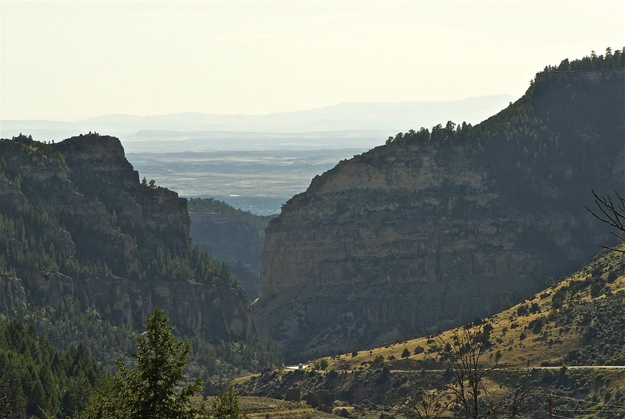
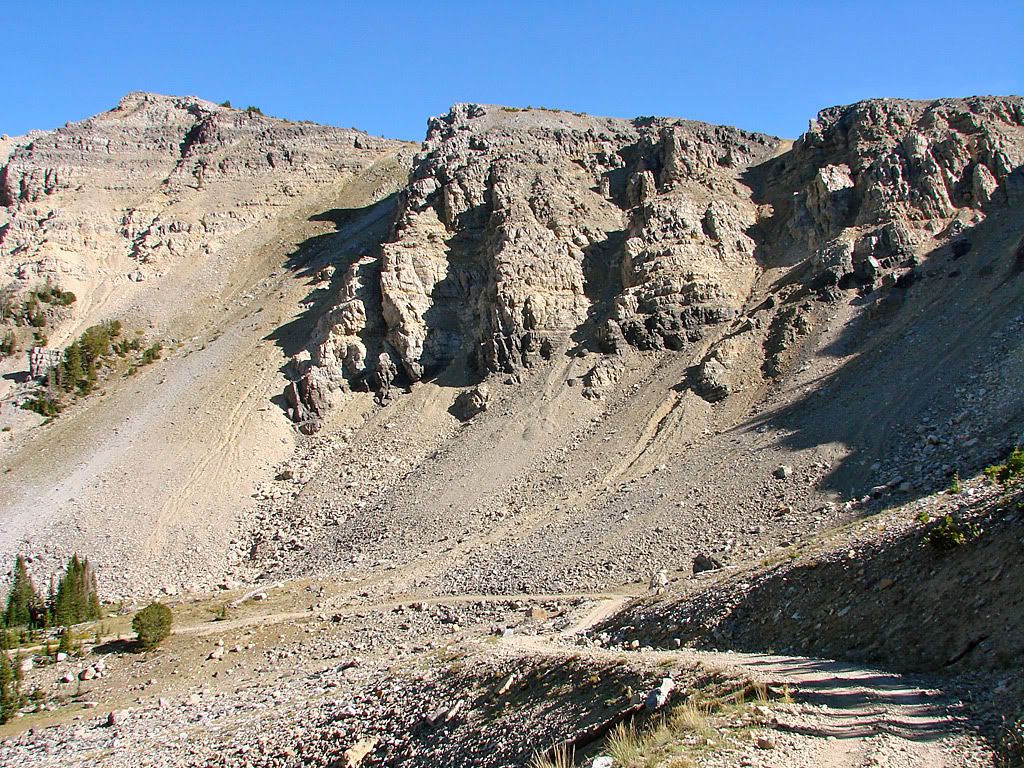
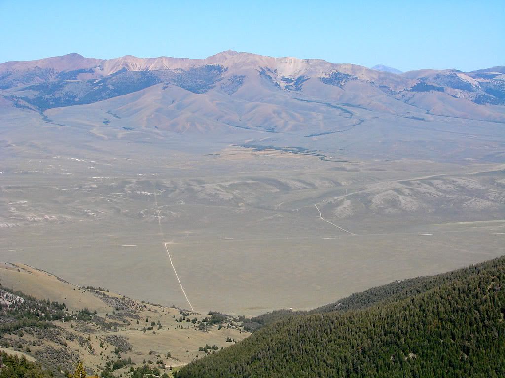
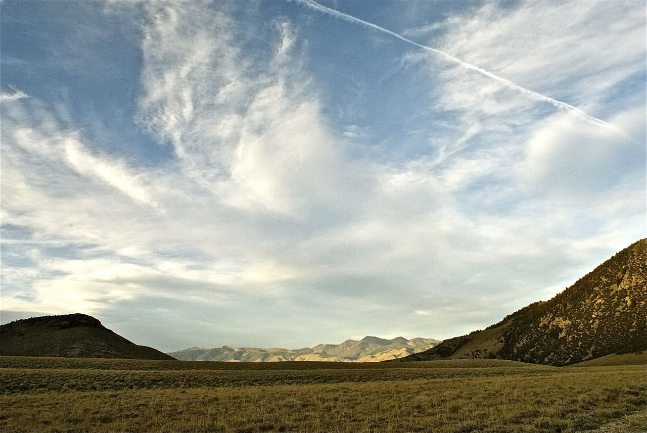
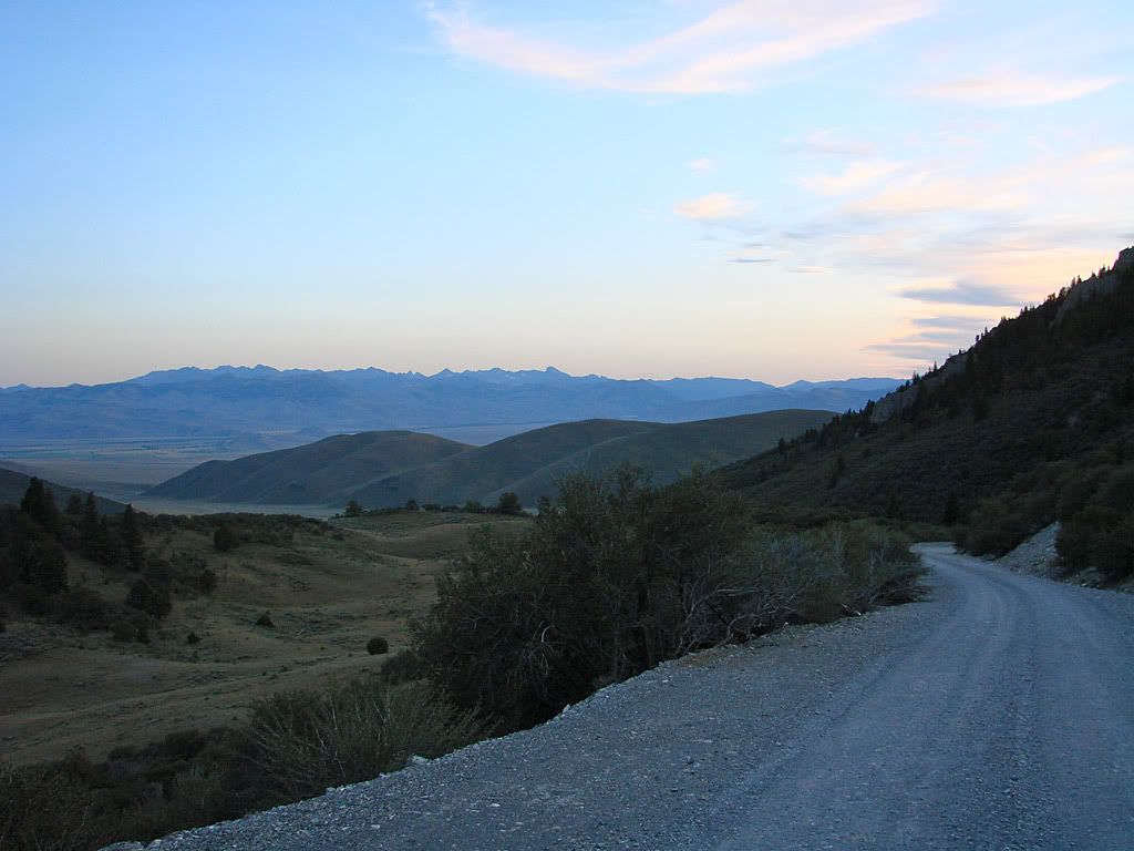
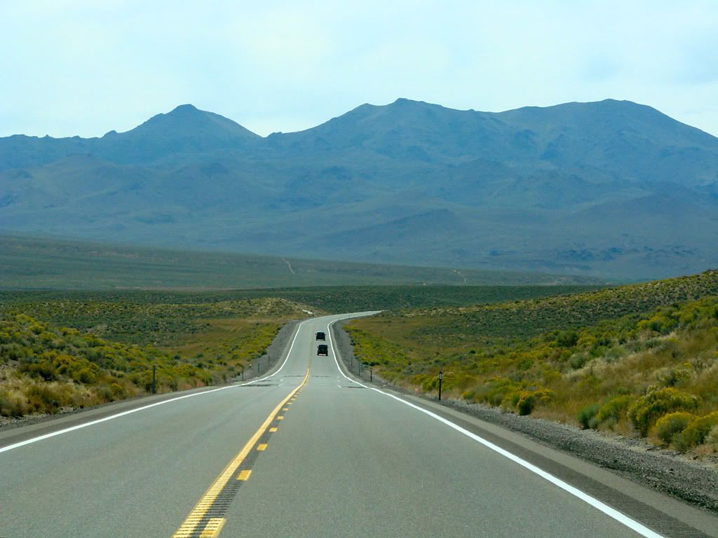
The general plan was to head further west than my 2007 trip to Colorado and explore areas west of The Rockies. Areas of interest were Idaho (why Idaho? more on that later), the north rim of the Grand Canyon, and of course, Utah.

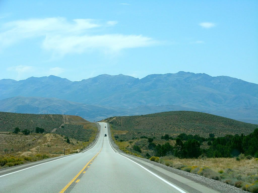
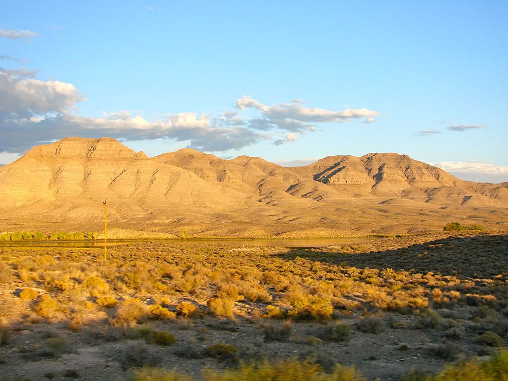
So logically it would be best to start in the North out there and head South and hope for somewhat cooler weather into later September.
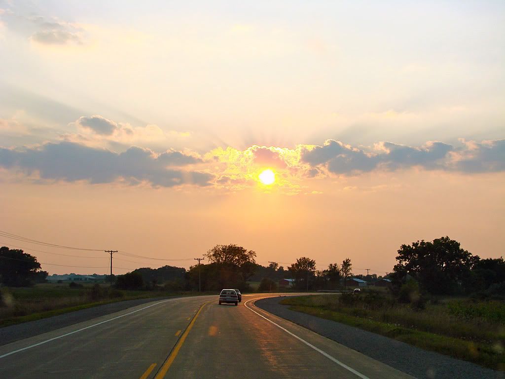
Day 1 - September 4

As usual, a successful trip by any Canadian traveller should always start at Canadian Tire.


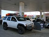
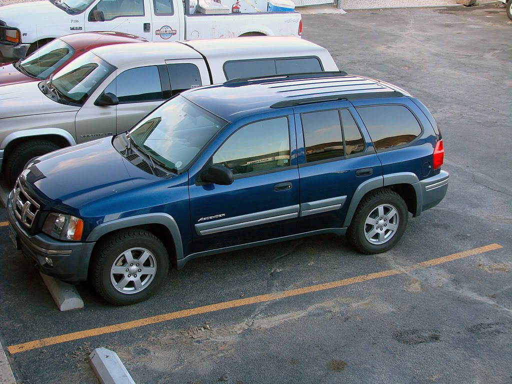
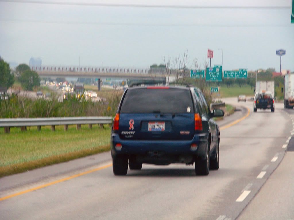
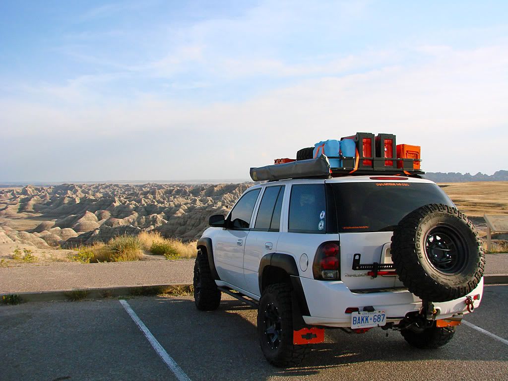
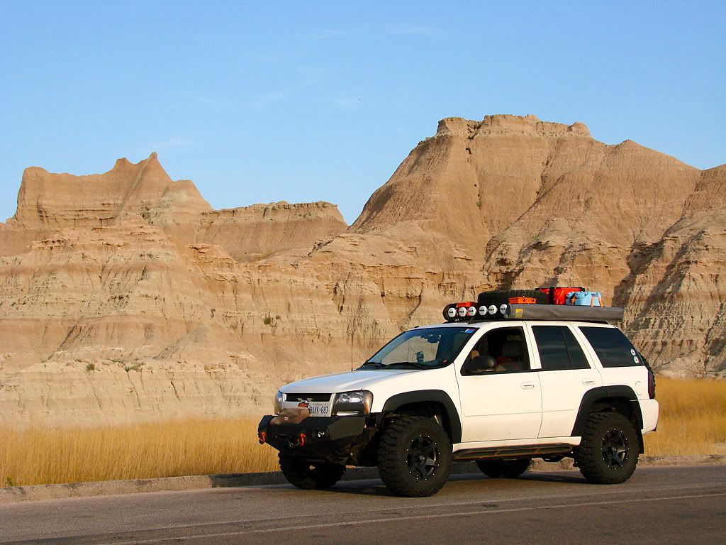
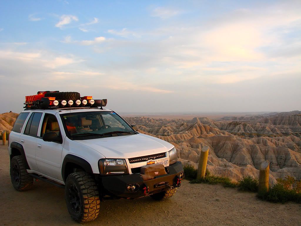
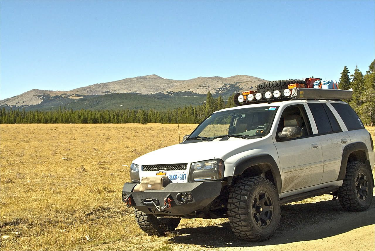
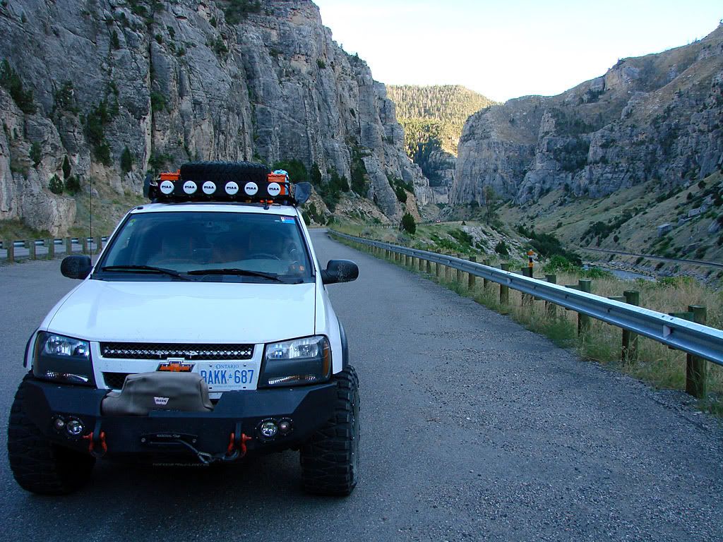
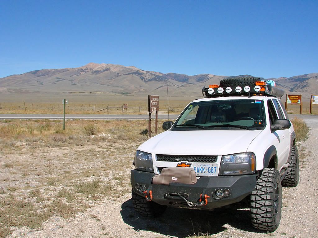
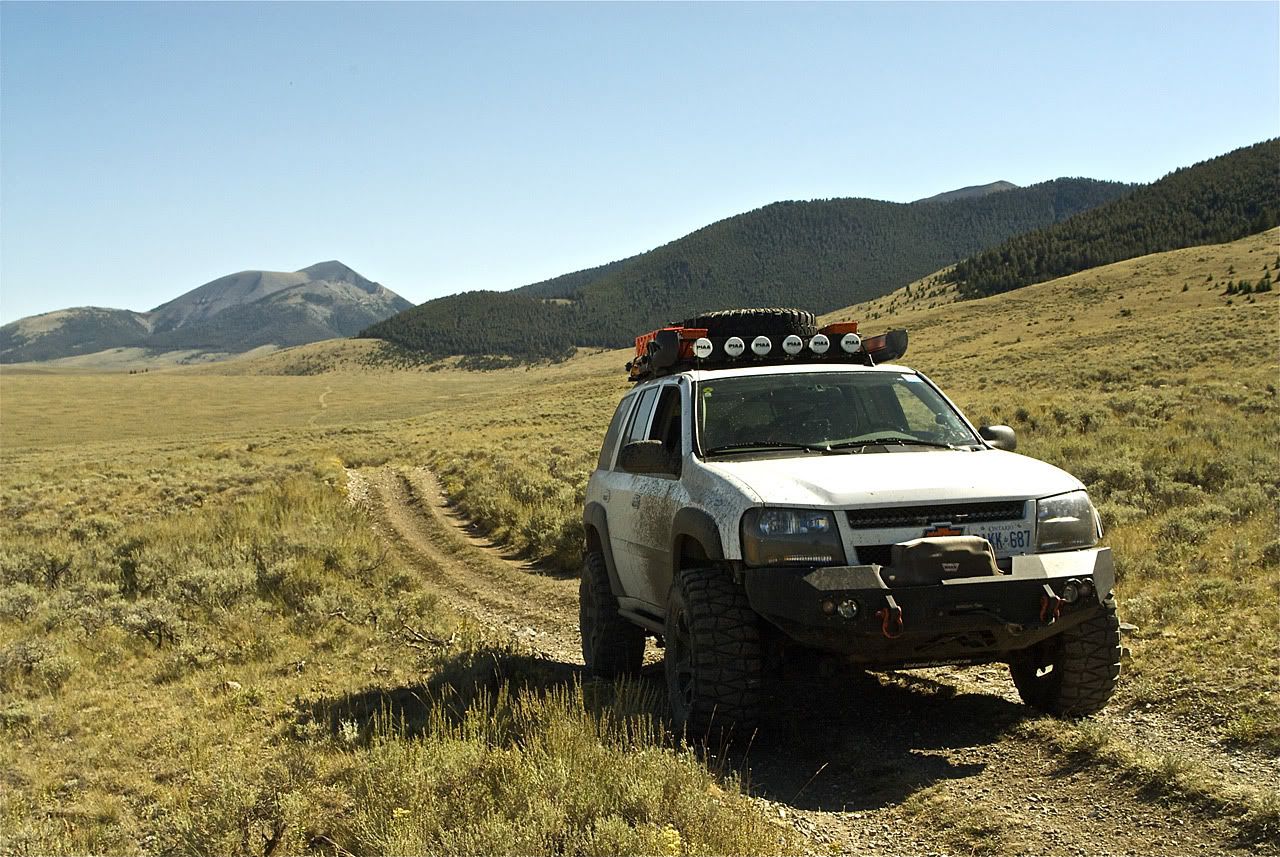
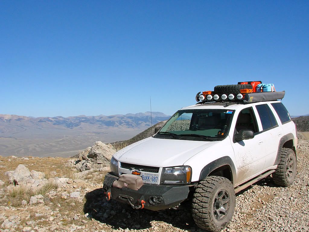
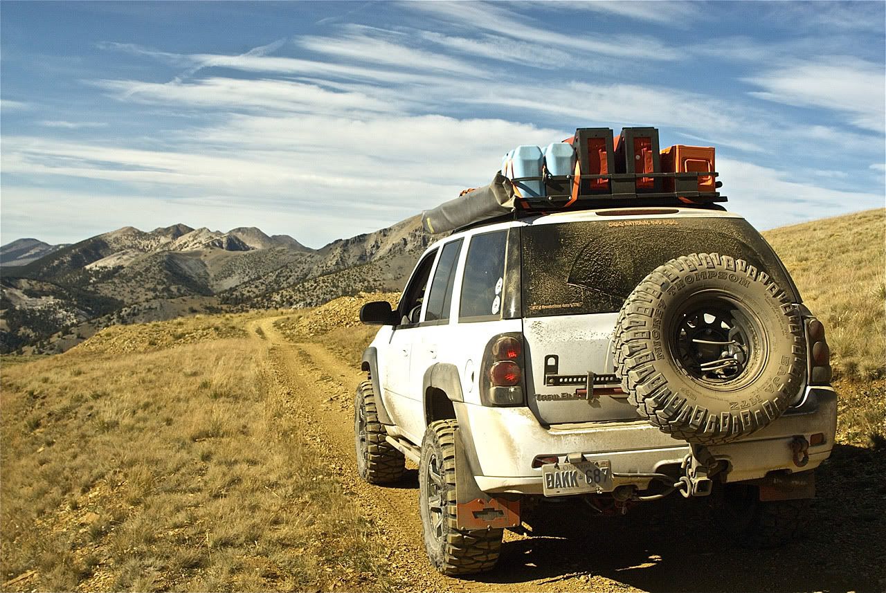
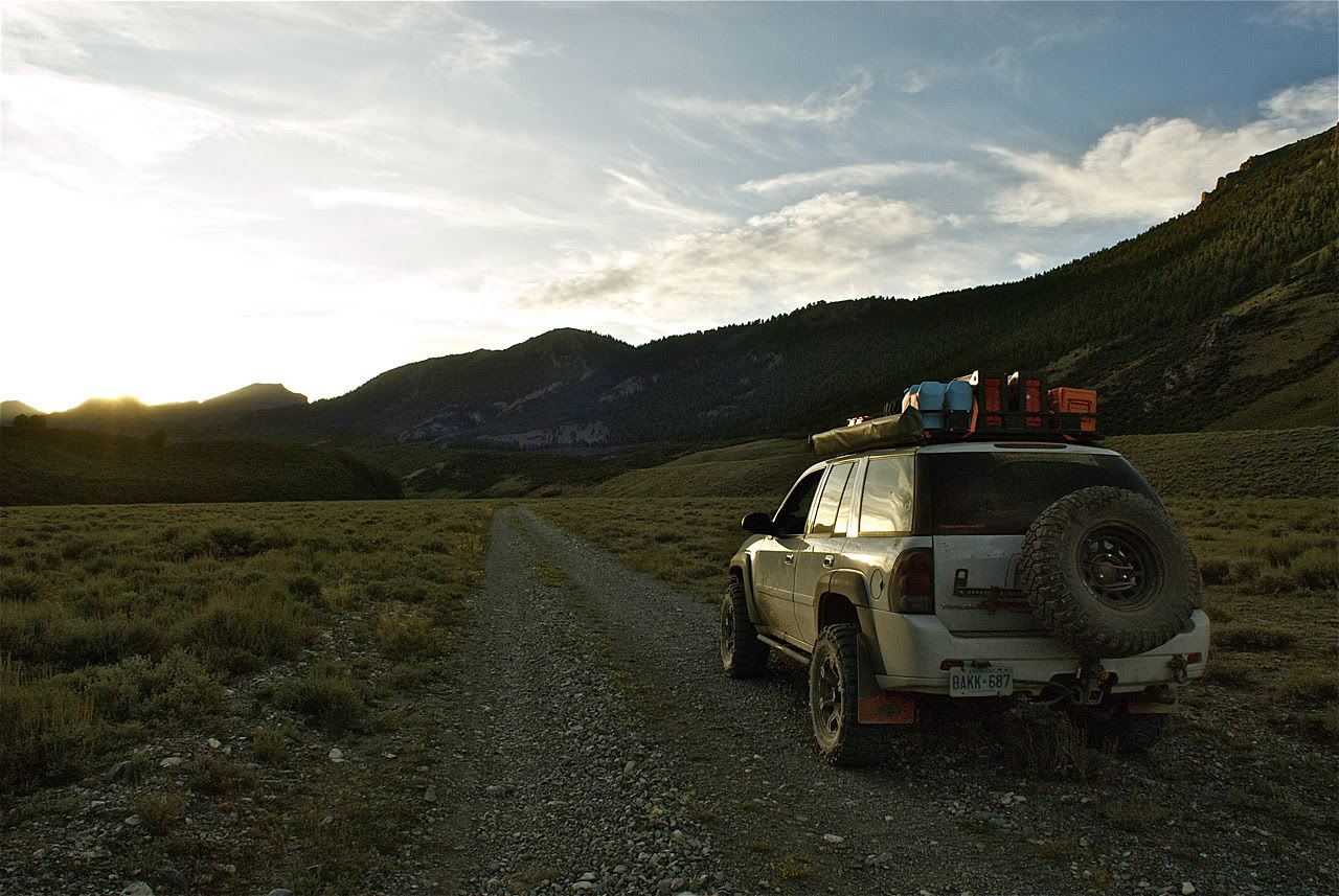
For readers that may know a little about my Trailblazer, you may notice a few new things on there. The roof rack actually has the PIAA light wired up! :eek: :woot: :eek:

It sure took me long enough but I finally was able to get the wiring done (fuses - relays - switches) in a nice clean install using the rear power lead next to the rear fuse panel (under the rear seats). I will be adding to my lighting write-up here sometime soon.

On the Surco Safari Rack itself, I now have the the Camping Lab awning instead of the Hi-Lift jack. The awning worked great earlier this year on my TECORE/MORA trip. The jack is now on the new rear spare tire carrier from C.B.I. Offroad Fab, the supplier that James Downing worked with.

Both the axe/shovel mounts and how the Hi-Lift mounts to the tire carrier use cool locking hardware (originally for an H2) from Gobi Racks USA. More on that and the new (much more sturdier) way I have mounted the Surco Safari rack to the Trailblazer rails when I update my write up here. There are also some cool powder coated surplus ammo cans up there for storage.

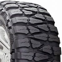
And finally the new wheels and tires. I got an itch last year to update them. The American Eagle rims and Mickey Thompson Baja MTZs were from my Old Blue Trailblazer that got crunched by a tree. The MT tires have always been outstanding, getting me through lots of different kinds of terrain. But the wheels started to look somewhat ragged (paint chipping, constantly cleaning the rust from the caps, and the fake beadlock ring getting duller and duller).

What I really wanted were the Teflon coated rims that American Racing produces. And when they released a new design called the Predator earlier this year I decided to go for it. I also decided to go up to 17" rims, stay at 33" diameter tires, but go from 11.5 width to 12.5. As for tires, I decided to give another manufacturer a try since I needed a whole new set for the 17" rims - Nitto Mud Grapplers. More on this when I start another thread. Here are some corporate shots until then.

wheel.jpg
wheeltire.jpg
closeup.jpg


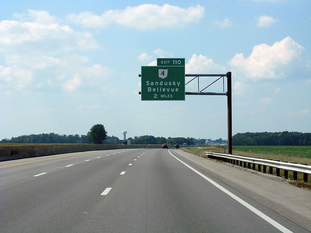
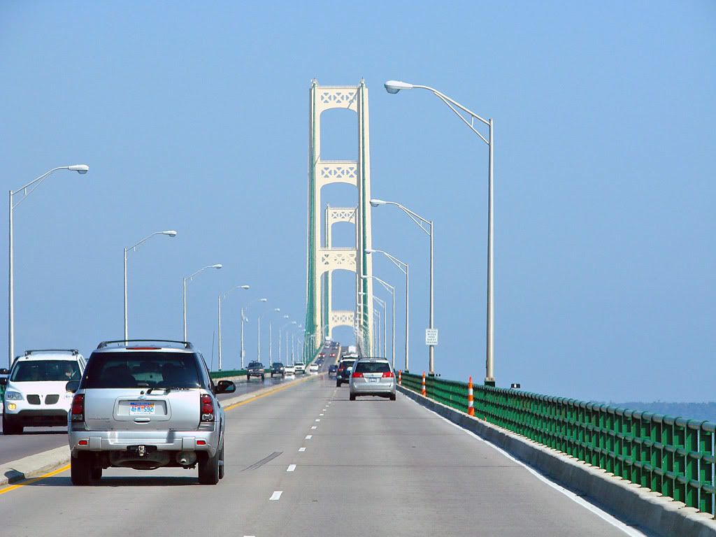
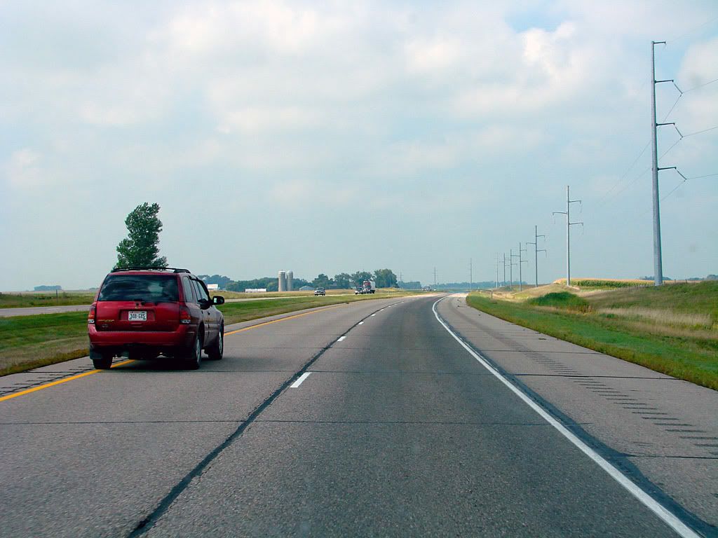
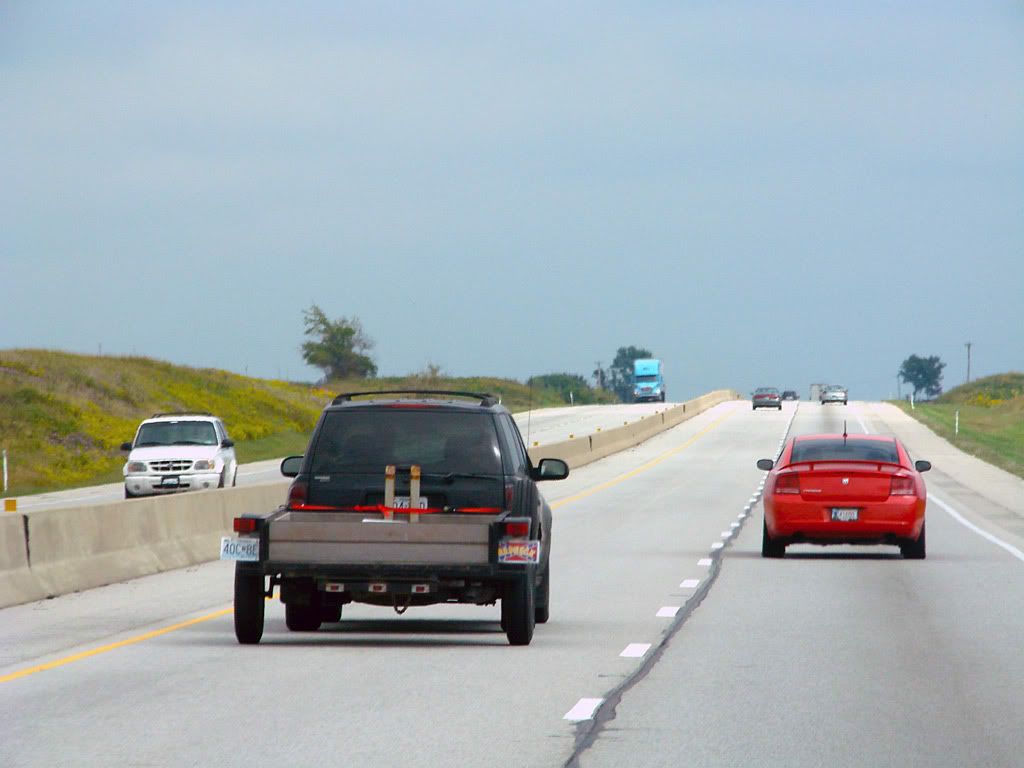
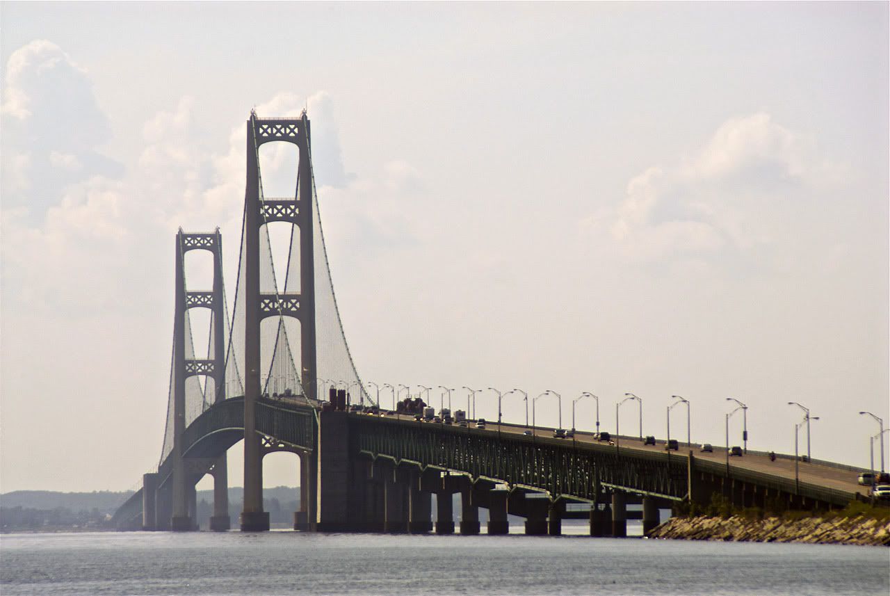
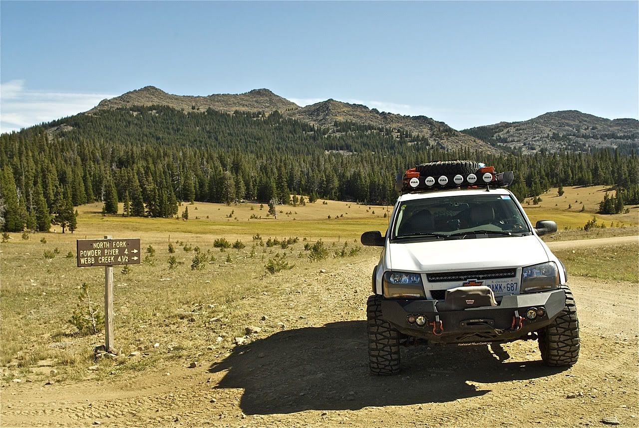
So the logical choice to get across to Idaho would be to head north in Canada, probably to Sault Ste. Marie, cross the border there (Northern Michigan), and head west south of Lake Superior.

However, a couple of things forced my plan to crossing at Niagara Falls. One, I had a few things waiting for me at my US mailbox that I would need for the trip. And two, I really wanted the neoprene Hi-Lift jack cover (which I could not find anywhere locally). Since I was heading south anyways, I decided to order the jack cover from www.4wd.com and pick it up on the way in Columbiana, OH.

Garmin GPS Track (large file)

September 4 Google Map
 

AlekG

Adventurer
The Big Western Trip - Day 2

Day 2 - September 5 - Part 1

Day 2 started with my side visit to Columbiana to pick up the jack cover. The weather so far was perfect - sunny and not too hot. I really like 4Wheel Drive Hardware's system. When you purchase from their online store, you have a choice for delivery or pickup. Pickup is at over 60 affiliated stores across the US (although they are skewed slightly towards the west).

The plan today was to head west around Lake Erie and then north between Lake Michigan and Lake Huron all the way up to Mackinaw City. MI. Not much to report from the Interstates in general. The first picture is notable only that it shows the sign for Sandusky, OH. Sandusky is where the ferry crossing is from Leamington in Ontario. I have always wanted to get to the US using that ferry, on another trip I guess. The second picture is from a bridge at Saginaw, MI. Its over the Saginaw River that empties out to Saginaw Bay in Lake Huron.


Since there wasn't too much excitement on this day, I do want to mention something important that I noticed on my whole trip. What I noticed was that there are a whole lot of Trailvoys out there! Driving along the Interstates, particularly through what is called "Middle America", I would notice a Trailvoy passing the other way a shocking amount of times. Definitely disproportionate to other SUVs (Tahoe/Yukons, Explorers, Durangos, Pathfinders, Cherokees, etc.)

GM sure cranked out a lot of GMT 360s/365s over the years. Which makes its cancelling even more a kick in the *****. After coming home I finally ended up seeing the "The Last Truck: The Closing of a GM Plant" documentary all the way through. I would encourage everybody here to seek it out and give it a viewing.

After I noticed this, I ended up trying to capture each Trailvoy that passed me along the trip. The set of photos below are from the entire trip (not just this day) but make an interesting (to us anyways) case study. I managed to get all the versions except for a Saab and SS (one did pass me but I was not quick enough to get a photo :D), even the elusive Ascender!

Continued ...
 

AlekG

Adventurer
The Big Western Trip - Day 3

Day 3 - September 6

I woke up again this day to excellent weather. Mackinaw City is an interesting town right on the water with the predominant landmark being the Mackinac Bridge which crosses the straight between Lake Michigan and Lake Huron.

The photos I took are interesting in that they demonstrate how the bridge takes on different colors depending on the light and the weather. As I started to cross it heading north with clear blue skies ahead of me, it was a glistening alabaster and green. As I took another photo heading on the downside of the bridge it started to look darker with the clouds behind it. And then finally after taking some photos from the shore it looked even a darker gray.


Please note that I took a new DSLR with me on this trip. The background to this is that I finally decided to resurrect some old (but high quality) Tamron non-autofocus lenses I used to use. I ended up buying a used Nikon D200 from eBay which allows me to use the lenses with adapters. Because of its programming, it also allows using the lenses in semi-auto exposure mode.

So the 4:3 photos are from the Sony point-and-shoot and the 3:2 photos are from the DSLR. I'm still learning the finer points of the Nikon so some photos will be better than others.

A quick shot from the truck driving towards the sunset.


The day's drive took me across northern Michigan, into Wisconsin and by Green Bay, then west to the Minnesota border and over the Mississippi River to Rochester.

Garmin GPS Track (large file)

September 6 Google Map
 

AlekG

Adventurer
The Big Western Trip - Day 4

Day 4 - September 7 - Part 1

So far I was really lucky with the weather, but remembering 2 years ago, I also had great weather. It must be the season - mid to late September.

This day I had a loooooooong straight drive ahead of me across most of Minnesota, all of South Dakota, and then finally into Wyoming. A few things broke up the monotonous, flat, straight driving.

A huge wind farm in South Dakota, something strange by the side of the Interstate, and crossing the Missouri River.

The day's saving grace was that my plan was to visit Badlands National Park in the afternoon. I got there towards the end of the day when the colors just go wild.

NP-Badlands.jpg

Entering the park from the east, you follow the Badlands Loop Road which takes you down and up the cliffs a few times. There are many great overlooks.

Continued ...
 

AlekG

Adventurer
The Big Western Trip - Day 4

Day 4 - September 7 - Part 2

Just before the loop road exits the park, there is a turnoff onto the Sage Creek Rim gravel road, it continues along the rim and then drops down before exiting the park to the west. Its around this area where there is the most wildlife activity. I got shots of Prairie Dogs, Bighorn Sheep, and Bison. Some up close and others with my 500mm lens.

I had planned to go to the western part of the park (the Stronghold Unit) and explore Sheep Mountain Road. This is the only road in the park where 4WD is recommended. It takes you onto Sheep Mountain Table that has some stunning overlooks, but unfortunately darkness caught up to me quickly and I would have to miss it this time.


Afterwards I headed northwest to Rapid City and the Wyoming border. Mt. Rushmore in Black Hills National Forest was close by but again, not on my itinerary this trip. An unexpected pass-through was Sturgis just before the border, with various motorcycle and related ads on billboards.

Garmin GPS Track (large file)
Garmin GPS Track - Sage Creek Rim Road Badlands NP (large file)

September 7 Google Map
 

AlekG

Adventurer
The Big Western Trip - Day 5

Day 5 - September 8 - Part 1

On this day, bad weather finally caught up to me. But I decided to drive up to Devils Tower National Monument anyways and give it peek. On the way there a fine mist started to fall and it got dramatically colder, enough for trackpants and a sweatshirt.

NM-DevilsTower.jpg


When I got there, the mist gave the tower an eerie feeling, sometimes visible, sometimes shrouded by a thick fog.

I read about how the tower was formed, since its the only such outcropping of rock for hundreds of miles. It seems that millions (billions?) of years ago, a massive amount of magma (molten rock) thrust itself up towards the Earth's surface from deep down, but it never broke through. Basically a failed volcano. Over the millennia, erosion took away the softer earth around the volcanic rock and Devils Tower is what is left.

As I headed west towards Idaho, the weather cleared up nicely and I found myself driving through Bighorn National Forest and the Bighorn Mountains which are a sister range of the Rockies.

NF-Bighorn.jpg


I used my Garmin GPS and looked for some forest roads that would take me away from the pavement, and return me back to the pavement further west. The first one ended up being an easy gravel road but with some nice views at various clearings.

The second one was more interesting but had a dead end. There were a few turnoffs and I probably missed the one I needed to take. Bighorn is a very nice area of Wyoming and would definitely warrant a lot more exploration and camping.

Continued ...
 

AlekG

Adventurer
The Big Western Trip - Day 5

Day 5 - September 8 - Part 2

Continuing on US 15, it drops into Ten Sleep Canyon as it leaves Bighorn NF. As I was descending into the canyon I saw a gravel road on the opposite side (to my left) of the canyon that looked interesting. Using my GPS I realized it was Old Hwy 15 and parallels the paved road all the way down and out of the NF.

Totally miffed at myself for having missed it at the top. I decided to turn onto it at the bottom, take it back up, and then take 15 back down again! I'm glad I did as there were some spectacular views all along Old Hwy 15.

The next major landmark on the way to Idaho was Wind River Canyon. This one came up unexpectedly as all I saw in the distance was what seemed like a wall with no way through (Please excuse the blurry pictures, it was getting late in the day and the exposures were long).


But then as I got closer, a sharp cut started to appear and it was apparent that this is where the road was going to go. The road follows the Wind River closely and exits to the south at the Boysen Reservoir.

As darkness came I started to regret that I was not even able to get to the Grand Tetons before nightfall. I knew from when I started planning this that I was going to pass by Yellowstone and Grand Teton National Parks at night, or at least late in the day. This area has so much to offer that it warrants a dedicated trip, so for my planned destination of Utah, they would have to be missed this time around.

One last incident this day was encountering very heavy construction through Teton National Forest. As I was approaching, the traffic warning signs were flashing so I tuned into the AM info station. The road was completely closed to 2-way traffic all night. What they do is provide a "guide car" which takes a column of vehicles (including construction vehicles) through the zone. The problem is that you have to wait for the guide car to come back (bringing opposing traffic through) and that could be as much as 2 hrs the radio said! Luckily, my wait was only 20 minutes and off we went.

Garmin GPS Track (large file)
Garmin GPS Track - Side routes - Bighorn NF (large file)

September 8 Google Map
 

AlekG

Adventurer
The Big Western Trip - Day 6

Day 6 - September 9 - Part 1

So why Idaho you may ask? The story goes back a few years.

There used to be a magazine called "Truckin's SUV" which is since defunct. I started reading it as I was planning to get my original (blue) Trailblazer. I guess that is the genesis of my "expedition/exploration" bug as they tried to include an offroad adventure in every issue. The December 2001 issue had a write up of what is called "Little Switzerland" in East-Central Idaho.

It intrigued me at the time because it helped me realize that it wasn't only Colorado that had the Rocky Mountains, they must of course pass through other states as they make their way north to Canada. Plus the magazine had pictures of river crossings, remote 2-track trails, everything that was exotic to me at the time.

Luckily I kept the magazine stored away and when this trip was taking shape, I dug it out and decided to work Idaho into my itinerary during my northern route going west.

During my research I decided to do a bit of online searching to see if there was a guide for the area similar to the great Peter Massey books I used for my Colorado trip 2 years ago. Luckily there is a guide by a local brother & sister, the Howard's, that is on par with the Massey books ... Backcountry Roads - Idaho. Leland Howard is a professional photography so the imagery in their book is spectacular. The guiding and GPS info is not as detailed as in the Massey books but still more than acceptable.

I ordered this book and picked it up at my mailbox in Niagara Falls on day 1 of this trip. Reading through it makes me want to come back to the very scenic and very interesting state of Idaho!

Heading north out of Idaho Falls, I first crossed a wide basin that is situated in front of the Rocky Mountains. This basin along with how the mountain ranges I was heading to are situated prompts the writers to say this:
"Gas stations are distant from the expedition starting points. There is no cellphone coverage."


Another interesting fact about this area is that it qualifies as a "cold desert", receiving most of its moisture in the form of snow during the winter months. It definitely looked very dry when I was there.

My goal for this day was to head north into the mountains, cross 3 ranges which come down like fingers with flats between them, and then head south to Twin Falls, ID. The first was the Lemhi Range and the historic Charcoal Kilns, page 187 of the book. To get to the Kilns you take one of a multitude of roads and tracks that crisscross the flat, this is where the book comes in handy as it has exact mileage and GPS coordinates. Crossing the flats here always means that you will probably encounter cattle herds. The trick is to drive through slowly and honk the horn if necessary.

The charcoal kilns are on the eastern edge of the Targhee National Forest. There is a small parking lot with some historical information and a water well, but I am not sure if it is potable water. The book explains that 16 kilns were built in 1883, only 3 remain. They were designed to process the local wood into charcoal, that would then be used at the nearby Viola lead mine's smelter.

Continued ...
 

AlekG

Adventurer
The Big Western Trip - Day 6

Day 6 - September 9 - Part 2

My next destination was Spring Mountain Canyon and the pass road that would take me over the Lemhi mountain range. The road tops out at 10,007 feet near Big Windy Peak and is the highest road elevation described in the book, on page 181.

To get to the start of the trail, I decided to use my GPS and cut across the flat going north instead of backtracking all the way back to the main road. After opening and closing a couple of gates (as requested by the National Forest signs), I stopped to take a picture of where I came from. You can make out the long, lonely track all the way back to the last hill. The mud is from a couple wet areas of the track, but it was mostly dry going.


At the point where I picked up the route from the book, I stopped to talk to a couple who were out hunting Pronghorn Antelope in the NF. Although all I saw were cattle, the gentlemen said that he had spotted a couple of bucks with his high powered binoculars, but they were really waiting for dusk when they come out in the open more.

Addendum from Day 4
Here are the Wiki links to my other wildlife mentions: Prairie Dog, Bighorn Sheep, Bison.


The Spring Mountain Canyon trail started up the mountain right away, and it got extremely rocky and bumpy right away too! It was definitely slow going all the way up to the pass. In fact, the book warns the reader about this as well. The trail got very scenic after clearing the tree line and reminded me of the great trails in Colorado.

Challis National Forest is right next to Targhee, so as soon as you crest the pass and start down, your are in Challis. There were a couple of tricky spots in terms of navigation as the main trail down was not immediately evident. But after a couple of false starts, I got on the main one and headed down to the next flat. Going down was a little better then going up, but still pretty bumpy!


Continued ...
 

AlekG

Adventurer
The Big Western Trip - Day 6

Day 6 - September 9 - Part 3

The next destination required me to go a bit more north in the flat and then west into the Lost River Range, page 169 in the book. This is where it all started as the original SUV magazine's article described the Upper Pahsimeroi river and the foothills of the Lost River Range of mountains. The reason this area has a nickname of "Little Switzerland" is because bunched together in this range are 7 of Idaho's 9 peaks over 12,000 feet. The trail (as described in the book) takes you right up close to this concentration of peaks.

Unfortunately, I misjudged the amount of daylight I had left so when I got to the turn off to head south towards the river and Borah & Leatherman Peaks, I made a judgement call to not go. Going that way would require a return trip back to this turn-off spot in order to then head over the pass to come out at the next flat. Even though this pass road was described as drivable 2wd road, I didn't want to try it in the dark.

As I headed towards Doublespring Pass over the Lost River Range, I pulled off on a side trail to get some sunset pictures. I was still learning the intricacies of the Nikon D200 so some results were better than others.

As I crested the pass and started down, I noticed some movement to my left far in the distance. A short while later I noticed what it was. Two Pronghorns were running in parallel to my Trailblazer, about 400 yards away. When I stopped to take pictures, they stopped. When I started up, they galloped along, it was pretty strange. Luckily the gravel road was very smooth here and I could truck along at a pretty good pace.

Even though it was dusk and getting pretty dark, I decided to get out my 500mm lens and try to snap a few shots (it needs a lot of light). These are the least blurry.


I finally got out to the Highway 93 just before it got totally dark. And therefore I had to cut my original plan short by 1/3. I was going to take Trail Creek Road (page 205 in the book) over the last "finger", the Pioneer Mountains, come out at Ketchum, and then drive south to Twin Falls. And even thought this graded gravel road was definitely rated as 2wd, I didn't see a point trying it in the dark, even with my PIAA's operational.

Ahh, forgot to mention that I had used the 4 PIAA long range lights on the Safari rack a few times up till now. You can see them uncovered in one of the pictures above. On a side note, back on day 4 after leaving Badlands NP, and on this night, driving to Twin Falls, they definitely saved my skin with wildlife crossing the road.

I always wondered if they would be effective since they are on the smaller side (I like how they fit well with the height of the rack). I am pleased to report that after I aimed them to light up ahead of me longer than the low-beams, but shorter than the high-beams, they are outstanding. In both instances some kind of deer bolted across the road at a point that would have been difficult to see with even the high beams. With the PIAA's, I was able to see the deer and slow down in time to avoid any carnage.


Garmin GPS Track (large file)
Garmin GPS Track - Spring Mountain Canyon - Targhee NF (large file)

September 9 Google Map
 

AlekG

Adventurer
The Big Western Trip - Day 7

Day 7 - September 10

This day was a long travel day south, through the Great Basin and into Las Vegas.

First, I would like to re-iterate how awesome and interesting Idaho was. Not that Nevada-Arizona-Utah are not going to be outstanding, but Idaho was a total surprise once I got there. I would love to go back. OK, now onto the day's drive.

You enter the Great Basin area shortly after leaving Twin Falls, ID. First over some small hills, and then flat, straight, flat, straight, etc. etc. The saving grace is that there is always something interesting to look at in the distance.

The temperature climbed into the 90s very quickly (sign of things to come) but my temps remained at good levels with the transmission cooler and deep pan working excellently. One casualty of the hot temperatures however was my windshield. A rock must have hit it somewhere on the trip and when it got into the 90s it started to crack.

Oh, did I mention that the road was flat and straight? :hahano: :hahano: :hahano:

A few times the road gets closer to the mountain ranges that are for the most part, off in the distance.


As I got further south, the distance between the ranges to the East and West became less. I was still quite a ways from Vegas when it started to get darker so I stopped and uncovered the PIAA driving lights. They definitely came in handy again on these long and straight roads. I was also glad I used them because towards the very end, the road borders the Desert National Wildlife Range where the signs constantly remind drivers to watch for crossing deer.


And then finally I turned onto Interstate 15 which has a great descent into Vegas, particularly at night. I planned a stop before checking into the hotel and that was to a car wash. The Trailblazer was quite muddy and dusty from the past couple of days. Plus I had to re-arrange a few things inside to make it easier at the hotel.


Garmin GPS Track (large file)

September 10 Google Map
 

Forum statistics

Threads
189,830
Messages
2,921,416
Members
232,931
Latest member
Northandfree
Top