HenryJ
Expedition Leader
Twin springs (43 37.0338' , 117 25.0926')
Picassa album
The trip started much later than anticipated. We were ready to leave by 8:00 but JERM had a late night and did not arrive until closer to noon. By the time we hit Twin springs the first day was pretty well done.
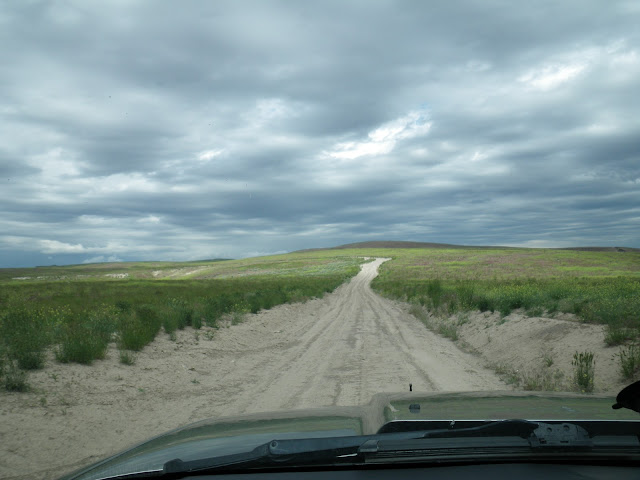
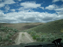
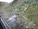
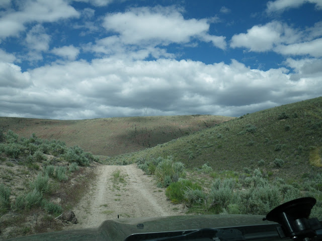
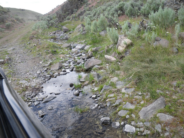
Green is the best description. June weather has been wet and the year has seen average to above average rainfall. Actually I think we already have the years annual rainfall in the bank. The roads were pretty rough , but packed and only a few small mud puddles.
We arrived to find Nate's trailer there. I recognized the tent and Washington plates confirmed it was theirs.
This was a Sunday afternoon , so I was surprised to see a motor-home across the road. We had a neighbor.
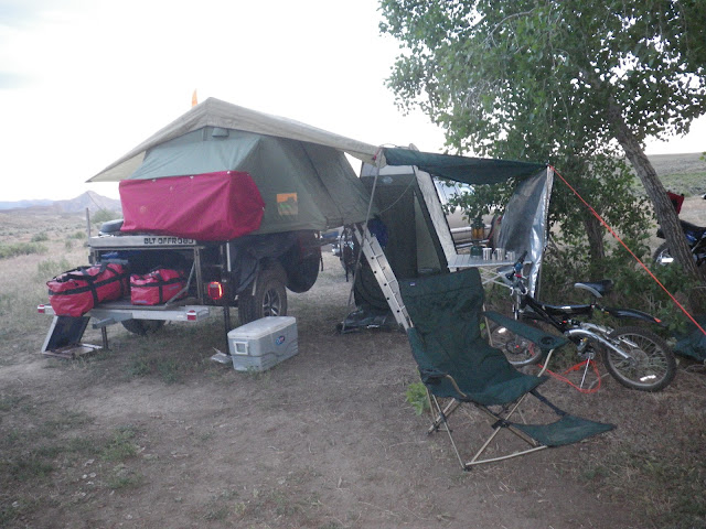
Arriving late we set up camp and took a little short ride on the bikes.

Dogs and chili for dinner. Popcorn for desert. Jiffy Pop over the campfire works great.
Sprinkled rain showers, thunder and a little lightning kept us dashing for cover while trying to get dinner together.
Our son had the stomach flu. The night before he had a fever and we thought we might have to cancel. It broke and he did feel better. Arriving at camp the stomach turned and the "scoots" took over. Not a happy camper.
We feared that we would need to pack up and head home in the morning if he was not better. Camping is not fair when you are young and miserable.
Morning brought relief. A steady stomach and blue skies. Our goal was Dry Creek Cache. the fastest way there turned out to be a bit of a Goose chase. A small reservoir had been built where a road used to run.
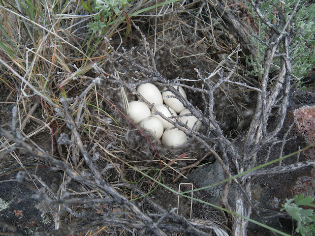
This little water hole was pretty nasty, but this little Teal calls it home.
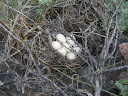
We were a bit shocked to see a duck pop out from the brush.
We ended up going far west to find a way east and south to the cave. It was not a bad journey and we were happy to find a few caches hidden along the way.

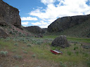
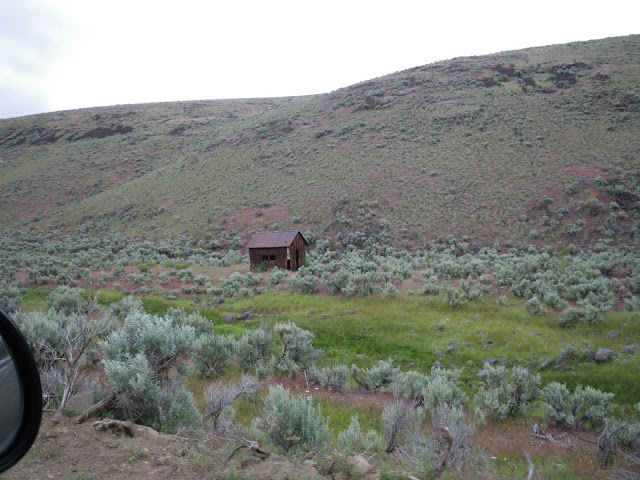
I had not approached Dry Creek Cave from this direction before. It was a small hike down from the top. Much has changed. Someone had been in there and fenced off a water hole that appeared to be full of blue algae. They left their trailer there too.
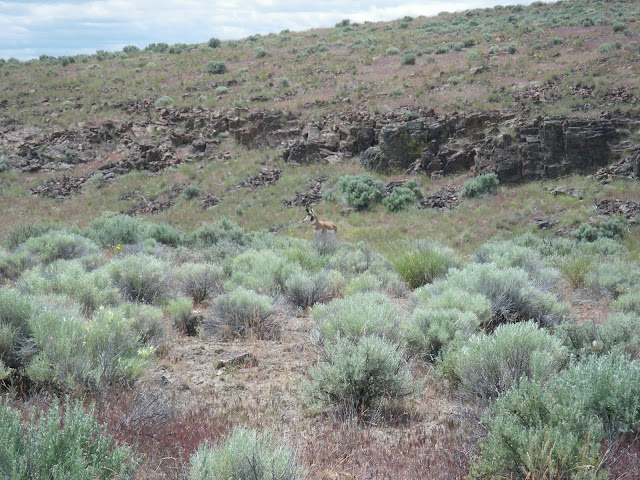
After checking out our cache and freshening it up a bit we decided it was best to skip the trip to the miners cabin. It was getting late and we had a long ride back to camp. Up on top we came across a healthy antelope.

It was intently watching the Cran Crew and paid no attention to us.
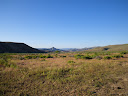
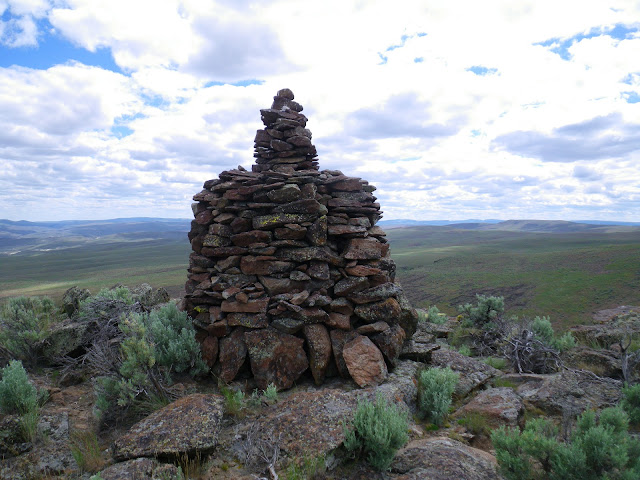
Along the horizon we had seen a pinnacle.
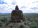
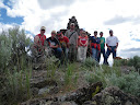
We took the time to check it out and decided to take a group photo. I have no idea "what, who or why". It did not show up on my maps.
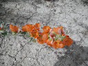
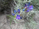
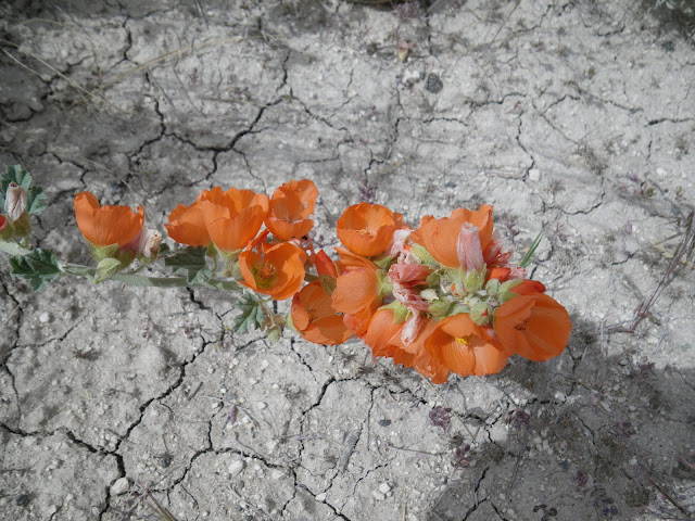
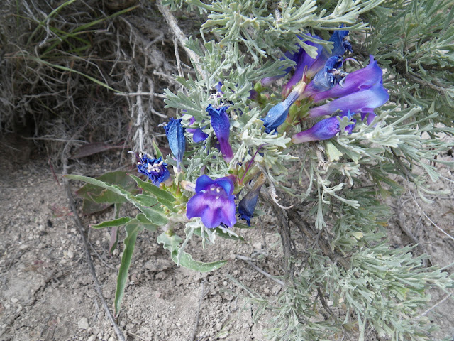
Wild flowers were everywhere. I did a poor job documenting all the varieties.
The road back was much more comfortable after taking time to air down and disconnect the sway bar. Floating over the terrain we made good time back to camp.
Back at camp we fixed pork fried noodles and thanks to Jacks salt, Brazillian BBQ. It turned out good, but not as good as I have had. I am still learning how to properly "spank the meat"") timing is everything. Still it was very good. A few beers and some wine shared we dined well. desert was Smores tonight.
timing is everything. Still it was very good. A few beers and some wine shared we dined well. desert was Smores tonight.
We had a visitor to the smore fire.
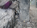
This lizard was probably nine inches long and well fed on all the ants this year. We were afraid it would crawl through that hole into the fire we had roaring on the inside. I guess the warmth just felt good.
With obligations at home the next day and the Cran Crew eager to make Salt Lake City the next day we planned to pack out early.
The night brought out the Night hawks and a pair of barn owls. No bats tonight. No coyotes on this trip. to bed we went.
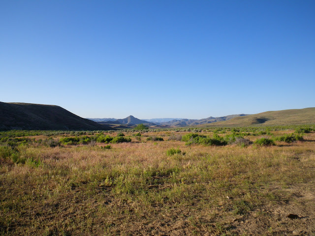
Morning brought the crystal clear skies and probably the best weather of the trip.
Homeward bound. We took the road north to Vale as our exit. It is longer, but was in better condition. We made good time back.
What did we learn.
The solar panels ROCK. I may retire the generator to the garage.
My awning plan sucks. A new Camping labs awning is on the way.
One bottle of propane per night that we need heat.
I need to look over my maps carefully. We did not take the trail that I had planned. That led to a long drive and not much time to explore.
The tracking works great. Very useful.
Bug spray. I have it. USE IT. I had two ticks. E had one, J five and our dog Entei one.
I think we are all still itchy after that.
Things are becoming clearer on what works.
Picassa album
The trip started much later than anticipated. We were ready to leave by 8:00 but JERM had a late night and did not arrive until closer to noon. By the time we hit Twin springs the first day was pretty well done.
Green is the best description. June weather has been wet and the year has seen average to above average rainfall. Actually I think we already have the years annual rainfall in the bank. The roads were pretty rough , but packed and only a few small mud puddles.
We arrived to find Nate's trailer there. I recognized the tent and Washington plates confirmed it was theirs.
This was a Sunday afternoon , so I was surprised to see a motor-home across the road. We had a neighbor.
Arriving late we set up camp and took a little short ride on the bikes.
Dogs and chili for dinner. Popcorn for desert. Jiffy Pop over the campfire works great.
Sprinkled rain showers, thunder and a little lightning kept us dashing for cover while trying to get dinner together.
Our son had the stomach flu. The night before he had a fever and we thought we might have to cancel. It broke and he did feel better. Arriving at camp the stomach turned and the "scoots" took over. Not a happy camper.
We feared that we would need to pack up and head home in the morning if he was not better. Camping is not fair when you are young and miserable.
Morning brought relief. A steady stomach and blue skies. Our goal was Dry Creek Cache. the fastest way there turned out to be a bit of a Goose chase. A small reservoir had been built where a road used to run.
This little water hole was pretty nasty, but this little Teal calls it home.
We were a bit shocked to see a duck pop out from the brush.
We ended up going far west to find a way east and south to the cave. It was not a bad journey and we were happy to find a few caches hidden along the way.
I had not approached Dry Creek Cave from this direction before. It was a small hike down from the top. Much has changed. Someone had been in there and fenced off a water hole that appeared to be full of blue algae. They left their trailer there too.

After checking out our cache and freshening it up a bit we decided it was best to skip the trip to the miners cabin. It was getting late and we had a long ride back to camp. Up on top we came across a healthy antelope.
It was intently watching the Cran Crew and paid no attention to us.
Along the horizon we had seen a pinnacle.
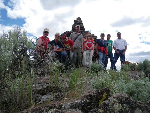
We took the time to check it out and decided to take a group photo. I have no idea "what, who or why". It did not show up on my maps.
Wild flowers were everywhere. I did a poor job documenting all the varieties.
The road back was much more comfortable after taking time to air down and disconnect the sway bar. Floating over the terrain we made good time back to camp.
Back at camp we fixed pork fried noodles and thanks to Jacks salt, Brazillian BBQ. It turned out good, but not as good as I have had. I am still learning how to properly "spank the meat"
timing is everything. Still it was very good. A few beers and some wine shared we dined well. desert was Smores tonight.We had a visitor to the smore fire.
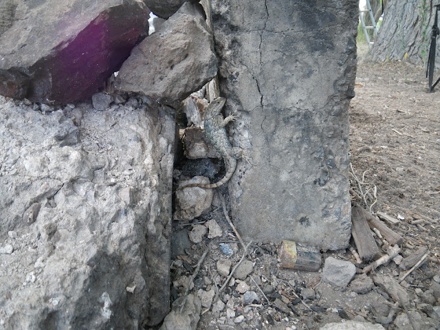
This lizard was probably nine inches long and well fed on all the ants this year. We were afraid it would crawl through that hole into the fire we had roaring on the inside. I guess the warmth just felt good.
With obligations at home the next day and the Cran Crew eager to make Salt Lake City the next day we planned to pack out early.
The night brought out the Night hawks and a pair of barn owls. No bats tonight. No coyotes on this trip. to bed we went.
Morning brought the crystal clear skies and probably the best weather of the trip.
Homeward bound. We took the road north to Vale as our exit. It is longer, but was in better condition. We made good time back.
What did we learn.
The solar panels ROCK. I may retire the generator to the garage.
My awning plan sucks. A new Camping labs awning is on the way.
One bottle of propane per night that we need heat.
I need to look over my maps carefully. We did not take the trail that I had planned. That led to a long drive and not much time to explore.
The tracking works great. Very useful.
Bug spray. I have it. USE IT. I had two ticks. E had one, J five and our dog Entei one.
I think we are all still itchy after that.
Things are becoming clearer on what works.