Garmin GPSMAP 276C

cshontz

Supporting Sponsor
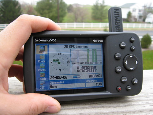
I published a blog entry about my new 276C. Its just a blurb that presents its fundamental features and some of my general opinions. Hopefully, it will help inform folks who are looking for a new GPS.

http://ixplor.us/index.php?/garmin_gpsmap_276c/

Here are pictures if you think I write like I'm constipated.

http://www.flickr.com/photos/cshontz/sets/72157594399935028/

Anyway, I got this at the end of November, and I love it. I sent my proof of purchase in for the $100 rebate, but I haven't seen it yet. No rush, but that'll be sweet.

335470743_cc66173d41.jpg


Bummed out that (as my blog entry states) the built-in basemap is so lame. I knew it allowed the upload of more detailed basemaps, so I wasn't too concerned. I just thought it'd would be slightly better out-of-box. Its only a very slight improvement over my 12 year old GPSIII.

Also bummed out that I have to purchase expensive proprietary memory to even upload a basemap ... oh, and purchase a pricey MapSource basemap software CD as well! I guess the moral of the story is: be prepared to shell out $200 (memory and software) on top of the $600 GPS for decent basemaps.

I'd use the rebate money to get memory or something, but I got burnt by the man months ago and had to tap into our savings, so I owe us. I've put it off too long already.
310834858_c675b54648.jpg


Not to be totally negative about the thing - I really should've put the negative comments toward the end of the post, because I'm really extremely happy with the GPS. Great ergonomics, utility, versatility, nice and accurate, plenty bright ... became self-aware and took control of my Jeep. I cannot wait to get a big ol' $140 512mb memory card (or two) loaded with detailed street and topo maps.

I love it, love it, love it, love it, love it ... and I love maps and GPSr's and everything of the sort.

I give it 5 mounties. (really 4.5, but there are no half-mounties)

:26_7_2: :26_7_2: :26_7_2: :26_7_2: :26_7_2:
 

dhackney

Expedition Leader
I started with a Garmin III+, then moved up to V. We used the V to explore some places around the world (http://www.hackneys.com/travel) on various motorcycles.

We recently moved up to a 276c in preparation for an upcoming expedition. We tested the 276c with a month long trip to British Columbia, Canada and a multi-month cross-country trek from San Diego to CO to MN to TX to MS to AL to TN to AR to MN to AR and back to CA.

We purchased the West Marine branded 276c as it contains a few additional marine features we hope to use in future charters. BTW, a 376 is really the way to go if you are staying in the US as it supports XM weather - real time weather & radar is VERY COOL if you are a sailor and could also be very important for back country expeditions and adventures.

Upside to 276c vs. V :
- USB connection - much nicer to carry a single, small cable than a clunky serial to USB converter, much higher data transfer rates = quicker download and upload times
- large, color screen - size and color is much easier for me to read at speed (or at stop these days...)
- more memory - larger map sets can be loaded into the 276c and a larger track point set can be stored and later downloaded into your laptop, more waypoint capacity
- faster operation - boot up, acquisition, route calculation, etc. all are significantly faster, very fast on course calculation (off road & water)
- proprietary battery - smaller form factor and long life, provides more current capacity required for large color display
- greatly expanded secondary data sets (tide tables, etc.)
- nice features - auto switch to night lighting at local sundown, etc.

Downside to 276c vs. V :
- single orientation - there is no way to rotate the display, so you are limited to horizontal mounting, this can be a limitation on a bike
- proprietary battery - with a V you could always put in some AAs and make it back (assuming you had some good alkalines available - not a sure bet in other countries)
- size and weight - larger and heavier than a V, not as easy to stick into your jacket pocket when you dismount off the bike, not as much of an issue in a truck cab, weight affects dash pad mounting in terms of mass, especially during deceleration, needs a secure mounting point, don't count on a cigarette lighter type mount
- route guideance - this was useless beyond major cities, points of interest, interstate exits, etc. The address database never once had our destination available in over three months of daily use. This was by far the biggest disappointment of this unit. Be very, very wary of justifying any portion of the $ for this unit with your wife/partner/SO by touting "it will guide us anywhere." It will guide you basically nowhere past the exit. We didn't bother to take the 276 with us to Europe for this reason, even after we'd spent the money for the Europe street level routing maps. We do not plan to utilize this feature (no maps available with street routing) for our expedition, so it's not a deal killer for that application. For "take me to this address" capability it does not even equal the system we had in our 2000 BMW 5 series, which would be about 7-8 year old technology by now.


If you have no existing investment in Garmin, i.e. knowing the menu structure and the PC software, then I couldn't recomend the 276 as an "input a street address - take me there" system.

If you are:
- not buying the unit for that purpose
- not selling your wife/partner/SO on the purchase based on that capability
- using the unit in areas where there are not street level routing maps available
- sailing/boating and buying the 276c West Marine branded model
- looking for a large display, color, fully capable GPS
- looking to leverage an existing investment in Garmin software, tracks, waypoints, UI experience, etc.

then I think it's a solid choice.


Basemap
Regarding the basemap, we found the global basemap for the V to be pretty amazing. We were on very remote two tracks in Africa and the Middle East and they were on the Garmin basemap. It's not always spot on, for instance it was certain we were riding through Tokyo Bay, but it had the tiny little forest roads we found up in the mountains of Japan.

It will never be the street level, Roads & Rec or Topo level we are used to here in North America, but for finding your way back to a baseline route (river, railroad, major road) it did what we needed it to wherever we were, from the 11k ft passes of the Himalayas to the Syrian desert.
 

cshontz

Supporting Sponsor
All excellent points! :)

Regarding the route guidance capability, shouldn't that function much more effectively with the MapSource City Navigator basemap data? Because, I agree, out-of-box the street-level routing capabilities are near useless.

Also, we should mention the 276C comes with a power/data cable that allows you to operate the GPS off your vehicle's power. In this case, the unit does not require a battery - although its still very nice to have.
 

dhackney

Expedition Leader
Chris,

All of our "input an address and take me there" testing was done with the Garmin street level route guidance map sets, i.e. City Navigator North America. Our results were so poor with the NA product we didn't bother loading and testing City Navigator Europe while we were there.

We found the street address database to be entirely inadequate in this type of use. By this I mean inputting "323 Main Street, Santa Barbara, CA" into the 276 and having it guide us to that address. Not once in three months of usage did the 276 ever have the street address we were looking for. Admitidly, after a few weeks of frustration we didn't try every address anymore. I would test it once a week or so just out of curiosity to see if we could ever get anything to come up.

For all other types of information, i.e. next fuel available, restaurant, hotel, etc. the database was adequate.

Battery use will be of most use for people on rental motorcycles or if they use the unit as their only GPS and need to dismount it from a vehicle for hiking, kayaking, etc.

Doug
 

Desertdude

Expedition Leader
Hmmm... I have had great luck in NA with turn by turn directions and the detour functions with the Cities Select CD sold by Garmin - I am always impressed by the GPS ability to get me somewhere turn by turn

I do have a few issues;

(1)do not like the stupoid "1980" memory card 256 MB (how dated)

(2) the glossy screen is hard to read in the sun ( it says anti glare)

(3) the car adapter speaker plug on the GPS side is prone to early breakage due to the angle plug and constant removal

other than that is has been good to me
 

dhackney

Expedition Leader
Desertdude said:
had great luck in NA with turn by turn directions and the detour functions with the Cities Select CD sold by Garmin

Please note that we also had good luck with the actual turn by turn directions, that was not the issue we stuggled with.

The only major flaw we found in the product is that the database of available street addresses you can select to have the device guide you to is dismal. If you can find your target in the database, I believe it will successfully guide you to it. The challenge is that we never once had a street address we wanted to find that existed in the database.

I would normally write this off to ESO (Equipment Smarter than Operator), but I was so frustrated with it I cracked open the manual, studied, researched and tried every which way but Sunday to make this a success. Not that the endless reminders of the purchase decision being soley mine from the passenger seat had anything to do with it... :rolleyes:
 

Desertdude

Expedition Leader
Big Smile :) I see... I am with you now.

I have messed with the address locater on many occasions - it was a 50/50 deal - sometimes it would find the address/street/number. What is frustrating is trying to type in the address, this takes dedicated patience.
...and sometimes it would not let go of a previuos city location in order to find and address close to where you are now located :)
 

Forum statistics

Threads
188,279
Messages
2,904,806
Members
229,953
Latest member
Mp3phelan
Top