FortyMileDesert
Adventurer
Land Rover Trek Number 159 – Another Monte-Disco Production – 2009 August 8.
Four Mile Flat, Five Mile Canyon, Red Ant Mines, Sand Springs Mountains, Arterial Canyon, the granite south of Lucky Boy Canyon, spring south even further, Fairview Valley Bombing Range, North Stillwater Pass, the canyon south of La Plata, Mountain Well, Diamond Canyon, Rainbow Mountain, and Wyemaha Valley - - Just thought that I would throw in an all-encompassing title there - -
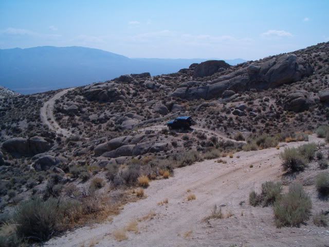
Up at 6:30, on the road at 7:00, breakfast at Jerry’s in Fallon and finally heading east on 50 by 7:45. Just past Sand Mountain we turn south onto dirt crossing the east end of Four Mile Flat. We both air down to 25psig. That’s pretty moderate but should do the job all day in the mix of sand, gravel and rocks we’ll be in all day. Then it’s passing Atomic Well, Wightmans Well, Roy’s Well and into Four Mile Canyon. Then we begin a long winding climb up into the Sand Springs Range towards Aplite Ridge.
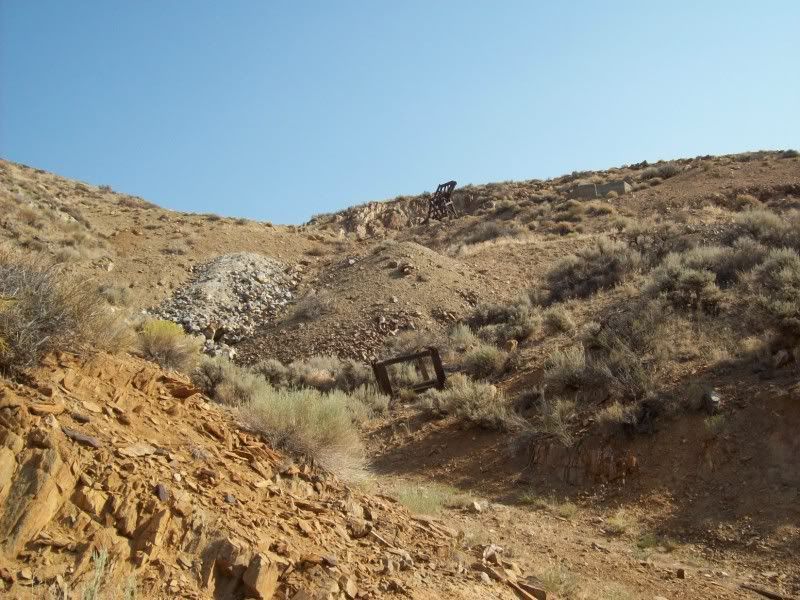
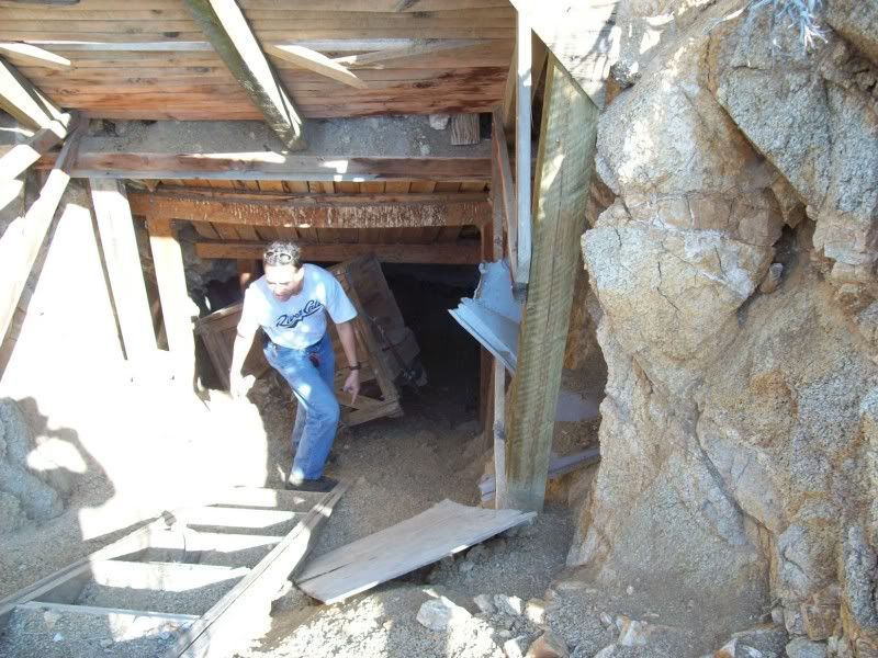
The first stop is at the Red Ant Mine for a very brief look-around and then loop down a steep slope and start looking for the hard to see trail that heads up a narrow wash to another mine site. After a very brief stop at that mine we continue on over a high ridge and then down past an old cabin and continue east again to the very strange mine with all of the chemical vats, tanks, barrels lots of frame structures that are so different than most mines that I have ever seen. The sure-footed Ben decides to climb down into the adit with what looks like an ore-car of sorts. As it turns out it is sort of an elevator car. It has wheels that run on wooden rails.
We investigate another side trail before heading back to the Red Ant Pass. At the top I look over another side trail that I had noticed on the map. In real life it looks too tame to bother with so we head down Arterial Canyon towards the Fairview Valley. While on top we can hear the roar of F-18s and what we think are bombs going off. More on that later. I let Ben lead for a while so I can get some photos of him.
We take a few shots at the dry granite fall; it changes a bit every time I’m here. Right now it is probably the easiest that it has ever been due to the storms we had in June taking out all of the loose boulders leaving just the granite bed-rock.
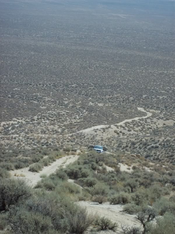
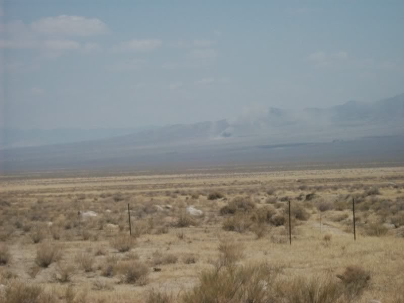
After leaving the canyon bottom and getting out onto the valley floor we can hear the jets again but cannot see them. Perhaps the visibility problems are due to the smoky haze coming from the big fires in Lassen National Forest over in California.
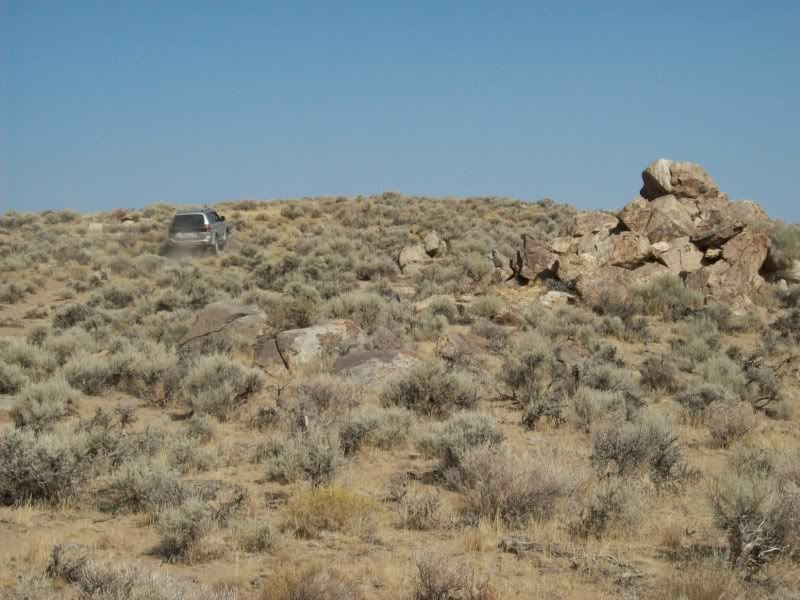
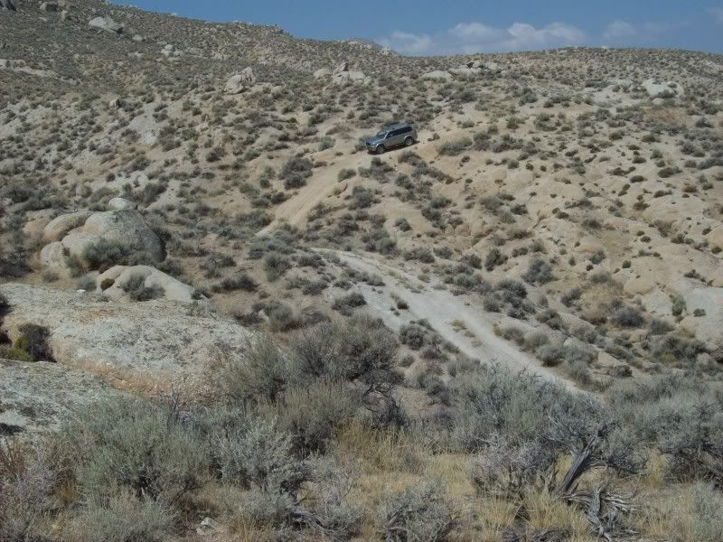
Next we head south past Lucky Boy Canyon for about a mile and begin the long steep up the granite to the peak with the very white quartz mine. We’re hearing the jets and bombs going off again. We still cannot see the planes but now we can see the bombs exploding on the other side of the valley. After a break at the quartz mine we crawl back down again to the valley floor. I spot a road that appears to go to another canyon to the south labeled “Spring”. What the heck; let’s go check it out.
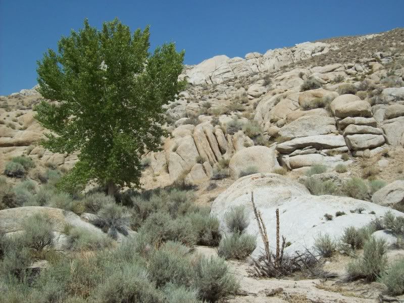
This canyon is very narrow between walls of granite boulders and has a sandy flat floor for very easy going. Less than half a mile into the canyon the trail is blocked by steel rail fences. The Nevada Wildlife Department has installed underground cisterns to hold the waters of the spring that is flowing out of the granite. There are several bird baths and the canyon has a large population of chukars and other game birds. We hike up the canyon for about a quarter mile. It’s pretty neat. Maybe I’ll have to come back some time and hike further up; according to the map it continues about two miles until it reaches cliffs below a 7122 foot peak.
We leave the canyon and travel north along the bombing range. We stop at one point to photograph the bombs exploding across the valley. We still only hear but never see the planes.
Crossing highway 50 we continue north along the west side of the Dixie Valley passing a couple of the bombing range radar sites and then we turn west up a trail that should possibly overlook sand mountain on the other side of the Stillwater Range.
The trail is soft crossing sand flats for the first two miles. Eventually we enter a canyon and pass over a low hill and meet a trail that is not on our maps. It turns out that this is a “recreational” trail that is part of the BLM Sand Mountain Recreation Area. There are steel posts with lots of warnings to not leave the marked trail about every 10 yards. I guess this was necessary to keep the dune buggies, motorcycles and ATVs from tearing up everything. The dunes on both sides of the trail are much scarred but it looks as if the vegetation is recovering pretty fast. After following this hemmed in trail for about a mile and a half; Ben and I have had enough and retrace our path back to the Dixie Valley.
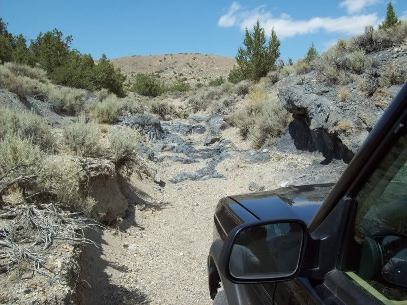
At the end of the bombing range road I have the choice of running up the wash to La Plata or taking a canyon south-west of it that will meet that trail near Mountain Well. As I have already been to La Plata a few times I take the other trail that I have not been on. This trail is more of a graded road. At a corral about 4 miles along the road I find a trail that runs up a dry wash. The wash trail only runs a bit over a mile through some pretty rough gravel, rocks and juniper trees and eventually just ends at some basalt outcroppings. I think I could have gotten over the rocks and continued another quarter mile but Ben is pretty sure that he cannot. We turn around and return to the road.
From the La Plata trail junction we head south-west down Mountain Well Canyon, then an un-named wash to Diamond Canyon Reservoir and then Diamond Canyon and eventually coming out at Diamond Well. Someone in the old days ran out of names?
After crossing an alkali flat we reach Rainbow Mountain. I take an un-mapped trail up to the copper prospects to play around a bit. Ben finds a rattlesnake and stops to get a couple pictures of it. From the prospects we cross Wyemaha Valley and eventually come out at the archaeological site at Grimes Point near Fallon.
We eventually get back to Fernley at about 5:00.
Four Mile Flat, Five Mile Canyon, Red Ant Mines, Sand Springs Mountains, Arterial Canyon, the granite south of Lucky Boy Canyon, spring south even further, Fairview Valley Bombing Range, North Stillwater Pass, the canyon south of La Plata, Mountain Well, Diamond Canyon, Rainbow Mountain, and Wyemaha Valley - - Just thought that I would throw in an all-encompassing title there - -
Up at 6:30, on the road at 7:00, breakfast at Jerry’s in Fallon and finally heading east on 50 by 7:45. Just past Sand Mountain we turn south onto dirt crossing the east end of Four Mile Flat. We both air down to 25psig. That’s pretty moderate but should do the job all day in the mix of sand, gravel and rocks we’ll be in all day. Then it’s passing Atomic Well, Wightmans Well, Roy’s Well and into Four Mile Canyon. Then we begin a long winding climb up into the Sand Springs Range towards Aplite Ridge.
The first stop is at the Red Ant Mine for a very brief look-around and then loop down a steep slope and start looking for the hard to see trail that heads up a narrow wash to another mine site. After a very brief stop at that mine we continue on over a high ridge and then down past an old cabin and continue east again to the very strange mine with all of the chemical vats, tanks, barrels lots of frame structures that are so different than most mines that I have ever seen. The sure-footed Ben decides to climb down into the adit with what looks like an ore-car of sorts. As it turns out it is sort of an elevator car. It has wheels that run on wooden rails.
We investigate another side trail before heading back to the Red Ant Pass. At the top I look over another side trail that I had noticed on the map. In real life it looks too tame to bother with so we head down Arterial Canyon towards the Fairview Valley. While on top we can hear the roar of F-18s and what we think are bombs going off. More on that later. I let Ben lead for a while so I can get some photos of him.
We take a few shots at the dry granite fall; it changes a bit every time I’m here. Right now it is probably the easiest that it has ever been due to the storms we had in June taking out all of the loose boulders leaving just the granite bed-rock.
After leaving the canyon bottom and getting out onto the valley floor we can hear the jets again but cannot see them. Perhaps the visibility problems are due to the smoky haze coming from the big fires in Lassen National Forest over in California.
Next we head south past Lucky Boy Canyon for about a mile and begin the long steep up the granite to the peak with the very white quartz mine. We’re hearing the jets and bombs going off again. We still cannot see the planes but now we can see the bombs exploding on the other side of the valley. After a break at the quartz mine we crawl back down again to the valley floor. I spot a road that appears to go to another canyon to the south labeled “Spring”. What the heck; let’s go check it out.
This canyon is very narrow between walls of granite boulders and has a sandy flat floor for very easy going. Less than half a mile into the canyon the trail is blocked by steel rail fences. The Nevada Wildlife Department has installed underground cisterns to hold the waters of the spring that is flowing out of the granite. There are several bird baths and the canyon has a large population of chukars and other game birds. We hike up the canyon for about a quarter mile. It’s pretty neat. Maybe I’ll have to come back some time and hike further up; according to the map it continues about two miles until it reaches cliffs below a 7122 foot peak.
We leave the canyon and travel north along the bombing range. We stop at one point to photograph the bombs exploding across the valley. We still only hear but never see the planes.
Crossing highway 50 we continue north along the west side of the Dixie Valley passing a couple of the bombing range radar sites and then we turn west up a trail that should possibly overlook sand mountain on the other side of the Stillwater Range.
The trail is soft crossing sand flats for the first two miles. Eventually we enter a canyon and pass over a low hill and meet a trail that is not on our maps. It turns out that this is a “recreational” trail that is part of the BLM Sand Mountain Recreation Area. There are steel posts with lots of warnings to not leave the marked trail about every 10 yards. I guess this was necessary to keep the dune buggies, motorcycles and ATVs from tearing up everything. The dunes on both sides of the trail are much scarred but it looks as if the vegetation is recovering pretty fast. After following this hemmed in trail for about a mile and a half; Ben and I have had enough and retrace our path back to the Dixie Valley.
At the end of the bombing range road I have the choice of running up the wash to La Plata or taking a canyon south-west of it that will meet that trail near Mountain Well. As I have already been to La Plata a few times I take the other trail that I have not been on. This trail is more of a graded road. At a corral about 4 miles along the road I find a trail that runs up a dry wash. The wash trail only runs a bit over a mile through some pretty rough gravel, rocks and juniper trees and eventually just ends at some basalt outcroppings. I think I could have gotten over the rocks and continued another quarter mile but Ben is pretty sure that he cannot. We turn around and return to the road.
From the La Plata trail junction we head south-west down Mountain Well Canyon, then an un-named wash to Diamond Canyon Reservoir and then Diamond Canyon and eventually coming out at Diamond Well. Someone in the old days ran out of names?
After crossing an alkali flat we reach Rainbow Mountain. I take an un-mapped trail up to the copper prospects to play around a bit. Ben finds a rattlesnake and stops to get a couple pictures of it. From the prospects we cross Wyemaha Valley and eventually come out at the archaeological site at Grimes Point near Fallon.
We eventually get back to Fernley at about 5:00.