Navigation - Best route to go?

flyingwil

Supporting Sponsor - Sierra Expeditions
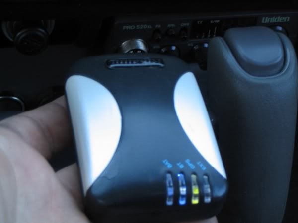
With my recent small fire (don't hard wire a cig adapter) it is time for me to rethink my navigation support.

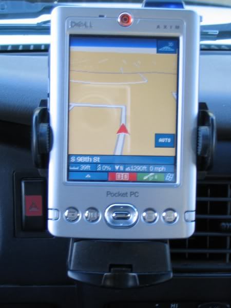
I am leaning towards the in vehicle PC because I think it might have greater versatility, and seems like the next step up from my previous Dell Axim 30, I was using.

PRO's:
  • more uses than a standalone GPS unit
  • Can update software
  • tons of memory
  • Internet
  • BT

CON's:
  • takes a bit to make HD and cause issues as the learning curve is made
  • No single out of the box unit
  • Dust and water might be an issue
  • Not portable, in the truck or not at all

Having NEVER used an actual GPS unit (garmin, ect.) I am afraid I might be disappointed. I have researched them and have it narrowed down to a Garmin 276c if I opt for that route.

I am very torn between a GPS unit or a in vehicle pc and thought I would open it up to discussion. If you had the opportunity to start all over right now what route would you go and why?
 

DaveInDenver

Middle Income Semi-Redneck
flyingwil said:
If you had the opportunity to start all over right now what route would you go and why?
Hmmm, not being a smoker I've never felt the least bit of a fire threat from my navigation system (maps and compass). Although I have been out a couple days past long than the beer supply lasted and looked quite longingly at the alcohol in my thermometer...

So, my vote is stick with maps. Little to no worry about fire, dead batteries, sun glare, dust, rain, Internet access, weight and space. Heck if the poop hits the fan, with a map you can make a fire happen with minimal financial impact when you'd really need it! But that's not to say people shouldn't buy GPS, a healthy market for them helps make it so I can afford to eat. So in the interest of getting my 22R-E rebuilt, I say get that Garmin. :)
 

Robthebrit

Explorer
I am sure there are as many different opinions as there are people, if you do a PC then preventing it from being stolen is difficult if you use a laptop and I am not too keen on vehicle PCs.

How about the half way house of a PDA with GPS software? They are light, easy to mount, easy to take with you and much more durable than a PC. Pretty much everything I do with my laptop when in a remote area I could do with a PDA. The only thing that a PDA could not do is take photos off the camera and store them. I have considered switching many times but as of yet have not done anything..

The laptop I use is an old 7 series Sony Vaio, its only got 256Mb of memory, 20Gb drive and a 800Mhz processor but its tiny, it runs XP and is real easy to mount. Its so old that if it breaks I don't care, I have dropped it out of the mog a couple of times and it still lives. Nobody has stolen it yet but its too high to see and its also bolted to the truck pretty well (now all you guys know where it is!)

I don't always take the PC so I also have a USB GPS unit which I always take (it has XM radio), sometimes I link the GPS to the PC for live tracking on the PC. The PC screen is usually easier to read but in bright sunlight you cannot see nothing, the standalone GPS is much easier to read as its designed for this scenario. The GPS software for PCs is not really any different from that in the standalone units. I have sometimes used topofusion with live tracking and have pre-downloaded the relevent USGS topo maps before leaving home. Its nice to have a moving topo map. This is somethine else that a standalone unit or a PDA will have trouble doing due to the storage requirements.

If you have a standalone GPS you can always get your tracks out of it when you get home. Mine easily stores 1000 miles worth of tracks even at mog speed so filling the memory is not really an issue. The maps in a GPS unit are suprisingly good, mine has all the roads in and around death valley as well as pretty much all the 'named' trails.

Rob
 

whitethaiger

Adventurer
Only you can decide what's the best route to go, it's different for everyone.

You've seen my setup with the notebook, 17" screen behind the seats, rollable keyboard and the thumb mouse. I use a Magellan SportTrack Map GPS. It has topo map capability (great for hiking) and mostly serves as antenna for the OziExplorer, which runs on the notebook.

I prefer the notebook over a truck PC since I can use it when not on trips. On trips it's also easy to remove to
  • view pictures of the day with others
  • review/plan tracks for hiking with others
  • take into a motel room to get on the net
I do carry at least some paper maps just in case.

There is a learning curve, but it's really not that bad, particularly since you have people around here who are familiar with the various pieces and it's easy to get help.

If you use a PC with Ozi I have complete map sets for the key states (AZ, UT, CO, NM, CA, NV). These are plug and play for Ozi. I really need to update my website with info on these DVD sets.:rolleyes:

So, the best route may be to sit down and think about what you really want from the system. Ultimately it's a tool and it has to be useful to you.
 

flyingwil

Supporting Sponsor - Sierra Expeditions
For navigation was using a Dell Axim X30H PDA, and a Bluetooth GPS. I modifed a glass powered PDA mount and mounted to where the air bag selector witch would be in a mini or a xtra cab, and that caught on fire...
IMG_0555.jpg


IMG_0551.jpg


The above photo was my PDA running OnCourse Navigator, which will automatically direct you to your destination along with voice prompts. Used for street and most trails.

The Rikaline GPS is tweeked for accuracy while flying... (I use Pocket FMS) and I learned has to be retweeked during ground usage, with OutDoor Navigator.

With the PDA I was able to use Bluetooth to access the Internet and surf the web and download Topo's.
 

valentine

New member
whitethaiger said:
Only you can decide what's the best route to go, it's different for everyone.

You've seen my setup with the notebook, 17" screen behind the seats, rollable keyboard and the thumb mouse. I use a Magellan SportTrack Map GPS. It has topo map capability (great for hiking) and mostly serves as antenna for the OziExplorer, which runs on the notebook.

I prefer the notebook over a truck PC since I can use it when not on trips. On trips it's also easy to remove to
  • view pictures of the day with others
  • review/plan tracks for hiking with others
  • take into a motel room to get on the net
I do carry at least some paper maps just in case.

There is a learning curve, but it's really not that bad, particularly since you have people around here who are familiar with the various pieces and it's easy to get help.

If you use a PC with Ozi I have complete map sets for the key states (AZ, UT, CO, NM, CA, NV). These are plug and play for Ozi. I really need to update my website with info on these DVD sets.:rolleyes:

So, the best route may be to sit down and think about what you really want from the system. Ultimately it's a tool and it has to be useful to you.

I have the SportTrack Pro & was wondering if it was as simple as hooking this
magpccombo.jpg
cable from the Magellan to the laptop?

Is there anything else I need to do?


Thanks
 

whitethaiger

Adventurer
First off, welcome to the forum!

valentine said:
I have the SportTrack Pro & was wondering if it was as simple as hooking this ... cable from the Magellan to the laptop?

Is there anything else I need to do?

To get the GPS data to the laptop that's all you have to do. If your laptop does not have a serial port you would need one of those Serial-to-USB converters (that's what I have to do).

Then things depend on which software you are using. At the very minimum you probably have to tell the software at which port the GPS is connected. Programs like Ozi let you select the model of a GPS. This is mainly for special communication like sending/getting tracks, waypoints, routes, etc.

A couple of common trouble shouting issues for first time connection:
1) remember to set your GPS to send NMEA data, I don't know if that's turned on by default.
2) verify that GPS and mapping software are using the same baud rate
 

BajaTaco

Swashbuckler
I agree with WT. It's a personal decision. I can say this - that everyone I know, who has used both a proprietary map (Garmin, Magellan, Lowrance, etc) and a PC based system running Ozi and other map programs of their choice, like the PC based stuff the best.

As a result, I decided to forego the investment for a proprietary system (though I still have my Magellan handheld) and use a PC based system. I needed to get a notebook anyway, so why not use it in the truck and enjoy all of the benefits? I decided on a "convertible" notebook that converts to a tablet. Hopefully this configuration will be more useful in the truck. A dedicated car PC would be nice, but I need the mobility and can't afford both. WT had some very good points about being able to use a removeable PC for different things when on a trip.

valentine, welcome to the forum.
 

pwc

Explorer
Wil, I'd start with your requirements and that might help lead you to which is better for you. Some questions:

- Do you want to remove it from the truck for hikes/walkabouts?
- Is ability for a co-pilot to easily use it important?
- How much information (track logs, waypoints, etc...) would you typically store on a trip?
- What kind of map detail is important to you and where would you get it from?
- Do you already perform other functions the PC can do (email, journalling, etc...) in some other form?
- Which is easier to secure from theft?

I kinda went down this list and ended up going with a handheld Garmin 76cxs, athough I still like the idea of a car computer. In the end, portability for hikes and kayak won out over something more robust in the cab. Plus I didn't want to go through the effort of piecing it together and spend that time on more valuable projects.
 

valentine

New member
Thanks for the replys!

I'm glad I stumbled on the link from the IH8Mud forum..

WT your info on the hook-up helps alot. I will be buying the cable soon.

I bought an older dell laptop that is going to be used only for our offroading/travel trips for pic storage & gps.

I have an '87 Land Cruiser, '97 Land Cruiser and '84 Toyota Pick-up.

I'm setting the '97 up for "expeditions" that will probably consist of weekend mine camp scouting trips etc. with the family. (Wife & 3 boys)

The '87 will be my bash'em up wheeler, and the pick-up is my work truck/ light duty wheeler....

I know absolutely nothing about gps/laptop use, and the only way I can see to figure it out is to jump right in and see what happens.

Baja, I might go to the pc based system if this works out ok. I just don't want to invest more $$ if I end up not using it alot.. And as of right now, I don't know if there are any benefits over what I already have.. Search will be my friend for a while.

pwc, Good points. I really need to trudge thru this forum to find the options that are out there before I can even start to answer those questions. :)

I do like the portability of my gps, but would like a bigger screen & as I learn, more options.....

WT, Baja & pwc, thanks for all your input I've already learned alot but still have a long way to go.
 

erin

Explorer
Lets not forget the system used to win the Expo Nav course! The lower end GPS combined with a laptop was a really effective setup, allowing Tacozona and Blake to do really well. Plus I really like the increased screen size it offers also, without having to constantly scroll around or minimze so much that you lose detail.
 

Forum statistics

Threads
189,958
Messages
2,922,663
Members
233,207
Latest member
Goldenbora
Top