77blazerchalet
Former Chalet owner
Well, the ol' Chalet still sits idle in an RV lot, exercised occasionally but still the victim of underbudgeted intentions. So, I hired my SOA friends again for two tours, and otherwise walked instead. Here's three brief sets of walking tour pics. Click on each to enlarge.
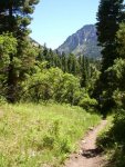
First, one trail to the Portland Mine starts right at the edge of the Amphitheater Forest Service campground above Ouray where I camped the whole week. It's a great walk through the forest most of the way.

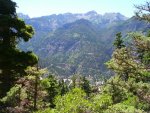
There's occasional glimpses of Ouray to the west.

And near the end, you cross the creek, head up the 4x4 road, and end up at the Portland, where what's left of the mine cart tracks point to the caved in entrance.

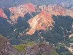
Next, a great view from last year's jeep tour over Imogene showed an intriguing road across the lowest of the talus slopes of Red Mountain #2 (just below center, slightly left), and I made a mental note to check it out this year.

So, parking just off the 550 road where one road accesses the Red Mountain/Guston mining district, I walked a short distance to this spot, and shot toward the west.

One level up and a bit further east was this mine dump. The spot in the Imogene overlook photo would be at the upper left.

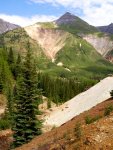
And finally to the aforementioned road across the talus slope. Looking southwest....

and northeast. The road continues through the trees, dead ending in a marshy meadow with large amounts of cut down old trees. I assume I was one level too far up from the remains of the Silverton Railroad turntable.

Finally, using the suggestion by "IntrepidXJ" about the condition of the road in Maggie Gulch last year, I parked at the base of it and walked up to the most scenic part of it. Turns out is is still so smooth that I could have driven my lowered VW GTI beyond this point at least two more curves, and parked at the fork in the road where the lower goes over to the base of the falls, and the upper goes up the shelf road.

View back down to the prior photo spot.

First, one trail to the Portland Mine starts right at the edge of the Amphitheater Forest Service campground above Ouray where I camped the whole week. It's a great walk through the forest most of the way.

There's occasional glimpses of Ouray to the west.

And near the end, you cross the creek, head up the 4x4 road, and end up at the Portland, where what's left of the mine cart tracks point to the caved in entrance.

Next, a great view from last year's jeep tour over Imogene showed an intriguing road across the lowest of the talus slopes of Red Mountain #2 (just below center, slightly left), and I made a mental note to check it out this year.

So, parking just off the 550 road where one road accesses the Red Mountain/Guston mining district, I walked a short distance to this spot, and shot toward the west.

One level up and a bit further east was this mine dump. The spot in the Imogene overlook photo would be at the upper left.

And finally to the aforementioned road across the talus slope. Looking southwest....
and northeast. The road continues through the trees, dead ending in a marshy meadow with large amounts of cut down old trees. I assume I was one level too far up from the remains of the Silverton Railroad turntable.
Finally, using the suggestion by "IntrepidXJ" about the condition of the road in Maggie Gulch last year, I parked at the base of it and walked up to the most scenic part of it. Turns out is is still so smooth that I could have driven my lowered VW GTI beyond this point at least two more curves, and parked at the fork in the road where the lower goes over to the base of the falls, and the upper goes up the shelf road.

View back down to the prior photo spot.

Last edited:

