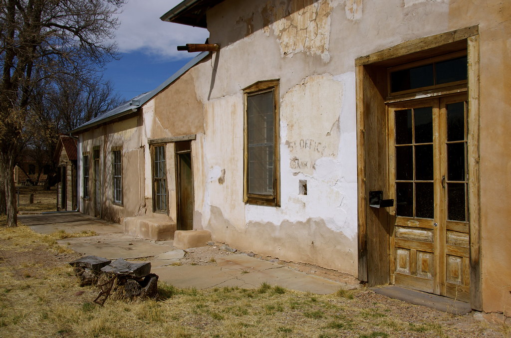
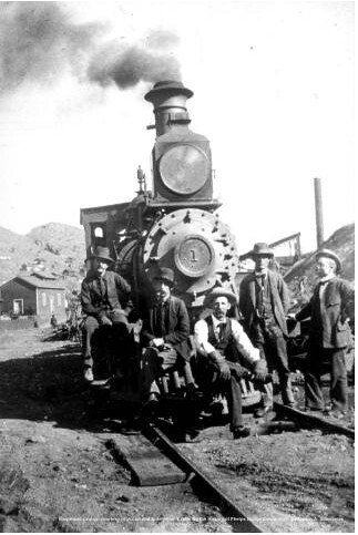
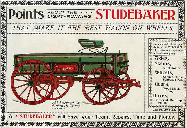
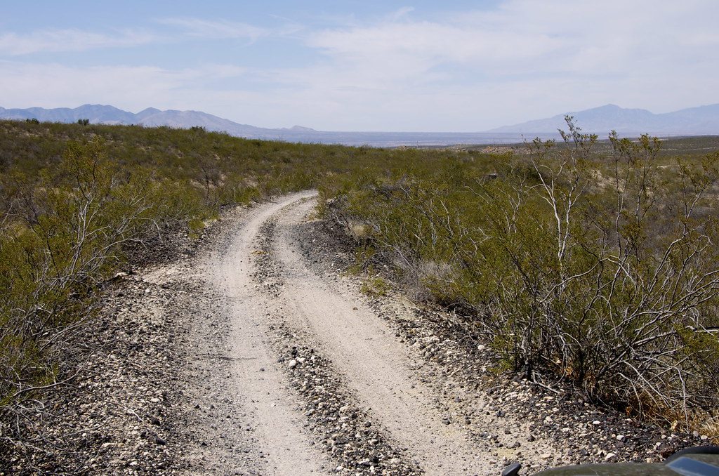
Overland Frontier: American Southwest to Canadian Northwest Expedition

mercier@streetsmart.ca

Expedition Scout
While searching for the most interesting historical routes on the continent, we discovered a series of dirt-sand-rock trails that can be interlinked across Arizona, Utah, Colorado, Wyoming, Montana, Alberta and British Columbia. This, the second half of a Trans American Loop, links to a route already scouted, mapped and documented from California, Nevada, Oregon, Idaho and British Columbia, that is over 80% dirt (see “Ultimate Expedition To/From Overland Expo”, thread in Forum and Expeditions on OverlandFrontier.com). When complete, final links in BC's Inside Passage, Yukon Territories Alaska and Baja-Mexican mainland will connect the Three Nation Expedition Loop Route.

Arizona Territory Wild West Journey

The first sequential Arizona Overland Frontier Journey was planned to start a few miles above the Mexican-Arizona border near Bisbee so it could link directly to a Mexican Journey. But after reading the captivating New York Times Bestseller, “The Last Gunfight”, it became obvious that a documentary on the old West should start in Tombstone, where global fascination with the American Wild West was sparked when the Earp Brothers, Doc Holiday and the Texas Cowboys would square off at OK Corral, in 1881.

Leg 1: Tombstone & The Texas Cowboy Gunfight at OK Corral.

My first visit to Tombstone was not love at first sight. To be fair, it was a weekend. A quick glimpse of tourist crowds, rows of souvenir shops, I took a few photos and hightailed it out town, 23 miles south to explore the incredibly preserved frontier border town of Bisbee and the equally frozen-in-time 40's ghost town of Lowell, a great springboard to the abandoned High Lonesome Road to the Gleeson - Pearce Ghost Town Road.

As always, while scouting trails for Overland Frontier, we look to travel across Old West Frontiers rich with interesting trails, tales and relics. The book “The Last Gunfight” and subsequent research provided context and helped me see Tombstone differently as I walked the streets – this time on a weekday – a much better experience.

Tombstone, the ‘Town To Tough To Die', continues to celebrate its colorful past. The Bucket of Blood Saloon survives, one of 100 saloons that once lined the streets after the silver strike of 1877. Today it is the Longhorn Restaurant.
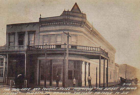

Bucket of Blood Saloon, later the renamed a more tourist friendly, Owl Hotel. by Overland Frontier, on Flickr

Drifting from one old West boomtown to another was not only common for prospectors, but also for gamblers, promoters, merchants and even lawman. The Earp brothers were no different and Tombstone was being taken over by Texas Cowboys outlaw gang.
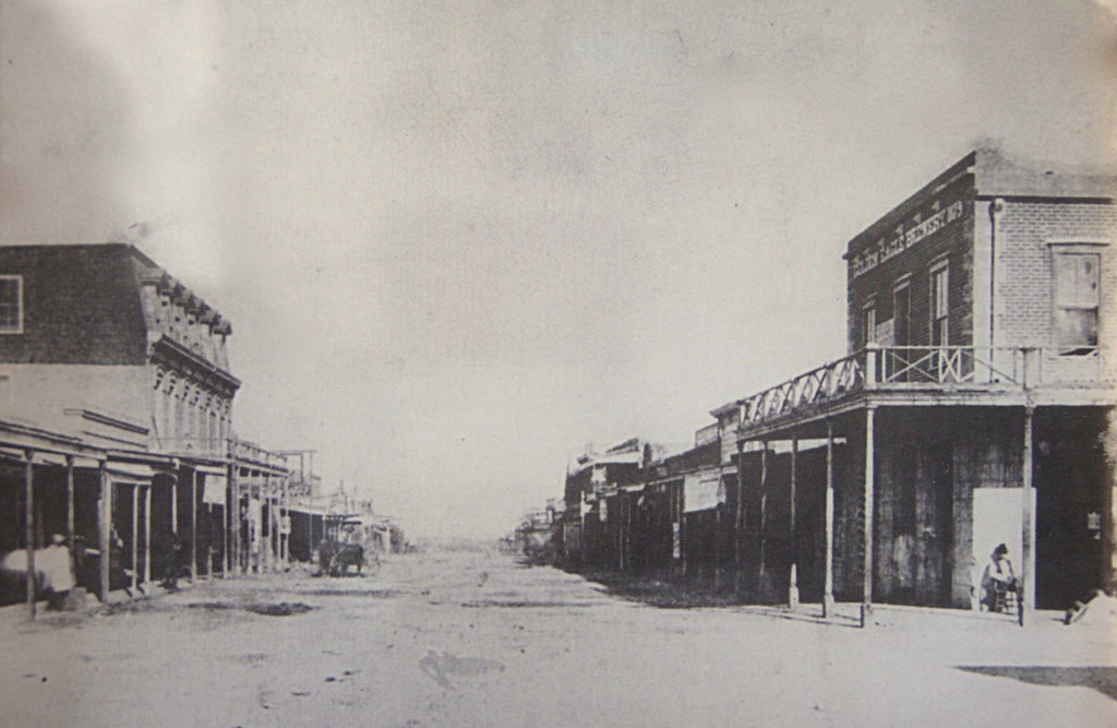

Tombstone, AZ 1882. by Overland Frontier, on Flickr

The shine was coming off Dodge City. Virgil, the first of the Earp's to move his badge, won a high profile US Deputy Marshal position and had an office over the Crystal Palace Saloon. Soon brothers Wyatt, James and Morgan followed.
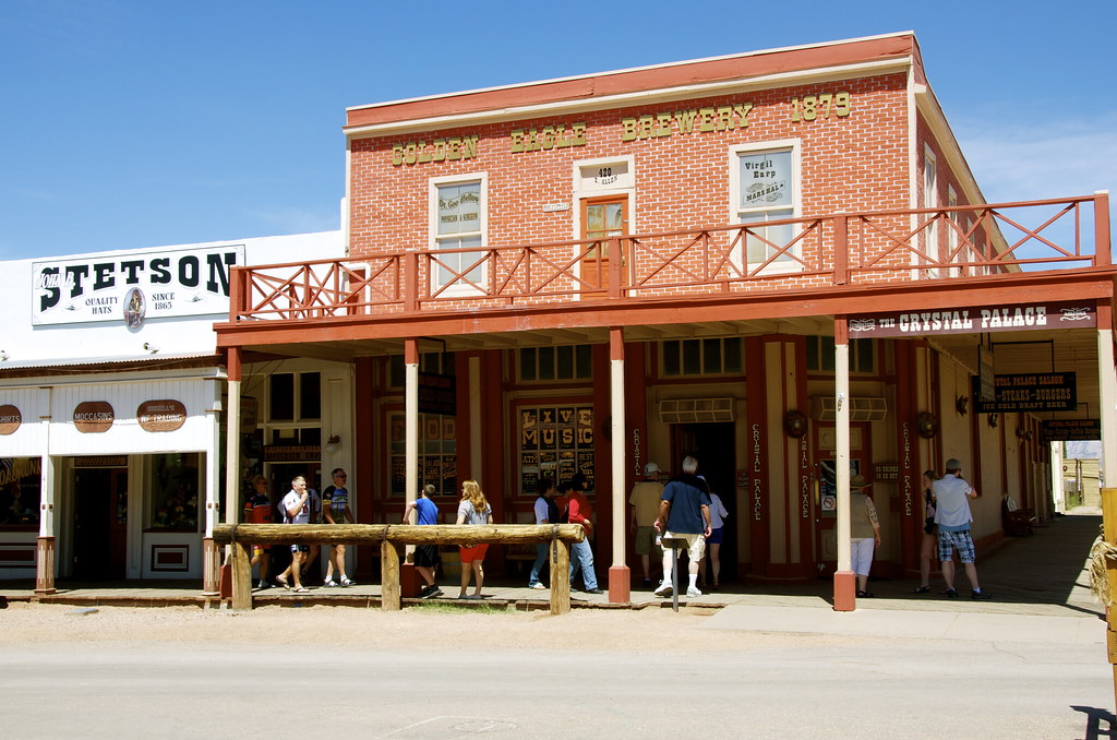

Crystal Palace, once the 2nd floor office of US Marshall Virgil Earp. by Overland Frontier, on Flickr

The real sign of a towns' importance was when Wells Fargo, the most respected shipper of valuables, opened an office in town. Timing could not have been better for Wyatt Earp. He was offered the job of “Shotgun Messenger”, a chance to prove himself for the Sheriff election.
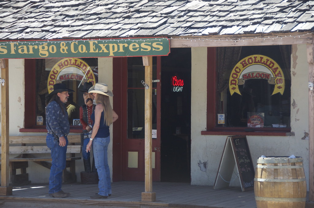

Wells Fargo & Company Express office, now Doc Holidays Saloon. by Overland Frontier, on Flickr

While in Dodge City, the Earp's introduced a city ordinance where everyone had to check their guns as they arrived to town, which did not sit well with the Johnny Ringo, Curly Bill and the rest of the wild Texas Cowboys Gang that had gotten used to creating havoc in town, when not robbing stages or rustling cattle.
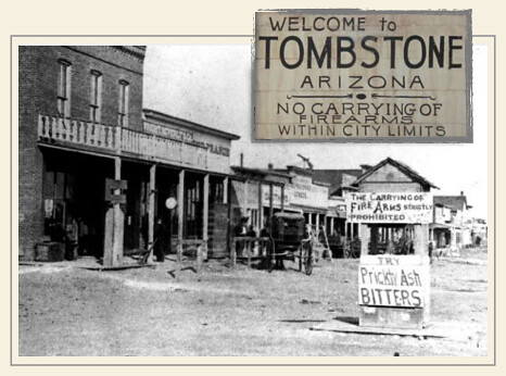

Tombstone Firearms Ordinance, a trend started in Dodge City. by Overland Frontier, on Flickr

Doc Holliday, a dentist by day, gambler and gunfighter by night, had endured himself with Wyatt after saving his life in a Texas gunfight. Wyatt urged Doc and his common law wife, a prostitute that had earned the nickname Big Nose Kate, to join him in Tombstone. The stage was set and all the players were in place.
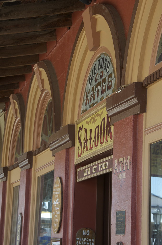

Big Nose Kates Saloon, formerly the Grand Hotel in Tombstone. by Overland Frontier, on Flickr

The night before the legendary Gunfight at OK Corral, Ike Clanton in his usual drunken stupor, followed Wyatt to the Oriental Saloon, with his revolver in plain sight, to boldly advise Wyatt that he would be looking for the Earp's and Doc Holliday in the morning, where they would finally settle the feud.
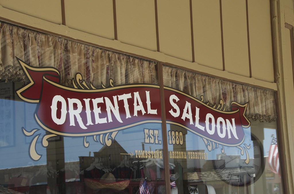

Oriental Saloon in Tombstone. by Overland Frontier, on Flickr

What happens next continues to be retold today – brilliantly, I might add. The New York Times Bestseller, “The Last Gunfight” – a must read - the real story is even more captivating than the film versions. Yet the movie, Thombstone, was a great, albeit romantic portrayal – Val Kilmer, Sam Elliot, Kurt Russell and Bill Paxton just seemed to suit the roles they played.
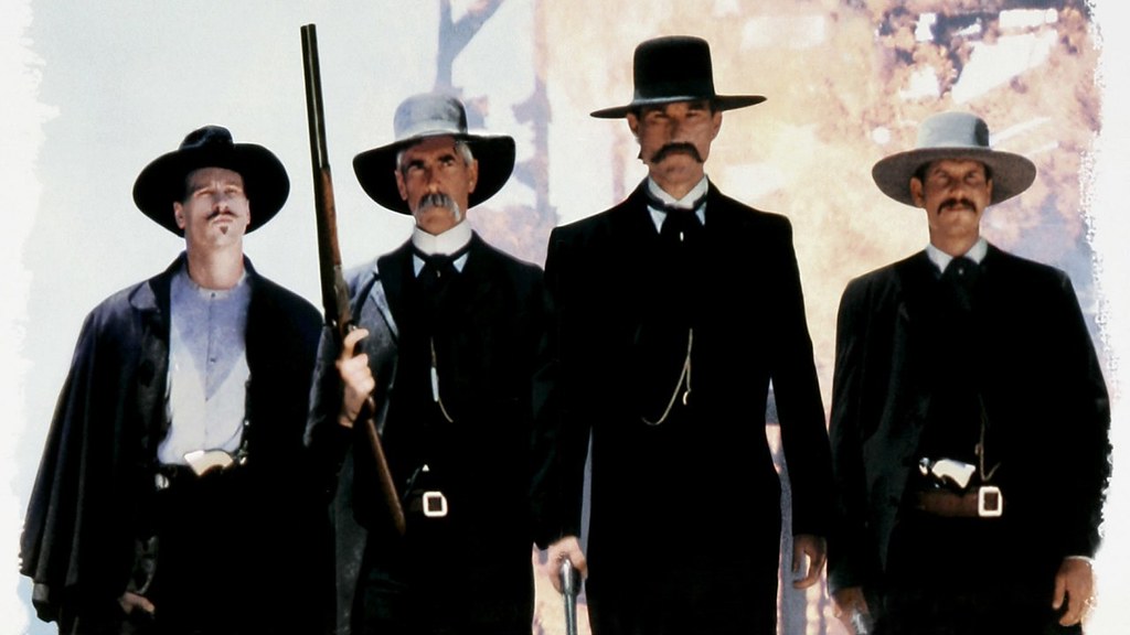

Walking to gunfight promo scene from Tombstone movie. by Overland Frontier, on Flickr

“Throw up your hands, boys. I intend to disarm you.” What happened next differs greatly depending on who was telling the story”. Friends of the cowboys state Frank and Billy were in the process of raising their hands and Tom was reaching to open his coat to show he was unarmed. The Earp's recalled revolvers being cocked. Some say Wyatt was first to reach for the pistol stashed in his coat pocket, beating Frank to the draw, firing a shoot into his gut.
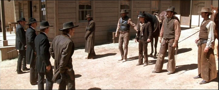

Gunfight promo scene from Wyatt Earp movie. by Overland Frontier, on Flickr

Frank MacLaury, while dragging himself down the street yells, “I've got you now”. Doc responds, “Blaze away! You're a daisy if you have”. Frank gets of a shot that caught Doc in the hip. It would be his last as Morgan fires a round that hits him in the head. All of this happens in less than a minute and would change perceptions of the American West forever – the event glamorized by Hollywood, time and time again.
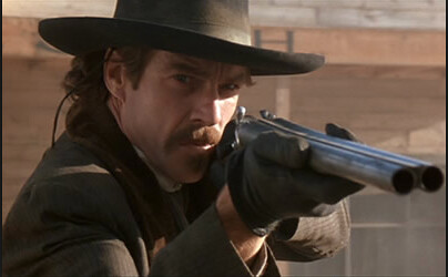

Wyatt Earp movie promo of Doc Holliday. by Overland Frontier, on Flickr

At the end of the day three men lost their lives; Tom and Frank MacLaury and Billy Clanton. The town was split on who was at fault. Some thought the cowboys were murdered as is evident by the marker found in cemetery on the edge of town.
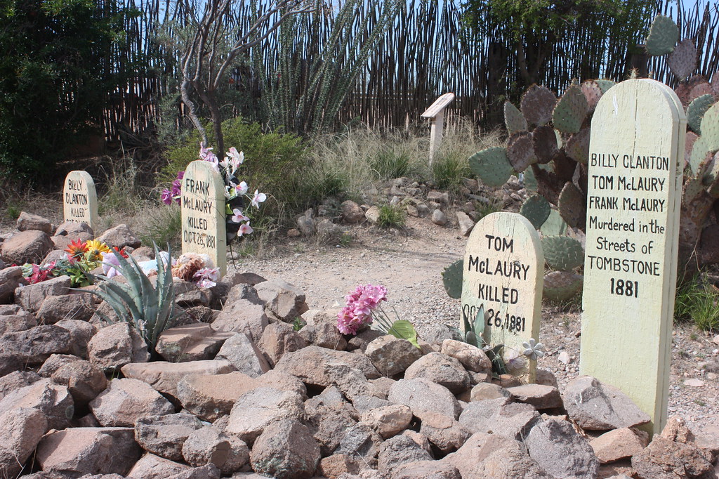

Graves of Billy Clanton, Frank & Tom McLaury killed in the Gunfight at OK Corral. by Overland Frontier, on Flickr

The cemetery was coined Boot Hill because so many interned there died with their boots on. The original hearse that delivered most of the coffins is now in the Bird Cage Museum.
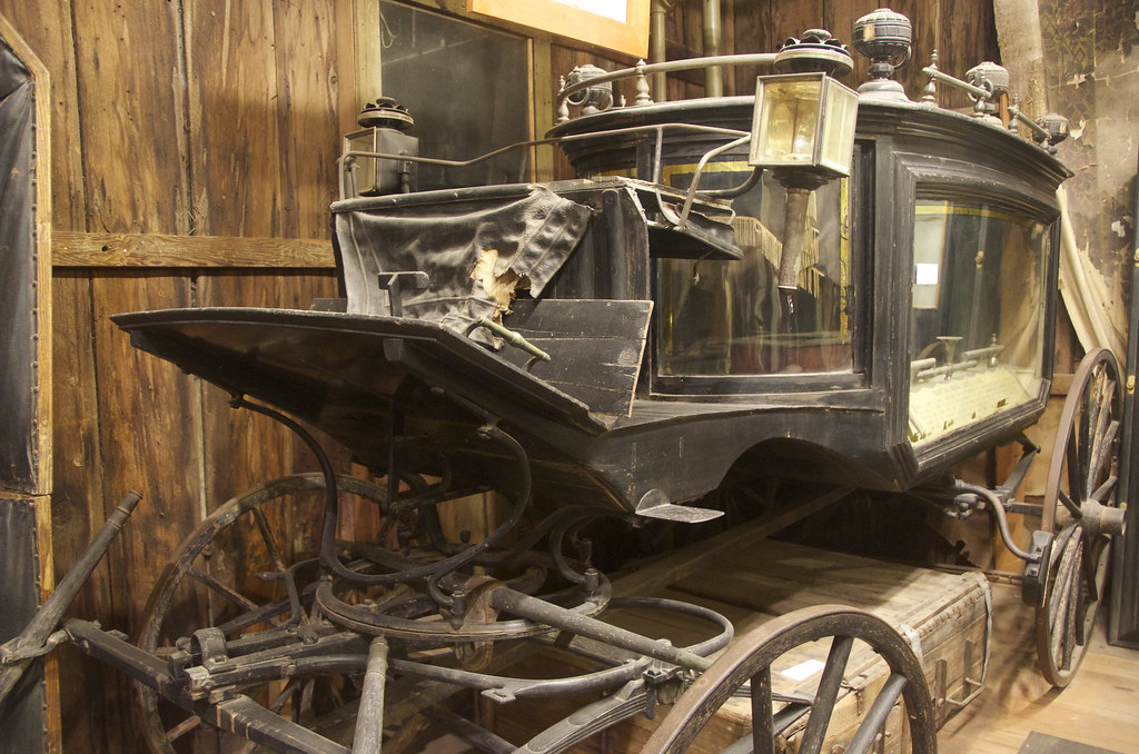

Tombstone Boot Hill Hearse, now on display in Bird Cage Museum. by Overland Frontier, on Flickr

The Gunfight at OK Corral would not be the last, nor would other violent deaths in town.
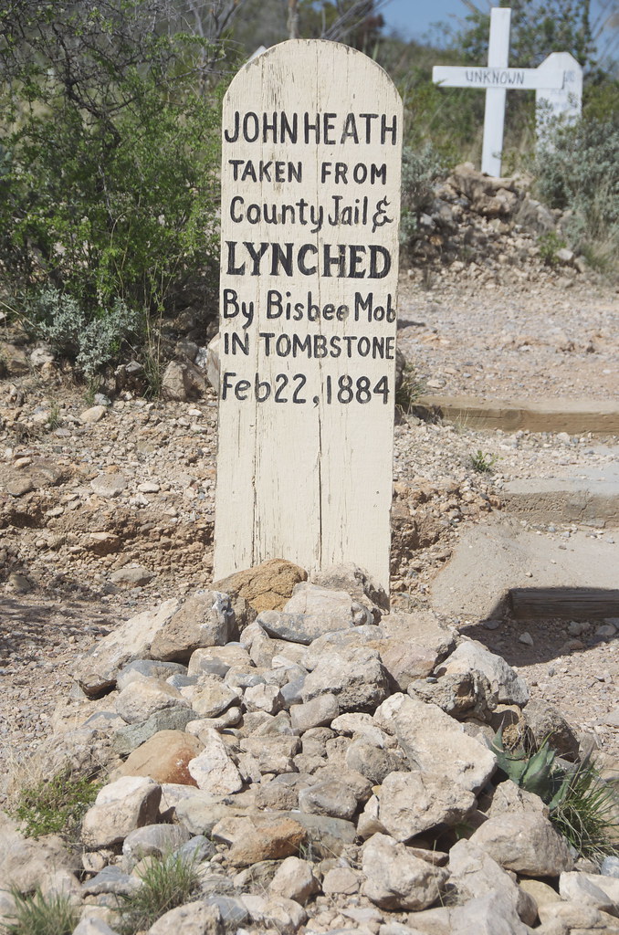

John Heath buried in Tombstone Boot Hill after being lynched in 1884. by Overland Frontier, on Flickr

Outside of Tombstone, the war with the Apache carried on for over 15 years, with Cochise as War Chief, and another 10 years with Geronimo's renegades.
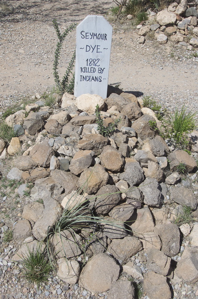

Seymore Dye 1882 Killed By Indians. by Overland Frontier, on Flickr

Be prepared for a commercial experience, the town survives as it has, since the early 1900's, on tourism.
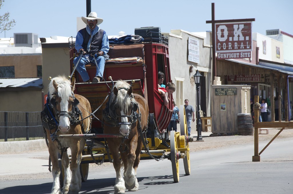

Stage coach leaving OK Corral in Tombstone. by Overland Frontier, on Flickr

Street performer working for donations.
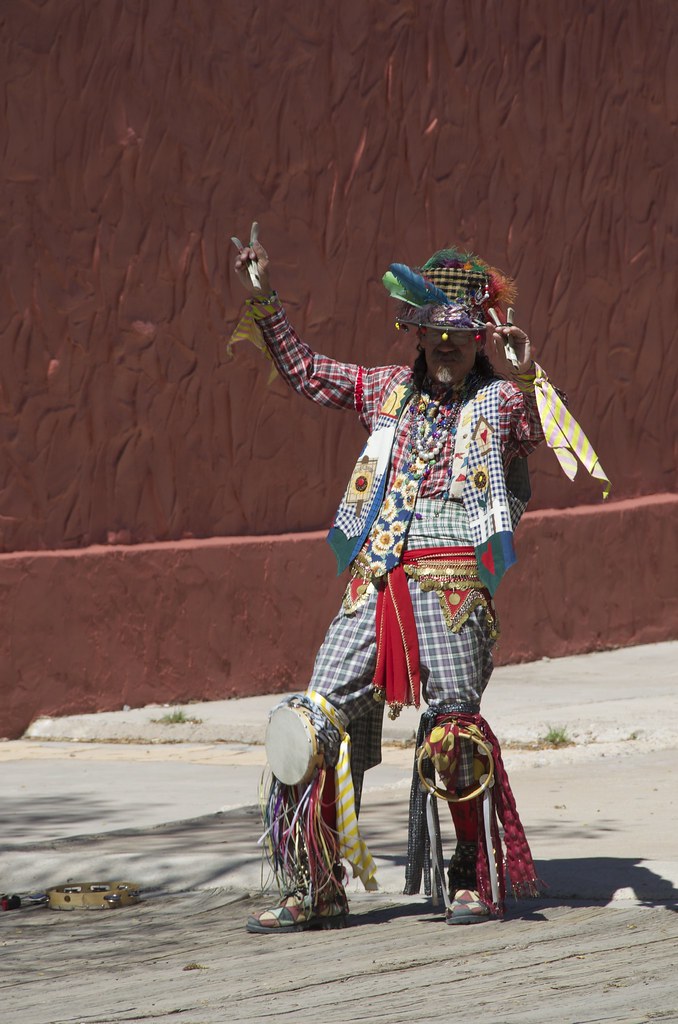

Street performer in Tombstone. by Overland Frontier, on Flickr

My Overland Buddy from Oregon, Pete Getty was quick to get in the picture with the Earp's and Doc before the shootout reenactment.
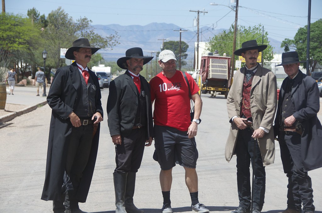

Pete Getty posing with Earp Brothers & Doc Holiday street performers in Tombstone. by Overland Frontier, on Flickr

The first and last enterprise to succeed in frontier towns was the Saloon, and this remains the way with surviving boomtowns. Big Nose Kates Saloon was hopping.
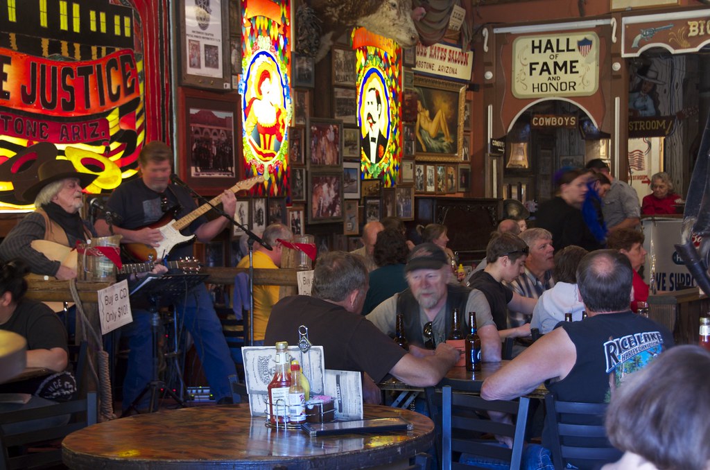

Big Nose Kates Saloon. by Overland Frontier, on Flickr

Pete Getty took to Tombstone's culture and historical attractions.
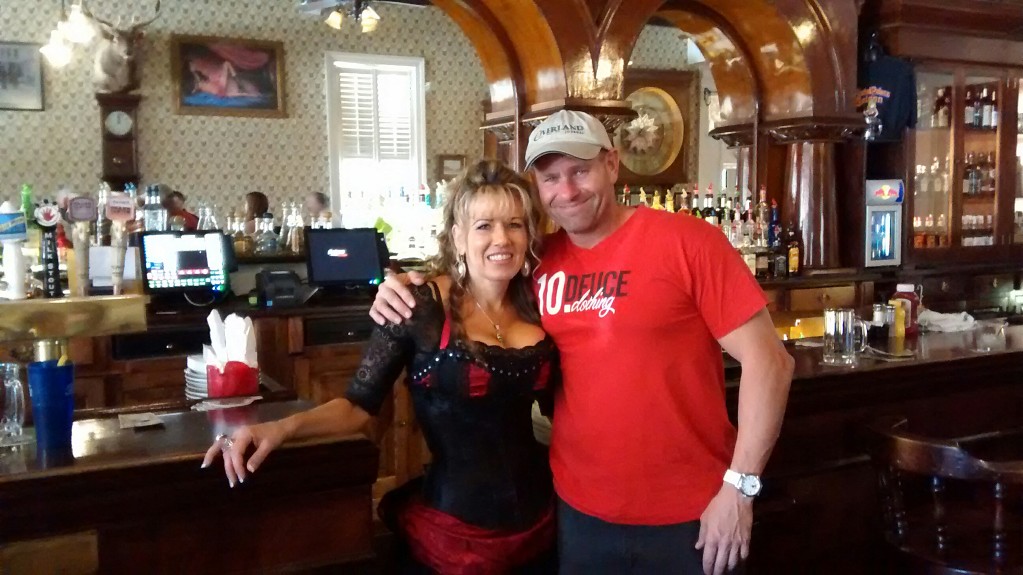

Pete Getty and Celeste of the Crystal Palace Saloon. by Overland Frontier, on Flickr

Grant Lovig, my rodeo and horseback excursion pal from Edmonton has a lot of experience in frontier saloons. It was great having him ride shotgun during our second scouting expedition.
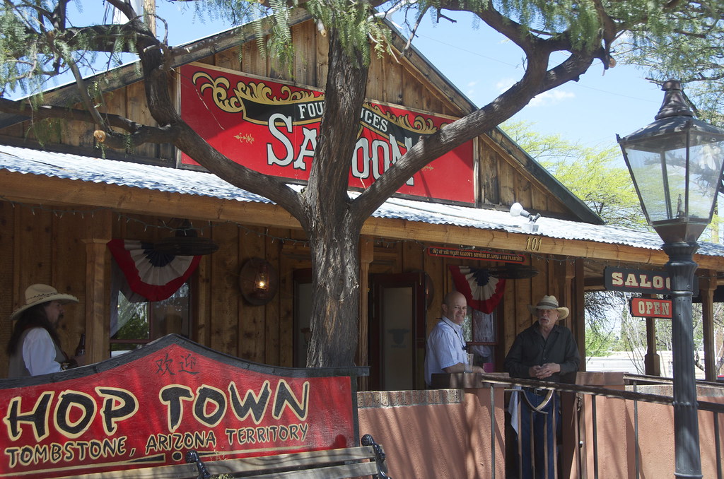

Grant Lovig on the deck of Saloon in Tombstone by Overland Frontier, on Flickr

The New York Times reported that Bird Cage Theater was the wickedest and wildest nightspot between the Barbary Coast and Basin Street. If you only have time to check out one exhibit in town, this is it.
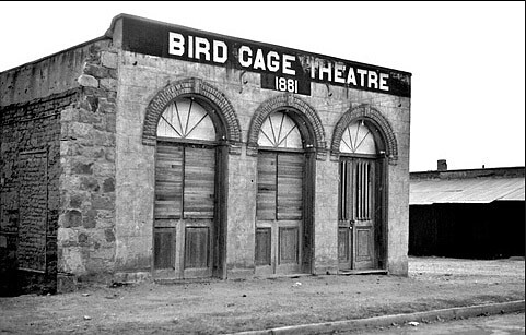
Bird Cage Theatre after it closed its doors in 1889. by Overland Frontier, on Flickr

Bird Cage was far more than a theater, but a saloon, bordello and gambling hall that ran 24/7. The original Grand Piano has never moved from its front-of-stage location.
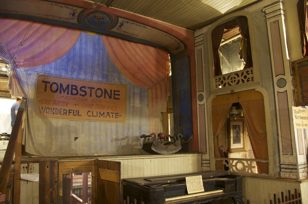

Bird Cage Theatre. by Overland Frontier, on Flickr

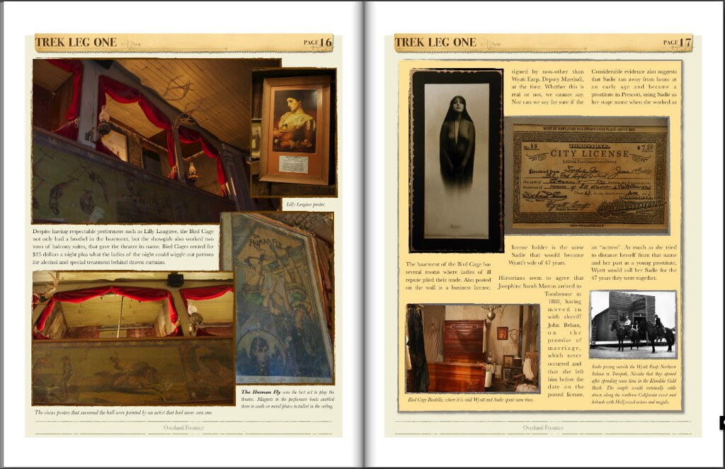
Despite having respectable performers such as Lilly Langtree, the Bird Cage not only had a brothel in the basement, but the showgirls also worked two rows of balcony suites, that gave the theater its name.
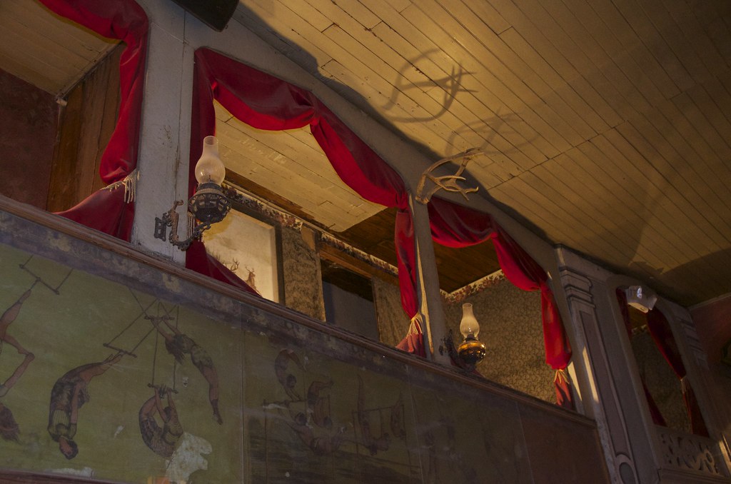

Two rows of balcony suites, gave the Bird Cage Theater its name, where ladies of Ill repute would work behind closed curtains. by Overland Frontier, on Flickr

Fatima, later known as “Little Egypt”, was a Oriental Belly Dancer. She played the Bird Cage in 1881 and later made a gift of this painting to hang in the front bar. It has hung in the same spot since 1882.
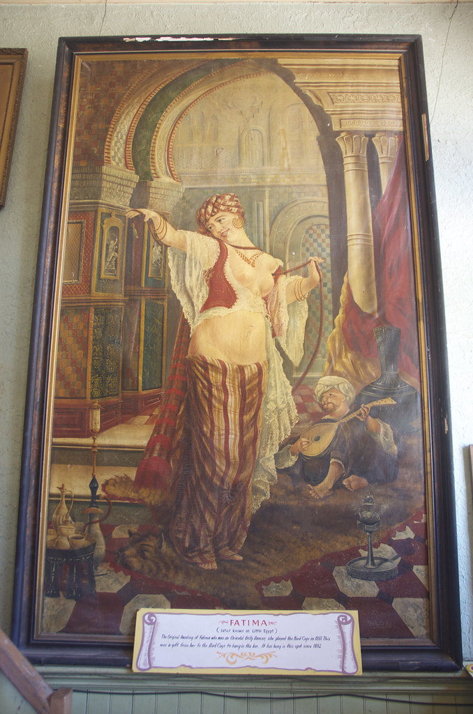

Fatima, later known as “Little Egypt”, a Oriental Belly Dancer painting in Bird Cage Saloon. by Overland Frontier, on Flickr

Private poker room-box seat right beside the stage.
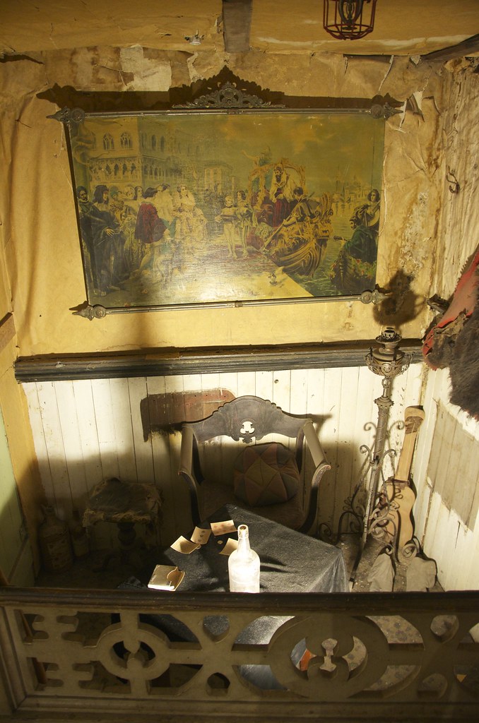

Private poker table and box seat in Bird Cage Theatre. by Overland Frontier, on Flickr

Join us for Leg 2, where we retrace the wagon-stage road that linked the first railway from Fairbanks and the abandoned El Paso & Southwestern Railway that parallels the wash that the Texas cowboy outlaw gang used to drive stolen cattle down to Frank and Tom MaClaury's ranch.MaClaury's ranch.
 
Last edited:

mercier@streetsmart.ca

Expedition Scout
It means a lot to me to hear that some of this background history is of interest to other Overlanders. It is what keeps me wanting to write these scouting reports, so I really appreciate getting your feedback. Thanks.
 

GHI

Adventurer
I enjoyed the time spent reading your report/thread. By all means, keep it coming.
 

mercier@streetsmart.ca

Expedition Scout
Leg. 2 Abandoned Railway to Fairbanks

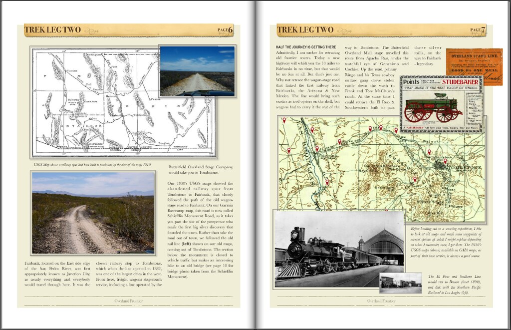
I had several favorable experiences in Tombstone, each only lasted several hours, but the town proved to be a great springboard to other adventures. Today a new highway will whisk you the 10 miles from Tombstone to the ghost town of Fairbank, in no time, but that would be no fun at all. But that’s just me. Admittedly, I am sucker for retracing old frontier routes. Why not retrace the wagon-stage road that linked the first railway from Fairbanks, the Arizona & New Mexico. The Butterfield Overland Mail stage travelled this route from Apache Pass, under the watchful eye of Geronimo and Cochise. Up the road, Johnny Ringo and his Texas cowboy outlaw gang drove stolen cattle down the wash to Frank and Tom MaClaury’s ranch, before they met their end at the OK Corral. At the same time I could retrace the abandoned El Paso & Southwestern Railway built to pass three silver mills, on the way to Fairbank - legendary.

When things would heat up in Tombstone, outlaw cowboys such as Johnny Ringo, Curly Bill and Billy Clanton would hang out in Fairbank, where there was less law and near outlaw friends Frank and Tom McLaury’s ranch, a known refuge for the cattle rustlers stolen livestock - where the posse led by US Marshall Virgil Earp and his deputies Wyatt and Morgan Earp found the 6 stolen US Army mules.


Fairbank Ghost Town. by Overland Frontier, on Flickr

We retraced the El Paso & Southwestern and the Butterfield Overland Mail stage route that shares the corridor between Tombstone and Fairbank, AZ.


2 El Pas & Southwestern by Overland Frontier, on Flickr

The railway would bring such exotics as iced oysters on the shell to Fairbank, but wagons had to carry it the rest of the way to Tombstone and on the way back, they would be loaded with ore.


3 Screen Shot 2015-07-05 at 9.35.42 AM by Overland Frontier, on Flickr

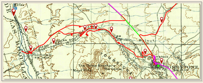
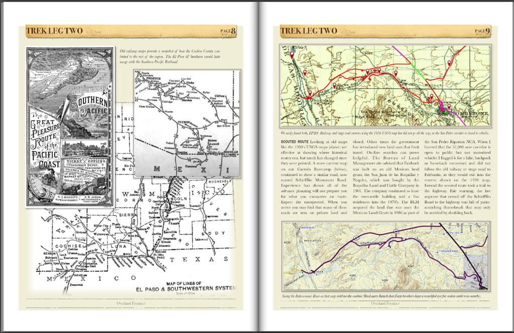
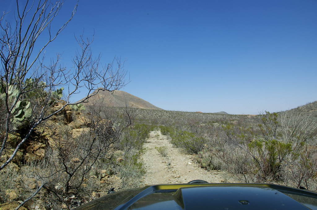
Looking at a 1930’s USGS on GAIA maps, showed the abandoned railway spur from Tombstone to Fairbank that closely followed the path of the old wagon-stage road to Fairbank. Rather than take the road out of town, we followed the old rail line shown on our old maps. We were forced off the abandoned railway bed by derelict or missing bridges, a great opportunity to explore the old wagon-stage road.


Abandoned El Paso & Southwestern Railway. by Overland Frontier, on Flickr

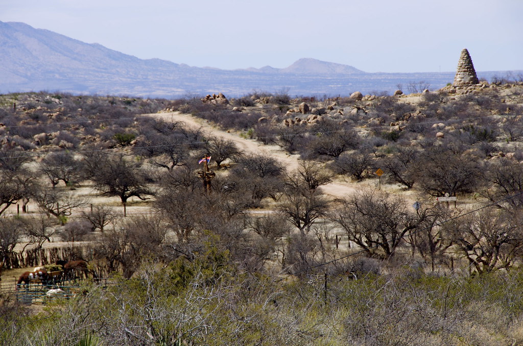
The old road travels south of the memorial gravesite of the first prospector to discover silver, Ed Schiefflin. The El Paso & Southwestern travels north of the site. In his will, Ed specified he wanted to be buried in mining clothes, with pick, shovel, and his old canteen but rather than a simple miners cairn he wanted, the town folk choose to build a grand 25’ monument in his honor.


Stage-wagon road to Fairbank, as it passes the memorial gravesite of Ed Schiefflin, the prospector that first found silver in Tombstone. by Overland Frontier, on Flickr

View El Paso & Southwestern trestle from the Ed Schiefflin memorial. Ed prospected 20 years before he made his Tombstone discovery. He tried “regular life": but after 18 months he stated he was “No better off than when I was prospecting and not half as satisfied.”

View El Paso & Southwestern trestle from the Ed Schiefflin memorial. by Overland Frontier, on Flickr

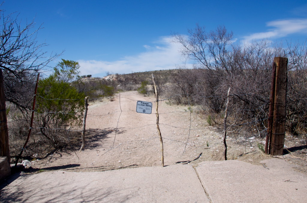
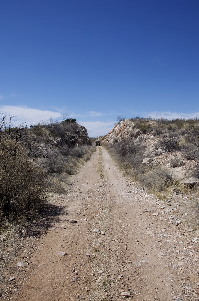
The historical road to Fairbank took on the feel of an old stage-wagon road, after we passed the gate.


Old stage-wagon road to Fairbank. by Overland Frontier, on Flickr

We soon encountered well-traveled sections of the old El Paso & Southwestern, again.


El Paso & Southwestern Railway. by Overland Frontier, on Flickr

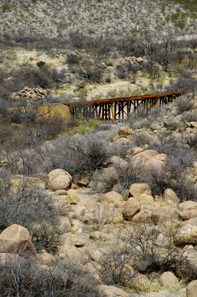
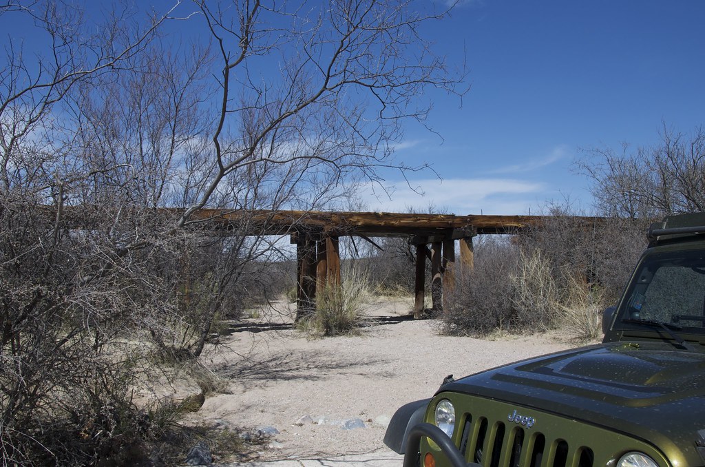
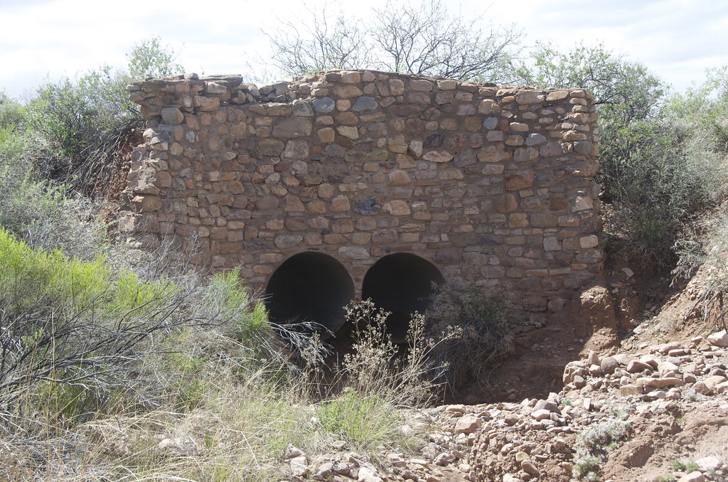
Derelict bridges forced us off the line, as we went along, adding interest. Considering how old the railway bridges are, they have stood the test of time, albeit unsafe for use.


Bypassing derelict trestle on El Paso & Southwestern. by Overland Frontier, on Flickr

We did not follow the old road all the way to Fairbank as it exits in the old San Juan de las Boquillas y Nogales Mexican land grant corridor. The Bureau of Land Management took over in 1990’s and it is closed to motor vehicles.


Route taken while using 1930 USGS map from GAIA Maps loaded on iPad. by Overland Frontier, on Flickr

Instead we followed an old trail that took us to the highway, a couple of miles East of Fairbank. Fair warning, the last segment that veered off the Schieffllin Road to the highway was full of paint-scratching thorn-brush and a badly eroded wash that may only be avoided by doubling back.


The last segment of scouted route added a few Arizona pin-stripes to our expedition vehicle. by Overland Frontier, on Flickr

Photos and descriptions for this thread, so far, are taken directly from Overland Frontier’s Scouting Report Slideshows for Trek Leg 1 and Trek Leg 2 of the 10-Trek Leg Arizona Wild West Journey that is currently in production.

All our free Scouting Reports are broken down into segments of a region that can be experienced in days (Trek Legs), week (Trek Series), up to a month (Journeys) or months (Expedition). They are not intended to be a recommended or definitive route. Rather, our documentaries of scouting expeditions provide pictorial reference and information that can help enthusiasts find scenery, terrain, activities and relics that fascinate them the most.

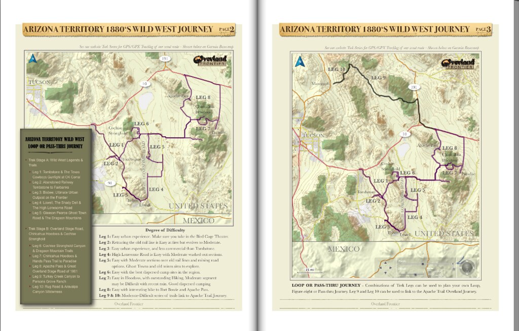
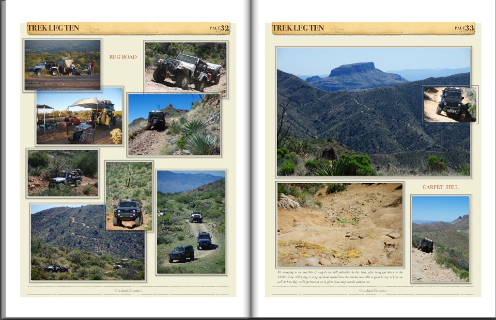
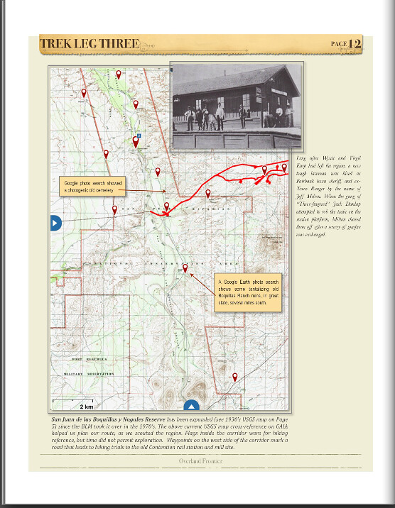
For our Journey synopsis we prepare an overview that includes historical photos, old and new maps, current photos and a top-line trail history. The following are a few examples from the pages from a sneak peak of the 10 interlinked Arizona Wild West Journey Trek Leg’s:


Sample from Arizona Territory Wild West Journey, Scouts Overview. by Overland Frontier, on Flickr


Sample from Arizona Territory Wild West Journey, Scouts Overview. by Overland Frontier, on Flickr


Sample from Arizona Territory Wild West Journey, Scouts Overview. by Overland Frontier, on Flickr


Sample from Arizona Territory Wild West Journey, Scouts Overview. by Overland Frontier, on Flickr


Sample from Arizona Territory Wild West Journey, Scouts Overview. by Overland Frontier, on Flickr


Sample from Arizona Territory Wild West Journey, Scouts OverviewSample pages from Trek Leg 1 Detailed Scouting Report. by Overland Frontier, on Flickr

To see the full Free Scout Overview check out the Journey Preview link to view on-line or download it to your device.


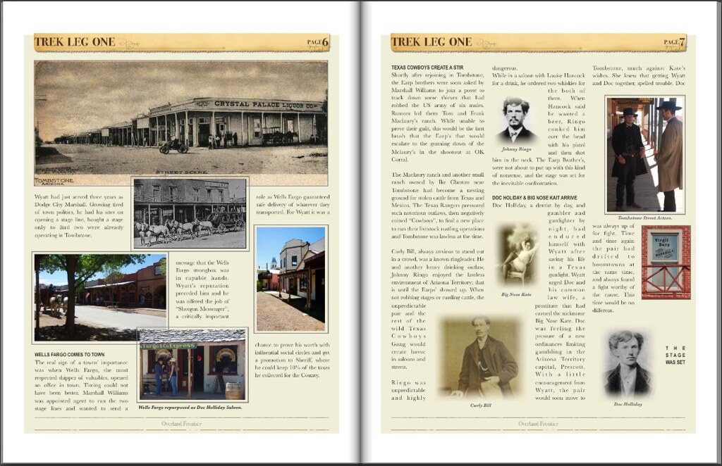
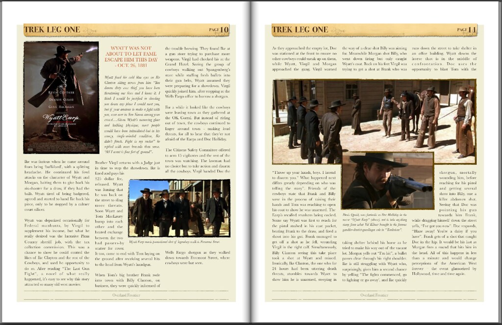
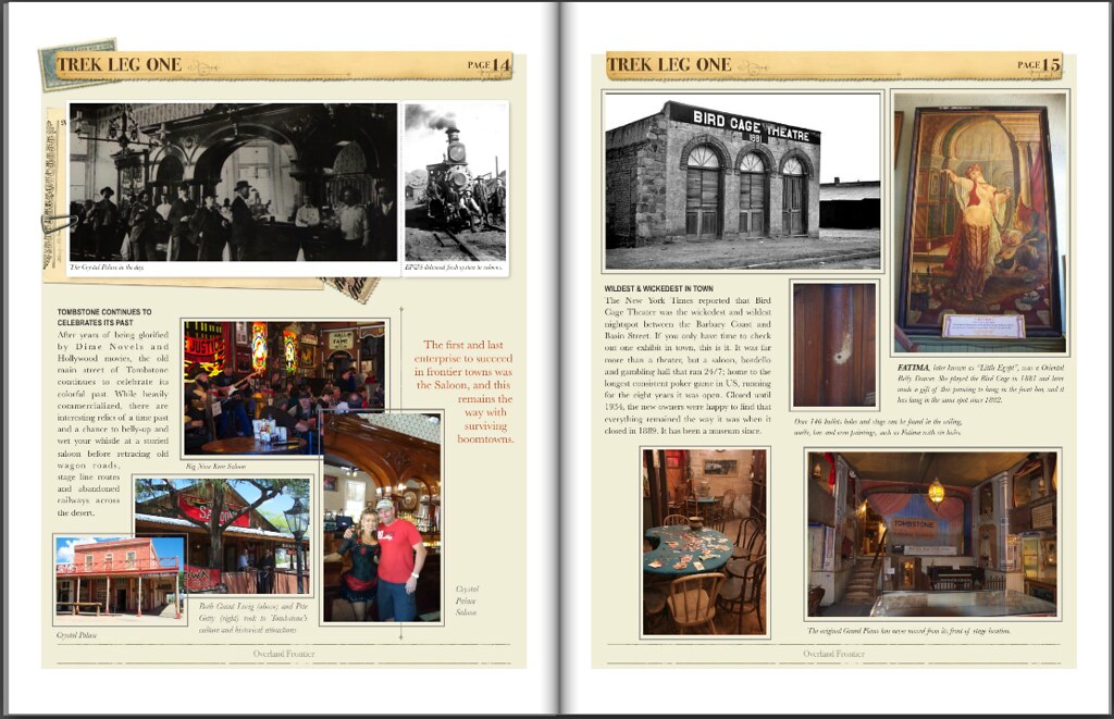
In addition to our slideshows, we added a more Detailed Scouting Report to some of our favored route segments; Trails with a particularly colorful past. Here are a few examples from Trek Leg 1: Tombstone & The Texas Cowboys.


Sample pages from Trek Leg 1 Detailed Scouting Report. by Overland Frontier, on Flickr


Sample pages from Trek Leg 1 Detailed Scouting Report. by Overland Frontier, on Flickr


Sample pages from Trek Leg 1 Detailed Scouting Report. by Overland Frontier, on Flickr


Screen Shot 2015-07-21 at 12.56.02 PM by Overland Frontier, on Flickr

You can view the Detailed Scouting Report Trek Leg 1:Tombstone & The Texas Cowboys on line or download it to your device.


At times, we add a more detailed scouting report to provide more historical and current maps to a particular segment, as was the case for Trek Leg 2: Abandoned Railway to Fairbank.


Sample pages from Trek Leg 2 Detailed Scouting Report. by Overland Frontier, on Flickr


Screen Shot 2015-07-21 at 12.57.27 PM by Overland Frontier, on Flickr


Sample pages from Trek Leg Detailed Scouting Report. by Overland Frontier, on Flickr

You can view the Free Detailed Scouting Report Trek Leg 2:Abandoned Railroad to Fairbank on line or download it to your device.


All our Scouting Reports are accompanied with a free companion GPS Tracklog. Our scouting expeditions flow continuously from one interesting North American region to another, state-to-state, province-to-province, nation-to-nation; using as little pavement as possible, and when we do, it tends to be byways versus freeways.

Each GPS tracklogs can be viewed live on our website in Google Maps/Satellite, and the GPS/GPX files can be downloaded for free, so you can work with them in your preferred topographical map software/device. See Trek Series A - Wild West Legends & Trails, to help plan your own route through Southeast Arizona. If you are looking for a cost effective way to plan and navigate with GPS maps, check out our Maps section.
 
Last edited:
91AzXJ

Adventurer
I have covered most of the state but you found a route I have yet to explore. Just an FYI, Bisbee is a very cool place to visit and spend some time and the Kartchner Caverns are well worth the time to explore if you can get in. Thanks for the history lesson.
 

mercier@streetsmart.ca

Expedition Scout
Arizona is incredible that way - so many trails - thats what makes it such a great state to Overland - only 15% is private land. I find Nevada like that as well. While Utah also has a lot of overland trails, there are more park reserves and natural canyons that limit through-routes. Yes, I agree Bisbee is extemely cool, in fact that is the next leg in my series I'm about to post. And yes, it did find some more interesting history tidbits on it as well. Hope it is not too much, but I just get such a kick out of researching what was there, so when I tour the region, I see it for what it truly is. Will have to check out Kartchener Caverns - Thanks!
 

mercier@streetsmart.ca

Expedition Scout
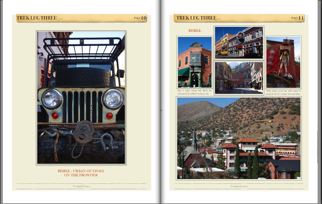
Leg 3: Bisbee Urban Outpost on the Frontier

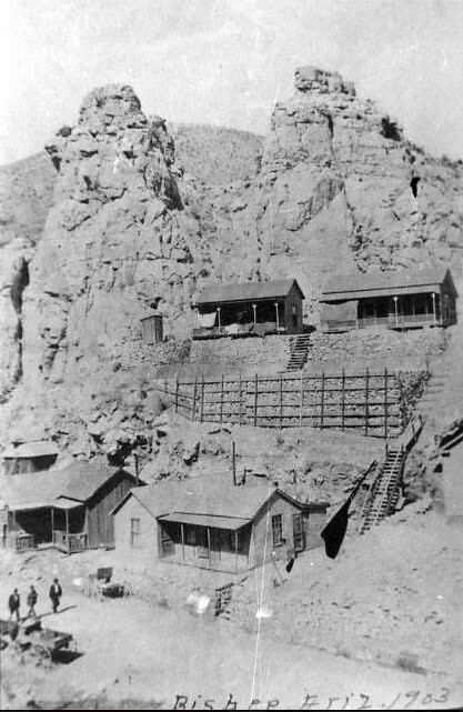
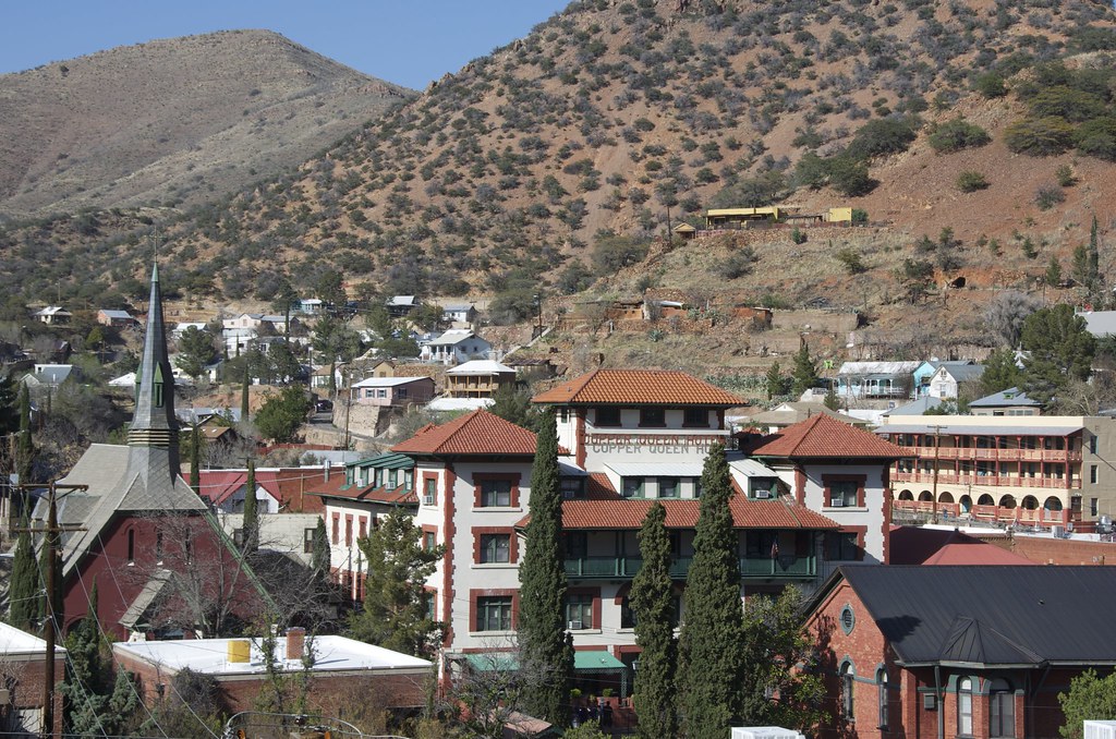
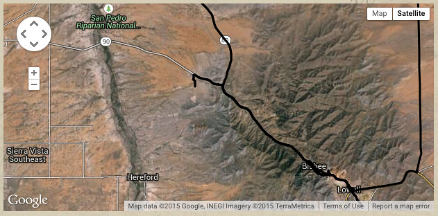
Bisbee is an outstanding boomtown that would reinvent itself without loosing its frontier soul. When many miners moved on, the artists and sleepy town enthusiasts moved in, giving the old city a unique look and culture. It is a great place to wallow in before or, preferably, after a long overland journey when a fine meal, shower and a little urban recreation is appreciated the most. The rich heritage really adds depth to the place and context for the upcoming Overland Journey.

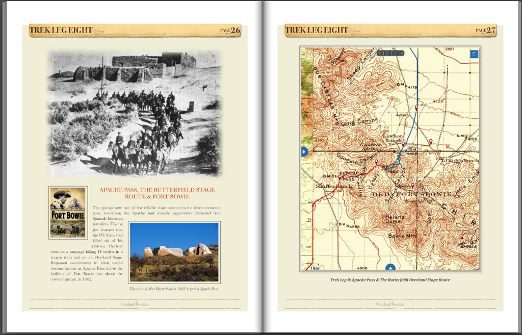
Recorded history started during the summer of 1876, the 6th US Cavalry was called to the field to put down the Chiricahua Apaches that had been attacking the Overland Stage and passing settlers in Apache Pass. By the time they arrived, many of the worst had fled to the rocky fastnesses of the Mexican mountain peaks, and remained a thorn in the side of the army, settlers and prospectors rooming the hills. A hostile force of 50 warriors embarked on a series of daring attacks in the far tip of Southeastern Arizona. Lieutenant John A. Rucker organized a company of scouts, both civilian and friendly Apache for counter intelligence. In command of a detachment of Troops H and L, and his scouts, he overtook and defeated a band of 50 Chiricahua warriors in the Leitendorf Mountains, N. M., on January 9, 1877.

White Mountain Apache Chief Alchesay joined the US Cavalry Scouts in 1871 under Brig. Gen Crook, commander of Arizona Territory. He was awarded the Medal of Honor for the gallant conduct during campaigns against the Tonto Basin Apache. He later served in Fort Bowie, tracking the Chiricahua Apache across the Territory and into this region.


White Mountain Apache Chief Alchesay - US Army Apache Scout. by Overland Frontier, on Flickr

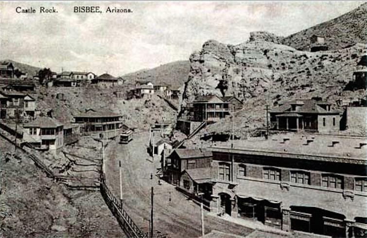
In May of 1877, Lt. Rucker and small reconnaissance troop of 15 from Company C of the 6th Cavalry were guided by Apache Scouts through the Mule Mountains and what became know as Tombstone Pass and Apache Springs. A civilian scout by the name of Jack Dunn found faint green stains on the hillside, near the springs and below two rock formations that would later be coined Castle Rock – the first strike.


Route over Mule Mountains to Tombstone Pass into Bisbee. by Overland Frontier, on Flickr

US Army Scout Dunn and Lt. Rucker lacking in experience, grubstaked a seasoned prospector, George Warren, to work their claim but he wound up staking and working his own interests further down the canyon, instead. Warren's claim would become known as the Copper Queen, one of the most successful mines in the world. The shifty Warren was repaid for his evil dealings when he lost his claim to a bet over a foot race. Sadly, Lt. Rucker drowned in a river crossing, while trying to save one of his men, shortly after his copper discovery.

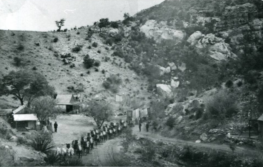
The copper discovered was so valuable at the time, that it paid to have the ore hauled by Mule Trains over 50 miles to the Benson mainline Railway-head, where it was shipped all the way to a Pennsylvania smelter for processing.


Mule Train in Tombstone Canyon, near Castle Rock Bisbee. by Overland Frontier, on Flickr

Dunn sold the original discovery he had made near Castle Rock for $4,500, turning out to be a wise decision, as the mineshaft that was built to reach the riches soon flooded. It became Apache Springs Well, and where the town of Bisbee, first started.


Castle Rock Homes, Bisbee. by Overland Frontier, on Flickr

Further down the canyon, the wilder side of town found a home up what became known as Brewery Gulch due to the high concentration of saloons, dance halls and bordellos.


Brewery Gulch. by Overland Frontier, on Flickr

To truly appreciate the town that got a reputation as the “Urban Outpost on the Frontier” you need to stay in one of the many historical hotels and spend some time walking the streets.


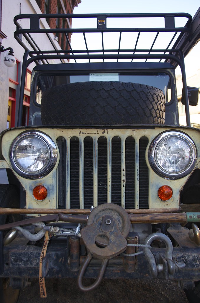
Willys in Bisbee The Outpost on the Frontier. by Overland Frontier, on Flickr

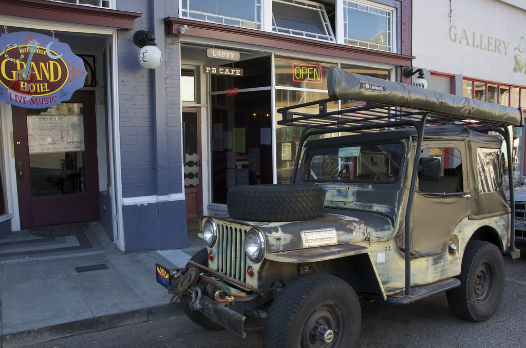
My first scouting trip was a whirlwind trip, that happened to land in Bisbee on a Friday night, but the town was booked. When I saw the Overland Willy's parked in front of the Grand Hotel, with live music, no less. I knew I would be back.


Overland Willys in front of Grand Hotel. by Overland Frontier, on Flickr

This was not the first time I had seen the little Willy's. I remembered it well. It was part of and the interesting squadron that set up camp at Amano Overland Expo, in 2011.


Overland Expo camp, in Amano, 2011. by Overland Frontier, on Flickr

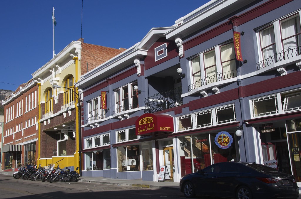
I was tempted to stay at the 1906 Grand Hotel, on a return visit. It seemed nicely restored, popular and I'm always a sucker for a place with live music.


Grand Hotel, Bisbee. by Overland Frontier, on Flickr

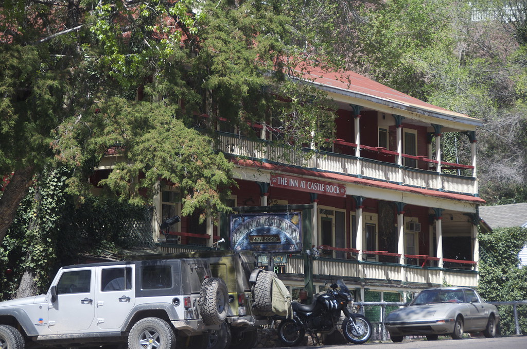
But after a little on-line research, the abode we chose for our first night in town was the Castle Rock Inn, the site of the first discovery that led to an incredible city being built in the Mule Mountains. The rooms are rustic, with an unusual eclectic collection of theme rooms, but it has great bones, providence and what a location, with decks facing Castle Rock.


Castle Rock Inn, Bisbee. by Overland Frontier, on Flickr

In 1895, the first mayor of the boomtown built his namesake Muirhead House —A boarding house (beside streetcar), one of the largest wooden structures in town, now The Inn at Castle Rock —right over the spring that drew Lt. Rucker and Scout Dunn to the area.


12) Bisbee main street near Castle Rock, by Overland Frontier, on Flickr

As we checked into the Castel Rock Inn, right off the lobby, we gazed down the mineshaft that was flooded and became Apache Springs. While not precious metals, the water source is a valuable commodity in a desert town.


Apache Springs, in the lobby of the Castle Rock Inn. by Overland Frontier, on Flickr

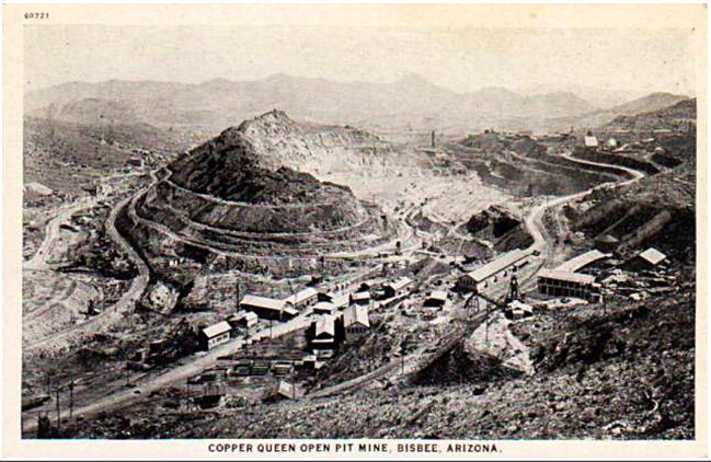
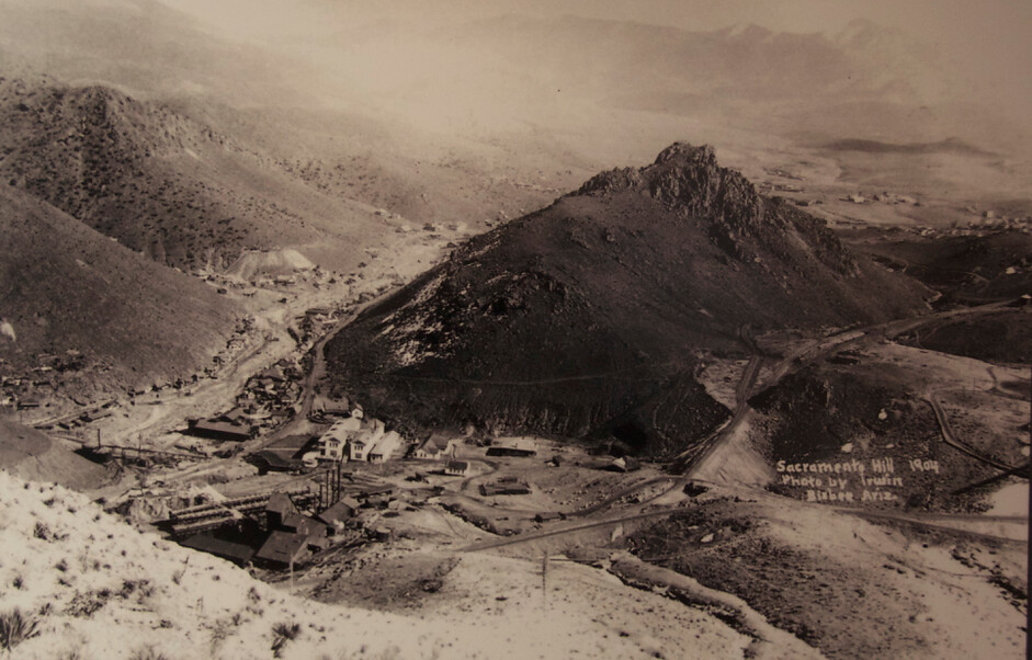
Bisbee came into its own when Phelps Dodge purchased the Atlanta claim near the Cooper Queen and hit the main load at about the same time the Copper Queen penetrated the load from a different location. The ‘rule of the apex' at the time awarded the strike to the deposit that came closest to the ground, which in this case was the Copper Queen. Rather than be outdone, Phelps Dodge purchased and merged both mines into the Copper Queen Consolidated Mining Company in 1883; a defining moment for the company that would be the only operator to mine the massive load until 1975, spurred on by the site of the company's first open pit mine, the “Lavender Pit”.


Copper Queen Mine on Sacramento Hill before it became a deep open pit mine. by Overland Frontier, on Flickr

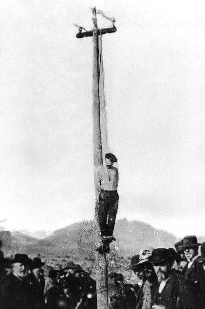
The Bisebee Massacre, a Copper Queen payroll heist gone-bad led to the deaths of five people including a pregnant woman. When the ringleader, Bisbee dancehall owner John Heith, only received a life sentence in Yuma Territorial Prison, a Bisbee Mob broke him out of a Tombstone jail February 22, 1884, the county seat where the trial was held and hanged him a block away, in broad daylight. No charges were laid, adding to Tombstone's notoriety.


17) Bisbee mob hanging. by Overland Frontier, on Flickr

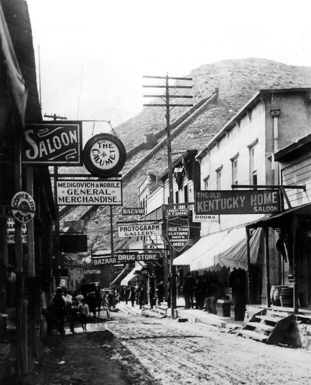
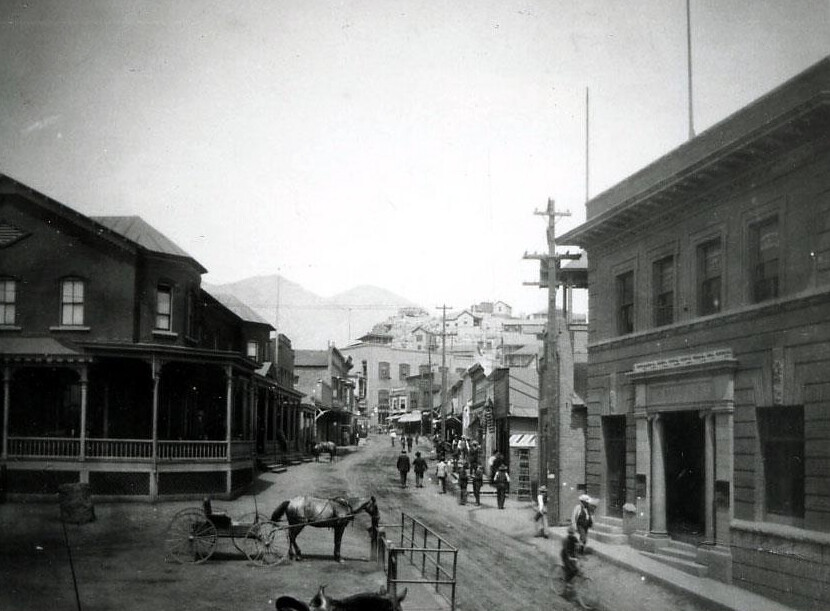
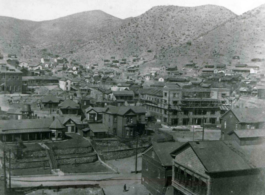
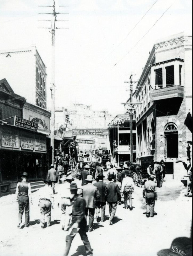
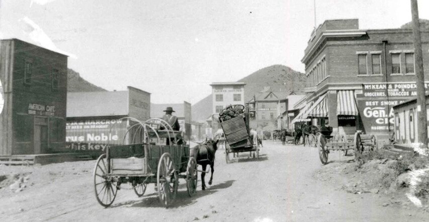
1889 Phelps Dodge financed railway to link with the line at Fairbank and on to the mainline and the rest of the world. The line cost nearly $500,000 to build, twice the estimate, but it paid off in spades. Bisbee blossomed from an upstart mine camp into one of the premier mining towns of the world - the largest city between St. Louis and San Francisco in the early 1900's. The Mains Street extended below Castle Rock. By 1902 the town was taking shape. The Bank of Bisbee (right corner below) continues to house a financial institution today, opposite the Copper Queen Library (left corner below).


Bisbee Main Street, 1902 with first library on left. by Overland Frontier, on Flickr

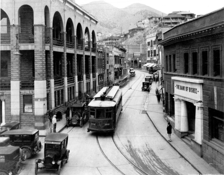
Later Phelps Dodge replaced the wooden library with the grand library (beside the streetcar) and post office building that continues to serve the community today.


Bisbee Main Street early 1900's. by Overland Frontier, on Flickr

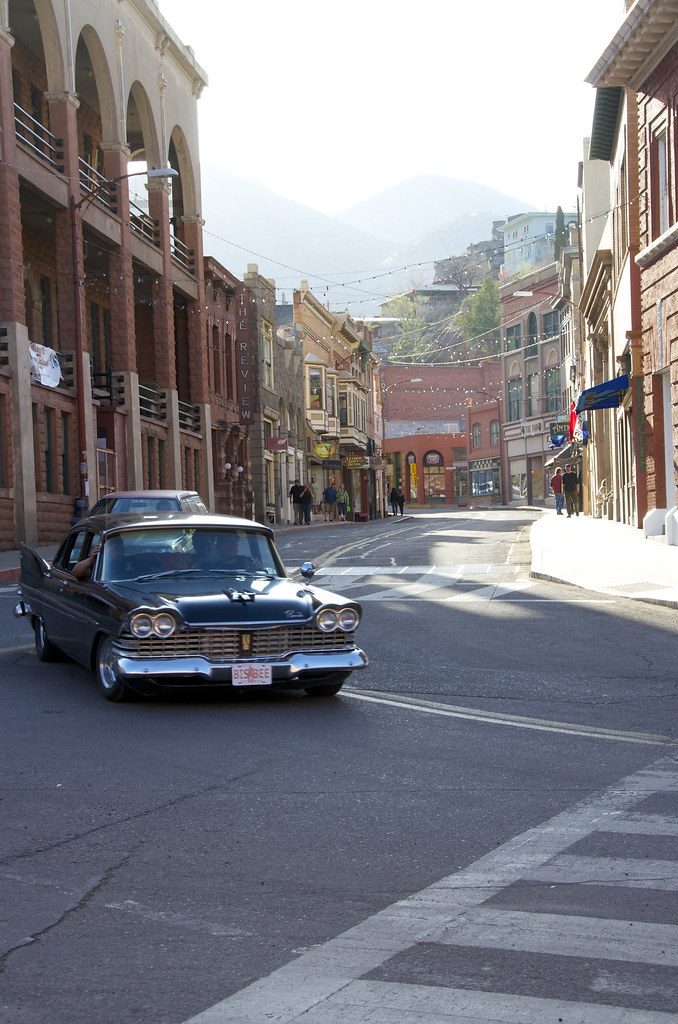
Main Street Bisbee looks much the same it day at the turn of the century.

Main Street Bisbee today. by Overland Frontier, on Flickr

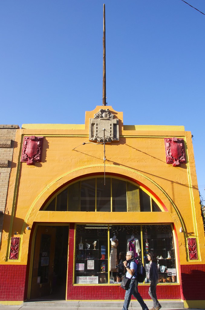
The town has reinvented itself without loosing its soul. The retail shops retain their former glory and continue to be serve.


Main Street Bisbee. by Overland Frontier, on Flickr

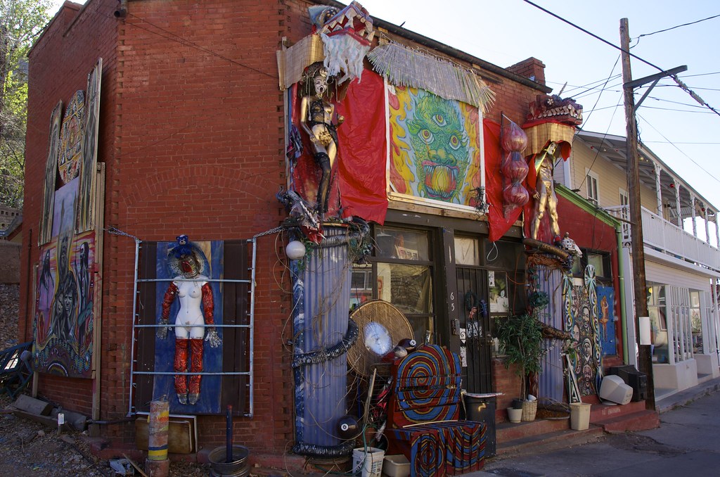
When the miners moved out, the artists moved in giving the old city a unique look and culture. This shop looked like this on our first visit, but all the creative art disappeared on our next. The brick building is waiting to repurposed, yet again.


Gallery in Bisbee. by Overland Frontier, on Flickr

The premier hotel in town, the Copper Queen was built in 1901, opening the following year.


Copper Queen being built in 1901 by Overland Frontier, on Flickr

Copper Queen Hotel is the oldest continually operating hotel in Arizona. Guests include President Teddy Roosevelt and John Wayne and numerous ghosts. Some guests report that they hear a female whisper in their ear when no one is around in the room named after Julie, the prostitute who kept a room here before committing suicide out of despair.


Copper Queen Hotel. by Overland Frontier, on Flickr

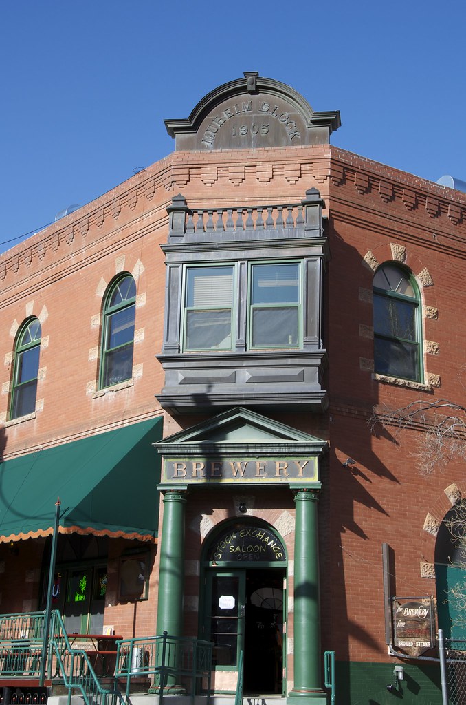
Half a block away, Brewery Gulch was starting to show its age. Joseph Muheim Sr. and his two uncles had built a brewery and saloon on the Gulch using a beer recipe they had brought from their native Swtizerland. By 1905 it was time to replace the dilapidated structure with the three-story Brewery building that stands today.


28) Brewery Gulch 1904. by Overland Frontier, on Flickr

Later the brewery was used to house the first stock exchange in Arizona and the only one between San Francisco and Chicago. The structure was renovated in 2012 to become the Stock Exchange Saloon. The old stock exchange boards were kept along the back wall. They make a fantastic Forno-oven pizza and next door, there is a fine dinning restaurant.


Brewery Block & The Stock Exchange Saloon. by Overland Frontier, on Flickr

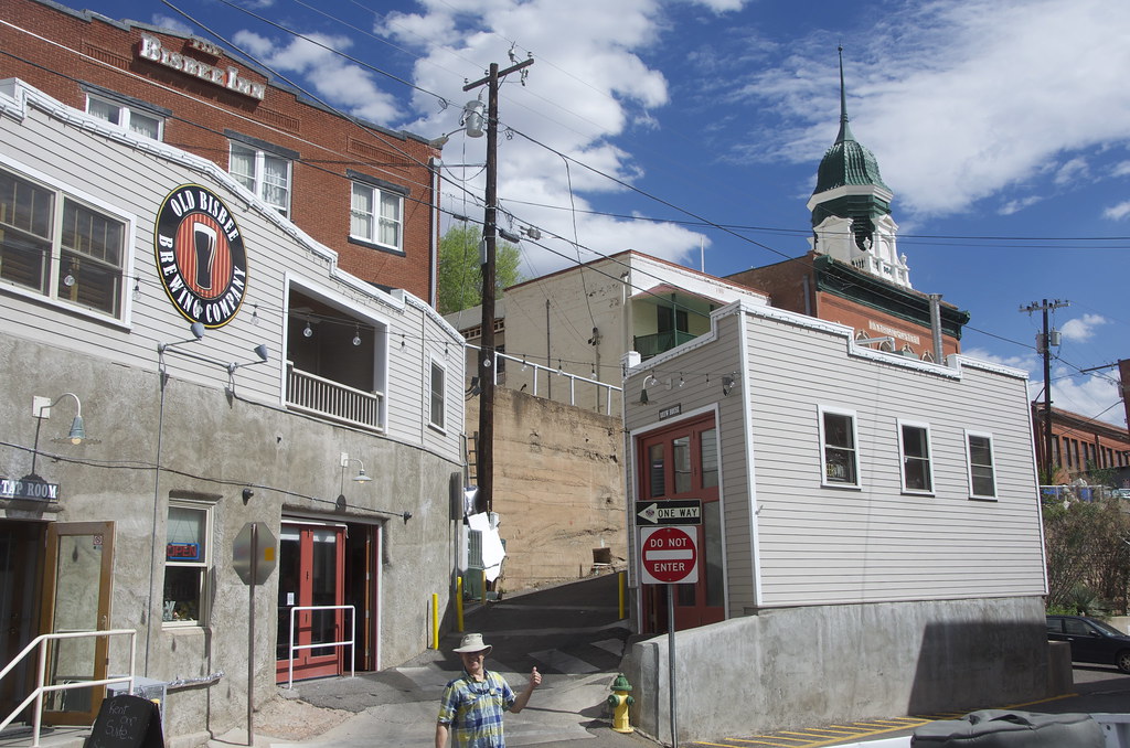
My buddy Grant Lovig was quick to discover that further up Brewery Gulch, they continue to celebrate their past with the Old Bisbee Brewing Company and a great selection of craft beers on tap.


Old Bisbee Brewing Company. by Overland Frontier, on Flickr

After our start at the Old Bisbee Brewing Company, we made sure we checked out all of the historical licensed establishments. The following day, an unusual site at lunch, waters all around – go figure.


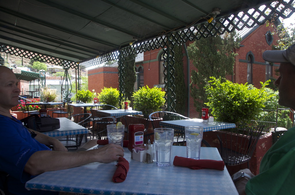
Brunch on the Copper Queen Hotel deck. by Overland Frontier, on Flickr

We had to take it slow and easy because we had one more night in the valley, down the road in Lowell and Shady Dell, a great springboard for starting an overland trip up the High Lonesome Road - but that is for another time - our next post.

If you want more then and now photos of Bisbee, check out our full Scout Report Slideshow:

http://www.overlandfrontier.com/trek-legs/bisbee-urban-outpost-frontier
 
Last edited:
mercier@streetsmart.ca

Expedition Scout
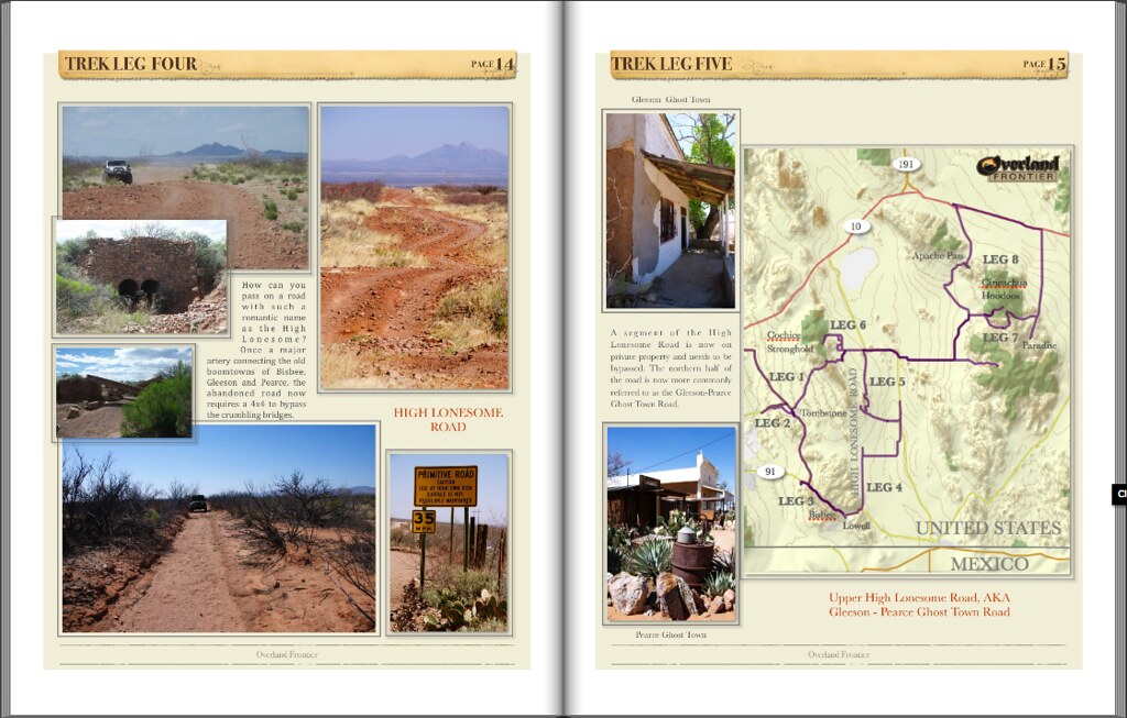
Trek Leg 4: Lowell, The Shady Dell & The High Lonesome.

During my research for interesting trails running north from Mexican-SE Arizona, that would link to Sonoma-Baja, as part of our three-nation expedition, I came across a road called “The High Lonesome”. It was just so Hollywood romantic; I had to try it out. The abandoned road is a blast, but it was discovering the combined Bisbee-Lowell urban frontier, that was the real treasure discovery. Bisbee an eclectic mix of turn-of the century structures, while Lowell and the Shady Dell appear frozen in its 1940-50’s peak. The combination makes for a perfect springboard to hit the High Lonesome, once a major artery connecting the boomtowns of Bisbee, Gleeson and Pearce. The abandoned road now requires a 4x4 to bypass the crumbling bridges. If you’re a photographer you will find ample fodder in the town. My humble documentary shots pale compared to the photos I’ve seen in galleries and on-line, but they will give you a sense of why this urban frontier sets the stage for the upcoming overland journey.

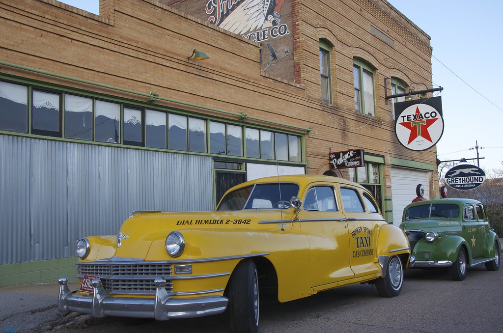
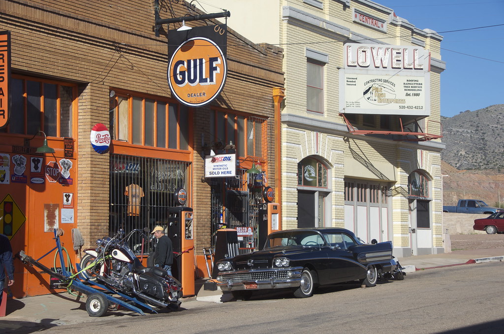
If you like old cars, motorbikes and antique trailer lodging from the period, it is a must visit.


Lowell Greyhound Bus Depot. by Overland Frontier, on Flickr

As Bisbee grew and prospered, the town soon ran out of room in the narrow Tombstone Canyon and the steep hillsides above. Newcomers looking for a place to build were forced to a small plain at the mouth of the canyon. New communities such as Johnston Addition and Lowell sprung up.


Naco Road in Johnson Addition, near Lowell. by Overland Frontier, on Flickr

By 1900, a couple of saloons and livery stable started Lowell’s main street, below Sacramento Hill, the site of the Copper Queen Mine, at the mouth of Tombstone Canyon in Bisbee.


Sacramento Hill 1904 by Overland Frontier, on Flickr

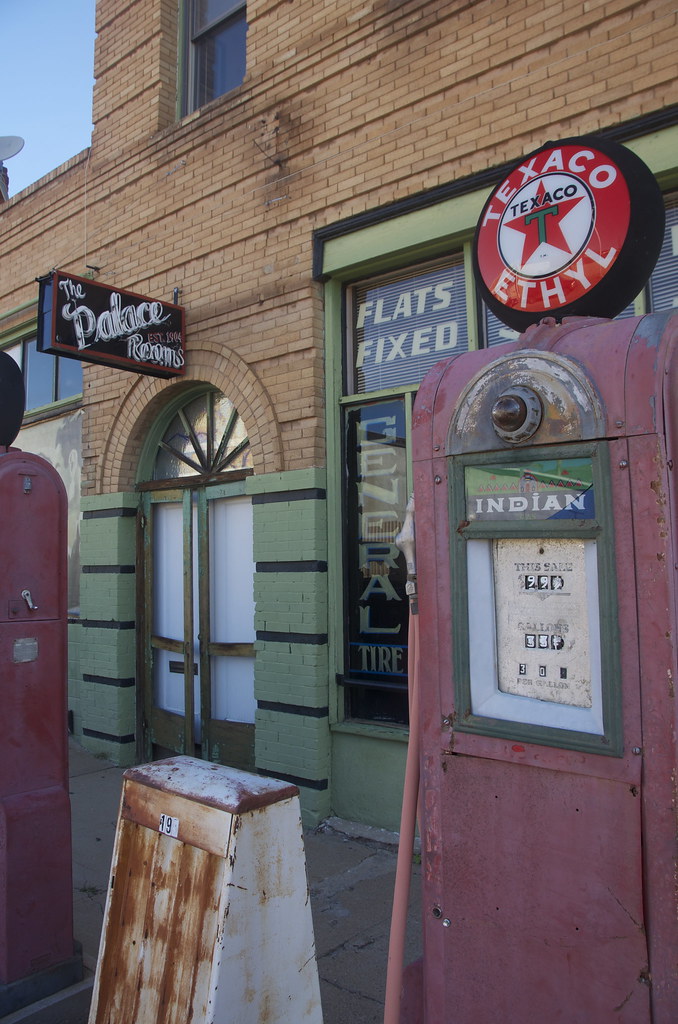
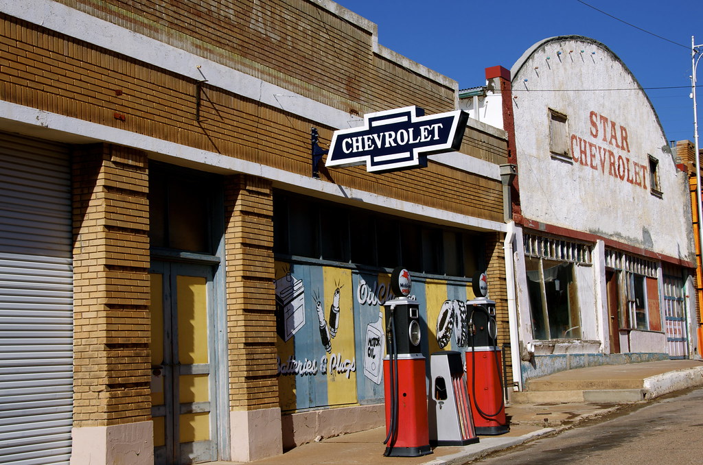
Most of the relics in Lowell have been left in a weathered state, giving the towns remains more of an authentic aura.


Palace Rooms above service station and Greyhound Bus Depot. by Overland Frontier, on Flickr

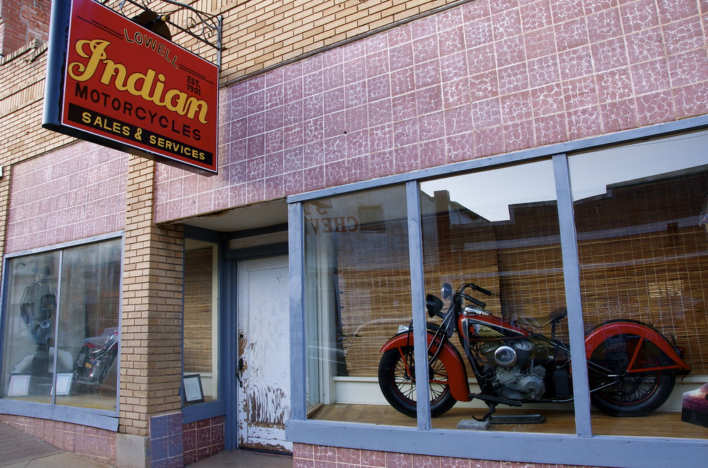
Jay Allan’s Trophy Garage. Jay’s father moved to Lowell in 1928 and Jay was born there in 1954. Jay is the owner of the world’s largest biker bar, the Broken Spoke Saloon, in Sturgis, South Dakota. Despite spending some time in Sturgis each year he still likes to call Lowell home, where his great collection of antique cars, hot rods and bikes can found displayed along Main Street. He and a couple of friends have restored many of the old structures, including a historic Indian and Harley Davidson dealership.

[url=https://flic.kr/p/wmGPnD]

Jay Allan’s Trophy Garage and Lowell Theater. by Overland Frontier, on Flickr


Indian Motorcycle Dealership. by Overland Frontier, on Flickr

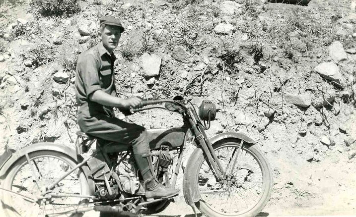
In the early days Bisbee and Lowell were home to early motorcycle enthusiast, you could even say they were dual sport. Most of the roads were dirt, but the first paved road in Arizona, US 80, ran between Bisbee and Douglas.


1920 Dual Sport Motorcycle, Bisbee. by Overland Frontier, on Flickr

The buildings have been renovated or stabilized in an arrested state of decay. Even those that are being restored are being done without taking away the flavor and patina of yesteryear – Kudos to Jay and friends.


Star Chevrolet. by Overland Frontier, on Flickr

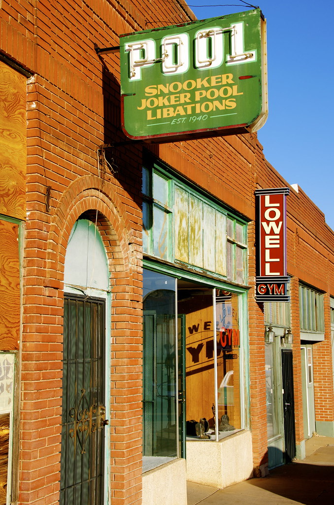
The 1940 Pool Hall, once served ‘libations’, a British term for alcohol, probably influenced by the British roots of the Dodge Phelps Mining Company.


1940 Pool Hall and Gym in Lowell. by Overland Frontier, on Flickr

You can’t forget you are in a mining town, relics abound and the old main street drops off into the massive 950’ Lavender Pit that produced 80.3 million pounds of copper until it closed in the 1970’s.

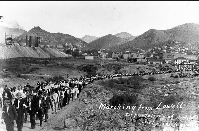
On July 12, 1917, the world was shocked when 1,200 striking workers were rounded by an armed posse, loaded on manure infested railcars and dumped off in a small New Mexico town with no food or water. The union was looking for safer conditions and less discrimination for foreign/minority workers. The “vigilantes” defended their action on rumors that weapons and dynamite was being cached to sabotage Bisbee. No legal action was taken against Phelps Dodge or any of the other mining companies.


Lowell Union Deportation. by Overland Frontier, on Flickr

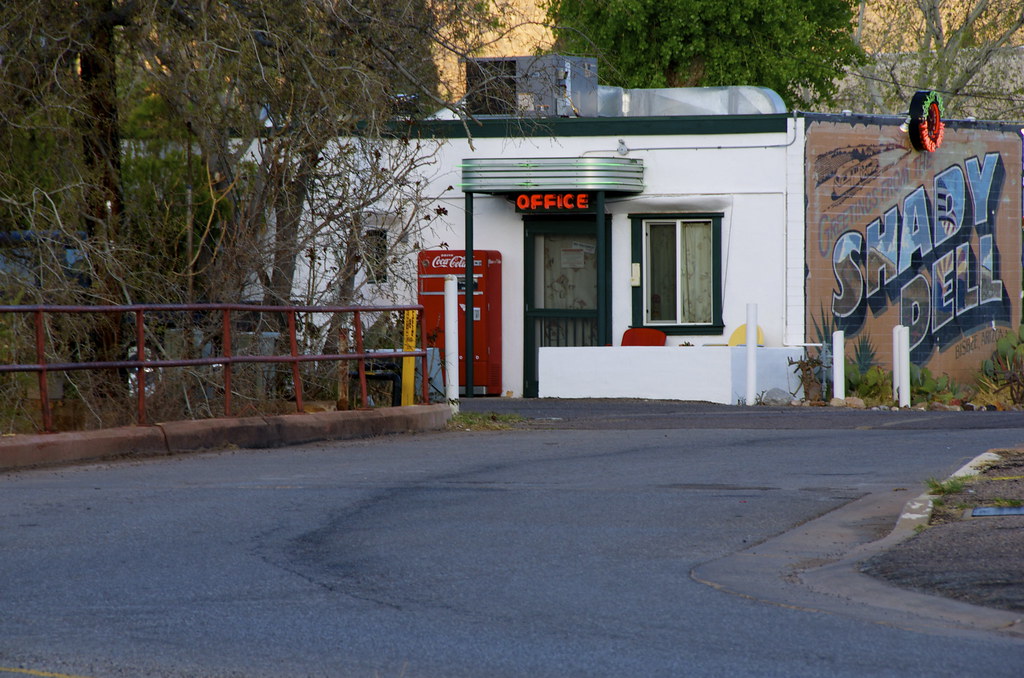
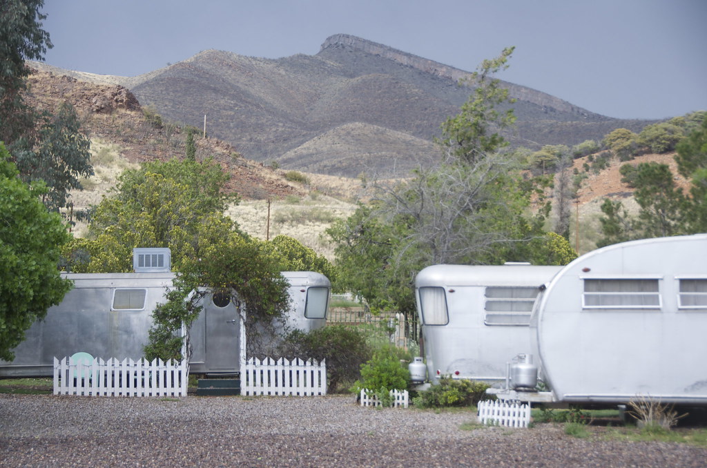
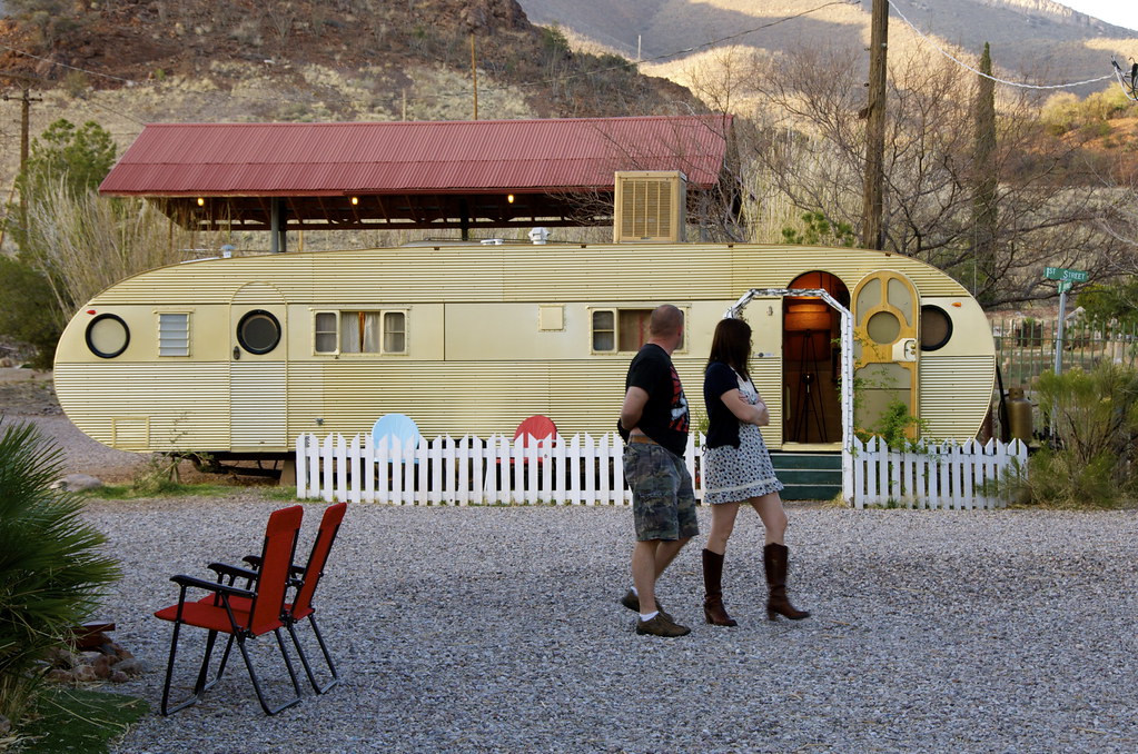
While the remains of Main Street are outstanding, I think the crowning jewel for Lowell is the Shady Dell, a historical trailer park that now offers lodging in antique 1940-50’s trailers, a 1941 Tiki Bus and even a 1947 Chris Craft Yacht. Travel trailers that would have once cruised along the first paved highway in Arizona, US 80, and stopped to camp here, have been lovingly restored to their original splendor, for the trailer court motel.


Shady Dell front office. by Overland Frontier, on Flickr


Shady Dell Trailer Motel. by Overland Frontier, on Flickr

The1959 Airfloat, one of the largest on the day.


1959 Airfloat. by Overland Frontier, on Flickr

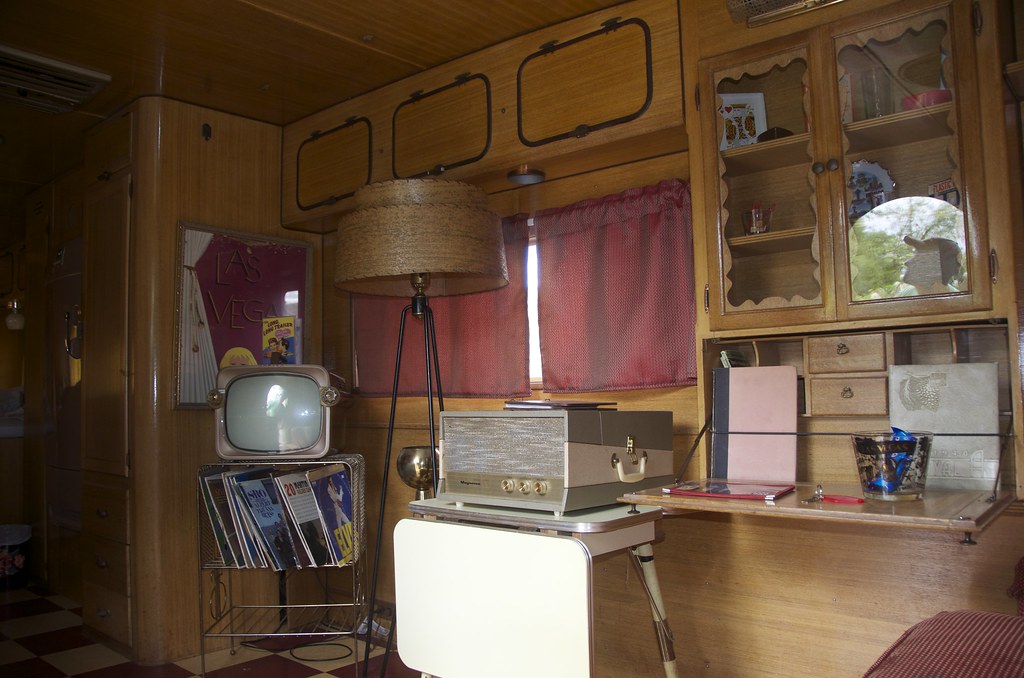
All the interiors have been restored to period including old phono players and records.

1959 Airfloat restored interior. by Overland Frontier, on Flickr

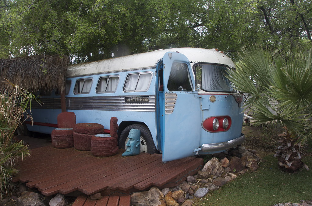
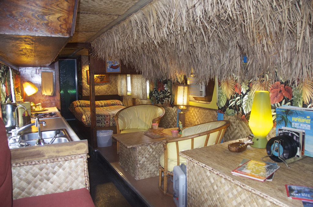
Grant and I choose the 1941 Tiki Bus, because it not only had two separate beds but it just seemed to have the most attitude.


1941 Tiki Bus. by Overland Frontier, on Flickr

The inside was equally colorful and funky.


1941 Tiki Bus Interior. by Overland Frontier, on Flickr

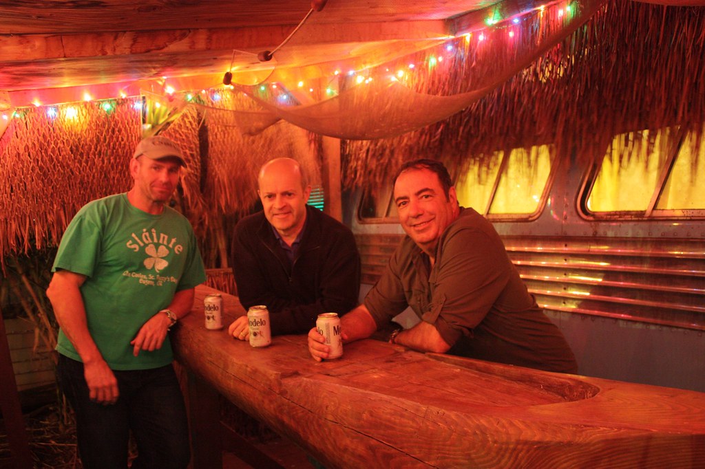
But the icing on the cake was the private Tiki Bar deck. (Left to right: Pete Getty, Grant Lovig and author, Roger Mercier).


Tiki Bus Private Bar. by Overland Frontier, on Flickr

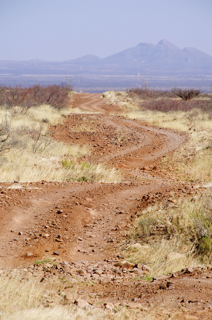
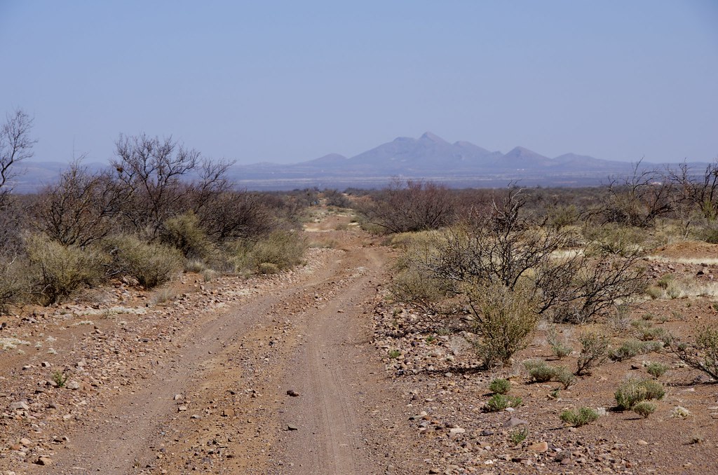
During my research for interesting trails running north from the Mexican Border, I came across a road called “The High Lonesome”. It was just so Hollywood romantic; I had to try it out.

High Lonesome Road. by Overland Frontier, on Flickr

Serpentine section of High Lonesome Road. by Overland Frontier, on Flickr

High Lonesome Road. by Overland Frontier, on Flickr

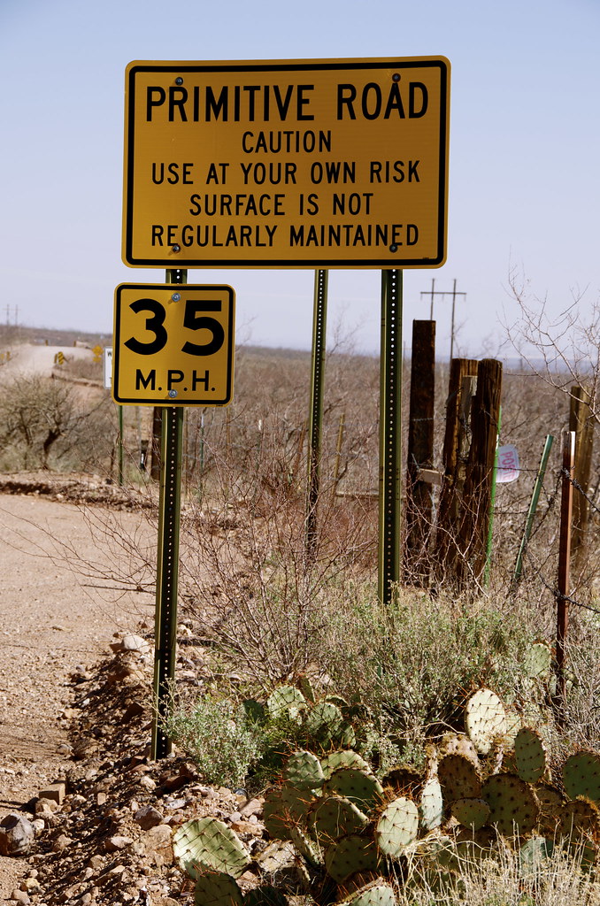
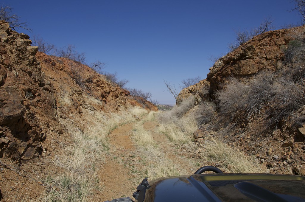
The reason the road is rated Moderately difficult is washes have to be crossed where crumbling bridges once spanned. I have been unable to find when the road was built and let to fall into disrepair. The numerous derelict bridges are telltales to a, once, important artery.

Crumbling bridge on High Lonesome Road. by Overland Frontier, on Flickr

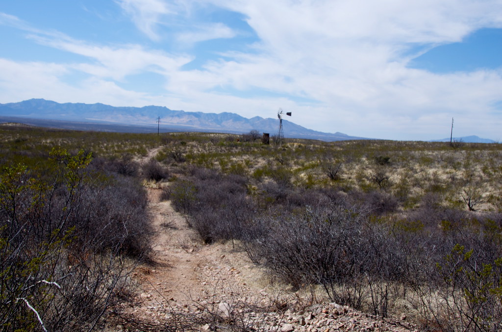
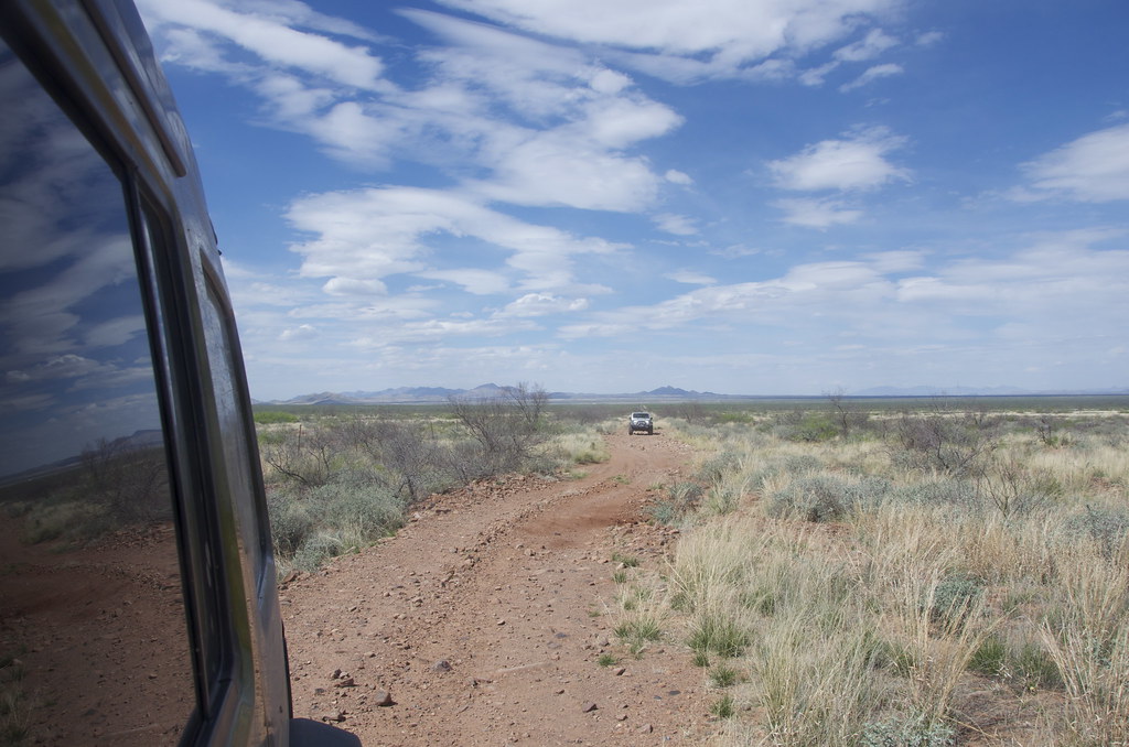
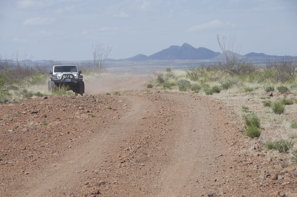
Most of the lower part of the High Lonesome is a solid, but rough road. Pete Getty traveling from the North. We can see from old maps that it used to run nearly straight up to mining boomtowns of Gleeson and Pearce, now ghost towns.


High Lonesome Road with Cochise Stronghold in background. by Overland Frontier, on Flickr

After the bridged sections, the road opened once again, until it disappeared in a new subdivision.


High Lonesome Road. by Overland Frontier, on Flickr

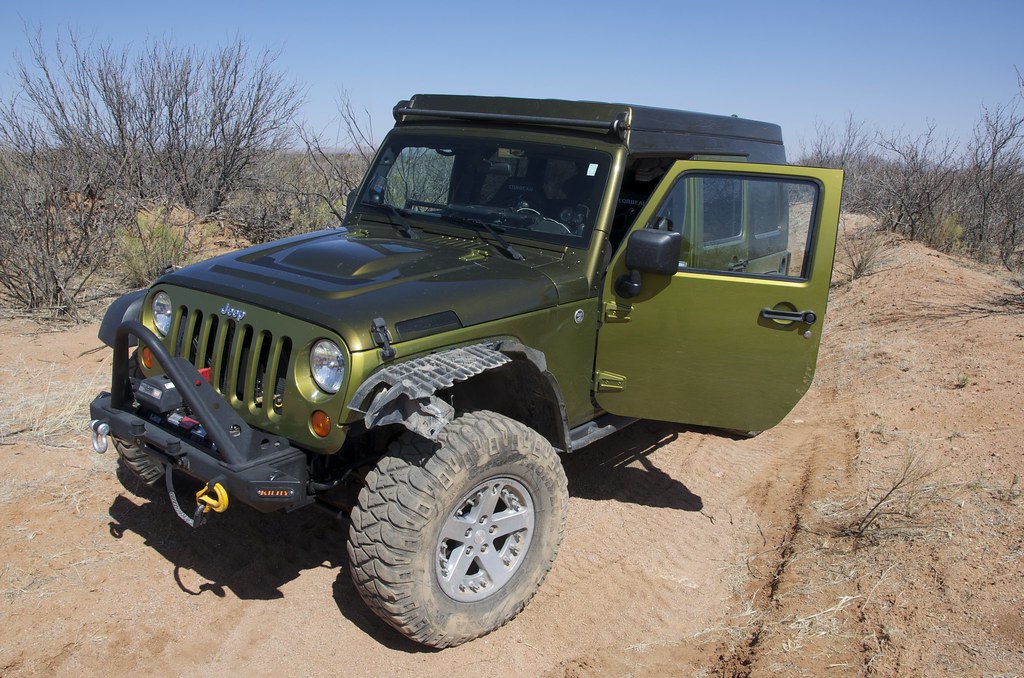
Following our USGS maps on Gaia GPS, I rediscovered the route, which at the time was without tracks, making it even more compelling leading me to hope that this narrow and overgrown trail carried on all the way up to the Cochise Stronghold. Unfortunately, a ‘Private Property’ sign was encountered shortly after on a ranch gate, bringing the JK to an abrupt halt.


Last section of High Lonesome Road leading to dead end for southern portion. by Overland Frontier, on Flickr

While doubling back to the subdivision, I encountered a low hanging branch that took out a fender flare. I think I was more disappointed that The High Lonesome came to a grinding halt.

Tree branch damage on overgrown section of High Lonesome Road. by Overland Frontier, on Flickr

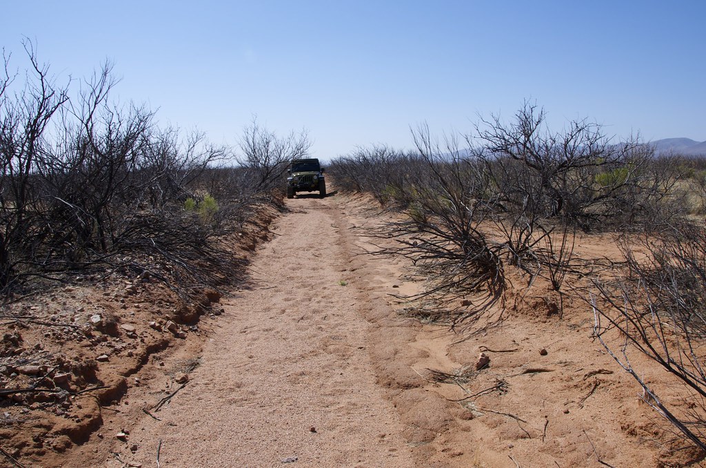
With that said, I soon discovered that only a 10-mile section was off-limits. After a short highway run to circumvent the ranch, I rediscovered the northern end of the High Lonesome, now rebranded as the Gleeson – Pearce Ghost Town Road, by Cochise County marketers; featured in our next Trek Leg.

Check out our free scouting report slideshow, with twice as many photos and a GPS/GPX Tracklog that can be viewed on-line or dowloaded free: http://www.overlandfrontier.com/trek-legs/lowell-shady-dell-high-lonesome-road

For a sneak peak of the rest of the Journey, check out our free Journey Synopsis at: http://www.overlandfrontier.com/journey/arizona-territory-wild-west-loop-or-pass-thru-journey
 

mercier@streetsmart.ca

Expedition Scout
Leg 5: Gleeson-Pearce Ghost Town Road & Dragoon Mountains

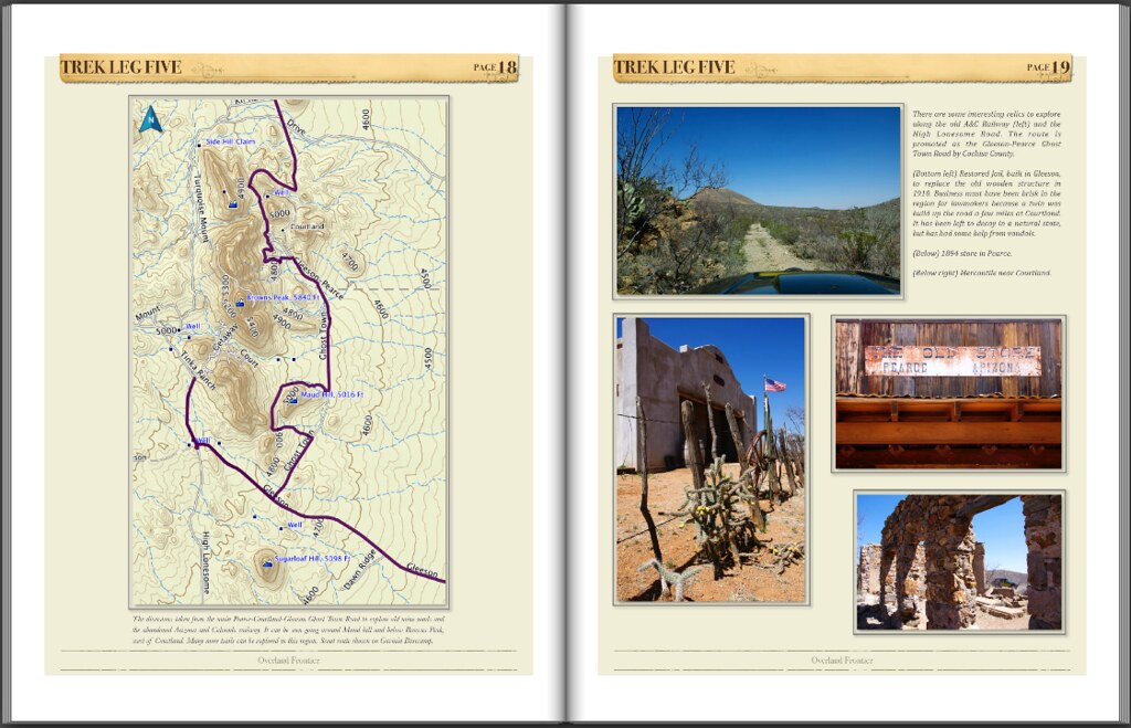
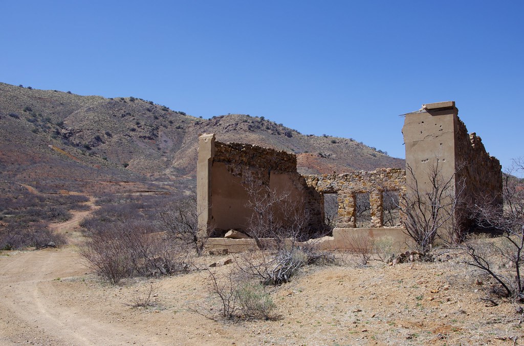
After bypassing the 10-mile ranch that now owns a section High Lonesome Road, we picked up the old route and followed it to Cochise Stronghold as it crosses the mineral rich toe of the Dragoon Mountains. We weaved in parts of the abandoned bed of the Arizona & Colorado Railway that was built from Cochise to Pearce and Gleeson, at the turn-of-the century. This northern section of High Lonesome has been coined the Gleeson to Pearce Ghost Town Road by Cochise County, to stimulate interest. The first town in the area was called Turquoise, named after the stone that had been mined by natives here for many generations. Later the town was moved closer to water, down the hill, and was renamed Gleeson. Discoveries of cooper, silver and lead drew more prospectors in the 1890‘s.


Old mercantile along the High Lonesome Road near Courtland. by Overland Frontier, on Flickr

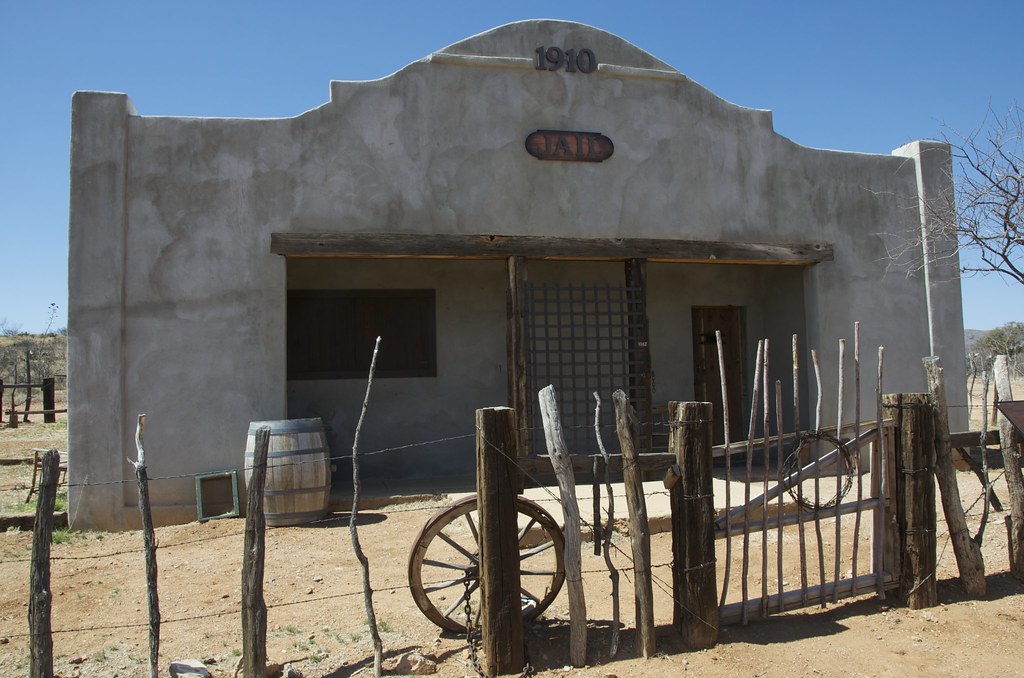
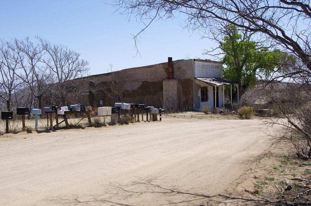
The1910 Jail in Gleeson was restored. Business must have been brisk in the region for lawmakers because a twin was built a few miles up the road, at Courtland where it has been left to decay in a natural state, but has had some help from vandals.


Gleeson 1910 Jail. by Overland Frontier, on Flickr


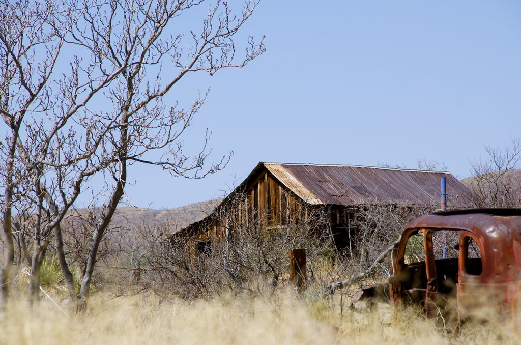
Gleeson Ghost Town. by Overland Frontier, on Flickr


Gleeson Ghost Town. by Overland Frontier, on Flickr


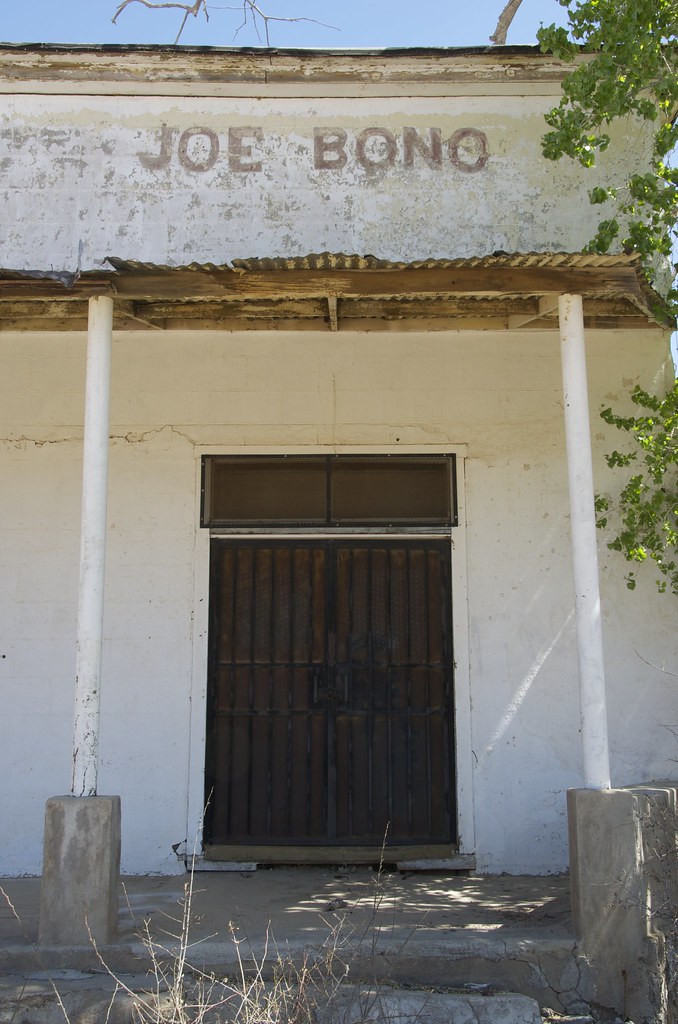
Jo Bono Saloon in Gleeson. by Overland Frontier, on Flickr


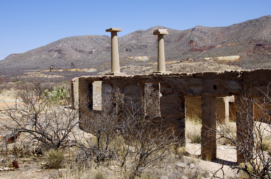
Gleeson School Ruins. by Overland Frontier, on Flickr


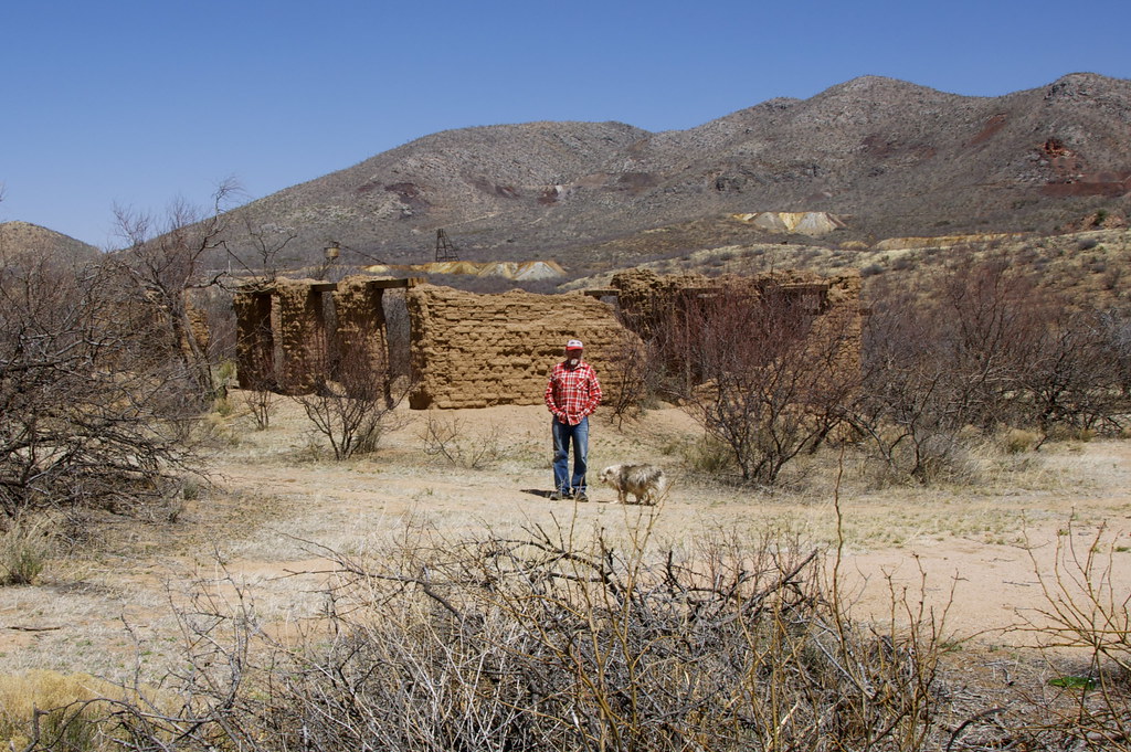
Gleeson Hospital Ruins and last resident of Gleeson Ghost Town. by Overland Frontier, on Flickr


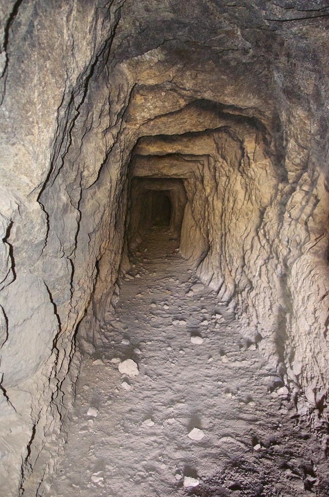
Mine Adit above Gleeson. by Overland Frontier, on Flickr


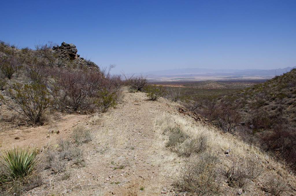
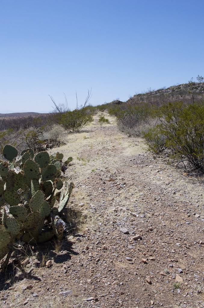
Abandoned bed of the Arizona and Colorado Railway, looking North. by Overland Frontier, on Flickr


Abandoned bed of the Arizona and Colorado Railway, looking Southwest. by Overland Frontier, on Flickr


Retracing the Arizona and Colorado Railway. by Overland Frontier, on Flickr


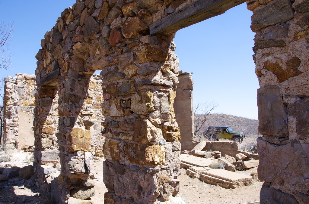
Mercantile ruins near Courtland by Overland Frontier, on Flickr


Arizona and Colorado Railway, below Browns Peak and Turquoise Mountain. by Overland Frontier, on Flickr


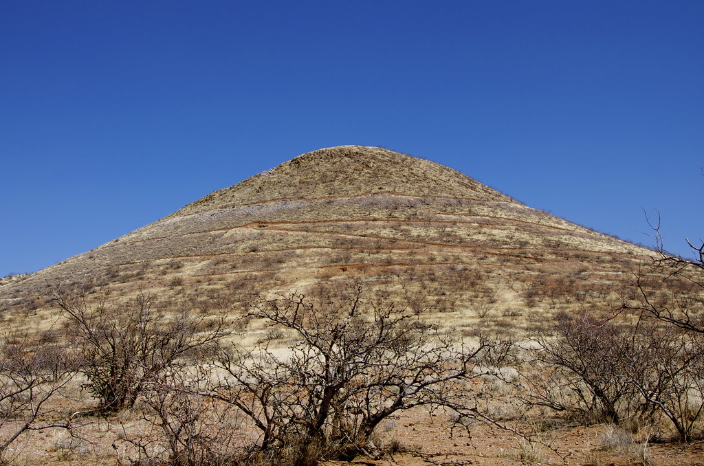
Mexican Hat Mountain along High Lonesome Road. by Overland Frontier, on Flickr

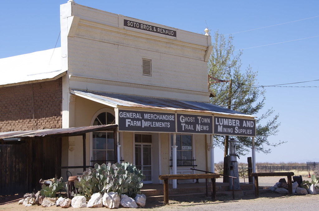
Pearce town site was built at the base of the Commonwealth Mine discovered in 1894 , after Jim Pearce found free standing gold on the corner of his recently purchased ranch property. They sold the mine but continued to operate the boarding house into the 1930's.


Tin fronted adobe mercantile built in 1894 by Soto Bros and Renuad by Overland Frontier, on Flickr


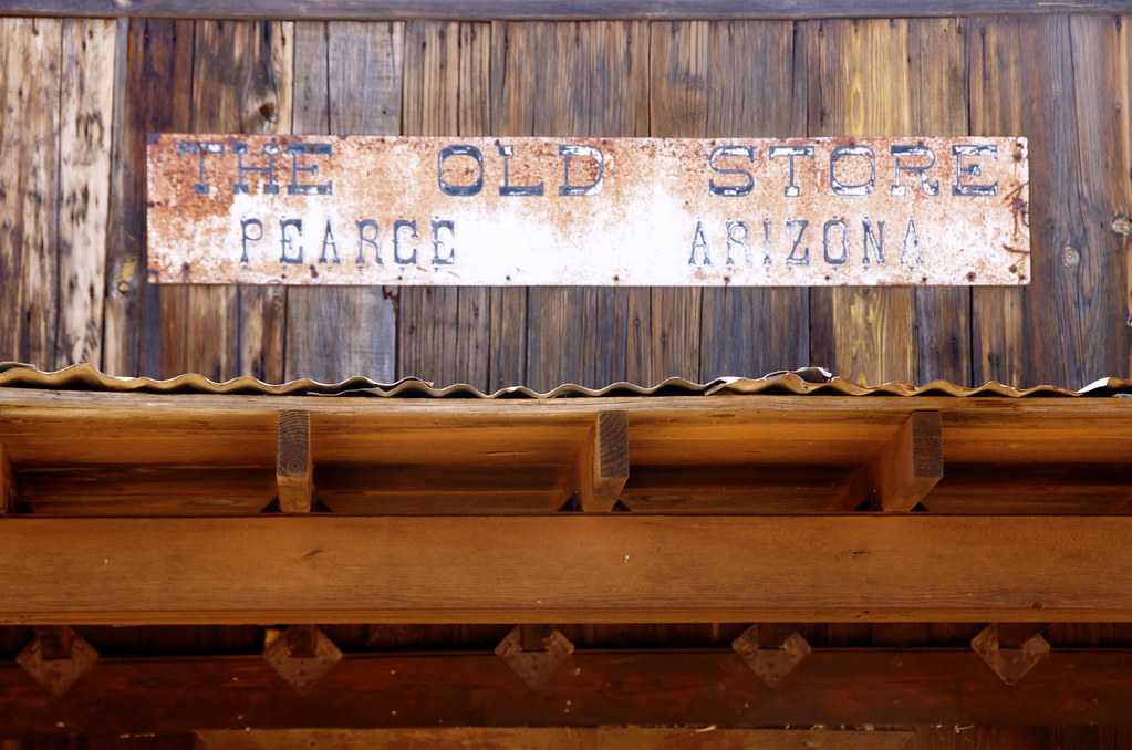
Old Store, Pearce, AZ. by Overland Frontier, on Flickr


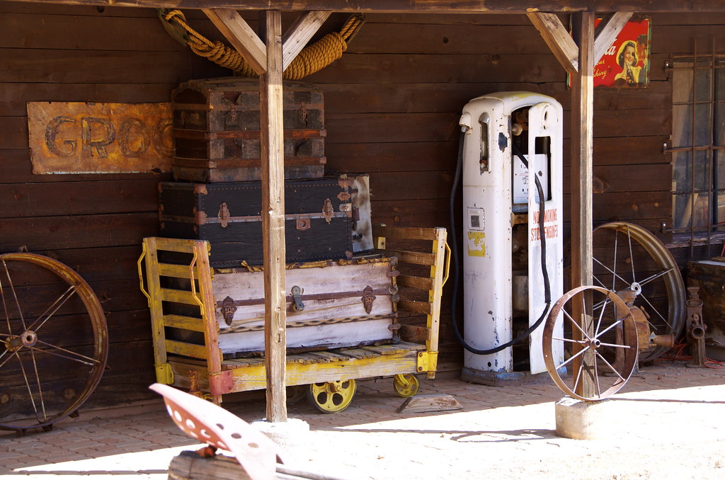
Relics in Pearce Ghost Town. by Overland Frontier, on Flickr

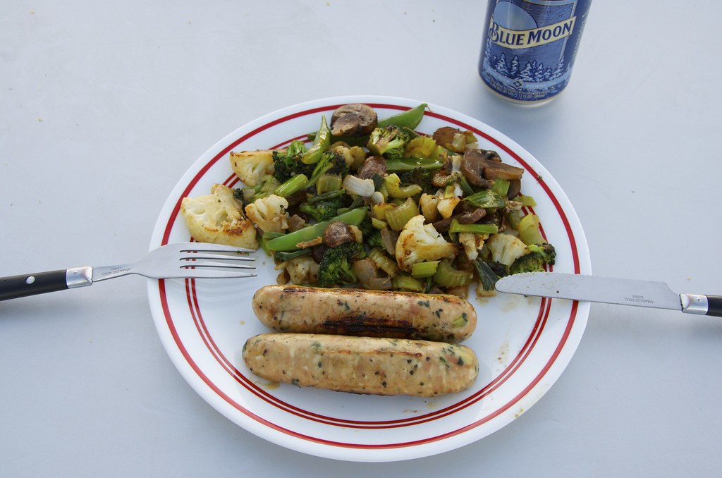
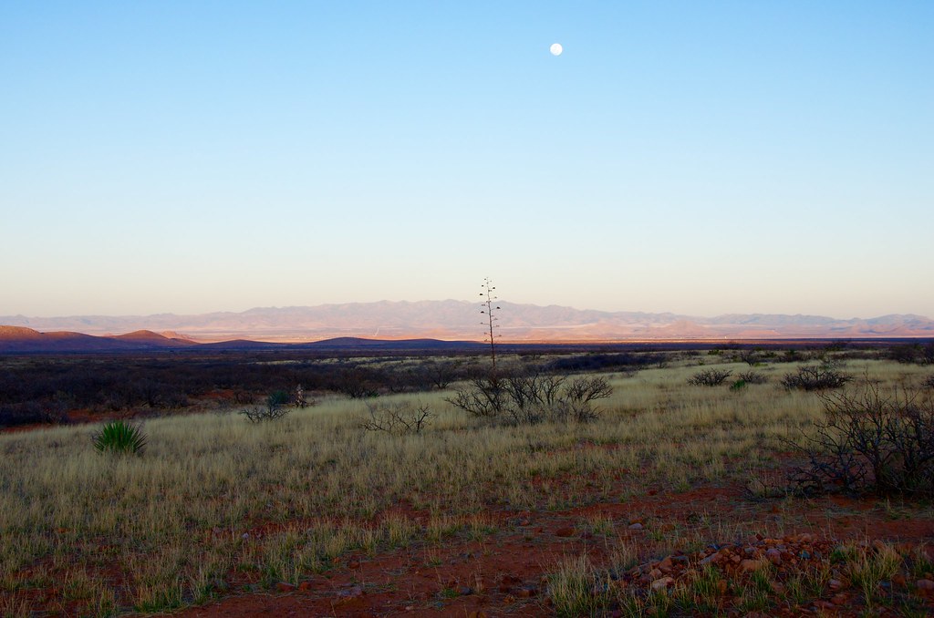
The original plan was to explore the tip of the Dragoon Mountains, south of Middle March Road, but dusk was approaching. The mellow valley views lured me to set up camp so I could get an early start scouting Cochise Stronghold the following morning. A great meal and beverage is always rewarding long day on the trail.


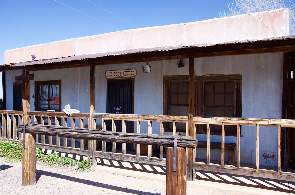
Pearce Post Office. by Overland Frontier, on Flickr


Camp near southern Dragoon Mountain Gateway. by Overland Frontier, on Flickr

Dinning entertainment was provided by the sunset making way for a full moon, a fine ending to a fine day.


Camp near southern Dragoon Mountain Gateway. by Overland Frontier, on Flickr

Check out our free scouting report slideshow, with twice as many photos and a GPS/GPX Tracklog that can be viewed on-line or downloaded free:

http://www.overlandfrontier.com/trek-legs/gleeson-pearce-ghost-town-road-dragoon-mountains

For a sneak peak of the rest of the Journey, check out our free Journey Synopsis at:
http://www.overlandfrontier.com/journey/arizona-territory-wild-west-loop-or-pass-thru-journey
 
Last edited:
Forum statistics

Threads
188,196
Messages
2,903,666
Members
229,665
Latest member
SANelson
Top