Roaming North America in a 17 foot camper - Newfoundland

Hey everyone. We are Bobby and Cynthia, and we are 2 1/2 months into our adventure of traveling around North America in our Kimberley Karavan. Sorry that I didn't start this right when we started but things were a bit hectic with this new lifestyle. If anyone wants to catch up on where we've been and what we've done you can check out our blog wanderwithus.

Friday, June 29th
We left Baie-Comeau after getting some scheduled maintenance done on the Colorado and stocking up on some food. The first part of QC-389 is paved and in really good condition. The highway follows the Manicougan River and there are three dams along the route. The largest of which is Manic 5. The largest arch and buttress dam in the world.
TLH-5-Manic-5-compressor.jpg

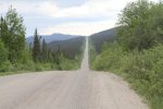
Right after Manic 5 the road goes to gravel. The road isn't traveled by a lot of people. Mostly big rigs and work trucks, both of whom drive way faster than we do.
TLH-8-compressor.jpg

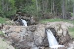
The scenery here is breathtaking. Everything seems to just go on forever. We passed a lovely little waterfall right on the side of the road.
TLH 9a-min (1).JPG

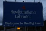
And then around night fall we finally made it into Labrador.
TLH-11-compressor.jpg
 
Saturday, June 30th

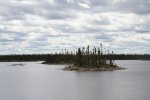
We left Labrador City and headed out on the Trans Labrador Highway towards Churchill Falls. We passed many lakes, streams, and rivers. The scenery here never gets old.
TLH-13-compressor.jpg

We stopped in Churchill Falls to fill up and I also purchased a fishing license. We drove until we found a nice area to pull off that was close to a stream so that we could do a little fishing.
20180630_175009.jpg

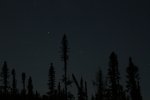
Unfortunately we didn't have any luck fishing so we headed back to the camper. It had been cloudy for the last few days but that evening the clouds started to break up so I went outside and got some photos of the night sky.

TLH-15-compressor.jpg
TLH-18f-compressor.jpg
TLH-16-compressor.jpg
 
Last edited:
Sunday, July 1st

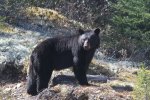
Shortly after we got on the road we came across this black bear that was eating grass on the side of the highway. We were able to take photos of him for a several minutes before we continued back on our way.
TLH-25-compressor.jpg
TLH-26-compressor.jpg
TLH-27-compressor.jpg
TLH-31-compressor.jpg
TLH-35-compressor.jpg

It was nice finally spotting some wildlife along the highway. We were beginning to think that we were cursed. We finished our drive to Happy Valley-Goose Bay and that is where we are at the moment. The town has a Chevy dealer and we wanted to have something looked at before we headed off so we are staying here another day. The next time we have internet I will update.
 
Wednesday, July 4th

We left Happy Valley-Goose Bay and headed south on 510. The road stayed paved for about and hour then it turned to gravel dirt. We crossed into Newfoundland Time Zone.
Red-Bay-02-compressor.jpg

The dust from the road gets EVERYWHERE. We have a seal on the Karavan that has pulled away that we need to get fixed. The Karavan was full of dust when we set up camp for the night. We stayed in the Mary's Harbour for the evening. They allow travelers to set up at the school during the summer.


Thursday, July 5th

Luckily the road is paved starting in Mary's Harbour. We headed out and made the short drive to Red Bay, a UNESCO World Heritage Site. Red Bay is the site of the first industrial efforts in North America. In the mid-16th century, Basque fisherman came to harvest right and bowhead whales, establishing a whaling port in Red Bay to produce oil that was sent back to Europe to light lamps.
Red-Bay-06a-compressor.jpg

We toured Saddle Island, where the Basque whalers would process the whales.
Red-Bay-06-compressor.jpg

We even spotted a "small" iceberg floating. You can make out Newfoundland in the background.
Red-Bay-12-compressor.jpg

The drive from Red Bay was nice. With lots of open road.
Red-Bay-16-compressor.jpg

and great views
IMG_9042-compressor.jpg
Red Bay 18-min.JPG
Red-Bay-19-compressor.jpg

We decided to stay in West Saint Modeste, at the Oceanview Resort. They have water and 30 amp hookups. We ended up staying 4 days instead of the 2 that we were planning. We drove around and checked out the neighboring towns. We spotted our first whales on the trip so far
Red Bay 21-min.JPG

and also a herd of seals.
Red-Bay-23-compressor.jpg

We are taking the ferry from Blanc-Sablon to Saint Barbe this morning and will post again here shortly.
 

whitenoise

Adventurer
Hey guys - Thank you very much for posting, great photos. We are planning to do the same route in mid-August. I had a few questions I hope you won't mind answering:

- How's the weather and the bugs? Ride reports from last year suggest lots of black flies etc.
- Can you camp pretty much anywhere up there, or do you have to go to a campground? What resources would you suggest to find good campsites?
- Are you carrying extra fuel? I have a thirsty Land Cruiser with only a 300 mile range.
- Did you guys make any ferry reservations or is it reasonable to expect finding last-minute space on the ferries?


Thanks in advance!

I don't mind at all. Part of the reason I wanted to post here was trying to pay it forward for all the help that this forum has given me in the past.

- The weather has been fairly chilly. Where we camped at a bit east of Churchill Falls it got down into the 30's at night. Some days have gotten into the 70's but mostly 50's and 60's with a fair amount of wind with nighttime temps being in the 40's. As far as bugs go, I hope that I'm not jinxing ourselves but we haven't had any black flies and the mosquitoes haven't been too bad either. What we are being told is that Spring was pretty late to get here this year so this might be affecting this.

- You can camp pretty much anywhere. I asked a gentleman in Mary's Harbour about a campground and he told me if i see an opening anywhere just pull on in there and set up camp. This seems to be the case in most places. All along the highway there are pull off places where you can just park and camp, a lot of these are right near water, so if you are interested in fishing there are plenty of places.

- We carry two extra 5 gallon jerry cans of diesel. The fuel mileage of the Colorado towing is pretty good and we average pretty close to 18 mpg, so we never came close to needing any fuel from our cans. You might want to carry extra just to give yourself some piece of mind but I really doubt you would need it. Just a warning though fuel is expensive. Expect to pay over $5 and in a lot of places close to $6 or more.

- Our first ferry crossing in Canada was today actually. We were near the ferry office on Saturday so went in to see about purchasing a ticket for today and the lady told me that it wasn't possible to purchase one that it was already booked up but to just come to the office two hours before departure and there won't be any problem . So we showed up just before 11am for the 1pm crossing and had no issues purchasing a ticket. We were the second people there.

I hope this helps and don't hesitate to ask any more questions. The posts on our website has a bit more photos and goes into more detail if you are interested. Wander With Us
 

whitenoise

Adventurer
Excellent info and link, thanks guys! I did have a follow-up question, 18mpg with towing is awesome - What is your range on that truck on a full tank - 600 miles? I only have a best-case 300 mile range (14mpg mixed) and cannot carry jerry cans without making a rack or something, so just wondering how many I will need.
 
Excellent info and link, thanks guys! I did have a follow-up question, 18mpg with towing is awesome - What is your range on that truck on a full tank - 600 miles? I only have a best-case 300 mile range (14mpg mixed) and cannot carry jerry cans without making a rack or something, so just wondering how many I will need.

We have a 21 gallon take so its about 378 miles on our tank and 550 miles with the extra fuel. We were never close to running out. The rule of thumb is just never pass a gas station without filling up. We filled up near Manic 5, but there is also a place in Relais-Gabriel about 60 miles up the road. From there I believe the next place to get fuel is Fermont, which is about 155 miles away. Labrador City is only about 15 miles away from Fermont so you can easily just wait until Labrador City. From there it't another 155 miles or so to Churchill Falls. From there it is about 180 miles to Happy Valley-Goose Bay. Then its about 255 miles to Port Hope Simpson, which is the greatest distance between fuel stops on the highway. After that fuel isn't an issue because there are a few small towns and none are very far away. Hope this helps.
 

whitenoise

Adventurer
Excellent info and link, thanks guys! I did have a follow-up question, 18mpg with towing is awesome - What is your range on that truck on a full tank - 600 miles? I only have a best-case 300 mile range (14mpg mixed) and cannot carry jerry cans without making a rack or something, so just wondering how many I will need.

We have a 21 gallon take so its about 378 miles on our tank and 550 miles with the extra fuel. We were never close to running out. The rule of thumb is just never pass a gas station without filling up. We filled up near Manic 5, but there is also a place in Relais-Gabriel about 60 miles up the road. From there I believe the next place to get fuel is Fermont, which is about 155 miles away. Labrador City is only about 15 miles away from Fermont so you can easily just wait until Labrador City. From there it't another 155 miles or so to Churchill Falls. From there it is about 180 miles to Happy Valley-Goose Bay. Then its about 255 miles to Port Hope Simpson, which is the greatest distance between fuel stops on the highway. After that fuel isn't an issue because there are a few small towns and none are very far away. Hope this helps.
Wow, thanks a lot guys! This info is super helpful. Have a safe trip.

Sent from my ONEPLUS A3000 using Tapatalk
 

skyfree

Active member
FYI, the Colorado fuel tank is actually 25 gallons even though the brochure says 21. The fuel shut off point is set at 21 gallons, but you can slow fill it to much more. I've gotten almost 24 gallons into mine using a slow fill after running it down about 15 miles past the reserve light. Most people have filled at least 23.5 at some point. It gives me a pretty decent range on my ZR2 Duramax.
 

redruby

Member
After you got off the asphalt is it necessary to have a 4x4 vehicle for the dirt sections. We are planning on doing this trip next year, we where supposed to do it this year but unfortunately things got in the way. We will be driveing a 1 ton dually 2 wheel drive towing a 24' tow hauler, do you recommend doing this road with this setup? Thx for posting.
 
  • Like
Reactions: dwh

Forum statistics

Threads
188,360
Messages
2,903,748
Members
230,227
Latest member
banshee01
Top