You are using an out of date browser. It may not display this or other websites correctly.
You should upgrade or use an alternative browser.
You should upgrade or use an alternative browser.
unURBAN Adventures - Alaska to Argentina to AFRICA!
- Thread starter unURBAN
- Start date
Wow, finally got done reading, and catching up! Great read...
vivithemage and coax,
Thanks for comments and questions!
.
So! Here we go:
.
Can I ask how much you budgeted for food/fuel/hotels-lodging/repairs/emergency?
- yes, you can!
") Our budget was about 85 USD per day for the two of us in North America. In Central it dropped to about 40-60 USD per day, and about the same in the northern part of South America. Chile and Argentina is more expensive, with Chile on about 80 USD, and Argentina at about 65-70 (we haven't quite finished the spreadsheets for Chile and Argentina yet...). These numbers include food, acommodation, fuel, and "travel costs" as entrance fees, admission fees, road tax, maps, and stuff like that. The cost of the vehicle, shipping, and insurance is not included. Vehicle maintenance is also not in these numbers. This will probably depend on the vehicle. We have service every 15000 km, and it cost us about 3-400 USD. We do have some money in a bank account in case sh## happens, but we havent had to dig into it yet.
Our budget was about 85 USD per day for the two of us in North America. In Central it dropped to about 40-60 USD per day, and about the same in the northern part of South America. Chile and Argentina is more expensive, with Chile on about 80 USD, and Argentina at about 65-70 (we haven't quite finished the spreadsheets for Chile and Argentina yet...). These numbers include food, acommodation, fuel, and "travel costs" as entrance fees, admission fees, road tax, maps, and stuff like that. The cost of the vehicle, shipping, and insurance is not included. Vehicle maintenance is also not in these numbers. This will probably depend on the vehicle. We have service every 15000 km, and it cost us about 3-400 USD. We do have some money in a bank account in case sh## happens, but we havent had to dig into it yet..
Did you have a lot saved up?
- Yes, we saved up for several years for "something", and we had to chose between buying a home or go traveling. Easy choise...
.
Did you know it would take 1-1.5 years to do this?
- I guess, yes. We talked about traveling for about a year, but I think we kind of knew that it would take more than a year. 1.5 years is also good for hiting the "right" seasons.
.
Did you guys just up and quit your jobs?
- yes!
.
Have you guys done this big of a trip before?
- Not as big as this, and this is also the first time with a car. We have been backpacking a couple of times, and up to about 6 months. Then it has been between jobs or studies, and one time with a couple of months leave from our jobs.
.
How many miles/km could you do on a tank + jerry?
- We have 165 liters of fuel if we fill up our jerry. This will take us safely through 1000 kilometers on really bad roads and at high altitude. Normally we fill up our 145 liters tank, and this takes us comfortably 900 kilometers (we get about 100 kilometers on 15 liters fuel). You don't need this range to drive the PanAm, but we think it is nice to be able to drive past a couple of gas stations or to explore a little of the main routes, so we are very happy about our range. Wouldn't mind to have an even bigger or an extra fuel tank. But you CAN drive the PanAm on a normal fueltank.
.
I noticed you were reading a lot of books, do you wish you had a kindle instead of all the books? I mean ... hundreds of books in one, right?
- Quite a few people use them and are happy with them, but I'm not sure if one would survive long with our kind of use. A tent can get wet, and we like to read on the beach (yes, central america...). I havent really tried one, but books are HEAVY when you pack 20-30 of them, so it is worth a try! ...and we would need 2 of them.
.
Will definitely keep following..stay safe!
- Do that!
And good luck with planning!E&M
Chile Lake District
From the surf at the beaches of the Pacific coast, we drove inland and intended to cross the border back into Argentina at Paso Pehuenche o del Maule. We had a quick stop in Talca to see the local Nissan dealer for a spare fuel filter. We had looked for it in Mendoza, Argentina, but were there told that the only two in the country were in Buenos Aires, and it would take a week to get them. Chile should be easier. Easier, perhaps, but not cheaper! They ordered the filter for us, and we could pick it up the next day, but they charged us about 60 USD for it, and that was with a discount! I think I have to order the Argentinean ones…
.
.
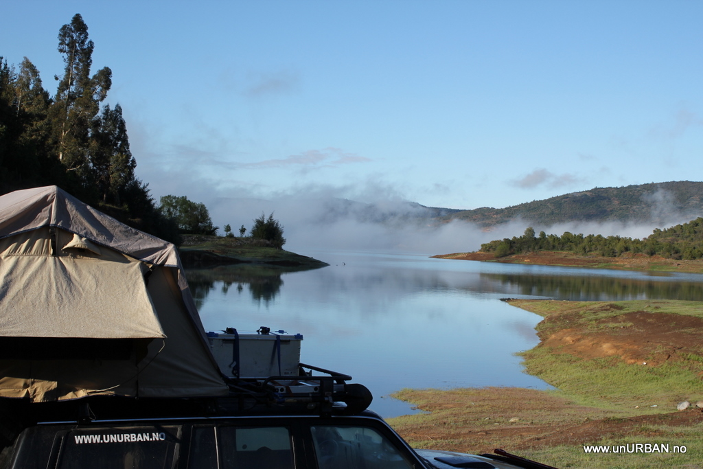
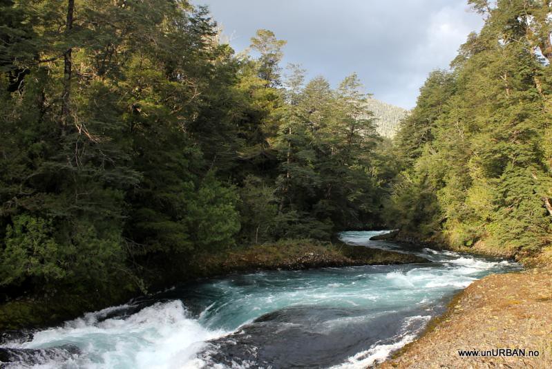
Found ourselves a nice camp on the shore of Lago Colbun an hour east of Talca while waiting for the filter to arrive. At Nissan they also informed us about the pass still being closed for the season, so our option was to go back north to Santiago and Mendoza, or to keep heading south in Chile. As going north is something we try to avoid these days, we aimed for the famous Lake District in Chile. The highway is excellent and we did about 600 kilometers that afternoon to Lago Villarico. Vulcan Villarico in the background.
.
.
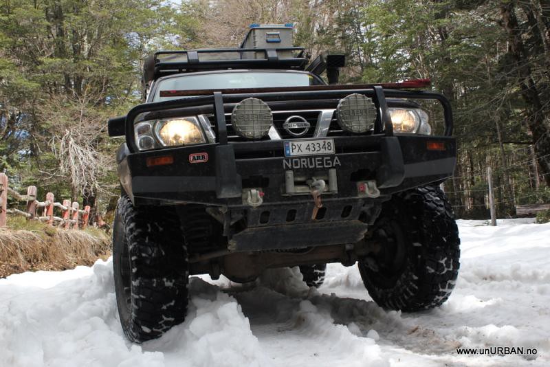
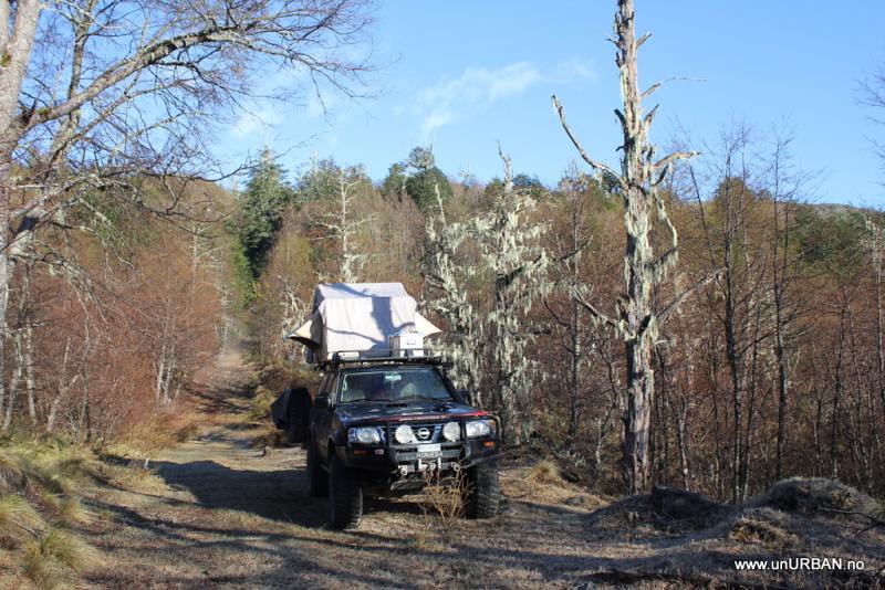
In an old Lonely Planet guidebook they mention the possibility to drive through the Parke Nacional Villarica, but that the road is bad, muddy, and that you definitely need a four wheel drive vehicle. So, we took off, and started driving up to the park entrance. The happy-go-lucky-feeling disappeared quickly when we saw how much snow was still in the area.
.
.
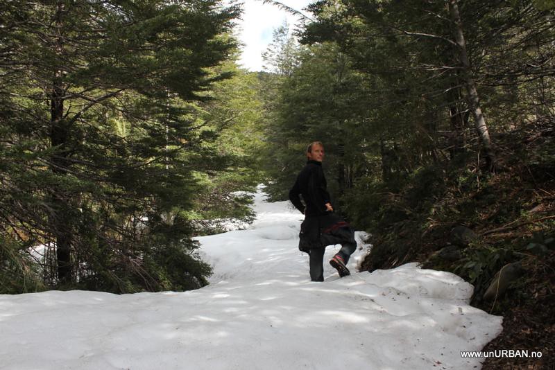
We kept going for a while, making our way through the snow, but a few kilometers in we realized that we were a couple of weeks too early.
.
.
We turned around. There was also a sign saying (we think.. don’t speak that much Spanish) saying “the road is very bad, don’t drive further”, but I never interpret this as an “illegal to..”.
.
.
Camped in the forrest before going back down to Pucon.
.
Back on the road, we drove towards Lago Calafquen and Conaripe, and continued south east to Neltume and Puerto Fuy. We could have crossed the border at Paso Mamuil Malal closer to Pucon, but we decided that the Paso Hua Hum would be more scenic. And it was a beautiful drive!
.
.
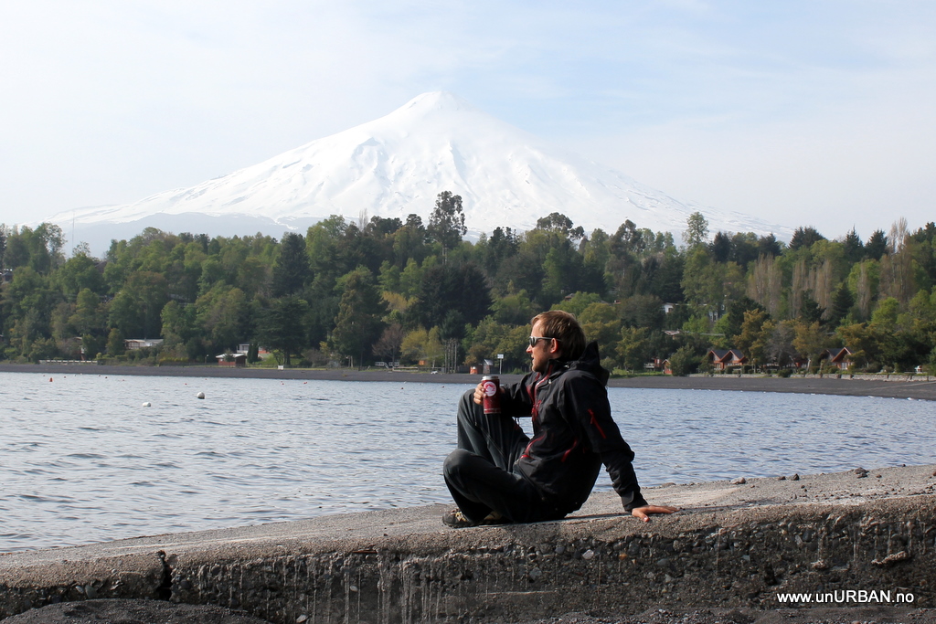
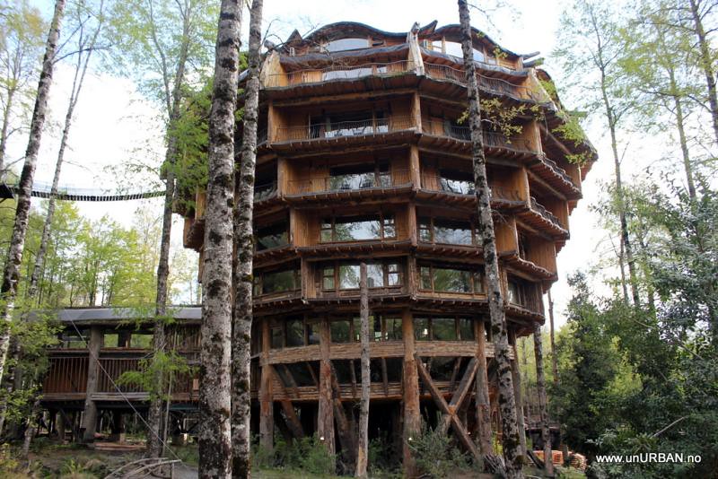
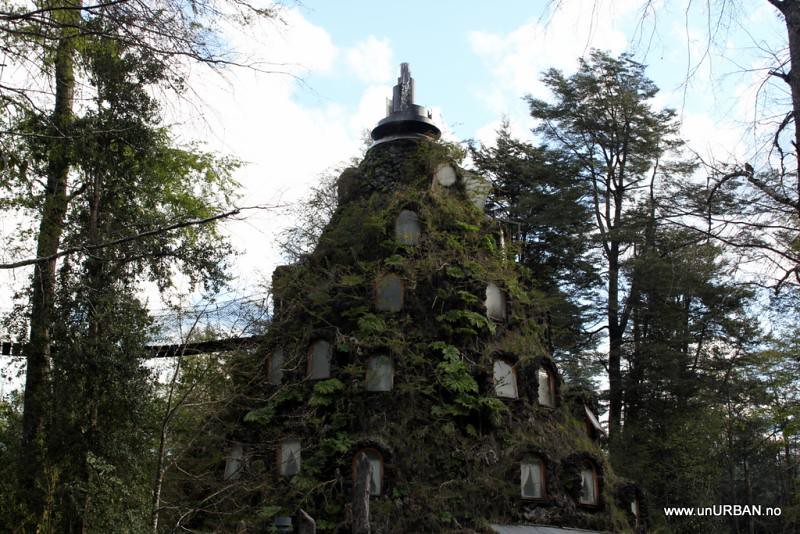
In Neltume we also came across this hotel, and would have loved to stay, if it wasn’t for the tiny little detail about the 320 USD per night… Still, this must be one of the most fascinating hotels I have ever seen.
.
.
The two buildings are connected, and the cone shaped one was the first to be built. See and read more about this amazing project on http://www.huilohuilo.com
.
.
The company/organization behind these hotels has bought up the whole area (and is the reason for a couple of other interesting roads now being closed (see posts from JPVM and reply)). But maybe it is for the best. Not often we see an area that appears as clean and unspoiled as this…
.
.
Trying to save a few bucks, we found ourselves a nice and free camp site on the shore of Lago Neltume a few kilometers away. Not bad at all.
.
.
And then we took the ferry to Argentina…
.
.
More soon!
E&M
From the surf at the beaches of the Pacific coast, we drove inland and intended to cross the border back into Argentina at Paso Pehuenche o del Maule. We had a quick stop in Talca to see the local Nissan dealer for a spare fuel filter. We had looked for it in Mendoza, Argentina, but were there told that the only two in the country were in Buenos Aires, and it would take a week to get them. Chile should be easier. Easier, perhaps, but not cheaper! They ordered the filter for us, and we could pick it up the next day, but they charged us about 60 USD for it, and that was with a discount! I think I have to order the Argentinean ones…
.
.
Found ourselves a nice camp on the shore of Lago Colbun an hour east of Talca while waiting for the filter to arrive. At Nissan they also informed us about the pass still being closed for the season, so our option was to go back north to Santiago and Mendoza, or to keep heading south in Chile. As going north is something we try to avoid these days, we aimed for the famous Lake District in Chile. The highway is excellent and we did about 600 kilometers that afternoon to Lago Villarico. Vulcan Villarico in the background.
.
.
In an old Lonely Planet guidebook they mention the possibility to drive through the Parke Nacional Villarica, but that the road is bad, muddy, and that you definitely need a four wheel drive vehicle. So, we took off, and started driving up to the park entrance. The happy-go-lucky-feeling disappeared quickly when we saw how much snow was still in the area.
.
.
We kept going for a while, making our way through the snow, but a few kilometers in we realized that we were a couple of weeks too early.
.
.
We turned around. There was also a sign saying (we think.. don’t speak that much Spanish) saying “the road is very bad, don’t drive further”, but I never interpret this as an “illegal to..”.
.
.
Camped in the forrest before going back down to Pucon.
.
Back on the road, we drove towards Lago Calafquen and Conaripe, and continued south east to Neltume and Puerto Fuy. We could have crossed the border at Paso Mamuil Malal closer to Pucon, but we decided that the Paso Hua Hum would be more scenic. And it was a beautiful drive!
.
.
In Neltume we also came across this hotel, and would have loved to stay, if it wasn’t for the tiny little detail about the 320 USD per night… Still, this must be one of the most fascinating hotels I have ever seen.
.
.
The two buildings are connected, and the cone shaped one was the first to be built. See and read more about this amazing project on http://www.huilohuilo.com
.
.
The company/organization behind these hotels has bought up the whole area (and is the reason for a couple of other interesting roads now being closed (see posts from JPVM and reply)). But maybe it is for the best. Not often we see an area that appears as clean and unspoiled as this…
.
.
Trying to save a few bucks, we found ourselves a nice and free camp site on the shore of Lago Neltume a few kilometers away. Not bad at all.
.
.
And then we took the ferry to Argentina…
.
.
More soon!
E&M
Last edited:
jpvm
Explorer
Very nice report Malin and Espen , at least you guys visited the right spots, the most "must be seen" spots (but in December - January was the correct time of the year to travel this part of Chile) , although there are thousand more places to see, but this will give you and idea of southern Chile (at least the lake district and northern Patagonia). Another chapter is if you drive the Carretera Austral (south of Puerto Montt)and go to Torres del Paine Natl Park. This is called Patagonia sur.
:drool:
:drool:
vivithemage
Observer
Thanks for the reply and update!
Can I ask how much you had saved up? My guess is about 30,000 USD?
You said you had gone out on 6~ month trips before, without the vehicle, were they all backwoods style camping? Or were they in and out of cities? Being unurban, I bet it was backwoods?
Where/how did you plan your trip? Did you pretty much map out most of the cities you wanted to hit? Most of the hot spots, like arizona/flats/mayan ruins?
Have you done a lot of off roading before, in your patrol?
Lake district Argentina
.
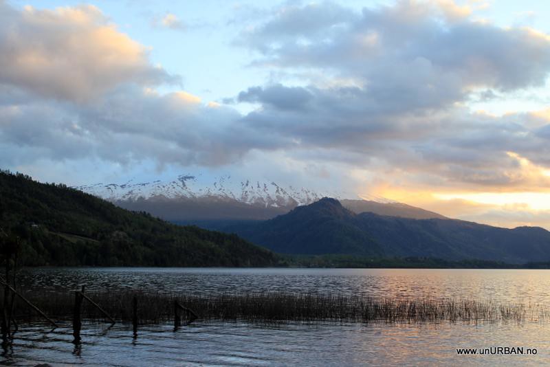
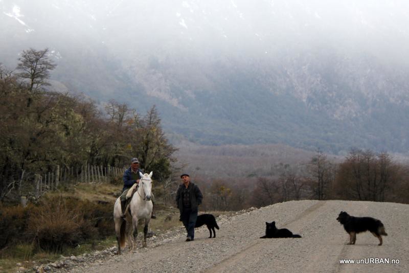
After crossing into Argentina at the Paso Hua Hum border crossing, we were in the Argentinian lake district, and it seemed like a relaxed place where people stop along the road for a chat. From here it was just a short drive to San Martin de los Andes where we stopped by the tourist office to ask about campgrounds. We are probably of the first tourists to arrive for the summer season which starts in December…, and most campgrounds are still closed. But halfway on the “camino de los Siete Lagos” – “road of the seven lakes” - at Lago Villarino, one camping area without facilities should be open for camping.
.
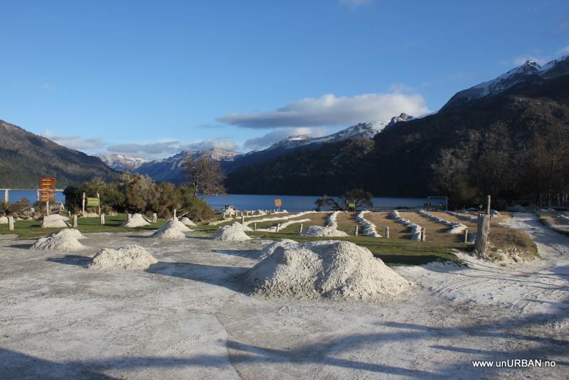
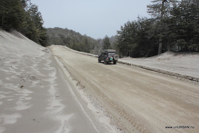
Driving south from San Martin de los Andes we started to notice a lot of grey dust along the road, and suddenly we realized it was not just along the road, but all over, kilometer after kilometer. After some time we understood that it must be ash from a volcano eruption. The further south we got the ash layer became thicker. At Lago Falkner, the campground with facilities was still closed, but they were working on removing the ash from the camping area.
.
.
We found our spot for the night at Lago Villarino, and we were careful to clean our shoes for ash before climbing into the tent that night.
.
.
It was a beautiful location for a camp site, and we enjoyed a slow morning with breakfast and reading our books.
.
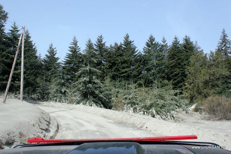
Leaving Lago Villarino the weather was perfect with clear blue sky and sun, but the closer we got to Villa La Angostura we drove into a strange grey “cloudy” fog. In some places it looked like it was winter, with snow and berms along the road, but it was just more ash….
.
.
.
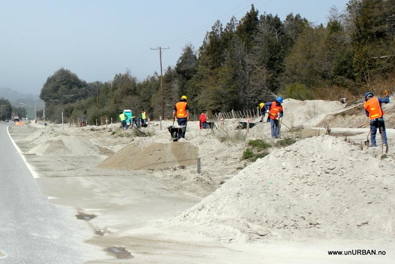
Getting closer to town we could see how they were working on moving all the ash. People were working with spades and brushes in places where they could not use machines, and then the trucks came in, got filled up, and then drove out of town somewhere to dump the ash.
.
.
I guess I have seen images like these in newspapers and on TV before, but like always its different to see it with your own eyes. At the tourist information we learned that the ash came from the Vulcan Puyehue in Chile that erupted on the 5th of July, more than four months ago.
.
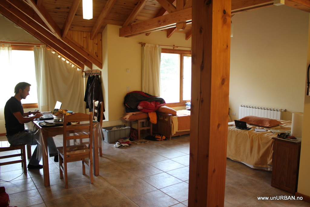
We had a desperate need to do laundry and get online again, and while looking at campgrounds (that did not really look that tempting with all the ash) we got a good offer for a one room apartment. It was great to live indoors again for four full days, and we spent most of the time in Villa La Angostura inside the apartment.
.
.
Through our windows we could not see any of the surrounding mountains on Saturday because it rained the whole day, but on Sunday it was a clear day and we had excellent views to the mountains. When we were leaving on Monday the strange grey “cloud” was back again. We wondered if the “cloud” reappeared on Monday when they started to move all the ash again. The cloud covered a huge area until south of San Carlos de Bariloche.
.
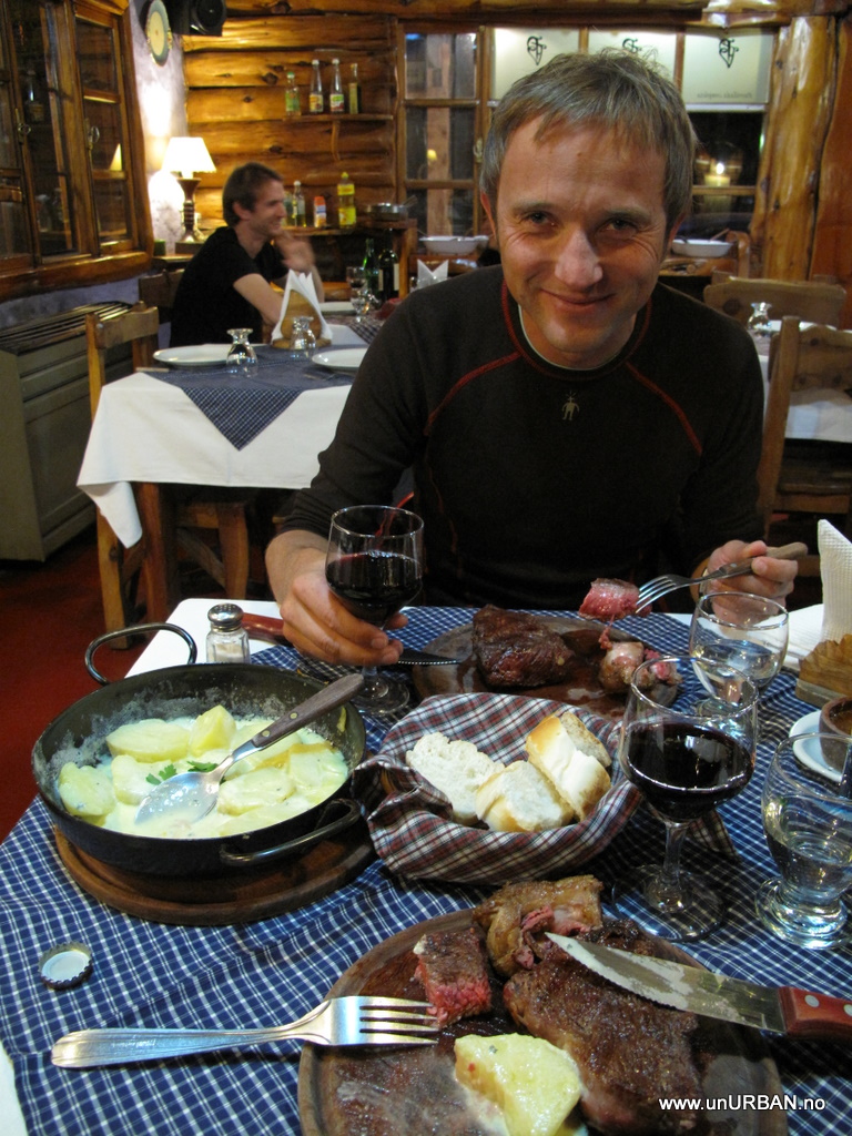
San Carlos de Bariloche did not look so nice as it was under a grey cloud, so we just stopped for lunch at the lake and quickly drove through the city. In El Bolson the sun was shining and we found a campground where we camped under blooming apple trees. It felt like spring at home. Before entering Argentina again we had decided to eat a proper Argentinian beef before going back to Chile. With recommendations from our camp host we had a great dinner that left us wondering why we are never able to find beef this tender in Norway even if you buy the most expensive meat you can find. We still don’t know.
.
.
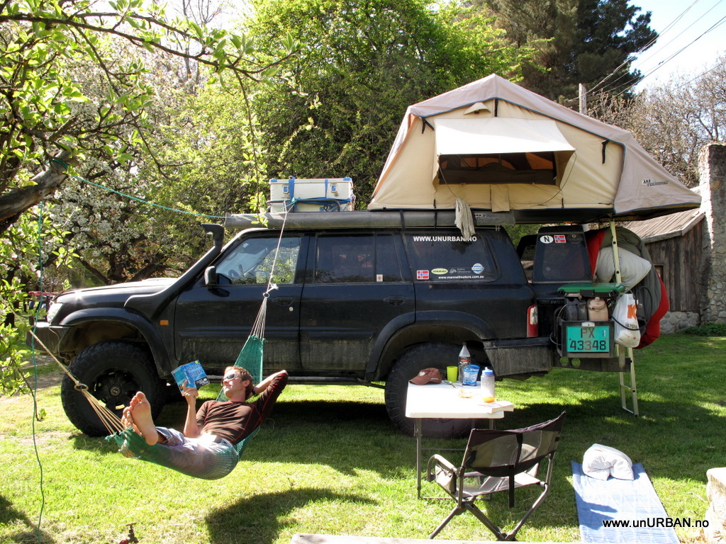
The plan was to leave the next day, but I had enjoyed a bit too much red vine the day before, so it was an easy decision to make to spend another day reading books under the apple trees.
.
.
.
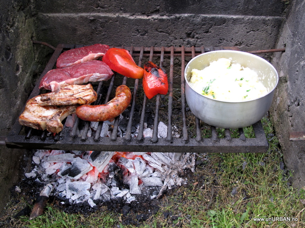
It also gave us the opportunity for a BBQ dinner with more good meat.
.
The next morning we were ready to leave Argentina and find our way to Carretera Austral.
.
M&E
.
After crossing into Argentina at the Paso Hua Hum border crossing, we were in the Argentinian lake district, and it seemed like a relaxed place where people stop along the road for a chat. From here it was just a short drive to San Martin de los Andes where we stopped by the tourist office to ask about campgrounds. We are probably of the first tourists to arrive for the summer season which starts in December…, and most campgrounds are still closed. But halfway on the “camino de los Siete Lagos” – “road of the seven lakes” - at Lago Villarino, one camping area without facilities should be open for camping.
.
Driving south from San Martin de los Andes we started to notice a lot of grey dust along the road, and suddenly we realized it was not just along the road, but all over, kilometer after kilometer. After some time we understood that it must be ash from a volcano eruption. The further south we got the ash layer became thicker. At Lago Falkner, the campground with facilities was still closed, but they were working on removing the ash from the camping area.
.
.
We found our spot for the night at Lago Villarino, and we were careful to clean our shoes for ash before climbing into the tent that night.
.
.
It was a beautiful location for a camp site, and we enjoyed a slow morning with breakfast and reading our books.
.
Leaving Lago Villarino the weather was perfect with clear blue sky and sun, but the closer we got to Villa La Angostura we drove into a strange grey “cloudy” fog. In some places it looked like it was winter, with snow and berms along the road, but it was just more ash….
.
.
.
Getting closer to town we could see how they were working on moving all the ash. People were working with spades and brushes in places where they could not use machines, and then the trucks came in, got filled up, and then drove out of town somewhere to dump the ash.
.
.
I guess I have seen images like these in newspapers and on TV before, but like always its different to see it with your own eyes. At the tourist information we learned that the ash came from the Vulcan Puyehue in Chile that erupted on the 5th of July, more than four months ago.
.
We had a desperate need to do laundry and get online again, and while looking at campgrounds (that did not really look that tempting with all the ash) we got a good offer for a one room apartment. It was great to live indoors again for four full days, and we spent most of the time in Villa La Angostura inside the apartment.
.
.
Through our windows we could not see any of the surrounding mountains on Saturday because it rained the whole day, but on Sunday it was a clear day and we had excellent views to the mountains. When we were leaving on Monday the strange grey “cloud” was back again. We wondered if the “cloud” reappeared on Monday when they started to move all the ash again. The cloud covered a huge area until south of San Carlos de Bariloche.
.
San Carlos de Bariloche did not look so nice as it was under a grey cloud, so we just stopped for lunch at the lake and quickly drove through the city. In El Bolson the sun was shining and we found a campground where we camped under blooming apple trees. It felt like spring at home. Before entering Argentina again we had decided to eat a proper Argentinian beef before going back to Chile. With recommendations from our camp host we had a great dinner that left us wondering why we are never able to find beef this tender in Norway even if you buy the most expensive meat you can find. We still don’t know.
.
.
The plan was to leave the next day, but I had enjoyed a bit too much red vine the day before, so it was an easy decision to make to spend another day reading books under the apple trees.
.
.
.
It also gave us the opportunity for a BBQ dinner with more good meat.
.
The next morning we were ready to leave Argentina and find our way to Carretera Austral.
.
M&E
Dgurley2000
Adventurer
Wow, looks nice some nice meals! The salt flats looked surreal in the photos - I'm sure they were more impressive in person!
being in Portland Or. during an eruption of St. Helen's I would advise you to wash and hose out running gear etc. Volcanic ash is super abrasive. We completely scratched a windshield even while using washer fluid and our wipers. It would be a great idea to have the truck greased and lubed.
Thanks for the reply and update!
Can I ask how much you had saved up?
Hi vivithemage!
Sounds like you are planning something
I'll try to give you some more costs info. .
My guess is about 30,000 USD?
- Adding up our average cost for the whole trip, we are at about 65 USD per day for the costs mentioned in the last reply. As we have been on the road now for almost 18 months, this means we have spent 65 usd x 540 days = 35100 USD.
- We have had 4 service for the car, and including changing the bushes for the rear axle control arms, this is about 2000 usd.
- In Moab we bought new tires and wheels that sat us back about 3000 usd, but this would be cheaper for smaller tires.
- Before we left North America we "upgraded" the car with a solar panel, a big propane bottle (with hoses and conections), a satphone (with 500 minutes), and a water purification system. All this cost about 2800 usd, but we count on using this on later trips/expeditions/adventures/etc.
- Insurance is also not in our average travel costs. A travel insurance willl be different depending on citizenship. Shop around. We pay about 1000 usd per year (Columbus Direct). We also have a world wide coverage for our car (the company is Alessie in Holland), which gives us liability for all countries (exept Mex, Belize, Costa Rica, Nicaragua and Colombia where you must buy at the borders) and a comprehensive insurance paying us 40000 usd if it is stolen, burns, rolls/crashes, etc. This cost in total about 3500 usd per year (no kilometer limitations). Not sure if I would buy the comprehensive part in the future. This is the expensive part, and most other travellers don't have it.
- if you feel like flying home to check in on friends and family, this should also be taken into the budget...
- lastly, for the cost part, modifying the Patrol. The offroad modifications was done before we decided to go on this trip. I would probably not gone to the extreme for a drive along the PanAm. A normal 4x4 with a good set of coils and shocks will do just fine. Add a locker in case of trouble, and it will take you anywhere you want to go. Better to prioritize a fridge and an extra battery than fancy offroad stuff. We have met people driving down here in old vans (with and without camping interior), small sedans, "normal" RVs, and super modified offroaders. Many do it on a pushbike! Buy a vehicle you like, make sure it is well maintained, and you'll be fine!
.
You said you had gone out on 6~ month trips before, without the vehicle, were they all backwoods style camping? Or were they in and out of cities? Being unurban, I bet it was backwoods?
- Both. We have done several backwoods trips up to a couple of weeks, but you need cities/siviliazation to stock up on food and stuff. We were quite used to sleep in a tent, though, so we knew we would be able to live for a while in a roof top tent. However, for the PanAm, I think I would go for a live-inside-vehicle the next time. Most of the longer travels have been as backpackers, meaning that we travel by public transport. These runs basicallly between cities and villages.
.
Where/how did you plan your trip? Did you pretty much map out most of the cities you wanted to hit? Most of the hot spots, like arizona/flats/mayan ruins?
- We outlined most of the route at home before leaving. We started with making "x"s
on a map of the things and places we had heard about/wanted to see, and then we tried to draw a line through as many of the "x"s as we could without adding too many kilometers to the trip. We talked to a biker here the other day that had biked 25000 kilometer to Tierra del Fuego from Alaska, but we are getting closer to 60000 kilometers. So there is definitely many ways to do this. The details of the route we fill in along the way, and the info we find in tourist information offices, guidebooks (we use Rough Guides and Lonely Planets), from other travellers (blogs and fellow travelers), and of course, Internet.
.
Have you done a lot of off roading before, in your patrol?
- Yes, I've been playing a little bit offroad before we started on this trip. Both in my Patrol (not so much as it was relatively new) and my previous car (also a Patrol). But offorading is not important for a PanAm trip. There are rough roads, but it is still roads. I guess the worst thing you could come across is mud, but in our 18 months I havent seen anything that a normal 4x4 could not handle. Don't worry about it!
.
Good luck on planning! (and ask as much as you want!)
E&M
jpvm
Explorer
The next morning we were ready to leave Argentina and find our way to Carretera Austral.
.
M&E
Cool reports guys, we are all following your path .... looking forward to see the "Carretera Austral" report & pictures .... saw it in your Google Earth map and can imagine all places visited. Although I saw your Twitts and you are already down to Tierra del Fuego / Ushuaia all the way down to the tip of America...
vivithemage
Observer
Wow, thanks a lot E&M!! I am planting the seed in the girlfriends brain, to see if we can make the trek ourselves one day.
Thanks again for all the commentrs, Everybody!
Good luck with the planning, vivithemage, and yes, bobdog, we gave it a GOOD wash and greased and lubed. Seeing all the cars parked in the streets with the hood open and people standing around scratching their beard is always a good reminder to take care of your gear..
E
Good luck with the planning, vivithemage, and yes, bobdog, we gave it a GOOD wash and greased and lubed. Seeing all the cars parked in the streets with the hood open and people standing around scratching their beard is always a good reminder to take care of your gear..
E
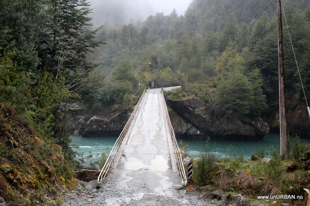
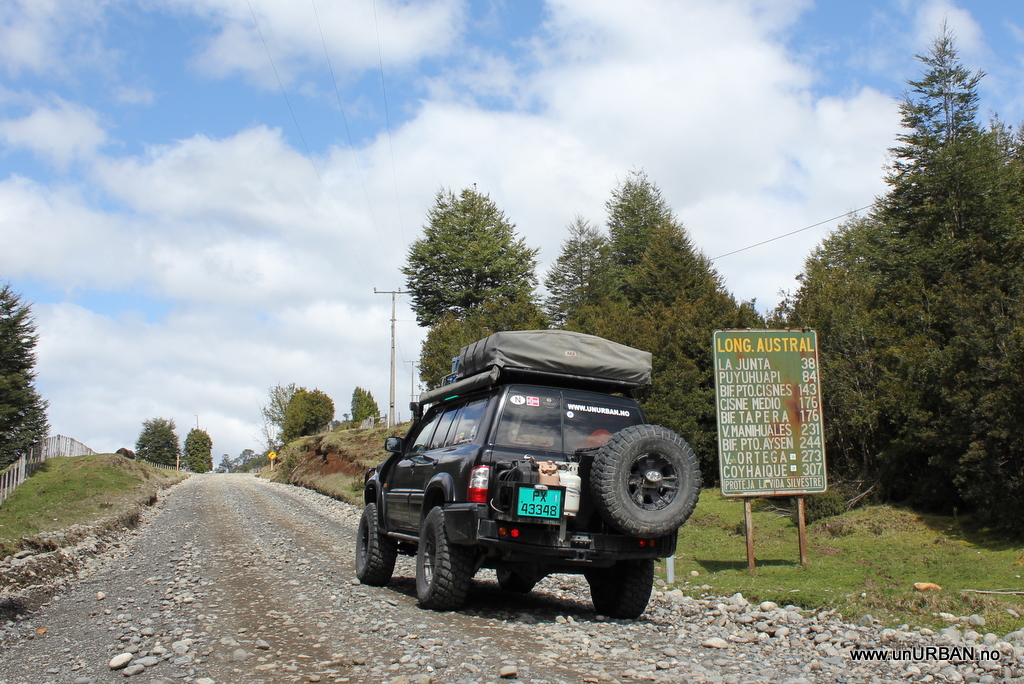
Carretera Austral in Chile
.
It was a bit grey and wet when we again crossed the border from Argentina into Chile. This time we our goal was to drive the Carretera Austral, formerly known as Carretera General Augusto Pinochet, which was built in 1976. It is a beautiful drive through a really wild country in Chilean Patagonia. The whole route is about 1200 kilometers if you take the ferry across from the island of Chiloé or Puerto Montt to Chalten and drive all the way down south to Villa O’Higgins. We, however, hit the Carretera Austral a few kilometers south of Chalten, from the border crossing Futaleufu.
.
.
We found a place to camp by Rio Frio the first night. It was almost dark when we saw a sign saying camping, and “gap” in the fence along the road. In Chile and Argentina we have been able and comfortable doing quite a bit of bush camping, but in some areas, especially as we’re getting further south into Patagonia, we are actually struggling to get off the road because of fences. These are running along all the main roads, about 10 meters from the road. You can of course pull off and park for the night, but we like to get a little bit away from the traffic. Not that it would bother you much as there aren’t many cars driving by at night (we counted 3 one night along Routa 40 in Argentina, and this is one of the main roads going south!), but better safe than sorry, right? Anyway, we drove in on the camping at Rio Frio, but the place was deserted. It said 1500 pesos (3 USD) per person per night, but we couldn’t find anyone to pay. Still very early in the season, I guess.
.
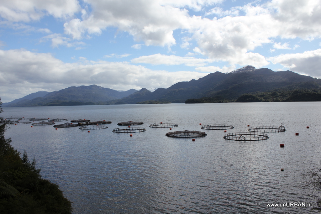
Carretera Austral also takes you past some of Patagonias fjords, and the Salmon you find in the supermarket back home could come from here.
.
.
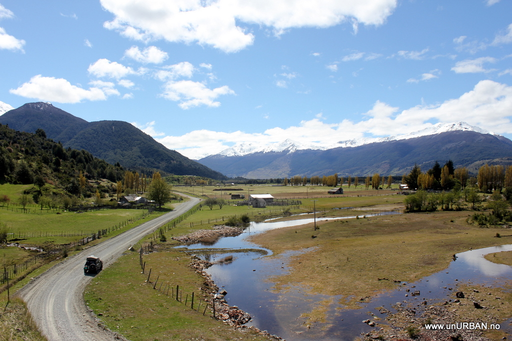
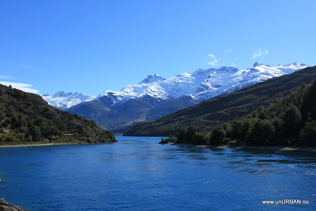
We took it nice and slow, and this picture is about a day and half down the road. We camped in “the far end” of this valley.
.
.
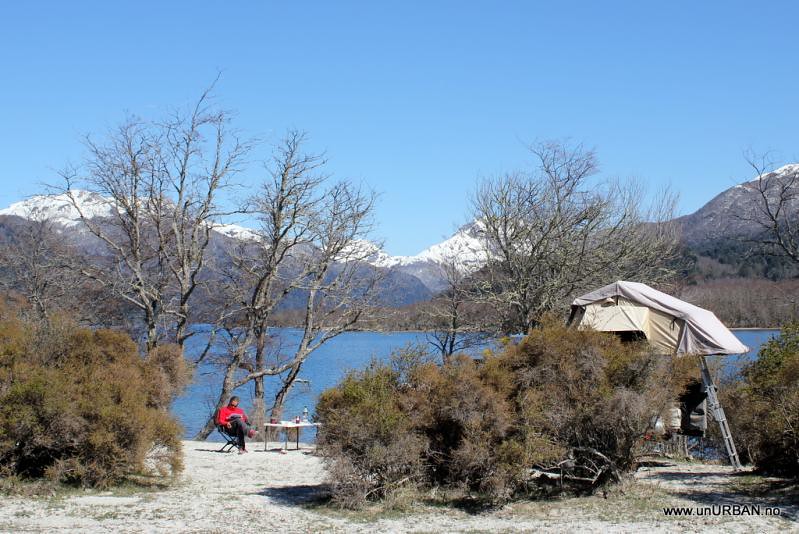
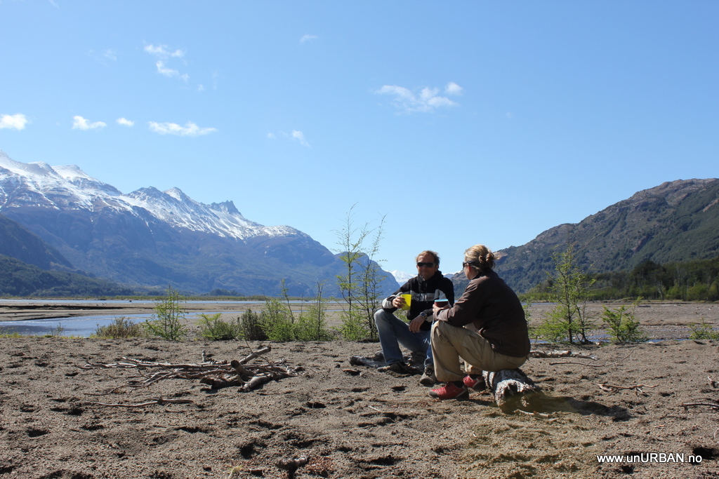
Patagonia is famous for its rain, low temperatures, and strong winds. We have been a little nervous about how much beating our roof top tent can take, but so far we have had no issues. Not even with the weather itself. The next morning we woke up to a clear blue sky, and no winds. Here we are enjoying our morning coffee and tea at Rio Ibanez about 50 meters away from our camp.
.
.
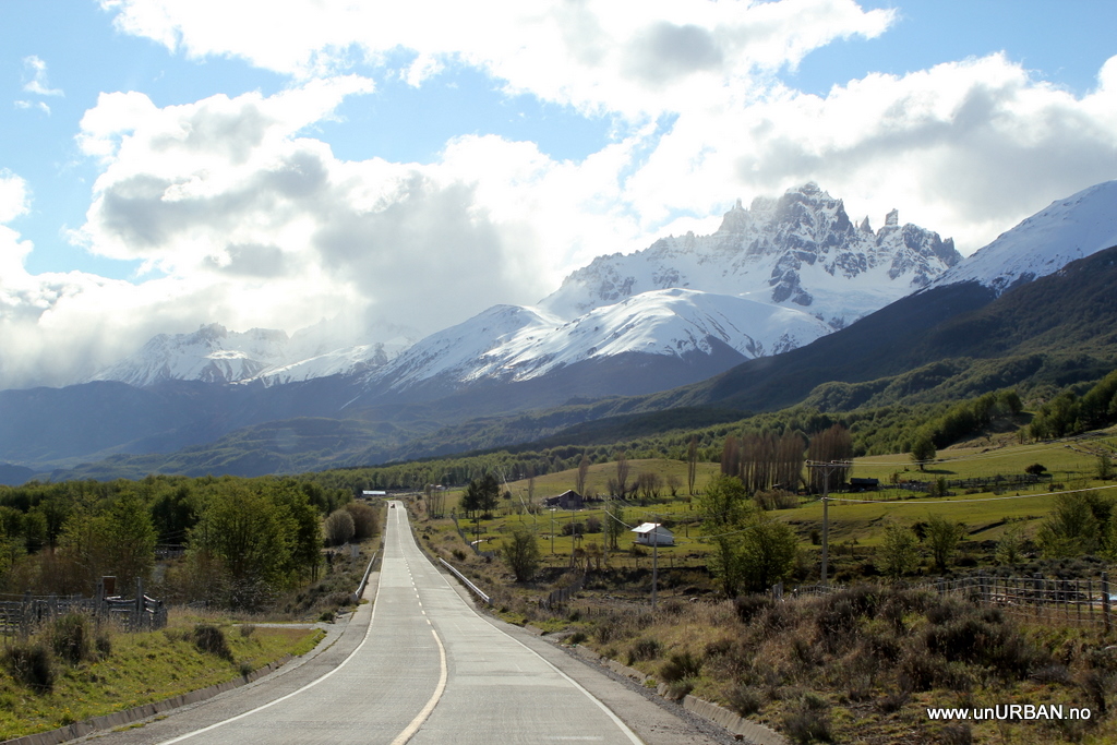
Around the city of Coyhaique the road is excellent. The part of the road we drove had tarmac about 1/3rd of the way, but the road was never in bad condition. Good for any kind of vehicle.
.
.
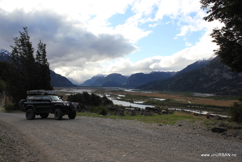
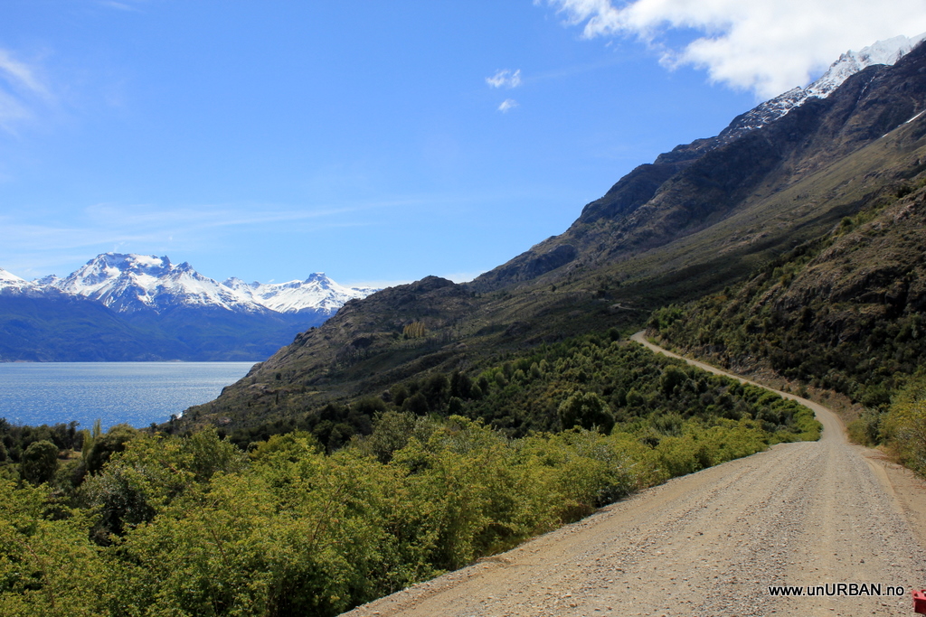
We drove around Lago General Carretera to get to Chilechico (you can take a ferry across the lake to save about 200 kilometers, but it is an AWSOME drive – highly recommended (at least in nice weather….)), and view just got better and better.
.
.
.
.
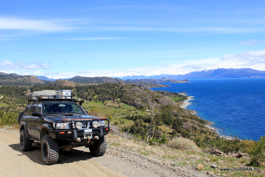
.
Half way around the lake you have to decide if you want to keep driving south to get to O’Higgins and “the end” of Carretera Austral (at least for the moment). We went east for Chilechico and the Argentinean border in order to put in a couple of long driving days to get down to Ushuaia in time for Malin to get to work in Punta Arenas.
.
E&M
.
It was a bit grey and wet when we again crossed the border from Argentina into Chile. This time we our goal was to drive the Carretera Austral, formerly known as Carretera General Augusto Pinochet, which was built in 1976. It is a beautiful drive through a really wild country in Chilean Patagonia. The whole route is about 1200 kilometers if you take the ferry across from the island of Chiloé or Puerto Montt to Chalten and drive all the way down south to Villa O’Higgins. We, however, hit the Carretera Austral a few kilometers south of Chalten, from the border crossing Futaleufu.
.
.
We found a place to camp by Rio Frio the first night. It was almost dark when we saw a sign saying camping, and “gap” in the fence along the road. In Chile and Argentina we have been able and comfortable doing quite a bit of bush camping, but in some areas, especially as we’re getting further south into Patagonia, we are actually struggling to get off the road because of fences. These are running along all the main roads, about 10 meters from the road. You can of course pull off and park for the night, but we like to get a little bit away from the traffic. Not that it would bother you much as there aren’t many cars driving by at night (we counted 3 one night along Routa 40 in Argentina, and this is one of the main roads going south!), but better safe than sorry, right? Anyway, we drove in on the camping at Rio Frio, but the place was deserted. It said 1500 pesos (3 USD) per person per night, but we couldn’t find anyone to pay. Still very early in the season, I guess.
.
Carretera Austral also takes you past some of Patagonias fjords, and the Salmon you find in the supermarket back home could come from here.
.
.
We took it nice and slow, and this picture is about a day and half down the road. We camped in “the far end” of this valley.
.
.
Patagonia is famous for its rain, low temperatures, and strong winds. We have been a little nervous about how much beating our roof top tent can take, but so far we have had no issues. Not even with the weather itself. The next morning we woke up to a clear blue sky, and no winds. Here we are enjoying our morning coffee and tea at Rio Ibanez about 50 meters away from our camp.
.
.
Around the city of Coyhaique the road is excellent. The part of the road we drove had tarmac about 1/3rd of the way, but the road was never in bad condition. Good for any kind of vehicle.
.
.
We drove around Lago General Carretera to get to Chilechico (you can take a ferry across the lake to save about 200 kilometers, but it is an AWSOME drive – highly recommended (at least in nice weather….)), and view just got better and better.
.
.
.
.
.
Half way around the lake you have to decide if you want to keep driving south to get to O’Higgins and “the end” of Carretera Austral (at least for the moment). We went east for Chilechico and the Argentinean border in order to put in a couple of long driving days to get down to Ushuaia in time for Malin to get to work in Punta Arenas.
.
E&M