Anza Borrego Desert State Park 2009

Echo_29

Observer
Anza Borrego Desert State Park.

Having led this trip on two prior occasions, I tried to add some new locations and routes to mix things up. The problem I find with plotting a path around Anza Borrego is the fact that several of the routes are one-way and necessitate counter-clockwise travel to link up various sites throughout the park. With this restriction there are always some stretches of highway travel and backtracking to get to the various points of interest. At the end of this write up one can locate links to prior year’s tours and stories.

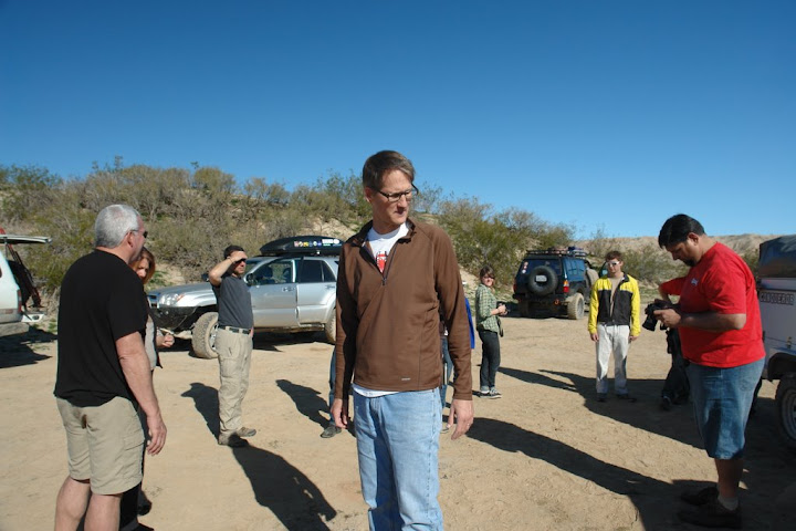
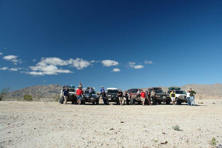
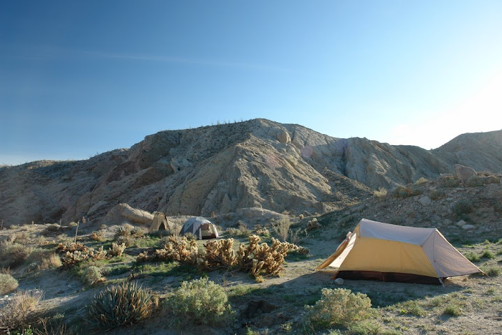
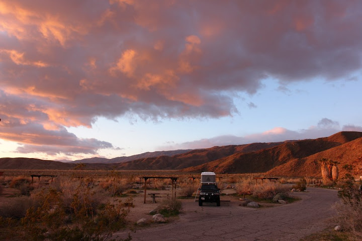
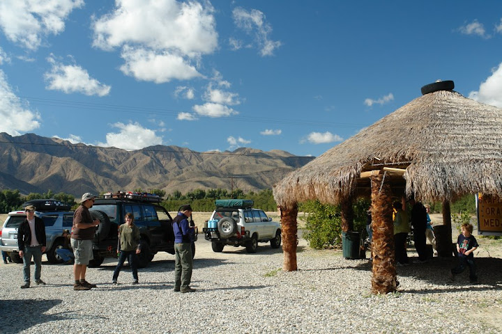
By five o'clock Wednesday afternoon all but one of the six trucks on the trip had arrived at the Palm Canyon Campground in Borrego Springs, California. Several in our group took it upon themselves to whip up some dinner for the group, most notably Andy with Salmon he caught in Alaska, some spicy BBQ chicken, and Stacy and George with pasta that we all enjoyed around a roaring fire.

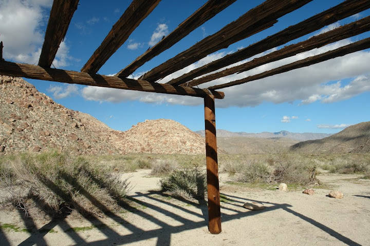
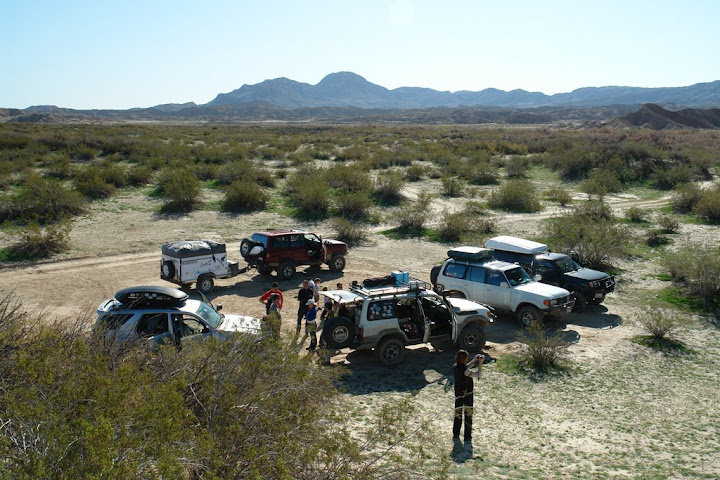
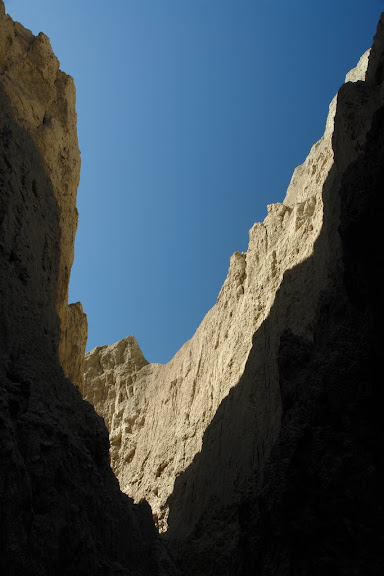
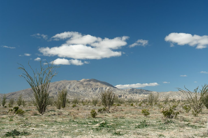
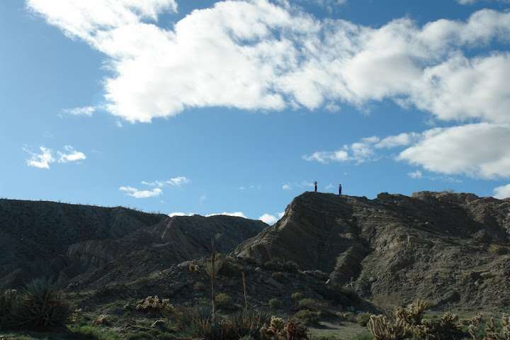
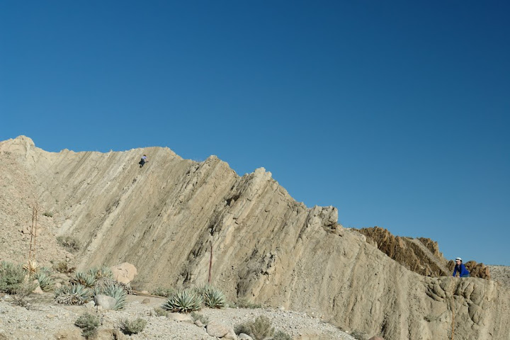
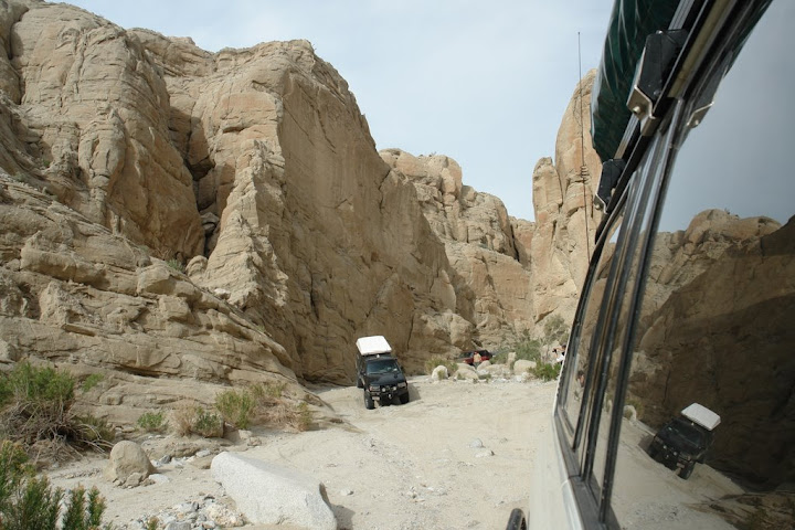
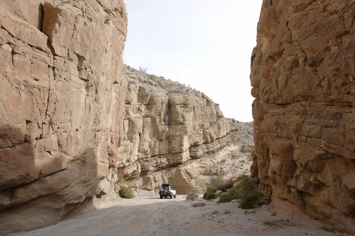
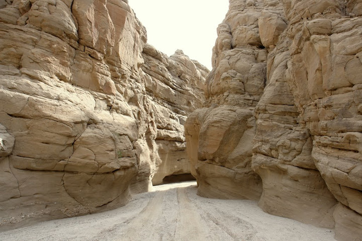
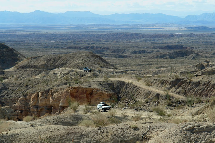
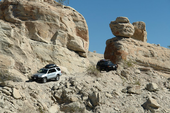
Thursday morning we were out of camp early and on the road to the Calcite mine 20 miles east of Borrego Springs off of San Diego County road S-22. The Calcite mine was purchased and mined by the Polaroid Corporation during WWII to withdraw optical grade calcite for ring-sights and rocket sights. After a short drive on the narrow shelf road we all wandered about the site, exploring the notches carved into the hillsides directly into the rich calcite veins.


DSC04418.JPG

Tracy and Allen @ dawn.
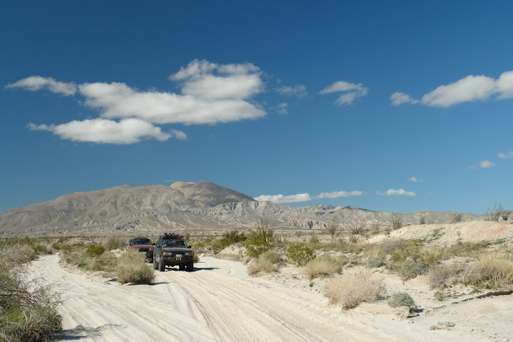

DSC04445.JPG

Calcite Mine Road


img145.jpg

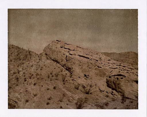
Calcite Mine area with Polaroid Chocolate Film
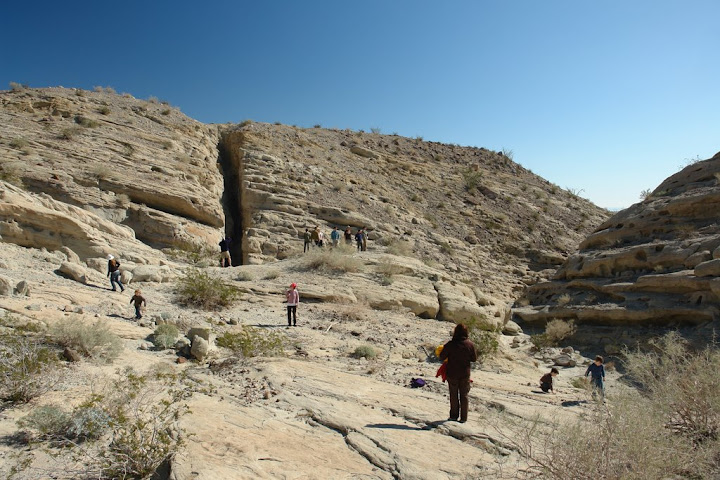

DSC04492.JPG

Exploring the mine


DSC04494.JPG

Departing


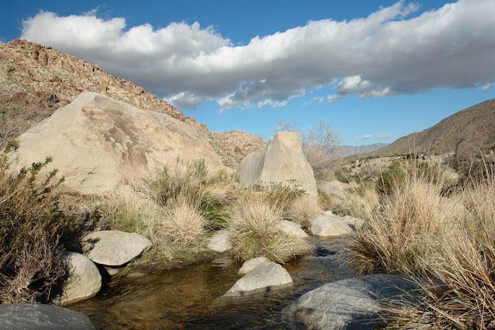
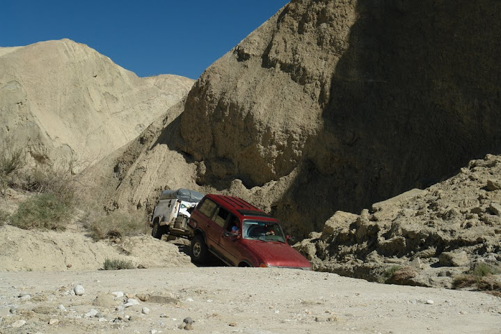
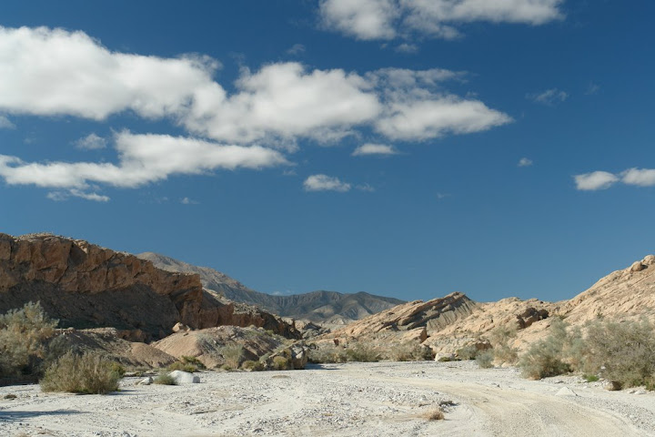
After descending the mining road we crossed the highway and proceeded southwest along the old Truckhaven Trail to the North Fork Arroyo Salado where we stopped for lunch in the windy and cool arroyo. From here we jumped back on the S-22 back towards Borrego Springs and Coyote Canyon, with a mandatory stop at the honor system Sea View Fruit Stand.


DSC04514.JPG


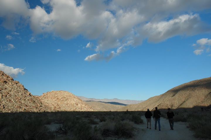
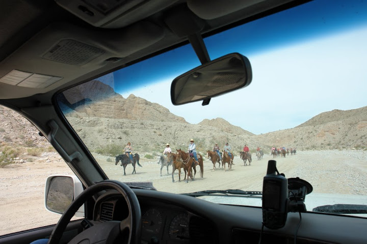
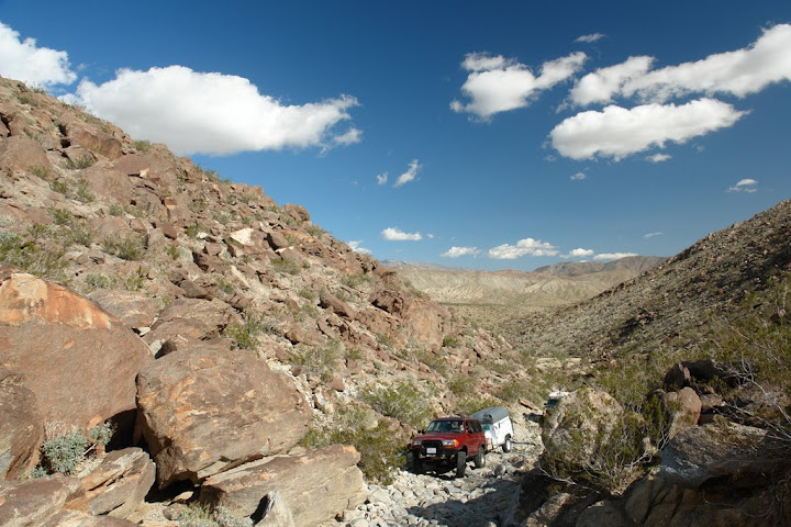
I planned the trip up Coyote Canyon on our first day in order to grab the great Sheep Canyon campsite and to avoid the traffic of day users that can make this route a bit congested on a weekend. After fording the third water crossing we began our uneventful drive up Coyote Canyon, where Rick's Conquest Conqueror easily climbed the rock strewn route as did Stacy and George's now lifted 4Runner. One change we did notice since our last trip two years ago was that at least three of the large granite boulders that used to protrude out into the trail, making navigation a little more precise and a bit threatening to side panels, had been sledge hammered away removing a foot or more of rock.


DSC04533.JPG

Rick and family with trailer


DSC04548.JPG

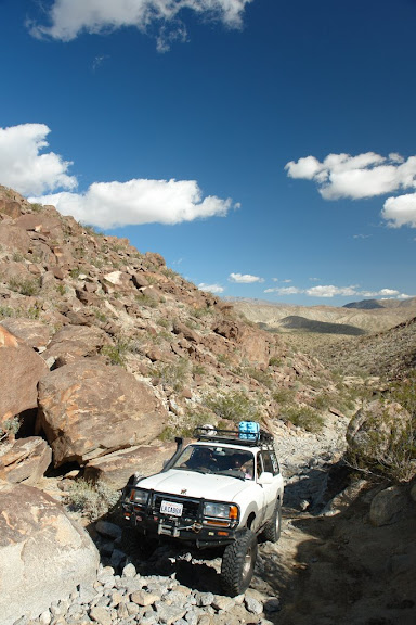
La Cabra piloted by Ivy
 

Echo_29

Observer
After arriving at camp a number of us set out on a hike up the South Fork of Sheep Canyon and Cougar Canyon. To drive to camp one must first drop into and cross a drainage at least 200-feet in width. Today as on prior trips we've always found the wash dry as a bone. When we headed out of camp on our hike we moved to the west and quickly found a braided stream with three water courses flowing six or more inches deep! On two prior occasions we'd never made it far enough out of camp to make this discovery. Crossing the streams everyone started boulder hoping and heading up the canyon intrigued by the native Washingtonia filifera palm groves lining the canyon in bunches. Unfortunately before we got too far the sun disappeared beyond the snow covered mountains and the temperature dropped at an alarming rate. With dinner and drinks calling we headed back to camp for our first planned meal. George and Stacy made chicken curry and rice while Rick and Tracy offered up pulled-pork sandwiches. Perfect dishes to warm the belly on the coldest night of camping.


DSC04577.JPG

Old Ranger Station ramada that shaded the rangers trailer in the 1950s


DSC04591.JPG


img148.jpg


DSC04598.JPG

Returning hikers


Friday morning we broke camp and made an uneventful drive down Coyote Canyon with a stop for photos at the "Desert Garden" near Alcoholic Pass then back into Borrego Springs for the Friday Farmers Market in Christmas Tree Circle. After our pit stop we drove south on the S-3, State Route 78 through Scissor Crossing then southeast on the S-2 where we turned off into Little Blair Valley for an off highway lunch detour. Departing Blair Valley we continued down the S-2 all the way to Ocotillo then east on S-80 four miles to Painted Gorge Road. We had our sights set on a drive up what is described as a spectacular canyon to the very top of Carrizo Mountain approximately 6 miles outside of the state park. Before the trip I did a quick search on Painted Gorge but I may have typed Painted Canyon into my search. None the less, I didn't come across any warnings about our intended route. So we continued through the wasteland of the Plaster City OHV Area to the narrow mouth of Painted Gorge only to find a locked gate and a sign stating that the gorge is closed from January 1-June 31 for Peninsular Bighorn Sheep lambing.


DSC04619.JPG

Abandoned Royal Spartanette trailer in Ocotillo


Now that Carrizo Mountain was off the list, so was our mornings hike up the nearby Fossil Canyon on Saturday. So, knowing we wanted to head back into the park and as far away from the OHV area as possible we took Andy's suggestion and head back to our regular camp spot at the Carrizo Stage Station at the end of Carrizo Creek and adjacent to the Carrizo Impact Area, a closed portion of the park filled with WWII and Korean War era munitions just waiting to go off.

To get to camp we head back up the S-2 to Canyon Sin Nombre then north to Carrizo Creek and 3-miles to the end of the road. In prior years we’ve been able to easily drive down the wet creek with no issues, 2-years ago there was a water trap that captured half of our group in its wet maw. This year it appeared that recent heavy rains had sent a considerable flow of water and alluvium down the creek so all we found was maybe 8-inches of water in our path.


DSC04632.JPG

Carrizo Creek with the Carrizo Carrizo Mountain, our intended campsite in the distance.


Dinner consisted of grilled, marinated chicken kabobs, veggie kabobs along with a butter lettuce salad from Tracy & Allen while Mary-Austin & I added to the meal with grilled potato slices, grilled marinated Salmon, and an Arugula salad. Camping next to the marshlands of Carrizo Creek meant that we were serenaded to sleep by the sound of what sounded like 100 frogs. It was a strange thing to hear in the middle of the Anza Borrego Desert badlands. That night we had our second night of rain, and like the night before it lasted all of five minutes but in the morning the Laguna Mountains in the Cleveland National Forest to the west of us had a fresh blanket of snow.

Saturday morning we drove out of camp and passed the continuation of the Carrizo Stage Trail that disappears into the Carrizo Impact Area and noticed one fresh set of motorcycle tracks entering the restricted area. (On Sunday the director of the Anza Borrego Park Foundation told me that the park doesn't bother putting up fences because they just get torn down. He also said that several years ago the Navy located and destroyed a 1,000-pound unexploded bomb inside the impact area, that the munitions experts hide behind a dune 1-mile away and still had shrapnel fly over their heads after detonation!)


DSC04661.JPG

Cleaned-up camp


DSC04688.JPG

Herding cats
 
Last edited:

Echo_29

Observer
After clearing Carrizo Creek we entered Vallecito Creek then Arroyo Tapiado where we'd explore some of the dozens of mud caves and slot canyons. The best info I have on this arroyo is from the Hidden San Diego website which has excellent maps and write-ups on the sights there.

First we hiked up Bridge Canyon all the way to the top of the mesa before heading over to Carey's Big Mud Cave, just one of the caves we've previously explored. With about half of the group joining us we climbed over a dune of sand that obscures the entrance to the cave then slowly we all entered through the upper entrance, then gathered inside. As we approached I mentioned that I'd hang back a bit since it takes my eyes seemingly forever to adjust to darkened locations, today made worse by the fact that I hadn't been wearing my sunglasses. Well, no sooner than I entered the cave I was blind, even with my headlamp, and made one small step to the side before disappearing into a narrow slot and dropping 10-12 feet instantly. Fortunately for me I didn't need the assistance of the E.R. doctor that was standing just above me. My fall was a brief Pachinko machine drop that ended on flat ground with me only ending up with some scratches. So, while most of these caves have flat bottoms...there are hidden dangers.

DSC04707.JPG

Bridge Canyon

At first we were going to abandon our spelunking but after I got my wits back we proceeded to the first exit point that's like a huge funnel, in a downpour, that leaves one in a barren land of sloping mud hills.

After lunch and back in our trucks we proceeded up Arroyo Topiado and crossed over the West Mesa to Arroyo Seco del Diablo and Diablo Drop-off. After we passed the assortment of weekend yahoos hill climbing on the closed portion of the slope and generally being obnoxious (with Pabst Blue Ribbon in hand), we turned north into Fish Creek until we reached Olla Wash.

DSC04715.JPG

Arroyo Topiado

DSC04724.JPG

West Mesa

DSC04728.JPG

West Masa

DSC04737.JPG

The group atop Diablo Dropoff
Nico, Alvaro, Ivy, Graham, Stacy, George, Allen, Tracy, Griffin, Rick, Leland, Tracy, Andy, Jeff, Mary-Austin and Scott
 
Last edited:

Echo_29

Observer
While we drove up to the top of the canyon, Andy and Alvaro drove up Sandstone Canyon to check it out and reported back that the slot canyon was quite dramatic while we were marveling at the geology and flora of Olla Wash. Somehow we'd never been up either one of these amazing canyons!

After picking a campsite several of us hiked up a side canyon to the towering Mud Palisades. Back at camp the three boys were climbing and playing on precariously steep mud hills having an adventurous time while sometimes heeding their parent's calls to stay away from the drop-offs. Andy & Jeff heated up some home-made spicy 3-meat chili and accompanied it with Andy's dutch-oven cornbread. Alvaro and Nico served engine block roasted pork ribs with a smile. Andy was kind enough not to dump any left over chili on our campfire this year, keeping us warm and happy. Thanks Andy!

DSC04751.JPG

Olla Wash

DSC04767.JPG

Kids at play

DSC04788.JPG

"Have you seen my little boy?"

DSC04777.JPG

Agave deserti

DSC04796.JPG

Olla Wash


Sunday was greeted with Rick's now regular last day pancake breakfast!

After a quick breakfast Andy and Alvaro tore out of camp early, due to their long drive back to Sacramento, while the rest of us lazily filled up on pancakes.

After breaking camp the remaining four trucks toured the narrow and twisting course of Sandstone Canyon, stopping to take photos and testing the articulation of Rick's trailer on one sharp drop off. From here we made the slow drive down wide Fish Creek. Just past the Wind Caves we turned a corner to meet 30-40 horses and riders making their way south, out for a well orchestrated Sunday ride in the Anza Borrego desert.

DSC04859.JPG

Olla Wash Camp

DSC04901.JPG

Sandstone Canyon

DSC04925.JPG


DSC04928.JPG


DSC04963.JPG


Prior trips photos: 2006, 2007 and write-up of 2006
 
Last edited:

AndrewP

Explorer
Nicely done write up!

Great trip, looking forward to next time, maybe a couple hundred miles further East?
 

teotwaki

Excelsior!
Funny how the Park Service can jackhammer rocks into oblivion......

Nice write up and I love looking at all of the pictures!
 

Forum statistics

Threads
189,830
Messages
2,921,401
Members
232,931
Latest member
Northandfree
Top