Cedar Mesa 12/19 to 12/20-09

ttora4runner

Expedition Leader
Since leaving Arizona at the beginning of summer to start a new job in Utah I had planned to take a week off work to come back down to Arizona to visit my parents. I knew I had wanted to spend a few days just traveling around southern Utah before heading down but I was a little undecided as what to do. Ultimately, it came down to either tooling around the St. George area or around SE corner of the state.

After doing some initial research I decided to head to SE Utah since there was very little information about trails around St. George. I had been wanting to head back that anyways to try and find a ruin site I had visited a couple of years ago and too exploring a few new areas (thanks for IntrepidXJ - Randy for his recent Cedar Mesa trip).

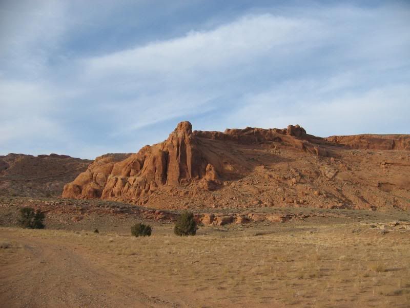
The plan was too leave work Friday after work and head to Blanding too stay for a few nights while traveling around the area. Fortunately, I was able too leave work a little earlier than normal and beat the worst of the crazy Utah rush hour traffic. The trip down was mostly uneventfully, despite some thick fog just North of Moab and a scary truck driver.

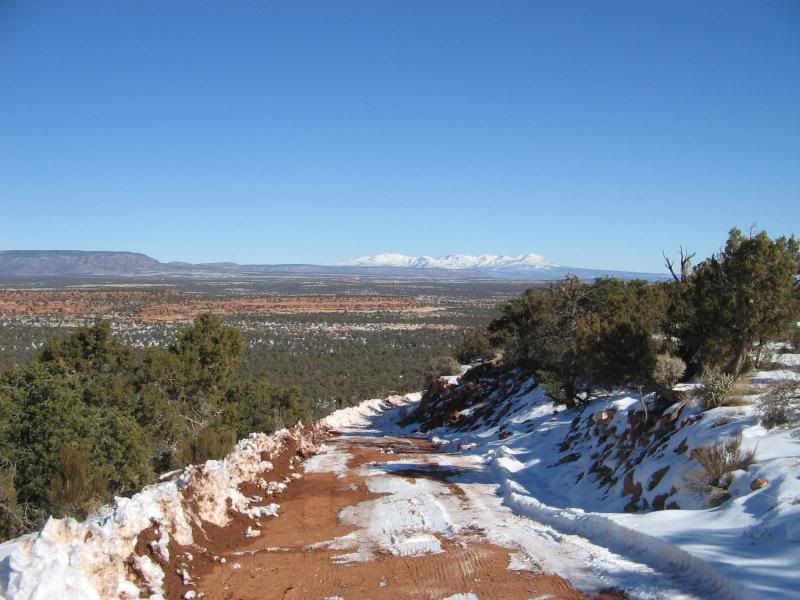
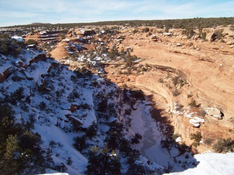
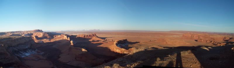
Arriving in Blanding sometime around 930 pm, I got a slight glimpse of what awaited me for the next morning. Snow covered ground. “Oh, joy that should make things fun” was my thought and it sure did.

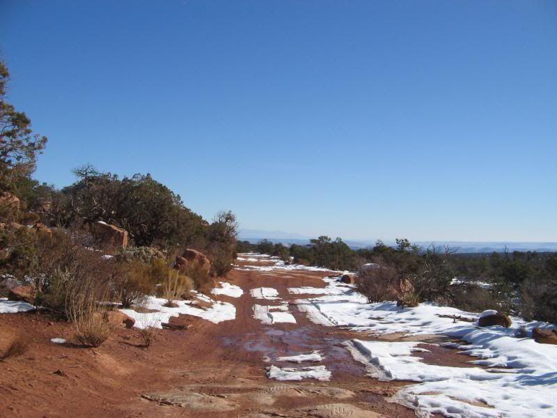
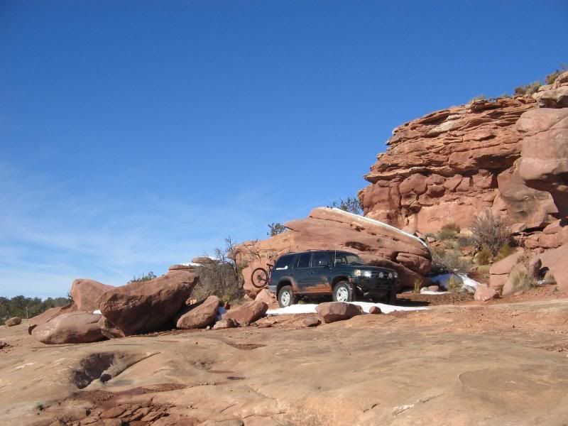
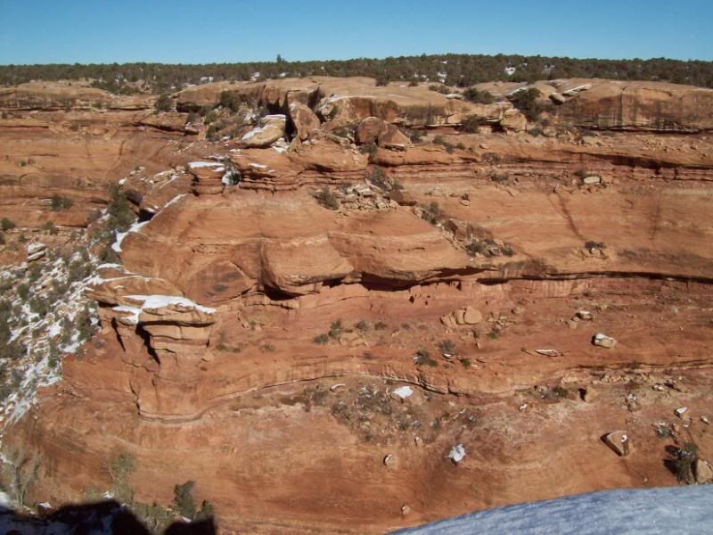
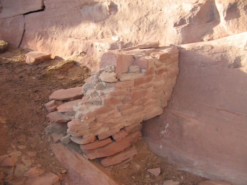
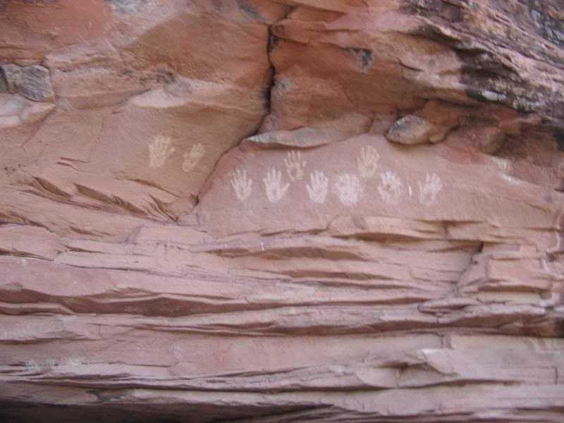
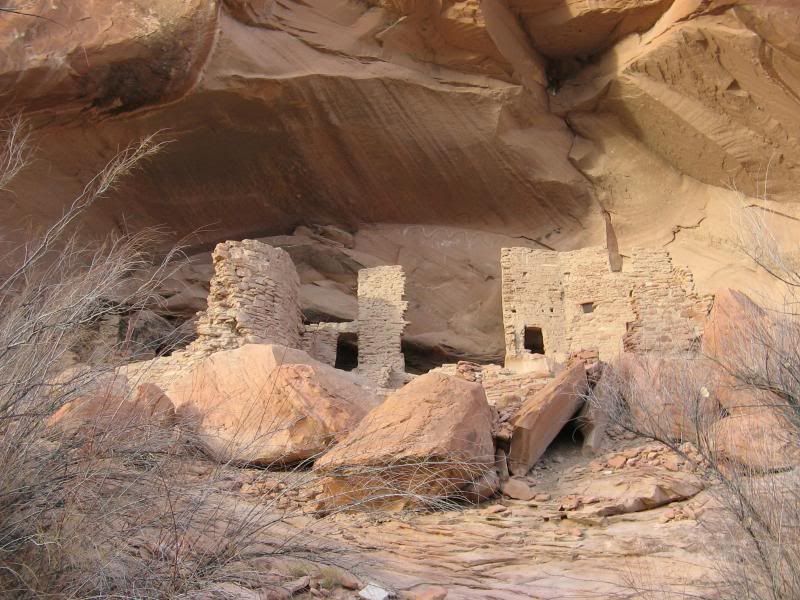
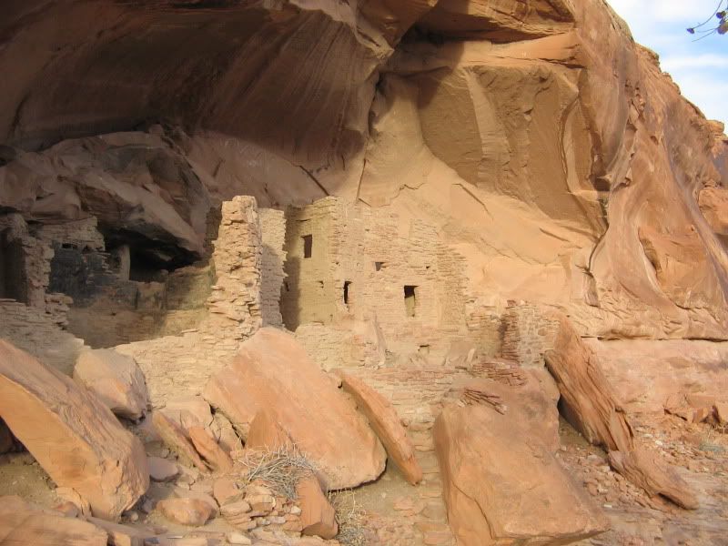
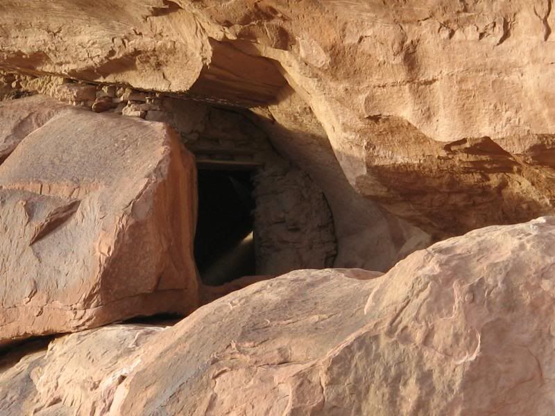
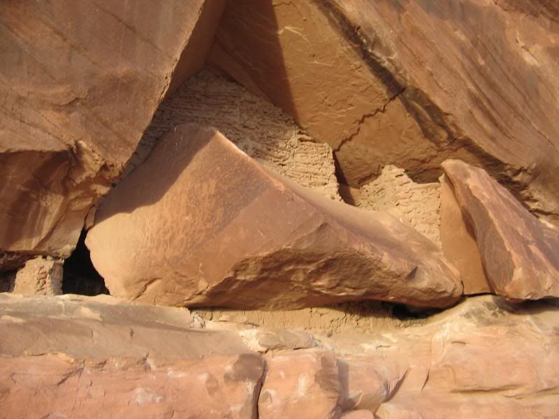
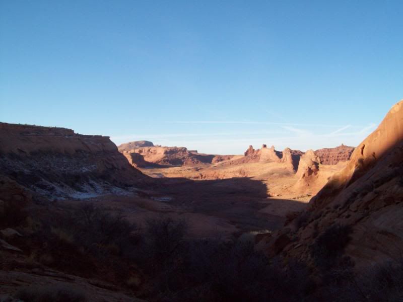
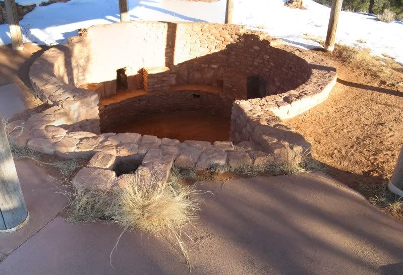
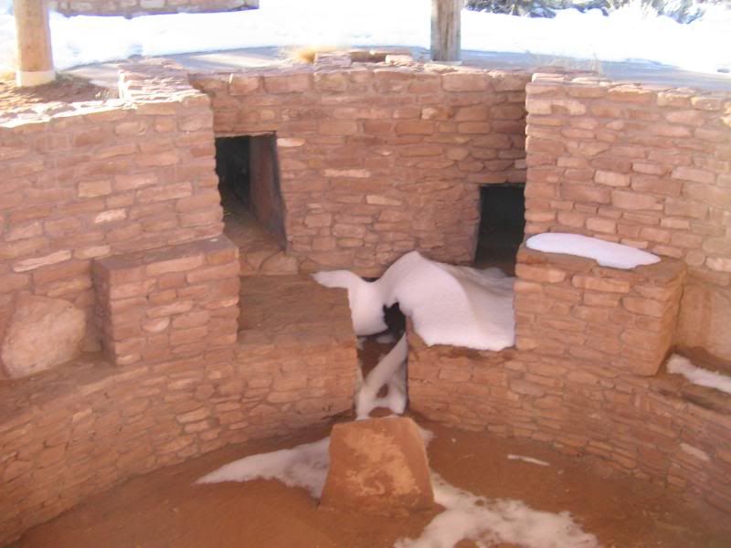
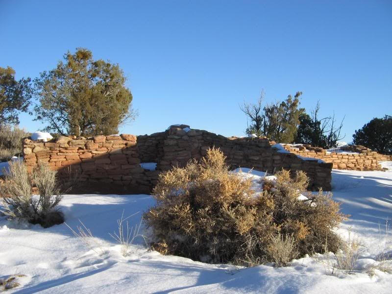
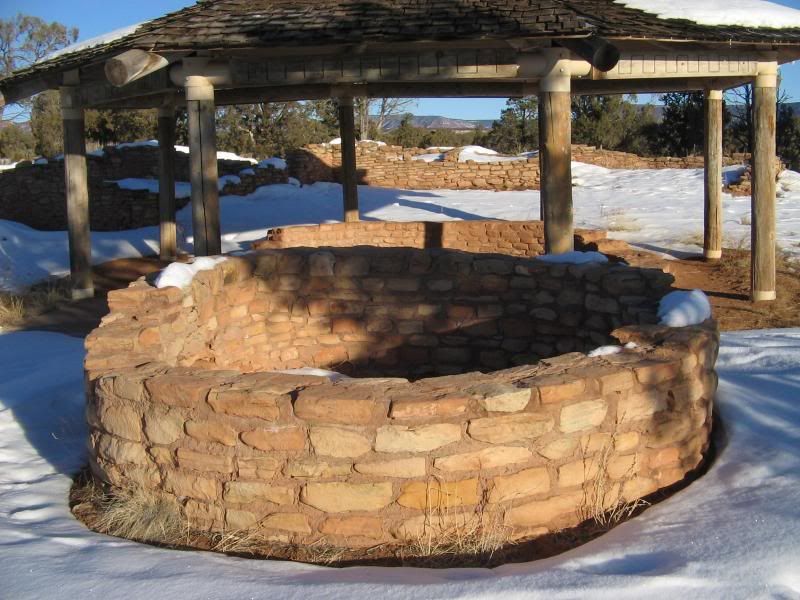
Come Saturday morning I left the hotel and headed to my first destination House of Fire Ruin. As I approached the way point for the parking area I learned a little too late that my G.P.S. had failed to save the route from the parking area to the ruin. A little disappointed I decided too go ahead and stop and visit the Mule Canyon Ruin next to parking area. Why not I'm already here.
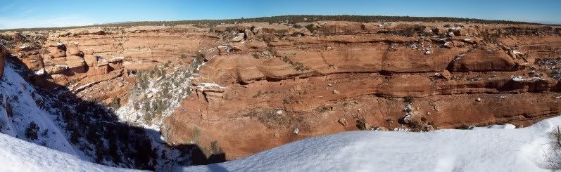
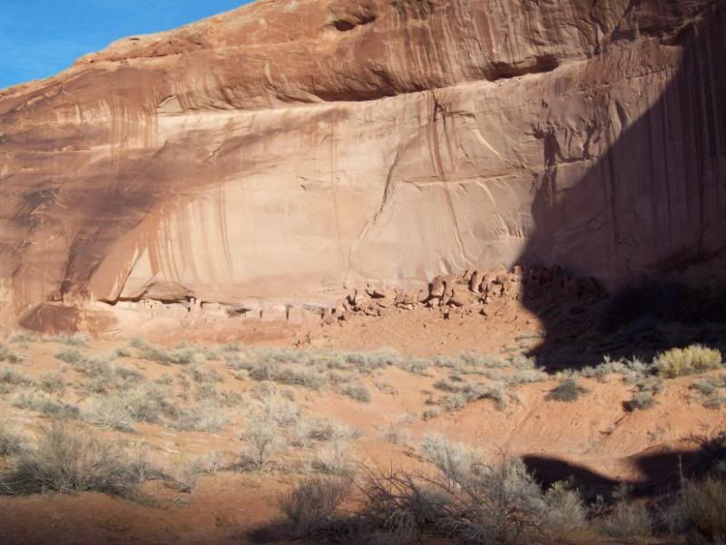
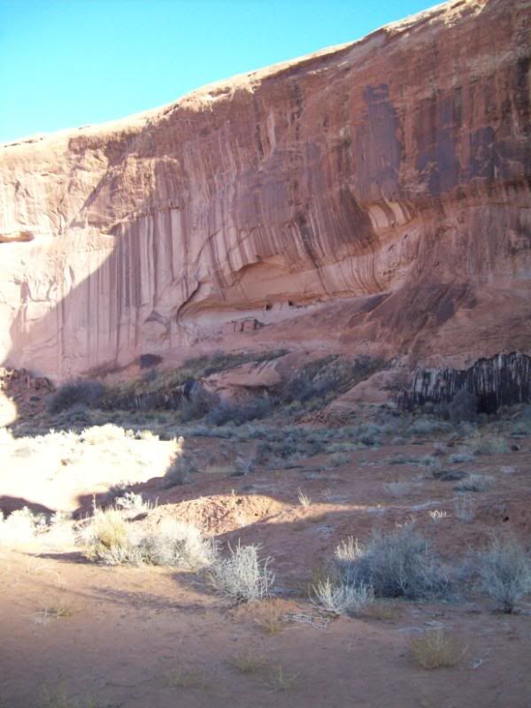
Mule Canyon Ruins:
MuleCanyonRuins-Kiva-1.jpg


IMG_0015.jpg


IMG_0002.jpg


IMG_0014.jpg
 
Last edited:

ttora4runner

Expedition Leader
Still wanting too try and find the ruins I had found some footprints in the snow that lead off in the direction that I wanted to go and followed suit. unfortunately, the tracks stopped at an overlook of the canyon I was supposed to be in but alas I found no other tracks so it was back to my vehicle to head too my next destination.

Next up was Cave Tower Ruin or so I thought!!!! I had followed the route set into my G.P.S. for the turnoff to the site only to find that it was still covered in about 6-8" inches of snow. Disappointed in not finding the last site I was determined too find this one. So I set off on foot though the snow (not very wise I know). The road back was clearly visible though the snow and was accurate with the tracks I had mapped out.

The snow had a thin frozen crust and was lightly packed under layer because of that you could see the tracks of deer and rabbits as they walked acrossed the snow. However, what was disturbing too me was the tracks of another animal that kept me alert and looking behind and around me at times (why did I forget my knife in the car)too make sure I wasn’t being stocked.

Track photo:
100_1607.jpg


Behind me and what laid ahead:
100_1606.jpg

100_1605.jpg


Fortunately, all the tracks had vanished about a third of the way. About at the half way point I had to make a decision to either carry on walk though the snow or too turn back and head to my next destination. Well, I said I was stubborn and decided to forge ahead. Unfortunately, too my dismay when I reached the location to where the ruins were supposed to located they were no were too be seen. So back I went a little slower and a little more tired from walk all that way though the snow. I think I’ll be taking up snowshoeing of cross-county skiing in the near future.

End of trail for me:
100_1608.jpg


Once, back at my vehicle off came the boots and on went the heat to warm my feet up and dry my boots out some as I journey to my next destination.
 

ttora4runner

Expedition Leader
Next, on the list was Moon House Ruins. I came across this ruin as I was plotting out my route to the Seven Kiva / Citadel and decided too do some investigating via the internet. From the photo's I saw I knew I had to go and to try and find them. The road forest/county road out that way had been plowed though up too the turn off. At which time it turned too following vehicles tracks though the snow to the parking area. The road out there was a mixer of snow packed roads, mud and slickrock crossings requiring 4-wheel drive too avoid sliding off the road and around corners.

Once too the final parking area (the BLM has the area marked) it was a short hike to canyon edge. Right off the bat I got glimpse of the first ruin but it didn't look like the photo's that I saw but once my eyes adjusted a little to the area I spotted the main ruin and several other minor ones. Too my amazement the ruins where exactly like what I saw and where in amazing shape for there age. The valley that they overlooked was beautiful covered in snow and ice.

I was hoping to be able to hike over too them but due to being early afternoon and not knowing the exact way around (I hiked around for bit)I decided the hike too would have too wait until summer (none of the information I found said anything about the hike it would take to get around the canyon). Despite, my two previous failures earlier that day finding this site overshadow those failures and brighten my spirits.

Road Back:
IMG_0026.jpg


IMG_0037.jpg


IMG_0039.jpg


Moon House Ruins and the surrounding area:
MoonHouseRuinCanyon-1.jpg


100_1612.jpg


100_1614.jpg


100_1616.jpg
 

ttora4runner

Expedition Leader
Up next was Seven Kiva Ruin/Citadel Ruins. Again the main road out to the area had been plowed but was still snow packed. Upon arriving at the turn-off for the ruins I saw that this route too was still covered in the snow and not wanting to repeat my previous adventure I decided not to venture off. However, I did hike up the road a little (that which wasn’t covered in snow) just too see if I could see anything but nope. Just more snow, which you could scrap off the top layer leaving a hard crust. The layer that you could scope off reminded me of cornflakes by the shape of the ice crystals.

“Um, I’m not going though this again. Next time”
100_1651.jpg


Wanting too make my stop for the day I headed back out to head down the Moki Dugway and back too the main road to head too River House Ruins. I made a quick stop at the top of the Moki Dugway to snatch a quick photo. The valley below only had a light skimppering of snow in areas while other areas had non. “Why, could the Mesa have been like this?”

MokiDugway.jpg
 

ttora4runner

Expedition Leader
The turn off for the River House Ruins lies just below Comb Ridge following a creek bed as it heads out towards the Colorado (part of the Hole in rock trail). The road out is not an area where I would want too be caught in a flash flood or while it is flowing as you make several crossings and follow the creek in various locations.

The road eventually leaves the creek and returns too a little higher ground up onto a small flood plain. As you near the end of the road you need to make a left turn up a small rocky section then then over a cattle guard (if you don't make the turn the road dead ends and you wonder where the ruins are at. At which time you decided to get out and hike along the river a ways only too realize that you needed too make that turn).

Road Back:
IMG_0058.jpg


Photo's from along the river:
IMG_0059.jpg


IMG_0064.jpg


IMG_0060.jpg


The first little site you come across is “The Rincone” and a small little ruin of what use too be a building. Past that lies the trail that takes you out to Snake House Ruins. Again, this is a ruin too my surpise still well intact along with a number of pictograph's.

IMG_0071.jpg


The Rincone:
IMG_0072.jpg


IMG_0074.jpg
 

ttora4runner

Expedition Leader
Just past that lies a another pictograph panel that has ben craved into the surrounding rock face but just slightly recessed. unfortunately, some vandalism has occurred ruining some of the pictographs.

IMG_0109.jpg


IMG_0114.jpg


IMG_0115.jpg


About this time it was getting dark and I wanted to head out there while I could still see the trail.

IMG_0117.jpg


Leavingsnakehouse.jpg


IMG_0129.jpg
 

ttora4runner

Expedition Leader
Sunday morning quickly came and it was time to start making making my journey back to Arizona but not before I made one last stop at Poncho's House another Indian ruin site that sees very, very few visitors. The only reason I knew about this site was that a few years back while serving a mission for my church in the area an individual from the local town had taken us too visit the site on one of the free days we had.

Fortunately, for me I had never forgotten about the site and was lucky enough too find the route back too the area (I had a general idea of the area I was looking for). If you don't know where too look or now that the site is there you'd probable miss it. It also washes out some once the sunlight hits it.

Once arriving at the general location I explored around bit trying to remember the route back down to it. As soon as I had the route figured out I was off and there is really only one route down to it. Bein part mountain goat (hehehe) I quickly made my way down to the site. To my dismay however the Navajo Nation had erected a fence and posted a no trespassing sign about 1/8 of mile from the site. A couple of years ago when I visited this was not the case but I assume in an effort to protect the ruins that have since down so. Still, you have great view of the lower and upper ruins. A camera with a zoom or some bonochlures would help. Despite this it still felt good to get back to the area and experience it once again.

General vicinity:
PonchosHouseOverlook-1.jpg


Poncho House Ruins:

Can you spot the ruins?
100_1660.jpg


Hike down:
100_1668.jpg


100_1667.jpg


100_1676.jpg


100_1677.jpg


100_1681.jpg


The said fence:
100_1682.jpg


100_1684.jpg


Despite the set backs that I had I would do it all over again, just this time in the summer. Which plans are currently in the works too return.

** I used 2 different camera's setup up the same way but each produced a different effect on the photo's (they are just cheap digital camera's)**

*** Before leaving for the this trip I had made sure too inform several individuals as too my ware abouts in case something should've happened too me they would know where I was at. I make it a point before any solo trip too do so.***
 

cnynrat

Expedition Leader
One of our favorite areas to explore. Looks like you had a great trip. I love Cedar Mesa with covering of snow, but it can limit your options for canyon hiking. The way down to Moon House involves some steep slickrock, which may have been challenging with the snow.

Thanks for sharing.
 

ttora4runner

Expedition Leader
One of our favorite areas to explore. Looks like you had a great trip. I love Cedar Mesa with covering of snow, but it can limit your options for canyon hiking. The way down to Moon House involves some steep slickrock, which may have been challenging with the snow.

Thanks for sharing.

That's what I thought but there really wasn't much information if any at all on how to access the ruins. My only guess is that you need to hike around western side of canyon until you can cross over but that's only a guess.

I diffently want to go back there to explore that area.
 

Forum statistics

Threads
189,845
Messages
2,921,498
Members
233,030
Latest member
Houie
Top