Central America Expedition IN PROGRESS

CanuckMariner/Nomad

Love having fun 😊 in the 🌞 by the ⛵ and the ⏳
:lurk::beer: Wish I could have made it Nick/Graham hope all is going well.:costumed-smiley-007
 
Last edited:

Toyotero

Explorer
PHOTOS - I have created a photo album but have no idea how to get the photos here - can anyone help me?

The scotch has not been good but the company & cigars have been great!

Thx, Angela
http://www.NoLimitX.com

You can put the images into your post using html or the shortcut button. Get the address for the photo (If Windows, right click on the photo to get the browser options and view/copy the address) to put it into the post using the
insertimage.gif
button.

...and I see what you mean about the scotch. Yikes.
 

chirigringo

Adventurer
A few images from James and Angela:
Costa Rica Mountains
5186639637_8825a1b274.jpg

Costa Rica cloud forest
5187237722_9e6e0588a1.jpg

Cano Negro Refuge, Costa Rica
5186639573_016a30fc5f.jpg

James and Graham do some route planning
5186639323_d5d2763165.jpg

Gallo Negro Scotch
5187237586_e46e7c9b09.jpg

Nicaragua cigar factory
5187237288_696e0bec60.jpg

And a couple tiny images:
Costa Rica beach camp
5186639501_d06da014de_m.jpg

Costa Rica volcano camp
5186639477_bb950219b4_m.jpg
 

NoLimitX

Sponsors
We have just concluded the Expedition in Antigua Guatemala. The 2 Defenders performed Great and everyone had an amazing time. Now that there is regular email we should get some good photos uploaded and some great stories. Stay Tuned!

http://www.nolimitx.com
 

benedmonson

Disabled Adventurer
I will be posting up some of my pictures before the weekend, editing all 3000 now!!! This trip was a blast and couldn't have gone any better. I highly recommend going with James, Angela and Graham! They are true pros.
 

benedmonson

Disabled Adventurer
Weren't able to get to Playa Naranja in Santa Rosa NP - they said the 'road' was closed until December. Excessive begging didn't help and the promise to not cross the river didn't work either. This is the elusive beach we have yet to make - but in our quest we found a very good alternative with not a soul around. Next day we took a track into Guanacaste National Park with great views of the nearby volcanoe and savannah lands with cool breezes. After another great meal prepared by chef James the group sipped on some Gallo Negro Scotch (translate that to English for a good laugh).

Today the NLX Team crossed the border into Nicaragua with minimal hours wasted and headed for the beach where 'Survivor' was filmed. After a few beers on the beach and another terrifice sunset over the Pacific Ocean everyone is wondering if the title of the show really fits. There are some great photos coming in courtesy of Ben Edmonson (world famous photographer destined to be strapped to the top of another Land Rover). I will try to figure out how to post the pics..... given enough time

Being strapped to one Land Rover while it was floating down the river is enough for me!! Promise me we won't sink this time and I'll think about it!!:sombrero:
 

gjackson

FRGS
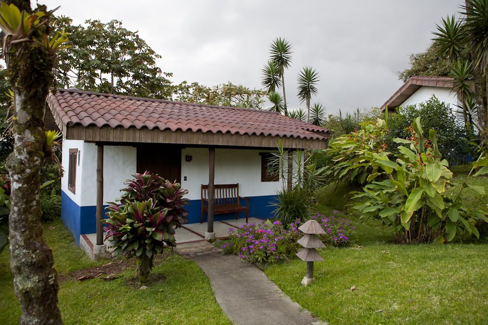
After we left Grenada the plan was to head to eastern Nicaragua and the Mosquito coast. Navigation out that way was easy enough, but the further east we got the less friendly things got. My the time we hit Rio Blanco east of Matagalpa, two things surprised us. First we were still deep in farm land, not the beginning of jungle as we had expected, and the locals were getting more and more afraid of us, literally running away and not talking to us in some cases. Based on this and the lack of intel on the Leimus border crossing, we decided to head back to Matagalpa and spend the night there. We found a strange German retreat called Black Forest (Selva Negra) and got a bungalow there.

attachment.php


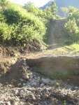
The plan was now to cross into Honduras and head east getting back to the Mosquito coast on the Honduran side and the Rio Platano. We crossed the border into Honduras with no issues at Las Manos and thought that the Biological Reserve at El Chile would be a good camping spot. Little did we realize that the road past Danli north was very slow going. By the time we reached Teupaseti and headed to towards the reserve we were on local directions which in this case turned out to be incorrect. We would not find out until the next day, and ended up camping in the road when we reached a washout that was not to be easily crossed. Camping in the road was the best option.

attachment.php


Local traffic is all two and four legged, hence the minimal fix.

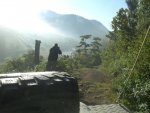
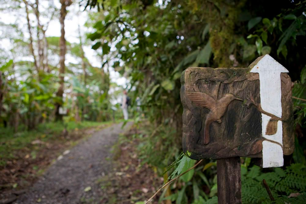
Next morning we discovered our camp was on the side of a mountain in the middle of a farming community. They are the ones who told us we were on the wrong road to get to the reserve. Oh well. It was a beautiful drive out on a misty morning where Ben got to exercise his camera to the fullest.

attachment.php


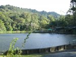
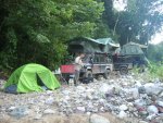
Next destination was the Sierra Agalta north of Catacamas. Again, as we discovered with most Honduran reserves, there are no roads into them, and little if any provision for camping. The mayor's son in Catacamas directed us to the archeological reserve at Talgua where he said we could camp. Arrival there precipitated a conversation with the military who said we could go into the park on one of their tracks and camp where we wanted. Very nice offer, except that we could only get in about a half mile before we hit the Rio Tinto and no way to cross in fading light. So a beautiful camp by the river with the certainty of having to winch our way back out the following morning.

attachment.php


That evening we got a guided tour of the Talgua caves, details of which I will leave for another venue. The morning brought a good winching exercise to get us back out of the park and, after resupply in Catacamas, we headed for the place on the map where the roads end.

attachment.php


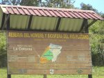
I have to insert a comment about the ITM map of Honduras here. It is, without out a doubt, the worst map I have ever had to use for navigation. And that includes a Subway Sandwich map I used for navigating around Managua. The ITM has roads that do not exist, it has place names completely wrong, and the extents of parks only have a passing resemblance with reality. On the map our decision point was at a town called Las Minas, where a northern route along the Rio Platano boundary or an eastern route into the park could be chosen. On the ground we discovered the town is actually called Los Mangos (mangos, mines, who knew?), and we decided that time required the northern route rather than the eastern one. At La Colonia the road gets pretty small, but the signs are big.

attachment.php


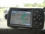
The roads on the Garmin had given up long before, so now we were back to navigating by local conversation. The people were more friendly than they had been in Nicaragua, but still suspicious. And coffee farms still dotted the landscape for as far as we could see, despite being on the boundary of what is called the second largest expanse of rain forest in the Americas.

attachment.php


More later

cheers
 

Attachments

  • CIMG4818.JPG
    CIMG4818.JPG
    195.7 KB · Views: 80
  • CIMG4824.JPG
    CIMG4824.JPG
    249.9 KB · Views: 75
  • CIMG4839.JPG
    CIMG4839.JPG
    164.1 KB · Views: 76
  • CIMG4859.JPG
    CIMG4859.JPG
    230.2 KB · Views: 108
  • CIMG4861.JPG
    CIMG4861.JPG
    177.1 KB · Views: 72
  • CIMG4863.JPG
    CIMG4863.JPG
    117 KB · Views: 78
  • CIMG4867.JPG
    CIMG4867.JPG
    202.2 KB · Views: 86

Toyotero

Explorer
You guys drove within a km of my house on your way to Selva Negra... bummer we didn't cross paths.

Did you take the obligatory photo in front of the burned out tank? :-D It's not as cool of a photos since it's been painted rainbow colors. :p
 
Last edited:

gjackson

FRGS
What do you mean by these ´German Retreats´

A lot of Germans emigrated to Central America before WWII and many started farms there. When Nicaragua declared war on Germany a lot were rounded up and deported, but several managed to stay. Selva Negra is one of the farms that the German settlers managed to keep.

cheers
 

gjackson

FRGS
You guys drove within a km of my house on your way to Selva Negra... bummer we didn't cross paths.

That is a bummer. It would have been great to have some local intel on the area. Have you been out to the Mosquito coast?

Did you take the obligatory photo in front of the burned out tank? :-D It's not as cool of a photos since it's been painted rainbow colors. :p

I didn't, but many in the group did. I'm sure that Ben has some great ones.

cheers
 

benedmonson

Disabled Adventurer
No Limit Expeditions Central America Trip Photo's

Not sure how many to put up here because there are so many from this trip! I have to say a big thank you to James, Graham and Angela for keep me safe and warm on this trip! The crew they selected made for an epic journey thru Central America!

Here is where we stayed the first might, high up in a cloud forest in northern Costa Rica
IMG_3553.jpg


There were great trails right out of the lodge, and did I mention that it was foggy!
_MG_0221.jpg

IMG_3597.jpg


Here are just a few from around the lodge:
IMG_3609.jpg

IMG_3612.jpg

IMG_3619.jpg


There were lots of flora and fauna to photograph, but I will not bore you overlanders with it!
IMG_3559.jpg


And then Graham starts to lay out his plans....
IMG_3635.jpg

IMG_3654.jpg


Lots of little fury things running around up here!
_MG_0220.jpg


What a good looking group.
_MG_0232.jpg


And an on site historic chapel built for the President of Costa Rica's wife
_MG_0272.jpg

_MG_0293.jpg
 

Toyotero

Explorer
Have you been out to the Mosquito coast?

I have not yet, but I'm eager to go. It's very unique place that is strikingly different than the Pacific side.

Coincidentally I was talking to a coworker this evening who made the trip to Puerto Cabezas in RAAN a few years ago. He followed more or less this route. About 215 miles, in the dry season, in a 4WD on unpaved roads that big trucks travel, no break-downs... and it took 24 hours of driving time.

EDIT: Of course, after that conversation, I'm eager to go! :-D

BTW, where did you get that map of Nicaragua?


benedmonson, great photos. What a beautiful place.
 
Last edited:

Forum statistics

Threads
189,901
Messages
2,922,012
Members
233,083
Latest member
Off Road Vagabond
Top