Explorer 1
Explorer 1
Just completed the trek between The Cleghron and Johnson Valley by attaching several well know trails together.
The original plan was to attach The Cleghorn to Pilot Rock to Willow Creek to Dishpan Springs to Holcum Valley/Creek to John Bull to Jacob Canyon to Heartbreak Ridge to Rattlesnake Canyon to Johnson Valley.
Somewhere around 100 miles of off-roading. We weren't out to avoid the tough trails so it was expected that travel may be slow at times.
In our group of 9 were several stock unmodified vehicles who choose to take an alternative route around the more tougher trails.

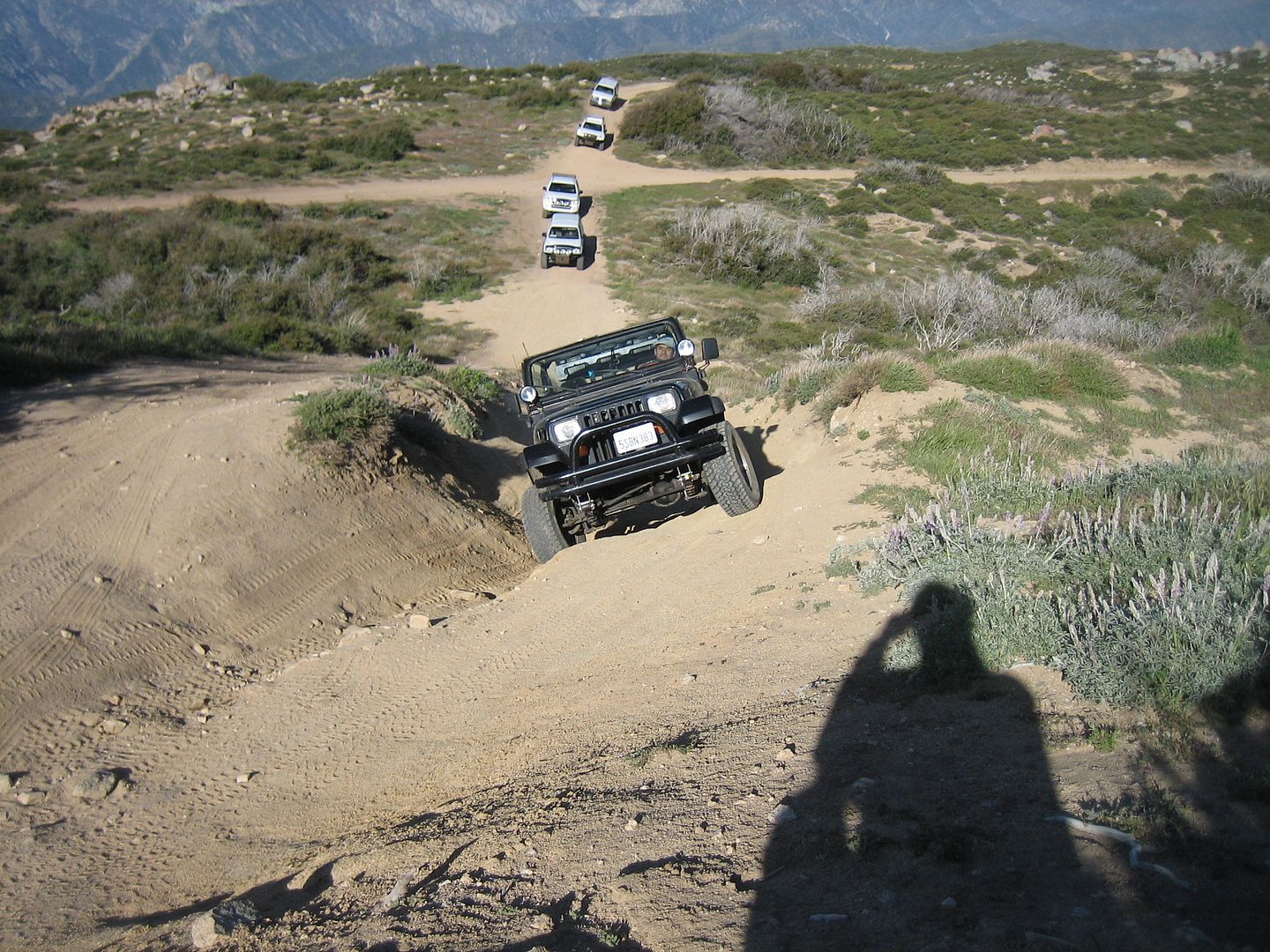
What we found was several of the more difficult sections of the Cleghorn (2N47) have been permanently closed on the climb from Interstate 15. Still a fun trail but the "V" notch is now a part of history.
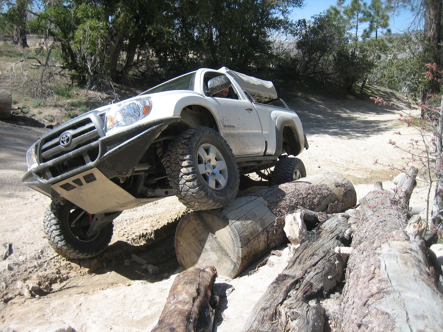
We then traveled a short distance on pavement to The Pilot Rock trail (2N33) where after a short distance the group split with most taking the tougher (2N17X) which was were Joe broke the front right axle on his Toyota Tacoma on one of the steeper rutted climbs. We pulled out the front axle and he continued on in 2wd.
We joined back together wher the two trail met and after lunch traveled 2N33 to Highway 173, here we once again hit pavement a short distance to Willow Creek (3N34X) past the Pinnacles Staging Area.
Somewhere along the road the "X" is dropped and we continued on 3N34 to the junction near Splinters Cabin wheer all but 4 of us left for a drive around Dishpan Springs trail which continues to be 3N34. Dishpan was so far the hardest trail with the Dry Falls climb giving us some challange. Those not taking Dishpan drove down to Hwy 18 amd around throughh Running Springs to meet us with us at Crab Flats campground.

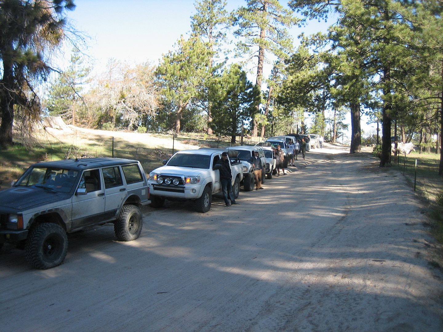
Here we arrive late in the afternoon enjoying a good meal and an evening around the campfire.
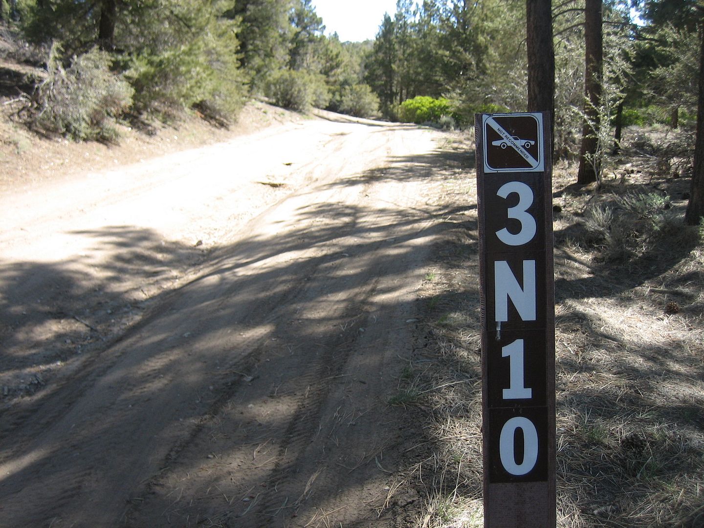
The next morning we continue in Holcomb Valley coming to the rocky junction of the Holcomb Creek trail now closed for the summer by the Forest Service. So our alternate route was to continue on t he Holcomb Valley road (3N16) to the road lading to Big Pine Flat campground best I could figure it was 3N16. We then came to the John Bull turn off (3N10) and all but 4 vehicles once again choose the easier route.
The last time I drove John Bull was last winter so now with the snow gone I was able to enjoy all the rocks. Here Jason managed to break a kight, mirror and windshield on a large tree which appeared to have has much of its bark removed from prior vehicle contact. On decending through the Gatekeeper he also broke his front u-joint, (best not to keep a Dana 30 locked any longer than necessary)
Here the group started breaking up. Jason with a broken front u-joint had to stay behind to make some temp. repairs in order to limp back home. His friennd Cameron stayed to help with the reapirs, Joe who already had broken his front axle decided he had had enough wheeeling that weekend, so his friend Cody also stayed behind to help Jason.


So with 4 fewer vehicles we continued on.
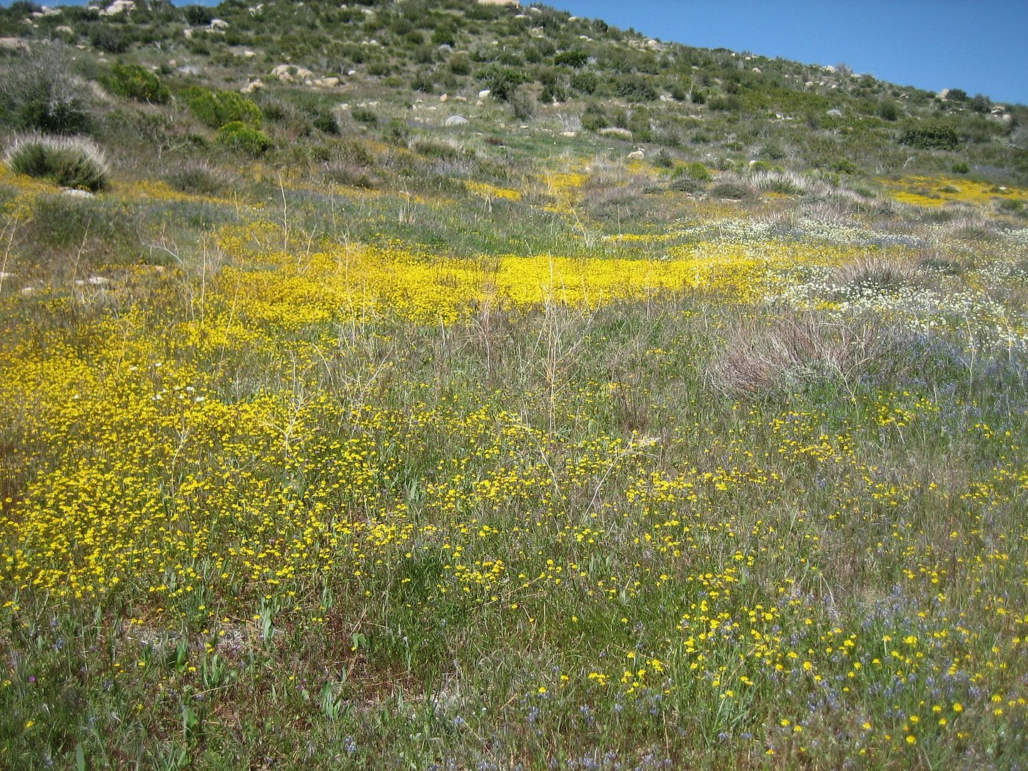
Along most of the way were flowers and then through the burn area we traveled.


We traveled 3N02 to 3N16 and shortly came to Jacobs Canyon (3N61) a delightful canyon with a moderate trail taking us to pavement on highway 18.
After a short drive south we exited pavement near the Catus Flats staging area on 3N03. After a few miles this blends into 2N02. There is a side loop which is rated difficult and since Jeff and I had to give up on Heartbreak Ridge due to the lateness of the afternoon, we separated from the group and enjoyed this small side trail.
Continuing together again on 2N02 we came to the Rattlesnake Canyon trail (2N91). This is a rather long trail with several places to get off track. I learned that you should always keep in the lowest trail in the canyon. We actually came across a 4 foot rattlesnake crossing the trail so I guess the canyon was properly named. Once out of the canyon there is a hard right turn out of the wash that is easliy missed ( we missed it) but eventually the wash is blocked by a fence, you can follow the fence east to the correct road.
The trail ends at hwy 247. We took the Interstate 15 route home with a stop at the In & Out in Victorville. Making it home in Whittier about 9 pm.

I learned that both wounded vehicles made it home under their own power, which is impressive considering the amount of damage.
Sorry for the few pictures as most of my film was in movies.
Next trip, Papoose Flats in the Inyo Mountains, June 2010.
Thanks,
Fred
Explorer 1
The original plan was to attach The Cleghorn to Pilot Rock to Willow Creek to Dishpan Springs to Holcum Valley/Creek to John Bull to Jacob Canyon to Heartbreak Ridge to Rattlesnake Canyon to Johnson Valley.
Somewhere around 100 miles of off-roading. We weren't out to avoid the tough trails so it was expected that travel may be slow at times.
In our group of 9 were several stock unmodified vehicles who choose to take an alternative route around the more tougher trails.
What we found was several of the more difficult sections of the Cleghorn (2N47) have been permanently closed on the climb from Interstate 15. Still a fun trail but the "V" notch is now a part of history.
We then traveled a short distance on pavement to The Pilot Rock trail (2N33) where after a short distance the group split with most taking the tougher (2N17X) which was were Joe broke the front right axle on his Toyota Tacoma on one of the steeper rutted climbs. We pulled out the front axle and he continued on in 2wd.
We joined back together wher the two trail met and after lunch traveled 2N33 to Highway 173, here we once again hit pavement a short distance to Willow Creek (3N34X) past the Pinnacles Staging Area.
Somewhere along the road the "X" is dropped and we continued on 3N34 to the junction near Splinters Cabin wheer all but 4 of us left for a drive around Dishpan Springs trail which continues to be 3N34. Dishpan was so far the hardest trail with the Dry Falls climb giving us some challange. Those not taking Dishpan drove down to Hwy 18 amd around throughh Running Springs to meet us with us at Crab Flats campground.
Here we arrive late in the afternoon enjoying a good meal and an evening around the campfire.
The next morning we continue in Holcomb Valley coming to the rocky junction of the Holcomb Creek trail now closed for the summer by the Forest Service. So our alternate route was to continue on t he Holcomb Valley road (3N16) to the road lading to Big Pine Flat campground best I could figure it was 3N16. We then came to the John Bull turn off (3N10) and all but 4 vehicles once again choose the easier route.
The last time I drove John Bull was last winter so now with the snow gone I was able to enjoy all the rocks. Here Jason managed to break a kight, mirror and windshield on a large tree which appeared to have has much of its bark removed from prior vehicle contact. On decending through the Gatekeeper he also broke his front u-joint, (best not to keep a Dana 30 locked any longer than necessary)
Here the group started breaking up. Jason with a broken front u-joint had to stay behind to make some temp. repairs in order to limp back home. His friennd Cameron stayed to help with the reapirs, Joe who already had broken his front axle decided he had had enough wheeeling that weekend, so his friend Cody also stayed behind to help Jason.
So with 4 fewer vehicles we continued on.
Along most of the way were flowers and then through the burn area we traveled.
We traveled 3N02 to 3N16 and shortly came to Jacobs Canyon (3N61) a delightful canyon with a moderate trail taking us to pavement on highway 18.
After a short drive south we exited pavement near the Catus Flats staging area on 3N03. After a few miles this blends into 2N02. There is a side loop which is rated difficult and since Jeff and I had to give up on Heartbreak Ridge due to the lateness of the afternoon, we separated from the group and enjoyed this small side trail.
Continuing together again on 2N02 we came to the Rattlesnake Canyon trail (2N91). This is a rather long trail with several places to get off track. I learned that you should always keep in the lowest trail in the canyon. We actually came across a 4 foot rattlesnake crossing the trail so I guess the canyon was properly named. Once out of the canyon there is a hard right turn out of the wash that is easliy missed ( we missed it) but eventually the wash is blocked by a fence, you can follow the fence east to the correct road.
The trail ends at hwy 247. We took the Interstate 15 route home with a stop at the In & Out in Victorville. Making it home in Whittier about 9 pm.
I learned that both wounded vehicles made it home under their own power, which is impressive considering the amount of damage.
Sorry for the few pictures as most of my film was in movies.
Next trip, Papoose Flats in the Inyo Mountains, June 2010.
Thanks,
Fred
Explorer 1