maxingout
Adventurer
EXPEDITION TO THE WHITE VOLCANOES AND PETROGLYPHS OF THE ARABIAN SHIELD
The cardinal rule of desert exploration is never go into the desert alone. Single vehicles expeditions are strictly off limits unless you have a strong desire to die.
The single vehicle rule is almost always true. Nevertheless, if you know what you are doing, every rule has times when you can safely stretch it, bend it, or break it if you have good reasons for doing so. If you have an unprepared vehicle without a good contingency plan, then you should not venture alone off road into the desert.
We decided that we wanted to visit the white volcanoes of the Arabian shield just north of Medina. The volcanoes are in a no man's land with lava fields stretching for hundreds of miles. We would be foolish to make a solo trip to this area in the heat of summer. But if it's the cold month of December, if we have two spare tires and enough water to survive for a couple of weeks, and if we are willing to burn one of our spare tires to make a smoke signal in an emergency, then a solo trip is not crazy. It may be pushing the limits a bit, and it might result in significant inconvenience if things go wrong, but the odds are in our favor that we will not die in the desert as long as we stay with the vehicle. The worst thing that would happen is we might spend a week in the desert awaiting rescue by a curious Bedouin who saw our smoke signal and came over to have a look. A plume of black smoke rising from volcanoes in a lava field usually generates lots of interest.
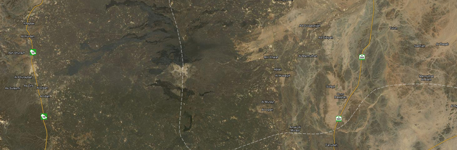
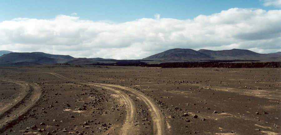
The patch of desert we want to explore is not that large. We will be off road for no more than 100 kilometers, so fuel will not be a problem. Our biggest challenge is to discover a Bedouin track that takes us where we want to go. There are not any road signs that tell us how to reach the white volcanoes of Khybar Harrat. When we drive in lava fields, there are lots of dead end tracks that do not cross the lava fields. We must be prepared to turn around and select another track that heads in the direction we want to travel. Maybe this time, it will not peter out, and it will take us to our destination.
The most difficult navigational challenge in this trip is locating the elusive track that actually carries us to the white volcanoes. There are dozens of tracks from which to choose.
We came from Riyadh, and when we arrived at the approximate latitude of the volcanoes, we left the asphalt, and turned in the direction of the white volcanoes.
This navigational problem starts with a line (road) in the east and ends with a line (road) in the west. The starting and ending point of the trip are easy. Reaching the white volcanoes is the hard part.
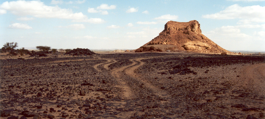
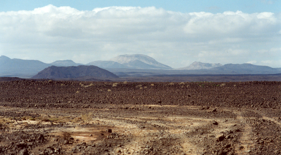
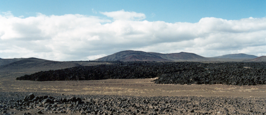
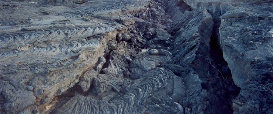
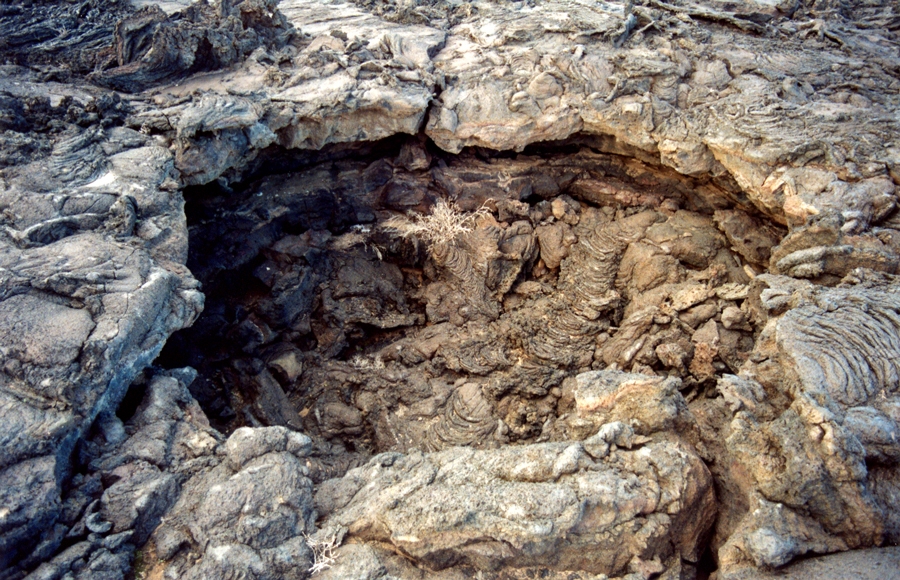
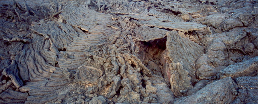
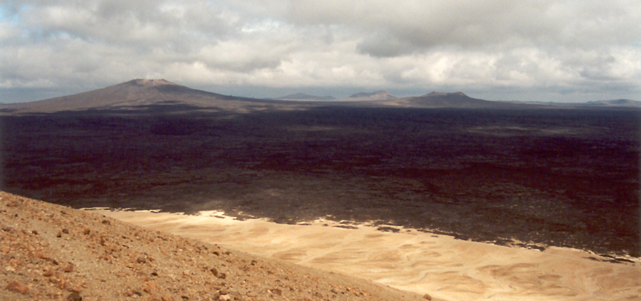
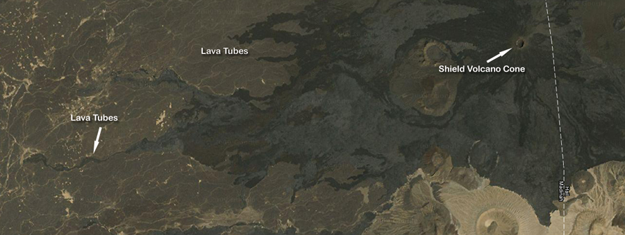
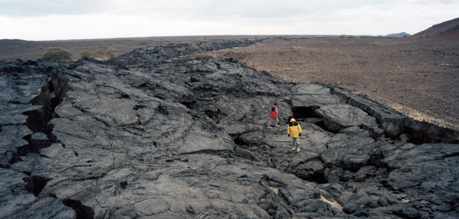
Lava fields are called harrat in Arabic. Transiting lava fields can be easy or hard, or anything in between. In thin lava flows, usually there are good tracks that are not too hard on our tires. The further we are from the volcanoes, the flatter the terrain, and the easier it is to make good time.
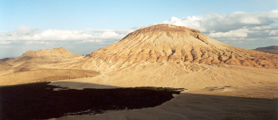
The closer we get to the volcanoes, the more dissected the terrain becomes, and the more challenging the driving. Lots of volcanic cones dot the countryside, and lava flows pile up on top of each other from many eruptions that happened over thousands of years. In some areas we can see three or more layers of lava all with different colors. Each volcano has its distinctive color of lava, and over time many lava flows overlap.
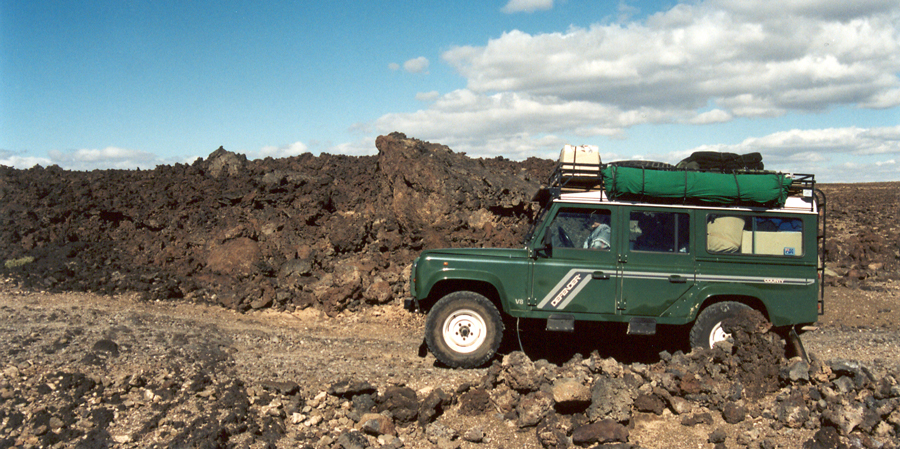
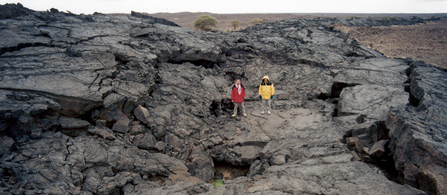
Closely spaced volcanic cones create heavily dissected terrain, and navigation is never in a straight line. We zig zag through lava flows as we ascend and descend Lavaland. It's easy to get lost in lava fields because we don't travel in straight lines. A track may dead end in a wall of lava, and we have to turn around and retrace our steps. When we drive in the severely dissected terrain, we spend as much time driving up and down as we do zig zagging to the right and left.
Driving in lava fields has so many dead ends that I made a cookie crumb trail with my GPS so I could figure out how to easily retrace my steps when I hit a dead end. More than once I was happy that I had the cookie crumb trail because it stopped me from erratically driving in circles among the volcanoes. Without the GPS, I would have been a Demented Defender Driver discovering that I was truly lost. I didn't need my GPS to tell me where I was. I needed the GPS to make it easy to retrace my steps.
We came from the east, and located a major track that took us west. Except for dead ends, the navigation is simply drive west until you come to the white volcanoes, and when it's time to leave, continue west until we come to the asphalt that takes us south to Medina.
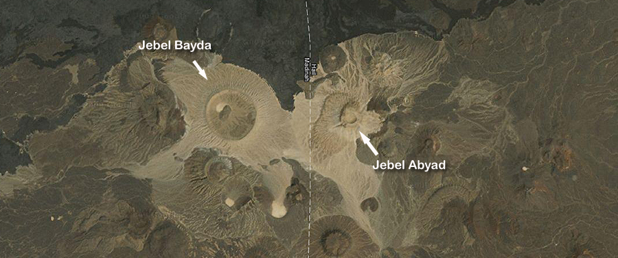
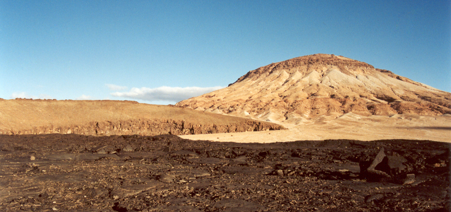
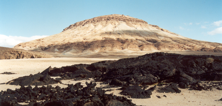
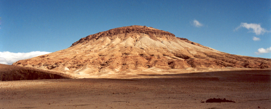
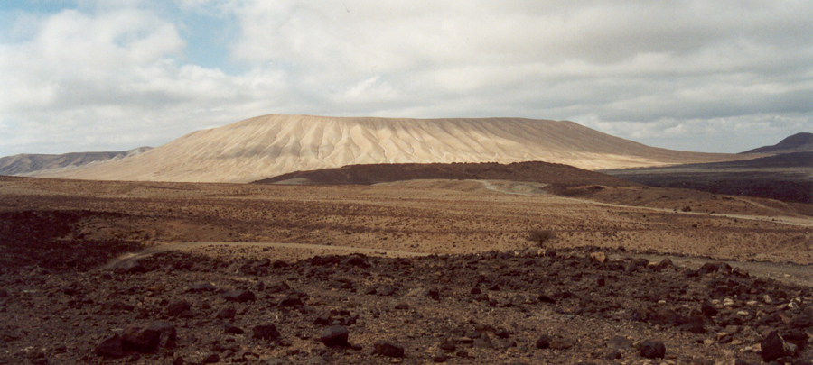
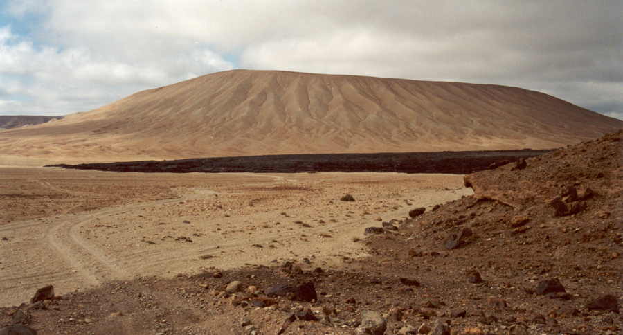
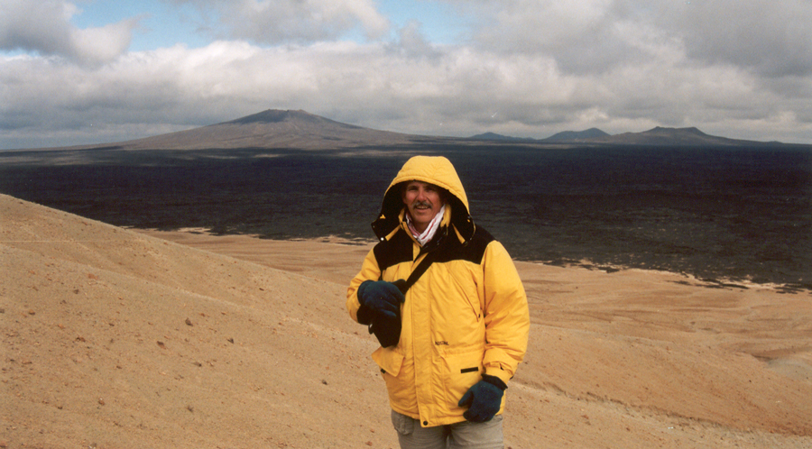
The two largest white volcanoes on the Khybar Harrat bear the names Jebel Bayda and Jebel Abyad. Both names mean the color white. Bayda is the feminine word for white in Arabic, and Abyad is the masculine word for white in Arabic. The word Bayda can also mean egg, and I presume it is referring primarily to egg white.
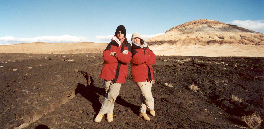
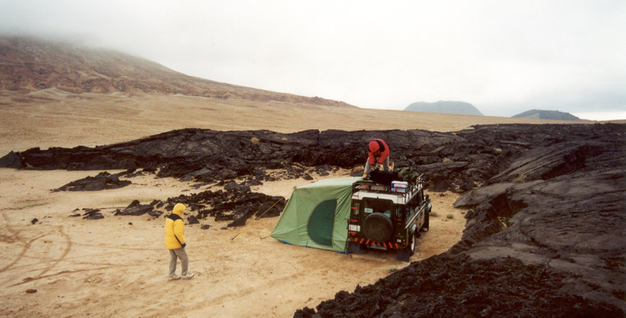
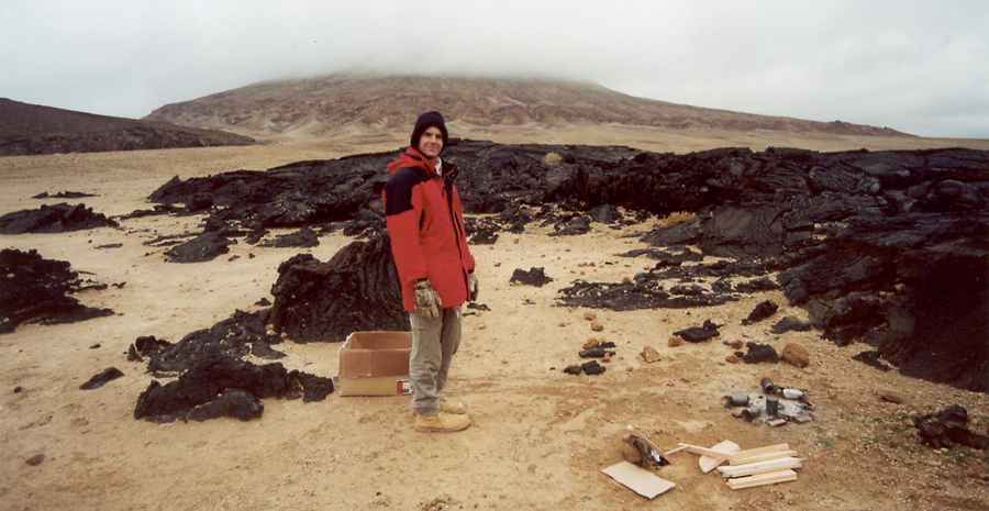
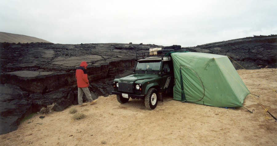
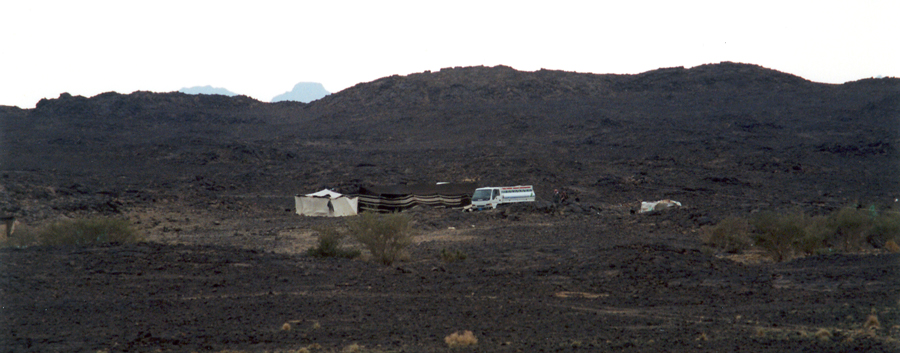
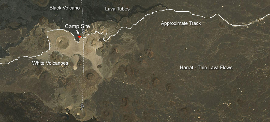
Jebel Abyad is the highest volcano in the area with an altitude of nearly 6800 feet. Just north of the white volcanoes is a black shield volcano called Jebel Qidr with an altitude of almost 6600 feet. Black lava from Jebel Qidr flowed south and covered the white lava from Jebel Bayda and Jebel Abyad. We set up camp at the end of the lava flow that comes south from Jebel Qidr.
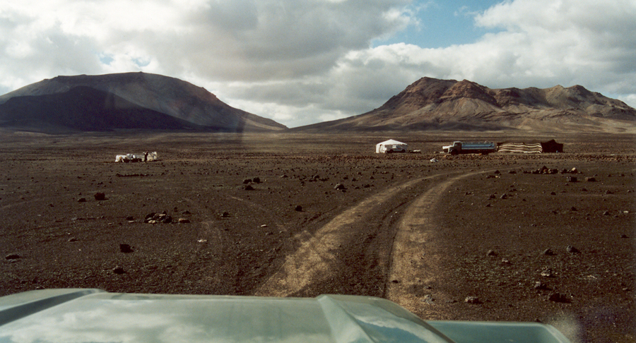
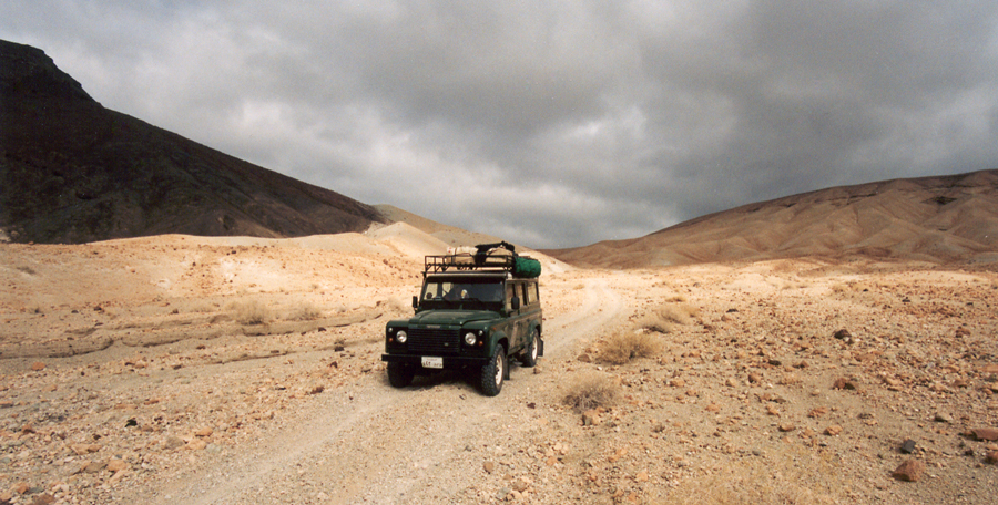
After leaving the highway, it requires a couple of hours to find a major track heading west toward the white volcanoes. These two tracks are good candidates. Tracks this large are going somewhere significant, and as long as they head west, there is a decent chance that they will quickly get our Defender well to the west.
The presence of the power lines suggests we are on a major track heading toward a town, and that means the track won't suddenly disappear into a dead end taking us to Nowhere Land.
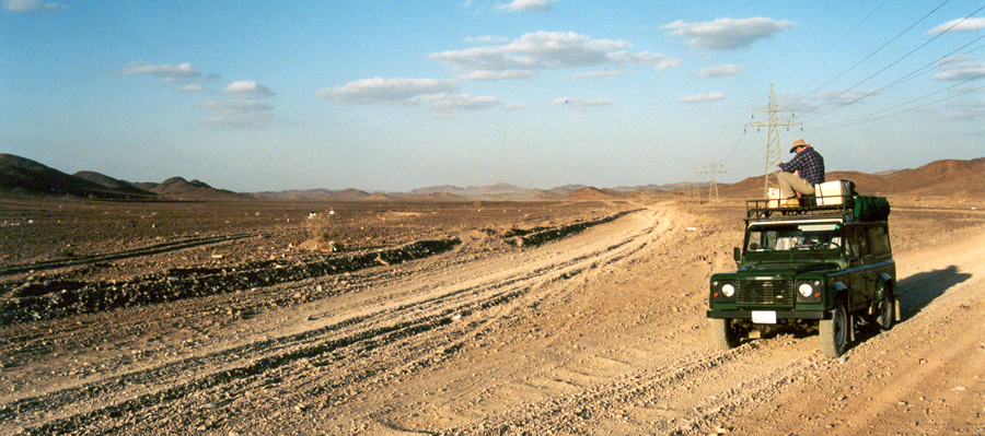
David sits on top of the Defender securing a box of firewood. We are traveling on large corrugations that are extremely effective at shaking things loose and moving them around on the roof rack. David climbs up and uses additional bungee straps to put things in order.
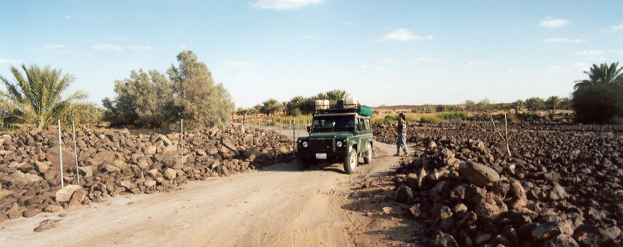
After we passed through a small village, we followed a track that dead-ended in an area with small farms and lots of volcanic rocks. We had no choice but to turn around and retrace our steps until we located a different track that headed west. Since we don't have a road map, it is pure trial and error finding a track that will take us to the land of the white volcanoes.
When we don't know how to get where we are going, it's always good to have long range fuel tanks and jerry cans. We can do miles of backtracking without worrying about running out of fuel.
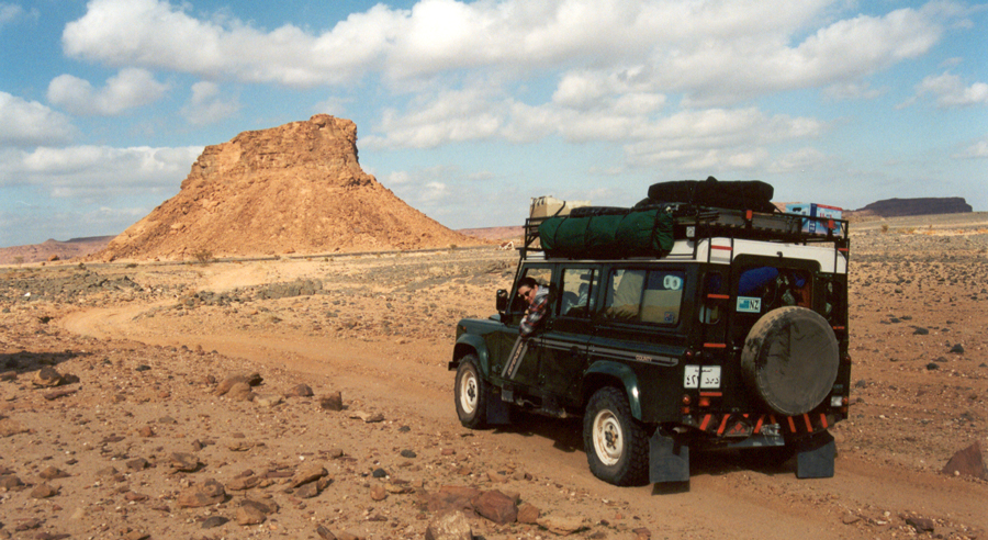
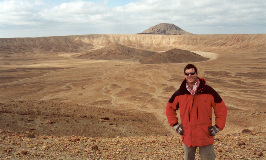
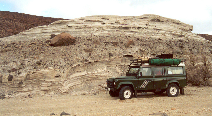
Eventually, we locate a well-developed track heading west that looks promising. A sandstone outcrop in the distance looks interesting and is worth exploring as it may be a good location to set up camp for the night.
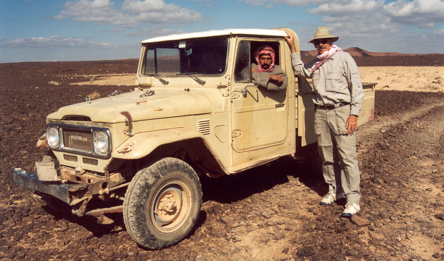
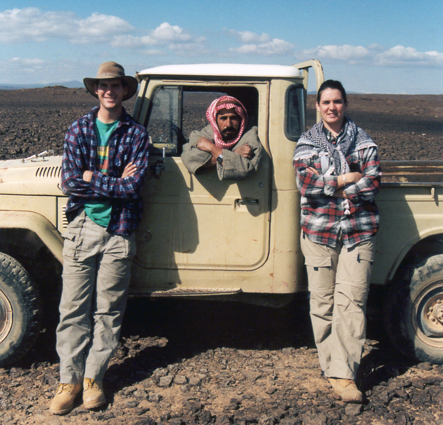
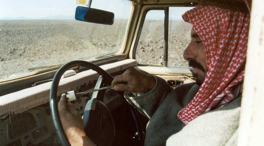
Although Wendy cannot drive on the highway in Saudi Arabia, once she is off road, she can drive anywhere she wants. It is not uncommon to see Bedouin women driving in the desert, and it is perfectly legal.
Wendy and David both learned how to drive in the Arabian desert. It doesn't matter whether they are in rocky desert or in the sand dunes, they drive the Defender like pros.
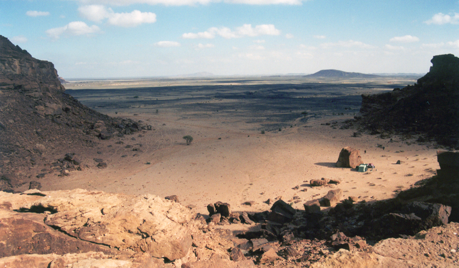
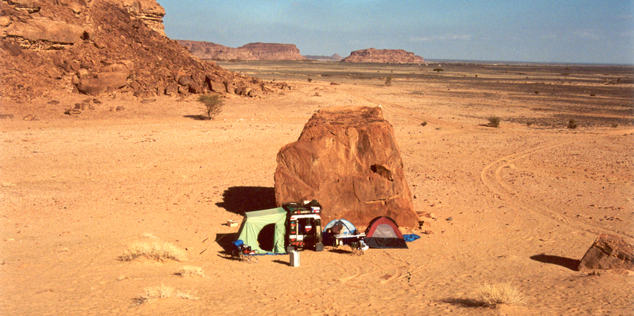
The sandstone outcrop turns out to be better than we had hoped. It's more than an outcrop. It's an enclosed canyon with a relatively narrow entrance. Tracks lead in and out of the canyon, so we are not the first people to be here. There is no trash or bottles lying around on the ground which means not many people come here and set up camp.
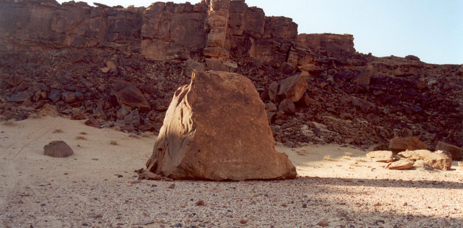
We decide to tuck in behind a large rock toward the back of the canyon. We place our vehicle and tents behind the rock to achieve some degree of shelter and privacy in an otherwise exposed location.
As an added bonus, our campsite is in sand which is a world better than on rocky ground. Fate has been kind to us in this campsite. Camping on rocky terrain is a good argument for a roof top tent, because it doesn't matter if you set up camp in the rocks. We are sand people. We are willing to search high and low to discover an elusive patch of sand on which we can erect our tents.
If we are too close to rocky outcrops, it's sometimes impossible to drive tent stakes into the ground. Rock is just a few inches below the sand, and tent stakes will not penetrate the rock. If that happens, we go without the stakes. We put lots of gear in the tents to anchor them in position so they will not blow away if a sandstorm happens.
This is what our campsite looks like from the entrance of the canyon. Tucked in behind that rock are three tents and one Defender. The sun is setting, and our tents and vehicle hide in the shadow of the high canyon walls.
If I had to order a perfect campsite for a single vehicle expedition, this would be what I would want. It doesn't get any better than this.
This is what our camp looks like from behind the rock. Wendy and David each have their own tent, and Donna and I use the green tent attached to the side of our Defender. Camp chairs are set up, the windscreen keeps the fire from blowing out, and the table is ready to prepare food for the next meal.
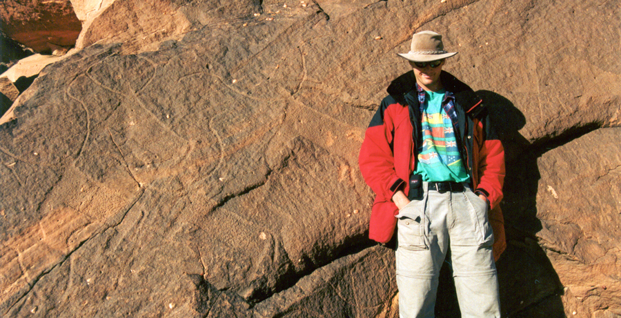
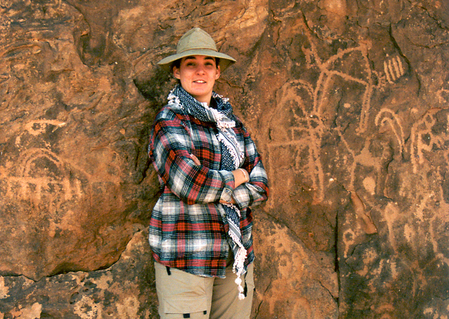
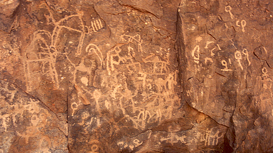
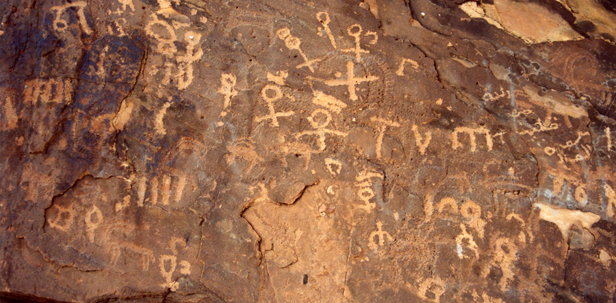
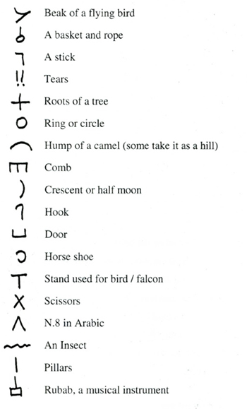
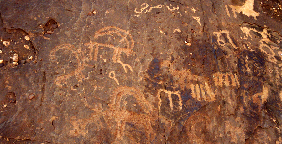
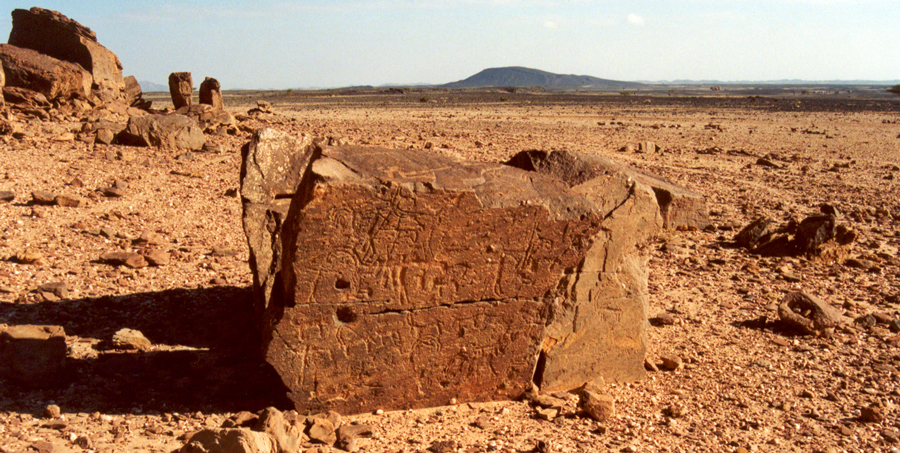
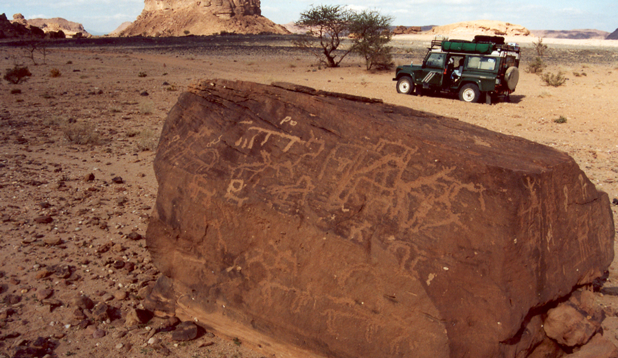
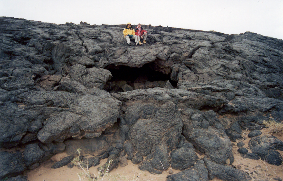
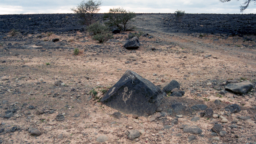
Off in the distance numerous sand stone outcrops come into view. Sandstone outcrops containing flat panels make awesome tablets on which to scribble rock graffiti otherwise know as petroglyphs.
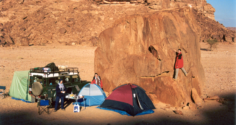
Petroglyphs decorate the rock panel just above the roof of the red tent. It's not often that we set up our tent next to a rock, and when we look up we discover a trove of ancient petroglyphs.
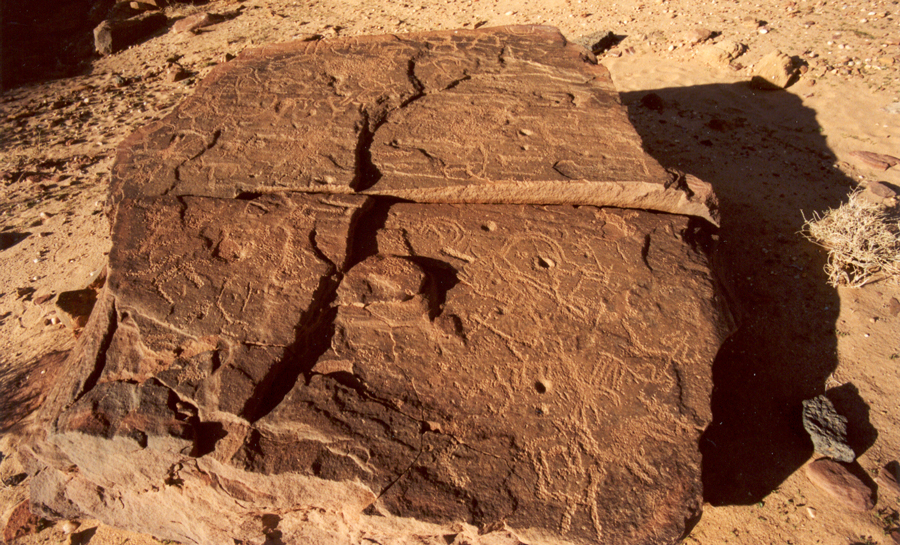
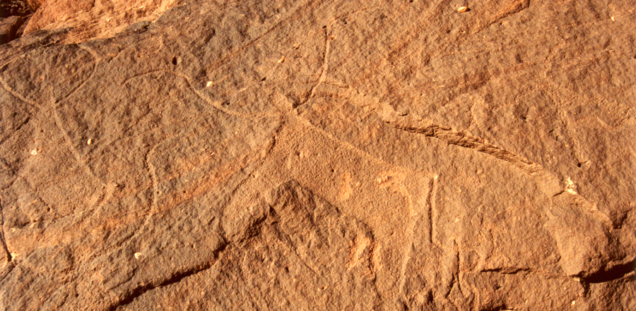
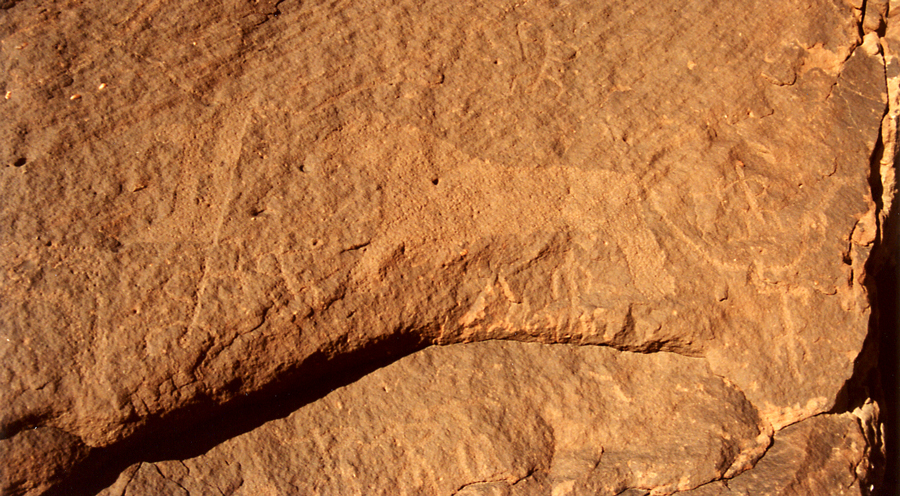
A few meters from our tents, a flat rock bears petroglyphs from edge to edge. For thousands of years, people have been pecking their drawings onto these sandstone faces.
Anyplace else in the world, this petroglyph bonanza would be a national park.