In Search of Overlooks - A Journey Through Death Valley

turbodb

Well-known member
In Search of Overlooks - A Fall Trip to Western Death Valley #1

Death Valley is not nearby, and yet - it continues to call time after time, urging us to make the 20 hour journey south to explore its wonders. And it's hard to say no. That's how - on a Wednesday morning - we found ourselves packed up in the truck and heading towards southern California, excited for the three-and-a-half days we'd have to explore.

I promised myself that this trip would be different. We wouldn't attempt to squeeze everything in; I wouldn't over-schedule our time; it wouldn't be like it always is - a mad dash to not miss a thing. I'd do this by keeping us in the northwest corner of the park - in Eureka and Saline Valleys, and by planning at most a single morning and single afternoon "attraction."

Or so I thought.

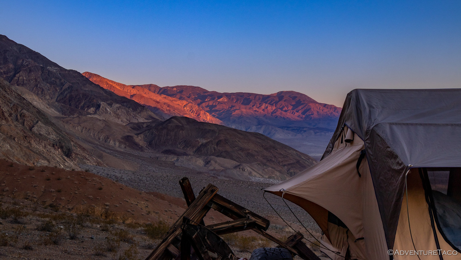
By the end (literally, shortly after midnight) of our first full day of driving, we made it to Walker Lake. There are a couple of free BLM campgrounds along the edge of the lake, and though they are very close to the highway, @mrs.turbodb and I were both exhausted and decided that trying to make it two more hours to a spot we'd found outside of Dyer, NV to camp was just not in the cards. We climbed into the tent and within minutes we were both sound asleep.

Five hours later, at 5:30am, my alarm went off. Unlike most mornings, it wasn't set early to catch the sunrise, but was instead because we needed to get on the road if we were going to have time to do everything I'd planned for the day. (Yes, I realize now that this is perhaps not the approach that leads to a more relaxed trip.) Still, getting up early did have its benefits!

49072075343_8cea50ff34_h.jpg


49072075303_7413847bfe_h.jpg


Intriguing sun shades provide relief to campers in the summer months.

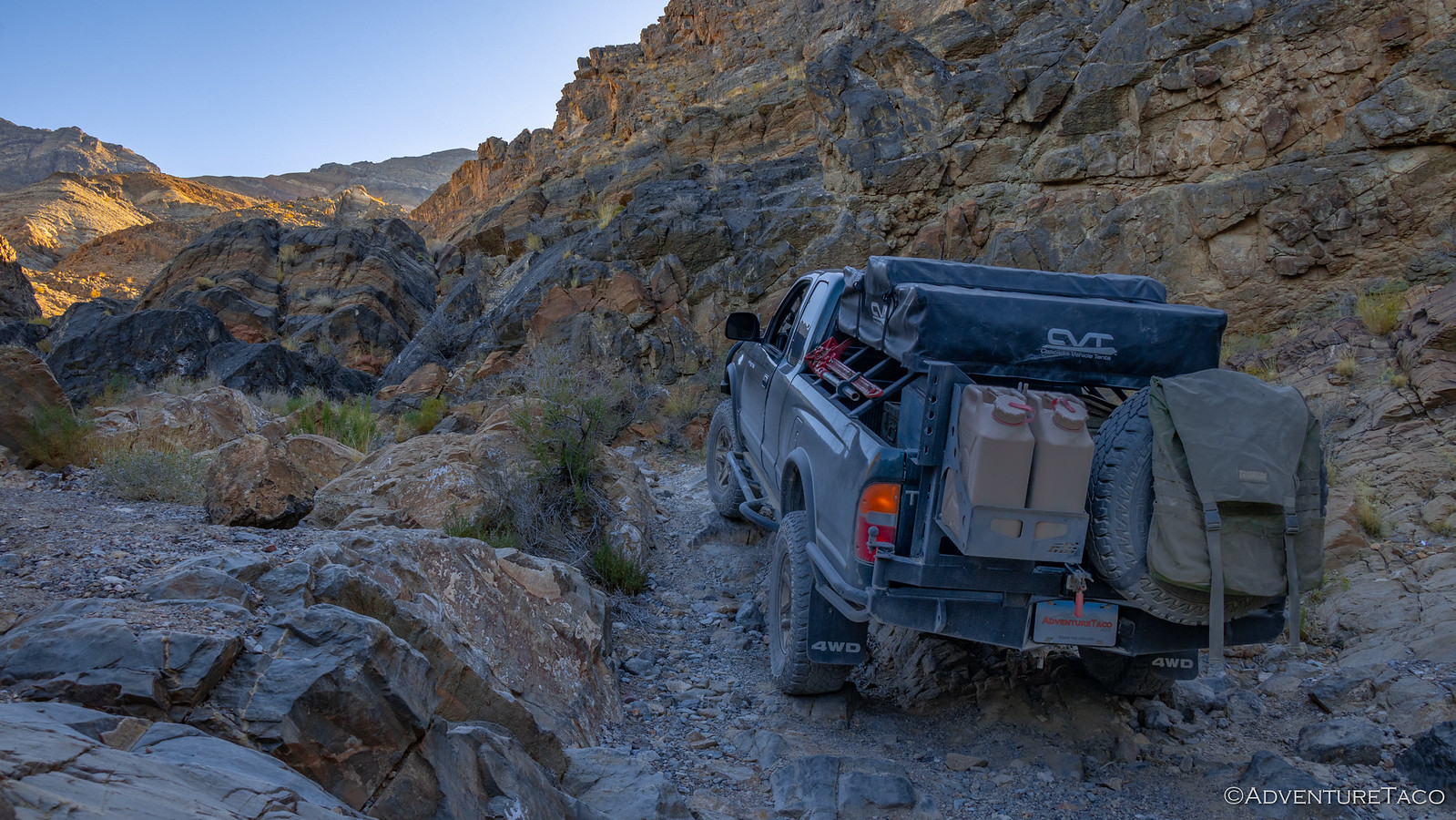
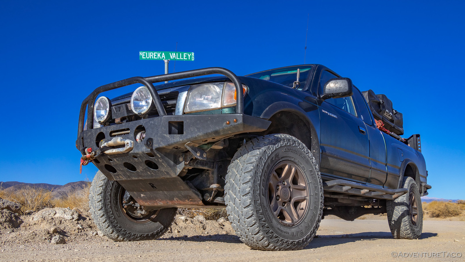
By 9:00am, we'd fueled up in Dyer (Note: though the pumps appear closed before the store is open, hunt around and figure out how to use your credit card by lifting the rubber cover.) and were turning off onto dirt - our entrance into the park via North Eureka Valley Road, one that was new for @mrs.turbodb, and in my opinion the second nicest way into the park (because it's hard to beat Titus Canyon Rd.)

49072808862_8310e15205_h.jpg


49072075213_4d653a6bb2_h.jpg


49072808657_a4921afd89_h.jpg

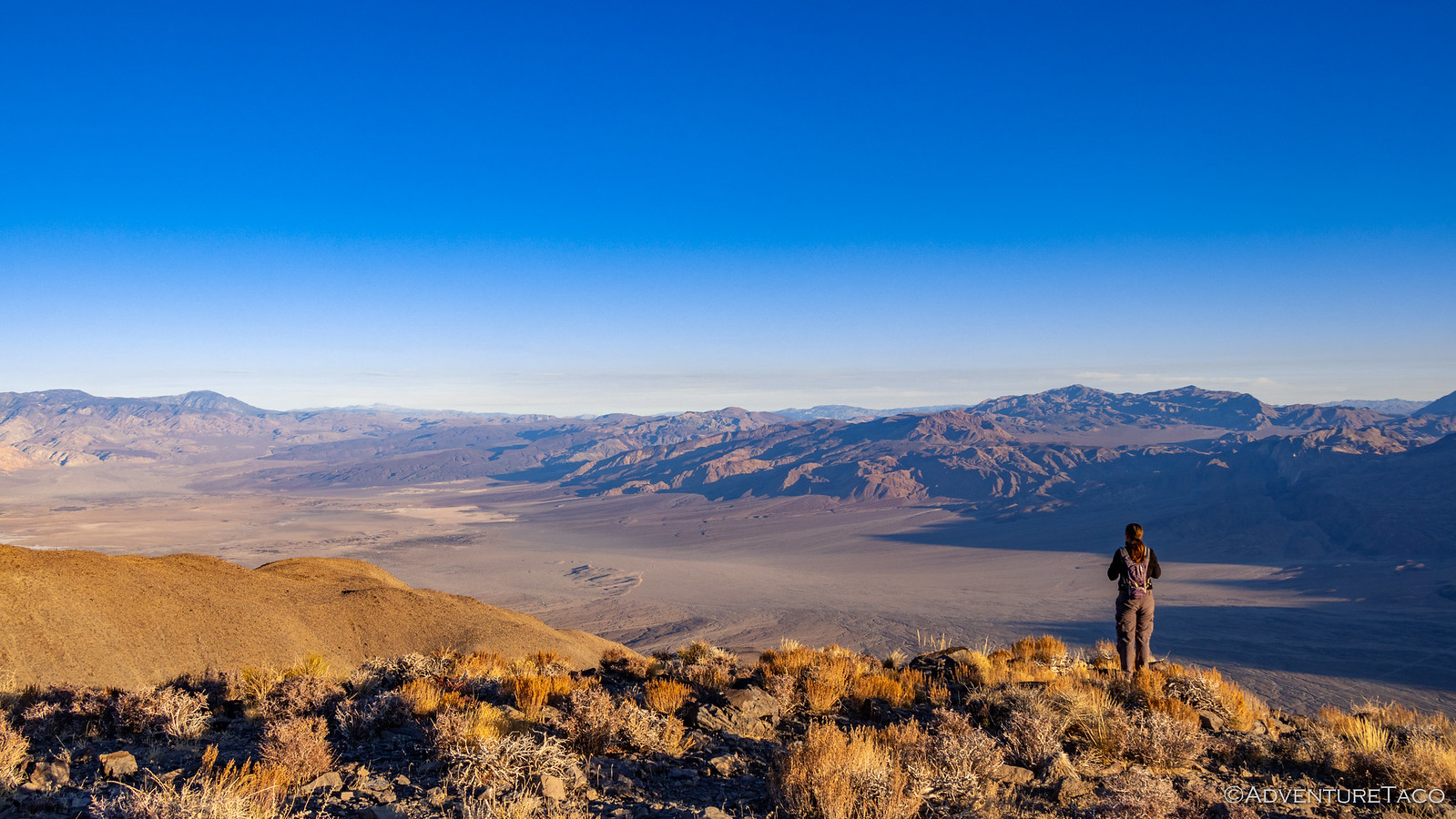
Under the warm morning sun we made good time, even with some photo stops for me, and geology stops for @mrs.turbodb, and it wasn't long before we reached the north end of Eureka Valley - the dunes where we'd be spending the night still just out of sight behind the north end of the Last Chance Range.

And they'd stay hidden a while longer, because our first destination was up in the mountains - to investigate the old sulfur mine and town site of Crater.

49072074983_3752a77fc9_h.jpg

The Crater Mine - and its associated town - started operation in 1929 and produced 50,000 tons of pure sulfur by the time it closed down in 1969 (nearly 30% of all California's sulfur) and the area is still rich with the stinky stuff - some 3,000,000 tons of the stuff still left in the ground! (Hiking Western Death Valley)

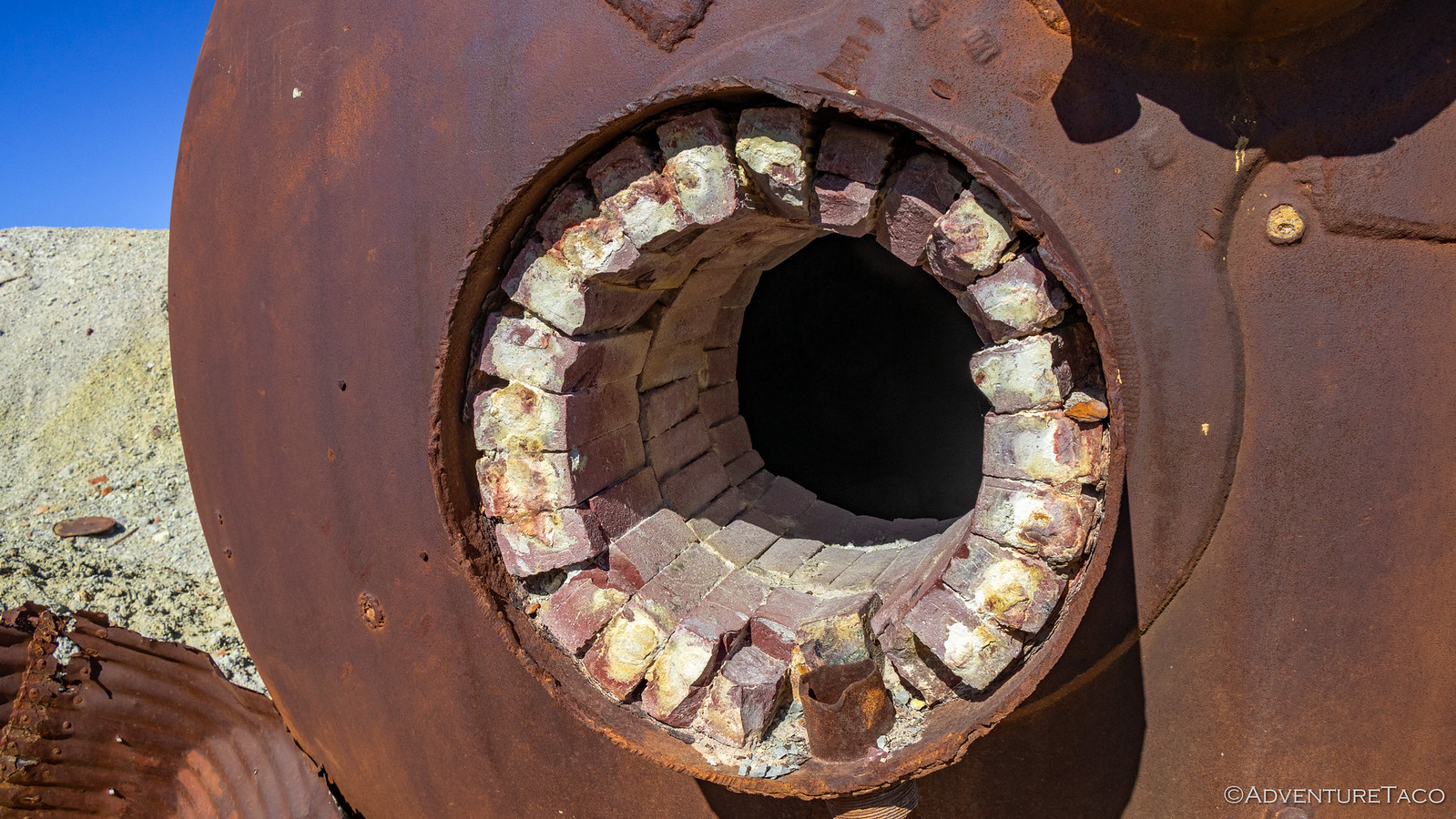
As we pulled up to the mine site, the remnants of the last refinery were immediately visible in the middle of a barren playa. Over the course of mining here, twice there were sulfur dust explosions as the material was refined for transport. Most prominent were the crusher and retort, now laying like a lunar lander in the sulfur ore, its refractory bricks still lining the interior.

49072808482_1ff727171e_h.jpg


49072074823_8a634c562f_h.jpg


49072808262_e07f143ba8_h.jpg

Wandering around, one could only wonder who kept passing gas as the sun's rays warmed the strikingly yellow ground around us, the light breeze only serving to waft the smell past our noses. ?

49072600656_6e5b39af1a_h.jpg

Most of the mines we find ourselves exploring are shaft-style mines, and Crater is one of the few pit mines that we've ever really walked around. The destruction of this style of mining was immediately apparent, the entire hillside having been carved out in search of quick profits.

49072808127_1b90dbc03e_h.jpg


49072600511_974feae62d_h.jpg

Soon enough, we decided it was time to move on. Just up the hill was the old town site of the same name, all of its buildings reduced to piles of timber by the passing of time. Only three relics mark the town site today - some sort of old double-door cooler, a pair of water tanks, and a storage shed built into the hillside. In all honesty, probably not worth visiting if you want my opinion! :gossip:

49072600381_6d69896358_h.jpg


49072074203_f192880000_h.jpg

Now, at this point, my plan had been that we'd eat lunch and then make our way back down into Eureka Valley so we could find a nice spot to camp and then make our way up the dunes. But @mrs.turbodb had gotten to reading Digonnet's Book, and well... there were several interesting things nearby that we decided we might as well add to the schedule.

So, after less than two hours in the park, our plan to keep things simple and not pack too much into a day went by the wayside. We were once again in full-on OMG there's so much to see mode.

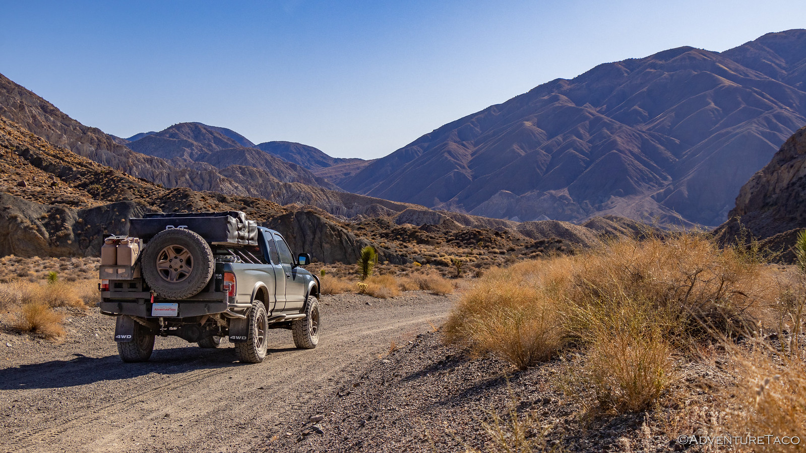
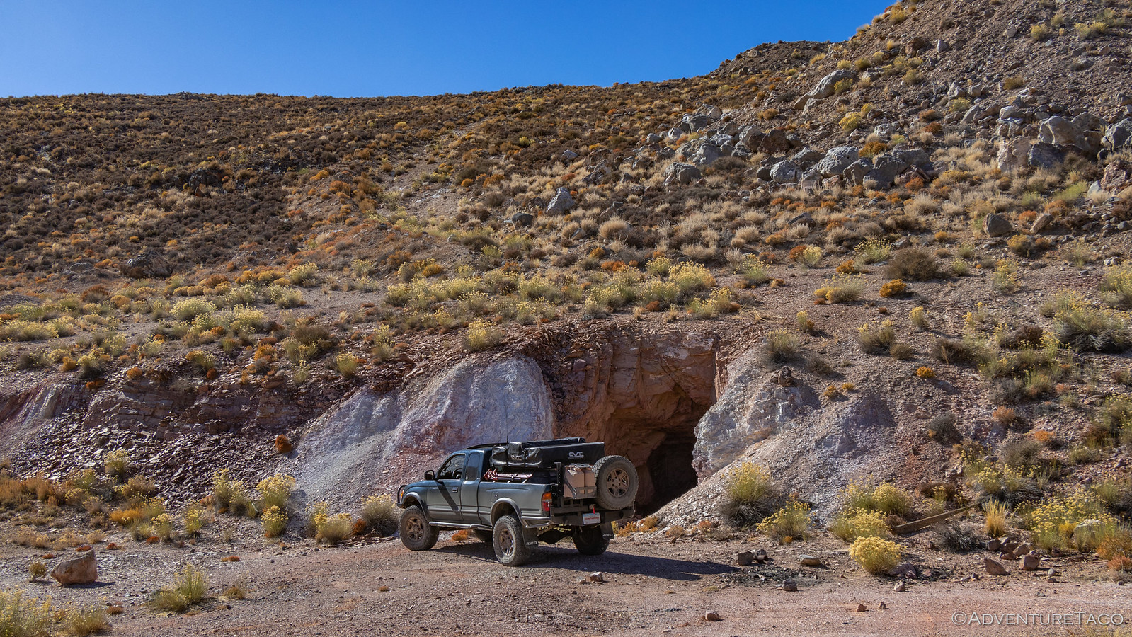
Our first detour was to the El Captan Mine. This was an old Mercury mine, the 800-foot long shaft still completely open and easily large enough to drive a Tacoma into. Keen to stay alive, we refrained from such a foolish move - though curiosity did get the best of me and I walked in 50' or so - opting instead to drive up the hill through which the shaft passes to an enormous hole that was created at the other end.

49072077568_7451d9950d_h.jpg


49072811012_2771532bf0_h.jpg


49072077368_ce503bb679_h.jpg

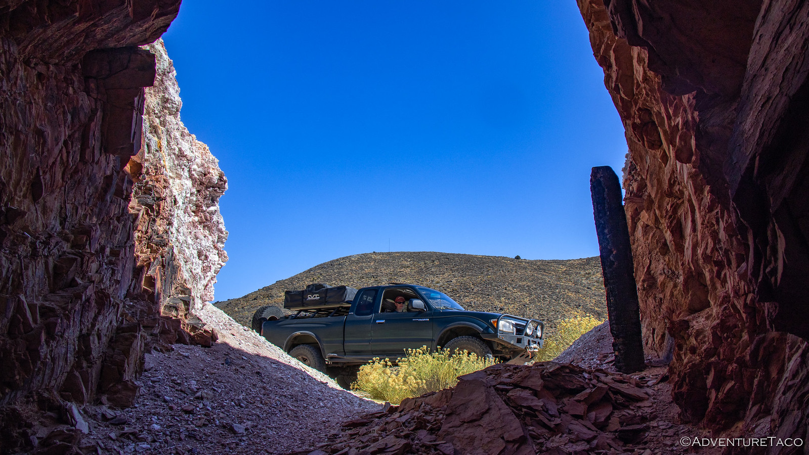
The hole was originally an access shaft that intersected the mine shaft 60-feet lower than its entrance, but when Mercury was found in the surrounding cinnabar ore, it became a glory hole - the material simply dropped down the hole to the end of the mine shaft where it could be hauled out. We kept ourselves out of this side of the mine altogether, its geological state clearly more precarious than the main shaft opening.

49072603381_e448e459c3_h.jpg


Don't miss the rest of the story, and all the remaining photos that don't fit here (due to max post size). Hopefully that can change in the future, but until then...


.
 
  • Like
Reactions: DVD

turbodb

Well-known member
Old Roads and Star Trails - In Search of Overlooks #2

One benefit of going to bed at 7:30pm is that even waking up as the sun crested the Last Chance Range at 6:30am, I got a full night sleep...and then some. And that was a good thing - because even in my attempt to plan reasonable-length days before heading out on this adventure, I knew I'd failed for this day - we had a lot to do. I'll get a bit ahead of myself here, but our goal was to make it out of Eureka Valley, explore some vast swaths of Saline Valley, conquer two multi-mile hikes, and eventually backtrack quite a few miles to camp at the middle Saline Valley Warm Springs.

Yeah, I'm not sure what I was thinking. Except that at 6:30am, all I was really thinking about was how cold it was (our water had frozen overnight) and how nice the sun felt as it finally started to warm us up in camp.

49083477087_32f533fba7_h.jpg


49083273691_fd4766b025_h.jpg

We ate a quick breakfast as we got the tent put away, and it wasn't long before we here headed south - past the dunes we'd hiked the day before - and towards our exit from Eureka Valley.

49082756188_cb66879122_h.jpg


49083476772_30da27eed3_h.jpg

That exit - as anyone familiar with the area has likely already realized - was via Dedeckera Canyon and Steel Pass. This fun little section of road would be the most technical that we'd traverse in the park on this trip, and was something I'd been looking forward to since I'd traveled it in the opposite direction a little more than 18 months earlier. At the time, I'd had less experience, and was glad to have been descending the four closely-spaced obstacles through Dedeckera rather than climbing them; gravity seemingly in my favor.

This time, I was happy to climb them - the challenge of something a little more exciting, my motivating factor. It wasn't long before we hit the first narrow, rocky section.

49082755998_935de222aa_h.jpg


49082755903_8adc2c6e34_h.jpg


49083476457_6658845e6d_h.jpg

Well, I must say - while it was fun, and a little narrow... I've clearly been jaded by the last 18 months of adventures. This is - I suppose - to be expected, but at the same time I'd be lying if I didn't say I was a little bummed.

It was of course still a beautiful drive, and @mrs.turbodb - having been on fewer trips - got plenty of thrills as we squeezed through the various narrows and climbed up over the dry falls; the e-brake just strong enough to hold he truck without slipping in a couple of situations as I hopped out to snap a quick photo.

49083273136_1aa0a7823c_h.jpg


49082755668_e75b210245_h.jpg


49083272906_ffb9c09fdf_h.jpg


49083476092_26f921ab3d_h.jpg

Something that was hard to capture on this trip through the canyon due to the long, early morning shadows - and that I think many people miss because they are focused on the driving - is that there are several very interesting looking side canyons branching off of the main wash. I had assumed that this might be my last trip through Dedeckera given its remoteness in relation to everything else in Death Valley National Park, but I can confidently say now that I will be back to this region - both to explore these side canyons, as well as several more places in Eureka Valley that have piqued my interest!

Today however, we passed by the side canyons and made our up and over through Steel Pass; we had places to be, and a limited number of hours to accomplish that be-ing.

49083272671_4118ed7c15_h.jpg


49082755283_0143ab5c43_h.jpg


49083272436_ca5213a0a5_h.jpg

As Saline Valley opened up in front of us, we both took in our first view of where we'd be spending the next couple of days. This valley and the Inyo Mountains to its west were to be our stomping grounds - our goal to uncover, and yet still keep, a few of its secrets.

49083475767_db03293c49_h.jpg


...So that's where this trip report is going to get a bit weird. I'm going to do things a little out of order and with some location redaction - in hopes of keeping a few of these special places special for just a little longer. If you find them, I think it'd be swell if you'd do the same!​

While it's obvious that salt plays an important role in Saline Valley's history, I think most people who've been there are mostly - or only - familiar with the Salt Tram that carried the white crystals up and over the Inyo Mountains to the west, and out to the Owens Valley.

49082754943_97ecbdf0a1_h.jpg

Well, it turns out that this was the both the initial and final path for the harvested salt, but it wasn't the only successful path over which the salt was transported. For that, we need to reach a bit deeper into the history of the operation. The brain child of an attorney named White Smith, the salt tram was constructed - at great cost - between 1911 and 1913.

Unfortunately, there were flaws in the construction which limited the amount of salt it could transport and by 1920, having transported only 5,000 tons of salt, Smith's company went bankrupt, and the tram was repossessed by the builder.

Not to be dissuaded, Smith lobbied the county to build a road from the Owens Valley to Saline Valley, via San Lucas Canyon. This road too took over two years to build. When completed, trucks would carry 10-ton loads of salt along a trail famed by miners to be "so precarious, it is only navigable by those crazy enough to do it drunk."

Last driven in the 1930's, no part of this dirt road is recognizable today - with one exception. At the most dangerous point on the route - where the road navigated around the edge of a 50-foot dry fall - a narrow ledge can be seen cut into the side of the canyon wall.

And that's where we were headed. Assuming my plan worked out.

See, rather than take the normal route from the top of San Lucas Canyon to the dry fall, I'd found a faint road and a side canyon that appeared to connect back into San Lucas - saving approximately 2 miles of hiking - assuming that it was passable. And it started with driving high above Saline Valley before parking the truck in a flexy spot at the top of the side canyon. :laugh:

49082754873_f84fe55ec2_h.jpg


49082754768_95801a1c12_h.jpg


Don't miss the rest of the story, and all the remaining photos that don't fit here (due to max post size). Hopefully that can change in the future, but until then...


.
 

turbodb

Well-known member
To Thunderbirds and Beyond - In Search of Overlooks #3

The night air was warm - probably 15°F warmer than it'd been in Eureka Valley - as the stars spun in the clear sky above. It was a great night, tucked away in our quiet, secluded corner of Saline Valley.

49088604156_f661c93c40_h.jpg

Once again having gone to bed early, it was no trouble getting up a little before sunrise. I wasn't sure we'd really get anything with cloudless skies and our position relative to the Inyo Mountains and Panamint Ranges. And in the end, there wasn't much except a bit of color in the sky, but even that was extremely pleasant as I sat overlooking the valley in a short-sleeve shirt, reading The Athena Project on my Kindle.

49088099548_5ca9f474b7_h.jpg

49088813652_f27b35a224_h.jpg

We had another full day in front of us, our slower-paced plan now a distant memory. A couple more hikes, exploration of a silver mine (that was an ad-hoc addition to the trip), and a hunt for petroglyphs hidden somewhere in Saline Valley before heading off in search of another great overlook where we could spend the night.

And here - once again - I should mention that I'll be doing this out-of-order and with a bit of obfuscation and/or redaction of certain places. If you know where they are, please do your best to keep them special as well! That means refraining from sharing specific locations, wandering off trail, and touching any rock art that you find. These places have a hard enough time surviving in a desert environment, without having to compete with the chaos that inattentive humans can bring.

With the sun streaking higher in the sky, @mrs.turbodb was soon out of the tent as well, and as got to prepping breakfast, I poked around a bit in the ruins of the dilapidated Salt Tram where we'd set up camp. There I found the usual suspects - old wood, nails, brackets, and cabling - but also a few unique items as well. The coolest - in my opinion - was some turquoise glass, which reminded me of the purple glass we'd found at the Champion Mine in Colorado.

49088603946_638799f5cc_h.jpg

Cereal - and some of the best store-bought blueberries I've ever eaten - consumed, we packed up the kitchen and tent and got on our way, heading back down toward Saline Valley Road from our camp at the base of the Inyos.

49088099383_fbe5777f88_h.jpg

Now, one of the treasures of Saline Valley are the *************************** petroglyphs. Located well off the beaten path, one has to find the right spot to park, and hike for a couple miles across the desert in the right direction in order to even hope to find them.

I'd discovered them - or hints about them - in several places during my research of Death Valley, and before we left on the trip, I was pretty sure I'd figured out their location. We wouldn't know for sure until we got there however, and so after making our way to a point I'd marked on the map, we parked the truck and set out on foot.

49088813417_13fe7f08e8_h.jpg

49088603711_3af543ecf4_h.jpg

A hike like this is always a bit of a gamble - I mean, you never really know if it'll be a success or not until you're fully committed - so it's always nice to look for little things to enjoy along the way... just in case there's no pot of gold at the end. Today, the little things were easy to enjoy. Somehow - I have no idea how - I happened to look down at the ground at just the right time to see a large chip of obsidian.

I've never seen obsidian here before, but I took it as a good sign that we were headed in the right direction for Native American art, and continued on.

49088603626_eb840bcead_h.jpg

The flora in Saline Valley - well, all of Death Valley really - is always amazing. With a name like Death Valley - and the desert climate to go along with it - I'm always struck by the color and beauty of the plant life. Along the "trail," we found numerous cacti - the red cotton-top cactus and chollos, especially vibrant.

49088813152_edb9899ce3_h.jpg

49088603486_c6994a1935_h.jpg

Eventually, a couple miles into our trek, we reached the edge of the valley and the mouth of the canyon that we hoped would contain our treasure. As the walls rose up around us, we pressed on.

49088812942_471e81bb05_h.jpg

Now was the moment of truth - sort of. A better analogy would probably be a slow motion highlight reel - or train wreck - depending on the outcome... because even if we'd found the right canyon, it was still a rather sizable place, and locating the carvings in the rock wasn't necessarily going to be an easy task.

Making our way back and forth across the wash, we inspected the walls as we headed deeper into the canyon. Eventually, we ran into the first panel, and we knew we'd found the right place!

I present to you - lady holes.

49088098818_39bad453d7_h.jpg

49088603141_f0bc0bb4a3_h.jpg

It's not known exactly what these figures represent, but it is purported that this was perhaps a fertility site, and these figures represent pregnant women - large bellies and oversize belly buttons, depicted on the rocks. Much like the yoni that we found further south near the Blue Sun Cave.

Now excited that we were in the right area, we pushed on further - our goal was to find a series of birds known as either Thunderbirds or Condors.

49088602951_a441218637_h.jpg

It wasn't long - at least relatively - before we found the next panel. This one had more variety than the first, various shapes and several different creatures depicted.

49088098453_44184ab101_h.jpg

49088602751_fbb738210b_h.jpg

49088098238_7d96091e2a_h.jpg

It was almost as though this second panel was a "scratch panel" of sorts - the carvings here seemingly scraped over in various places as though the artist had been practicing.

49088098113_17b95d1769_h.jpg


Don't miss the rest of the story, and all the remaining photos that don't fit here (due to max post size). Hopefully that can change in the future, but until then...


.
 

LocoX

Member
Going to set aside some time to go through this one for some nice evening reading-- looks fantastic! Just got done with your Dome fire / Mojave write up. Really setting an unachievable benchmark for the rest of us in terms of quality photos and write up :p
 

turbodb

Well-known member
Saline Warm Springs & Cerro Gordo: Once is Enough - In Search of Overlooks #4
Unlike most nights, where the temps seem to drop to their lowest point just before sunrise, our night high in ************ the Inyo Mountains turned out to be just the opposite. At some point, I was so warm that I even removed one of the comforters in order to maintain a reasonably-cozy-and-not-all-sweaty body temp. Even @mrs.turbodb commented on it in the morning, as we enjoyed our breakfast.

That of course was after I'd gotten out of bed in order to capture what might have been an amazing sunrise. See, as we'd arrived the previous evening, one of the things we'd noticed was that there was quite a bit of high-level smoke to our west. With a westerly wind, I figured we'd either reap the benefits of that smoke - with some spectacular color - or we'd end up with nothing more than a hazy mess. If the end, I think we got a bit of both.

The light on the horizon started oranger than we'd seen previous mornings - likely because this was the first time we had enough elevation to see closer to the horizon. The bright orange lasted only minutes, the smoke becoming more hazy as the sun neared the horizon.

49144522096_02392b4bc1_h.jpg

49093281093_c8907e8362_h.jpg

Breakfast with a view.

I probably scurried around camp - literally jogging from spot to spot in order to try and capture the grandeur - for a good 90 minutes before finally deciding that there was really no way I was going to be able to be in all places at once, and I'd just have to find my way back in the future so I could spend a few more days here. With @mrs.turbodb now out of bed and breakfast behind us, it was time to get on with our day. We only had about half the day to spend here in the wilderness - the other half to be spent making our way north towards home.

And here - once again - I should mention that I'll be doing this out-of-order and with a bit of obfuscation and/or redaction of certain places. If you know where they are, please do your best to keep them special as well!

Luckily for us, our first stop was reasonably nearby - the *************** Mine. This was a historic copper mine, responsible for more than two thirds of all the copper to come out of Saline Valley. Mined as an open cut, the most striking thing about this mine to me was the structure of the quartz crystals that are everywhere on the site. More than trillions of little crystals are imperceptible at first, and only on closer inspection does one notice the amazing geology.

49093281038_ea775c01cd_h.jpg

49093280903_63c32f14e3_h.jpg

As much as we'd have loved to stay to take in the views, we knew that there were other places to spend time before we hit the highway, and we pulled ourselves away towards our next destination. It's here that I'd be remiss however, if I failed to mention another really exciting experience that we'd had the last several days. In fact, it was one that I wasn't sure would be in the cards this time due to the unfortunate crash of a Navy F-18 at Father Crowley Point back in July. But - and I don't know if this has always been the Star Wars route, or if it's a new route for the planes - our time in Saline Valley was peppered with low-level fly-bys, several of the jets performing rolls as they passed overhead.

Could they see us - a lone vehicle with a dust trail as we drove our way around? - perhaps. But we could definitely see - and hear - them!

49093993217_d442ba930b_h.jpg

Surely, all of the folks at the Saline Valley Warm Springs enjoyed it as well. That place was hopping as we drove by - something that I think surprised @mrs.turbodb a little bit, given it's remoteness - and while we'd planned to stay there one night, in the end we were much happier with our private little spot by the Salt Tram - away from the chaotic parties that were surely raging below. A few minutes exploring the upper springs, and a quick stop at the bat sign, were the only time we allotted to what is - by far - the most popular place in Saline Valley.

49093797591_baf2fab888_h.jpg

49093280608_94d323cc02_h.jpg

Our next couple of mines were not quite on our way to the final destination of our trip - the mining ghost town of Cerro Gordo - but they were close enough. The ********* Mine - which worked primarily silver - and ********* Mine - which pulled garnets and several other semi-precious stones - were both located in the ************ near Lee Flat. We visited the silver mine first, working out way up to a small opening in the hillside. Don't let this opening fool you - if pressed, I'd say it was much smaller than the original opening, erosion of the surrounding area slowly working to cover this entrance. A few feet inside the mountain, both the the shaft height and width increased dramatically, large enough for several miners to work comfortably side by side.

49093797336_7b10aa1654_h.jpg

We were in no way going inside this mine however - the loose dirt and rock, indicators to us that we'd be safer out here in the open! As it turns out, this mine was reasonably near another attraction, and there were a few other explorers already set up there when we were at the ********* Mine, so we didn't hang out here long.

49093280393_61a45f48fc_h.jpg

Instead, we headed over to the nearby ********* garnet mine to see if we could find what we had heard was a profusion of garnet strewn about on the ground. This was especially interesting to @mrs.turbodb who'd also wanted to search for garnets on our trip to Indian Hot Springs in Idaho earlier in the year. There, we hadn't had time to do much poking around, but this time we figured it would be significantly easier, and so - why not?

Almost immediately, we discovered something else. In addition to garnets, this mine was apparently rich - at least, as far as we could tell - with turquoise. In fact, while we searched several tailings piles for garnets and never found any, there was no shortage of the bluish-green gem embedded in the surrounding rock. It quite literally, littered the ground!

49093280283_bfc1c9f63e_h.jpg

Here too there were mine shafts - the largest of which seemed to be bored into reasonably solid rock. That fact, and my hope that perhaps we'd find a garnet inside, propelled not only me - but also @mrs.turbodb - forward twenty feet or so into the shaft.

49093280158_69bb6b5f41_h.jpg

...which is when we noticed this little guy on the ceiling. Now, for anyone familiar with my stories - you may recall that it was only a couple months ago that I found a bat under my mattress when I was putting away the tent one morning. The discovery was enough to send @mrs.turbodb back the way she'd come, and I spent a few minutes trying to get a photo before making my way out as well. Garnet-less! (Which was just fine - it's not like they'd be coming home with us anyway, though it would have been nice to take home a picture.)

49093992257_dfc7c0bacc_h.jpg

With that, our exploration of the mine was complete - at least for this trip - and we climbed back in the truck and pointed ourselves west; our destination was Cerro Gordo. Located near the southern crest of the Inyo Mountains, this mining town founded by Mexicans in 1863 was unlike many in the Death Valley area. Where most mines were all work and no pay - disappointing generations of miners - Cerro Gordo was not only successful - it was the most successful. In fact, Hiking Western Death Valley retells a story of just how much silver was pulled out of this area:

Concentration of the ore by on-site smelting was a major part of Cerro Gordo's activities. The silver-lead bullion was cast into 80- to 90-pound ingots and freighted to markets my mule teams, beginning in 1868. For three years, renowned freighter Remi Nadeau ...


- - -

Don't miss the rest of the story, and all the remaining photos that don't fit here (due to max post size). Hopefully that can change in the future, but until then...


.
 

turbodb

Well-known member
I sure enjoy your reports, especially the fuller versions on the blog. Great work and many thanks for taking the time to put them up.
Glad you're enjoying and that you've clicked through to the fuller versions over on the blog! It's a lot of fun to go out on these trips, and nice when others can enjoy a bit as well.
Going to set aside some time to go through this one for some nice evening reading-- looks fantastic! Just got done with your Dome fire / Mojave write up. Really setting an unachievable benchmark for the rest of us in terms of quality photos and write up :p
Sounds great! ? The Mojave trip isn't quite done yet, still a few more days of that one to get up on to the blog. You can always sign up here to get notified of new stories as I post them! https://adventuretaco.com/subscribe/
 

turbodb

Well-known member
Great stories and photos! I really enjoyed the full posts on your website. Thanks!
I enjoy reading your expedition. The view looks amazing, you did a job well done capturing great images of Death Valley.
Thanks to you both! If you've enjoyed this DV trip, please do check out the others; it's a place I love to go, and seems to be an endless playground for those willing to explore!

All of my Death Valley trips:
 

Forum statistics

Threads
186,360
Messages
2,884,922
Members
226,303
Latest member
guapstyle
Top