Land Navigation Course, November 2010

teotwaki

Excelsior!
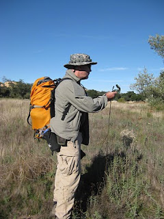
Think you're great with that GPS? A map and compass? I thought I was proficient, but found otherwise when I hung out with the pros at a Land Navigation course I took in November down in southern San Diego County.

Read all about it here at my blog: http://suntothenorth.blogspot.com/2010/11/adventures-with-land-navigation.html

Land+Nav+010.jpg
 
Last edited:

adventureduo

Dave Druck [KI6LBB]
Great class to take... how do you get invited? Thanks for sharing Jim,.... was your partner an Expo member? He looks familiar... from the Trestle hike we did not long ago.
 
Last edited:

bobcat charlie

Adventurer
I try not to go anywhere without a map to reference. Love orienteering courses!

I'm an old infantryman...map and compass = survival. Had to know where you were to call for help!

That said, I found it really interesting to do an extended trek in California's Trinity Alps, NW of Weaverville, with only a topo and a Thommen altimeter. Two weeks just me and the dog and never worried about where I was. A lot of terrain features (mountains, streams, rivers) and contour lines made orienteering an interesting game. Would have sucked in III Corp RVN...damn rice paddies lack terrain features!

I like a map/compass or topo map/altimeter and feel real comfortable with those tools...do like to know I have the Garmin in the truck though.
 

teotwaki

Excelsior!
I try not to go anywhere without a map to reference. Love orienteering courses!

I'm an old infantryman...map and compass = survival. Had to know where you were to call for help!

That said, I found it really interesting to do an extended trek in California's Trinity Alps, NW of Weaverville, with only a topo and a Thommen altimeter. Two weeks just me and the dog and never worried about where I was. A lot of terrain features (mountains, streams, rivers) and contour lines made orienteering an interesting game. Would have sucked in III Corp RVN...damn rice paddies lack terrain features!

I like a map/compass or topo map/altimeter and feel real comfortable with those tools...do like to know I have the Garmin in the truck though.

Great point about the altimeter! My Suunto Vector watch and Garmin GPS have very stable temperature compensated altimeters. They've been very helpful for interpreting topo maps.
 

Forum statistics

Threads
189,895
Messages
2,921,946
Members
233,083
Latest member
Off Road Vagabond
Top