escadventure
Adventurer
As someone who knows little about off road nav technology, the sheer amount and diversity of content is a bit overwhelming - especially since providers usually consider full disclosure about capability and limits of their content a low priority: true story -
I'm at Overland Expo the other day talking to the Magellan rep. First, he' got nothing to sell me and he's showing me 2 tablets he borrowed from a friend. Really? He tells me all about his software and what it is/has/can do. So I open a section of map that I'm very familiar with to compare my knowledge with his map info. It's not even close. His level of info/content isn't at all what he described. Then the stammering and backstepping and excusing. But I'd have been really mad if I found that AFTER I bought his stuff.
So, perhaps I'd be better off soliciting your experience and opinions...
I'd like something as easy to use as a map/compass/ruler.
I'm a dedicated Apple user.
I use Garmin Basecamp for my hand held gps and like that level/ease of interface.
I think all I really need/want is
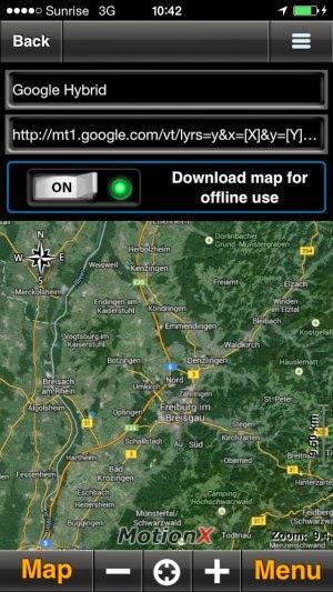
- access to maps with good detail i.e. topo info, dirt road/trail/2-tracks info, public/private land info - and basically the same level of info I would find on google earth
- offline map capability
- see my position on the map
- set waypoints before or during the trip
- capture routes as I travel them
I don't care about setting up tracks before hand.
I don't want something that requires a subscription - I'd rather pay more for something and be done with it...
So, are there offerings out there that can be that simple?
I'm at Overland Expo the other day talking to the Magellan rep. First, he' got nothing to sell me and he's showing me 2 tablets he borrowed from a friend. Really? He tells me all about his software and what it is/has/can do. So I open a section of map that I'm very familiar with to compare my knowledge with his map info. It's not even close. His level of info/content isn't at all what he described. Then the stammering and backstepping and excusing. But I'd have been really mad if I found that AFTER I bought his stuff.
So, perhaps I'd be better off soliciting your experience and opinions...
I'd like something as easy to use as a map/compass/ruler.
I'm a dedicated Apple user.
I use Garmin Basecamp for my hand held gps and like that level/ease of interface.
I think all I really need/want is
- access to maps with good detail i.e. topo info, dirt road/trail/2-tracks info, public/private land info - and basically the same level of info I would find on google earth
- offline map capability
- see my position on the map
- set waypoints before or during the trip
- capture routes as I travel them
I don't care about setting up tracks before hand.
I don't want something that requires a subscription - I'd rather pay more for something and be done with it...
So, are there offerings out there that can be that simple?


") but for all the details & links hit up:
but for all the details & links hit up: