The Mojave to the Eastern Sierra

v_man

Explorer
My drive started out in the lovely desert town of Mojave, just south of the El Paso Mountains and Red Rock State Park. I was by myself but I ran into lots of 4 wheelers out enjoying the excellent weather.

el%20paso%20map_zps47ghjiul.jpg


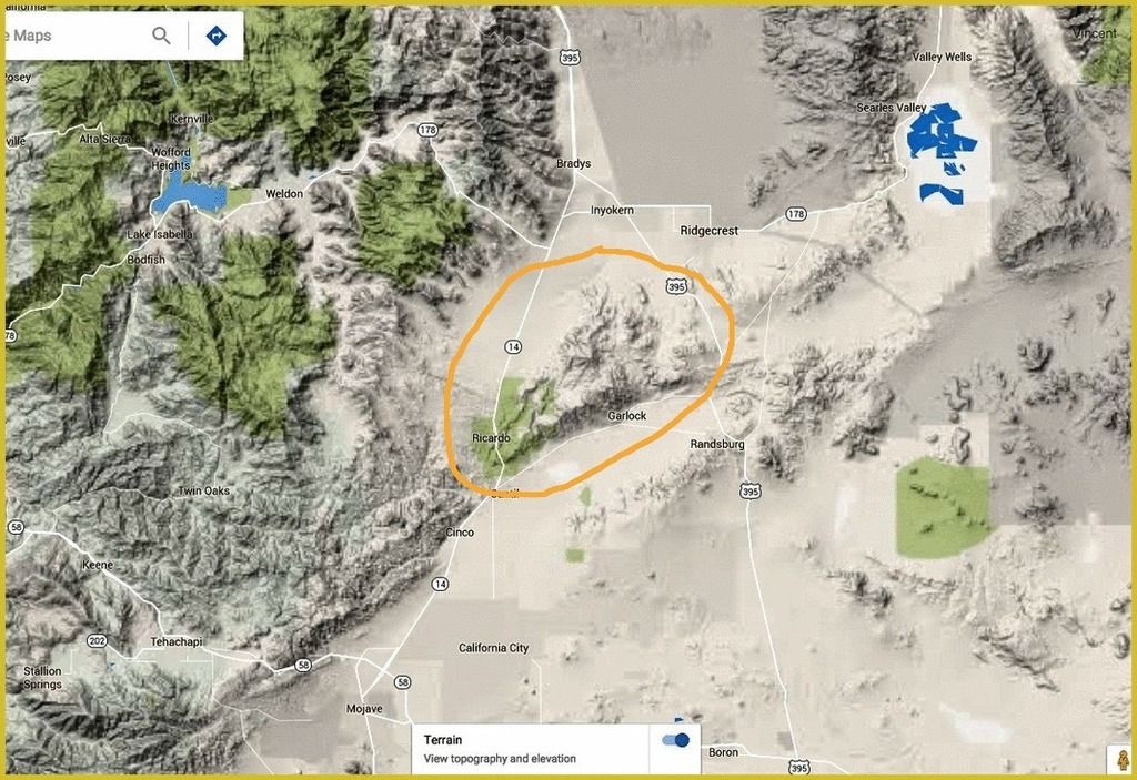
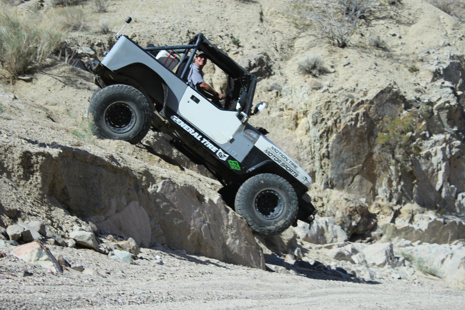
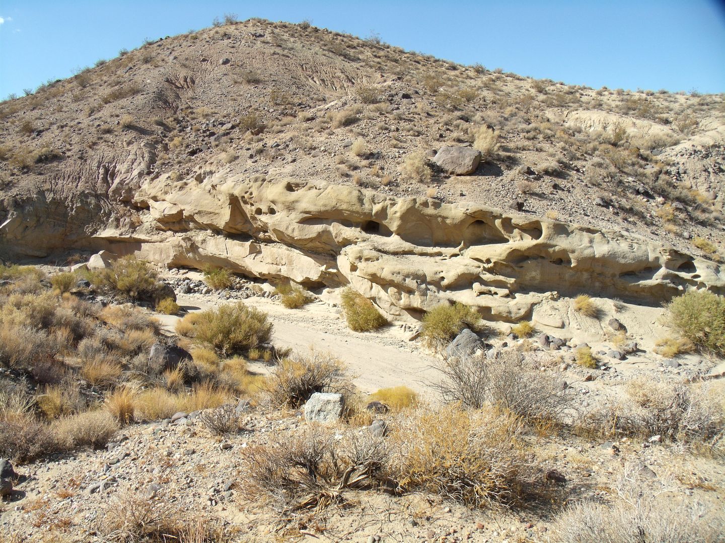
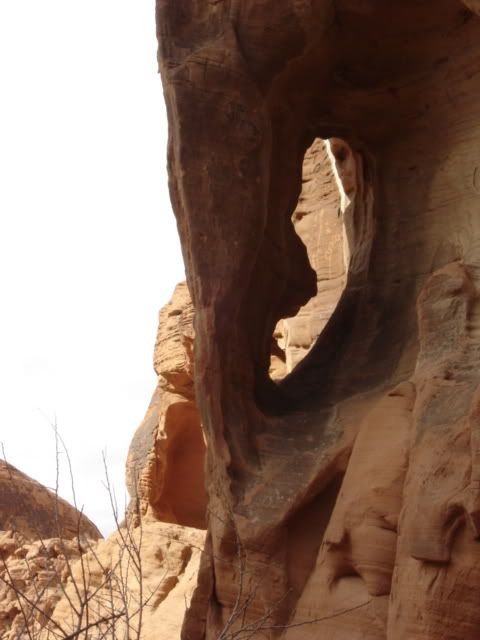
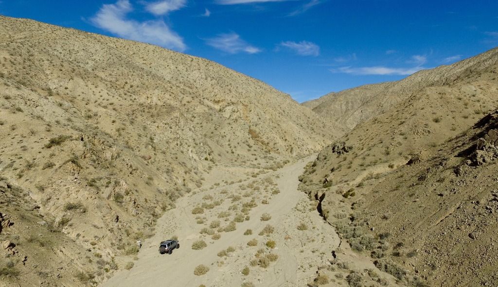
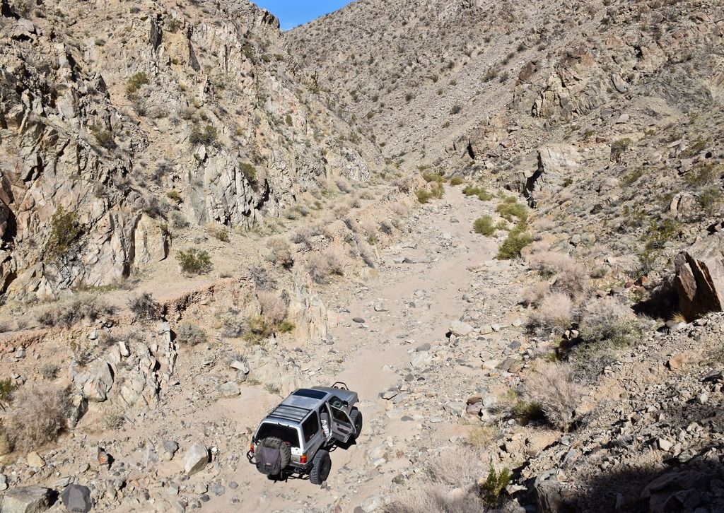
I started up Last Chance Canyon into the mountains. Temps were in the high 70's and the trail was moderate.

DJI_0004_zpsvan1eof9.jpg


DSC_0004_zpsnqphx6jn.jpg


DSC_0007_zps3q8uj132.jpg


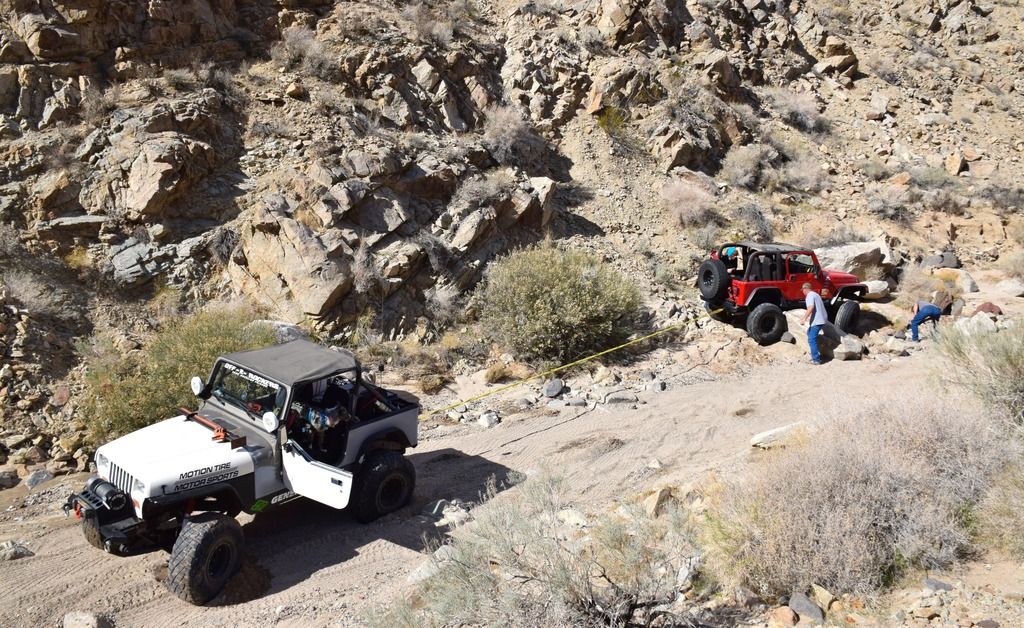
Jeeps are always getting stuck :sombrero:

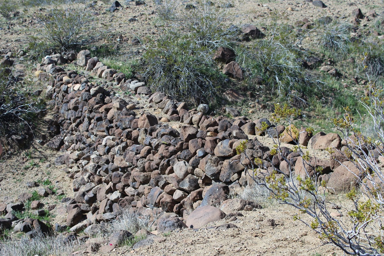
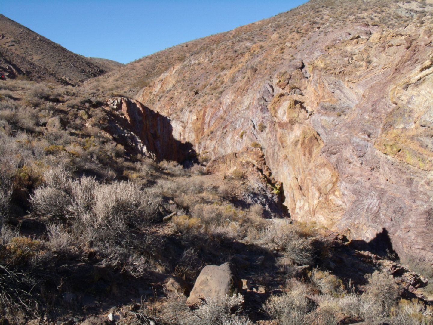
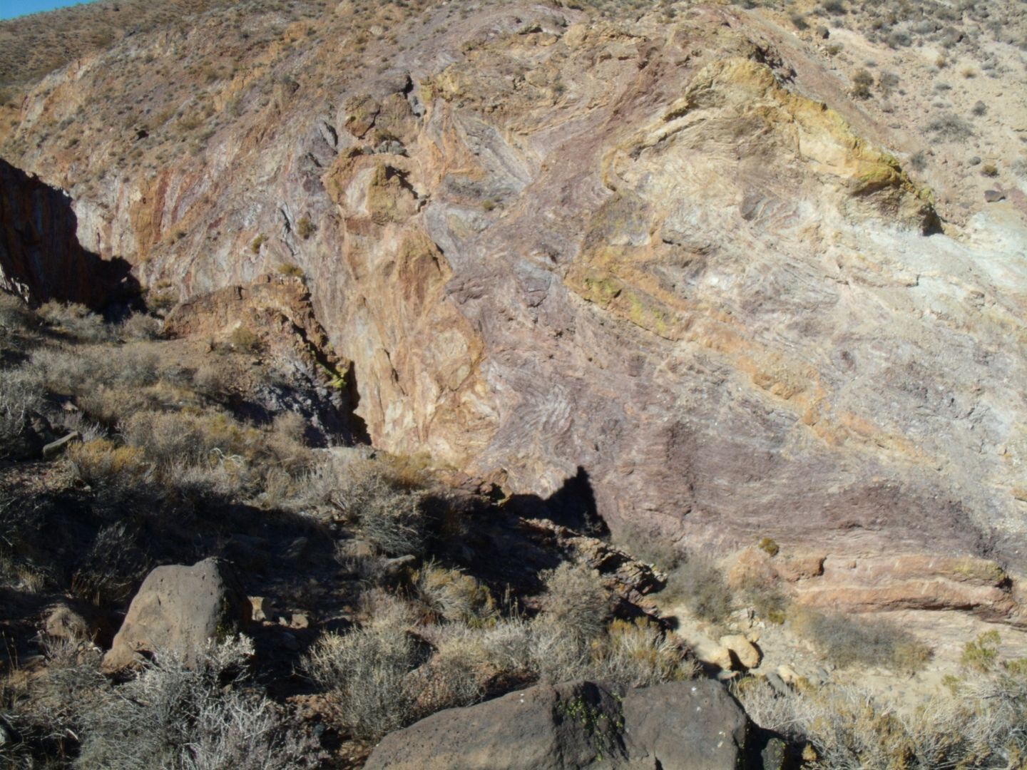
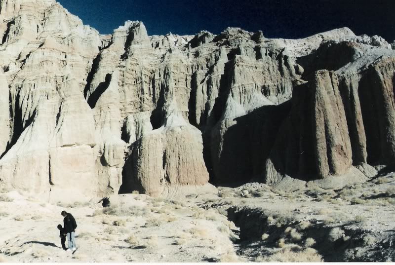
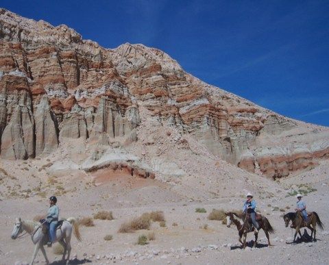
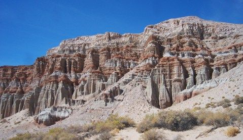
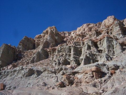
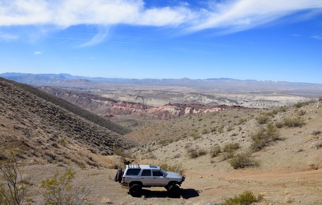
Higher up into the El Paso you can see some of the marvelous colors that give Red Rocks Sp its name.

DSC_0012_zpsu4dqfvaw.jpg


DSC_0015_zpsf8zaq0am.jpg


DJI_0026_zpstv8hwcj8.jpg


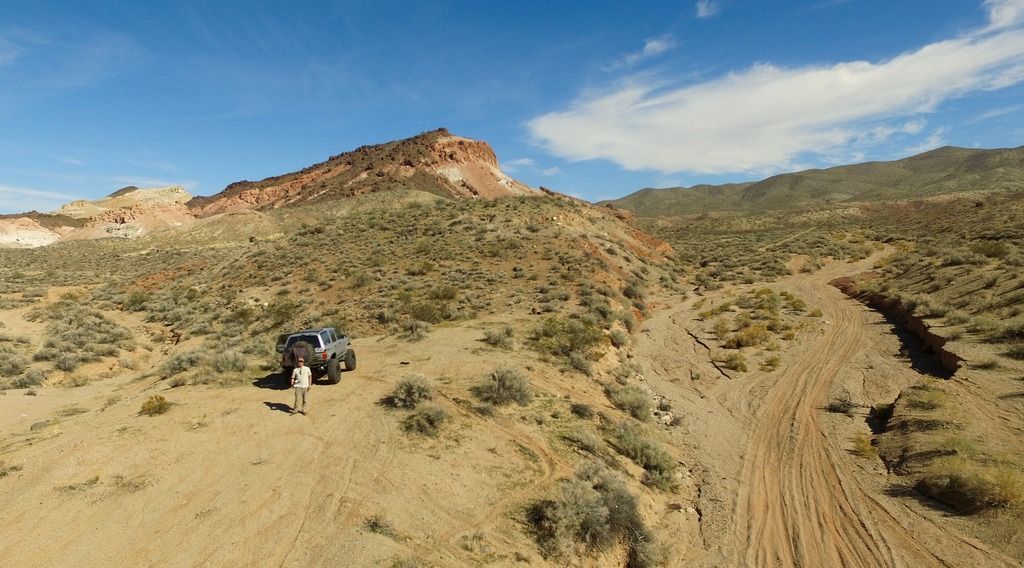
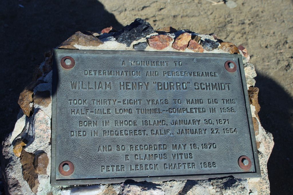
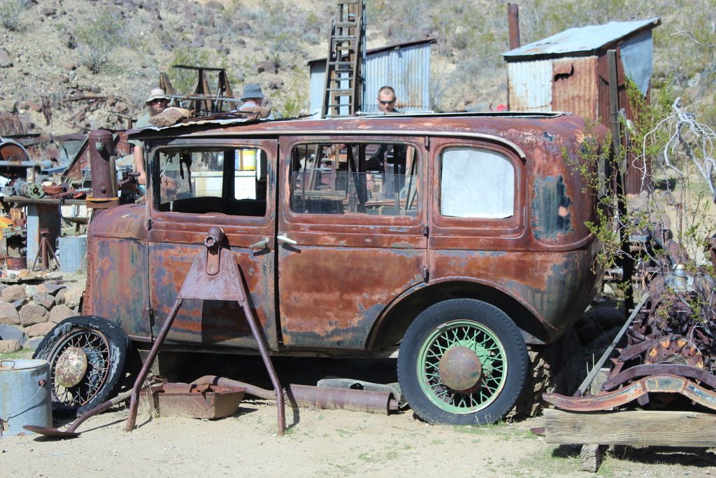
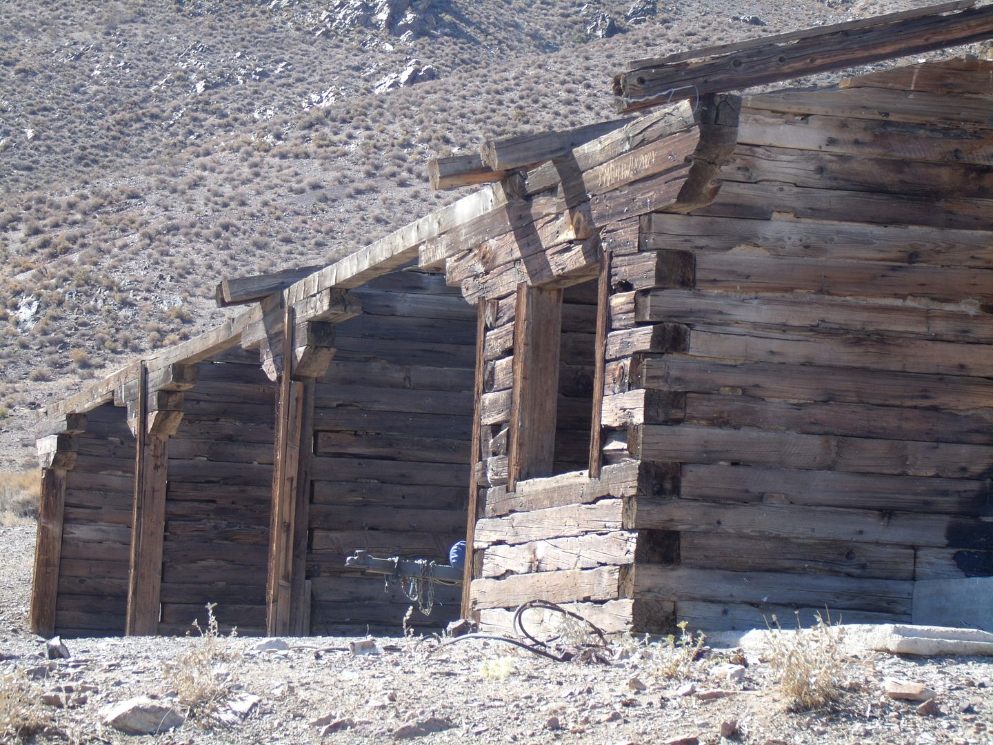
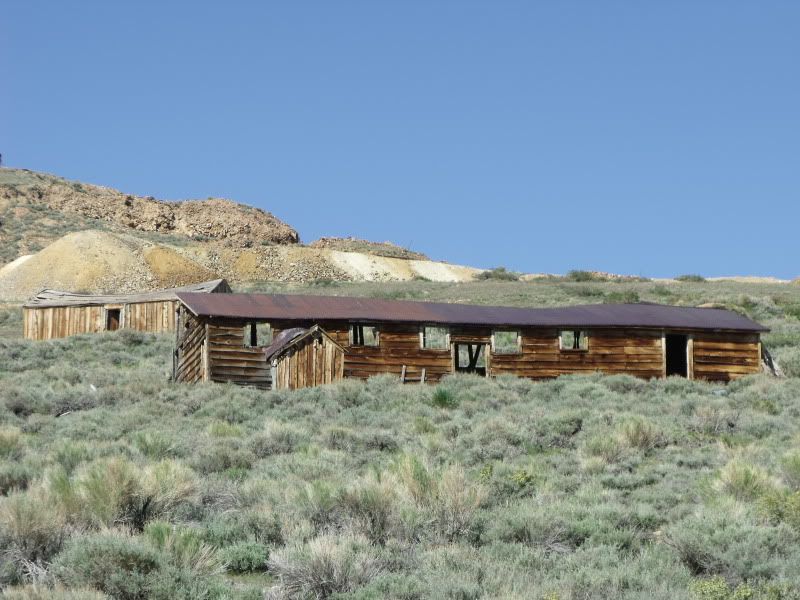
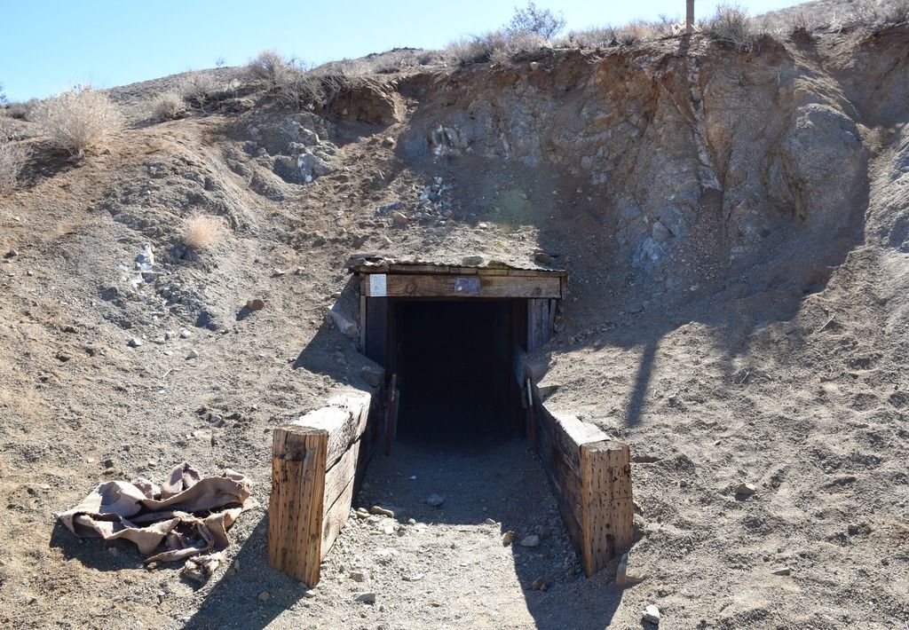
Mid day brought me to the famous Burro Schmidt tunnel. Burro Schmidt dug through half a mile of solid granite by himself and it only took him 38 years. By the time he completed his tunnel, a road had been built that made his tunnel obsolete.

DSC_0026_zpsceevlzfl.jpg


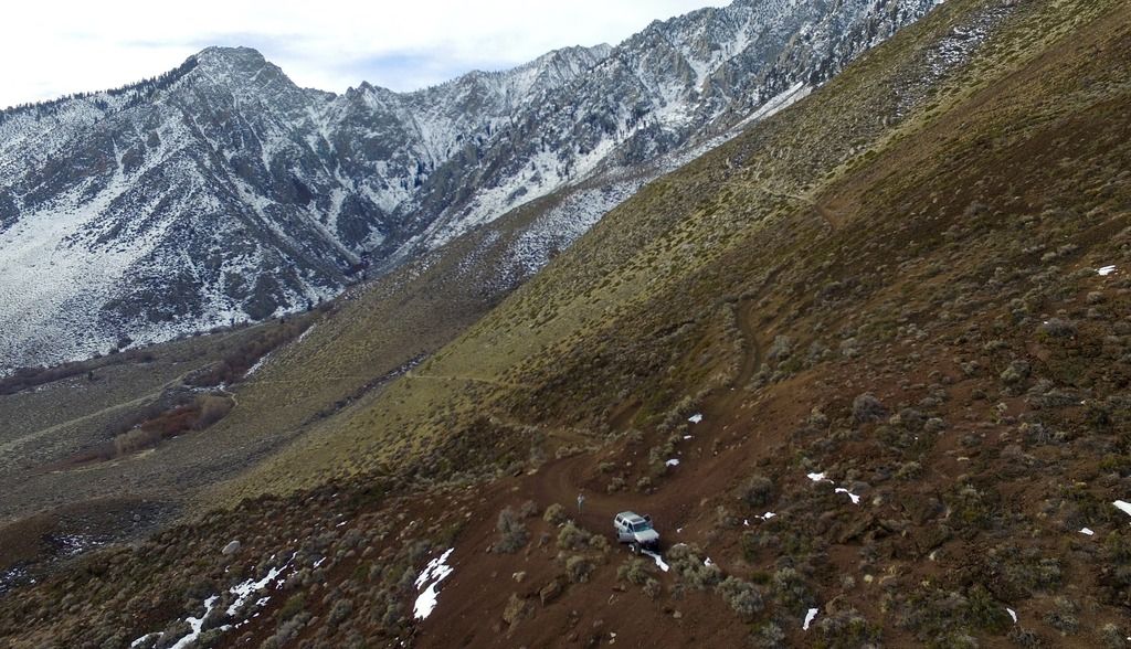
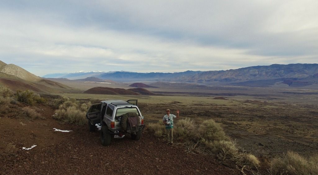
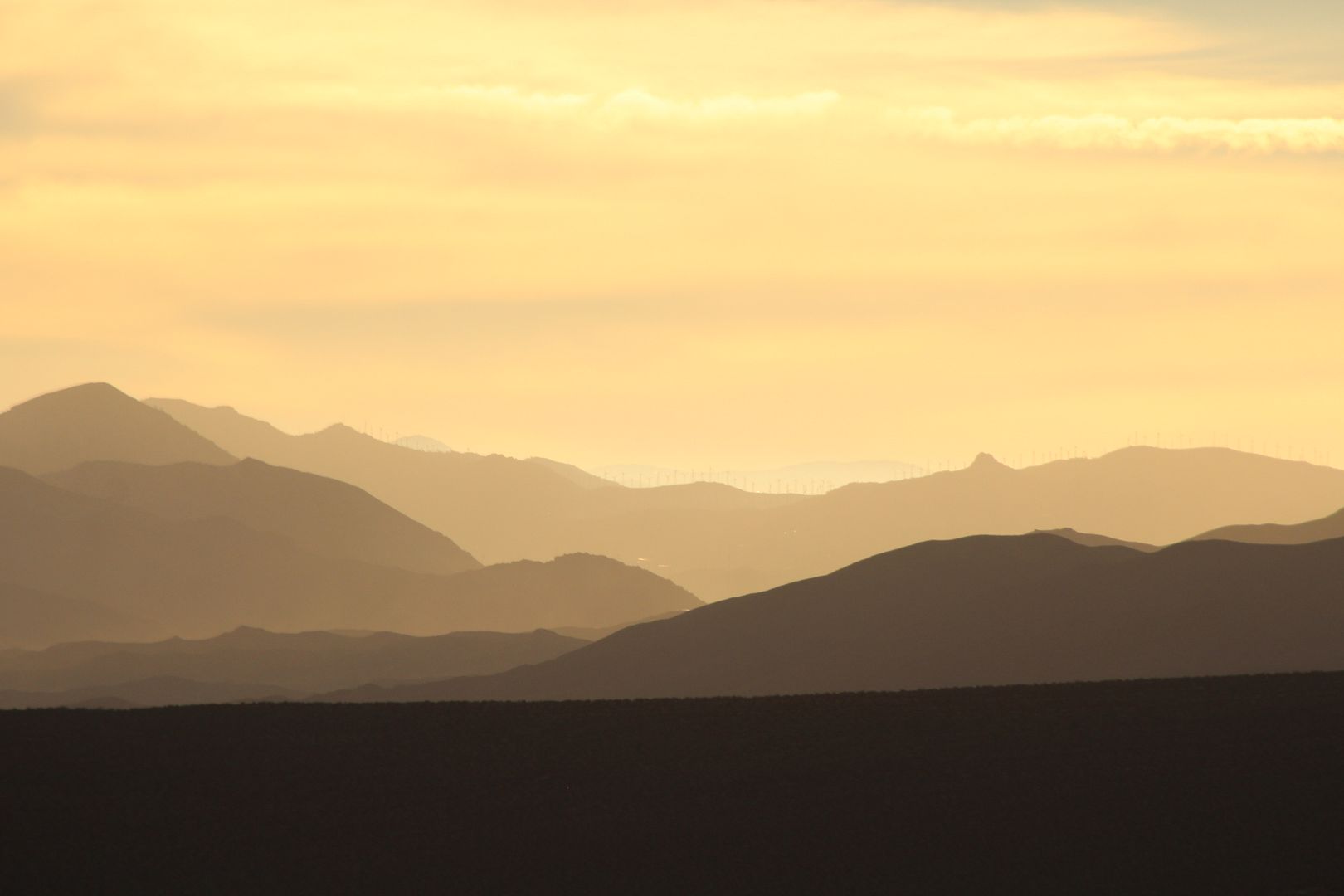
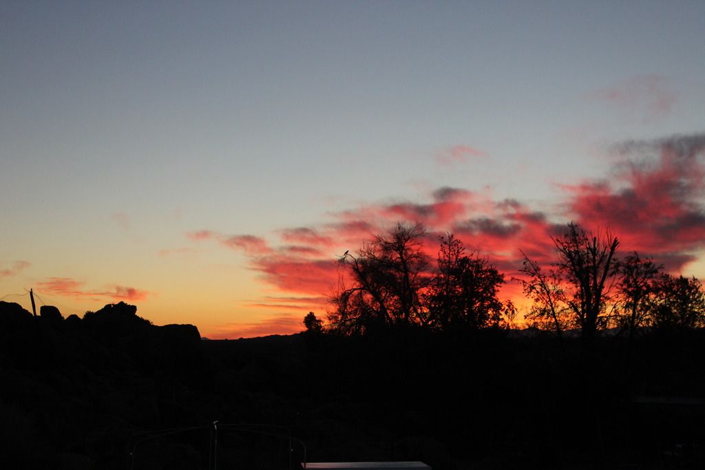
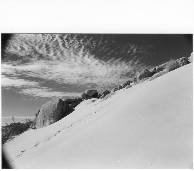
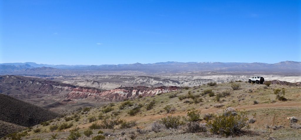
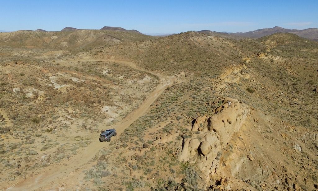
After the tunnel I headed north out of the El Paso on Mesquite Canyon, a long and lonely exit that took me up to the 395. I was flying my quad copter which helped me get some good aerial shots.

DJI_0038_zpsn4iurhm5.jpg
...

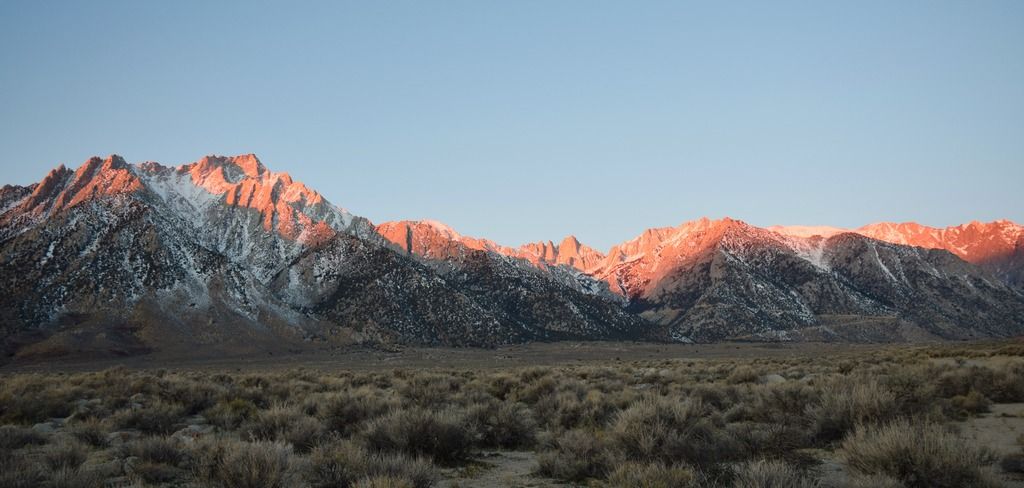
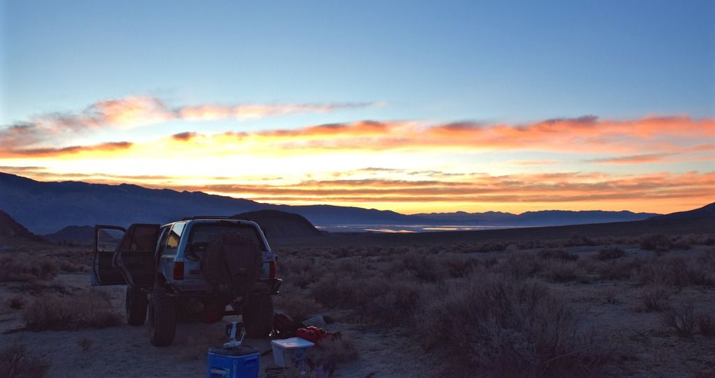
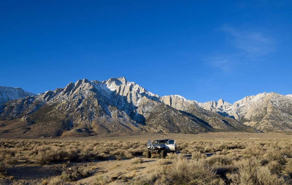
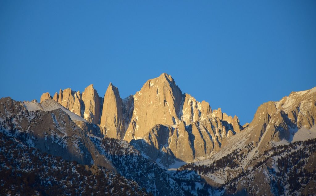
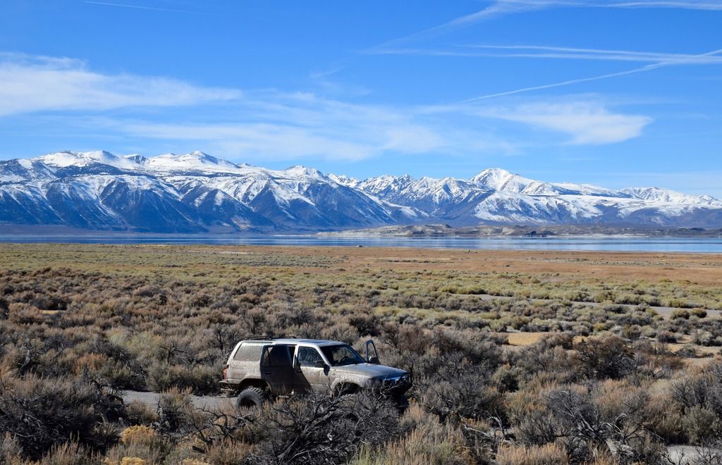
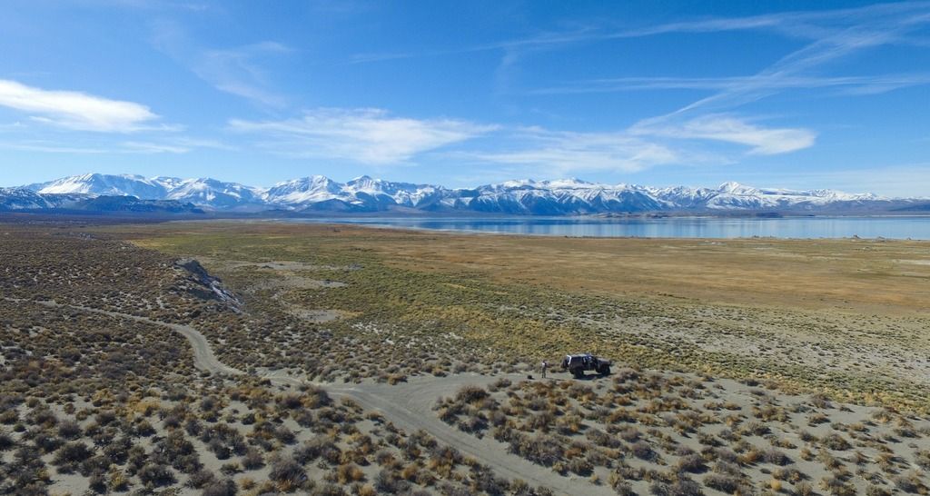
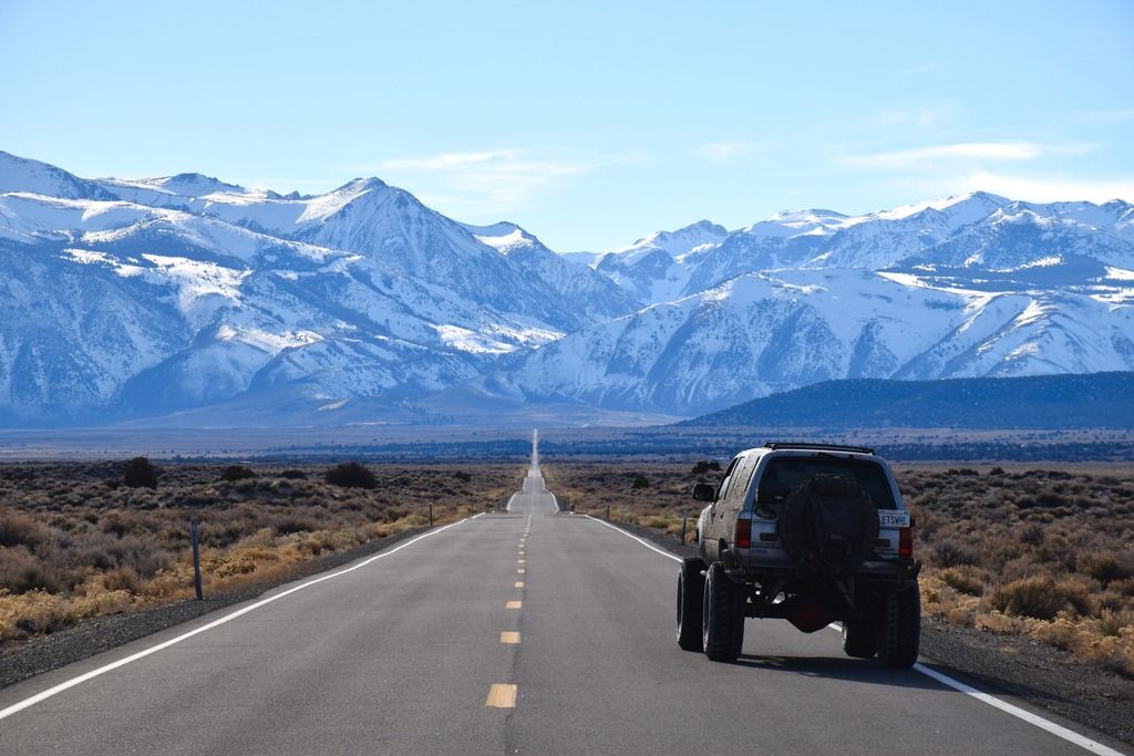
With the Mojave behind me I headed up to the eastern Sierra...
 

v_man

Explorer
I spent the night in the Alabama Hills near Lone Pine. I wanted to catch the sunrise on the Sierra.

DSC_0047_zpsfdm8cjnw.jpg


The rising sun slowly lit up Mt. Whitney with a beautiful glow

DSC_0039_zps6unjlac1.jpg


DSC_0058_zpsoyyyejuk.jpg


DSC_0050_zpschecgdqk.jpg


After saying adios to Mt. Whitney, I headed north to a lesser known trail on the eastern flank of the Sierra, Armstrong Canyon. The trail cuts steeply up the side of the mountain and ends and a sweet little campsite, that is currently under several feet of snow. I made it about half way up.

DJI_0085_zpsvxwg1hrk.jpg


DJI_0093_zpsuvcdrqee.jpg


I wrapped up the day at the Mammoth hot tubs with intentions to keep heading north tomorrow


IMG_6165_zpsd8i8cf4h.jpg


Next day I wanted to traverse Mono Lake. The dusty lonely road around the lake was long but relatively easy

DSC_0080_zpselg4kxgh.jpg


DJI_0113_zpssav9vyfh.jpg


After Mono it was time to head home to the Bay Area. Another little adventure turns to memories. Thanks for looking...

DSC_0095_zps66zfed97.jpg
 
Wow great write up! I was close to that area a few weeks back except in the alpine, skied at Mammoth. I would love to get back down to that area in April or early May time frame.

Thanks for sharing!
 

calicamper

Expedition Leader
Odd spot for the Jeep to get stuck. Looks like he left a perfectly drivable road to go off trail Rock Climbing? Not to be a nanny type but thats the sort of stuff that gets roads shut down. Man some of those views you had were awesome.
 

LionZoo

Observer
Cool report! How would you rate Mesquite Canyon? I'm going to be in Ridgecrest for rally school this weekend and I'm thinking of camping there between Saturday and Sunday. However, I won't be able to get on the trail until after nightfall.
 

XJLI

Adventurer
Wow. Awesome to see shots like that with NO ONE else there. Never seen any of this area. Thanks!
 

v_man

Explorer
Cool report! How would you rate Mesquite Canyon? I'm going to be in Ridgecrest for rally school this weekend and I'm thinking of camping there between Saturday and Sunday. However, I won't be able to get on the trail until after nightfall.

Yo Lion if you enter Mesquite from the north it's mellow. The further south u go the rockier it will get ... Rally school sounds fun !
 

jhberria

Adventurer
Great report and photos. I'm definitely appreciative of the solitude you clearly experience out there. Awesome.
 
We were the group of Jeeps who were traversing the canyon at Last Chance Cyn. YES, the two jeeps were trying out their mods to their vehicles on both Turtle Rock, and Crankcase Rock. And YES this area is a rock crawling area for all vehicles, and this activity IS allowed by the State Park. NO, Mesquite Canyon is NOT hard. and you enter not from the North, as it does NOT go north past EP-15, but from the Randsburg-Redrock road, which is SOUTH of the El Paso Mtns, and goes to the area of the Bickel Camp, and Colorado Camp. Yes. all 11 vehicle made the trip thru Last Chance Cyn, and only two were the rock crawlers. The rest of us took all the bypasses just like you did, and we even did "Graduation Hill", which you chickened out on. We them proceeded to Holland Camp where we had been camping for 4 days at the Apache Mine ruins, and transfer station ruins. We also did Sheep Springs Trail, by way of the wash and over the marked trail, as well as most of the EP-15, EP-26, and EP-11 trails, also ALL marked. You look like you have a capable rig, why not do some of the rougher stuff, and explore the real areas of the El Paso's?

2016-02-13%20holland%20camp%202-16%20003.jpg


2016-02-13%20holland%20camp%202-16%20001.jpg


2016-02-13%20holland%20camp%202-16%20020.jpg
 
"Burro Schmidt also was a prospector who owned and sold several claims in the El Paso Area, as well as was one of the water suppliers to the diggings in Last Chance, Bonanza Gulch, Colorado Camp, and even the coal diggings in Iron Cyn, and Mesquite Cyns.
You missed the history lesson of the "Post Office", and the camps of the Chinese Miners, who it is rumored, were buried alive by jealous miners in the top of Bonanza Gulch by the Post office. As well, you don't mention the Opal Mines, the several Talc mines like the "Dutch Cleanser", and "Holly Ash Mines" Nor the hand built dam above the diggings called the Hat-field-Rand Mines above Bonanza Gulch, or the dugouts along EP-15 used until the 1950's by many weekend prospectors. Nor the still used cabins along Bonanza Gulch wash.

Here are some of the things you missed by wimping out, and not exploring out there.


2016-02-14%20holland%20camp%202-16%20008.jpg

2016-02-12%20holland%20camp%202-16%20022_1.jpg
2016-02-12%20holland%20camp%202-16%20011.jpg


Yes, we did see you go use all the bypass areas, and those could be done, and have been done by 2wd pickups, and I took my old 2wd dodge van through there last year.
Perhaps you needed to do some research on the area you were planning to drive, and find out about the areas that you missed, as well as use that vehicle to it's advantage to explore and learn some of the secrets of the Last Chance, and Garlock faults and anticlines.

2016-01-24%20holland%20camp%202-16%20010.jpg

GEDC0406.jpg

GEDC0397.jpg

GEDC0370.jpg

GEDC0321.jpg
 
Last edited:
As you can see, there is a lot you did not take the time to see, and visit.

GEDC0315.jpg


Note how the rock has been twisted by the geologic forces, when it was up lifted..
GEDC0300.jpg

GEDC0301.jpg


caveinredrock.jpg

JohnnysandValleyofFire059.jpg


100_3781.jpg

100_3778.jpg

100_3735.jpg

7-2010triptoeasternsierra249.jpg


best seat in the area!!!
randsburghinlow022.jpg


randsburghinlow019.jpg

IMG_0005.jpg


some times as explorers, we need to stop and look at what we are seeing with a calm eye, and appreciative mind.
 

Forum statistics

Threads
186,143
Messages
2,882,532
Members
225,875
Latest member
Mitch Bears
Top